At a glance
Sourced facts only. Distances and services change — confirm before you travel.
- Local government
- MacDonnell Regional Council
- Traditional Owners
- NT Police: Kulgera is Pitjantjatjara country. The same profile records archaeological evidence that the area has been occupied by the Luritja Aboriginal people for at least 25,000 years.Keep both official sentences. Do not flatten neighbouring Finke/Aputula Pitjantjatjara and Yankunytjatjara wording, or Yulara Anangu wording, onto this village. Confirm current wording before treating a label as a townsite acknowledgement.
- Nearest regional city
- Alice Springs. NT Government rest-stop table prints the NT/SA Border rest stop 295 km south of Alice Springs. NT Police places Kulgera 21 km from that border. Those pages do not print a single Alice Springs–Kulgera kilometre, so this hub does not invent one.
- Capital
- NT Government rest-stop table prints Darwin 1786 km from the NT/SA Border rest stop. That is a border rest-stop kilometre, not a Kulgera townsite kilometre invented here.
- Nearest fuel
- NT Police: a store was built in 1955, the forerunner of the Kulgera Roadhouse today. Confirm the bowser on arrival; this hub does not invent a brand or hours.
- Nearest hospital or clinic
- NT Police: there is no health clinic located within Kulgera; medical facilities are limited to the Royal Flying Doctor Service and Station white box. Finke and Imanpa communities have a clinic staffed by a full-time registered nurse.
- Mobile coverage
- Check Telstra and Optus coverage maps before travel; do not assume a signal on Stuart Highway gaps north toward Erldunda or south across the SA border toward Marla.
- Best time to visit
- May–August cooler means on BOM Kulgera (015603): June mean max 18.9 °C (coolest mean max), July mean min 4.8 °C. Tourism NT camping around Alice Springs: cooler months April to September.
Climate
Monthly means from the Bureau of Meteorology station Kulgera (015603). This is not a forecast. Open station at the named village. Published location 25.84°S, 133.30°E matches NT Place Names’ village coordinates. Temperature 36 years (1980–2019); rainfall 35 years (1968–2023). Status open; latest available data 28 February 2023.
| Month | Mean max (°C) | Mean min (°C) | Rainfall (mm) |
|---|---|---|---|
| Jan | 37.0 | 22.2 | 30.2 |
| Feb | 35.7 | 21.3 | 31.8 |
| Mar | 32.3 | 18.1 | 29.1 |
| Apr | 28.1 | 13.9 | 13.3 |
| May | 22.7 | 9.1 | 12.3 |
| Jun | 18.9 | 5.3 | 15.5 |
| Jul | 19.1 | 4.8 | 11.4 |
| Aug | 22.0 | 6.6 | 8.4 |
| Sep | 27.0 | 11.3 | 14.8 |
| Oct | 30.4 | 15.1 | 19.7 |
| Nov | 33.3 | 18.4 | 24.9 |
| Dec | 35.2 | 20.5 | 32.1 |
Kulgera in pictures
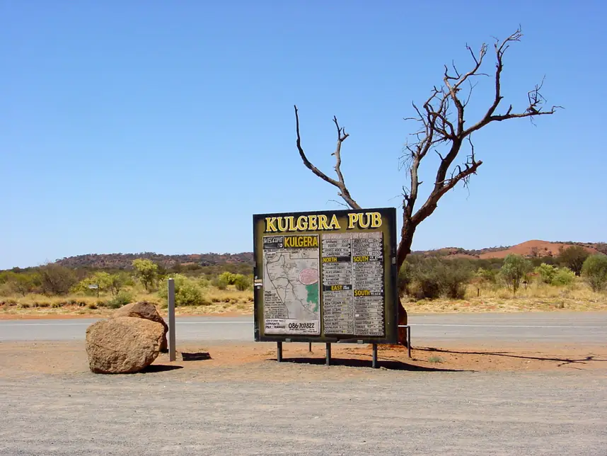
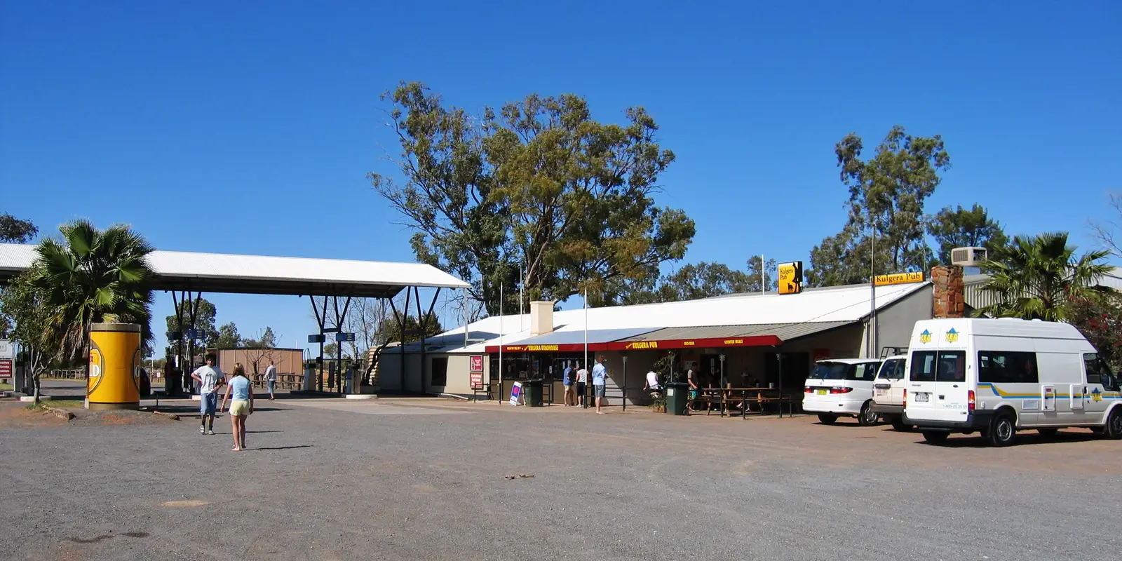
Kulgera Pub signPhoto: Frans-Banja Mulder · CC BY 3.0 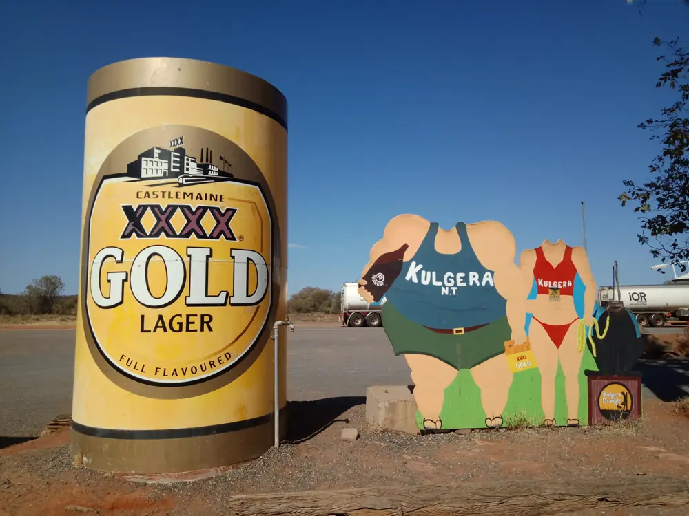
XXXX can and Kulgera NT cutouts at the pubPhoto: MEGutsell · CC BY-SA 4.0
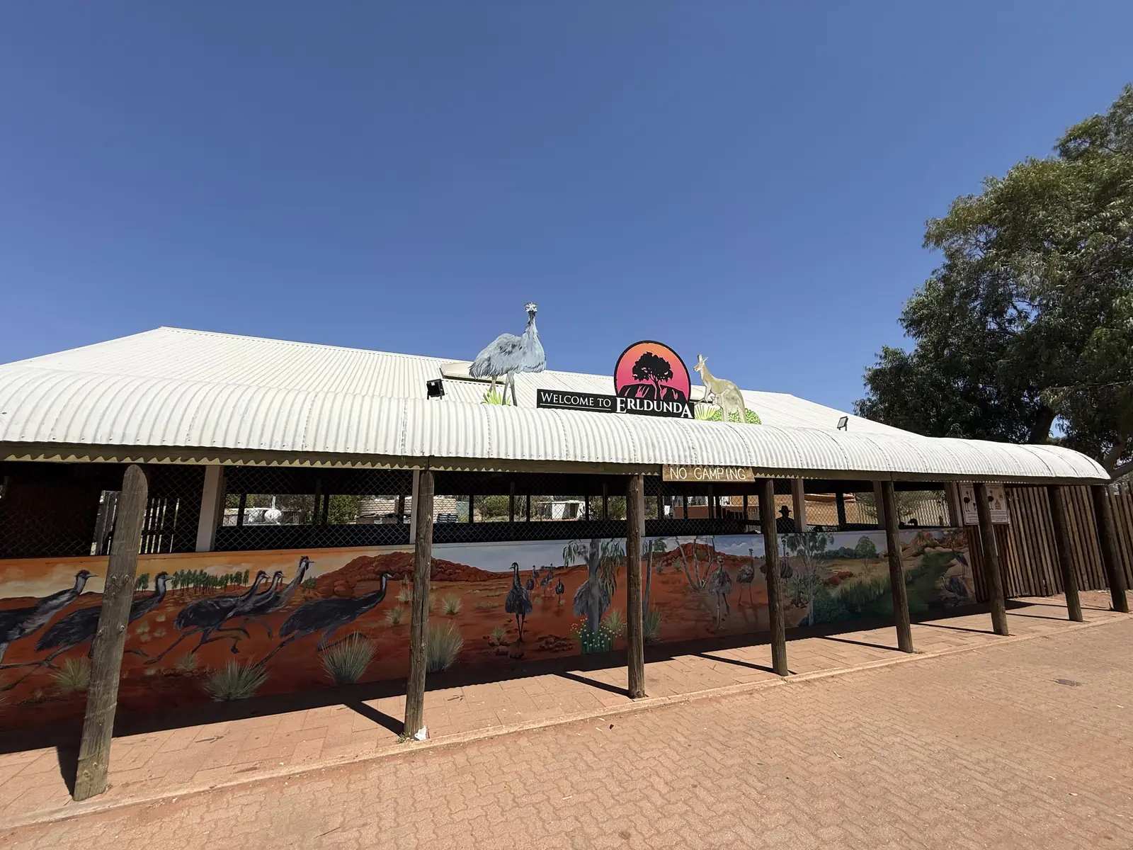
Kulgera is a Stuart Highway village in the Red Centre listing on this site, in the Ghan locality on NT Place Names. NT Police’s station profile is the geography used here: a small bush town surrounded by thousands of kilometres of cattle station, just 21 km from the South Australia / Northern Territory border. This hub is the last named Northern Territory village on the sealed Track before that border, not Marla on the South Australian side, and not Erldunda — the Stuart / Lasseter Highway junction further north, the sealed turn toward Yulara. Darwin is the capital; it has no town page here.
NT Place Names records Kulgera as a village, Place Id 14240, locality Ghan, MacDonnell local government, at 25.84°S, 133.30°E. That coordinate matches the Bureau of Meteorology’s KULGERA (015603) climate station. Place Names prints no origin story on the extract used for this rebuild. NT Police supplies the official history sentences: highway realignment in 1947, a store in 1955, the forerunner of the Kulgera Roadhouse today.
The Australian Bureau of Statistics does not publish a 2021 Urban Centre or SAL named Kulgera. NT Place Names puts the village in Ghan. Ghan SAL70108 counted 132 people at the 2021 Census, median age 32, Aboriginal and/or Torres Strait Islander people 14 (10.6%). That is a large rural geography that also contains Erldunda’s Place Names roadhouse. This hub does not flatten 132 onto the village. You still need the NT Road Report after rain.
Where it is, and how far
Kulgera sits on the public sealed Stuart Highway, on the same corridor as our Stuart Highway and Adelaide to Darwin guides. South, the NT / SA border is 21 km on NT Police, then Marla in South Australia on that town’s own guide. North, Erldunda is the Lasseter Highway junction in the same Ghan locality — this hub does not invent a Kulgera–Erldunda kilometre the sourced pages do not print. Further north, Alice Springs is the next large Red Centre town on this site.
NT Government’s Alice Springs–South Australian border rest-stop table is the official corridor table. It prints rest stops as kilometres south of Alice Springs, not as kilometres from Kulgera. This hub does not subtract NT Police’s 21 km from the border rest stop’s 295 km and call the remainder an Alice Springs–Kulgera drive.
| Place | Distance (sourced) |
|---|---|
| SA / NT border | 21 km from Kulgera (NT Police station profile) |
| NT / SA Border rest stop | 295 km south of Alice Springs; Darwin 1786 km (NT Government rest-stop table). 24-hour overnight camping. |
| Desert Oaks Rest Stop | 167 km south of Alice Springs; 128 km north of the SA border rest stop (NT Government; Tourism NT camping) |
| Finke River Rest Stop | 126 km south of Alice Springs; Tourism NT: half-way between Erldunda and Alice Springs |
A separate Alice Springs–Kulgera, Kulgera–Erldunda or Kulgera–Marla kilometre was not on those sourced pages, so this hub does not invent one. Use Erldunda and Marla for those towns’ own figures.
Facts at a glance
Population. No 2021 SAL or UCL named Kulgera. Ghan SAL70108 is the containing locality: 132 people, median age 32. Do not use that figure as a village headcount. Read Ghan QuickStats.
Climate. KULGERA, 015603, 25.84°S, 133.30°E, elevation 509 m, commenced 1968, status open, latest available data 28 February 2023. Mean maximum (36 years, 1980–2019): January 37.0 °C, June 18.9 °C coolest mean max — not July (19.1 °C). Mean minimum: January 22.2 °C, July 4.8 °C, annual 13.9 °C. Mean rainfall (35 years, 1968–2023): annual 249.9 mm. Mean days of rain ≥ 1 mm: 24.7. See Kulgera weather.
Visitor information. NT Police’s Kulgera station profile and NT Place Names are the official village listings used here. Neighbouring clinics sit at Finke (MacDonnell Regional Council 08 8959 8700, finke@macdonnell.nt.gov.au) and Imanpa (08 8950 0450, imanpa@macdonnell.nt.gov.au). Roads: NT Road Report.
Traditional Owners
NT Police’s Kulgera profile is the official wording used here. Kulgera is Pitjantjatjara country, and Aboriginal paintings can be found at sites in the area. The same profile records archaeological evidence that the area has been occupied by the Luritja Aboriginal people for at least 25,000 years. This guide keeps both sentences rather than collapsing them into one nation label.
Neighbouring MacDonnell Regional Council communities use different official wording. Finke / Aputula: approximately 160 local Pitjantjatjara and Yankunytjatjara speakers on council’s Finke page. Imanpa: 185 residents, mostly Pitjantjatjara and Yankunytjatjara speakers, 200 km south west of Alice Springs, a few kilometres off the Lasseter Highway. Those are community pages, not a Kulgera townsite acknowledgement. Neighbouring Yulara sits on Anangu Country on that hub. This guide does not flatten park or community wording onto the village.
Stay on public highways. Named art sites on a police recreation list are not a permit to walk onto Aboriginal land. See visiting Country respectfully.
History
NT Police is the official history used here. Kulgera and the nearby Mount Cavanagh stations were established as sheep farms in the late 1920s, then converted to cattle in the 1960s due to drought, poor wool prices and labour costs. The realignment of the Stuart Highway in 1947 saw Kulgera become a highway stopover. In 1955 a store was built, the forerunner of the Kulgera Roadhouse today.
NT Place Names records the feature as a village in the Ghan locality. The extract used here prints no gazettal date and no origin story. This hub does not invent a Place Names etymology.
MacDonnell Regional Council’s Finke / Aputula page is neighbouring-community history, not Kulgera town history: Finke was a railway siding on the original Ghan line until 1981, when the railway relocated 150 km to the west. Access today is a 434 km road that mostly follows the old Ghan railway route through Titjikala to Alice Springs. The Finke Desert Race is that community’s famous event on Tourism NT’s Alice Springs camping page — Alice Springs to Finke and return, not a Kulgera main-street carnival.
NT Police: there is no local school; School of the Air or boarding school are the education options.
Things to do
Official named things to do are modest. This is a highway village without a 2021 town Census.
- Stuart Highway border approach — NT Police: 21 km from the SA / NT border; then Marla in South Australia
- Kulgera Roadhouse — NT Police: 1955 store as forerunner; confirm it is serving
- NT / SA Border rest stop — NT Government, 295 km south of Alice Springs, 24-hour overnight camping
- 4WD Goyder stock route, local Aboriginal paintings, bushwalking and camping — NT Police recreation list. Confirm access and stay on public roads; this hub does not invent a track kilometre or a painting-site pin
- Erldunda — Stuart / Lasseter junction north, the Yulara turn
- Finke / Aputula — MacDonnell Regional Council neighbour; not a highway walk from the roadhouse
Where to stay
NT Police names camping among recreation activities and records the Kulgera Roadhouse as the 1955 store’s successor. NT Government names 24-hour overnight camping at the NT / SA Border rest stop 295 km south of Alice Springs. Those are official named types, not a ranked hotel strip. If the village is full, Erldunda is north on that junction’s own guide and Marla is south in South Australia.
- How to choose: Kulgera accommodation
- Camping detail: Kulgera caravan parks
- Operator enquiries: feature your business
Caravan and camping
The Stuart Highway is sealed. NT Police names camping. NT Government names the border rest stop. Tourism NT’s Alice Springs camping page: camping is only allowed in designated areas; rest stops are overnight stays, not a base for an extended stay. Confirm whether a roadhouse site exists on the day. Read Kulgera caravan parks and outback camping.
Fuel and services
A village without a 2021 town Census will not match Alice Springs for a hospital. NT Police: no health clinic located within Kulgera; medical facilities are limited to the Royal Flying Doctor Service and Station white box. Finke and Imanpa have clinics staffed by a full-time registered nurse. NT Police names the Kulgera Roadhouse. This guide does not list a bowser brand or invent clinic hours. Fill in Alice Springs if you are unsure. There is no local school.
Road access
Stuart Highway sealed north–south. South is the SA border at 21 km (NT Police), then Marla. North is Erldunda and the Lasseter Highway toward Yulara, then Alice Springs. NT Road Report is the authority. Stay on gazetted roads. Aboriginal land needs the permits those agencies print. NT Police’s 4WD Goyder stock route is a named recreation activity, not a promise that a side track is open after rain.
Our Stuart Highway and Adelaide to Darwin guides are the road-trip pages.
Nearby parks and towns
Parks (nearby, not in-town):
- Uluru-Kata Tjuta National Park — via Erldunda and Yulara on the Lasseter Highway, not a Kulgera main-street walk
- Witjira National Park / Dalhousie Springs — South Australian park on this site’s guide; confirm Parks SA access. Not a village walk.
Towns on this site:
- Erldunda — Stuart / Lasseter junction north, Yulara turn
- Marla — Stuart Highway in South Australia, SATC’s last SA stop before the NT border on Explorers Way copy
- Alice Springs — Stuart Highway north
- Yulara — Lasseter Highway west via Erldunda
- Finke — Aputula, MacDonnell Regional Council community on the old Ghan; NT Police’s Kulgera profile names a Finke clinic
When to go, and how long
Kulgera’s January mean maximum of 37.0 °C is a southern Red Centre summer. June’s 18.9 °C mean maximum and July’s 4.8 °C mean minimum, with August’s 8.4 mm, is the cool Dry on a 249.9 mm annual table. Tourism NT’s Alice Springs camping page prefers April to September for camping in the district, and notes winter nights can dip below zero. An hour covers fuel and the border approach. A night covers the named roadhouse if a room or site exists. Uluru is a separate Lasseter Highway day via Erldunda, not a village walk.
Operators who want a checked listing: feature your business. The listings slot on this hub stays empty until then.
Plan this trip
Tell us the dates, who you are travelling with and where you need help. We reply with planning notes for Kulgera — we are not a booking agent.
Events and road-conditions newsletter
Occasional notes on outback festivals, race days and official road-condition sources — not a daily blast. We use these details only to send the newsletter.
Northern Territory · Red Centre
Kulgera accommodation
Where to stay at Kulgera: NT Police records the 1955 store as the forerunner of the Kulgera Roadhouse and names camping. NT Government names the NT/SA Border rest stop. Confirm before you unhitch.
Read · 3 min
Northern Territory · Red Centre
Kulgera caravan parks
Camping at Kulgera: NT Police names camping and the Kulgera Roadhouse. NT Government names the NT/SA Border rest stop 295 km south of Alice Springs. Confirm before you unhitch.
Read · 3 min
Northern Territory · Red Centre
Kulgera weather
Kulgera climate from BOM Kulgera (015603): January mean max 37.0 °C, June 18.9 °C, annual rainfall 249.9 mm. Open station at the named village. Latest data 28 February 2023.
Read · 3 min
Northern Territory · Red Centre
Things to do in Kulgera
Things to do at Kulgera: Stuart Highway village 21 km from the SA border, Kulgera Roadhouse, NT/SA Border rest stop, NT Police recreation list. Red Centre, not Marla and not Erldunda.
Read · 3 min
Frequently asked questions
How far is Kulgera from the SA border and from Alice Springs?
NT Police: Kulgera is situated just 21 km from the South Australia/Northern Territory border. NT Government’s rest-stop table prints the NT/SA Border rest stop 295 km south of Alice Springs. Those official pages do not print a single Alice Springs–Kulgera kilometre, so this hub does not invent one by subtracting 21 from 295.
What is Kulgera’s population?
The ABS does not publish a 2021 Urban Centre or suburbs-and-localities named Kulgera. NT Place Names records Kulgera as a village in the Ghan locality (SAL70108), a large rural geography of 132 people at the 2021 Census. This hub does not flatten that 132 onto the village.
Whose Country is Kulgera?
NT Police: it is Pitjantjatjara country, and Aboriginal paintings can be found at sites in the area. The same profile records archaeological evidence that the area has been occupied by the Luritja Aboriginal people for at least 25,000 years. This hub keeps both official sentences.
Is Kulgera the same place as Erldunda or Marla?
No. Kulgera is the Stuart Highway village 21 km from the SA/NT border on NT Police. Erldunda is the Stuart/Lasseter Highway junction in the same Ghan locality on NT Place Names — the Yulara turn, further north. Marla is a South Australian Stuart Highway town on the other side of the border, on this site’s Marla guide.
What is the weather like in Kulgera?
BOM Kulgera (015603, open): January mean maximum 37.0 °C, June 18.9 °C (coolest mean max — not July at 19.1 °C), annual rainfall 249.9 mm (35 years, 1968–2023). Temperature means use 36 years (1980–2019). Status open; latest available data 28 February 2023.
Can I camp at Kulgera?
NT Police names camping among recreation activities and records the 1955 store as the forerunner of the Kulgera Roadhouse today. NT Government’s rest-stop table names the NT/SA Border rest stop 295 km south of Alice Springs, 24-hour overnight camping. Confirm a roadhouse site versus that border rest stop before you unhitch.
Sources and further reading
Facts on this page were checked against these primary and official sources. Conditions change — confirm before you travel or buy.
- Kulgera — NT Police, Fire and Emergency Services
- Kulgera (Place Names Register, id 14240) — NT Place Names Register
- Climate statistics for Kulgera (015603) — Bureau of Meteorology
- Road rest stops in NT — Northern Territory Government
- Camping around Alice Springs — Tourism NT
- Ghan 2021 Census QuickStats (SAL70108) — Australian Bureau of Statistics
- Finke — MacDonnell Regional Council
- Imanpa — MacDonnell Regional Council
- NT Road Report — Northern Territory Government