At a glance
Sourced facts only. Distances and services change — confirm before you travel.
- Population
- 72 people (SAL30010, 2021 Census)QuickStats notes limited tables because of the small population.
- Local government
- Quilpie Shire
- Nearest regional city
- Quilpie is the shire seat. This glance does not invent an Adavale–Quilpie kilometre the sourced pages do not print as a single figure.
- Nearest fuel
- Named on this hub’s fuel FAQ — confirm hours in Quilpie if the Adavale bowser is not open. This glance does not list brands.
- Nearest hospital or clinic
- Confirm with Queensland Health — do not invent a clinic name.
- Mobile coverage
- Check Telstra and Optus coverage maps before travel; do not assume a signal on floodways, parks or unsealed approaches.
- Best time to visit
- May–September on Adavale Post Office (045000) cooler mean maxima (July 20.4 °C; January 36.2 °C). QLDTraffic after rain.
Climate
Monthly means from the Bureau of Meteorology station Adavale Post Office (045000). This is not a forecast. Commenced 1889. Elevation 229 m. Status: Closed 31 Dec 1985. Annual mean rainfall 392.6 mm. Adavale Post Office is the named local table. Quilpie Airport (045015) remains open as a shire comparison — do not blend the two.
| Month | Mean max (°C) | Mean min (°C) | Rainfall (mm) |
|---|---|---|---|
| Jan | 36.2 | 22.3 | 62.7 |
| Feb | 34.8 | 22.0 | 58.8 |
| Mar | 33.0 | 20.0 | 49.6 |
| Apr | 28.9 | 14.8 | 24.0 |
| May | 24.1 | 10.2 | 28.5 |
| Jun | 20.8 | 6.6 | 24.8 |
| Jul | 20.4 | 5.1 | 21.6 |
| Aug | 22.7 | 6.9 | 13.7 |
| Sep | 26.8 | 10.6 | 15.5 |
| Oct | 30.9 | 15.2 | 25.4 |
| Nov | 34.5 | 18.3 | 26.5 |
| Dec | 36.5 | 21.0 | 40.5 |
Adavale in pictures
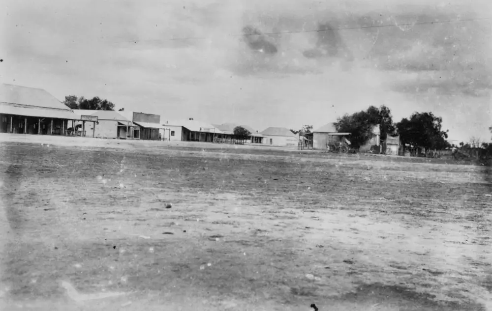
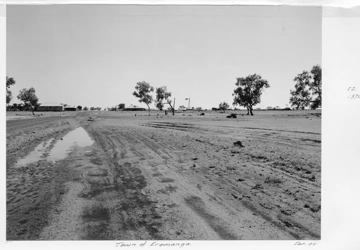
Historic view of AdavalePhoto: Item is held by John Oxley Library, State Library of Queensland. · Public domain 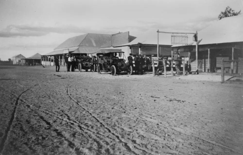
A historic photograph of AdavalePhoto: Richardson, H. J. · Public domain 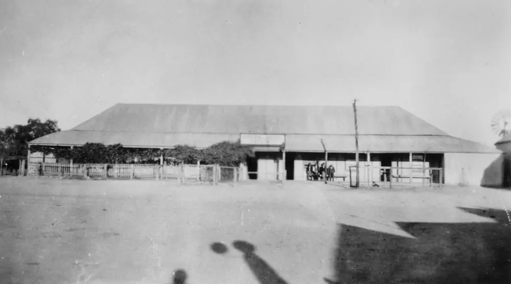
Adavale's Imperial HotelPhoto: Richardson, H.J. · Public domain 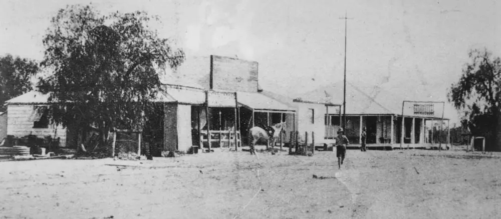
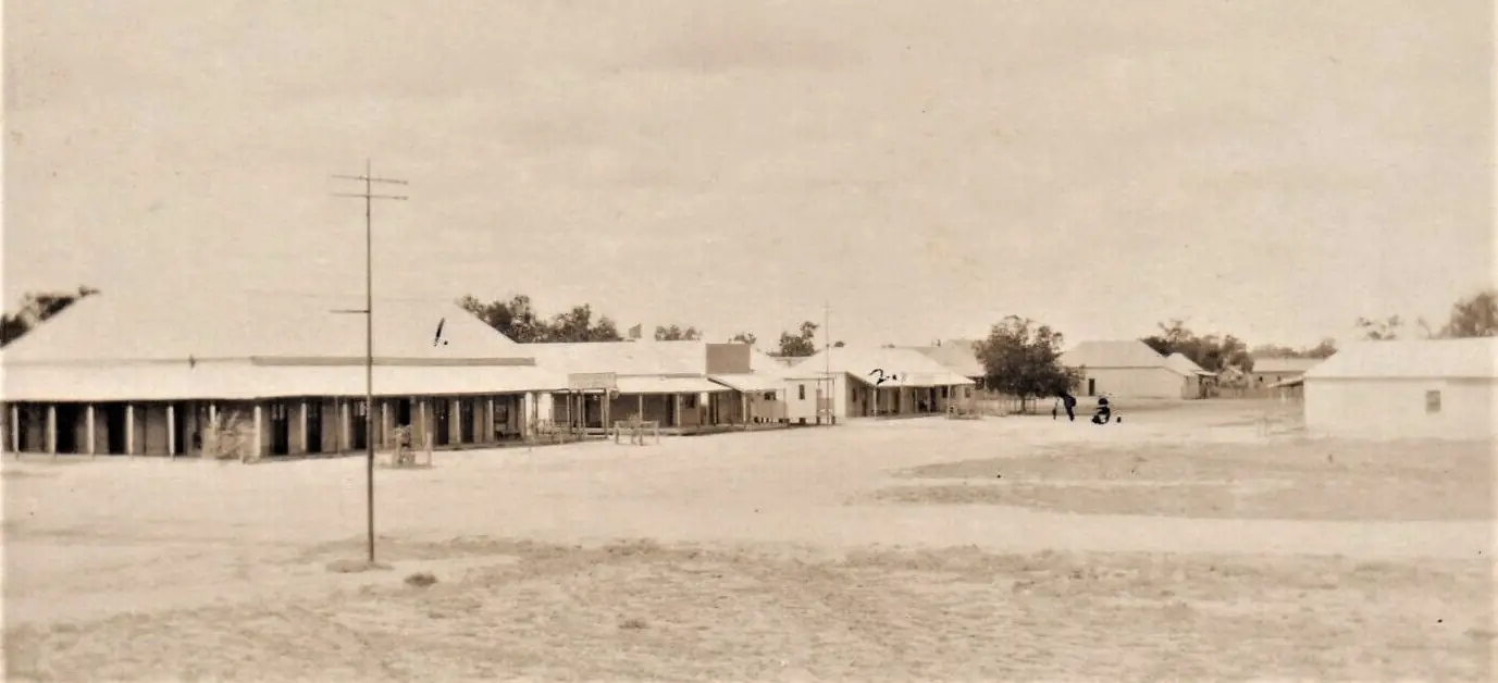
A historic street scene in AdavalePhoto: Contributor(s): Queenslander (Brisbane, Qld. : 1866-1939) · Public domain
Adavale is a tiny Quilpie Shire locality in Queensland’s south-west, on the named road to Hell Hole Gorge National Park. Outback Queensland’s stay list puts the Brick Hotel in Quilpie at 81 km. Queensland Parks puts the gorge 69 km north-west of Adavale, 189 km north of Quilpie and 256 km north-west of Charleville. Outback Queensland’s Natural Sciences Loop itinerary: take a break in Adavale on the way to Hell Hole Gorge, and check road conditions before visiting the park.
The Australian Bureau of Statistics does not publish a 2021 Urban Centre (UCL) named Adavale. Use suburbs-and-localities SAL30010: 72 people, median age 47, sex split 53.4% male / 46.6% female. QuickStats also prints 19 families and 36 private dwellings, and notes limited tables because of the small population. Outback Queensland’s town page says the population has dwindled to around 15 today — a tourism line for the town, not a second census. Do not mix 72 and 15 in one sentence as if they were the same geography.
Queensland Parks: no fuel is available at Adavale, although it has a small general store; public phones are located at Adavale. Fill up in Quilpie or Charleville. Access roads to Hell Hole are unsealed; a 4WD is required. You need QLDTraffic and Quilpie Shire road advice, because a 69 km run to the gorge is no use if the Milo-Gooyea Road is closed.
Where it is, and how far
Adavale sits north of Quilpie toward Blackall country, with Hell Hole Gorge on the north-west spur. Queensland Parks: from Adavale toward Blackall, take the Milo-Gooyea Road at the crossroads and follow signs to the park. Visit Quilpie Shire’s town introduction repeats about 69 km north-west; a things-to-do listing on the same page prints 80 km north-west. This hub uses Parks’ 69 km for the gorge and notes the 80 km listing rather than averaging them.
This hub does not invent an Adavale–Eromanga, Adavale–Blackall or Adavale–Isisford kilometre that is not on those pages. Eromanga is the dinosaur neighbour in the same shire. Blackall and Jundah are further north and west in the wider region.
| Place | Distance from Adavale (sourced) |
|---|---|
| Quilpie | 81 km (Outback Queensland stay list, Brick Hotel) |
| Hell Hole Gorge National Park | 69 km north-west (Queensland Parks); Visit Quilpie Shire also prints 80 km on a listing |
| Charleville | 256 km from the park via Adavale (Queensland Parks) — not an Adavale-town kilometre |
Facts at a glance
Population. ABS 2021 Census, Suburbs and Localities SAL30010: 72 people. Median age 47. 19 families, 36 private dwellings. No UCL. Use the Adavale SAL QuickStats. Outback Queensland’s “around 15” is visitor-guide wording for the town.
Climate. Bureau of Meteorology station ADAVALE POST OFFICE, 045000, commenced 1889, location 25.92°S, 144.60°E, elevation 229 m, closed 31 December 1985. Mean maximum temperature (35 years, 1938–1978): December 36.5 °C hottest month, January 36.2 °C, July 20.4 °C, annual 29.1 °C. Mean minimum: January 22.3 °C, July 5.1 °C, annual 14.4 °C. Mean rainfall (94 years, 1889–1985): annual 392.6 mm; January 62.7 mm wettest mean month; August 13.7 mm driest. Full columns: BOM Adavale Post Office all-years table. For a still-open nearby station, use Quilpie Airport, 045015: January mean maximum 37.0 °C, July 20.1 °C, annual rainfall 345.8 mm. See Adavale weather.
Visitor information. There is no Adavale VIC on the sourced pages. Use the Quilpie Visitor Information Centre, 51 Brolga Street, (07) 4656 0540, tourism@quilpie.qld.gov.au.
Traditional Owners
Quilpie Shire Council’s 2023–24 Annual Report states that the shire is the ancestral home of the Mardigan. This site’s Quilpie guide uses Mardigan Country for the shire seat. Visit Quilpie Shire’s Adavale page does not print a separate nation label for the Adavale townsite only. This hub follows the shire wording rather than flattening neighbouring Channel Country groups onto one street. Confirm a sentence you want on a plaque with the Quilpie VIC.
History
Outback Queensland: once a thriving town and business centre of the Quilpie Shire; changing the planned railway line from Adavale to what is now Quilpie was the beginning of the end for this pioneering town’s prosperity. Graves dating from the early 1800s are a testament to the harsh outback lifestyle on that page. Visit Quilpie Shire: once a booming town in the 1800s with six pubs, a police station, Chinese market gardens and a hospital; when the railway bypassed it, the town’s prospects changed.
Visit Quilpie Shire names an Adavale Town Interpretive Walk, an Outdoor Mini Museum, and the Police Hut Museum (currently under repair). Outback Queensland names the Adavale Pub and a decadent high tea at the Elegant Emu Cafe, plus annual Rodeo and Gymkhana. Confirm any current event with (07) 4656 0540.
Things to do
Adavale Town Interpretive Walk, Outdoor Mini Museum, Police Hut Museum — Visit Quilpie Shire. The police hut is currently under repair on that listing; do not treat it as a guaranteed indoor gallery. Walk in the cooler hours. Adavale Post Office’s December mean maximum is 36.5 °C. See things to do in Adavale.
Elegant Emu — Visit Quilpie Shire: home-baked bread, cakes, pastries and high tea; handbags; verandah. Phone 0408 296 404. Hours change. Book if you want high tea, do not arrive at dusk in January.
Adavale Pub — named on Outback Queensland. Confirm what is open with the VIC.
Adavale Veterans Retreat — named on Visit Quilpie Shire as a visit. Ask the VIC what that means on the day; this hub does not invent motel rooms.
Hell Hole Gorge National Park — Queensland Parks: Hell Hole Waterhole, steep rocky banks, cascades after heavy rain, rugged gorges, wildflowers after rain. 4WD; not suitable for caravans; off-road camper trailer with care. Camping with a permit near Powell Creek, 750 m from the main waterhole on Visit Quilpie Shire. No drinking water in the park; bring at least 7 litres per person per day. Pets not permitted. Cooler months April to September recommended. There is no Hell Hole page on this site; use parks.qld.gov.au/parks/hell-hole-gorge.
Where to stay
Official named types on the pages used here:
- Hell Hole Gorge camping — permit required; Visit Quilpie Shire lists it under Adavale accommodation and points to tourism@quilpie.qld.gov.au, (07) 4656 0540
- Quilpie rooms — Outback Queensland’s Adavale stay list prints The Lake, The Brick Hotel (81 km), Quilpie Motor Inn and Channel Country Tourist Park & Spas as nearby, not in Adavale
Visit Quilpie Shire does not name an in-town caravan park. This hub does not invent one. Confirm at (07) 4656 0540.
- How to choose: Adavale accommodation
- Camping detail: Adavale caravan parks
- Operator enquiries: feature your business
If Adavale is the wrong size, Quilpie is 81 km on that stay list. That is a distance fact, not a booking guarantee.
Caravan and camping
Vans should treat Adavale as a pause, not a park town. Official named camping is Hell Hole Gorge with a permit, 4WD, not suitable for caravans on Queensland Parks. Ask the Quilpie VIC whether any in-town site exists on the night you call. Read Adavale caravan parks and outback camping.
After rain, Hell Hole access is the constraint. Parks: prepare for an extra four or five days if stranded.
Fuel and services
Queensland Parks, visiting Hell Hole safely: No fuel is available at Adavale (69 km) although it has a small general store. Allow sufficient fuel for travelling within the park as well as the return trip. Fill up in Quilpie (189 km from the park) or Charleville (256 km from the park) on that page. Public phones are at Adavale. A locality whose Census count is 72, and whose tourism page says around 15 in town, will not match Quilpie for a hospital. For current questions, use Quilpie Shire Council and (07) 4656 0540.
Road access
Access to Hell Hole is via unsealed roads and working pastoral properties. Queensland Parks: 4WD required; all roads have soft sections when dry and may become impassable when wet; access is not suitable for caravans. Head from Adavale towards Blackall, Milo-Gooyea Road at the crossroads, follow signs. Leave gates as you find them. After rain, check QLDTraffic and 13 19 40, plus Quilpie Shire and Hell Hole park alerts. Do not drive around closed signs. Mobile coverage is not available in the national park.
South: Quilpie 81 km on the stay list. The Natural Sciences Loop itinerary uses Adavale as a break on a Hell Hole day from Quilpie. Eromanga is west in the same shire on a different sealed loop.
Nearby parks and towns
Parks:
- Hell Hole Gorge National Park — 69 km, permit camping, 4WD (Queensland Parks)
- There is no Currawinya, Welford or Idalia in Adavale. Those parks belong to Paroo, Barcoo and Blackall approaches on this site.
Towns on this site:
- Quilpie — 81 km; boulder opal, VIC
- Eromanga — dinosaurs, same shire
- Charleville — 256 km from the park via Adavale on Parks
- Blackall and Jundah — further on the Blackall / Channel Country side of this map
- Isisford — Barcoo, not a sourced kilometre from here
When to go, and how long
Adavale Post Office’s December mean maximum of 36.5 °C is hot for an interpretive walk at midday. July’s 20.4 °C mean maximum is the comfortable walking season; July’s 5.1 °C mean minimum is why a gorge camp needs a layer. Annual rainfall 392.6 mm on the closed-station table is wetter than Quilpie Airport’s 345.8 mm. Queensland Parks recommends April to September for Hell Hole; summer day-time temperatures can soar above 45 °C on that park page.
Two hours at the walk, pub and café is the minimum if those doors are open. A night in Quilpie is the conservative plan. A Hell Hole camp is a separate 4WD trip with a permit, extra water, and QLDTraffic agreement — not an Adavale main-street overnight we invented.
Operators who want a checked listing: feature your business. The listings slot on this hub stays empty until then.
Plan this trip
Tell us the dates, who you are travelling with and where you need help. We reply with planning notes for Adavale — we are not a booking agent.
Events and road-conditions newsletter
Occasional notes on outback festivals, race days and official road-condition sources — not a daily blast. We use these details only to send the newsletter.
Queensland · South West
Adavale accommodation
Where to stay around Adavale: Hell Hole Gorge camping with a permit as named by Visit Quilpie Shire, and Quilpie rooms 81 km. No in-town motel strip is invented here.
Read · 3 min
Queensland · South West
Adavale caravan parks
Camping around Adavale: Hell Hole Gorge permit camping named by Queensland Parks and Visit Quilpie Shire. No in-town caravan park is invented. 4WD, no fuel in Adavale.
Read · 3 min
Queensland · South West
Adavale weather
Adavale climate from BOM Adavale Post Office (045000): December mean max 36.5 °C, July 20.4 °C, annual rainfall 392.6 mm. Station closed 1985; Quilpie Airport 045015 remains open.
Read · 4 min
Queensland · South West
Things to do in Adavale
Things to do in Adavale: Town Interpretive Walk, Outdoor Mini Museum, Elegant Emu, Adavale Pub and Hell Hole Gorge 69 km north-west. Tiny locality, sourced list only.
Read · 4 min
Frequently asked questions
How far is Adavale from Quilpie and Hell Hole Gorge?
Outback Queensland’s Adavale stay list prints the Brick Hotel in Quilpie at 81 km. Queensland Parks puts Hell Hole Gorge 69 km north-west of Adavale, 189 km north of Quilpie and 256 km north-west of Charleville. Visit Quilpie Shire also prints 69 km north-west in the town introduction and 80 km north-west on a listing — this hub quotes Parks for the park distance.
What is Adavale’s population?
72 people at the 2021 Census for Adavale suburbs-and-localities (SAL30010). The ABS does not publish a 2021 Urban Centre (UCL) named Adavale. Outback Queensland’s town page says the population has dwindled to around 15 today — tourism wording for the town, not the Census locality.
Is there fuel in Adavale?
Queensland Parks’ Hell Hole Gorge visiting-safely page states that no fuel is available at Adavale, although it has a small general store. Fill up in Quilpie or Charleville.
Can I camp at Adavale and Hell Hole Gorge?
Hell Hole Gorge camping is named by Queensland Parks and Visit Quilpie Shire, with a permit. Visit Quilpie Shire does not list an in-town caravan park. Confirm at the Quilpie Visitor Information Centre.
What is the weather like in Adavale?
BOM Adavale Post Office (045000) monthly means (temperature 1938–1978, rainfall 1889–1985): December mean maximum 36.5 °C, July 20.4 °C, annual rainfall 392.6 mm. The station closed in 1985. Quilpie Airport (045015) remains open.
Where is the visitor centre?
There is no Adavale visitor centre on the sourced pages. Use the Quilpie Visitor Information Centre at 51 Brolga Street, (07) 4656 0540, tourism@quilpie.qld.gov.au. Queensland Parks notes public phones at Adavale.
Sources and further reading
Facts on this page were checked against these primary and official sources. Conditions change — confirm before you travel or buy.
- Climate statistics for Adavale Post Office (045000) — Bureau of Meteorology
- Adavale 2021 Census QuickStats (SAL30010) — Australian Bureau of Statistics
- Climate statistics for Adavale Post Office (045000) — Bureau of Meteorology
- Climate statistics for Quilpie Airport (045015) — Bureau of Meteorology
- Outback Queensland — Adavale — Outback Queensland Tourism Association
- Visit Quilpie Shire — Adavale — Quilpie Shire Council
- Hell Hole Gorge National Park — Queensland Parks and Wildlife Service
- Visiting Hell Hole Gorge safely — Queensland Parks and Wildlife Service
- Natural Sciences Loop — Outback Queensland Tourism Association
- QLDTraffic — Queensland Government