At a glance
Sourced facts only. Distances and services change — confirm before you travel.
- Population
- 218 people (SAL31416, 2021 Census)
- Local government
- Longreach Regional Council
- Nearest regional city
- Longreach and Yaraka are named on this hub’s distance FAQ
- Nearest fuel
- Confirm in the service town named under nearest regional city; this guide does not list bowser brands.
- Nearest hospital or clinic
- Confirm with Queensland Health — do not invent a clinic name.
- Mobile coverage
- Check Telstra and Optus coverage maps before travel; do not assume a signal on floodways, parks or unsealed approaches.
- Best time to visit
- May–September on Isisford Post Office (036026) cooler mean maxima (July 22.8 °C; January 37.0 °C). QLDTraffic after rain.
Climate
Monthly means from the Bureau of Meteorology station Isisford Post Office (036026). This is not a forecast. Commenced 1885. Elevation 203 m. Status: Open. Annual mean rainfall 448.0 mm. Town station.
| Month | Mean max (°C) | Mean min (°C) | Rainfall (mm) |
|---|---|---|---|
| Jan | 37.0 | 23.2 | 69.7 |
| Feb | 35.9 | 22.5 | 71.8 |
| Mar | 34.4 | 20.5 | 61.7 |
| Apr | 30.8 | 16.1 | 35.6 |
| May | 26.3 | 11.4 | 27.3 |
| Jun | 23.0 | 7.9 | 20.9 |
| Jul | 22.8 | 6.7 | 20.3 |
| Aug | 25.4 | 8.2 | 12.2 |
| Sep | 29.5 | 12.3 | 15.3 |
| Oct | 33.3 | 16.8 | 27.9 |
| Nov | 35.8 | 20.0 | 35.9 |
| Dec | 37.1 | 22.1 | 52.5 |
Isisford in pictures
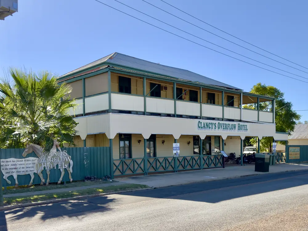
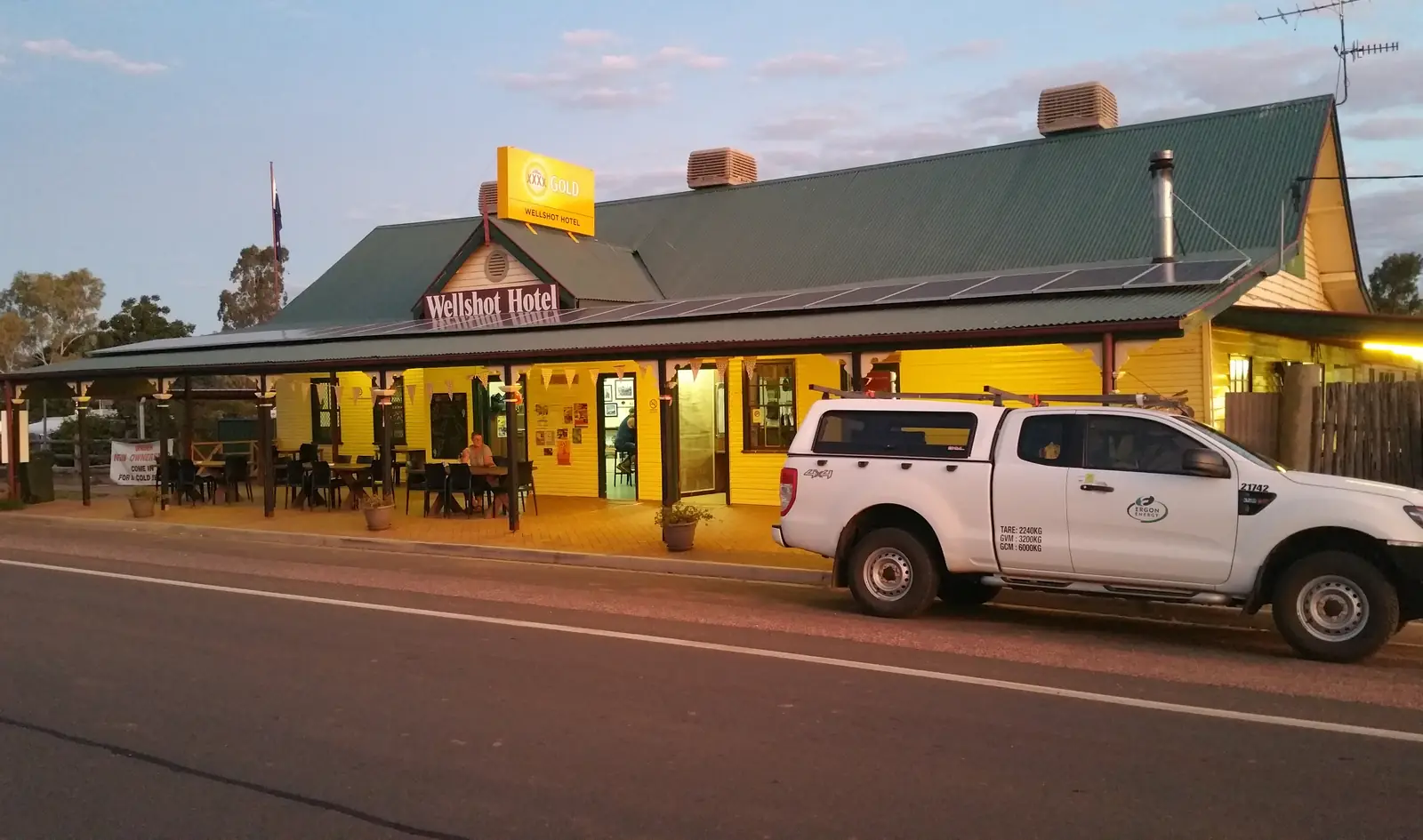
Isisford's Clancy's Overflow HotelPhoto: Chris Olszewski · CC BY-SA 4.0 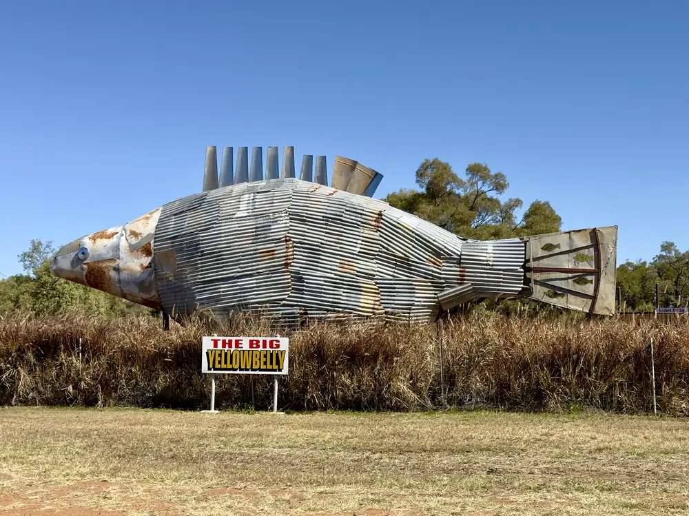
The Big Yellowbelly in IsisfordPhoto: Kgbo · CC BY-SA 4.0 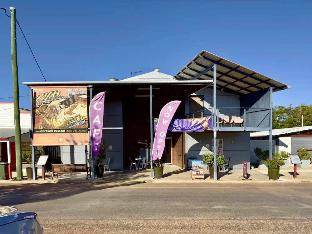
Outer Barcoo Interpretation Centre in IsisfordPhoto: Chris Olszewski · CC BY-SA 4.0 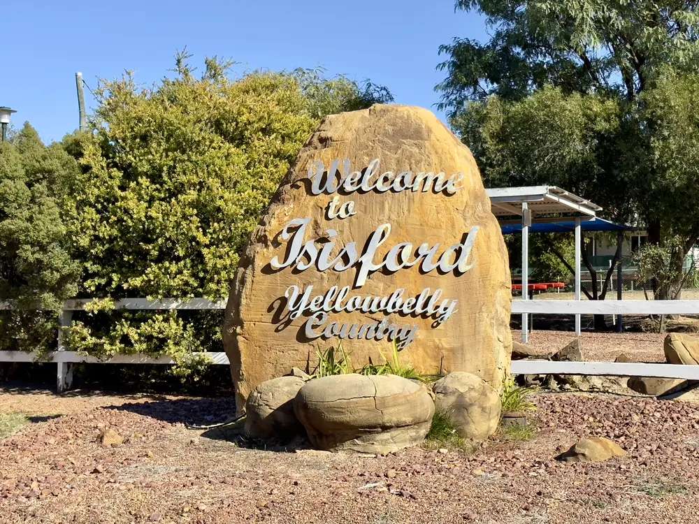
Welcome sign in IsisfordPhoto: Kgbo · CC BY-SA 4.0
Isisford sits on the Barcoo River in Longreach Regional Council, in Queensland’s central west. Outback Queensland’s stay list puts named Longreach parks at 86 km. The same organisation’s Yaraka page puts that rail locality 100 km from Isisford. Travellers stop for the Outer Barcoo Interpretation Centre, the Big Yellowbelly, Whitman’s museums, and named camping at Oma Waterhole and Barcoo Weir. The Matilda Way is the sealed Landsborough spine through Blackall, Barcaldine and Longreach nearby — not a claim that Isisford itself is on that highway. You still need QLDTraffic after rain on the Barcoo, because an 86 km run to Longreach is no use if the side road is closed.
The Australian Bureau of Statistics does not publish a 2021 Urban Centre (UCL) named Isisford. Use suburbs-and-localities SAL31416: 218 people, median age 54, sex split 54.8% male / 45.2% female. QuickStats also prints 64 families, 183 private dwellings, and Aboriginal and/or Torres Strait Islander people 4.6%. That locality count is the Census geography for this hub, not a street-by-street town-only figure, and it is not a Yaraka-only count.
Where it is, and how far
Isisford is south of Longreach and Ilfracombe, west of Blackall, and north of Yaraka on the Isisford Yaraka River Road. Experience Longreach places Yuranigh Pond six kilometres out of town on Emmet Road, and Oma Waterhole 16 km south-west on the Isisford Yaraka River Road. Outback Queensland repeats the 16 km Oma figure and names a boat ramp, hot showers and toilets there.
This hub does not invent an Isisford–Blackall or Isisford–Jundah kilometre that is not on those pages. Outback Queensland’s Isisford stay list prints kilometre bands to named Longreach, Barcaldine and station stays; those are sourced bands, not a promise that a particular motel is open.
| Place | Distance from Isisford (sourced) |
|---|---|
| Longreach (named parks on the stay list) | 86 km (Outback Queensland) |
| Oma Waterhole | 16 km south-west on the Isisford Yaraka River Road (Experience Longreach; Outback Queensland) |
| Yuranigh Pond | 6 km on Emmet Road (Experience Longreach) |
| Yaraka | 100 km (Outback Queensland Yaraka page) |
| Lara Wetlands | 96 km (Outback Queensland stay list) |
| Idalia National Park | approximately 150 km (Queensland Parks — nearest fuel and supplies from the park, not a separate town-to-gate figure on that page) |
Jundah and Stonehenge are Channel Country neighbours further south-west. Welford National Park is 45 km south of Jundah on Queensland Parks — not an Isisford street attraction.
Facts at a glance
Population. ABS 2021 Census, Suburbs and Localities SAL31416: 218 people. Median age 54. 64 families, 183 private dwellings. Indigenous status 4.6%. No UCL. Use the Isisford SAL QuickStats.
Climate. Bureau of Meteorology station ISISFORD POST OFFICE, 036026, commenced 1885, location 24.26°S, 144.44°E, elevation 203 m, status open. Mean maximum temperature (110 years, 1913–2026): December 37.1 °C (hottest month by mean max), January 37.0 °C, July 22.8 °C, annual 30.9 °C. Mean minimum: January 23.2 °C, July 6.7 °C, annual 15.6 °C. Mean rainfall (138 years, 1885–2026): annual 448.0 mm; February 71.8 mm wettest mean month; August 12.2 mm driest. Mean days of rain: 42.0 a year. Full columns: BOM Isisford Post Office and the all-years table. See Isisford weather.
Visitor information. Isisford Visitor Information Centre, 20 St Mary Street, on Longreach Regional Council’s visitors page. Outer Barcoo Interpretation Centre, 12 Saint Mary Street, phone (07) 4658 8133, on Queensland Parks’ Idalia about page — the same phone Experience Longreach prints for Whitman’s Cafe. Longreach Explore Centre, 99A Qantas Park, Eagle Street, Longreach, (07) 4658 4141 or (07) 4658 4142, experience@longreach.qld.gov.au. Confirm hours before you treat either desk as open on a Sunday.
Traditional Owners
This hub sits inside Longreach Regional Council. The Longreach town guide on this site names Iningai Country for Longreach on the Thomson. Experience Longreach’s Isisford page does not print a separate nation label for the Isisford townsite. Yuranigh Pond is named, on that page, after Yuranigh, an Aboriginal Australian from Molong in New South Wales who worked as a guide for Sir Thomas Mitchell — a person’s name on a picnic pond, not a native-title determination for the Barcoo town. This guide follows that caution rather than flattening several groups onto one street. Confirm wording you want on a plaque with the Isisford Visitor Information Centre.
History
Experience Longreach’s Whitman’s Museum listing: a couple of brothers broke an axle while attempting to cross the Barcoo, settled on the banks, and established a hotel, butcher’s shop, store and saddlery to service surrounding stations. Originally called Whitman, the village changed its name to Isisford in 1878 — a link to the river ford and proximity to Isis Downs station.
The same organisation: historic downtown on the banks of the Barcoo was settled in the mid 1800s; wander the main street and see an old store, butcher, bakery and hotel. Whitman’s Hospital Museum: the old Isisford Hospital opened in 1892; the building dated back to 1908; the museum houses memorabilia from the 1890s. Experience Longreach calls it a 124-year-old historic building built for maximum airflow, with large verandahs and a breeze way.
Outback Queensland: the two-storey Clancy’s Overflow Hotel was said to have been re-named in honour of Banjo Paterson’s poem. Experience Longreach’s current listing names the Golden West Hotel for meals and rooms. This hub quotes both official wordings rather than inventing a rename date.
Isisfordia duncani is the fossil story. Experience Longreach: the Outer Barcoo Interpretation Centre features a life-sized replica of Isisfordia duncani, who lived around 98 million years ago, described there as the evolutionary ancestor of all crocodilians that live on earth today. Outback Queensland calls the find Australia’s oldest modern crocodile. This hub does not invent visitor numbers for the museum.
Things to do
Outer Barcoo Interpretation Centre — Experience Longreach: a museum depicting the evolution of nature from 100 million years ago to the present; displays of local fauna, flora, reptiles, birds and fossils, and general history of the Isisford area. Parks’ Idalia about page puts it at 12 Saint Mary Street. Confirm hours at (07) 4658 8133. December’s mean maximum is 37.1 °C — walk it in the cooler hours.
The Big Yellowbelly — Outback Queensland and Experience Longreach: 12 metres long and five metres high; windmill parts, corrugated iron and thousands of pop rivets gathered from surrounding properties. It celebrates the Isisford Fishing Competition, last weekend of July, held at Oma Waterhole.
Whitman’s Museum and Whitman’s Hospital Museum & Recreational Centre — the axle story and the 1892 hospital building, as named above. Outback Queensland also names displays in the park.
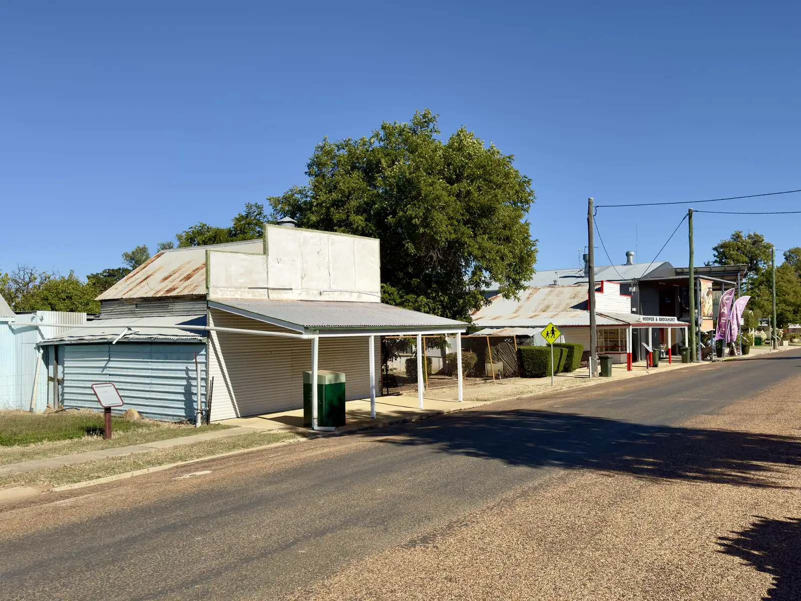
Historic downtown — old store, butcher, bakery and hotel on Experience Longreach. Hours change. Do not treat the street as a 24-hour gallery.
Yuranigh Pond — picnic 6 km on Emmet Road.
Oma Waterhole — 16 km south-west; camping, fishing, boat ramp, hot showers and toilets. Register at the Isisford Council Office. Subject to wet weather and flooding.
Barcoo Weir — short stroll from town on Experience Longreach; picnic, bird watching, walking tracks on Outback Queensland. Same camp fees as Oma.
Whitman’s Cafe — (07) 4658 8133. Golden West Hotel — lunch and dinner on Experience Longreach.
Isisford Swimming Pool — sporting complex with tennis court, skate park and BBQ area on Experience Longreach.
Events named on official pages: fishing competition last weekend of July; Outback Queensland names an annual Show in May and Ross Cup Races in October; Experience Longreach names the Isisford Sheep & Wool Show. Confirm any current date at 20 St Mary Street rather than assuming an annual booking.
Idalia National Park and Welford are 4WD park days, not main-street attractions. Parks: Idalia 102 km south-west of Blackall (Experience Longreach’s nature page prints 113 km — this hub quotes both and does not average). Empty chemical toilets in Blackall or Isisford, never in park toilets.
Where to stay
Official named types on the pages used here:
- Golden West Hotel — Experience Longreach names affordable accommodation and a caravan park
- Oma Waterhole camping — $5.00 per night per vehicle or $27.00 per vehicle for 7 nights; register at the Isisford Council Office
- Barcoo Weir camping — same fees and registration
- Longreach rooms — Outback Queensland’s stay list prints named Longreach parks and motels at 86 km
Those are official named types, not a ranked inventory. Confirm at 20 St Mary Street or (07) 4658 4141.
- How to choose: Isisford accommodation
- Camping detail: Isisford caravan parks
- Operator enquiries: feature your business
If Isisford is full, Longreach is 86 km on that stay list and has more rooms. That is a distance fact, not a booking guarantee.
Caravan and camping
Vans use Isisford as a quieter Barcoo overnight than Longreach on a festival weekend. Official named camps are the Golden West Hotel park, Oma Waterhole and Barcoo Weir. Ask the VIC for stay limits, dump points and whether the weir or Oma is open after rain. Read Isisford caravan parks and outback camping.
After rain, the Barcoo is the constraint. QLDTraffic first. Do not treat Yuranigh Pond as a legal overnight unless the VIC says it is.
Fuel and services
A locality of 218 people will not match Longreach for fuel choice, groceries or a hospital. This guide does not list bowser brands. Outback Queensland names a Cafe, Store, Hotel, Caravan Park, Swimming Pool and Golf Club. Queensland Parks’ Idalia visiting-safely page lists Isisford (approximately 150 km) among nearest fuel and supplies from that park, with Blackall and Yaraka. Confirm what is actually open when you arrive, especially on a Sunday. Fill up in Longreach or Blackall if you are continuing toward Idalia or Welford without a confirmed bowser. For current questions, use Longreach Regional Council and (07) 4658 4141.
Road access
Isisford is off the sealed Matilda Way Landsborough spine. Reach it from Longreach / Ilfracombe, or from Blackall on the Isisford Road that Parks uses as the first leg toward Idalia. Experience Longreach places The Twelve Mile approximately 20 kilometres south of Ilfracombe on the Ilfracombe–Isisford Road — that is an Ilfracombe outing, not an Isisford kilometre invented here.
The Isisford Yaraka River Road is the Oma and Yaraka corridor. After rain, check QLDTraffic and 13 19 40. Do not drive around closed signs to keep a fishing-comp booking. Parks: even small amounts of rain can make Idalia and Welford roads impassable; carry extra supplies.
Queensland Rail’s Spirit of the Outback serves Longreach, 86 km on the stay list. Regional flights serve Longreach Airport. This hub does not invent an Isisford passenger timetable.
Nearby parks and towns
Parks and named nature sites:
- Barcoo River, Oma Waterhole and Barcoo Weir (Experience Longreach; Outback Queensland)
- Yuranigh Pond (6 km)
- Idalia National Park — Gowan Range, Monks Tank camping, 4WD; Parks 102 km south-west of Blackall
- Welford National Park — 45 km south of Jundah on Parks; southern entrance via Blackall then Yaraka then the Yaraka–Retreat Road (Parks: Blackall 260 km on that southern approach)
Towns on this site:
- Longreach — 86 km; Stockman’s Hall of Fame, Qantas Founders Museum, Thomson River
- Ilfracombe — Machinery Mile on the Landsborough
- Blackall — woolscour, Idalia approach
- Yaraka — 100 km; Mount Slowcombe
- Jundah — Thomson, Welford northern approach
- Stonehenge — Thomson Developmental Road
When to go, and how long
Isisford Post Office’s December mean maximum of 37.1 °C is hot for a main-street museum walk at midday. July’s 22.8 °C mean maximum is the comfortable walking season on paper; July’s 6.7 °C mean minimum is why a weir camp needs a layer. Annual rainfall 448.0 mm on the open station is wetter than many south-west tables on this site. Two hours at the Interpretation Centre, Big Yellowbelly and hotel verandah is the minimum. A night lets you use Oma or the weir if the council office has taken your registration. Two nights only if you are adding Idalia or a Longreach museum day, and QLDTraffic agrees.
Queensland Parks recommends April to September for Idalia and Welford; summer temperatures on those park pages reach over 40 °C, and summer rain often causes flooding. Experience Longreach already shortens Longreach Explore Centre weekend hours in summer. Treat that as an operational response to the same climate table, not a closed season for Isisford.
Operators who want a checked listing: feature your business. The listings slot on this hub stays empty until then.
Plan this trip
Tell us the dates, who you are travelling with and where you need help. We reply with planning notes for Isisford — we are not a booking agent.
Events and road-conditions newsletter
Occasional notes on outback festivals, race days and official road-condition sources — not a daily blast. We use these details only to send the newsletter.
Queensland · Central West
Isisford accommodation
Where to stay in Isisford: Golden West Hotel rooms named by Experience Longreach, Oma Waterhole and Barcoo Weir camping at published council fees, and Longreach rooms 86 km.
Read · 3 min
Queensland · Central West
Isisford caravan parks
Camping in Isisford: Golden West Hotel caravan park named by Experience Longreach, Oma Waterhole 16 km and Barcoo Weir at published council fees. Idalia is a separate 4WD permit camp.
Read · 4 min
Queensland · Central West
Isisford weather
Isisford climate from BOM Isisford Post Office (036026): December mean max 37.1 °C, July 22.8 °C, annual rainfall 448.0 mm. Station open; use QLDTraffic for the week you drive.
Read · 4 min
Queensland · Central West
Things to do in Isisford
Things to do in Isisford: Outer Barcoo Interpretation Centre, Big Yellowbelly, Whitman’s museums, Oma Waterhole 16 km and Idalia as a 4WD day. Sourced list only.
Read · 6 min
Frequently asked questions
How far is Isisford from Longreach and Yaraka?
Outback Queensland’s Isisford stay list prints named Longreach parks at 86 km. The same organisation’s Yaraka town page puts Yaraka 100 km from Isisford.
What is Isisford’s population?
218 people at the 2021 Census for Isisford suburbs-and-localities (SAL31416). The ABS does not publish a 2021 Urban Centre (UCL) named Isisford. Median age 54.
Where is the visitor centre?
Longreach Regional Council places the Isisford Visitor Information Centre at 20 St Mary Street. Queensland Parks’ Idalia about page prints the Outer Barcoo Interpretation Centre at 12 Saint Mary Street, phone (07) 4658 8133. Longreach Explore Centre phones are (07) 4658 4141 or (07) 4658 4142.
Can I camp at Isisford?
Yes, as named types. Experience Longreach names Oma Waterhole (16 km on the Isisford Yaraka River Road) and Barcoo Weir, both $5 per night per vehicle or $27 per vehicle for 7 nights, register at the Isisford Council Office. The Golden West Hotel is named with a caravan park.
What is the weather like in Isisford?
BOM Isisford Post Office (036026) monthly means: December mean maximum 37.1 °C, July 22.8 °C, annual rainfall 448.0 mm. The station is open.
Is Isisford on the Matilda Way?
Isisford sits off the sealed Landsborough Highway spine. The Matilda Way runs through Blackall, Barcaldine and Longreach nearby. Tambo’s visitor guide on this site names a Barcoo Way idea west through Blackall, Isisford and Yaraka toward Windorah — a touring idea, not a guarantee that every side road is sealed.
Sources and further reading
Facts on this page were checked against these primary and official sources. Conditions change — confirm before you travel or buy.
- Isisford 2021 Census QuickStats (SAL31416) — Australian Bureau of Statistics
- Climate statistics for Isisford Post Office (036026) — Bureau of Meteorology
- Climate statistics for Isisford Post Office all-years (036026) — Bureau of Meteorology
- Experience Longreach — Isisford — Longreach Regional Council (Experience Longreach)
- Experience Longreach — Nature — Longreach Regional Council (Experience Longreach)
- Longreach Regional Council — Visitors and Travellers — Longreach Regional Council
- Outback Queensland — Isisford — Outback Queensland Tourism Association
- Outback Queensland — Yaraka — Outback Queensland Tourism Association
- Idalia National Park — Queensland Parks and Wildlife Service
- About Idalia — Queensland Parks and Wildlife Service
- Visiting Idalia safely — Queensland Parks and Wildlife Service
- Welford National Park — Queensland Parks and Wildlife Service
- Visiting Welford safely — Queensland Parks and Wildlife Service
- QLDTraffic — Queensland Government