At a glance
Sourced facts only. Distances and services change — confirm before you travel.
- Population
- 122 people (SAL31249, 2021 Census)
- Local government
- Burke Shire
- Nearest regional city
- Burke Shire’s visitor page prints road distances from Burketown, not a Gregory–Mount Isa kilometre this guide will invent. This site’s Boodjamulla park page places the park about 340 km north-west of Mount Isa, with the common route from Cloncurry or Mount Isa via Gregory.
- Nearest fuel
- Gregory Downs Hotel sells diesel only (Explore Burke; Burke Shire directory). Confirm hours when you arrive. Unleaded is not named at the hotel on those pages.
- Nearest hospital or clinic
- Gregory Downs Clinic: Royal Flying Doctor Service every second Wednesday (Burke Shire visitor page). Not staffed permanently. Confirm with Queensland Health.
- Mobile coverage
- Check Telstra and Optus coverage maps before travel; do not assume a signal on the Wills Developmental Road or the Boodjamulla run.
- Best time to visit
- May–September (cooler Burketown Post Office mean maxima); this is a labelled neighbour table, not a Gregory street mean. Wet-season roads close.
Climate
Monthly means from the Bureau of Meteorology station Burketown Post Office (029004). This is not a forecast. Open temperature table for the named Burke Shire neighbour. Gregory Downs Outstation (029100) is rainfall-only (opened 1902, elevation 78 m). Do not blend the two.
| Month | Mean max (°C) | Mean min (°C) | Rainfall (mm) |
|---|---|---|---|
| Jan | 34.2 | 25.0 | 223.5 |
| Feb | 33.6 | 24.7 | 201.5 |
| Mar | 33.5 | 23.5 | 161.9 |
| Apr | 33.1 | 20.8 | 26.2 |
| May | 30.5 | 17.1 | 6.2 |
| Jun | 28.0 | 14.3 | 5.7 |
| Jul | 27.7 | 13.1 | 2.5 |
| Aug | 29.4 | 14.5 | 1.0 |
| Sep | 31.9 | 17.8 | 1.8 |
| Oct | 34.2 | 21.1 | 12.7 |
| Nov | 35.4 | 23.7 | 40.5 |
| Dec | 35.4 | 24.8 | 115.3 |
Gregory in pictures
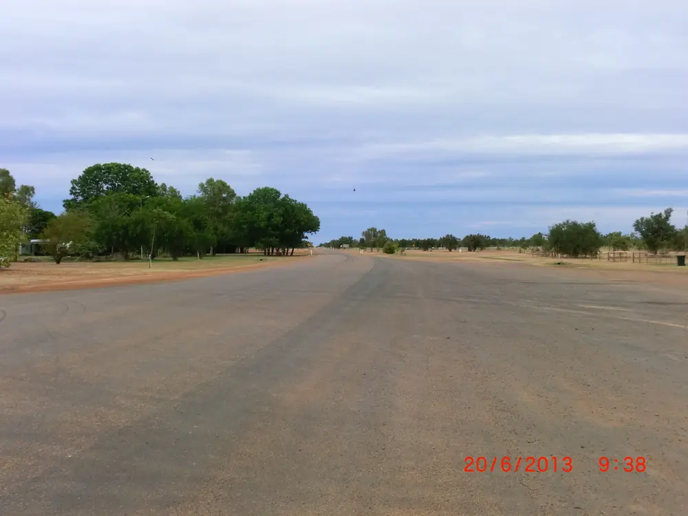
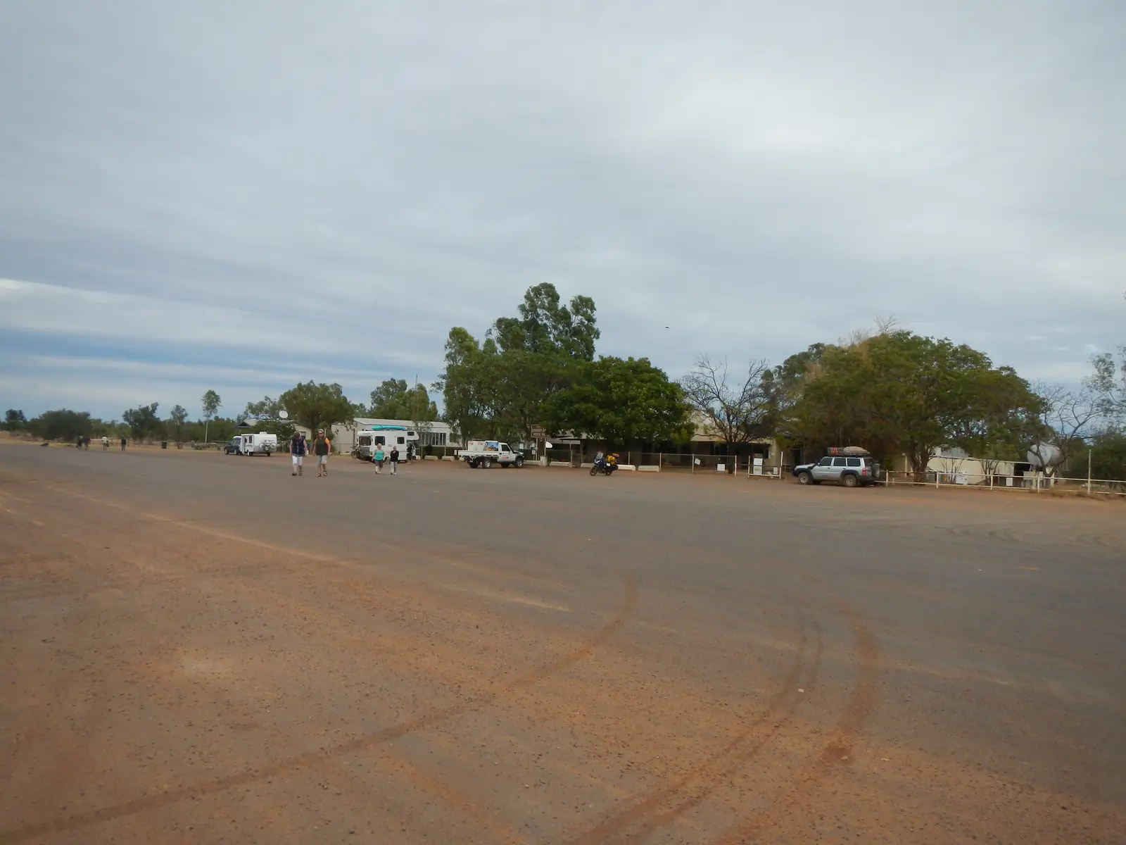
Road through the Gregory Downs settlementPhoto: Lobster1 · CC BY-SA 3.0 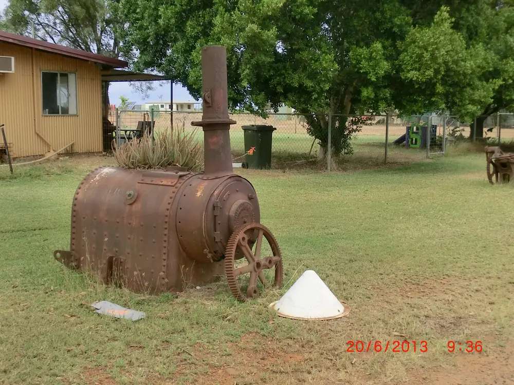
Historic boiler on a Gregory Downs propertyPhoto: Lobster1 · CC BY-SA 3.0 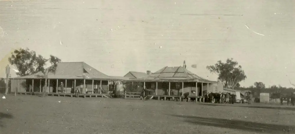
Gregory Downs HotelPhoto: State Library of Queensland · Public domain 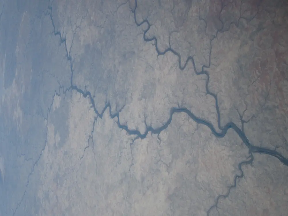
Gregory River in Boodjamulla, the named nearby parkPhoto: Bidgee · CC BY-SA 3.0 au
Gregory, Queensland sits in Burke Shire on the Wills Developmental Road, in Queensland’s outback north inventory on this site. Explore Burke’s township page is the source for that placement: originally called Gregory Downs, the town officially changed its name to Gregory in 2013. This is not Gregory in Western Australia, and it is not Judbarra / Gregory National Park in the Northern Territory. Search Gregory Downs Qld if a search engine offers the wrong state first.
The 2021 Census counted 122 people in the locality. Travellers stop because the Gregory Downs Hotel has served drinks since 1877, because a free township camp sits on the Gregory River, and because Boodjamulla (Lawn Hill) National Park is approached from Cloncurry or Mount Isa via Gregory on this site’s park page. You still need QLDTraffic in the wet, because a Gulf run toward Burketown is no use if the Wills Developmental Road is closed.
Where it is, and how far
Gregory is the Burke Shire stop on the Wills Developmental Road between the Cloncurry / Mount Isa inland run and Burketown / Boodjamulla country. Burke Shire’s visitor page prints road distances from Burketown, not a Gregory street kilometre. This hub reprints those Burketown figures as labelled and does not convert them into a fake Gregory–Mount Isa total.
| Place | Distance (official pages used here) |
|---|---|
| Burketown | Burke Shire distances below are from Burketown, not from Gregory |
| Mount Isa via Camooweal | 400 km from Burketown; 257 km Camooweal–Gregory mostly unsealed — council: not recommended for caravans or conventional vehicles |
| Mount Isa via Cloncurry | 565 km from Burketown — sealed with some single-lane sections |
| Cloncurry via Burke Developmental Road | 450 km from Burketown, sealed, allow 6 hours |
| Cairns via Savannah Way | 878 km from Burketown, allow 12 hours |
| Boodjamulla (Lawn Hill) | this site’s park page: about 340 km north-west of Mount Isa; common route from Cloncurry or Mount Isa via Gregory. No Gregory–park kilometre on the Gregory pages used here |
| Camooweal | on the unsealed Camooweal–Gregory stretch named above; no extra Gregory kilometre invented here |
| Brisbane | not published on those Gregory pages |
Mount Isa and Cloncurry are the inland service towns. Camooweal is the Barkly Highway neighbour on the unsealed alternative. Use QLDTraffic for the day you drive.
Facts at a glance
Population. ABS 2021 Census, Suburbs and Localities SAL31249 Gregory (Qld): 122 people. Median age 39. Sex split 57.5% male / 42.5% female. Families 18. Private dwellings 196. Average household size 2.3. Median weekly household income $900. The ABS does not publish a 2021 Urban Centre named Gregory on the product used here. Explore Burke’s township page says a population of approximately 50 people; that is not the Census count and is not used as one here. QuickStats notes small-area confidentiality. Use the Gregory (Qld) SAL QuickStats.
Climate. BOM GREGORY DOWNS OUTSTATION, 029100, 18.64°S, 139.25°E, elevation 78 m, opened 1902, status Open. Rainfall-only. All-years monthly means: annual 566.8 mm; January 147.7 mm wettest; August 0.6 mm driest. BOM does not publish a monthly climate-averages temperature table for that station. The labelled Burke Shire comparison table used here is Burketown Post Office, 029004, commenced 1886, elevation 6 m, January mean maximum 34.2 °C, July 27.7 °C, July mean minimum 13.1 °C, annual rainfall 788.4 mm. Do not blend Gregory rain with Burketown rain. Full Burketown columns: BOM Burketown Post Office. See Gregory weather.
Visitor information. There is no Gregory visitor information centre on the sourced pages. Use Burketown Visitor Centre, corner of Musgrave and Burke Streets, managed by Gangalidda Garawa Services, (07) 4745 5111, Monday–Friday 9:00am–4:00pm during the tourist season March to October, after hours and weekends by appointment on Burke Shire’s visitor page. Hours change.
Traditional Owners
Explore Burke: the traditional owners of the Gregory River are the Waanyi people, who call the river at Gregory Bidunggu or Ngumaurina. Parks QLD’s Boodjamulla page names Waanyi as Traditional Owners of the park and records that Boodjamulla means rainbow serpent country. This hub prints river and park wording as sourced. It does not flatten park groups onto every Gregory street. Visit as a guest; see visiting Country respectfully. Confirm a Welcome to Country sentence at the Burketown visitor centre.
History
Explore Burke is the visitor-history source used here.
In 1861, William Landsborough came across the river during his expedition to find the lost Burke and Wills expedition. He found the river while travelling from Burketown and followed it to the Barkly Tableland. He named it the Gregory River in honour of Augustus Gregory, then Queensland Surveyor General. Read more in this site’s Burke and Wills guide.
The township was originally called Gregory Downs and officially changed its name to Gregory in 2013. The Gregory Downs Hotel has been serving drinks since 1877 on Burke Shire’s business directory and Explore Burke’s hotel listing.
This hub does not invent a pastoral production table the shire pages do not print.
Things to do
Gregory Downs Hotel. Wills Developmental Road, (07) 4748 5566. Historic pub since 1877. Explore Burke: meals, diesel only, takeaway food and beverages, accommodation available. Hours change. Confirm before you treat the verandah as a guaranteed lunch.
Murray’s Place. Named on Explore Burke’s township and caravan pages as a café. This guide does not invent a second street address those pages do not print.
Township facilities. Explore Burke names public toilets, a playground with BBQs, tennis courts, a race track, a community hall and an airstrip.
Gregory River. Named for swimming in the hotel directory’s “after a day of swimming” sentence, and for low-impact camping. Freshwater crocodiles live in north-west Queensland waterways on this site’s crocodile safety guide. Do not assume a swimming hole is crocodile-free.
Boodjamulla (Lawn Hill) National Park. The reason most travellers pass through. Canoeing Lawn Hill Gorge, Indarri Falls, Riversleigh D Site. See Boodjamulla and Riversleigh. Adels Grove is named on Burke Shire’s accommodation list as a stay near the park, not as a Gregory town page.
A fuller order of a day is on things to do in Gregory.
Nearby, not in the main street: Burketown for Morning Glory season and the Albert River; Mount Isa for Outback at Isa; Cloncurry for Cloncurry Unearthed.
Where to stay
Burke Shire and Explore Burke name Gregory Downs Hotel Motel for food, fuel and accommodation, (07) 4748 5566. They do not print a room count, a tariff or a star rating. This hub will not invent them.
- How to choose a type of stay: Gregory accommodation
- Parks and camping: Gregory caravan parks
- Operator enquiries: feature your business
If Gregory is full, Burketown is the shire centre; Adels Grove and the Boodjamulla campground are named on Burke Shire’s accommodation list for the park end of the road. That is geography, not a booking guarantee.
Caravan and camping
Vans use Gregory because it is the Boodjamulla approach and a named free camp. Burke Shire: a free, low-impact camping area in the township of Gregory Downs; the council does not encourage camping within the banks of the Gregory River. Explore Burke: self-contained camping, maximum 7 days, take all rubbish home; sites behind the hotel next to the river; dump point opposite the pub. Print both wordings. Read Gregory caravan parks and outback camping.
The Camooweal–Gregory 257 km stretch is mostly unsealed and not recommended for caravans on Burke Shire’s visitor page. Use the sealed Cloncurry route unless QLDTraffic and your rig say otherwise.
Fuel and services
Explore Burke: diesel only from the hotel. Unleaded is not named at Gregory on those pages. Fill with a plan in Cloncurry, Mount Isa or Burketown. There is no supermarket named in Gregory. Gregory Downs Clinic operates every second Wednesday through the Mount Isa Royal Flying Doctor Service and is not staffed permanently. Call 000 in an emergency.
For current questions, use Burke Shire Council and (07) 4745 5111 at Burketown in season.
Road access
The Wills Developmental Road is the named spine through Gregory. It is remote Gulf country, shared with road trains. Check QLDTraffic and 13 19 40. Do not drive around closed signs to keep a hotel meal.
Inland: Cloncurry or Mount Isa via the sealed route Burke Shire names from Burketown as 565 km. Unsealed alternative: Camooweal–Gregory 257 km, not recommended for vans. North: Burketown and the Savannah Way. West: Boodjamulla. This is not Channel Country, and it is not the Victoria Highway.
Nearby parks and towns
Named nature sites (official pages):
- Gregory River — Bidunggu / Ngumaurina on Explore Burke
- Boodjamulla (Lawn Hill) National Park — gorge, canoeing, Waanyi Country
- Riversleigh World Heritage Area — D Site fossils
Towns on this site:
- Burketown — shire centre, Morning Glory
- Mount Isa — inland service city
- Cloncurry — sealed inland approach
- Camooweal — Barkly Highway neighbour on the unsealed alternative
When to go, and how long
Burketown Post Office’s January mean maximum of 34.2 °C is hot for a river camp at midday. July’s 27.7 °C mean maximum is still warm; July’s 13.1 °C mean minimum is why a van night needs a layer. Gregory Downs Outstation’s January mean rainfall of 147.7 mm and August 0.6 mm are why the wet season isolates this road. Two hours at the hotel and the river is the minimum. A night lets you use the named camp or motel if confirmed. Two nights only if you are adding Boodjamulla and QLDTraffic agrees. This site’s Boodjamulla page names April to September as the park season.
Operators who want a checked listing: feature your business. The listings slot on this hub stays empty until then.
Plan this trip
Tell us the dates, who you are travelling with and where you need help. We reply with planning notes for Gregory — we are not a booking agent.
Events and road-conditions newsletter
Occasional notes on outback festivals, race days and official road-condition sources — not a daily blast. We use these details only to send the newsletter.
Guide
Gregory accommodation
Where to stay in Gregory (Gregory Downs) — Gregory Downs Hotel Motel as named by Burke Shire. Confirm diesel, rooms and the township camp. Not Gregory WA.
Read · 4 min
Guide
Gregory caravan parks
Camping around Gregory (Gregory Downs) — Burke Shire free low-impact township camp, seven-day limit, dump point opposite the pub. Do not camp in the river banks. Not recommended via Camooweal for vans.
Read · 4 min
Guide
Gregory weather
Gregory (Gregory Downs) weather — Gregory Downs Outstation is rainfall-only. Use labelled Burketown Post Office (029004) means. Check QLDTraffic; the Camooweal stretch is not recommended for vans.
Read · 4 min
Guide
Things to do in Gregory
Things to do in Gregory (Gregory Downs) — Gregory Downs Hotel, Murray’s Place, Gregory River, township camp and the Boodjamulla (Lawn Hill) approach. Not Gregory WA.
Read · 3 min
Frequently asked questions
Is this Gregory in Queensland or Western Australia?
This guide is Gregory, Queensland, in Burke Shire on the Wills Developmental Road — formerly Gregory Downs, renamed Gregory in 2013 on Explore Burke’s township page. It is the Boodjamulla (Lawn Hill) approach town. Search Gregory Downs Qld if a search engine offers Gregory WA or Judbarra / Gregory National Park in the Northern Territory first.
What is Gregory’s population?
122 people at the 2021 Census for Gregory (Qld) suburbs-and-localities (SAL31249). Median age 39. The ABS does not publish a 2021 Urban Centre (UCL) named Gregory on the QuickStats product used here. Explore Burke’s “approximately 50 people” sentence is not the Census count.
How far is Gregory from Mount Isa and Burketown?
Burke Shire’s visitor page prints distances from Burketown, not a Gregory kilometre this guide will invent: Mount Isa via Camooweal 400 km (257 km Camooweal–Gregory mostly unsealed, not recommended for caravans); Mount Isa via Cloncurry 565 km. This site’s Boodjamulla page places the park about 340 km north-west of Mount Isa via Gregory.
What is the weather like in Gregory?
BOM Gregory Downs Outstation (029100) is rainfall-only: annual mean 566.8 mm, January 147.7 mm wettest, August 0.6 mm driest. For temperature use Burketown Post Office (029004), labelled as a different station: January mean maximum 34.2 °C, July 27.7 °C, annual rainfall 788.4 mm.
Can I camp at Gregory?
Yes, as a named type. Burke Shire operates a free, low-impact camping area in the township and does not encourage camping within the banks of the Gregory River. Explore Burke names self-contained camping, maximum 7 days, take rubbish home, with a dump point opposite the pub.
Whose Country is Gregory on?
Explore Burke: the traditional owners of the Gregory River are the Waanyi people, who call the river at Gregory Bidunggu or Ngumaurina. Parks QLD’s Boodjamulla page names Waanyi as Traditional Owners of the park. Confirm Welcome to Country at the Burketown visitor centre rather than flattening park wording onto every street.
Sources and further reading
Facts on this page were checked against these primary and official sources. Conditions change — confirm before you travel or buy.
- Gregory (Qld) 2021 Census QuickStats (SAL31249) — Australian Bureau of Statistics
- Monthly rainfall — Gregory Downs Outstation (029100) — Bureau of Meteorology
- Climate statistics for Burketown Post Office (029004) — Bureau of Meteorology
- Gregory — Explore Burke — Burke Shire Council (Explore Burke)
- Gregory Downs Hotel — Explore Burke — Burke Shire Council (Explore Burke)
- Gregory Downs Hotel — Burke Shire Council — Burke Shire Council
- Caravans — Explore Burke — Burke Shire Council (Explore Burke)
- Tourist and Visitor Information — Burke Shire Council — Burke Shire Council
- Boodjamulla (Lawn Hill) National Park — Queensland Parks and Wildlife Service
- QLDTraffic — Queensland Government