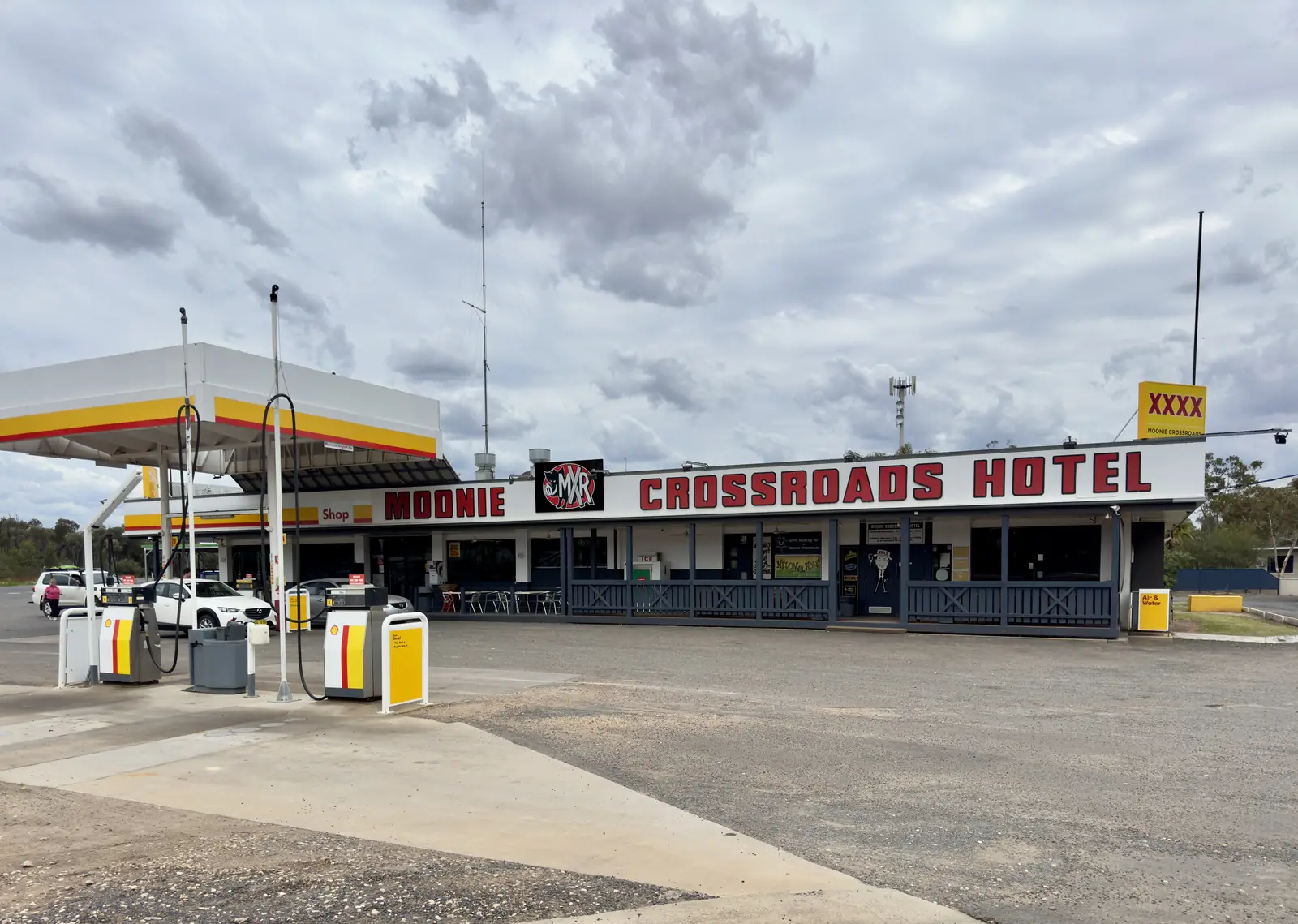
Moonie sits at the intersection of the Leichhardt Highway and the Moonie Highway. Western Downs Queensland’s Experience Moonie brochure is the camping source used here. It names Moonie Crossroads as a café, motel, caravan park, licensed hotel and fuel station. It does not print a powered-site count, a dump-point street, a tariff or a booking URL. This page will not invent them.
Confirm a site at the Moonie Rural Transaction Centre, Lot 37 Leichhardt Highway, (07) 4665 0189, moonie.rtc@wdrc.qld.gov.au. Brochure hours: Monday–Friday 9am–3pm, Saturday 10am–2pm, Sunday 9am–12pm. Hours change. A Sunday arrival without a call is a risk.
Fuel is named at the same Crossroads stop. Bowser brands, LPG and 24-hour hours are not printed. Fill with a plan. There is no Moonie hospital on the sourced pages. Confirm with Queensland Health rather than assuming a clinic.
The Moonie and Weir Rivers are named for fishing, birdwatching and stargazing. Yellowbelly or cod are the fish the brochure tells you to ask about. The brochure does not print a public river camp. Stay off private banks. After flood, stay off closed country. Queensland fisheries rules apply.
Working oilfield land is not a freedom camp. Australia’s first onshore oilfield was established here in 1961. Production land remains private. Do not unhitch beside a well because a photograph looked empty.
If the Crossroads park is full, Tara is the named Western Downs neighbour on the festival FAQ (about 45 km on the Leichhardt Highway then about 28 km on the Surat Developmental Road from Tara). Miles and Dalby are the larger service towns on this site. Chinchilla sits on the Warrego Highway. St George is further south-west. Those towns are geography, not a site guarantee.
The Leichhardt and Moonie Highways are freight roads, shared with road trains. Check QLDTraffic and 13 19 40. Do not drive around closed signs to keep a van night. Read outback camping for general outback van rules this site already publishes.
Dalby Airport (041522) is the labelled neighbour climate table on the hub: January mean maximum 32.7 °C, July mean maximum 19.8 °C, July mean minimum 4.1 °C, annual rainfall 598.6 mm. A July van night needs a layer. Full columns: Moonie weather.
This page will not invent extra parks.
Types of camp to ask about
Ask the Rural Transaction Centre about:
- Moonie Crossroads caravan park — the only named park on the Experience Moonie brochure, sitting with the motel, licensed hotel and fuel station.
- Dump-point access — confirm the street; this page does not invent one.
- River overnight — not printed as a public camp on the brochure. Stay off private Moonie and Weir River banks.
- Tara, Miles or Dalby parks — fallbacks when the Crossroads is full. See those towns’ own camping pages rather than assuming a Moonie overflow.
Those are categories, not bookings.
How to choose
Arriving after the RTC has closed. Brochure Sunday hours end at midday. Have a fallback rather than unhitching on the highway reserve.
One night, self-contained. Ask whether a Crossroads site is open. If the answer is no, continue to Tara or Dalby while you are still legal and awake.
Towing, two nights. Confirm powered sites, pets, stay limits and whether the Leichhardt Highway is clear. After rain, QLDTraffic (13 19 40) decides. Closed means closed.
Summer. Labelled Dalby Airport January mean maximum 32.7 °C. A canvas camp in that heat is for people who already know inland camping. Read Moonie weather.
Oilfield land. Australia’s first onshore oilfield was established here in 1961. Production land remains private. Do not treat a well pad as a freedom camp.
Official pages, not a round-up
If a third-party site lists a free camp we have not sourced, treat it as unverified.
Empty listings on Outback Now
We do not publish invented operators, prices or ratings. Town listings stay empty until a business asks to appear and we have checked it. If you run a park in Moonie, use feature your business. Until then, the Rural Transaction Centre is the directory.
If Moonie is the wrong size for your rig
Dalby and Miles have larger service-town parks. Tara has lagoon parklands. Use Moonie when you want the highway junction and the oilfield panels — not when you need a guaranteed dump-and-pool complex.
Related
Plan this trip
Tell us the dates, who you are travelling with and where you need help. We reply with planning notes for Moonie — we are not a booking agent.
Frequently asked questions
Is there a caravan park in Moonie?
Yes. The Experience Moonie brochure names Moonie Crossroads as a café, motel, caravan park, licensed hotel and fuel station. It does not print a site count or a tariff.
Where is the dump point?
Confirm dump-point rules at the Moonie Rural Transaction Centre, Lot 37 Leichhardt Highway, (07) 4665 0189. This page does not invent a dump-point street.
Can I camp on the Moonie or Weir Rivers?
The brochure names fishing, birdwatching and stargazing on those rivers. It does not print a public river camp GPS. Stay off private banks and closed flood country.
Is the highway suitable for vans?
The Leichhardt and Moonie Highways are named sealed spines through this junction. They are freight roads. Check QLDTraffic and 13 19 40 after rain. Do not drive around closed signs.
Sources and further reading
Facts on this page were checked against these primary and official sources. Conditions change — confirm before you travel or buy.
- Experience Moonie brochure — Western Downs Regional Council
- Tourism and Destination Events — Western Downs Regional Council — Western Downs Regional Council
- QLDTraffic — Queensland Government
- Outback camping — Outbacknow