Moonie is a Western Downs crossroads of 182 people at the 2021 Census (SAL31902). Western Downs Queensland’s Experience Moonie brochure is the visitor-day source used here. It names a Rural Transaction Centre, an oil-rig photograph, a licensed highway stop, a sports club and two rivers. It does not print a museum street or a secret fishing GPS. This page stays inside that list.
Start at the Moonie Rural Transaction Centre and Visitor Information Centre, Lot 37 Leichhardt Highway, (07) 4665 0189, moonie.rtc@wdrc.qld.gov.au. Brochure hours: Monday–Friday 9am–3pm, Saturday 10am–2pm, Sunday 9am–12pm. The desk sells souvenirs, artisan gifts and locally made produce and carries library and postal services. Interpretive panels on the Moonie oilfields sit here. Hours change. Ask before you time a Sunday arrival.
The brochure’s history is short and specific. The town’s name is inspired by the Moonie River, first recorded as Mooni by Sir Thomas Mitchell in November 1846. European settlement in the district is dated to about 1849 at Weranga. Australia’s first onshore oilfield was established here in 1961. Production commenced in 1964. The late-1960s peak was around 9500 barrels of oil per day. By the end of 2008 the rate had declined to 200 barrels per day. Of 38 wells drilled to date on that brochure, 32 have produced oil, with an economic limit printed as 2059. The Oil Rig photograph is the named selfie stop. Working wells are not a public walking track. Stay off private production land.
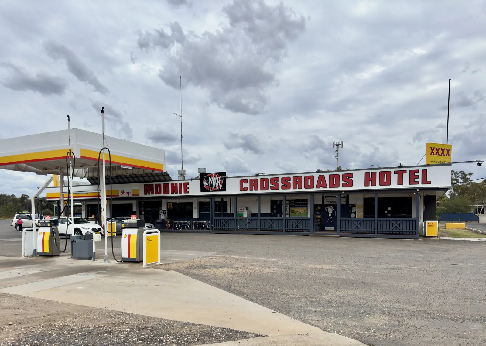
Moonie Crossroads is named as a café, motel, caravan park, licensed hotel and fuel station, with murals and stories of emergency landings. It is a highway stop, not a second town. Confirm meals and hours at the RTC.
Moonie Sports Club is named as the district social hub. Fixture lists are not printed on the brochure. Ask locally.
Moonie and Weir Rivers are named for fishing, birdwatching and stargazing. Yellowbelly or cod are the fish the brochure tells you to ask about. Queensland fisheries rules apply. This page does not invent a hole, a boat ramp or a camping GPS on the bank. After flood, stay off closed banks and check QLDTraffic.
A locality this size does not hold a second-day street. Nearby, not in Moonie: Tara for Tara Lagoon Parklands and the biennial Tara Festival of Culture and Camel Races. The festival FAQ is the page that prints a Tara–Moonie leg: about 45 km north on the Leichhardt Highway then about 28 km on the Surat Developmental Road from Tara. Dalby is the larger Downs service town on the Moonie Highway. Miles sits on the Warrego–Leichhardt crossroads. Chinchilla is the next Warrego Highway neighbour. St George is further south-west. This site does not publish a Goondiwindi town guide in this wave.
Dalby Airport (041522) is the labelled neighbour climate table used on the hub: January mean maximum 32.7 °C, July 19.8 °C. Midday in January is a poor time for a panel walk. July’s 4.1 °C mean minimum is why a river evening needs a layer. Full columns live on Moonie weather.
Two hours at the RTC, the oil-rig photograph and the Crossroads is an honest day. A night only if a Crossroads motel or van site has been confirmed.
How to spend the hours you have
Forty-five minutes. Interpretive panels at Lot 37, a photograph at the named Oil Rig, a question about what is open at the Crossroads.
Half a day. Add the Sports Club if a fixture is on, or a river stop only if QLDTraffic and fisheries rules agree. Do not invent a hole the brochure does not print.
Overnight plus. Crossroads motel or van park if confirmed, then Tara Lagoon Parklands or the Leichhardt run toward Miles. Two full tourist days is more than the sourced Moonie list supports unless you are using the junction as a rest day on the Great Inland Way.
What this page will not add
Farm-stay tours, unnamed lookouts, a public well tour, a Goondiwindi town-guide link (that page is not on this site in this wave), or a Dalby kilometre the Moonie brochure does not print. If a third-party site lists an attraction we have not sourced, treat it as unverified and ask (07) 4665 0189.
Western Downs Regional Council’s First Nations page names the Bigambul around the Tara area among Traditional Owners of the Western Downs. Confirm Welcome to Country at the RTC rather than flattening a neighbouring label onto the oilfield townsite. See visiting Country respectfully.
Operators: feature your business. The parent hub is Moonie.
Plan this trip
Tell us the dates, who you are travelling with and where you need help. We reply with planning notes for Moonie — we are not a booking agent.
Frequently asked questions
What is there to do in Moonie?
The Experience Moonie brochure names the Rural Transaction Centre and Visitor Information Centre, an oil-rig photograph, Moonie Crossroads, the Sports Club, and fishing and birdwatching on the Moonie and Weir Rivers.
Can I visit the oilfield itself?
The brochure invites a selfie at the Oil Rig and interpretive panels at the Rural Transaction Centre. It does not print a public tour of working wells. Stay off private production land unless an operator has invited you.
Is there a visitor centre?
Moonie Rural Transaction Centre and Visitor Information Centre, Lot 37 Leichhardt Highway, (07) 4665 0189. Brochure hours: Monday–Friday 9am–3pm, Saturday 10am–2pm, Sunday 9am–12pm.
What can I do nearby?
Tara Lagoon Parklands and the biennial camel-race festival sit in Tara, the named neighbour on the festival FAQ. Dalby and Miles are the larger Downs service towns on this site.
Sources and further reading
Facts on this page were checked against these primary and official sources. Conditions change — confirm before you travel or buy.
- Experience Moonie brochure — Western Downs Regional Council
- Tourism and Destination Events — Western Downs Regional Council — Western Downs Regional Council
- Getting Here — Tara Festival FAQ — Tara Festival of Culture and Camel Races
- QLDTraffic — Queensland Government