At a glance
Sourced facts only. Distances and services change — confirm before you travel.
- Local government
- Blackall-Tambo Regional Council
- Traditional Owners
- Blackall-Tambo Regional Council’s published acknowledgement names Aboriginal and Torres Strait Islander peoples as Traditional Custodians of the lands and waters, without a single-nation label for Tambo township on the pages used for this research. Confirm wording with the Tambo Visitor Information Centre before treating a nation name as settled.
- Mobile coverage
- Check Telstra and Optus coverage maps before travel; do not assume a signal.
- Best time to visit
- May–September on Tambo Post Office cooler mean maxima
Climate
Monthly means from the Bureau of Meteorology station Tambo Post Office (035069). This is not a forecast. Open. Commenced 1877. Elevation 395 m.
| Month | Mean max (°C) | Mean min (°C) | Rainfall (mm) |
|---|---|---|---|
| Jan | 35.1 | 20.6 | 78.9 |
| Feb | 33.9 | 20.0 | 76.5 |
| Mar | 32.5 | 17.8 | 61.3 |
| Apr | 29.2 | 12.8 | 36.7 |
| May | 25.0 | 8.2 | 32.7 |
| Jun | 21.7 | 5.0 | 27.9 |
| Jul | 21.4 | 3.9 | 26.4 |
| Aug | 23.7 | 5.2 | 18.5 |
| Sep | 27.5 | 9.2 | 21.1 |
| Oct | 31.1 | 13.9 | 35.5 |
| Nov | 33.3 | 17.2 | 48.1 |
| Dec | 34.8 | 19.3 | 68.7 |
Tambo in pictures
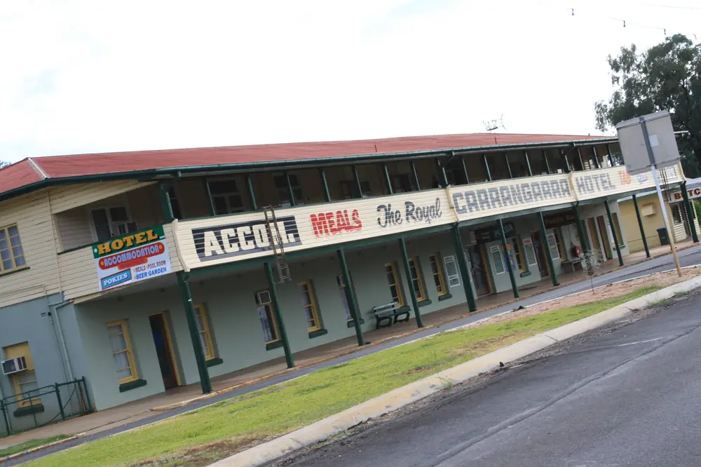
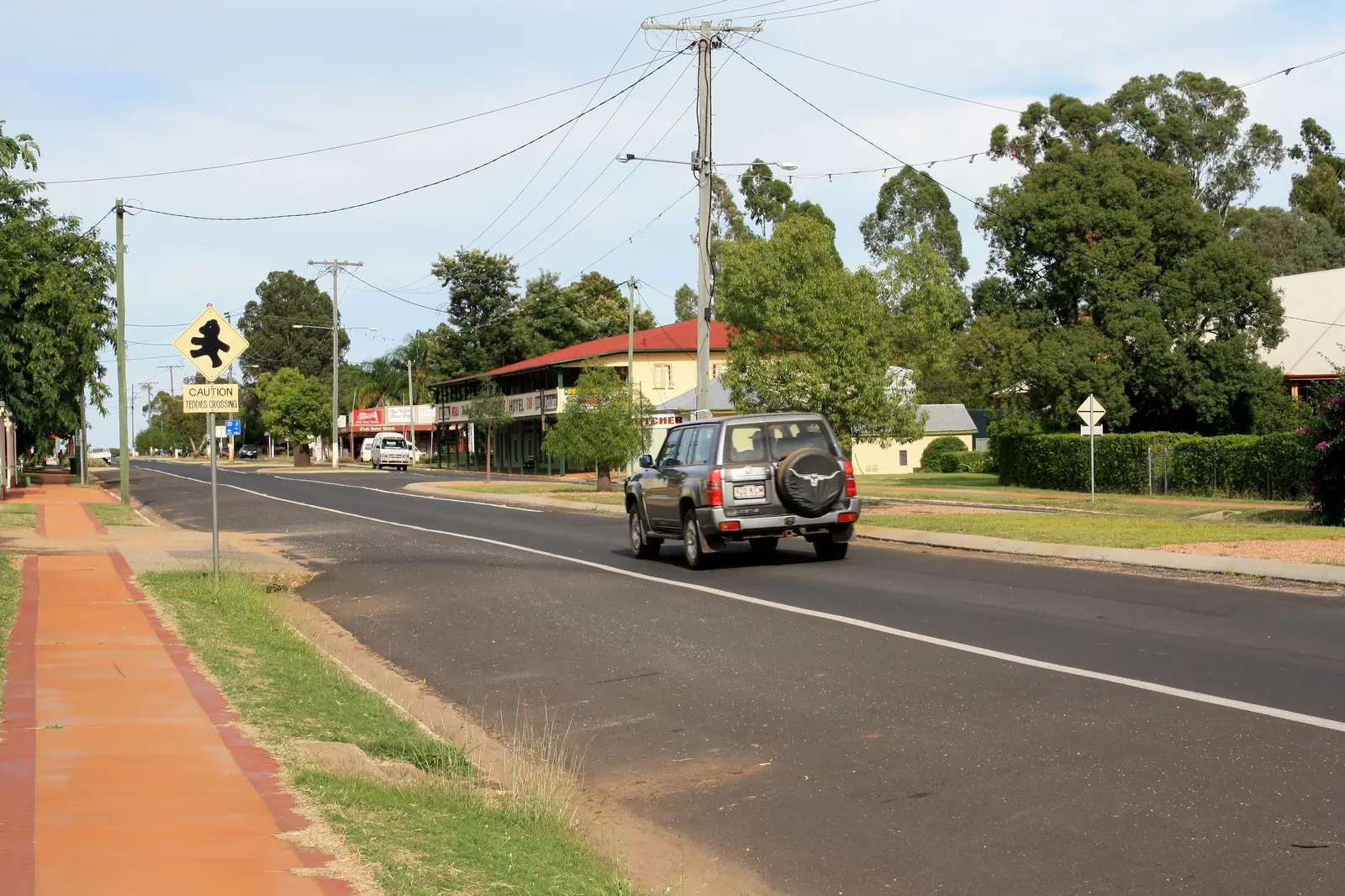
Tambo's Royal Carrangarra HotelPhoto: Troykeith85 · CC BY-SA 3.0 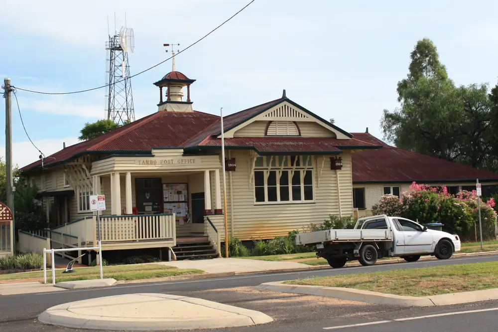
Post Office in TamboPhoto: Troykeith85 · CC BY-SA 3.0 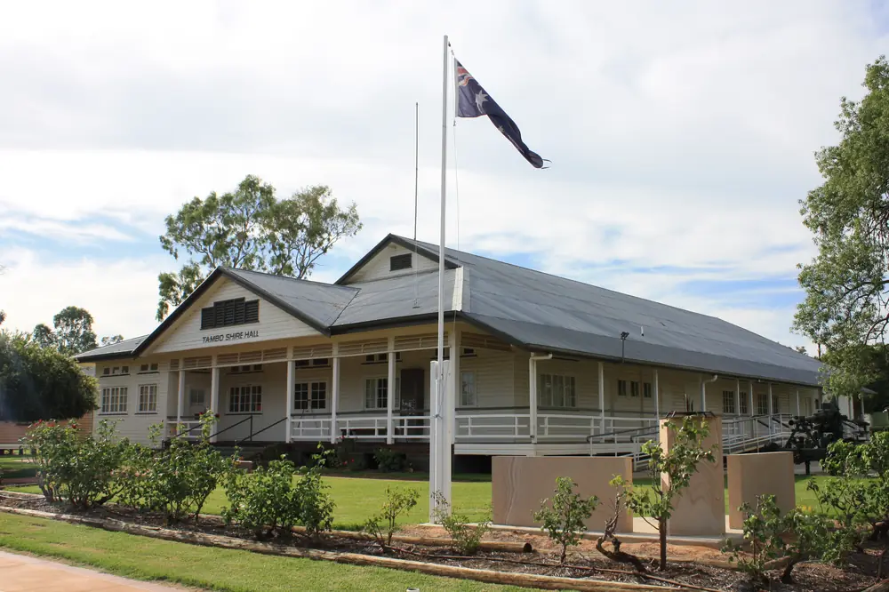
Tambo Shire Hall buildingPhoto: Troykeith85 · CC BY-SA 3.0 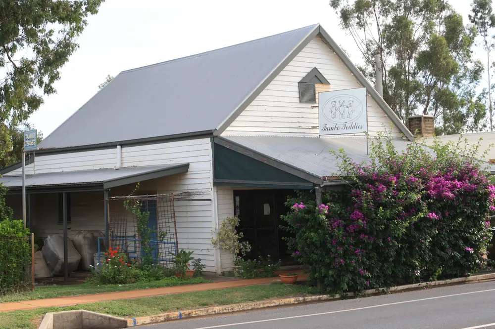
Tambo Teddy's WorkshopPhoto: Troykeith85 · CC BY-SA 3.0
Tambo sits on the Barcoo River in Queensland’s central west, in Blackall-Tambo Regional Council. Outback Queensland calls it the oldest town in western Queensland. Visit Blackall Tambo places Tambo and Blackall 100 km apart on the fully sealed Matilda Way. Council says both towns lie along the historic Barcoo on the Landsborough Highway (Matilda Way), with Tambo between Blackall to the north-west and Augathella to the south-east. The 2021 Census counted 283 people in the urban centre.
Travellers stop for Tambo Teddies, the Heritage Precinct, the river, and a quieter night than Longreach. You do not need a 4WD to reach Tambo in ordinary weather on the Landsborough Highway. You do need a high-clearance 4WD, and QLDTraffic, if you leave the bitumen for Salvator Rosa in Carnarvon National Park.
Where it is, and how far
Tambo is on the inland touring spine that Outback Queensland and Drive Queensland treat as the Matilda Way — Cunnamulla to Karumba via Charleville, Tambo, Blackall, Barcaldine and Longreach. Visit Blackall Tambo’s getting-here page: the region sits in the middle of that sealed route from Cunnamulla to Karumba, and Tambo and Blackall are 100 km apart. The 2026 visitor guide lists Brisbane to Tambo at about 862 km (around 9–10 hours). Council rounds the region to approximately 900 km north-west of Brisbane.
Queensland Parks puts Salvator Rosa (Carnarvon National Park) 135 km from Tambo via Mount Playfair Road. Outback Queensland describes Tambo as the starting point for the Wilderness Way, a 260 km self-drive toward the Great Dividing Range and Salvator Rosa. The visitor guide also names Tambo as a starting point for the Barcoo Way west through Blackall, Isisford and Yaraka toward Windorah — use that as a touring idea, not as a guarantee that every side road is sealed.
Kilometres from Tambo to Augathella, Barcaldine and Longreach were not on the council and Outback Queensland pages used for the town facts. This guide will not insert third-party figures. The sequence on the sealed highway is the fact: Augathella–Tambo–Blackall–Barcaldine–Longreach.
| Place | Distance from Tambo (official pages used here) |
|---|---|
| Blackall | 100 km (Visit Blackall Tambo) |
| Brisbane | about 862 km (2026 visitor guide) |
| Salvator Rosa (via Mount Playfair Road) | 135 km (Queensland Parks) |
| Augathella, Barcaldine, Longreach | not published as Tambo kilometres on those pages |
Facts at a glance
Population. Australian Bureau of Statistics 2021 Census, Urban Centres and Localities UCL322115, Tambo (L): 283 people. Median age 49. Sex split 50.0% male / 50.0% female. Families 77. Private dwellings 151. Median weekly household income $1,178. Use the ABS UCL QuickStats page. The suburbs-and-localities geography (SAL32730) counted 318 people, median age 48. Council’s “Our Region” page quotes a Tambo population of 600; that is not the 2021 UCL count. Do not mix the figures.
Climate. Bureau of Meteorology station TAMBO POST OFFICE, 035069, commenced 1877, 24.88°S, 146.26°E, elevation 395 m, status Open. Annual mean rainfall 531.2 mm (145 years, 1877–2026). Hottest month by mean maximum: January 35.1 °C. Coolest month by mean maximum: July 21.4 °C. July mean minimum 3.9 °C. August mean rainfall 18.5 mm is the driest month in the table. Full columns: BOM Tambo Post Office. See Tambo weather.
Visitor centre. Tambo Visitor Information Centre, heritage-listed Tambo Historical Courthouse (built 1888 on the council visitor page), 9 Arthur Street, (07) 4654 6408, TamboVIC@btrc.qld.gov.au. The same building houses the Tambo Library. Confirm hours before a public holiday. Visit Blackall Tambo also lists the Blackall VIC at Shamrock Street, (07) 4657 4637, 100 km away.
Traditional Owners
Blackall-Tambo Regional Council’s acknowledgement in the 2026 visitor guide names Australia’s Aboriginal and Torres Strait Islander peoples as Traditional Custodians of the lands and waters, and pays respect to Elders past, present and emerging. That sentence does not name a single nation for Tambo township. This guide follows that wording rather than flattening several possible nations into one label from an unsourced page.
Confirm the sentence you want on a plaque or school project with the Tambo Visitor Information Centre on (07) 4654 6408 before publishing a single-nation claim for the townsite. Visit as a guest; see visiting Country respectfully.
History
Outback Queensland and Visit Blackall Tambo both use oldest town in western Queensland as Tambo’s origin headline. Council’s visitor page places the VIC in the 1888 courthouse in the Heritage Precinct. Visit Blackall Tambo’s Heritage Precinct page says the original Post and Telegraph Office buildings once connected northern Australia with the south, and that in 1904 they were relocated by bullock team and logs to make way for the town’s new Post Office, where they remain.
Displays named on that page cover station life, wool, communications, the telephone exchange, the old picture theatre, the town’s goat population, and the only Qantas aircraft crash in the airline’s history. There is an interactive Morse-code display. Hours: Monday–Friday 9:00am–3:00pm, subject to volunteer availability. Address: 10 Arthur Street.
Council’s Our Region page ties the shire’s economy to cattle, sheep and wool, with tourism and cypress pine sawmilling named as later diversification, and notes that shearer Jackie Howe lived and worked in the area — the Howe memorial itself is interpreted in Blackall, not as a Tambo street statue on the pages used here.
This guide does not invent a gazettal year beyond what those pages state, or a hotel list from the 1860s.
Things to do
Tambo Visitor Information Centre, 9 Arthur Street. Maps, heritage, Salvator Rosa road questions, Stubby Bend camping. Phone (07) 4654 6408.
Tambo Heritage Precinct, 10 Arthur Street. Volunteer-run collection in the relocated Post and Telegraph buildings. Hours above.
Tambo Teddies, 17 Arthur Street. Visit Blackall Tambo: handmade Australian wool / sheepskin bears, workshop viewing, local wool products. Outback Queensland: each bear is named after a Tambo-district property. Phone 1300 185 638. Confirm hours; the operator’s own contact page has listed Monday–Friday 9:00am–5:00pm, Saturday 9:00am–12:30pm, Sunday 10:00am–1:00pm.
Grassland Art Gallery — named by Outback Queensland for locally produced and touring exhibitions. Confirm current shows at the VIC.
Coolibah Walk along the Barcoo River — Outback Queensland: shady native trees, waterholes, birdlife.
Tambo Dam and Parklands — picnic, barbecue, birdwatching, and a swim when water levels allow, on the Outback Queensland town page.
Stubby Bend — Visit Blackall Tambo’s stay page: free riverside camping on the Barcoo, Dawson Developmental Road, phone the VIC.
A fuller order of a day is on things to do in Tambo.
Salvator Rosa, Carnarvon National Park — 135 km via Mount Playfair Road; high-clearance 4WD; unsealed roads that become impassable in the wet. Official park page: parks.qld.gov.au/parks/carnarvon-salvator-rosa. This site’s Carnarvon Gorge guide is a different section of the same national park, not a Tambo afternoon.
Where to stay
Visit Blackall Tambo’s Tambo stay page names motel and pub rooms, cabin parks, whole houses and Stubby Bend free camping. Named operators on that directory include Tambo Mill Motel & Caravan Park, Tambo Tavern, Tambo Cabin & Caravan Park, Royal Carrangarra Hotel, Kings Cabins, Oakwood House and Rosewood Cottage. Those names belong on the official stay page. This page does not publish prices or ratings.
- How to choose: Tambo accommodation
- Parks and river camping: Tambo caravan parks
- Tambo VIC: (07) 4654 6408
- Operators: feature your business
If Tambo is full, Blackall is 100 km. That is a distance fact, not a booking guarantee.
Caravan and camping
Vans use Tambo because the Landsborough Highway is sealed, Arthur Street parks are named, and Stubby Bend is the sourced free riverside camp. Confirm stay limits, fires and whether the river flat is open after rain. Read Tambo caravan parks and outback camping.
After rain, Salvator Rosa roads close. The highway through town is a different question — still check QLDTraffic. July nights at 3.9 °C mean minimum are why hoses freeze even when July days average 21.4 °C.
Fuel and services
Visit Blackall Tambo’s getting-here page says both towns are well-supported with multiple fuel options. Council’s travel-safety notes: refuel regularly, distances between fuel stops can exceed 100 km in parts of western Queensland, road trains are common, and the region primarily operates on the Telstra mobile network. This guide does not list bowser brands. Fill up in Tambo if you are heading into the Wilderness Way.
Council: nearest hospital services for Salvator Rosa are at Tambo (134 km south-west of that park section) and Springsure. For anything beyond a small-town clinic, know where Blackall and Charleville sit on your map before you need them.
Road access
The Landsborough Highway / Matilda Way is sealed through Tambo. Council: fully sealed highways for ordinary regional access; 4WD for scenic and remote locations. Freight road: road trains, livestock, wildlife at dusk. Check QLDTraffic and 13 19 40. Do not drive around closed signs on the Barcoo floodplain.
South-east: Augathella, then Charleville. North-west: Blackall, Barcaldine, Longreach. East of town, Queensland Parks describes Wilderness Way / Mount Playfair Road access to Salvator Rosa — unsealed, often unsigned intersections, high-clearance 4WD only on the second route. The Matilda Way guide covers the longer Cunnamulla–Karumba spine.
Council also lists Blackall Airport (QantasLink), Greyhound coaches, and Queensland Rail’s Spirit of the Outback to Longreach with a coach connection toward Tambo. Confirm current services with the VIC rather than freezing a timetable here.
Nearby parks and towns
Parks:
- Salvator Rosa, Carnarvon National Park — 135 km via Mount Playfair Road; 4WD; Nogoa River camping
- Carnarvon Gorge — a different park section; not a Tambo day trip on the Tambo town page
Towns on this site:
- Blackall — 100 km; Woolscour, Black Stump, Jackie Howe
- Barcaldine — Tree of Knowledge, further north-west on the Matilda Way
- Longreach — Stockman’s Hall of Fame, Qantas Founders Museum
- Augathella — south-east on the Landsborough Highway
- Charleville — south of Augathella on the same touring route
When to go, and how long
January’s mean maximum of 35.1 °C is hot for the Coolibah Walk at midday. July’s 21.4 °C mean maximum is the comfortable walking season; pack for 3.9 °C nights. Annual rainfall 531.2 mm over a very long record still includes flood years. Two hours at Teddies and the Heritage Precinct is the minimum. A night lets you walk the Barcoo at a cooler hour. Two nights if Salvator Rosa is open and you have a 4WD. Three nights only if you are waiting on weather or walking both the town and the Wilderness Way without rushing.
The Royal Carrangarra Hotel is named on the stay directory as home of Ben’s Chicken Races; confirm whether they are running rather than treating a seasonal event as daily.
Operators who want a checked listing: feature your business. The listings slot on this hub stays empty until then.
Plan this trip
Tell us the dates, who you are travelling with and where you need help. We reply with planning notes for Tambo — we are not a booking agent.
Events and road-conditions newsletter
Occasional notes on outback festivals, race days and official road-condition sources — not a daily blast. We use these details only to send the newsletter.
Queensland · Central West
Things to do in Tambo
Things to do in Tambo: Tambo Teddies workshop, Heritage Precinct and 1888 courthouse VIC, Coolibah Walk, Tambo Dam, Grassland Art Gallery and Salvator Rosa 4WD access.
Read · 5 min
Queensland · Central West
Tambo accommodation
Where to stay in Tambo: motels, cabin parks, hotel rooms, cottages and Stubby Bend free camping as named by Visit Blackall Tambo. Official directory, not a fake hotel round-up.
Read · 4 min
Queensland · Central West
Tambo caravan parks
Caravan parks and camping in Tambo: Tambo Mill Motel & Caravan Park, Tambo Cabin & Caravan Park, and Stubby Bend free riverside camping as named by Visit Blackall Tambo. Official names only.
Read · 4 min
Queensland · Central West
Tambo weather
Tambo climate from Bureau of Meteorology Tambo Post Office (035069): January mean maximum 35.1 °C, July 21.4 °C, annual rainfall 531.2 mm, July nights 3.9 °C. Full monthly table on BOM.
Read · 4 min
Frequently asked questions
How far is Tambo from Blackall and Brisbane?
Visit Blackall Tambo says Blackall and Tambo are only 100 km apart. The region’s 2026 visitor guide lists Brisbane to Tambo at about 862 km (around 9–10 hours). Blackall-Tambo Regional Council describes the region as approximately 900 km north-west of Brisbane.
What is Tambo’s population?
283 people at the 2021 Census for the Tambo urban centre (UCL322115). Median age 49. The suburbs-and-localities figure (SAL32730) is 318 people and is not the town count.
Where is the Tambo visitor centre?
Blackall-Tambo Regional Council places the Tambo Visitor Information Centre in the heritage-listed Tambo Historical Courthouse at 9 Arthur Street, phone (07) 4654 6408, email TamboVIC@btrc.qld.gov.au. The building also houses the Tambo Library.
What are Tambo Teddies?
Visit Blackall Tambo names Tambo Teddies at 17 Arthur Street as handmade sheepskin bears crafted in Tambo. Outback Queensland says each bear is named after a property in the Tambo district. Phone 1300 185 638 on those listings. Confirm hours before you arrive.
What is the weather like in Tambo?
Bureau of Meteorology Tambo Post Office (035069) has a January mean maximum of 35.1 °C, a July mean maximum of 21.4 °C and annual mean rainfall of 531.2 mm (145 years, 1877–2026). July’s mean minimum is 3.9 °C.
Whose Country is Tambo on?
Blackall-Tambo Regional Council’s published acknowledgement names Aboriginal and Torres Strait Islander peoples as Traditional Custodians of the lands and waters, without a single-nation label for Tambo township on the pages used for this research. Confirm wording with the Tambo Visitor Information Centre before treating a nation name as settled.
Sources and further reading
Facts on this page were checked against these primary and official sources. Conditions change — confirm before you travel or buy.
- Tambo (L) 2021 Census QuickStats (UCL322115) — Australian Bureau of Statistics
- Tambo 2021 Census QuickStats (SAL32730) — Australian Bureau of Statistics
- Climate statistics for Tambo Post Office (035069) — Bureau of Meteorology
- Blackall-Tambo Regional Council — Visitor Information — Blackall-Tambo Regional Council
- Visit Blackall Tambo — How to get here — Blackall-Tambo Regional Council
- Tambo Teddies — Blackall-Tambo Regional Council
- Outback Queensland — Tambo — Outback Queensland Tourism Association
- Salvator Rosa, Carnarvon National Park — Queensland Parks and Wildlife Service
- QLDTraffic — Queensland Government