At a glance
Sourced facts only. Distances and services change — confirm before you travel.
- Local government
- Western Downs Regional Council
- Traditional Owners
- Western Downs Regional Council’s First Nations page names the Iman (Yiman) around Wandoan. Confirm wording at the Wandoan Visitor Information Centre, O’Sullivan Park, Zupp Road.
- Nearest regional city
- Western Downs Queensland’s Miles town map lists Wandoan 69 km from Miles. The same map lists Taroom 130 km from Miles. Official Wandoan pages used here do not print a Wandoan–Taroom or Wandoan–Roma kilometre.
- Capital
- Western Downs Queensland’s Miles town map puts Brisbane 335 km from Miles. That is a Miles figure, not a Wandoan town kilometre.
- Nearest fuel
- Western Downs Queensland’s Wandoan town page does not name a bowser brand. Confirm on arrival; this hub does not invent hours.
- Mobile coverage
- Check Telstra and Optus coverage maps before travel; do not assume a signal on Leichhardt Highway gaps.
- Best time to visit
- May–September on labelled nearby Miles Constance Street (042112) cooler mean maxima (July 20.3 °C; January 34.0 °C). Summer-peak rain. QLDTraffic after storms. Do not treat those means as a Wandoan street figure.
Climate
Monthly means from the Bureau of Meteorology station Miles Constance Street (042112). This is not a forecast. Open. Labelled nearby table — BOM’s Queensland climate-averages index used here does not include a Wandoan town station. 035029 is Giligulgul, not Wandoan. Commenced 1997. Elevation 305 m. Location 26.66°S, 150.18°E. Annual mean rainfall 568.4 mm (24 years, 1997–2026). Do not blend with Taroom Post Office (035070).
| Month | Mean max (°C) | Mean min (°C) | Rainfall (mm) |
|---|---|---|---|
| Jan | 34.0 | 20.6 | 69.0 |
| Feb | 33.0 | 20.0 | 72.9 |
| Mar | 31.3 | 18.2 | 73.0 |
| Apr | 27.8 | 13.3 | 26.3 |
| May | 23.7 | 8.3 | 27.3 |
| Jun | 20.5 | 5.8 | 32.2 |
| Jul | 20.3 | 4.4 | 20.6 |
| Aug | 22.9 | 5.5 | 29.9 |
| Sep | 26.8 | 9.9 | 25.4 |
| Oct | 29.7 | 14.1 | 49.4 |
| Nov | 31.5 | 17.2 | 63.8 |
| Dec | 33.1 | 19.2 | 85.1 |
Wandoan in pictures
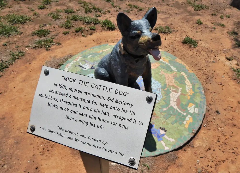
Mick the Cattle Dog monument in WandoanPhoto: RegionalQueenslander · CC BY-SA 4.0 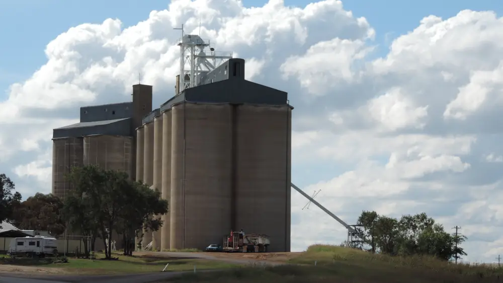
Grain silos in WandoanPhoto: Kerry Raymond · CC BY 3.0 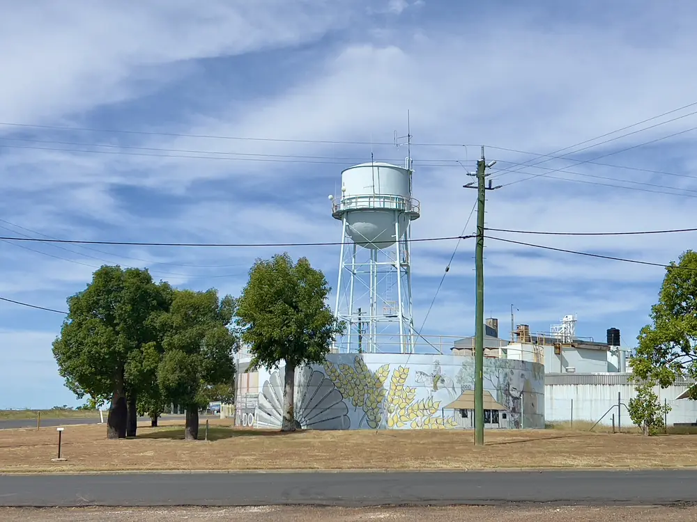
Wandoan water towerPhoto: Kgbo · CC BY-SA 4.0 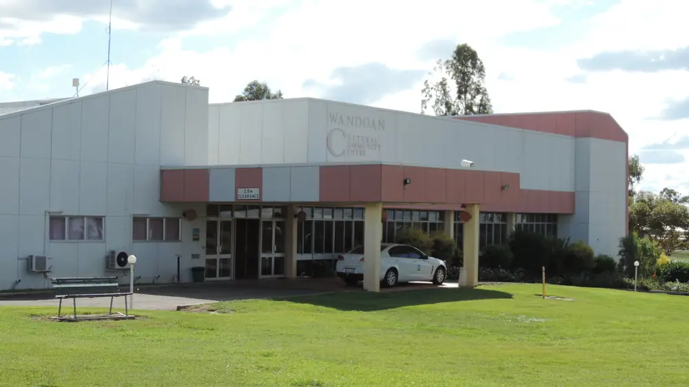
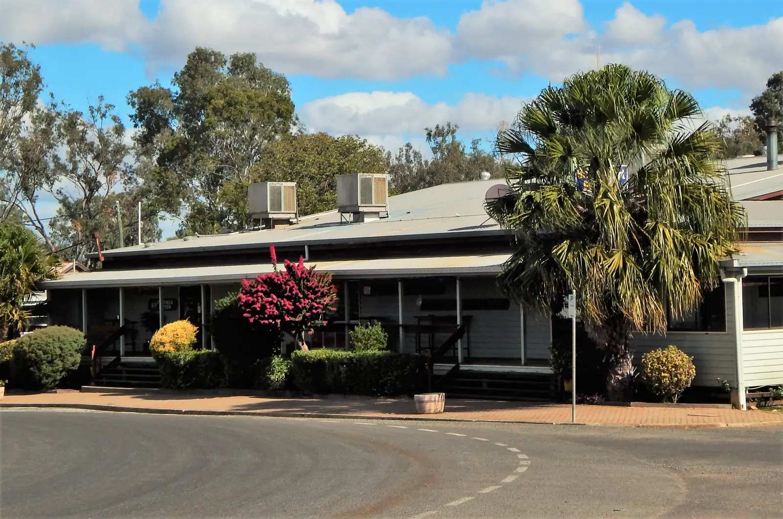
Community Cultural Centre in WandoanPhoto: Kerry Raymond · CC BY 3.0
Wandoan sits in the Western Downs on the Leichhardt Highway (A5), in this site’s Downs directory. Western Downs Queensland’s town page is the local source used here: make Wandoan your stop along the scenic Leichhardt Way, nested between Miles and Taroom, a wheat and cattle town framed by grain silos. This is not a Miles suburb and not a Banana Shire page. Taroom’s own hub is filed in Capricorn Burnett on this site.
The 2021 Census counted 666 people in the locality. Travellers stop for Waterloo Plain Environmental Park, Juandah Head Station, the Avenue of Honour, a heritage trail that starts at the visitor centre, and named motel rooms if those listings are still current. You still need QLDTraffic after storms. A 69 km run from Miles is no use if the Leichhardt is closed.
Where it is, and how far
Wandoan is the Leichhardt Highway town north of Miles and south of Taroom on Western Downs Queensland’s neighbour list. Distances with a number below are copied from the Miles town map on that council tourism site. Official Wandoan pages used here do not print a Wandoan–Taroom, Wandoan–Roma or Wandoan–Yuleba kilometre. This hub does not invent those figures.
Yuleba sits on the Warrego Highway east of Roma — a different sealed spine from the Leichhardt. Roma is a neighbour on this site as the Maranoa service city, not because this page measured a shortcut. Guluguba is named on the Wandoan town page as a rural community just south of Wandoan. This site has no Guluguba town page — named, not linked.
| Place | Distance (official pages used here) |
|---|---|
| Miles | 69 km (Western Downs Queensland Miles town map) |
| Taroom | 130 km from Miles on that same map — not published as a Wandoan kilometre |
| Roma | not published as a Wandoan kilometre on those Wandoan pages |
| Yuleba | not published as a Wandoan kilometre on those Wandoan pages |
| Brisbane | Miles map 335 km from Miles — a Miles figure, not a Wandoan town kilometre |
| Waterloo Plain Environmental Park | 3 km from the centre of town, on West Street (Western Downs camping page) |
| Juandah Heritage Site | 92 Windeyer Road (Western Downs camping page) — no kilometre printed beyond the street address |
| Wandoan Showgrounds | 92 Roche Creek Road (Western Downs camping page) |
Facts at a glance
Population. Australian Bureau of Statistics 2021 Census, Suburbs and Localities SAL32980, Wandoan: 666 people. Median age 31. Sex split 52.3% male / 47.7% female (353 male, 322 female). Families 130. Private dwellings 409. Average household size 2.3. Median weekly household income $1,243. Aboriginal and/or Torres Strait Islander people 47 (7.1% of the locality). Non-Indigenous 503 (75.5%); Indigenous status not stated 124 (18.6%). The ABS does not publish a 2021 Urban Centre named Wandoan on the QuickStats page used here. Use the ABS SAL QuickStats page.
Climate. Bureau of Meteorology’s Queensland climate-averages index used here does not include a Wandoan town station. 035029 on that index is Giligulgul, not Wandoan. Miles Constance Street (042112) is the labelled nearby table: 26.66°S, 150.18°E, elevation 305 m, commenced 1997, status: open. Mean maximum: January 34.0 °C, July 20.3 °C, annual 27.9 °C. Mean rainfall (24 years, 1997–2026): annual 568.4 mm; December 85.1 mm wettest mean month; July 20.6 mm driest. Median annual 551.5 mm. Mean days of rain ≥ 1 mm: 50.7. Product research date on this site’s Miles weather page: 14 November 2026. Do not blend these means with Taroom Post Office (035070). See Wandoan weather.
Visitor information. Western Downs Queensland’s getting-here page lists Wandoan Visitor Information Centre, O’Sullivan Park, Zupp Road, (07) 4627 5227, under “Other Visitor Information Centres” (not the accredited Dalby / Miles / Chinchilla list). The Waterloo Plain camping page also prints that number, and prints Miles Visitor Information Centre 4627 4192 as a second contact. This site’s Miles hub quotes (07) 4627 1492 from the Miles VIC listing. This hub prints each official page as written rather than inventing a winner. Confirm hours at O’Sullivan Park. This hub does not reprint a railway-station street address that was not on those official pages.
Traditional Owners
Western Downs Regional Council’s First Nations page names the Iman (Yiman) around Wandoan, alongside Barunggam west of Dalby, Bigambul around Tara, and Wakka Wakka and Jarowair around the Bunya Mountains. This hub keeps the Wandoan sentence rather than flattening five nations onto one verandah. Confirm wording at O’Sullivan Park, Zupp Road. Visit as a guest; see visiting Country respectfully.
History
Western Downs Queensland’s Wandoan town page: embark on a self-guided heritage trail from the Visitor Information Centre, then the statue of Mick, the legendary lifesaving dog, then Juandah Head Station — the original site of European settlement — with preserved buildings, historical displays, and stories of Ludwig Leichhardt’s explorations and the soldier settlers who helped forge the community.
The same page: stop and commemorate the 103 families who came to Wandoan through the Soldier Settler Scheme between 1952 and 1954 and read their stories at the Avenue of Honour memorial site.
Western Downs Regional Council’s Avenue of Honour page: O’Sullivan Park, Henderson Road, Wandoan. The Wandoan Soldier Settler Scheme of the 1950s was integral to the development of the Wandoan community as an agricultural centre. Official opening event 24 April 2021. Local artist Dion Cross was commissioned to build the Soldier Sculpture from scrap metal and tools collected off the farms selected by the returned soldiers. The sculpture was unveiled on 25 April 2022.
Just south of Wandoan, the town page names Guluguba as a rural community of around 40 farming families. Once a mixed-cropping area, it now thrives on producing premium beef cattle and grain — a tourism line on that page, not a Census substitute. Named, not linked.
Things to do
Heritage trail. Start at the Visitor Information Centre. Western Downs: Mick the lifesaving dog, Juandah Head Station, Leichhardt stories, soldier settlers. Confirm the current map at O’Sullivan Park.
Avenue of Honour. O’Sullivan Park, Henderson Road. 103 families, 1952–1954. Council storytelling pages sit on the Avenue of Honour URL used in the sources list. This is a memorial walk, not a theme park.
Waterloo Plain Environmental Park. Western Downs town page: 11 hectares of parkland and a lake dotted with water lilies; walkways and bridges; public murals; birdlife. Some visitors have recorded up to 30 different birds in just 30 minutes. The hotels page names whistling kite, rainbow bee-eaters and shining bronze cuckoos as birds to look for. The camping page: 3 km from the centre of town on West Street; nature playground; self-guided heritage trail. Grab a Birds of Western Downs guide at the VIC if they still stock it.
Leichhardt Gallery, silo light projections, heritage statues, Wandoan Camel Races. Named on the town page’s arts-and-culture block. Confirm dates and hours at (07) 4627 5227. This hub does not invent a 2026 race calendar.
Juandah Head Station / Juandah Heritage Site. Town page: original site of European settlement. Camping page: 92 Windeyer Road, caretaker 0475 435 737. See Wandoan things to do.
Do not treat Taroom Steel Wings, Isla Gorge or Gilbert’s Lookout as a Wandoan town walk. Do not treat Miles Historical Village as a Wandoan street. Those are neighbour lists.
Where to stay
Western Downs Queensland’s hotels page for Wandoan names:
- Wandoan Bushlander Motel — 17 Henderson Road, (07) 4627 5500
- Juandah Hotel Motel — corner Royd and Lawton Streets, (07) 4627 4155
- Wandoan Accommodation Park — 4 Zupp Road, (07) 4627 5000
Those are official named types, not a ranked inventory and not a price list. Confirm on arrival. The town page also points at farm stays as a Western Downs category without a Wandoan property name on that block — this hub does not invent one.
- How to choose a type of stay: Wandoan accommodation
- Parks and camping: Wandoan caravan parks
- Operator enquiries: feature your business
If Wandoan is full, Miles is 69 km on the Miles map and Taroom is the next Leichhardt Highway town toward the Dawson on Western Downs pages. That is geography, not a booking guarantee.
Caravan and camping
Vans use Wandoan because the Leichhardt Highway is sealed through town. Official named camping on the Western Downs camping page:
- Waterloo Plain Environmental Park — 3 km from the centre of town on West Street; toilets, hot showers, rubbish bins, picnic tables; free
- Juandah Heritage Site — 92 Windeyer Road; small nightly fee; caretaker 0475 435 737
- Wandoan Showgrounds — 92 Roche Creek Road; Western Downs Regional Council 4558 3045
Read Wandoan caravan parks and outback camping. Confirm stay limits at (07) 4627 5227. After rain, check QLDTraffic.
Fuel and services
Western Downs Queensland’s Wandoan town page does not name a bowser brand. Confirm fuel on arrival. This guide does not list hours that go stale.
A locality of 666 people is a Western Downs service town, not Miles and not Roma. For a supermarket-scale restock, use Miles 69 km south on the Miles map, or Roma as the Maranoa city if that is your corridor. Do not invent clinic hours.
RV facilities on Western Downs’ getting-here page for Wandoan: dump point Jerrard Street (near the water treatment plant); potable water Jerrard Street; casual parking O’Sullivan Park. That page registers Chinchilla, Dalby and Miles as RV Friendly “to name a few”; it does not put Wandoan in that named RV-Friendly sentence. Use the dump-point line as printed.
For current questions, use (07) 4627 5227 and Western Downs Regional Council.
Road access
The Leichhardt Highway (A5) is the sealed spine. South: Miles 69 km on the Miles map, then the Warrego Highway east–west. North: toward Taroom on Western Downs pages. Check QLDTraffic and 13 19 40. Freight, fatigue, cattle and wildlife are the usual inland risks. Do not drive around closed signs to keep a silo photograph.
Western Downs’ getting-here page: the inland Leichhardt Highway is an epic journey from Melbourne through the region to Rockhampton. That is a corridor sentence, not a Wandoan–Rockhampton kilometre this hub will invent.
Yuleba and Roma sit on the Warrego, not on this Leichhardt street. Skip Goondiwindi, Stanthorpe and Warwick as town-style pages on this rebuild.
Nearby parks and towns
Named nature and heritage sites (official pages):
- Waterloo Plain Environmental Park — 11 ha, West Street, 3 km from town
- Juandah Head Station / Juandah Heritage Site — 92 Windeyer Road
- Avenue of Honour — O’Sullivan Park, Henderson Road
- Guluguba — named rural community south of Wandoan; no town page here
Towns on this site:
- Miles — 69 km on the Miles map; Historical Village, Warrego / Leichhardt crossroads
- Taroom — Leichhardt Highway north; Steel Wings, Isla Gorge; Capricorn Burnett on this site
- Yuleba — Warrego Highway; Cobb & Co
- Roma — Maranoa service city; Big Rig, saleyards
Isla Gorge, Lake Murphy and Carnarvon Gorge are the Taroom and Injune lists, not Wandoan town walks. Carnarvon in Western Australia is a different town — not this gorge.
When to go, and how long
Labelled nearby Miles Constance Street: January mean maximum 34.0 °C, July 20.3 °C, July mean minimum 4.4 °C, annual rainfall 568.4 mm, wetter in summer (December 85.1 mm). Those are Miles means. Do not treat them as a Wandoan street figure. July nights are a frost-risk packing problem on Downs tables. Summer storms are a QLDTraffic problem.
An hour covers the VIC, Mick, and a first loop of Waterloo Plain if the boardwalks are open. A night covers the Avenue of Honour and Juandah if the caretaker is taking campers. Two nights if camel-race weekend or silo projections are actually on and confirmed. Three nights only if you are adding Miles Historical Village and a Taroom park start without rushing. Operators: feature your business.
Plan this trip
Tell us the dates, who you are travelling with and where you need help. We reply with planning notes for Wandoan — we are not a booking agent.
Events and road-conditions newsletter
Occasional notes on outback festivals, race days and official road-condition sources — not a daily blast. We use these details only to send the newsletter.
Queensland · The Downs
Things to do in Wandoan
Things to do in Wandoan: Waterloo Plain Environmental Park, Juandah Head Station, Mick the lifesaving dog, Soldier Settlers Avenue of Honour, Leichhardt Gallery. Western Downs, not a Miles suburb.
Read · 4 min
Queensland · The Downs
Wandoan accommodation
Where to stay in Wandoan: Western Downs names Wandoan Bushlander Motel, Juandah Hotel Motel, Wandoan Accommodation Park, plus Waterloo Plain camping. Confirm before you unhitch. Not a Miles suburb.
Read · 3 min
Queensland · The Downs
Wandoan caravan parks
Camping in Wandoan: Western Downs names Waterloo Plain Environmental Park 3 km from town (free, hot showers), Juandah Heritage Site and Wandoan Showgrounds. Confirm stay limits before you unhitch.
Read · 3 min
Queensland · The Downs
Wandoan weather
Wandoan climate from labelled nearby BOM Miles Constance Street (042112): January mean max 34.0 °C, July 20.3 °C, annual rainfall 568.4 mm. No Wandoan town table on the QLD index used here.
Read · 3 min
Frequently asked questions
Is Wandoan a suburb of Miles?
No. This hub is Wandoan in the Western Downs, Queensland, on the Leichhardt Highway (A5). Western Downs Queensland’s town page places it between Miles and Taroom as a wheat and cattle town. The Miles town map lists Wandoan 69 km from Miles. It is not a Miles suburb and not a Banana Shire page.
How far is Wandoan from Miles and Taroom?
Western Downs Queensland’s Miles town map lists Wandoan 69 km from Miles and Taroom 130 km from Miles. Official Wandoan pages used here do not print a Wandoan–Taroom kilometre. This hub does not invent one by subtraction.
What is Wandoan’s population?
666 people at the 2021 Census for Wandoan suburbs-and-localities (SAL32980). Median age 31. Male 52.3% / female 47.7%. The ABS does not publish a 2021 Urban Centre named Wandoan on the QuickStats page used here.
What is there to do in Wandoan?
Western Downs Queensland names a self-guided heritage trail from the Visitor Information Centre, the statue of Mick the lifesaving dog, Juandah Head Station, Waterloo Plain Environmental Park (11 hectares, walkways, murals, birdlife), the Avenue of Honour for 103 soldier-settler families (1952–1954), the Leichhardt Gallery, silo light projections, and the Wandoan Camel Races. Confirm current hours at O’Sullivan Park, Zupp Road.
What is the weather like in Wandoan?
BOM’s Queensland climate-averages index used here does not include a Wandoan town station. Miles Constance Street (042112) is the labelled nearby table: January mean maximum 34.0 °C, July 20.3 °C, annual rainfall 568.4 mm (24 years, 1997–2026). Do not treat those means as a Wandoan street figure, and do not blend them with Taroom Post Office (035070).
Can I camp at Wandoan?
Yes, as named types. Western Downs names Waterloo Plain Environmental Park 3 km from the centre of town on West Street: toilets, hot showers, rubbish bins, picnic tables, free. The same camping page names Juandah Heritage Site (92 Windeyer Road, caretaker 0475 435 737, small nightly fee) and Wandoan Showgrounds (92 Roche Creek Road). Confirm stay limits at (07) 4627 5227.
Sources and further reading
Facts on this page were checked against these primary and official sources. Conditions change — confirm before you travel or buy.
- Wandoan 2021 Census QuickStats (SAL32980) — Australian Bureau of Statistics
- Climate statistics for Miles Constance Street (042112) — Bureau of Meteorology
- Western Downs Queensland — Wandoan — Western Downs Regional Council
- Wandoan Hotel & Motel Accommodation — Western Downs Regional Council
- Caravan and Camping in Wandoan — Western Downs Regional Council
- Getting Here — Visitor Information Centres — Western Downs Regional Council
- Wandoan Soldier Settlers Avenue of Honour — Western Downs Regional Council
- Western Downs Regional Council — First Nations People — Western Downs Regional Council
- Western Downs Queensland — Miles — Western Downs Regional Council
- QLDTraffic — Queensland Government