At a glance
Sourced facts only. Distances and services change — confirm before you travel.
- Population
- 885 people at the 2021 Census for Taroom suburbs-and-localities (SAL32755). Median age 41.
- Local government
- Banana Shire Council
- Traditional Owners
- Sandstone Wonders names the Iman people for the Star of Taroom groove stone at Taroom Museum. QPWS Isla Gorge is jointly managed with the Wulli Wulli. Banana Shire’s visitor guide, as used on this site’s Biloela hub, acknowledges the Darumbal, Gangulu, Wadja, Wulli Wulli, Wakka Wakka and Iman people in the shire. Confirm wording at 10 Yaldwyn Street.
- Nearest regional city
- Sandstone Wonders’ Taroom page names Theodore 100 km north-east and Cracow 150 km east. Western Downs Queensland’s Miles town map lists Taroom 130 km from Miles. Official Taroom pages used here do not print a Roma kilometre.
- Nearest fuel
- QPWS Isla Gorge: Taroom is 55 km south of the park and provides fuel and supplies. Confirm the bowser on arrival; this hub does not invent a brand.
- Nearest hospital or clinic
- QPWS Lake Murphy: closest hospital at Taroom, 31 km south-east of the park. QPWS Expedition: nearest hospital at Taroom, 89 km south-east of Robinson Gorge section, with a half-time doctor and flying-doctor access. Confirm with Queensland Health.
- Mobile coverage
- Check Telstra and Optus coverage maps before travel; QPWS says mobile coverage is limited at Isla Gorge and unreliable at Lake Murphy and Expedition.
- Best time to visit
- May–September on Taroom Post Office (035070) cooler mean maxima (July 21.3 °C; January 34.0 °C). QPWS Isla Gorge and Lake Murphy: rain mostly December–March. QLDTraffic after rain.
Climate
Monthly means from the Bureau of Meteorology station Taroom Post Office (035070). This is not a forecast. Open. Commenced 1870. Elevation 199 m. Location 25.64°S, 149.80°E. Latest available data 12 November 2026. Temperature 73–74 years (1952–2026); rainfall 139 years (1870–2026). Annual mean rainfall 666.8 mm.
| Month | Mean max (°C) | Mean min (°C) | Rainfall (mm) |
|---|---|---|---|
| Jan | 34.0 | 20.8 | 96.6 |
| Feb | 33.1 | 20.5 | 88.6 |
| Mar | 31.8 | 18.4 | 64.2 |
| Apr | 28.9 | 14.1 | 34.6 |
| May | 24.7 | 9.7 | 38.6 |
| Jun | 21.7 | 6.4 | 35.8 |
| Jul | 21.3 | 5.3 | 32.7 |
| Aug | 23.4 | 6.7 | 27.2 |
| Sep | 27.1 | 10.6 | 31.5 |
| Oct | 30.2 | 14.8 | 55.3 |
| Nov | 32.1 | 17.7 | 73.8 |
| Dec | 33.6 | 19.7 | 88.6 |
Taroom in pictures
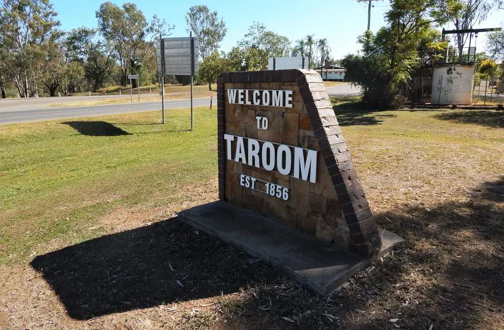
Welcome to Taroom signPhoto: RegionalQueenslander · CC BY-SA 4.0 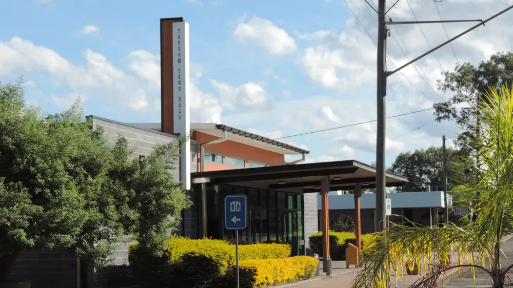
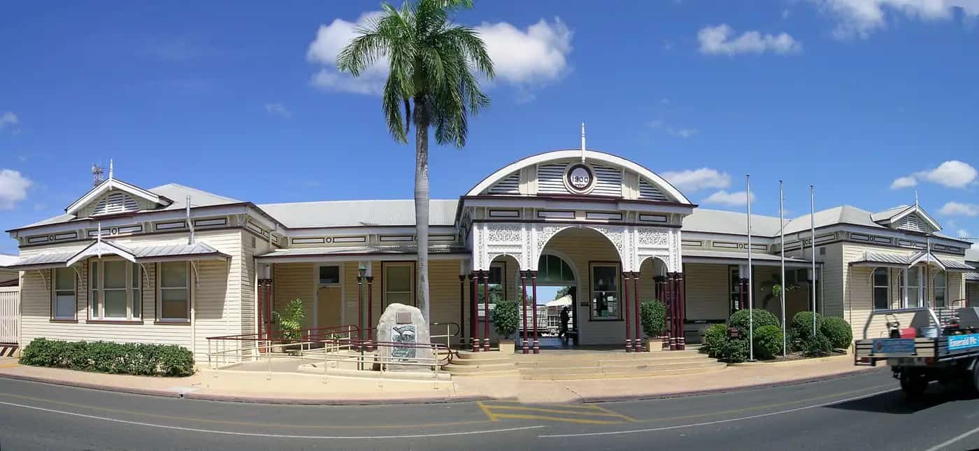
Taroom town hallPhoto: Kerry Raymond · CC BY 3.0 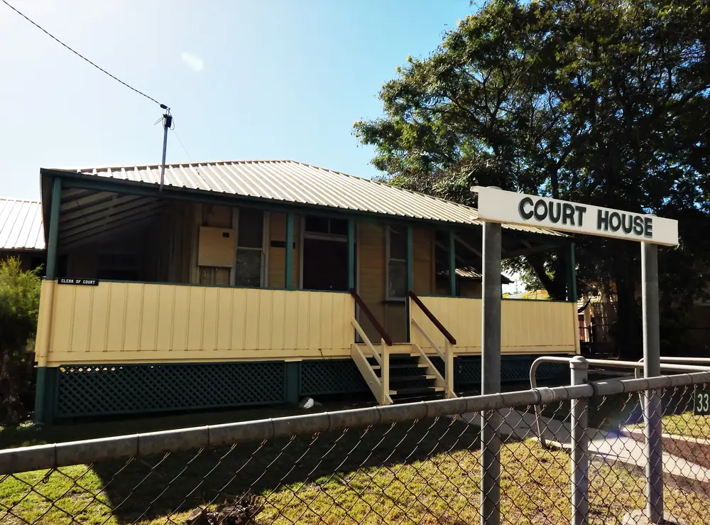
Court house in TaroomPhoto: RegionalQueenslander · CC BY-SA 4.0 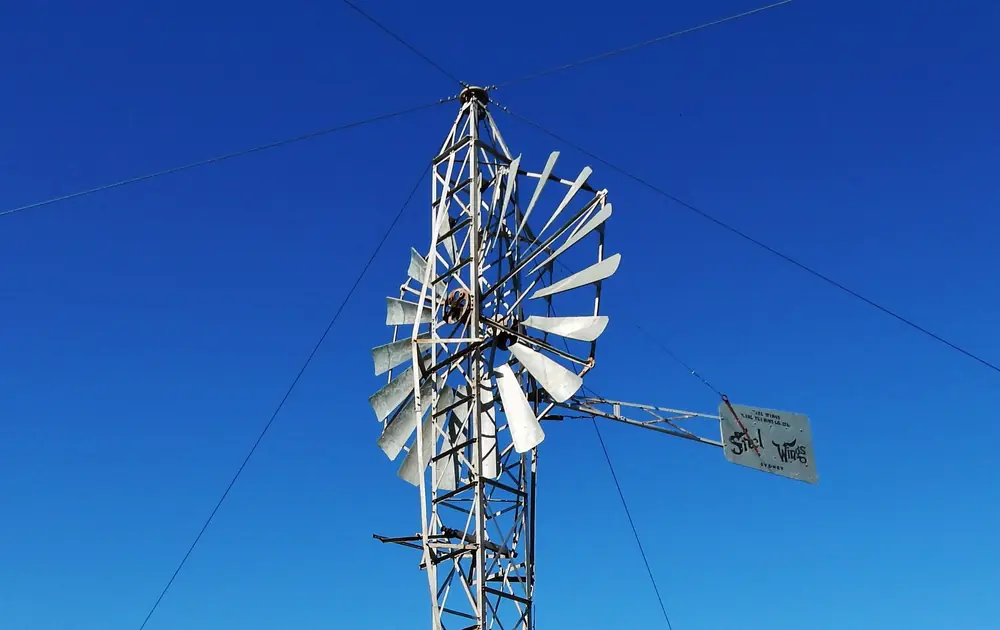
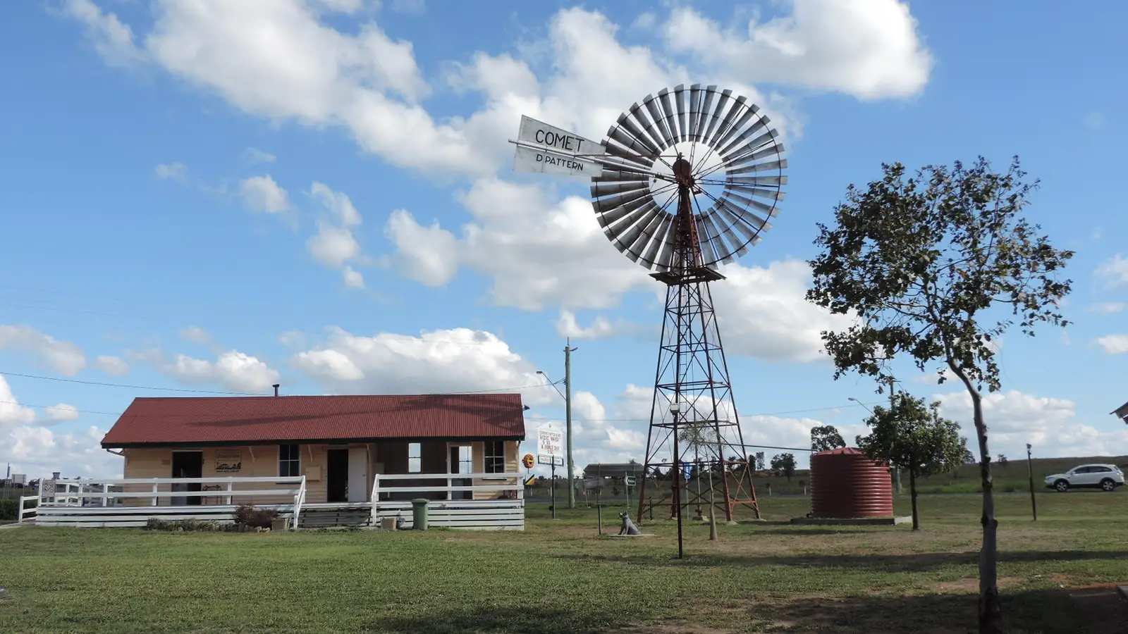
Steel Wings windmill in TaroomPhoto: RegionalQueenslander · CC BY-SA 4.0
Taroom sits in Banana Shire on the Leichhardt Highway and the Dawson River, in this site’s Capricorn Burnett directory. That region kebab matches docs/WAVE9_TOWNS.md. Older inventory directories sometimes filed Taroom as south-west; this hub does not follow that filing. This is not a New South Wales town page and not a Wandoan suburb.
Sandstone Wonders, Banana Shire’s tourism site, is the local page used here: the tell-tale sign that you have arrived is the Steel Wings windmill at the northern entry to town. Ludwig Leichhardt camped by the Dawson in 1844 and carved LL 1844 into a coolibah; the initials are long since gone and the tree still stands in the main street, which is the Leichhardt Highway. Travellers stop for Gilbert’s Lookout, Taroom Museum, Isla Gorge National Park, Lake Murphy Conservation Park, Expedition National Park’s Robinson Gorge section, and Glebe Weir. You still need QLDTraffic after rain.
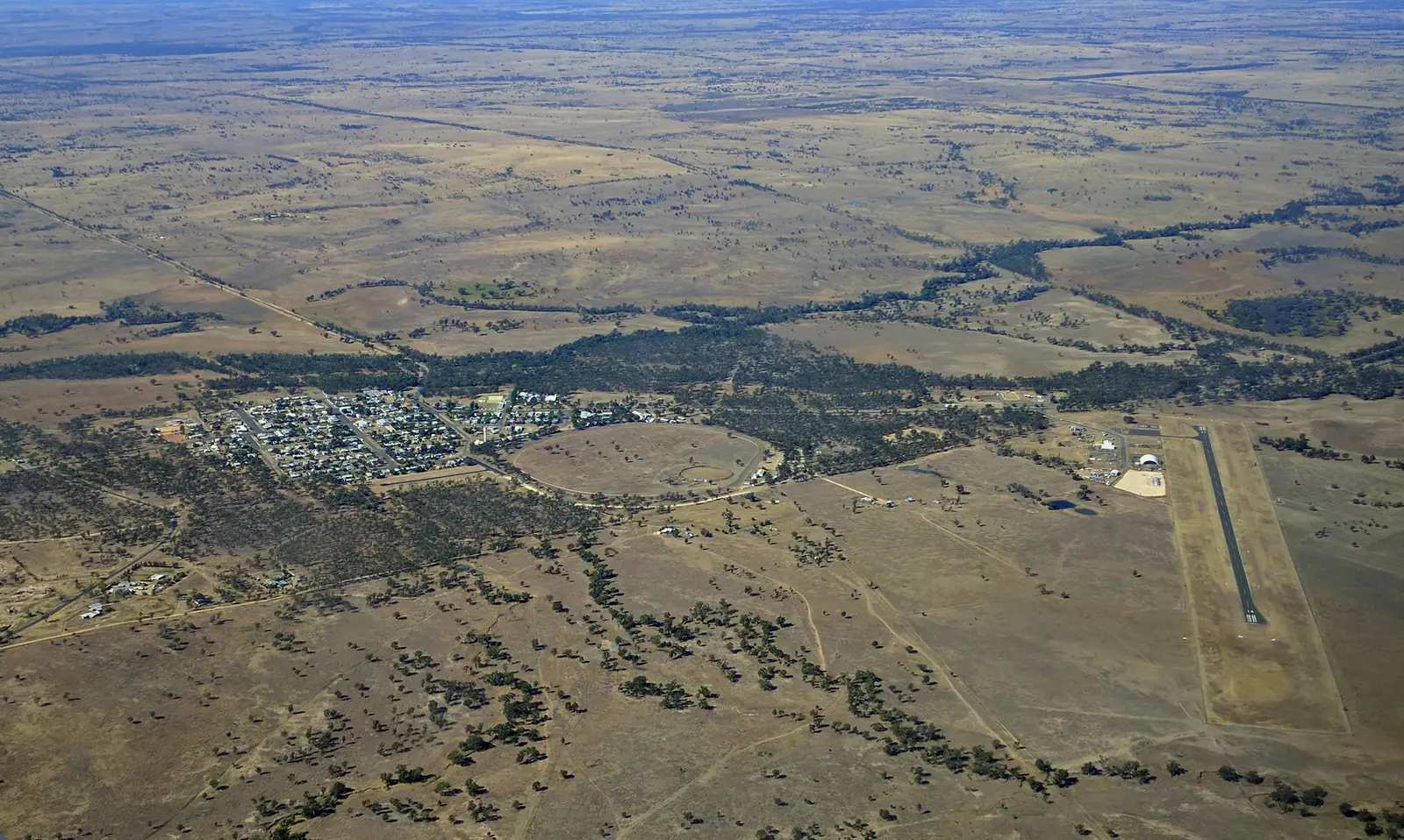
The 2021 Census counted 885 people in the locality. That is a working Banana Shire service town for the sandstone parks, not a ghost town and not Biloela.
Where it is, and how far
Taroom is the Leichhardt Highway town between Wandoan to the south and Theodore to the north-east on Sandstone Wonders’ neighbour list. Western Downs Queensland’s Miles town map lists Taroom 130 km from Miles. Official Taroom pages used here do not print a Taroom–Wandoan or Taroom–Roma kilometre. This hub does not invent those figures. Injune and Roma are neighbours on this site because Expedition’s Lonesome and Beilba sections are reached via Injune, and Roma is the Maranoa service city — not because this page measured a shortcut.
Carnarvon Gorge is the sandstone park on the Injune approach. Taroom’s own parks are Isla Gorge, Lake Murphy and Expedition (Robinson Gorge). Carnarvon in Western Australia is a different town — not this gorge.
| Place | Distance (official pages used here) |
|---|---|
| Miles | 130 km (Western Downs Queensland Miles town map) |
| Theodore | 100 km north-east (Sandstone Wonders Taroom) |
| Cracow | 150 km east (Sandstone Wonders Taroom) |
| Isla Gorge lookout turn-off | 55 km north of Taroom on the Leichhardt Highway; lookout 1.3 km west of the highway (QPWS) |
| Lake Murphy | 31 km north-west of Taroom (QPWS); via 18 km north on the Leichhardt then Fitzroy Developmental Road and Glenhaughton Road |
| Glebe Weir | 54 km from Taroom on Theodore Road / Leichhardt Highway (Outback Queensland) |
| Chain Lagoons | approximately 15 km north of Taroom, then 1.1 km down Chain Lagoons Road (Sandstone Wonders) |
| Robinson Gorge (Expedition NP) | 90 km or two hours north-west of Taroom along a gravel road; last 16 km 4WD only (QPWS) |
| Roma | not published as a Taroom kilometre on those Taroom pages |
| Wandoan | not published as a Taroom kilometre on those Taroom pages |
| Brisbane | QPWS Isla Gorge: park about 515 km by road north-west of Brisbane — a park figure, not a Taroom town kilometre |
Facts at a glance
Population. Australian Bureau of Statistics 2021 Census, Suburbs and Localities SAL32755, Taroom: 885 people. Median age 41. Sex split 49.4% male / 50.6% female (436 male, 447 female). Families 221. Private dwellings 467. Average household size 2.5. Median weekly household income $1,323. Aboriginal and/or Torres Strait Islander people 38 (4.3% of the locality). Use the ABS SAL QuickStats page.
Climate. Bureau of Meteorology TAROOM POST OFFICE, 035070, 25.64°S, 149.80°E, elevation 199 m, commenced 1870, status: open, latest available data 12 November 2026. Mean maximum (73 years, 1952–2026): January 34.0 °C, July 21.3 °C, annual 28.5 °C. Mean minimum (74 years, 1952–2026): January 20.8 °C, July 5.3 °C, annual 13.7 °C. Mean rainfall (139 years, 1870–2026): annual 666.8 mm; January 96.6 mm wettest mean month; August 27.2 mm driest. Median annual 635.3 mm. Mean days of rain ≥ 1 mm: 47.7. See Taroom weather.
Visitor information. Taroom Visitor Information Centre, 10 Yaldwyn Street, (07) 4628 6113, hottaroom@hotmail.com. Sandstone Wonders: open Monday–Friday 10am–2pm (December–February) and Monday–Friday 9am–4pm (March–November). Banana Shire also lists a council administration office at 18 Yaldwyn Street. Banana Shire’s Biloela office: 62 Valentine Plains Road, (07) 4992 9500, enquiries@banana.qld.gov.au.
Traditional Owners
Sandstone Wonders’ history page names the Star of Taroom as an ancient groove stone, a tool sharpener used by the Iman people as a waypoint directing people towards food sources and a boundary marker of traditional country. The stone is at the Wardingarri Keeping Place at Taroom Museum, viewable by appointment on 0409 663 701.
Queensland Parks’ Isla Gorge page: this is Wulli Wulli land, jointly managed by the Wulli Wulli and QPWS. Expedition National Park’s Robinson Gorge welcome is from the Kongabulla Clan of the Iman Tribe — the Carpet Snake People.
Banana Shire’s visitor guide, as quoted on this site’s Biloela hub, acknowledges the Darumbal, the Gangulu, the Wadja, the Wulli Wulli, the Wakka Wakka and the Iman people in the Banana Shire region. This hub keeps those shire-wide nations and the Iman / Wulli Wulli park sentences rather than flattening six groups onto one verandah. Confirm wording at 10 Yaldwyn Street. Visit as a guest; see visiting Country respectfully.
History
Sandstone Wonders: the region opened up to settlers in the 1840s with Ludwig Leichhardt. He took a liking to the place while camped by the Dawson River, carving his initials and year date — LL 1844 — into the bark of a coolibah. The initials are long since gone, in somewhat controversial circumstances; the tree still stands pride of place in the main street. Taroom is steeped in early European history and built on primary industries — first sheep, now cattle and grain.
Gilbert’s Lookout was built in honour of John Gilbert (1812–1845), ornithologist on Leichhardt’s first overland expedition in 1844 to Port Essington. Sandstone Wonders quotes Gilbert’s last diary entry of 28 June 1845. The lookout is on Bonner Street.
Taroom Museum houses St Mary’s Church, built in 1893, the Boathouse, and Jongh Tai Shue’s Confectionary and Bakery business among the museum’s buildings. Objects from early enterprises, a blacksmith’s forge, jewellery belonging to Sarah, wife of John Becker the Bootmaker, c1870, a 19th-century round pole and slab house that served as both the Reynolds’ residence and the township’s general store, and Taroom’s first jail are named on that Sandstone Wonders history page.
This hub does not invent a 2026 museum timetable beyond the appointment number printed for the groove stone. Ask 10 Yaldwyn Street.
Things to do
Steel Wings windmill. Northern entry to town. Sandstone Wonders: manufactured around the turn of the 20th century; one of two known windmills of its type still in working order.
Leichhardt’s coolibah. Main street / Leichhardt Highway. Initials gone; tree still standing.
Gilbert’s Lookout. Sandstone Wonders: less than a kilometre from town; picnic lunch in an undercover area overlooking the Dawson River, the town and surrounding countryside. Address: Bonner Street.
Leichhardt Park, Yaldwyn Street. Sandstone Wonders: site of Leichhardt’s memorial; dedicated to native flora with weeping bottle brush, flaxleaf paperbark, lemon scented gum, swamp mahogany and bloodwood; exception a single Aleppo Pine seeded from Lone Pine on the Gallipoli Peninsula.
Taroom Museum and the Star of Taroom. Named buildings and the Iman groove stone as above. Appointment 0409 663 701 for the keeping place.
Isla Gorge National Park. QPWS: maze of gorges and sandstone outcrops; Gorge Creek, a tributary of the Dawson; lookout 55 km north. Wulli Wulli Country. No domestic animals. Camping permits required. See Taroom things to do.
Lake Murphy Conservation Park. QPWS: about 31 km north-west; perched lake that fills only when nearby Robinson Creek overflows. Conventional vehicle access in dry weather. Camping permits required. No domestic animals.
Expedition National Park — Robinson Gorge. QPWS: 90 km north-west; last 16 km 4WD. Sandstone cliffs up to 100 m. Lonesome and Beilba sections are via Injune, a 5–6 hour drive from Robinson Gorge with no direct connecting roads.
Glebe Weir and Chain Lagoons. Named camping and Dawson River time — see Taroom caravan parks.
Where to stay
Sandstone Wonders and Outback Queensland name camping types at Chain Lagoons, Glebe Weir and the QPWS parks. A Taroom motel brand was not printed on the Sandstone Wonders Taroom and stay pages fetched for this guide. Confirm rooms at 10 Yaldwyn Street. This hub does not invent a hotel strip.
- How to choose a type of stay: Taroom accommodation
- Parks and camping: Taroom caravan parks
- Operator enquiries: feature your business
If Taroom is full, Wandoan is the next Leichhardt Highway town toward Miles on Western Downs pages, and Injune holds named parks on the Carnarvon Highway. That is geography, not a booking guarantee.
Caravan and camping
Vans use Taroom because the Leichhardt Highway is sealed through town. Official named camping on the pages used here:
- Chain Lagoons — about 15 km north, 10 unpowered free sites, basic, take rubbish
- Glebe Weir — 54 km on Theodore Road / Leichhardt Highway, 20 unpowered and 4 powered sites, pet-friendly, toilets, showers, barbecues; Banana Shire fees, envelopes on site; no bookings on the Outback Queensland page
- Lake Murphy and Isla Gorge — QPWS permits and fees; no pets
- Robinson Gorge / Starkvale — 4WD, permits
Read Taroom caravan parks and outback camping. After rain, unsealed park roads become impassable. January’s Taroom Post Office mean of 96.6 mm is not a drizzle.
Fuel and services
QPWS Isla Gorge: Theodore is 35 km north of the park and the closest town for fuel and supplies; Taroom is 55 km south and also provides these services. Confirm the bowser on arrival. This guide does not list brands or hours.
A locality of 885 people is a Banana Shire service town, not Biloela. QPWS names a hospital in Taroom for Lake Murphy and Expedition (half-time doctor, flying-doctor access on the Expedition page). Confirm with Queensland Health. Do not invent clinic hours.
For current questions, use (07) 4628 6113.
Road access
The Leichhardt Highway is the sealed spine. North: Isla Gorge turn-off 55 km, then Theodore. South: toward Wandoan and Miles. Check QLDTraffic and 13 19 40. Freight, fatigue, cattle and wildlife are the usual inland risks.
Park roads are a different grade. Isla Gorge lookout is 1.3 km off the highway. Flagstaff Hill section from Taroom: 31 km north on the Leichhardt, then 49 km via the Flagstaff via Waterton signpost, then 2 km. Lake Murphy: 18 km north, then Fitzroy Developmental Road and Glenhaughton Road. Robinson Gorge: gravel, last 16 km 4WD. QPWS: unsealed roads are slippery when wet and can become impassable after heavy rain.
Injune is the Carnarvon Highway approach to Carnarvon Gorge and to Expedition’s Lonesome and Beilba sections. That is a different sealed highway from Roma, not a Taroom side street.
Nearby parks and towns
Named parks (official pages):
- Isla Gorge National Park — Wulli Wulli Country; lookout 55 km north
- Lake Murphy Conservation Park — 31 km north-west
- Expedition National Park — Robinson Gorge 90 km north-west; Lonesome and Beilba via Injune
- Carnarvon Gorge — Injune approach, not a Taroom town walk
Towns on this site:
- Wandoan — Leichhardt Highway south, Western Downs
- Miles — 130 km on the Miles town map
- Injune — Carnarvon Highway; gorge and Expedition Lonesome/Beilba
- Roma — Maranoa service city
- Biloela — Banana Shire seat
Theodore and Cracow are named on Sandstone Wonders. This site has no town pages for them — named, not linked. Skip Blackwater, Moranbah and Dingo as town hubs on this rebuild.
When to go, and how long
BOM Taroom’s January mean maximum of 34.0 °C and January rainfall mean of 96.6 mm are the heat-and-storm core. July’s 21.3 °C mean maximum and 5.3 °C mean minimum are the cool walking window; QPWS warns of heavy frosts in this region in winter. August’s 27.2 mm is the driest mean month. QPWS Isla Gorge and Lake Murphy: rain mostly December to March.
An hour covers Steel Wings, the coolibah and Gilbert’s Lookout. A night covers the museum if it is open and an early park start. Two nights if Isla Gorge lookout and Lake Murphy are both open and dry. Three nights only if Robinson Gorge’s 4WD last 16 km is actually passable. Operators: feature your business.
Plan this trip
Tell us the dates, who you are travelling with and where you need help. We reply with planning notes for Taroom — we are not a booking agent.
Events and road-conditions newsletter
Occasional notes on outback festivals, race days and official road-condition sources — not a daily blast. We use these details only to send the newsletter.
Queensland · Capricorn Burnett
Taroom accommodation
Where to stay in Taroom: Sandstone Wonders names Chain Lagoons camping; Outback Queensland names Glebe Weir. Confirm motel rooms at 10 Yaldwyn Street. Banana Shire, not Taroom NSW.
Read · 4 min
Queensland · Capricorn Burnett
Taroom caravan parks
Camping in Taroom: Sandstone Wonders names Chain Lagoons 15 km north. Outback Queensland names Glebe Weir 54 km. QPWS Lake Murphy and Isla Gorge need permits. Confirm before you unhitch.
Read · 3 min
Queensland · Capricorn Burnett
Taroom weather
Taroom climate from BOM Taroom Post Office (035070): January mean max 34.0 °C, July 21.3 °C, annual rainfall 666.8 mm. Open station commenced 1870. Banana Shire, not a NSW table.
Read · 3 min
Queensland · Capricorn Burnett
Things to do in Taroom
Things to do in Taroom: Steel Wings windmill, Leichhardt’s coolibah, Gilbert’s Lookout, Taroom Museum, Isla Gorge, Lake Murphy and Expedition’s Robinson Gorge. Banana Shire, not Taroom NSW.
Read · 4 min
Frequently asked questions
Is this Taroom in Queensland or New South Wales?
This hub is Taroom in Banana Shire, Queensland, on the Leichhardt Highway and Dawson River. It is filed here in Capricorn Burnett, matching WAVE9_TOWNS.md, even if some older directories listed it as south-west. It is not a New South Wales town page.
How far is Taroom from Miles, Theodore and Isla Gorge?
Western Downs Queensland’s Miles town map lists Taroom 130 km from Miles. Sandstone Wonders puts Theodore 100 km north-east of Taroom. QPWS Isla Gorge: turn off the Leichhardt Highway 55 km north of Taroom or 35 km south of Theodore; the lookout is 1.3 km west of the highway.
What is Taroom’s population?
885 people at the 2021 Census for Taroom suburbs-and-localities (SAL32755). Median age 41. Male 49.4% / female 50.6%.
What is the Steel Wings windmill?
Sandstone Wonders: the tell-tale sign that you have arrived in Taroom is the Steel Wings windmill at the northern entry to town. Manufactured around the turn of the 20th century, it is a rare commodity, being only one of two known windmills of its type still in working order.
What is the weather like in Taroom?
BOM Taroom Post Office (035070), elevation 199 m, open: January mean maximum 34.0 °C, July 21.3 °C, annual rainfall 666.8 mm (139 years, 1870–2026). Latest available data on the table fetched for this guide: 12 November 2026.
Can I camp at Taroom?
Yes, as named types. Sandstone Wonders names Chain Lagoons, about 15 km north of Taroom, 10 unpowered free sites. Outback Queensland names Glebe Weir 54 km from Taroom on Theodore Road (Leichhardt Highway), 20 unpowered and 4 powered sites. QPWS Lake Murphy camping needs a permit. Confirm at 10 Yaldwyn Street.
Sources and further reading
Facts on this page were checked against these primary and official sources. Conditions change — confirm before you travel or buy.
- Taroom 2021 Census QuickStats (SAL32755) — Australian Bureau of Statistics
- Climate statistics for Taroom Post Office (035070) — Bureau of Meteorology
- Sandstone Wonders — Taroom — Banana Shire Council (Sandstone Wonders)
- Gilberts Lookout — Banana Shire Council (Sandstone Wonders)
- History of the Sandstone Wonders region — Banana Shire Council (Sandstone Wonders)
- Visitor Information Centre Locations — Banana Shire Council
- Isla Gorge National Park — visiting safely — Queensland Parks and Wildlife Service
- Expedition National Park — visiting safely — Queensland Parks and Wildlife Service
- Lake Murphy Conservation Park — visiting safely — Queensland Parks and Wildlife Service
- Outback Queensland — Glebe Weir — Outback Queensland Tourism Association
- Camp at Chain Lagoons, Taroom — Banana Shire Council (Sandstone Wonders)
- QLDTraffic — Queensland Government