At a glance
Sourced facts only. Distances and services change — confirm before you travel.
- Local government
- Paroo Shire
- Mobile coverage
- Check Telstra and Optus coverage maps before travel; do not assume a signal.
- Best time to visit
- May–September on Cunnamulla Post Office cooler mean maxima
Climate
Monthly means from the Bureau of Meteorology station Cunnamulla Post Office (044026). This is not a forecast. Open. Labelled Paroo neighbour table. Commenced 1879. Elevation 189 m.
| Month | Mean max (°C) | Mean min (°C) | Rainfall (mm) |
|---|---|---|---|
| Jan | 36.3 | 22.5 | 47.7 |
| Feb | 35.0 | 21.8 | 50.4 |
| Mar | 32.5 | 19.1 | 42.8 |
| Apr | 28.1 | 14.3 | 26.4 |
| May | 23.0 | 9.9 | 29.5 |
| Jun | 19.4 | 6.9 | 26.0 |
| Jul | 18.9 | 5.8 | 22.7 |
| Aug | 21.5 | 7.2 | 17.3 |
| Sep | 25.8 | 10.8 | 18.4 |
| Oct | 29.8 | 15.0 | 25.4 |
| Nov | 33.0 | 18.3 | 31.3 |
| Dec | 35.4 | 20.9 | 38.5 |
Wyandra in pictures
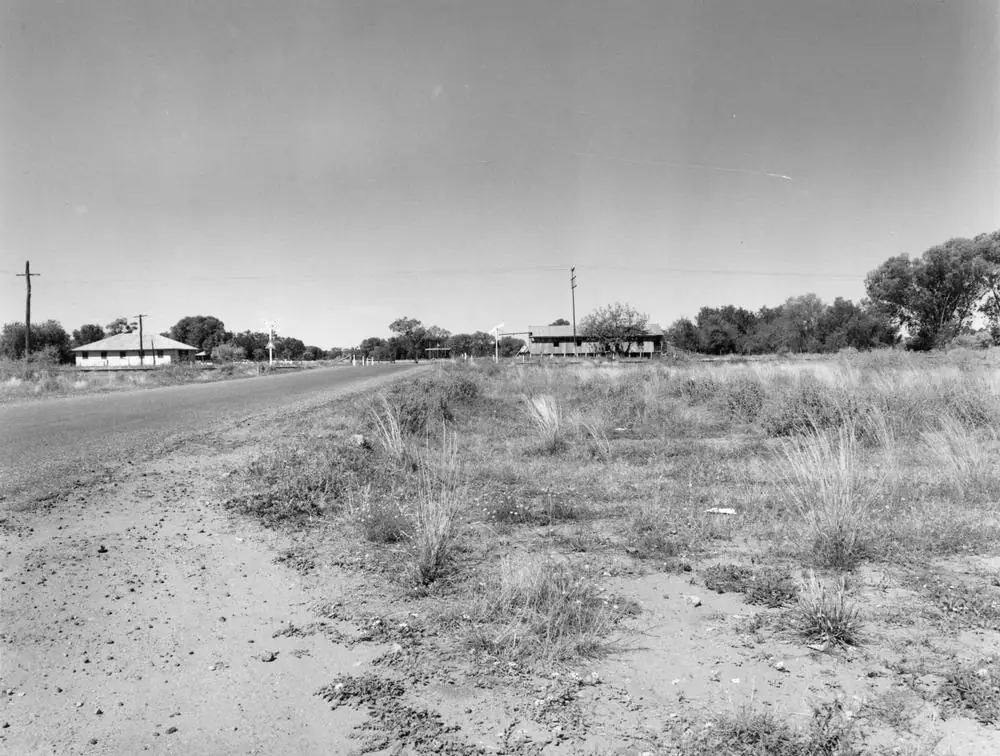
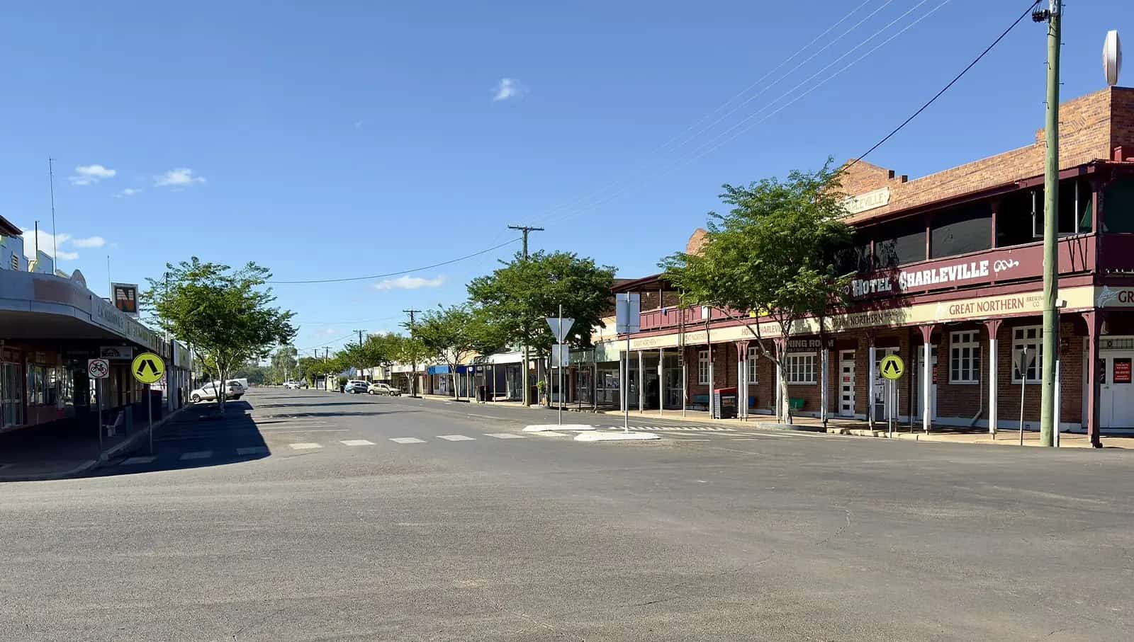
View of Warrego Street in WyandraPhoto: Item is held by John Oxley Library, State Library of Queensland · Public domain 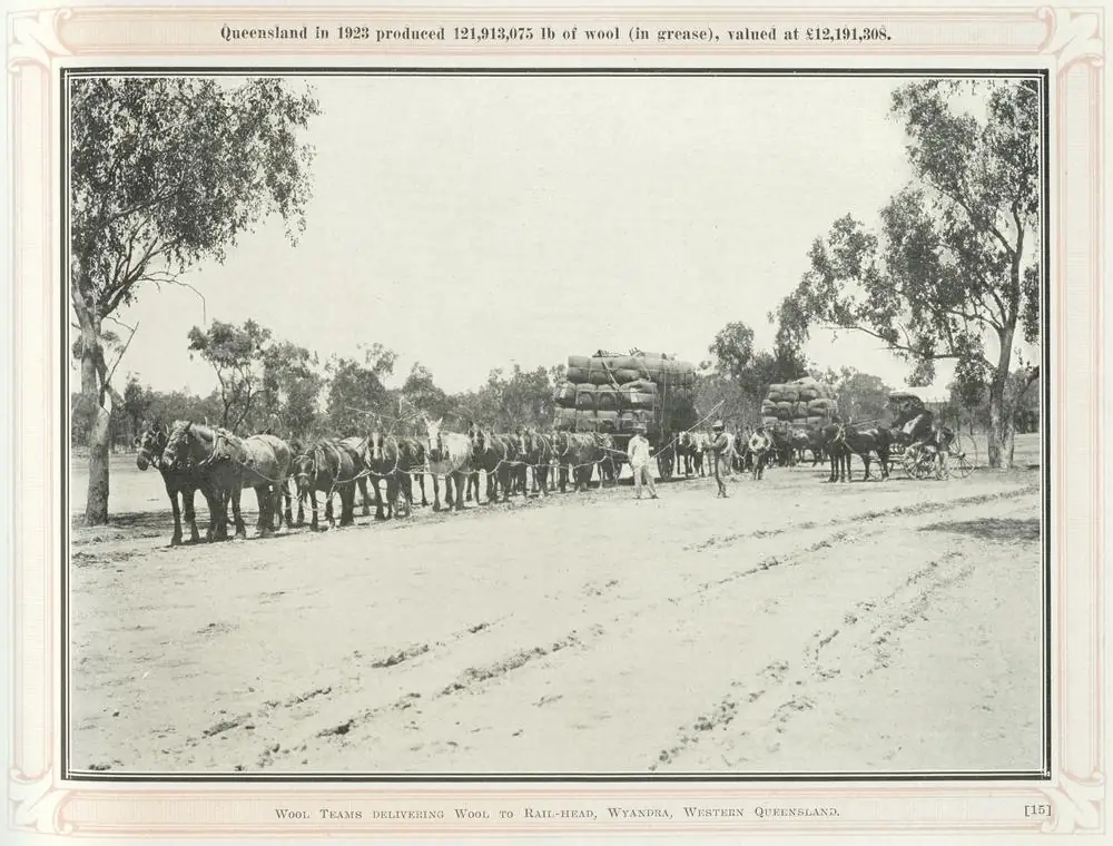
Wool teams at the rail head in WyandraPhoto: Copied and digitised from an image appearing in Sunny Queensland, its tropical grandeur, scenic charms and industrial activities, 1924. · Public domain 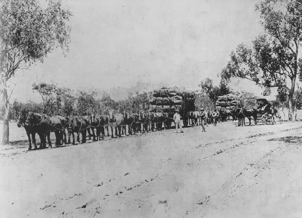
Horse teams with loaded wagons at WyandraPhoto: Item is held by John Oxley Library, State Library of Queensland · Public domain
Wyandra is a Paroo Shire town on the Warrego River and the Mitchell Highway in Queensland’s south-west, on the Matilda Way between Cunnamulla and Charleville. Cunnamulla Tourism puts it about 100 km north of Cunnamulla and halfway between Cunnamulla and Charleville. Outback Queensland’s town page repeats the halfway line. Outback Queensland’s stay list prints Club Boutique Hotel Cunnamulla at 83 km. This hub quotes those official figures rather than inventing a Charleville kilometre.
Paroo Shire’s Corporate Plan 2023–2028 names Cunnamulla, Eulo, Wyandra and Yowah as the shire’s communities, with the Warrego through Cunnamulla. Eulo and Yowah are Adventure Way and opal-field neighbours, not Mitchell Highway suburbs.
The Australian Bureau of Statistics does not publish a 2021 Urban Centre (UCL) named Wyandra. Use suburbs-and-localities SAL33182: 78 people, median age 51, sex split 55.1% male / 44.9% female. QuickStats also prints 21 families and 68 private dwellings, and notes limited tables because of the small population. Outback Queensland says an 1898 school opened with about 60 pupils, “about the same number as today’s total population” — tourism wording, not a substitute Census. Travellers stop for the Heritage Trail, The Beach on the Warrego, the pub and a named free camp.
The Mitchell Highway is sealed Matilda Way country in ordinary weather. You still need QLDTraffic after rain on the Warrego, because a 100 km run to Cunnamulla is no use if the highway is closed.
Where it is, and how far
Wyandra sits on the Mitchell Highway / Matilda Way between Cunnamulla and Charleville, with the Warrego beside town. Cunnamulla Tourism’s “The Beach” paragraph is the sourced 100 km north figure. Outback Queensland’s stay list 83 km to a named Cunnamulla hotel is a second official band, not a third census.
This hub does not invent a Wyandra–Morven or Wyandra–Augathella kilometre. Morven and Augathella are Warrego Highway / Matilda Way neighbours north of Charleville.
| Place | Distance from Wyandra (sourced) |
|---|---|
| Cunnamulla | about 100 km south (Cunnamulla Tourism); 83 km to Club Boutique Hotel on Outback Queensland’s stay list |
| Charleville | halfway from Cunnamulla on Outback Queensland and Cunnamulla Tourism (no separate kilometre on those pages) |
| Ticklemans Garden | 63 km on Outback Queensland’s Wyandra stay list |
Facts at a glance
Population. ABS 2021 Census, Suburbs and Localities SAL33182: 78 people. Median age 51. 21 families, 68 private dwellings. No UCL. Use the Wyandra SAL QuickStats.
Climate. BOM lists WYANDRA RAILWAY ST, 044076 on the Queensland rainfall-station directory (about 27.2464°S, 145.9808°E; November 1897–May 1998). BOM does not publish a monthly climate-averages table for that site. The nearest published open table to the south is Cunnamulla Post Office, 044026, commenced 1879, elevation 189 m, January mean maximum 36.3 °C, July 18.9 °C, annual rainfall 375.3 mm (146 years, 1879–2026). The nearest published open table to the north is Charleville Aero, 044021, January 35.3 °C, July 19.8 °C, annual rainfall 492.6 mm. Full columns: BOM Cunnamulla Post Office. See Wyandra weather.
Visitor information. There is no Wyandra VIC on the sourced pages. Use the Cunnamulla Fella Information Centre, 2 Jane Street, Cunnamulla, (07) 4655 8470, visitor@paroo.qld.gov.au.
Traditional Owners
Paroo Shire’s Corporate Plan 2023–2028 lists traditional groups in and around Cunnamulla as Kooma, Kunja, Kullilli, Budjiti, Mardigan, Bidjara and Murrawarri. Cunnamulla Tourism’s history page, used on this site’s Eulo and Yowah guides, holds in respect the same seven groups. Neither page names a single nation for the Wyandra townsite only. This guide follows that list rather than flattening seven groups onto one Warrego label. Confirm wording with the Cunnamulla Fella Information Centre. Charleville, further north, is Bidjara Country on this site’s Charleville guide — a neighbouring shire sentence, not a Wyandra plaque.
History
Outback Queensland: so many outback towns exist because of inland railways, and Wyandra is such a town. A railway settlement was established as the halfway point between Charleville and Cunnamulla. In 1898 a school opened with about 60 pupils. Cunnamulla Tourism: built along the Western Railway Line, the town was a major water stop for steam engines heading through to Charleville.
Cunnamulla Tourism names The Beach on the Warrego — a sandy enclave popular with locals and visitors; in days gone by the whole community gathered there to celebrate Christmas Day with picnics, swimming and playing in the sand. That is a heritage note, not a patrolled surf beach.
Outback Queensland: if you are interested in outback architecture, the town retains some great old buildings. A heritage trail guiding visitors past old and unusual buildings offers photographic opportunities. Cunnamulla Tourism: the original powerhouse was designed as a one-man 24-hour operation with the superintendent living next door.
Things to do
Heritage Trail — Cunnamulla Tourism and Outback Queensland: walk the town; camera for boom-period buildings. Walk it in the cooler hours. Cunnamulla Post Office’s January mean maximum is 36.3 °C. See things to do in Wyandra.
The Beach on the Warrego — Cunnamulla Tourism. Queensland fisheries and swimming-at-your-own-risk rules apply. After flood, stay off closed banks.
Wyandra Pub — Cunnamulla Tourism: finish the walk with a cool drink at the Wyandra Pub and scones at the Post Office Café. Wyandra Pub & Truck Stop, 21 Railway Street, Karen 0407 690 554 on the Paroo accommodation page.
Post Office Café / cinema — Cunnamulla Tourism: don’t miss the chance to watch an old black-and-white movie at the cinema in the caravan park. Hours change. Ask at 35 Railway Street or (07) 4655 8470.
There is no national park in Wyandra. Currawinya is the wetland park south via Cunnamulla and Eulo, not a Mitchell Highway loop.
Where to stay
Cunnamulla Tourism’s Paroo accommodation page names:
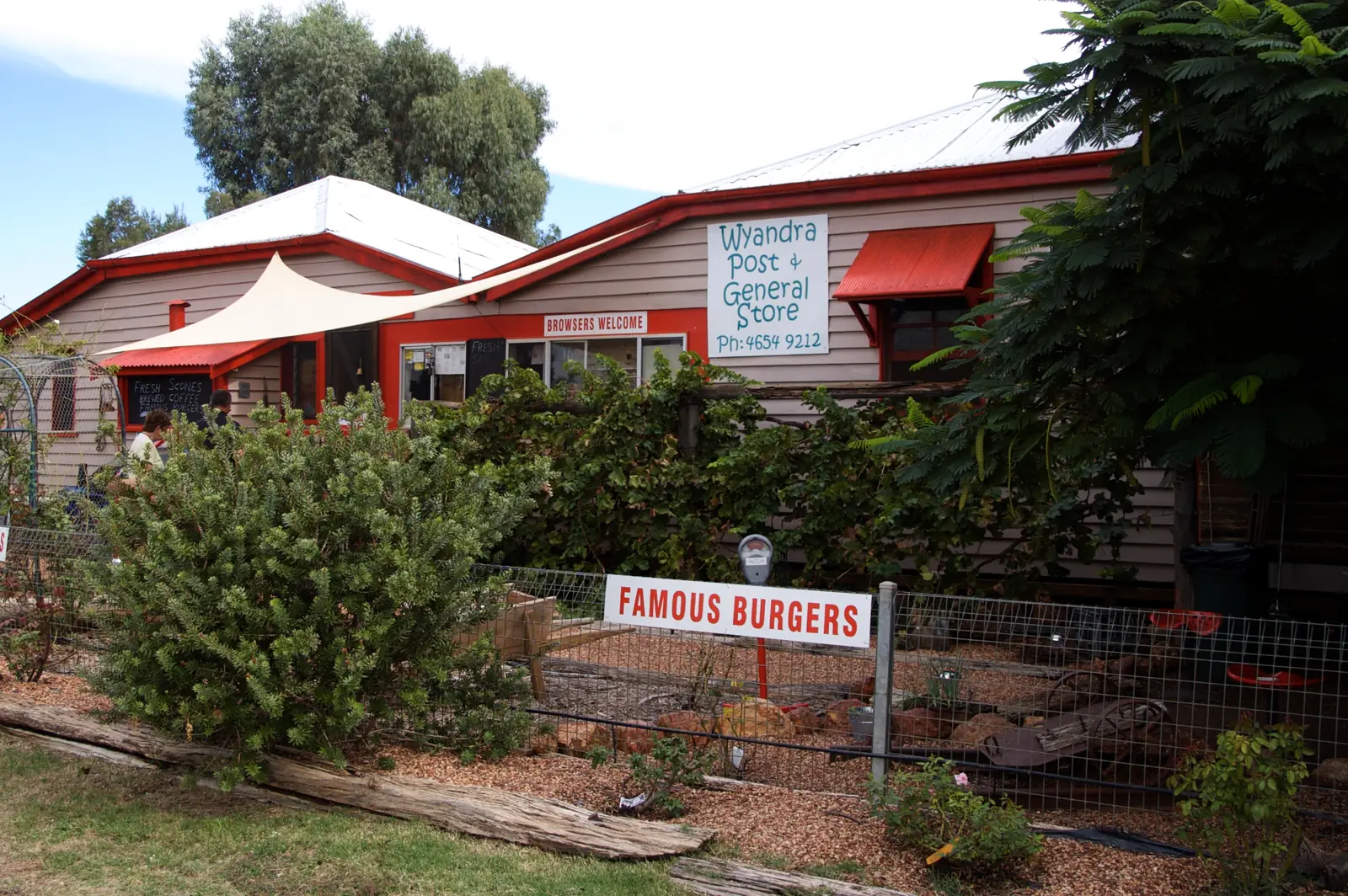
- Wyandra Post, General Store & Caravan Park — 35 Railway Street, 07 4654 9212, 30 powered campsites, some with special pet-friendly fencing
- Wyandra Pub & Truck Stop — 21 Railway Street, Karen 0407 690 554
- Wyandra Free Camp — Moody Street
Outback Queensland names the Post, general store, café and caravan park, and Wyandra Free Camp a short walk from the centre. Those are official named types, not a ranked inventory. Confirm at (07) 4655 8470.
- How to choose: Wyandra accommodation
- Camping detail: Wyandra caravan parks
- Operator enquiries: feature your business
If Wyandra is full, Cunnamulla is about 100 km south and Charleville is the halfway counterpart to the north. That is a distance fact, not a booking guarantee.
Caravan and camping
Vans use Wyandra as a quieter Matilda Way overnight than Cunnamulla or Charleville. Official named camps are the Post caravan park, the free camp on Moody Street, and whatever the pub actually offers on the night you call. Ask the Cunnamulla VIC for stay limits and dump points. Read Wyandra caravan parks and outback camping.
After rain, the Warrego is the constraint. QLDTraffic first.
Fuel and services
A locality of 78 people will not match Cunnamulla or Charleville for a hospital. Cunnamulla Tourism names a general store and café at the Post, and a pub and truck stop. This guide does not list bowser brands. Confirm fuel when you arrive. Fill up in Cunnamulla or Charleville if you are not sure. For current questions, use Paroo Shire Council and (07) 4655 8470.
Road access
The Mitchell Highway / Matilda Way is the sealed spine through Wyandra between Cunnamulla and Charleville. It is a freight road. Pull over for road trains. After rain on the Warrego, check QLDTraffic and 13 19 40. Do not drive around closed signs to keep a café booking.
South: Cunnamulla, then the Adventure Way west to Eulo or the NSW border at Barringun. North: Charleville, then Morven and Augathella. Yowah is the opal detour from the Adventure Way, not from this highway.
Nearby parks and towns
Parks and named nature sites:
- The Beach / Warrego River (Cunnamulla Tourism)
- Currawinya National Park — wetlands on the Paroo, a separate trip via Cunnamulla and Eulo
Towns on this site:
- Cunnamulla — about 100 km; Fella centre, hot springs
- Charleville — Cosmos Centre, bilbies, Matilda Way north
- Eulo — Paroo, mud baths
- Yowah — opal field
- Morven and Augathella — further north on the Matilda Way
When to go, and how long
Cunnamulla Post Office’s January mean maximum of 36.3 °C is hot for a Heritage Trail walk at midday. July’s 18.9 °C mean maximum is the comfortable walking season; July’s 5.8 °C mean minimum is why a river camp needs a layer. Annual rainfall 375.3 mm on the open southern table is wetter than Quilpie Airport’s 345.8 mm. Two hours at the trail, pub and river is the minimum. A night lets you use the free camp or powered sites if the VIC has confirmed them. Two nights only if you are using Wyandra as a rest day on the Matilda Way.
Operators who want a checked listing: feature your business. The listings slot on this hub stays empty until then.
Plan this trip
Tell us the dates, who you are travelling with and where you need help. We reply with planning notes for Wyandra — we are not a booking agent.
Events and road-conditions newsletter
Occasional notes on outback festivals, race days and official road-condition sources — not a daily blast. We use these details only to send the newsletter.
Queensland · South West
Things to do in Wyandra
Things to do in Wyandra: Heritage Trail and boom-era buildings, The Beach on the Warrego, Post Office Café cinema and the pub. Tiny town, sourced list only.
Read · 3 min
Queensland · South West
Wyandra accommodation
Where to stay in Wyandra: Post caravan park, pub and Moody Street free camp named by Cunnamulla Tourism. Confirm at the Cunnamulla Fella Information Centre.
Read · 3 min
Queensland · South West
Wyandra caravan parks
Camping in Wyandra: Post caravan park powered sites and Moody Street free camp as named by Cunnamulla Tourism. Confirm at the Cunnamulla Fella Information Centre.
Read · 3 min
Queensland · South West
Wyandra weather
Wyandra climate: BOM station 044076 has no monthly averages table. Use Cunnamulla Post Office (044026): January mean max 36.3 °C, July 18.9 °C, annual rainfall 375.3 mm.
Read · 4 min
Frequently asked questions
How far is Wyandra from Cunnamulla and Charleville?
Cunnamulla Tourism’s Wyandra page puts the town about 100 km north of Cunnamulla and halfway between Cunnamulla and Charleville. Outback Queensland’s town page also calls it halfway between those two towns. Outback Queensland’s Wyandra stay list prints Club Boutique Hotel Cunnamulla at 83 km. This hub does not invent a Charleville kilometre that is not on those pages.
What is Wyandra’s population?
78 people at the 2021 Census for Wyandra suburbs-and-localities (SAL33182). The ABS does not publish a 2021 Urban Centre (UCL) named Wyandra. QuickStats notes limited tables because of the small population.
Can I camp at Wyandra?
Yes, as named types. Cunnamulla Tourism’s Paroo accommodation page names Wyandra Post, General Store and Caravan Park (30 powered campsites at 35 Railway Street), Wyandra Pub and Truck Stop, and Wyandra Free Camp on Moody Street. Confirm at the Cunnamulla Fella Information Centre.
What is the weather like in Wyandra?
BOM lists Wyandra Railway St (044076) as a rainfall station but does not publish a monthly climate-averages table. Use Cunnamulla Post Office (044026): January mean maximum 36.3 °C, July 18.9 °C, annual rainfall 375.3 mm.
Which towns are in Paroo Shire?
Paroo Shire’s Corporate Plan 2023–2028 names Cunnamulla, Eulo, Wyandra and Yowah as the shire’s communities, with the Warrego running through Cunnamulla.
Where is the visitor centre?
There is no Wyandra visitor centre on the sourced pages. Use the Cunnamulla Fella Information Centre, 2 Jane Street, Cunnamulla, (07) 4655 8470, visitor@paroo.qld.gov.au.
Sources and further reading
Facts on this page were checked against these primary and official sources. Conditions change — confirm before you travel or buy.
- Wyandra 2021 Census QuickStats (SAL33182) — Australian Bureau of Statistics
- Climate statistics for Cunnamulla Post Office (044026) — Bureau of Meteorology
- Climate statistics for Charleville Aero (044021) — Bureau of Meteorology
- Cunnamulla Tourism — Wyandra — Paroo Shire Council
- Accommodation in Paroo — Paroo Shire Council
- Outback Queensland — Wyandra — Outback Queensland Tourism Association
- Paroo Shire Corporate Plan 2023–2028 — Paroo Shire Council
- QLDTraffic — Queensland Government