At a glance
Sourced facts only. Distances and services change — confirm before you travel.
- Local government
- Pastoral Unincorporated Area (Outback Communities Authority)
- Traditional Owners
- Not named for the Border Village roadhouse on the sourced SATC Border Village Roadhouse listingSANTS names the Far West Coast determination towns including Nundroo; Border Village is not in that named town list and is not flattened here. SATC’s Kaurna footer is the Commission’s Adelaide office, not this roadhouse. Confirm at the Ceduna VIC.
- Nearest regional city
- Eucla is 12 km west on this site’s Nullarbor table (Nullarbor Net). Tourism WA puts Eucla 10 minutes from the South Australian border. Ceduna is the last major SA service town this site names further east.
- Capital
- A Border Village–Adelaide kilometre is not printed on the SATC Border Village Roadhouse listing. Tourism WA puts Eucla 1,430 km from Perth.
- Nearest fuel
- SATC names Border Village Roadhouse on the Eyre Highway, Nullarbor SA 5690. Confirm the bowser on arrival; this hub does not invent a brand or hours.
- Nearest hospital or clinic
- No Border Village hospital on the SA Health list fetched for this rebuild. Ceduna District Health Services / Ceduna Hospital, 3 Eyre Highway, (08) 8626 2110 (SA Health) is the last major SA hospital this site names east of the Nullarbor roadhouses. Emergencies 000.
- Mobile coverage
- Check Telstra and Optus coverage maps before travel; do not assume a signal on Eyre Highway gaps.
- Best time to visit
- Autumn, winter and spring on this site’s Nullarbor road-trip page. BOM Eucla (011003) January mean maximum 26.0 °C; July 18.1 °C, with winter-peak rain. That station is in Western Australia, 12 km west on Nullarbor Net.
Climate
Monthly means from the Bureau of Meteorology station Eucla (011003). This is not a forecast. BOM does not publish a Border Village monthly climate-averages table. Temperature and rainfall below are Eucla 011003 (open; elevation 93 m; commenced 1876). Temperature 105 years (1910–2026); rainfall 130 years (1876–2026). Latest available data 13 November 2026 on this site’s Eucla hub. Do not blend with Nullarbor 018106.
| Month | Mean max (°C) | Mean min (°C) | Rainfall (mm) |
|---|---|---|---|
| Jan | 26.0 | 16.8 | 16.4 |
| Feb | 25.8 | 17.1 | 18.6 |
| Mar | 25.2 | 16.1 | 22.9 |
| Apr | 23.7 | 13.5 | 26.2 |
| May | 21.2 | 10.6 | 30.5 |
| Jun | 18.8 | 8.3 | 30.5 |
| Jul | 18.1 | 7.2 | 25.0 |
| Aug | 19.3 | 7.6 | 26.5 |
| Sep | 21.5 | 9.3 | 21.9 |
| Oct | 23.3 | 11.4 | 18.9 |
| Nov | 24.2 | 13.5 | 20.0 |
| Dec | 25.1 | 15.2 | 18.4 |
Border Village in pictures
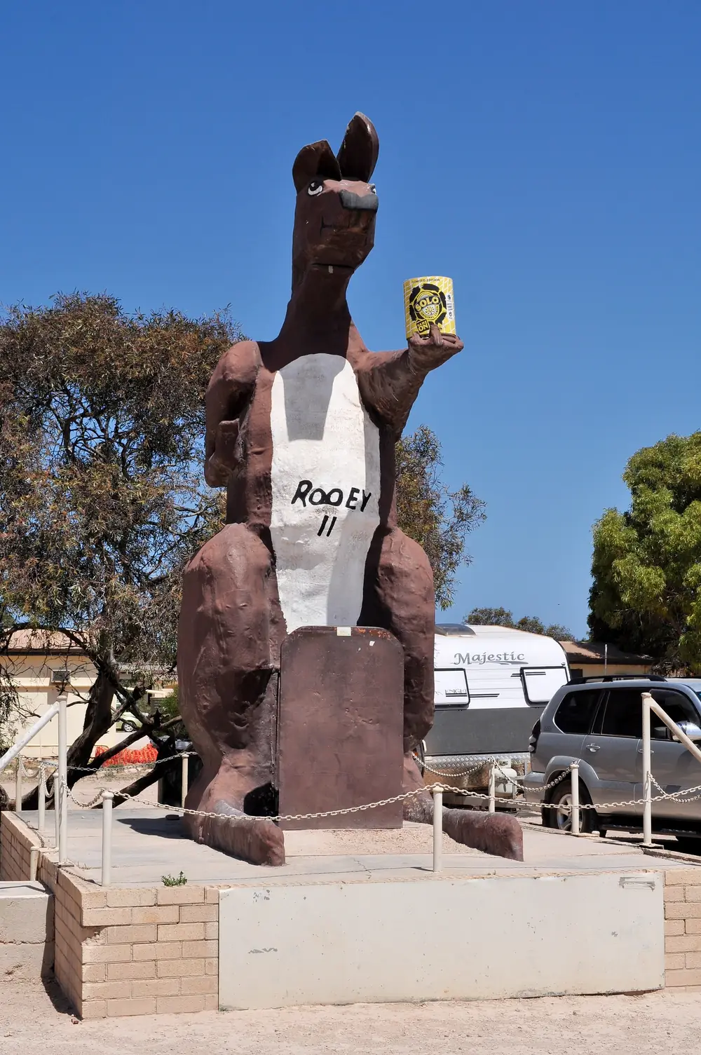
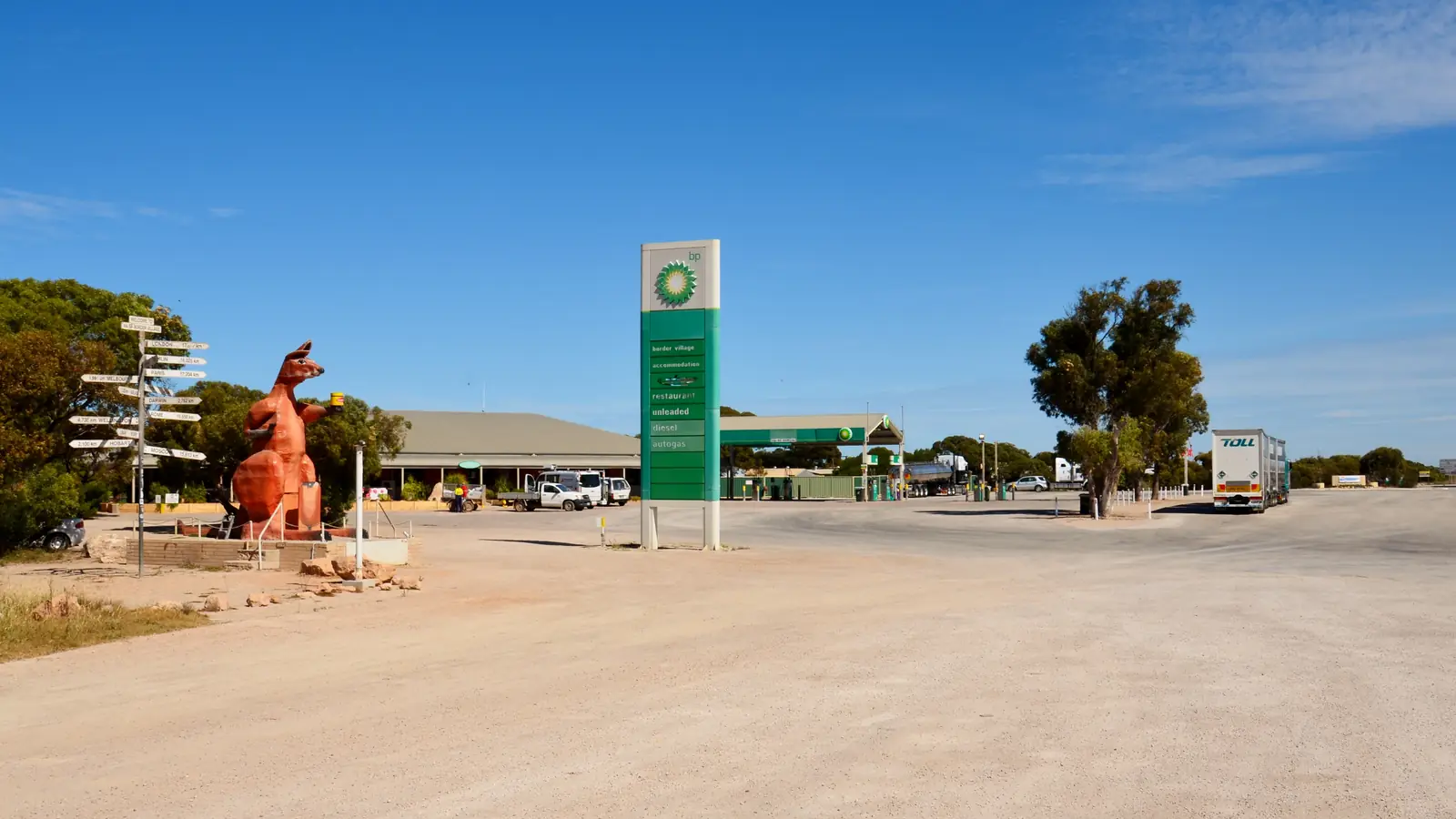
Rooey II kangaroo statue at Border VillagePhoto: WikiWookie · CC BY-SA 4.0 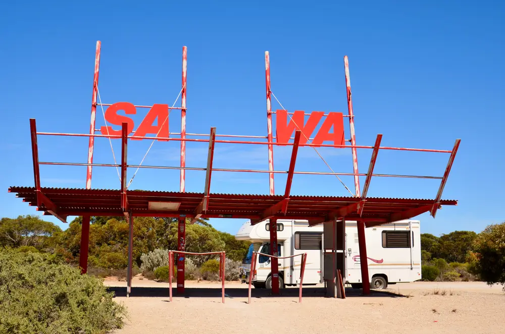
SA and WA border shelter at Border VillagePhoto: Bahnfrend · CC BY-SA 4.0 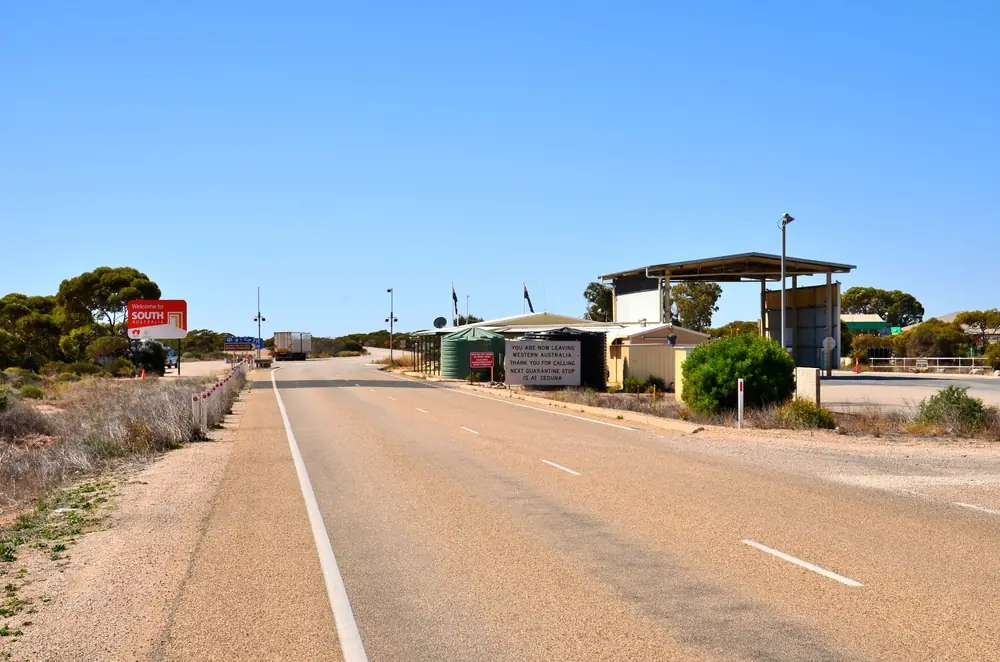
Quarantine checkpoint at Border VillagePhoto: Bahnfrend · CC BY-SA 4.0 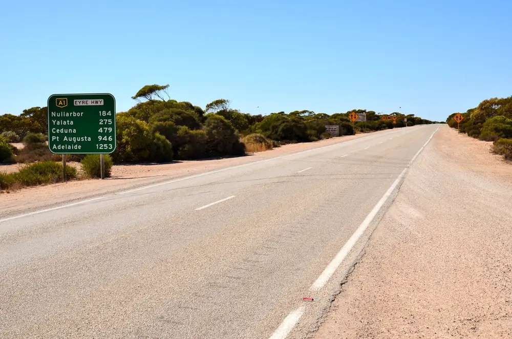
Eyre Highway distance sign at Border VillagePhoto: Bahnfrend · CC BY-SA 4.0
Border Village sits on the Eyre Highway in South Australia, at the Western Australian border. SATC’s product listing puts Border Village Roadhouse at Eyre Highway, Nullarbor, South Australia 5690, phone 08 9039 3474. This is the SA Nullarbor border stop, not Eucla in the Shire of Dundas. Tourism WA puts Eucla 10 minutes into Western Australia. This site’s Nullarbor table, citing Nullarbor Net, lists Border Village 12 km east of Eucla. Travellers mix the two names; the state line does not.
The Australian Bureau of Statistics does not publish a 2021 Urban Centre (UCL) or suburbs-and-localities (SAL) named Border Village on the pages used here. Eucla SAL50494 counted 37 people; that is a Western Australian locality and this hub does not flatten it onto Border Village. Nearby Nullarbor SAL41056 is a different South Australian locality name. Travellers stop for fuel, a meal, a SATC-named room, Rooey II, and the fruit checkpoint. You still need Traffic SA after rain, because a sealed highway is no use if a floodway is closed.
This site groups Border Village with Outback SA towns. Municipal services sit with the Outback Communities Authority. Visitor briefing for the Far West still goes to the Ceduna Visitor Information Centre this site’s Penong guide already uses: 08 8625 3343. SATC’s roadhouse listing is the in-locality directory.
Where it is, and how far
Border Village is the eastern South Australian settlement on this border: sealed Eyre Highway (A1), immediately east of the WA line. SATC’s listing does not print a Border Village–Adelaide or Border Village–Ceduna kilometre. This site’s Nullarbor guide, citing Nullarbor Net, is the distance table used here.
| Place | Official note |
|---|---|
| Eucla | 12 km west (this site’s Nullarbor table, Nullarbor Net). Tourism WA: 10 minutes from the SA border |
| Nullarbor Roadhouse | 186 km east (Nullarbor Net; longest SA Nullarbor fuel gap on that table) |
| Norseman | 721 km west (Nullarbor Net west-to-east table) |
| Yalata | East of Nullarbor Roadhouse on the same table (94 km Nullarbor Roadhouse–Yalata) |
| Ceduna | Last major SA service town this site names further east; SATC does not print a Border Village–Ceduna kilometre on the roadhouse listing |
| Perth | Use Eucla’s 1,430 km (Tourism WA) plus the 12 km Nullarbor Net leg; do not invent a Border Village total |
| Adelaide | Not printed on the SATC roadhouse listing; do not invent a total |
Sealed highway: Traffic SA. Unsealed lookout spurs: stay on signposted tracks. Parks SA and DIT outback road warnings still apply off the bitumen. This site’s Nullarbor page names the unofficial Central Western time used around Caiguna to Border Village — check roadhouse hours in local time.
Facts at a glance
Population. No 2021 SAL or UCL named Border Village. Do not use Eucla SAL50494 as a Border Village count.
Climate. No Border Village monthly climate-averages table on BOM. Use Eucla (011003): 31.68°S, 128.90°E, elevation 93 m, commenced 1876, status open. January mean maximum 26.0 °C, July 18.1 °C, annual rainfall 273.7 mm. Full columns: Border Village weather. Nullarbor (018106) is a different station further east. Do not blend.
Visitor information. SATC: Border Village Roadhouse, 08 9039 3474, admin@bordervillageroadhouse.com.au, bordervillageroadhouse.com.au. SATC lists 37 rooms and 24 hour reception. Ceduna VIC 08 8625 3343 for the Far West corridor.
Traditional Owners
A Traditional Owner nation named for the Border Village roadhouse was not on the SATC Border Village Roadhouse listing fetched for this rebuild. SA Native Title Services’ Far West Coast determination sentence names towns including Ceduna/Thevenard, Koonibba, Denial Bay, Smoky Bay, Penong, Fowlers Bay, Nundroo and Coorabie. Border Village is not in that named town list, and this hub does not flatten that list onto the border. SATC’s website footer acknowledges Kaurna Country for the Commission’s Adelaide office — that is not a Border Village townsite sentence. Confirm current wording at the Ceduna VIC. Read visiting Country respectfully.
History and the highway
Border Village’s visitor meaning on SATC is a border services stop: fuel, meals, rooms, a swimming pool, a traveller’s chapel, and SATC’s named Rooey II. This hub does not invent a gazettal year SATC did not print.
Quarantine is the reason many travellers remember the name. SATC’s Nullarbor map, already quoted on this site’s Penong hub, puts checkpoints at Ceduna (into SA) and Border Village (into WA). This site’s Nullarbor guide, citing DPIRD, also names the WA checkpoint on the Eyre Highway at Eucla as 24/7. Both sentences are already on this site; this hub does not choose one kilometre of bitumen over the other. Eat or bin fruit, vegetables and honey before the WA line. Heading east, PIRSA fruit rules are a Ceduna briefing.
Things to do
Official pages support a short list in and around Border Village:
- Border Village Roadhouse — SATC: fuel, restock, meals, stay; facilities named below
- Rooey II — SATC’s listing photograph set names the giant kangaroo
- SA / WA border — the state line the listing is written around; the shelter in Commons photographs is the photo stop, not a second town
- Quarantine checkpoint — SATC map: into WA at Border Village; DPIRD: Eucla checkpoint 24/7
- Bunda Cliffs lookouts — this site’s Nullarbor page: east of Border Village, signposted, stay behind barriers. Not a Border Village main street
Not in Border Village: Eucla’s Old Telegraph Station, jetty and museum are 12 km west in Western Australia. Yalata is a Far West Aboriginal community, closed without a permit — not a highway novelty stop on the way to the border.
See things to do in Border Village.
Where to stay
SATC names Border Village Roadhouse as the stay: 37 rooms, 24 hour reception, bar, cafe, restaurant, swimming pool, traveller’s chapel, ATM, laundry, public telephone, kiosk, electric vehicle charging point, family friendly, pet friendly — enquire. SATC lists a from–to price range on that product page; this hub does not reprint dollar figures that date. Confirm a room or a site on arrival. If Border Village is full, Eucla is the SATC / Tourism WA named neighbour 12 km west, and Nullarbor Roadhouse is 186 km east on Nullarbor Net — not a 12 km hop the other way.
- How to choose: Border Village accommodation
- Camping detail: Border Village caravan parks
- Operators: feature your business
Caravan and camping
SATC’s schema on the product page is Campground, and the listing is written as a stay-and-play roadhouse. Confirm powered or unpowered sites, dump points and stay limits at the desk. Do not camp on the highway verge. Yalata coastal campsites are permit-only on YAAC wording, further east. Read Border Village caravan parks.
Fuel and services
A locality without a published Census town figure will not match Ceduna for a hospital or a supermarket aisle. SATC names the roadhouse as the place to restock, refuel and recover. This guide does not list brands or prices. Confirm the bowser; Nullarbor Net, already quoted on this site, notes hours change.
Ceduna Hospital, 3 Eyre Highway, (08) 8626 2110, is the SA Health service used here for the eastern end of this corridor. There is no Border Village hospital on the SA Health list fetched for this rebuild. Emergencies 000.
For current questions use the roadhouse, the Ceduna VIC, OCA and Traffic SA.
Road access
The Eyre Highway is sealed. SATC’s Nullarbor map reminds travellers to prepare food, water, fuel and communications, and that quarantine checkpoints sit at Ceduna (into SA) and Border Village (into WA). The 186 km Border Village–Nullarbor Roadhouse leg is one of the three longest fuel gaps on this site’s Nullarbor table.
West: Eucla, then Mundrabilla, Madura, Cocklebiddy, Caiguna, Balladonia, Norseman. East: Nullarbor Roadhouse, Yalata, Nundroo, Penong, Ceduna. See the Nullarbor crossing guide.
Nearby parks and towns
Parks and corridor sites:
- Bunda Cliffs lookouts (this site’s Nullarbor page; east of the border)
- Head of Bight whale-watching centre (SATC listing under Yalata; YAAC FAQ: 25 km from Nullarbor Roadhouse, 88 km from Yalata Roadhouse — not a Border Village footpath)
- Yalata Indigenous Protected Area (YAAC; permit-only coastal camping)
Towns on this site:
- Eucla — WA Nullarbor town, 10 minutes from the SA border on Tourism WA
- Yalata — Far West Aboriginal community; closed without a permit
- Nundroo — SATC-named roadhouse east of Yalata
- Penong — Windmill Museum, SATC-named caravan park
- Ceduna — last major SA service town, oysters, VIC
- Port Augusta — Eyre / Stuart / Augusta junction
When to go, and how long
Eucla’s January mean maximum of 26.0 °C is milder than inland Eyre Peninsula January at Wudinna Aero, but still a sun-and-wind problem on a highway verge. July’s 18.1 °C mean maximum is the comfortable crossing season on this site’s Nullarbor page; July’s 7.2 °C mean minimum is why a room matters. Annual rainfall 273.7 mm, winter-wetter than the far north (May and June 30.5 mm mean at Eucla). SATC’s Head of Bight whale-centre listing names June–October as the southern right whale nursery season — that centre is east of Nullarbor Roadhouse, not a Border Village afternoon unless you have already planned the extra kilometres.
A fuel and quarantine stop is the minimum. A night covers an early start east toward the Bunda Cliffs and Nullarbor Roadhouse, or west into Eucla. Two nights if you are waiting on wind, a closed floodway, or a quarantine briefing.
Operators who want a checked listing: feature your business. The listings slot on this hub stays empty until then.
Plan this trip
Tell us the dates, who you are travelling with and where you need help. We reply with planning notes for Border Village — we are not a booking agent.
Events and road-conditions newsletter
Occasional notes on outback festivals, race days and official road-condition sources — not a daily blast. We use these details only to send the newsletter.
South Australia · Outback SA
Border Village accommodation
Where to stay at Border Village: SATC names Border Village Roadhouse, 37 rooms, 24 hour reception, pool. Confirm on arrival. Eucla is 12 km west. This is SA, not Eucla WA.
Read · 4 min
South Australia · Outback SA
Border Village caravan parks
Camping at Border Village: SATC names Border Village Roadhouse as a Campground-type stay on the SA Nullarbor border. Confirm sites on arrival. Eucla is 12 km west. Do not camp on the verge.
Read · 4 min
South Australia · Outback SA
Border Village weather
Border Village climate from BOM Eucla (011003): January mean max 26.0 °C, July 18.1 °C, annual rainfall 273.7 mm. No Border Village monthly climate-averages table.
Read · 3 min
South Australia · Outback SA
Things to do in Border Village
Things to do at Border Village: SATC names Border Village Roadhouse and Rooey II on the SA Nullarbor border. Link Eucla. Quarantine into WA. Bunda Cliffs sit east — not a Ceduna suburb list.
Read · 4 min
Frequently asked questions
Is Border Village in South Australia or Western Australia?
This hub is Border Village on the Eyre Highway in South Australia, at the Western Australian border. SATC’s product listing puts Border Village Roadhouse at Eyre Highway, Nullarbor, South Australia 5690. It is not Eucla. Eucla is the Shire of Dundas town 10 minutes into Western Australia on Tourism WA.
How far is Border Village from Eucla and Nullarbor Roadhouse?
This site’s Nullarbor road-trip page, citing Nullarbor Net, lists Border Village 12 km east of Eucla and 186 km west of Nullarbor Roadhouse (721 km from Norseman on the west-to-east fuel table). SATC’s Border Village Roadhouse listing does not print those kilometres.
What is Border Village’s population?
The ABS does not publish a 2021 Urban Centre or suburbs-and-localities named Border Village. Eucla SAL50494 (37 people) is a different Western Australian locality and is not used here as a Border Village town figure.
Where is the WA fruit quarantine checkpoint?
SATC’s Nullarbor map, already quoted on this site’s Penong hub, puts quarantine checkpoints at Ceduna (into SA) and Border Village (into WA). This site’s Nullarbor guide, citing DPIRD, also names the WA checkpoint on the Eyre Highway at Eucla as 24/7. Heading east, PIRSA fruit rules are a Ceduna briefing.
What is there to do at Border Village?
SATC names Border Village Roadhouse as a fuel, meal and stay stop, and its listing photograph set includes Rooey II, the giant kangaroo. This site’s Nullarbor page names Bunda Cliffs lookouts east of the border. Do not treat Eucla’s Old Telegraph Station as a Border Village walk.
What weather record should I use?
BOM does not publish a Border Village monthly climate-averages table. Use Eucla (011003): January mean maximum 26.0 °C, July 18.1 °C, annual rainfall 273.7 mm. That station is in Western Australia.
Sources and further reading
Facts on this page were checked against these primary and official sources. Conditions change — confirm before you travel or buy.
- Border Village Roadhouse — South Australian Tourism Commission
- Climate statistics for Eucla (011003) — Bureau of Meteorology
- Eucla 2021 Census QuickStats (SAL50494) — Australian Bureau of Statistics
- Eyre Peninsula Nullarbor map — South Australian Tourism Commission
- Quarantine WA border checkpoints — Department of Primary Industries and Regional Development, WA
- Travelling to South Australia — Primary Industries and Regions SA
- Eucla — Tourism Western Australia
- Ceduna District Health Services — SA Health
- Outback road warnings — Department for Infrastructure and Transport SA
- Traffic SA — Government of South Australia
- Outback Communities Authority — Outback Communities Authority