At a glance
Sourced facts only. Distances and services change — confirm before you travel.
- Local government
- Pastoral Unincorporated Area (Outback Communities Authority)
- Traditional Owners
- Far West Coast Native Title Claim Group (Nundroo named in the determination area)SANTS: the 5 December 2013 determination area includes Penong, Fowlers Bay, Nundroo and Coorabie. The claim group includes Mirning, Wirangu and Kokatha peoples. Parks SA’s Fowlers Bay page acknowledges Far West Coast people.
- Nearest regional city
- Ceduna is the last major service town this site names east of Penong on the Eyre Highway. SATC and this site’s Nullarbor fuel table place Nundroo west of Penong; a Nundroo–Ceduna kilometre is not printed on the SATC Windmill Museum page.
- Capital
- A Nundroo–Adelaide kilometre is not printed on the SATC Nullarbor map or the Windmill Museum page. Ceduna Tourism / council put Ceduna 780 km west of Adelaide.
- Nearest fuel
- SATC’s Eyre Peninsula / Nullarbor map names Nundroo Roadhouse as a highway stop. Confirm the bowser on arrival; this hub does not invent a brand or hours.
- Nearest hospital or clinic
- Ceduna District Health Services / Ceduna Hospital, 3 Eyre Highway, (08) 8626 2110 (SA Health). Emergencies 000.
- Mobile coverage
- Check Telstra and Optus coverage maps before travel; Parks SA notes limited coverage in Fowlers Bay Conservation Park. Do not assume a signal on Eyre Highway gaps.
- Best time to visit
- Autumn, winter and spring on this site’s Nullarbor road-trip page. BOM Ceduna AMO January mean maximum is 28.7 °C; July 17.5 °C, with winter-peak rain.
Climate
Monthly means from the Bureau of Meteorology station Ceduna AMO (018012). This is not a forecast. BOM does not publish a Nundroo monthly climate-averages table. Temperature and rainfall below are Ceduna AMO, 85–86 years (1939–2026). Fowlers Bay 018030 is a different coastal table west of Penong with temperature means 1927–1967; do not blend.
| Month | Mean max (°C) | Mean min (°C) | Rainfall (mm) |
|---|---|---|---|
| Jan | 28.7 | 15.3 | 12.9 |
| Feb | 28.3 | 15.1 | 14.4 |
| Mar | 26.7 | 13.4 | 16.2 |
| Apr | 24.3 | 10.8 | 19.9 |
| May | 20.9 | 8.5 | 31.8 |
| Jun | 18.2 | 6.5 | 36.1 |
| Jul | 17.5 | 5.8 | 38.2 |
| Aug | 18.8 | 6.2 | 33.7 |
| Sep | 21.7 | 7.9 | 25.4 |
| Oct | 24.1 | 10.1 | 25.2 |
| Nov | 26.0 | 12.4 | 19.3 |
| Dec | 27.5 | 14.2 | 20.4 |
Nundroo in pictures
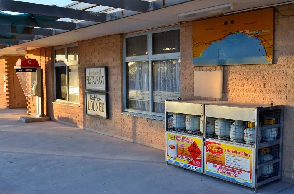
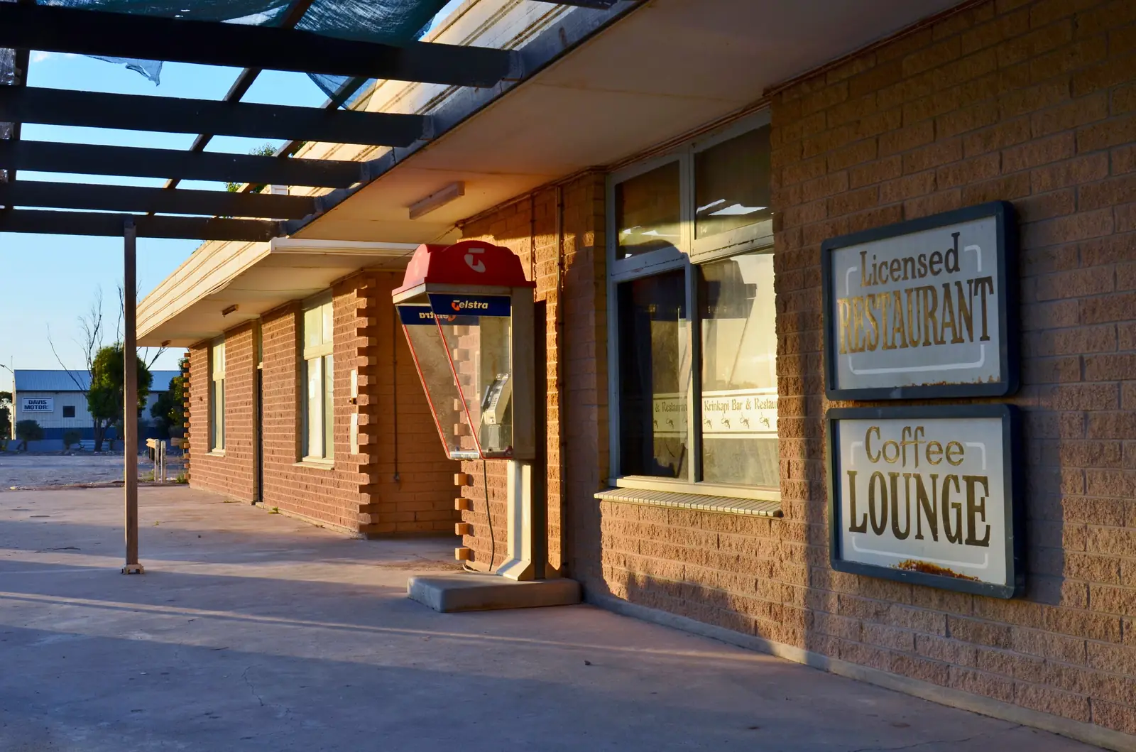
Nundroo Roadhouse restaurant signs and gas cagesPhoto: Bahnfrend · CC BY-SA 4.0 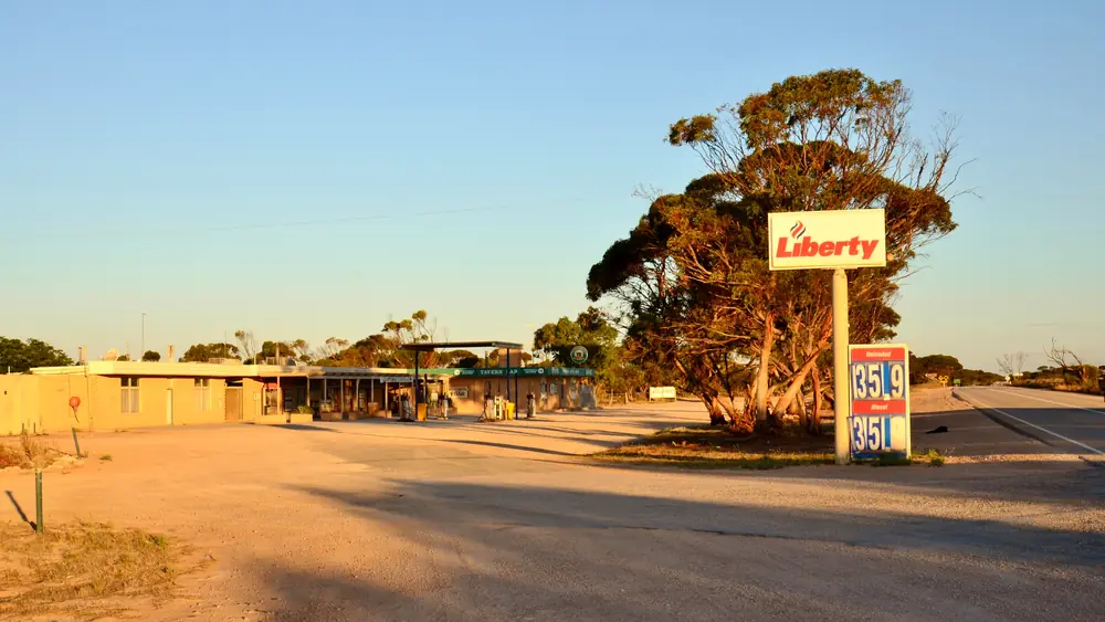
Nundroo Roadhouse and Liberty bowser from the highwayPhoto: Bahnfrend · CC BY-SA 4.0 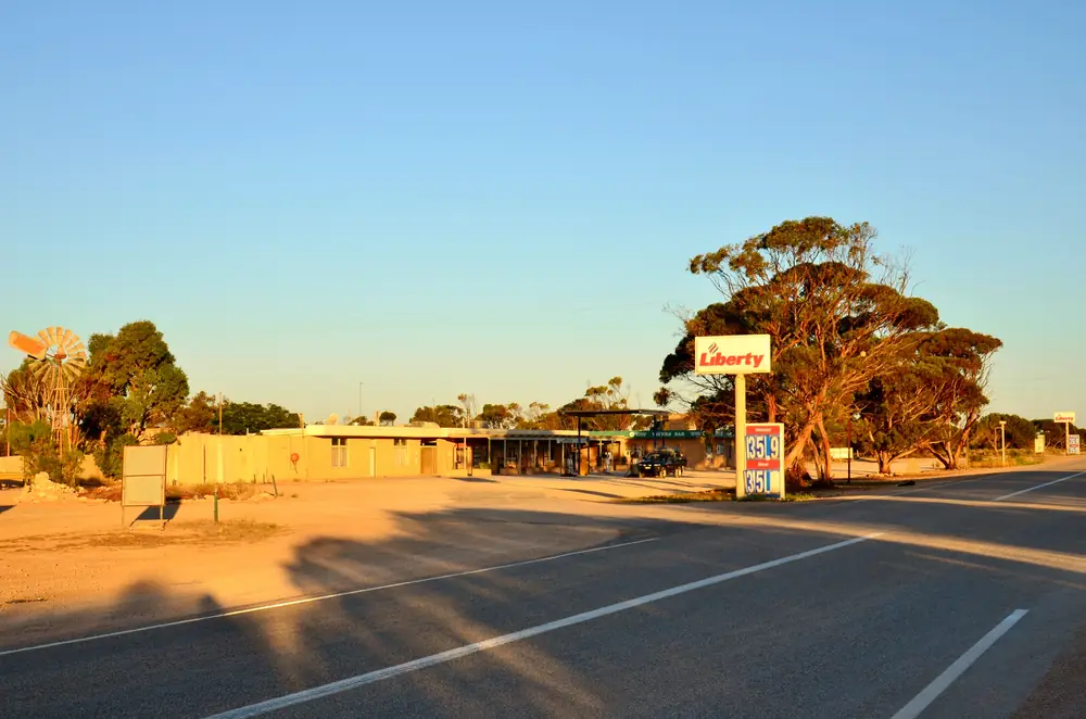
Nundroo Roadhouse from the Eyre HighwayPhoto: Bahnfrend · CC BY-SA 4.0 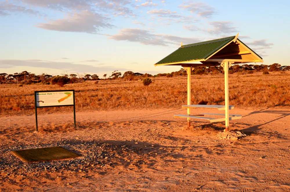
Wombat Hole picnic shelter at NundrooPhoto: Bahnfrend · CC BY-SA 4.0
Nundroo sits on the Eyre Highway in South Australia’s Far West, west of Penong and Ceduna, toward Yalata and the Nullarbor roadhouses. SATC’s Eyre Peninsula / Nullarbor map names Nundroo Roadhouse on that sealed corridor and groups it with Nullarbor Roadhouse as a stay-and-play stop on the Nullarbor Links story. This is a highway locality, not a wheatbelt main street borrowed from Wudinna, and not Eucla in Western Australia.
The Australian Bureau of Statistics does not publish a 2021 Urban Centre (UCL) or suburbs-and-localities (SAL) named Nundroo on the pages used here. Nearby Nullarbor SAL41056 counted 71 people; that is a different locality name and this hub does not flatten it onto Nundroo. Travellers stop for fuel, a meal and a Nullarbor night. You still need Traffic SA after rain, because a sealed highway is no use if a floodway is closed.
This site groups Nundroo with Outback SA towns. Municipal services sit with the Outback Communities Authority, not the District Council of Ceduna’s town boundary. Visitor briefing for the Far West still goes to the Ceduna Visitor Information Centre SATC prints on the Penong museum listing: cedunavic@ceduna.sa.gov.au, 08 8625 3343.
Where it is, and how far
Nundroo is west of Penong on the sealed Eyre Highway (A1). SATC does not print a Nundroo–Ceduna kilometre on the Windmill Museum page. This site’s Ceduna hub puts Ceduna 780 km west of Adelaide (Ceduna Tourism / council). This site’s Nullarbor guide, citing Nullarbor Net, lists Nundroo on the west-to-east fuel table as 1,053 km from Norseman, 52 km east of Yalata and 76 km west of Penong. Those are Nullarbor Net legs already used on this site, not a SATC survey of the townsite.
| Place | Official note |
|---|---|
| Penong | East on the Eyre Highway; this site’s Nullarbor table: 76 km (Nullarbor Net) |
| Yalata | West on the Eyre Highway; this site’s Nullarbor table: 52 km (Nullarbor Net) |
| Ceduna | East of Penong; SATC: last major SA service town on this corridor; no Nundroo–Ceduna kilometre on the SATC museum page |
| Adelaide | Use Ceduna’s 780 km figure plus the unnamed Nundroo–Ceduna gap; do not invent a Nundroo total |
| Fowlers Bay Conservation Park | Parks SA: 119 km from Ceduna to the Fowlers Bay turn-off — a park-access figure, not a Nundroo town post |
Sealed highway: Traffic SA. Unsealed park tracks (Fowlers Bay beaches, Googs Track): Parks SA and DIT outback road warnings. Parks SA also prints 1300 361 033.
Facts at a glance
Population. No 2021 SAL or UCL named Nundroo. Do not use Nullarbor SAL41056 as a Nundroo count.
Climate. No Nundroo monthly climate-averages table on BOM. Use Ceduna AMO (018012): 32.13°S, 133.70°E, elevation 15 m, commenced 1939, status open. January mean maximum 28.7 °C, July 17.5 °C, annual rainfall 291.3 mm. Full columns: Nundroo weather. Fowlers Bay (018030) is a different table west of Penong; temperature means there run 1927–1967. Do not blend.
Visitor information. SATC museum listing for Penong: Ceduna Visitor Information Centre, 08 8625 3343, cedunavic@ceduna.sa.gov.au. Parks SA Ceduna office 08 8625 3144 for Yumbarra and Fowlers Bay bookings.
Traditional Owners
SA Native Title Services states that on 5 December 2013 the Court recognised the Far West Coast Native Title Claim Group, and that the determination area includes the towns of Ceduna/Thevenard, Koonibba, Denial Bay, Smoky Bay, Penong, Fowlers Bay, Nundroo and Coorabie. The group includes Mirning, Wirangu and Kokatha peoples (and related groups named in that determination). The Far West Coast Aboriginal Corporation RNTBC administers the land. Parks SA’s Fowlers Bay Conservation Park page acknowledges Far West Coast people as custodians of the Far West Coast region. This hub follows those official sentences rather than picking one language group for the roadhouse verge. Confirm wording at the Ceduna VIC. Read visiting Country respectfully.
History and the highway
Nundroo’s visitor meaning on SATC maps is a highway services stop on the Far West Nullarbor run, west of Penong’s town services. SATC’s Penong caravan-park listing calls Penong either your first or last stop with town services for the Nullarbor adventure; Nundroo sits further west on that same map. This hub does not invent a gazettal year SATC did not print.
Quarantine for the crossing is a Ceduna / Border Village problem — SATC’s Nullarbor map puts checkpoints at Ceduna (into SA) and Border Village (into WA). See this site’s Nullarbor guide and PIRSA / DPIRD, not a Nundroo by-law we invented.
Things to do
Official pages support a short list in and around Nundroo:
- Nundroo Roadhouse — SATC Nullarbor map: highway stay-and-play stop named with Nullarbor Roadhouse on the Nullarbor Links corridor
- Penong Windmill Museum, West Terrace — SATC: east of Nundroo; Bruce, Australia’s biggest mill, around 20 donated mills, free entry
- Fowlers Bay Conservation Park — Parks SA: seabirds, sea-lions, southern right whales May–October; 119 km from Ceduna to the Fowlers Bay turn-off. Town guide: Fowlers Bay
- Yalata Lands camping and fishing — SATC and Yalata Anangu Aboriginal Corporation: permit-only, not a Nundroo footpath. The residential community is closed without a permit
- Head of Bight — SATC lists the whale-watching centre under Yalata; Yalata’s contact FAQ puts the car park 88 km from Yalata Roadhouse. That is west of Nundroo, not a town walk
Where to stay
SATC names Nundroo Roadhouse as a highway accommodation stop on the Nullarbor map. SATC does not publish a live product page for that roadhouse on the fetch used here, so this hub does not invent motel room counts, cabin types or tariffs. Confirm on arrival. If Nundroo is full, Penong Caravan Park is the SATC-named town park east, and Ceduna has the larger room count this site’s Ceduna guide covers.
- How to choose: Nundroo accommodation
- Camping detail: Nundroo caravan parks
- Operators: feature your business
Caravan and camping
Vans use Nundroo as a Far West Nullarbor overnight west of Penong. Official named camping starts with whatever sites the SATC-named Nundroo Roadhouse is actually offering that night — confirm at the desk. Parks SA adds Fowlers Bay campgrounds (fees, book before you go). Yalata coastal campsites are permit-only on YAAC wording. Ask the Ceduna VIC for stay limits. Read Nundroo caravan parks.
Fuel and services
A locality without a published Census town figure will not match Ceduna for a hospital or a supermarket aisle. Fill in Ceduna if you are eastbound onto the long Nullarbor gaps; confirm Nundroo bowsers if you are westbound and treating SATC’s named roadhouse as the next fuel. This guide does not list brands or prices.
Ceduna Hospital, 3 Eyre Highway, (08) 8626 2110, is the SA Health service used here. There is no Nundroo hospital on the SA Health list fetched for this rebuild. Emergencies 000.
For current questions use the Ceduna VIC, OCA and Traffic SA.
Road access
The Eyre Highway is sealed. SATC’s Nullarbor map reminds travellers to prepare food, water, fuel and communications, and that quarantine checkpoints sit at Ceduna (into SA) and Border Village (into WA). Unsealed spurs to Fowlers Bay beaches and Googs Track are a VIC / Parks SA / DIT problem. Googs Track has a published summer closure on Parks SA.
East: Penong, then Ceduna, then Port Augusta. West: Yalata, Nullarbor Roadhouse, the Bunda Cliffs, Border Village, Eucla. See the Nullarbor crossing guide.
Nearby parks and towns
Parks:
- Fowlers Bay Conservation Park (Parks SA; Fowlers Bay)
- Yumbarra Conservation Park and Yellabinna (Parks SA; Googs Track)
- Yalata Indigenous Protected Area (YAAC; permit-only coastal camping — not a public park you drive into from the highway without a booking)
Towns on this site:
- Penong — Windmill Museum, SATC-named caravan park
- Ceduna — last major service town, oysters, VIC
- Yalata — Far West Aboriginal community; closed without a permit
- Border Village — SA Nullarbor border roadhouse
- Eucla — WA Nullarbor town, 10 minutes from the SA border on Tourism WA
- Port Augusta — Eyre / Stuart / Augusta junction
When to go, and how long
Ceduna AMO’s January mean maximum of 28.7 °C is milder than inland Eyre Peninsula January at Wudinna Aero, but still hot on a highway verge at midday. July’s 17.5 °C mean maximum is the comfortable crossing season on this site’s Nullarbor page; July’s 5.8 °C mean minimum is why a room or a decent swag matters. Annual rainfall 291.3 mm, winter-wetter than the far north (July 38.2 mm mean). SATC whale watching at Fowlers Bay is May–October.
A fuel stop is the minimum. A night covers an early start west toward Yalata and Border Village, or east toward Penong’s museum. Two nights if you are adding Fowlers Bay camping or waiting on Googs Track conditions.
Operators who want a checked listing: feature your business. The listings slot on this hub stays empty until then.
Plan this trip
Tell us the dates, who you are travelling with and where you need help. We reply with planning notes for Nundroo — we are not a booking agent.
Events and road-conditions newsletter
Occasional notes on outback festivals, race days and official road-condition sources — not a daily blast. We use these details only to send the newsletter.
South Australia · Outback SA
Nundroo accommodation
Where to stay in Nundroo: SATC’s Nullarbor map names Nundroo Roadhouse. Confirm on arrival. Penong Caravan Park and Ceduna are the SATC-named fallbacks east. This is SA, not WA.
Read · 4 min
South Australia · Outback SA
Nundroo caravan parks
Camping in Nundroo: SATC names Nundroo Roadhouse as a stay-and-play stop. Confirm sites on arrival. Penong Caravan Park and Parks SA Fowlers Bay campgrounds are the official named alternatives.
Read · 3 min
South Australia · Outback SA
Nundroo weather
Nundroo climate from BOM Ceduna AMO (018012): January mean max 28.7 °C, July 17.5 °C, annual rainfall 291.3 mm. No Nundroo monthly climate-averages table.
Read · 3 min
South Australia · Outback SA
Things to do in Nundroo
Things to do around Nundroo: SATC names Nundroo Roadhouse on the Nullarbor Links corridor. Penong Windmill Museum, Fowlers Bay Conservation Park and permit-only Yalata Lands sit nearby — not a Ceduna suburb list.
Read · 4 min
Frequently asked questions
Is Nundroo in South Australia or Western Australia?
This hub is Nundroo on the Eyre Highway in South Australia’s Far West, west of Penong and Ceduna toward Yalata and the Nullarbor roadhouses. SATC’s Eyre Peninsula / Nullarbor map names Nundroo Roadhouse on that SA corridor. It is not a Western Australian town page. Eucla is the WA Nullarbor settlement on this site.
How far is Nundroo from Ceduna, Penong and Yalata?
SATC does not print a Nundroo–Ceduna kilometre on the Windmill Museum page. This site’s Nullarbor road-trip page, citing Nullarbor Net, lists Nundroo 52 km east of Yalata, 76 km west of Penong, and 1,053 km from Norseman on the west-to-east fuel table. This hub does not invent a Nundroo–Adelaide total.
What is Nundroo’s population?
The ABS does not publish a 2021 Urban Centre or suburbs-and-localities named Nundroo. Nearby Nullarbor SAL41056 counted 71 people; that is a different locality name and is not used here as a Nundroo town figure.
Whose Country is this?
SA Native Title Services states the Far West Coast Native Title determination area includes the towns of Ceduna/Thevenard, Koonibba, Denial Bay, Smoky Bay, Penong, Fowlers Bay, Nundroo and Coorabie. The claim group includes Mirning, Wirangu and Kokatha peoples. Parks SA’s Fowlers Bay Conservation Park page acknowledges Far West Coast people as custodians of the Far West Coast region.
What is there to do in Nundroo?
SATC’s Eyre Peninsula / Nullarbor map names Nundroo Roadhouse as a highway stay-and-play stop on the Nullarbor Links corridor. Official visitor time around Nundroo is a fuel and rest stop, then Penong’s Windmill Museum, Fowlers Bay Conservation Park, or the permit-managed Yalata Lands — not a main-street attraction list this hub invents.
What weather record should I use?
BOM does not publish a Nundroo monthly climate-averages table. Use Ceduna AMO (018012): January mean maximum 28.7 °C, July 17.5 °C, annual rainfall 291.3 mm. Do not blend with Fowlers Bay (018030).
Sources and further reading
Facts on this page were checked against these primary and official sources. Conditions change — confirm before you travel or buy.
- Nullarbor 2021 Census QuickStats (SAL41056) — Australian Bureau of Statistics
- Climate statistics for Ceduna AMO (018012) — Bureau of Meteorology
- Climate statistics for Fowlers Bay (018030) — Bureau of Meteorology
- Eyre Peninsula Nullarbor map — South Australian Tourism Commission
- Penong Windmill Museum — South Australian Tourism Commission
- Far West Coast Aboriginal Corporation RNTBC — SA Native Title Services
- Fowlers Bay Conservation Park — National Parks and Wildlife Service SA
- Ceduna District Health Services — SA Health
- Outback road warnings — Department for Infrastructure and Transport SA
- Traffic SA — Government of South Australia
- Outback Communities Authority — Outback Communities Authority
- Quarantine WA border checkpoints — Department of Primary Industries and Regional Development, WA