At a glance
Sourced facts only. Distances and services change — confirm before you travel.
- Local government
- Pastoral Unincorporated Area (Outback Communities Authority)
- Traditional Owners
- Adnyamathanha people (community wording)Nepabunna Community’s Our Story page: We are the Adnyamathanha (ad-nya-mut-na) people. “Adnya” means “rock” and “matha” means “group” or “group of people”. Parks SA: Vulkathunha-Gammon Ranges National Park is traditional country of the Adnyamathanha people, co-managed since 2010. Nantawarrina IPA is managed by the Adnyamathanha community / Nipapanha Community Aboriginal Corporation.
- Nearest regional city
- Arkaroola’s getting-here page: about 2 hours from Leigh Creek via Nipapanha (Nepabunna); about 130 km unsealed from Copley to Arkaroola. Copley is 6 km north of Leigh Creek South (OCA). This hub does not invent a separate Nepabunna–Leigh Creek kilometre.
- Capital
- Arkaroola’s getting-here page puts the sanctuary 600 km north of Adelaide. OCA puts Copley about 560 km north of Adelaide. This hub does not invent a separate Nepabunna–Adelaide drive.
- Nearest fuel
- Confirm in Leigh Creek or Copley before the unsealed road. This hub does not invent a Nepabunna bowser.
- Nearest hospital or clinic
- Leigh Creek Health Service, Black Oak Drive, (08) 8678 6022 (SA Health). Clinic hours 9am–5pm weekdays excluding public holidays; 24/7 emergency support on that number. Emergencies 000.
- Mobile coverage
- Check Telstra and Optus coverage maps before travel; do not assume a signal on the Copley–Arkaroola road or in Nantawarrina.
- Best time to visit
- Cooler months on SATC outback itineraries; DIT decides whether the unsealed road is open. BOM Arkaroola January mean max 34.5 °C
Climate
Monthly means from the Bureau of Meteorology station Arkaroola (017099). This is not a forecast. BOM does not publish a Nepabunna climate-averages table. Nearest named open ranges station used here is Arkaroola (017099), 30.31°S 139.34°E, elevation 318 m. Temperature 43/42 years (1977–2026); rainfall 87 years (1938–2026). Leigh Creek Airport (017110) is the open plains table for the sealed approach. Do not blend the two.
| Month | Mean max (°C) | Mean min (°C) | Rainfall (mm) |
|---|---|---|---|
| Jan | 34.5 | 20.3 | 34.2 |
| Feb | 33.3 | 19.5 | 39.2 |
| Mar | 29.9 | 16.0 | 30.5 |
| Apr | 25.3 | 11.2 | 14.6 |
| May | 20.3 | 7.2 | 16.8 |
| Jun | 16.8 | 4.4 | 14.7 |
| Jul | 16.6 | 3.3 | 14.4 |
| Aug | 19.2 | 4.7 | 15.0 |
| Sep | 23.4 | 8.0 | 14.7 |
| Oct | 26.7 | 11.6 | 18.7 |
| Nov | 30.3 | 15.5 | 18.3 |
| Dec | 32.8 | 17.8 | 25.2 |
Nepabunna is an Adnyamathanha community on the unsealed public road between Copley and Arkaroola, grouped on this site with Flinders Ranges towns. The community’s own site uses Nepabunna on the home page and Nipapanha (formerly known as Nepabunna) on the Nantawarrina page. Arkaroola’s getting-here page writes Nipapanha (Nepabunna) on the about 2 hours from Leigh Creek sentence. This hub follows those official spellings. It is not a Stuart Highway roadhouse, not a substitute for Arkaroola Village, and not a casual lookout you pull into without a reason to be there.
The Australian Bureau of Statistics does not publish a 2021 Urban Centre (UCL) named Nepabunna. Use suburbs-and-localities SAL41019: 26 people, median age 51, sex split 51.7% male / 48.3% female. QuickStats notes limited tables because of the small population. 6 families, 45 private dwellings, average household size 1.6.
Municipal services sit with the Outback Communities Authority in the Pastoral Unincorporated Area. Contact on the community site: (08) 8648 3764, fax (08) 8648 3742, admin@nipapanhacommunity.com.au, Nepabunna Community, Via Copley, SA 5732. Parks SA uses the same phone for Nantawarrina Indigenous Protected Area permits.
Where it is, and how far
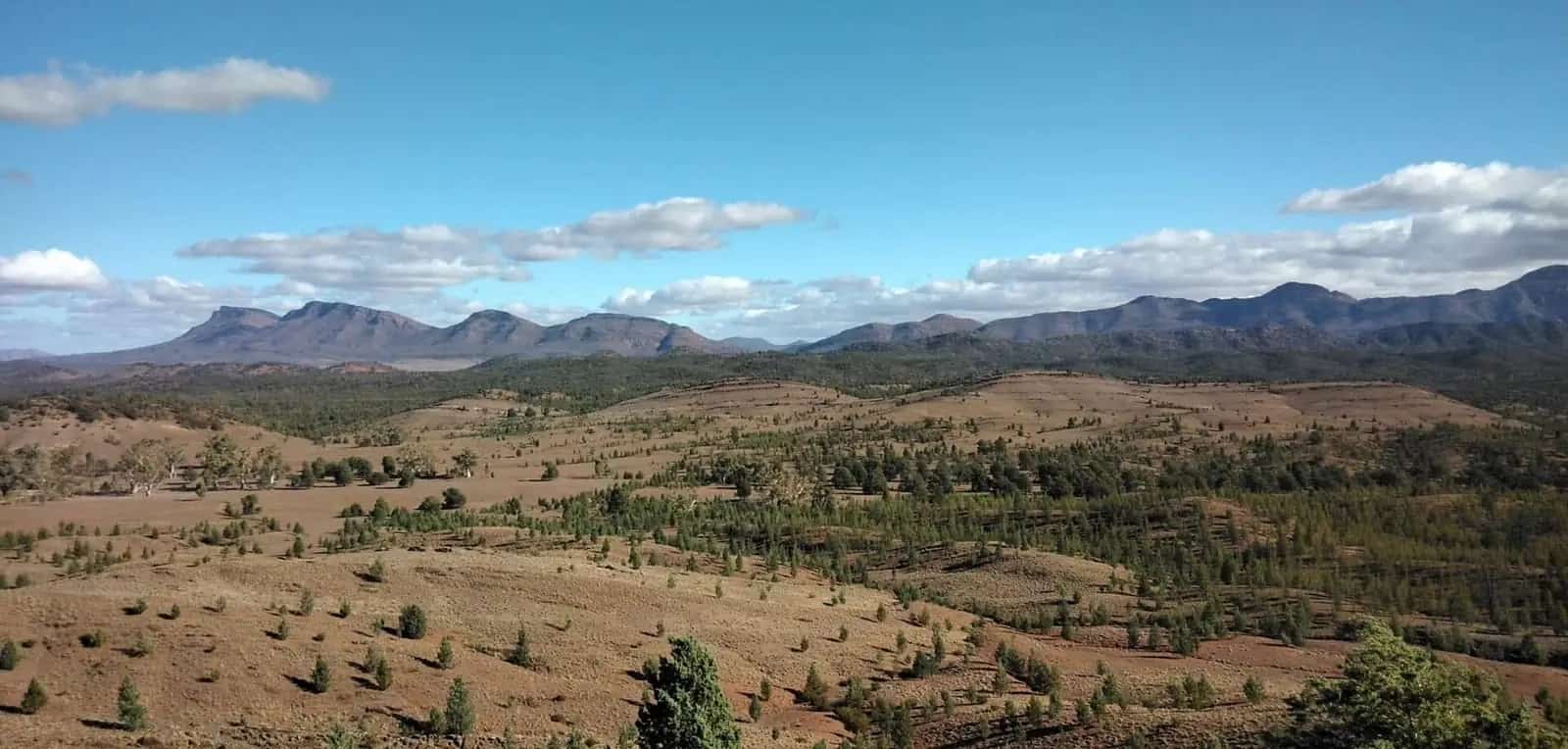
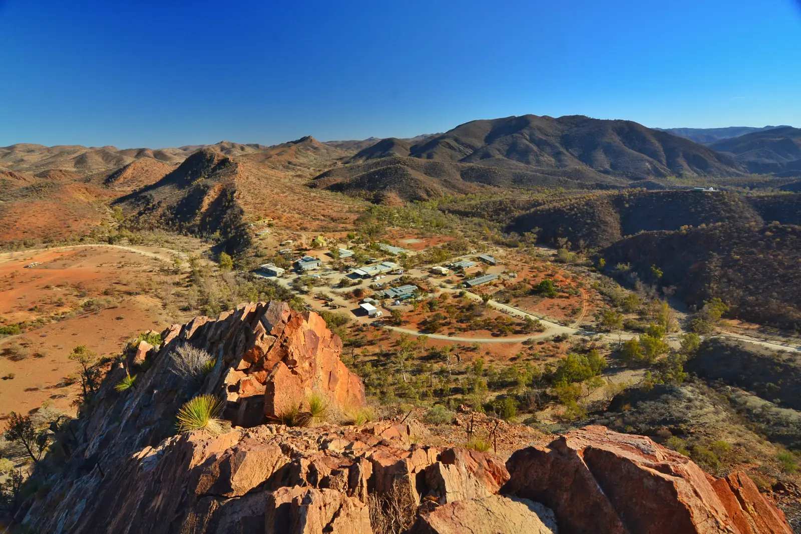
Nepabunna sits on the Copley–Arkaroola (Gammon Ranges) road. West is sealed country at Copley (6 km north of Leigh Creek South on the Outback Communities Authority Copley page; about 560 km north of Adelaide on that same page). East is Arkaroola Village and Vulkathunha-Gammon Ranges National Park. Arkaroola’s getting-here page: the road from Copley is about 130 km, unsealed but generally maintained, with the average driving time from Leigh Creek via Nipapanha (Nepabunna) approximately 2 hours. Parks SA puts Vulkathunha 660 km north of Adelaide and 100 km east of Leigh Creek.
This hub does not invent a Nepabunna–Copley or Nepabunna–Adelaide kilometre those pages do not print for the community itself.
| Place | Official note |
|---|---|
| Copley | Sealed-road turnoff; 6 km north of Leigh Creek South; about 560 km north of Adelaide (OCA Copley page) |
| Leigh Creek | About 2 hours to Arkaroola via Nipapanha (Nepabunna) (Arkaroola getting-here) |
| Arkaroola | About 130 km unsealed from Copley; 600 km north of Adelaide (Arkaroola getting-here) |
| Nantawarrina Plaque Campground entrance | Community: 12 km east of Nipapanha off the main Gammon Ranges Road (Copley–Arkaroola) |
| Vulkathunha-Gammon Ranges NP | 660 km north of Adelaide; 100 km east of Leigh Creek (Parks SA) |
Sealed spine back to Hawker and Port Augusta: Traffic SA. Unsealed Copley–Arkaroola road: DIT outback road warnings and 1300 361 033. Arkaroola warns that hire-car policies often exclude unsealed roads.
Stay on the public road unless you have a booked community product or a Nantawarrina permit. Do not treat houses, yards or unmarked tracks as a town walk.
Facts at a glance
Population. ABS 2021 Census, Suburbs and Localities SAL41019: 26 people. Median age 51. 6 families, 45 private dwellings. No UCL. Use the Nepabunna SAL QuickStats.
Climate. Bureau of Meteorology does not publish a Nepabunna climate-averages table. Nearest named open ranges station used here: ARKAROOLA, 017099, 30.31°S, 139.34°E, elevation 318 m, commenced 1938, status open. January mean maximum 34.5 °C, July 16.6 °C, annual rainfall 253.0 mm (rainfall 87 years, 1938–2026). For the sealed approach use Leigh Creek Airport (017110): January 36.0 °C, annual 212.8 mm. Do not blend. Full columns: Nepabunna weather.
Visitor information. Community phone (08) 8648 3764. Parks SA Vulkathunha headquarters at Balcanoona, 08 8648 4829 on the Arkaroola hub. SATC’s Flinders Ranges Visitor Information Centre is at the station in Quorn. Confirm unsealed roads with DIT.
Traditional Owners
This hub uses official wording only.
Nepabunna Community’s Our Story page: We are the Adnyamathanha (ad-nya-mut-na) people. “Adnya” means “rock” and “matha” means “group” or “group of people”. The page states that people used to roam throughout this country from the Northern Flinders south to Port Augusta and as far east as Broken Hill, and that five tribes then came together — the Kuyani, Wailpi, Yadliaura, Pilatapa and Pangkala. Arrival at the current site of Nepabunna is placed in the 1930s, after earlier camps near Damper Hill and Ram Paddock.
Parks SA: Vulkathunha-Gammon Ranges National Park is traditional country of the Adnyamathanha people, co-managed since 2010. Yellow-footed rock-wallabies are andu in the Adnyamathanha language on that park page. The Adnyamathanha community manages Nantawarrina Indigenous Protected Area adjoining the park’s southern boundary; access is by permit from the community — Parks SA phone (+61 8) 8648 3764.
NIAA: Nantawarrina was dedicated in 1998, 58,000 hectares on Adnyamathanha lands, administered by Nipapanha Community Aboriginal Corporation.
Read visiting Country respectfully. Confirm current tour and permit wording with the community before you print a Welcome to Country for your own itinerary.
History
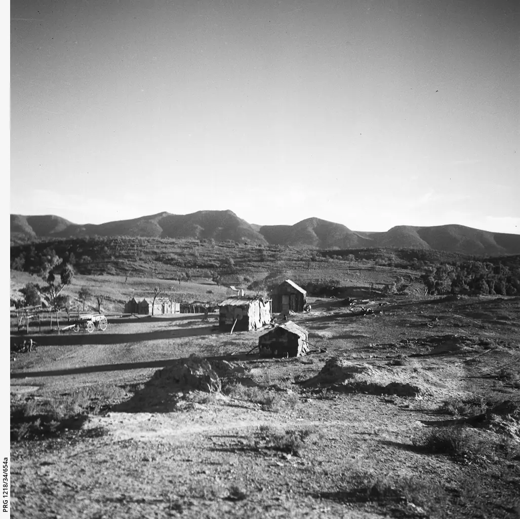
Community Our Story: people arrived at the current site of Nepabunna in the 1930s. Prior sites named: Damper Hill and Ram Paddock. The page states there were a few hundred people at that time, that travel was necessary because of pastoralists and the lack of a reliable water supply, and that many people including fathers and uncles worked on station properties.
Nantawarrina: in 1998 the Nipapanha Community created Australia’s first Indigenous Protected Area on the old pastoral station. The community page: the property was then degraded through over-grazing and successive droughts; management using traditional knowledge set out to restore land and biodiversity. NIAA’s 25th-anniversary note marks 2 September 2023 and names Chairperson Ian Johnson Snr.
This is a community and IPA story, not a copper-town main street and not a sanctuary lodge page. Arkaroola keeps the Sprigg-family sanctuary. Copley keeps the sealed-road turnoff.
Things to do
Visitor products the community and Parks SA actually name:
- Cultural tours — community Tours page: visit a number of protected cultural sites within 15 kilometres of Nepabunna with a local Adnyamathanha guide. Named sites: Malkawi, Ram Paddock Gate, Mount Searle Station, Eagle and the Crow Dreaming Site, Damper Hill. The tour takes about five hours from site to site by vehicle. Packages: half day, full day (minimum of two people), campfire evening. All tour packages are priced upon application. Book on (08) 8648 3764. This hub does not invent a walk-up desk.
- Nantawarrina IPA camping — permit via registration envelope and cash fees at entry points on the community page. Plaque, Moro Gorge, Irish Well. See Nepabunna caravan parks.
- Vulkathunha-Gammon Ranges National Park — Parks SA park next door; free entry on that park page; most internal tracks 4WD. Not a substitute for a Nantawarrina permit.
- Public road through to Arkaroola — operator: National Parks Permits are not required for Arkaroola, or for your travel to us. That sentence is for the sanctuary and the road to the village. It is not a Nantawarrina permit.
See things to do in Nepabunna.
Where to stay
This is a living community. The community Tours page states accommodation on site is available in the campfire-evening package note — that is a type, not a motel directory. Nantawarrina camping is the other official type. Do not camp in the township without community arrangement. Do not treat Copley or Arkaroola beds as Nepabunna rooms.
- How to choose: Nepabunna accommodation
- Camping detail: Nepabunna caravan parks
- Copley and Arkaroola are the named corridor overflows
- Operator enquiries: feature your business
Caravan and camping
Vans use this road as the Arkaroola approach, not as a highway overnight you unhitch in a community street. Official named camping for visitors who have paid is Nantawarrina: Plaque, Moro Gorge and Irish Well. Community: $30 per vehicle for one night’s camping; additional days $10; cash in a registration envelope. Fees date — confirm. Parks SA Vulkathunha campgrounds are a separate park product. Arkaroola Village camping is a sanctuary product. Read Nepabunna caravan parks.
Fuel and services
A northern Flinders dirt road will not match Leigh Creek for fuel, groceries or a clinic. This guide does not invent a Nepabunna bowser. Fill in Leigh Creek or confirm at Copley before you leave the seal. Leigh Creek Health Service, Black Oak Drive, (08) 8678 6022: clinic 9am–5pm weekdays excluding public holidays; 24/7 emergency support on that number. Emergencies 000. There is no Nepabunna hospital on the SA Health list used here.
Dump points, potable water and card-only fuel belong to operators you confirm on the day. Carry water. Parks SA and DIT close unsealed roads after rain.
Road access
The Copley–Arkaroola road is unsealed (DIT). Arkaroola: about 130 km from Copley, about 2 hours from Leigh Creek via Nipapanha. Hire-car unsealed-road exclusions are an operator warning. Closed means closed.
Nantawarrina has two entrances on the community page: 12 kilometres east of Nipapanha off the Gammon Ranges Road to Plaque Campground; and off the North Flinders Road (Blinman–Balcanoona) near Mulga View Station to Irish Well. Those are IPA entries, not shortcuts through yards.
Our Flinders Ranges itinerary is the wider ranges page. This community is a permit-and-respect stop on that dirt, not a second Wilpena.
Nearby parks and towns
Parks and named nature:
- Nantawarrina Indigenous Protected Area — community / NIAA / Parks SA permit wording used throughout this hub
- Vulkathunha-Gammon Ranges National Park — Parks SA, co-managed with Adnyamathanha people since 2010
- Arkaroola Protection Area — adjoining sanctuary; see the Arkaroola hub
Towns on this site:
- Copley — sealed-road turnoff
- Leigh Creek — service town and health clinic
- Arkaroola — sanctuary east along the same road
- Flinders Ranges hub
When to go, and how long
SATC outback itineraries prefer cooler months. BOM Arkaroola’s January mean maximum of 34.5 °C is hot sanctuary-and-gorge weather; July 16.6 °C / 3.3 °C is a cold camp. DIT, not the monthly mean, decides whether you reach Nepabunna at all. See Nepabunna weather.
A booked five-hour community tour is a full day. A Nantawarrina camp is an overnight you have paid for. Driving through on the public road to Arkaroola without stopping in the community is the default respectful pass. Two unscheduled tourist days in a locality of 26 people is not a plan this hub will invent.
Operators who want a checked listing: feature your business. The listings slot stays empty until then.
Plan this trip
Tell us the dates, who you are travelling with and where you need help. We reply with planning notes for Nepabunna — we are not a booking agent.
Events and road-conditions newsletter
Occasional notes on outback festivals, race days and official road-condition sources — not a daily blast. We use these details only to send the newsletter.
South Australia · Flinders Ranges
Nepabunna accommodation
Where to stay near Nepabunna: community on-site accommodation as a named type on the Tours page, Nantawarrina permit camps, Copley and Arkaroola overflow. Not a motel strip.
Read · 3 min
South Australia · Flinders Ranges
Nepabunna caravan parks
Camping near Nepabunna: Nantawarrina IPA camps at Plaque, Moro Gorge and Irish Well. Permit and cash fees on the community page. Not a township street camp. Parks SA and Arkaroola are separate products.
Read · 3 min
South Australia · Flinders Ranges
Nepabunna weather
Nepabunna climate from BOM Arkaroola (017099): January mean max 34.5 °C, July 16.6 °C, annual rainfall 253.0 mm. No Nepabunna-named table. Leigh Creek Airport for the sealed approach. DIT for the dirt.
Read · 3 min
South Australia · Flinders Ranges
Things to do in Nepabunna
Things to do in Nepabunna: booked Adnyamathanha cultural tours within 15 km, Nantawarrina IPA by permit. Stay on the public Copley–Arkaroola road unless you have a community product.
Read · 3 min
Frequently asked questions
How do I visit Nepabunna respectfully?
Stay on the public Copley–Arkaroola road unless you have booked a community tour or a Nantawarrina permit. Parks SA: access to Nantawarrina Indigenous Protected Area is by permit from the community, (08) 8648 3764. Nepabunna Community, Via Copley, SA 5732. This is a living Adnyamathanha community, not a highway lookout.
What is Nepabunna’s population?
26 people at the 2021 Census for Nepabunna suburbs-and-localities (SAL41019). Median age 51. Sex split 51.7% male / 48.3% female. 6 families, 45 private dwellings. The ABS does not publish a 2021 Urban Centre named Nepabunna. QuickStats notes limited tables because of the small population.
Whose Country is this?
Nepabunna Community’s Our Story page: We are the Adnyamathanha (ad-nya-mut-na) people. “Adnya” means “rock” and “matha” means “group” or “group of people”. Parks SA’s Vulkathunha-Gammon Ranges National Park page states that park is traditional country of the Adnyamathanha people and has been co-managed with them since 2010.
What is Nantawarrina?
In 1998 the Nipapanha (formerly known as Nepabunna) Community created Australia’s first Indigenous Protected Area on the old pastoral station of Nantawarrina. NIAA: 58,000 hectares on Adnyamathanha lands between the Flinders and Gammon Ranges. Community camping: Plaque, Moro Gorge and Irish Well. Entrance fees $30 per vehicle for one night’s camping; additional days $10 (community page; confirm before you go).
What weather record should I use?
BOM does not publish a Nepabunna climate-averages table. This guide uses Arkaroola (017099): January mean maximum 34.5 °C, July 16.6 °C, annual rainfall 253.0 mm. Leigh Creek Airport (017110) is the open table for the sealed approach (January 36.0 °C, annual 212.8 mm). Do not blend.
Do I need a 4WD?
Arkaroola’s getting-here page lists about 130 km unsealed from Copley (about 2 hours from Leigh Creek via Nipapanha) and warns that hire-car policies often exclude unsealed roads. Check DIT outback road warnings (1300 361 033) the day you drive. This hub does not invent a 2WD rating for the community access.
Sources and further reading
Facts on this page were checked against these primary and official sources. Conditions change — confirm before you travel or buy.
- Nepabunna 2021 Census QuickStats (SAL41019) — Australian Bureau of Statistics
- Climate statistics for Arkaroola (017099) — Bureau of Meteorology
- Climate statistics for Leigh Creek Airport (017110) — Bureau of Meteorology
- Nepabunna Community — Nipapanha Community Aboriginal Corporation
- Our Story — Nepabunna Community
- Nantawarrina — Nepabunna Community
- Tours — Nepabunna Community
- Nantawarrina IPA and Rangers — National Indigenous Australians Agency
- Getting to Arkaroola Village — Arkaroola
- Vulkathunha-Gammon Ranges National Park — National Parks and Wildlife Service SA
- Copley — Outback Communities Authority
- Leigh Creek Health Service — SA Health
- Outback road warnings — Department for Infrastructure and Transport SA
- Traffic SA — Government of South Australia