At a glance
Sourced facts only. Distances and services change — confirm before you travel.
- Local government
- Shire of Mount Magnet
- Traditional Owners
- Barimaia families still live in the Mount Magnet area, in Shire of Mount Magnet trails notes on The Granites and Walganna rocksConfirm current wording at 22 Hepburn Street before treating a single-nation label as a plaque sentence.
- Nearest regional city
- Cue, 80 km north on the Shire of Cue About page. Paynes Find is the Great Northern Highway neighbour toward Perth on this site.
- Capital
- A Mount Magnet–Perth kilometre is not printed on the sourced Golden Outback or shire visitor-centre pages used here. Golden Outback prints four and a half hours’ drive east of Geraldton.
- Nearest fuel
- Great Northern Highway town; confirm the bowser on arrival. This hub does not invent a brand or hours.
- Nearest hospital or clinic
- Mount Magnet Health Centre (WA Country Health Service Midwest hospitals page). Acute and emergency services 8.00am to 4.00pm Monday to Friday.
- Mobile coverage
- Check Telstra and Optus coverage maps before travel; do not assume a signal off the highway.
- Best time to visit
- Cooler BOM Mount Magnet Aero mean maxima May–August (July 19.0 °C). Golden Outback names September races.
Climate
Monthly means from the Bureau of Meteorology station Mount Magnet Aero (007600). This is not a forecast. Open station. Temperature 30 years (1995–2026); rainfall 29 years (1995–2026). Latest available data 14 November 2026. Older Mount Magnet (007057) is a comparison site — do not blend.
| Month | Mean max (°C) | Mean min (°C) | Rainfall (mm) |
|---|---|---|---|
| Jan | 38.3 | 23.7 | 22.8 |
| Feb | 37.1 | 23.3 | 34.0 |
| Mar | 33.6 | 20.6 | 35.9 |
| Apr | 29.0 | 16.4 | 17.0 |
| May | 24.1 | 11.6 | 15.7 |
| Jun | 19.9 | 8.3 | 22.9 |
| Jul | 19.0 | 7.1 | 24.7 |
| Aug | 21.5 | 8.2 | 17.9 |
| Sep | 25.1 | 10.8 | 10.5 |
| Oct | 29.5 | 14.5 | 7.2 |
| Nov | 32.9 | 18.1 | 12.0 |
| Dec | 36.3 | 21.4 | 18.1 |
Mount Magnet in pictures
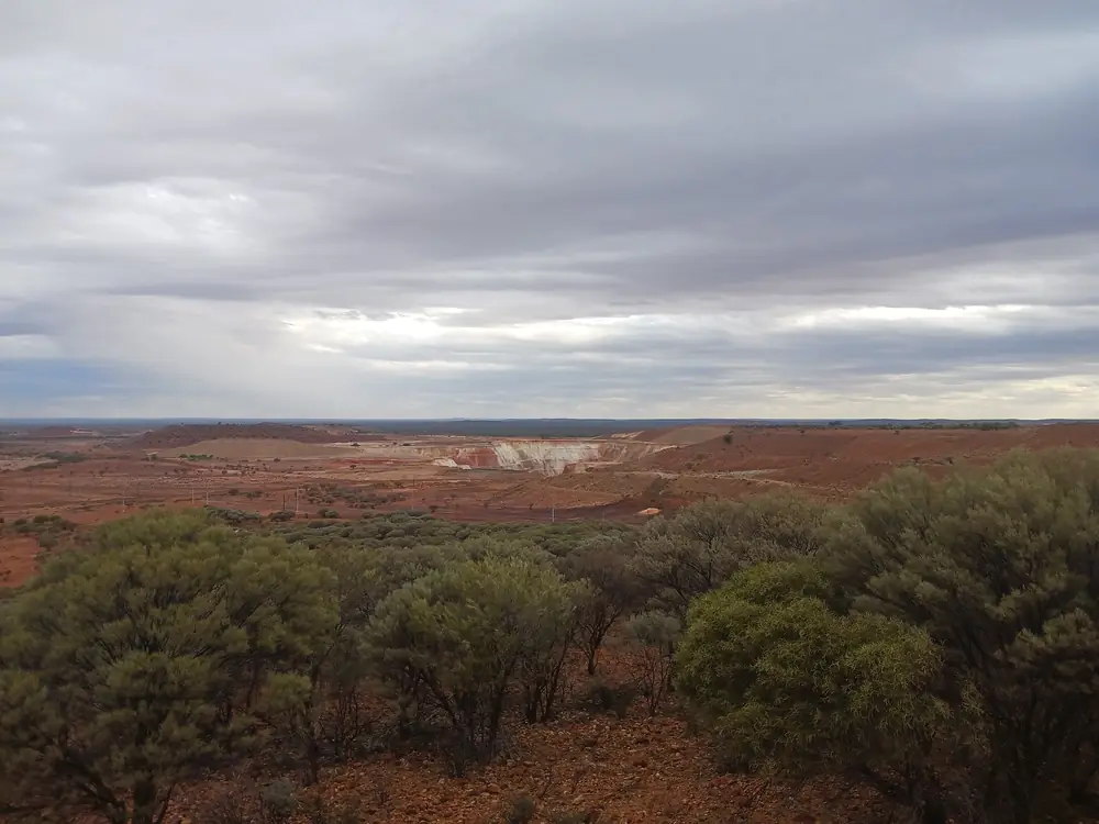
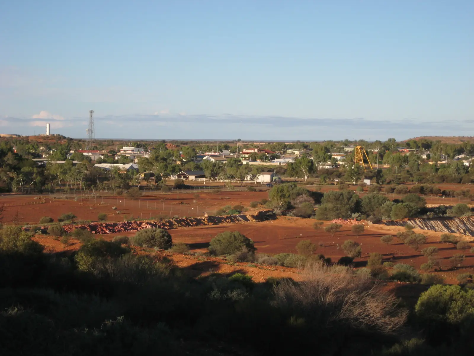
View of Mount Magnet from Warramboo lookout, October 2025 01Photo: Calistemon · CC BY-SA 4.0 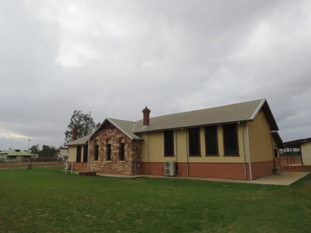
Mount Magnet Public Library, October 2025Photo: Calistemon · CC BY-SA 4.0 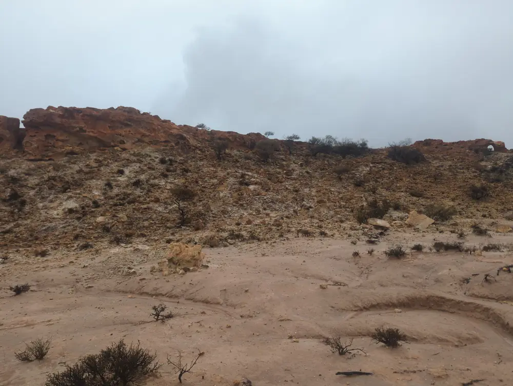
The Granites Mount MagnetPhoto: Loomhigh223555 · CC0 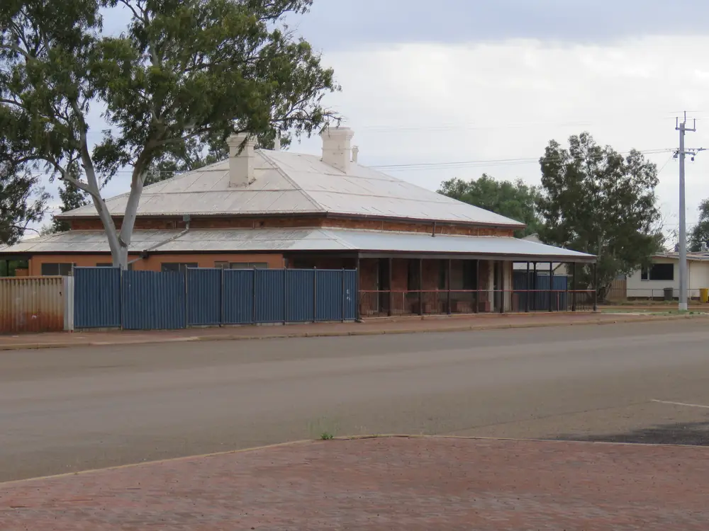
Former Schoolmaster's House, Mount Magnet, Western Australia, October 2025 01Photo: Calistemon · CC BY-SA 4.0
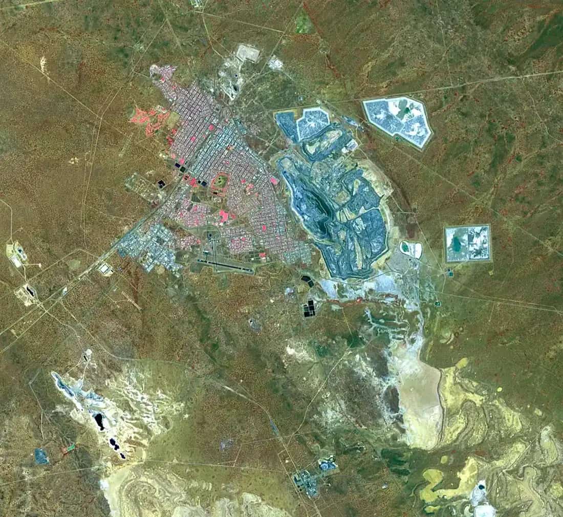
Australia’s Golden Outback describes Mount Magnet as the hub of the Murchison, the longest surviving gold mining settlement in Western Australia, and four and a half hours’ drive east of Geraldton. In town the Great Northern Highway is Hepburn Street. The Shire of Mount Magnet visitor centre is at the southern entrance; the shire-run caravan park is at the northern end. This is Golden Outback country.
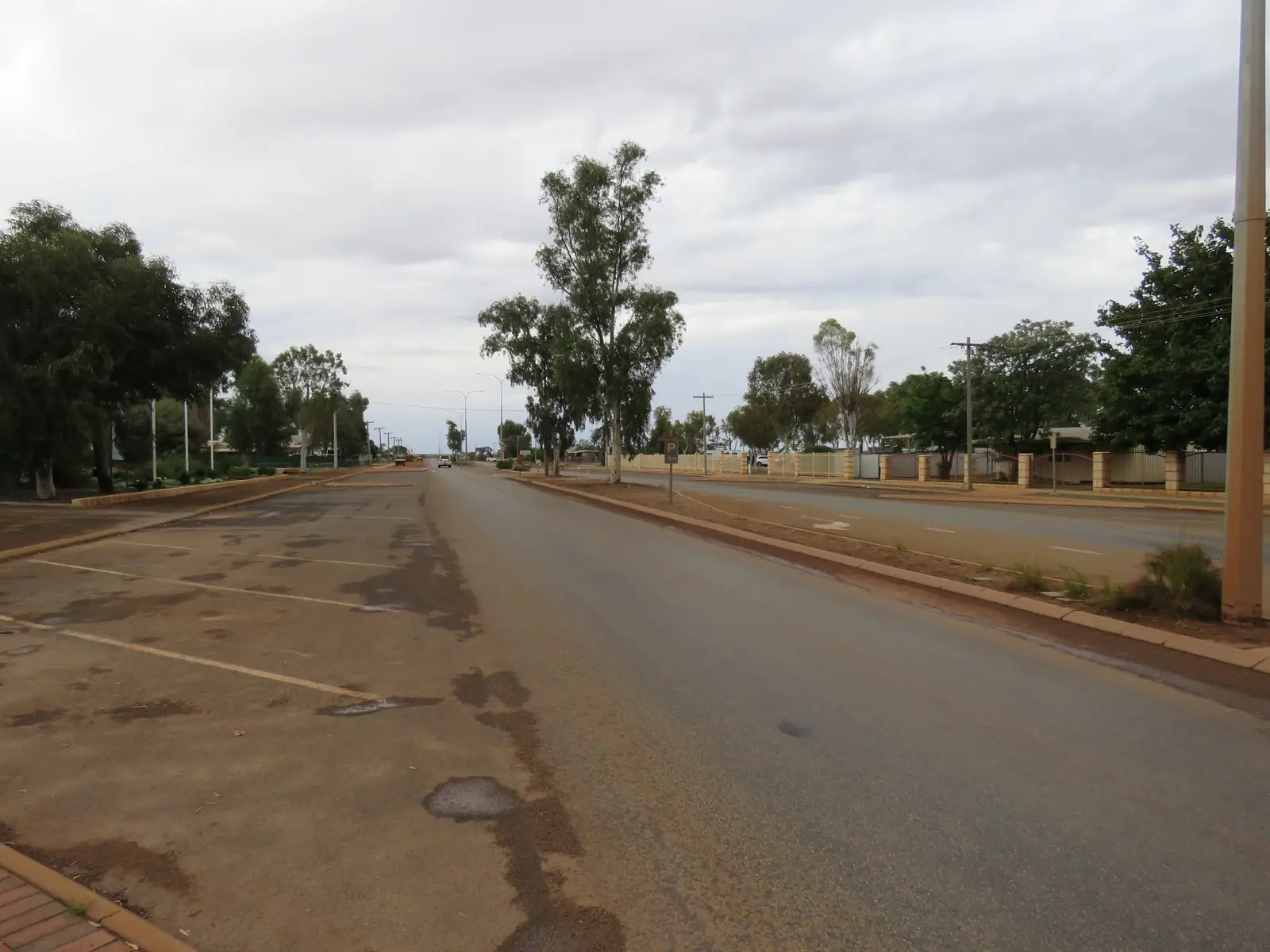
Hepburn Street is sealed freight highway. You do not need a Lands permit to reach town on that spine. You do need the Main Roads WA travel map after rain, and you do need water when January mean maxima sit near 38.3 °C on the Mount Magnet Aero table.
Where it is, and how far
Golden Outback’s published figure is driving time from Geraldton, not a kilometre table from Perth. The Great Northern Highway is the sealed spine north toward Meekatharra and Newman, and south toward Paynes Find and the coast. Cue sits north on the same highway. Sandstone is the eastern shire neighbour on the Miners Pathway. Kalgoorlie-Boulder is the large Goldfields service centre to the south-east, not a Mount Magnet suburb.
The shire’s Miners Pathway notes say Mount Magnet sits at the crossroads of that 970 km self-drive, and that the road from Meekatharra to Sandstone is not sealed. Do not treat every Murchison side road as Great Northern Highway bitumen.
Facts at a glance
Population. Australian Bureau of Statistics 2021 Census, Urban Centres and Localities UCL521033 Mount Magnet (L): 576 people. Median age 43. Sex split 53.1% male / 46.9% female. Aboriginal and/or Torres Strait Islander people 54 (9.4%). Suburbs and localities SAL51024: 583 people. Local government area LGA55810: 653. Use UCL for the town. Read ABS QuickStats for Mount Magnet (L).
Climate. Bureau of Meteorology MOUNT MAGNET AERO, 007600, commenced 1995, open. Location 28.12°S, 117.84°E, elevation 407 m. Annual mean rainfall 239.2 mm (29 years, 1995–2026). Hottest month by mean maximum: January 38.3 °C. Coolest month by mean maximum: July 19.0 °C. Annual mean maximum 28.9 °C, mean minimum 15.3 °C. Full table: BOM Mount Magnet Aero. See Mount Magnet weather.
Visitor centre. 22 Hepburn Street (Great Northern Highway), southern end of town. (08) 9963 4172, visitor@mtmagnet.wa.gov.au. May–September: Monday–Sunday 9.00am–3.30pm, closed 12.00pm–1.00pm. October–April: Monday–Friday, same hours. Entry to the Mining and Pastoral Museum is through the visitor centre; entry fees apply (amounts change — use the shire page).
Shire office. 90 Hepburn Street, (08) 9963 3000, weekdays 9.00am–4.00pm on the contact page.
Traditional Owners
The Shire of Mount Magnet trails page, in its notes on The Granites and Walganna rocks, states that paintings on the rocks at Walganna have been dated at 9,000 years old, and that several families of the Barimaia tribe still live in the Mount Magnet area. Australia’s Golden Outback describes The Granites as a significant Aboriginal rock art site. This guide follows those official sentences rather than flattening several language groups into one label for the whole shire.
The same shire page names Wirnda Barna Art Centre in the caravan-park vicinity list on the accommodation page. Buy from an art centre, not from an unnamed roadside stall. Confirm opening hours at the visitor centre.
History
The visitor centre / museum page is the sourced history used here. The Mining and Pastoral Museum covers pastoral activity since 1878 and gold mining since 1891. Golden Outback’s “longest surviving gold mining settlement” line sits on that gold date. The original Boogardie State Battery has been rebuilt on the museum site. A Rabbit Proof Fence exhibit (film sets and stories from two movies) is part of the same precinct.
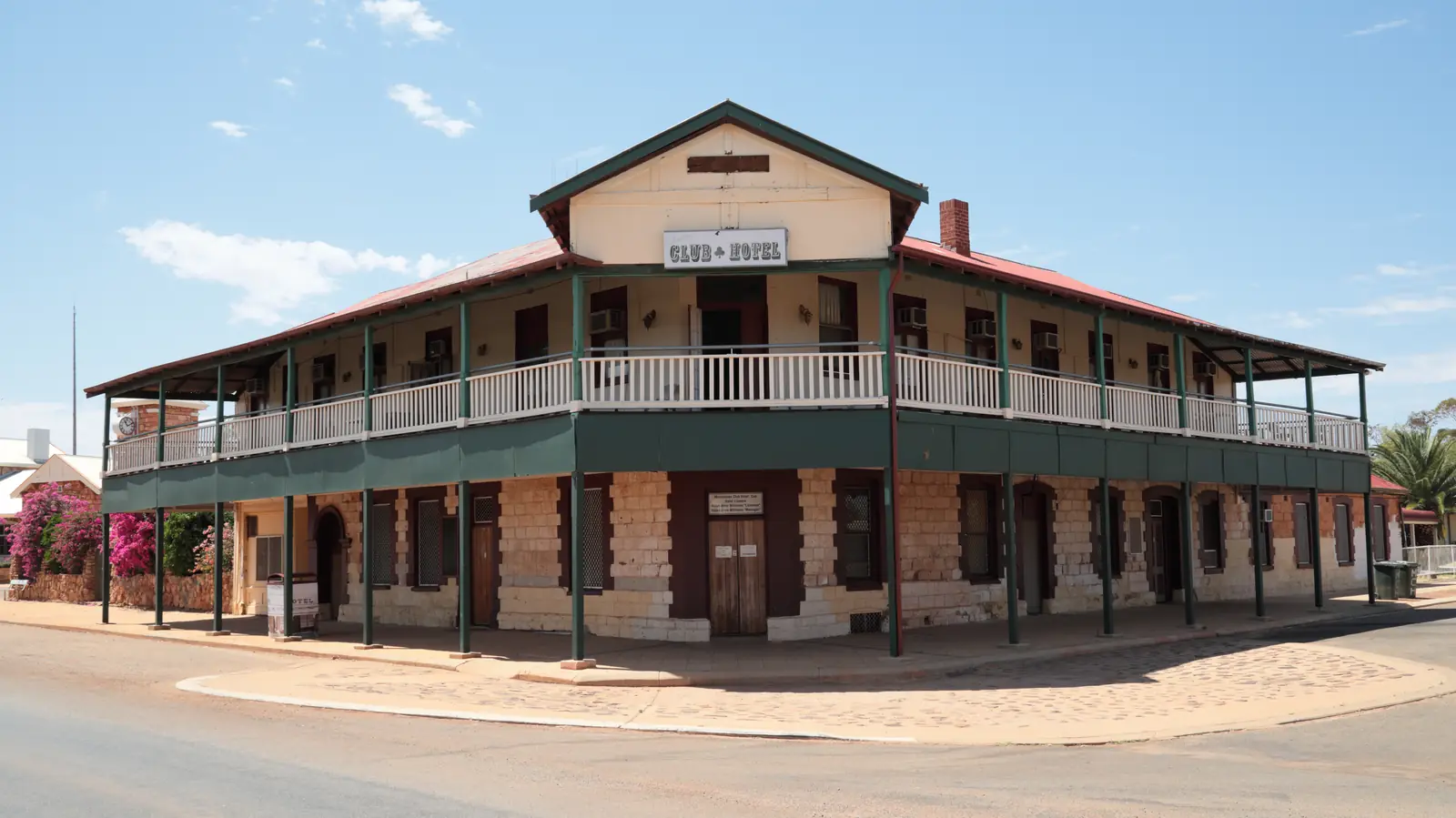
The shire Heritage Walk still gives a main-street sense of the gold-rush town: wide road, old shop fronts, Old School Masters House, Old School (now a Rural Transaction Centre on the trails page), Station Masters House, original Bank of Western Australia, Old Post Office and Residence. The first police station, the trails page says, was destroyed by fire.
Lennonville, a vacant mining town just north of the townsite, is on the Tourist Trail. Golden Outback also names abandoned settlements such as Lennonville. This guide does not invent gazettal trivia beyond those pages.
Things to do
Start at the visitor centre and Mining and Pastoral Museum. Allow time for the battery reconstruction, the pastoral collection and the rock collection the shire calls “Ron the Rock Man’s” extraordinary Rock Collection. Fees apply. Hours above.
Heritage Walk — a town stroll on the shire trails page. Collect the map at the visitor centre or shire office.
Tourist Trail — a 37 kilometre self-drive (shire and Golden Outback). Golden Outback lists old and new goldmine sites, views from Warrmboo Hill, granite formations, a natural amphitheatre and a cave. The shire names the Amphitheatre on the Boogardie–Lennonville (Tourist) road as a Murchison GeoRegion site and a long-standing picnic place, no camping in GeoRegion notes used elsewhere. Confirm the current brochure at 22 Hepburn Street.
The Granites. Shire: a popular picnic spot east of Mount Magnet on the right-hand side about 4 kilometres along the Cue road. Golden Outback also describes The Granites as a significant Aboriginal rock art site (that page has used a different distance wording). Use the shire’s Cue-road location, treat the place as culturally significant, and do not camp (GeoRegion: no camping at The Granites). Do not touch or wet painted surfaces.
Outdoor picture theatre — Golden Outback: the town’s original open-air film theatre, summer months only, described there as one of only three traditional outdoor cinemas still operating in Western Australia. Confirm screenings at the visitor centre.
Wildflowers in season, fossicking where it is legal (Golden Outback), Mt Magnet races in September (Golden Outback). Fossicking is not a free-for-all on other people’s leases; ask the visitor centre and see fossicking and gem fields.
A fuller order of a day: things to do in Mount Magnet.
Where to stay
The shire accommodation page groups caravan park, self-contained units, hotel/motels and station stays. Golden Outback adds hotel, backpacker and lodge as town types, plus a caravan park and nearby station stays. Named private operators change; the shire page is the live directory. Kirkalocka Station is marked currently closed on the shire list used in this research — another reason not to copy a round-up.
- Shire stay page: Mount Magnet accommodation
- How to choose: Mount Magnet accommodation
- Parks: Mount Magnet caravan parks
- Feature your business
Mount Magnet Caravan Park, 100 Hepburn Street, northern end of town, (08) 9963 4198, is the only shire-run accommodation in town on that page.
Caravan and camping
The highway is sealed through town. The shire park is the named van option. GeoRegion and shire picnic sites (Granites, Amphitheatre) are not caravan parks — no camping at those GeoRegion sites. After rain, unsealed Miners Pathway legs are a Main Roads and shire-conditions question. Read Mount Magnet caravan parks and caravanning in the outback.
Fuel and services
Golden Outback: the town is well serviced by two service stations, a supermarket, cafe, butcher, nursing post and post office. This guide does not list brands or hours. Fill here before unsealed legs. Skippers Aviation is named by Golden Outback for scheduled Perth–Mount Magnet flights; confirm current services with the airline, not with this page.
Road access
Great Northern Highway — sealed freight road. Road trains, heat, animals at dusk. Main Roads WA travel map, 138 138.
North: Cue, Meekatharra, then a long run toward Newman on the same highway. East: Sandstone; the shire warns Meekatharra–Sandstone is not sealed. South: Paynes Find and the Geraldton or Perth approaches. The Perth to Darwin drive uses this highway. Do not drive around closed signs.
Nearby parks and towns
There is no national park inside Mount Magnet on the Parks pages used for this research. Nature stops are shire and GeoRegion sites: Granites, Amphitheatre, Tourist Trail granite country.
On this site:
- Sandstone — eastern neighbour, London Bridge on heritage listings
- Kalgoorlie-Boulder — Goldfields service city
- Newman — further north on the Great Northern Highway
- Coolgardie and Leonora — Goldfields towns on this hub if you are looping rather than running the highway north
Cue appears on Golden Outback’s Gascoyne Murchison list but does not yet have a full guide here. Meekatharra now does.
When to go, and how long
January mean maximum 38.3 °C at the airport is hot for the Heritage Walk at midday. July 19.0 °C mean maximum is the walking season; nights mean minimum 7.1 °C. Annual rain 239.2 mm still includes storm bursts. Spring wildflowers are named by Golden Outback without a guaranteed peak week.
One night covers museum and main street. Two nights cover the 37 km trail, Granites and a quiet van day. Three nights only if you are joining the Miners Pathway and the unsealed legs are open. See Mount Magnet weather. Operators: feature your business.
Plan this trip
Tell us the dates, who you are travelling with and where you need help. We reply with planning notes for Mount Magnet — we are not a booking agent.
Events and road-conditions newsletter
Occasional notes on outback festivals, race days and official road-condition sources — not a daily blast. We use these details only to send the newsletter.
Western Australia · Golden Outback
Mount Magnet accommodation
Where to stay in Mount Magnet: shire caravan park, hotel and motel rooms, units and station stays. Official Shire of Mount Magnet and Golden Outback directories — no invented round-up.
Read · 3 min
Western Australia · Golden Outback
Mount Magnet caravan parks
Caravan parks in Mount Magnet: the shire-run Mount Magnet Caravan Park at 100 Hepburn Street. Official name from the Shire of Mount Magnet — no invented parks. Granites and Amphitheatre are not camps.
Read · 3 min
Western Australia · Golden Outback
Mount Magnet weather
Mount Magnet climate from Bureau of Meteorology Mount Magnet Aero (007600): January mean maximum 38.3 °C, July 19.0 °C, annual rainfall 239.2 mm. Full monthly table on BOM.
Read · 3 min
Western Australia · Golden Outback
Things to do in Mount Magnet
Things to do in Mount Magnet: Mining and Pastoral Museum, Heritage Walk, 37 km Tourist Trail, The Granites, Amphitheatre and Wirnda Barna Art Centre. Official shire and Golden Outback list only.
Read · 4 min
Frequently asked questions
What is Mount Magnet’s population?
576 people at the 2021 Census for the urban centre (UCL521033). The suburbs-and-localities figure is 583 (SAL51024). The Shire of Mount Magnet local government area counted 653 (LGA55810). Use the UCL figure for the town.
Where is the Mount Magnet visitor centre?
Shire of Mount Magnet places it at 22 Hepburn Street (Great Northern Highway), southern end of town. Phone (08) 9963 4172. May–September daily 9.00am–3.30pm; October–April weekdays; closed 12.00pm–1.00pm for lunch. Confirm before a public holiday.
What is the weather like in Mount Magnet?
Bureau of Meteorology Mount Magnet Aero (007600) has a January mean maximum of 38.3 °C, a July mean maximum of 19.0 °C and annual mean rainfall of 239.2 mm. The full table is on the BOM page.
Is Mount Magnet on a sealed highway?
Yes. Australia’s Golden Outback and the shire place the town on the Great Northern Highway, which becomes Hepburn Street in town. Check the Main Roads WA travel map for incidents. The shire notes that the Meekatharra to Sandstone road on the Miners Pathway is not sealed.
Whose Country is Mount Magnet on?
The Shire of Mount Magnet trails page states that several families of the Barimaia tribe still live in the Mount Magnet area, in notes on The Granites and Walganna rocks. Confirm current wording at the visitor centre before treating a single-nation label as a plaque sentence.
Sources and further reading
Facts on this page were checked against these primary and official sources. Conditions change — confirm before you travel or buy.
- Midwest hospitals and health services — WA Country Health Service
- Mount Magnet (L) 2021 Census QuickStats (UCL521033) — Australian Bureau of Statistics
- Climate statistics for Mount Magnet Aero (007600) — Bureau of Meteorology
- Mount Magnet Visitor Centre — Shire of Mount Magnet
- Trails and Walks — Shire of Mount Magnet — Shire of Mount Magnet
- Caravan Park, Self Contained Units and Hotel/Motels — Shire of Mount Magnet
- Mount Magnet — Australia’s Golden Outback — Australia's Golden Outback
- Main Roads WA travel map — Main Roads Western Australia