At a glance
Sourced facts only. Distances and services change — confirm before you travel.
- Local government
- Shire of Sandstone
- Nearest regional city
- Mount Magnet is the sealed-highway neighbour on this site. Cue and Meekatharra are the other Murchison highway towns. The Shire of Mount Magnet warns that Meekatharra–Sandstone is not sealed.
- Nearest fuel
- Shire home page: 24/7 self-serve fuel at 19 Payne Street.
- Nearest hospital or clinic
- Sandstone Nursing Post (WA Country Health Service Midwest hospitals page). Open 8am to 4pm on Thursday only; no emergency care — contact RFDS. Mount Magnet Health Centre is the weekday neighbour.
- Mobile coverage
- Check Telstra and Optus coverage maps before travel. The shire caravan-park page names Telstra only.
- Best time to visit
- Shire Heritage Museum April–October. Cooler months on the 1906–1929 BOM temperature series (July mean maximum 17.5 °C).
Climate
Monthly means from the Bureau of Meteorology station Sandstone (012072). This is not a forecast. Listed open; latest available data 31 December 2024. Rainfall 111 years (1904–2024). Mean maximum and minimum temperatures use 21 years (1906–1929) only. Nearby open Mount Magnet Aero (007600) is a separate modern airfield table — do not blend.
| Month | Mean max (°C) | Mean min (°C) | Rainfall (mm) |
|---|---|---|---|
| Jan | 35.8 | 21.3 | 30.8 |
| Feb | 35.5 | 20.9 | 33.3 |
| Mar | 32.4 | 18.4 | 29.3 |
| Apr | 27.7 | 14.1 | 19.3 |
| May | 22.1 | 9.3 | 26.0 |
| Jun | 18.2 | 6.3 | 26.2 |
| Jul | 17.5 | 5.1 | 22.4 |
| Aug | 19.6 | 6.2 | 18.0 |
| Sep | 24.1 | 8.8 | 7.7 |
| Oct | 27.6 | 11.8 | 8.5 |
| Nov | 32.4 | 16.6 | 11.3 |
| Dec | 35.3 | 19.8 | 16.7 |
Sandstone in pictures
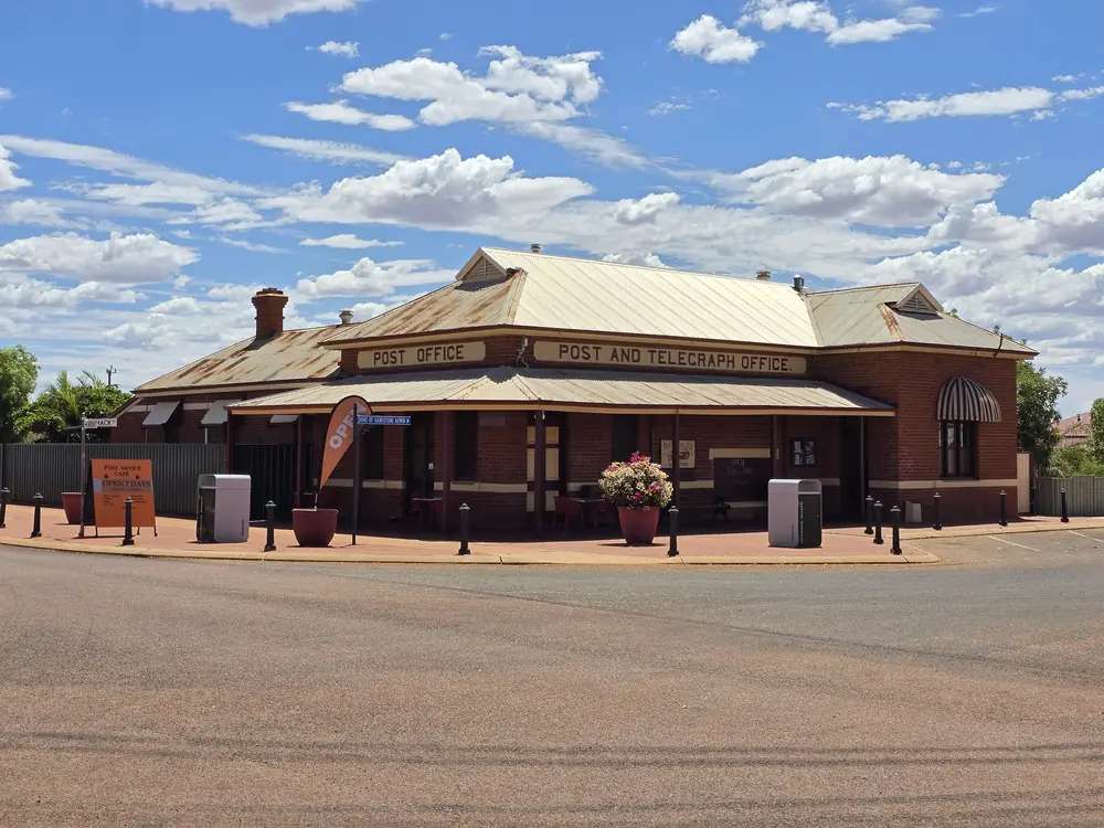
Sandstone Post Office and Telegraph BuildingPhoto: Auxodium III · CC BY-SA 4.0
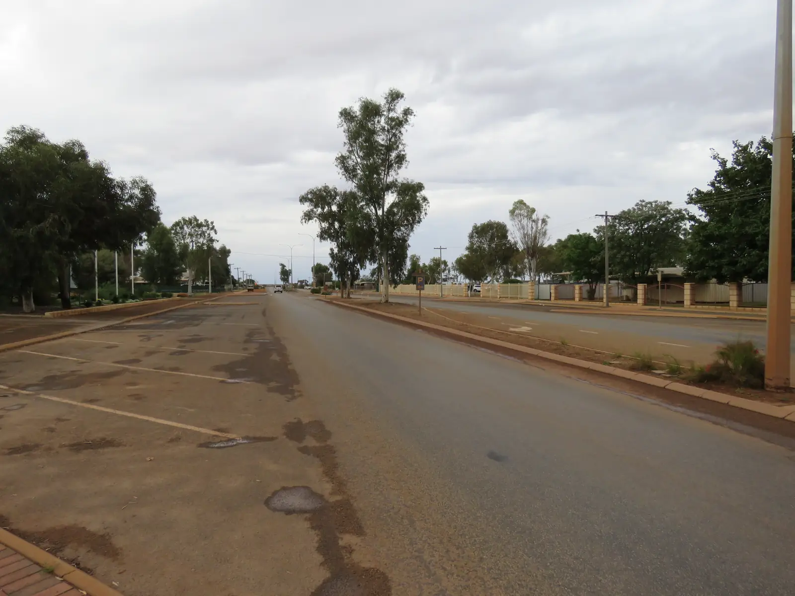
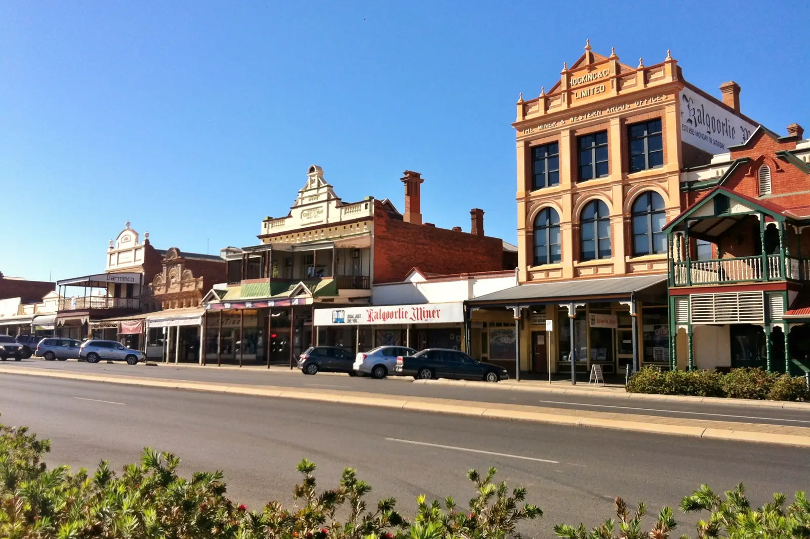
Sandstone is a small Goldfields–Murchison town in the Golden Outback, the seat of the Shire of Sandstone. The 2021 Census counted 109 people in both the locality and the whole local government area. That scale is the point: a heritage street, a shire caravan park, and a rock arch the shire put on the State Heritage inventory — not a service city.
Mount Magnet is the western neighbour with a full guide on this site. Leinster sits toward the Goldfields on the sealed highway. Kalgoorlie-Boulder remains the large regional fallback.
Where it is, and how far
The town is east of Mount Magnet on the Murchison–Goldfields network, on the Gascoyne Murchison Miners Pathway that the Shire of Mount Magnet describes as about 970 km with Mount Magnet at a crossroads. That shire page is explicit that Meekatharra to Sandstone is not sealed. Treat every approach except confirmed bitumen as a gravel question for Main Roads WA and the Shire of Sandstone road conditions page (which names, among other legs, Youanmi/Mt Magnet and the Heritage Trail).
This guide does not invent a Perth kilometre count. Use a current maps distance after you have checked which roads are open.
Facts at a glance
Population. Australian Bureau of Statistics 2021 Census, Suburbs and Localities SAL51326: 109 people. Median age 60. Sex split 65.4% male / 34.6% female. Local government area LGA57630 is the same 109. Read ABS QuickStats for Sandstone SAL. Small-cell Census adjustments apply.
Climate. BOM SANDSTONE, 012072, 27.99°S, 119.30°E, elevation 533 m, commenced 1904, status open on the table used here (latest rainfall data through 31 December 2024). Annual mean rainfall 249.2 mm (111 years, 1904–2024). Temperature means are 1906–1929 only (21 years) — January mean maximum 35.8 °C, July 17.5 °C, annual mean maximum 27.3 °C. Do not quote those temperatures as if they were a 1995–2026 airport series. See Sandstone weather.
Shire office. 23 Hack Street, Monday–Friday 8.30am–4.30pm, (08) 9963 5802, cso@sandstone.wa.gov.au.
Visitor centre and Heritage Museum. 18 Hack Street, (08) 9963 5061, visitus@sandstone.wa.gov.au. Published seasonal hours: Monday–Friday 9.00am–4.00pm, April–October. Shire notice 20 October 2026: closed for the season, to reopen around April 2027. When the centre is closed, the shire office is the contact.
Fuel. Shire home page: 24/7 self serve, 19 Payne Street.
Traditional Owners
A dedicated Shire of Sandstone sentence that names a single nation for the townsite was not found on the shire pages used for this research. Neighbouring Murchison visitor material for Mount Magnet names Barimaia in that shire; this guide does not copy that label onto Sandstone. Confirm wording with the visitor centre or shire office before publishing a plaque sentence.
History
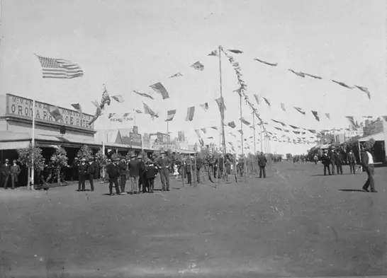
Murchison GeoRegion visitor material (which lists the Sandstone Heritage Museum against sandstone.wa.gov.au) treats the wide streets as a reminder of a heyday after a major gold discovery in 1894. The Heritage Museum, in a building described there as a 1940s grocery store, holds photographs and items from the turn of the twentieth century. A short walk away, Heritage Cottage is described as built in 1923 by a local pastoralist.
The shire parks page names Gold & Wool Interpretive Park (opened 2009) across from the National Hotel, with mining and pastoral equipment. Phillip Lefroy Park on Hack Street has picnic tables, playground, splash park, and Anzac Day services at a memorial plaque.
Cemeteries on the shire page carry early dates: first burial at Sandstone Cemetery March 1908; Nungarra as an earlier township 1903–1907. Those are cemetery-history facts, not a ghost-town tour schedule. Ask the visitor centre for booklet access; some cemetery roads are gravel.
This guide does not invent hotel counts from 1906 or a boom population.
Things to do
Heritage Museum and visitor centre when in season — 18 Hack Street. Confirm the April reopening. See things to do in Sandstone.
London Bridge (also the Devil’s Arch). The inHerit listing is Local Government: Sandstone, author Shire of Sandstone. It describes a natural formation large enough for vehicles to pass underneath, part of a larger formation about 800 metres long and three to ten metres high, weathered basalt, rock believed about 350 million years old. Tourism WA places it on the Sandstone Heritage Trail and notes a picnic / sunset use. Murchison GeoRegion: no camping, no climbing. The Shire of Murchison GeoRegion page on the same formation asks visitors to view from ground level because erosion is wearing it. Do not climb.
Heritage Trail. Named on the shire road-conditions list as a gravel road to drive to conditions. Tourism WA and GeoRegion tie it to London Bridge and the brewery / heritage sites. Collect a brochure at the museum when open. The shire does not publish a full stop list on the home page used here; do not invent extra ruins.
The Brewery. GeoRegion Site 17, no camping. inHerit history notes a local brewery near London Bridge. Confirm access at the visitor centre.
Town parks. Phillip Lefroy Park and Gold & Wool Interpretive Park, as above.
Astrodome / old school building is listed on the shire home page as a contact point. Ask the shire what is actually open to visitors; this guide does not invent a night-sky tour.
Where to stay
The shire names Alice Atkinson Caravan Park, Irvine Street, as Sandstone’s caravan park, with sites and two units completed at the end of 2024. Phone (08) 9963 5859, stay@sandstone.wa.gov.au. That is the official stay. This page does not copy nightly rates (they change; the shire table is the live list). Dogs on a leash are welcome on sites on that page; no dogs in units. No ATM in Sandstone; Telstra is the only service provider named there.
If the park is full, Mount Magnet is the next town with a shire park on this site.
Caravan and camping
Alice Atkinson is the named park. London Bridge and the brewery are no camping in GeoRegion notes. Heritage Trail is a drive, not a bush camp unless the shire says otherwise. After rain, gravel closes. Read Sandstone caravan parks.
Fuel and services
24/7 self-serve fuel at 19 Payne Street on the shire home page. No ATM, Telstra only, on the caravan-park page. The shire office is weekdays. The visitor centre is seasonal. Carry cash or a card that works on the bowser, and do not rely on a second supermarket. This guide does not list a hospital; Mount Magnet’s Golden Outback page names a nursing post there.
Road access
Check:
The Mount Magnet Miners Pathway note about Meekatharra–Sandstone unsealed is the official warning this hub repeats. Do not assume every Sandstone approach is the same sealed standard as Great Northern Highway through Mount Magnet.
Nearby parks and towns
No national park inside Sandstone on Parks pages used here. Nature is London Bridge and breakaway country on the Heritage Trail.
On this site:
- Mount Magnet — west, museum and 37 km trail
- Meekatharra — north-west; the Meekatharra–Sandstone road is not sealed in the Mount Magnet Miners Pathway notes
- Kalgoorlie-Boulder — Goldfields service city
- Leonora — Goldfields Highway town if you are looping rather than returning to the Great Northern Highway
Leinster is the Goldfields Highway nickel town named in regional geography.
When to go, and how long
The visitor centre season April–October is the practical window for museum hours. That matches milder months on the old temperature table (July mean maximum 17.5 °C in 1906–1929) and the shire’s own closed-for-summer-season notice. Summer still exists: use BOM rainfall and a conservative heat plan, and see Sandstone weather.
One night covers London Bridge and the town parks. Two nights if the museum is open and you want the Heritage Trail without rushing gravel. Operators: feature your business.
Plan this trip
Tell us the dates, who you are travelling with and where you need help. We reply with planning notes for Sandstone — we are not a booking agent.
Events and road-conditions newsletter
Occasional notes on outback festivals, race days and official road-condition sources — not a daily blast. We use these details only to send the newsletter.
Western Australia · Golden Outback
Sandstone accommodation
Where to stay in Sandstone: Alice Atkinson Caravan Park and two shire units on Irvine Street. Official Shire of Sandstone page only — no invented hotels or prices.
Read · 3 min
Western Australia · Golden Outback
Sandstone caravan parks
Caravan parks in Sandstone: Alice Atkinson Caravan Park on Irvine Street, named by the Shire of Sandstone. London Bridge is not a camp. No invented park names.
Read · 3 min
Western Australia · Golden Outback
Sandstone weather
Sandstone climate from BOM station 012072: annual rainfall 249.2 mm (1904–2024). Temperature means are 1906–1929 only — January 35.8 °C, July 17.5 °C. Read the station notes.
Read · 3 min
Western Australia · Golden Outback
Things to do in Sandstone
Things to do in Sandstone: London Bridge on the shire heritage listing, Heritage Trail, Heritage Museum when in season, town parks. Official shire, inHerit and Tourism WA only.
Read · 3 min
Frequently asked questions
What is Sandstone’s population?
109 people at the 2021 Census for both the suburbs-and-localities geography (SAL51326) and the Shire of Sandstone local government area (LGA57630). Median age 60. There is no separate urban-centre count on the QuickStats pages used here.
Does the Shire of Sandstone name London Bridge?
Yes. The State Heritage inHerit entry for London Bridge (also called the Devil’s Arch) lists Local Government Sandstone and author Shire of Sandstone. Murchison GeoRegion and Tourism WA also name the formation on the Sandstone Heritage Trail. Do not climb it.
When is the Sandstone visitor centre open?
The shire lists Sandstone Visitor Centre, 18 Hack Street, Monday to Friday 9.00am–4.00pm, April–October, phone (08) 9963 5061. A 20 October 2026 shire notice said the Visitor Centre and Heritage Museum were closed for the season, to reopen around April 2027. Confirm with the shire office (08) 9963 5802.
What is the weather like in Sandstone?
BOM station Sandstone (012072) has annual mean rainfall of 249.2 mm (1904–2024). Temperature means are a short early record only (1906–1929): January mean maximum 35.8 °C, July 17.5 °C. Use the BOM table and do not treat the old temperature means as a modern 30-year normal.
Is the road from Mount Magnet to Sandstone sealed?
The Shire of Mount Magnet Miners Pathway notes treat Mount Magnet as a sealed-highway crossroads and separately warn that the Meekatharra to Sandstone road is not sealed. Confirm the Mount Magnet–Sandstone leg on the Main Roads WA travel map and Shire of Sandstone road conditions before you tow.
Sources and further reading
Facts on this page were checked against these primary and official sources. Conditions change — confirm before you travel or buy.
- Midwest hospitals and health services — WA Country Health Service
- Sandstone 2021 Census QuickStats (SAL51326) — Australian Bureau of Statistics
- Climate statistics for Sandstone (012072) — Bureau of Meteorology
- Shire of Sandstone — Shire of Sandstone
- Accommodation — Alice Atkinson Caravan Park — Shire of Sandstone
- Parks — Shire of Sandstone — Shire of Sandstone
- London Bridge — inHerit — Heritage Council of Western Australia
- London Bridge — Tourism Western Australia — Tourism Western Australia
- Main Roads WA travel map — Main Roads Western Australia