At a glance
Sourced facts only. Distances and services change — confirm before you travel.
- Population
- 147 people in the urban centre (UCL522052, 2021 Census); 1,159 in the wider locality (SAL51165)
- Local government
- Shire of East Pilbara
- Nearest regional city
- Newman, 191 km south, and Marble Bar, 112 km north-west, on the Shire of East Pilbara Nullagine pages (Marble Bar Road).
- Nearest fuel
- Australia’s North West fuel-stops table lists ULP and diesel at the Nullagine Hotel on Marble Bar Road. Confirm on arrival.
- Nearest hospital or clinic
- The shire Nullagine services wording used on this hub names a 24-hour on-call Nursing Post in the main street. Marble Bar Nursing Post and Newman Health Service are the WACHS Pilbara neighbours.
- Mobile coverage
- Check Telstra and Optus coverage maps before travel; the shire tips list used here describes mobile reception as limited.
- Best time to visit
- Cooler months on the closed BOM Nullagine table (July mean maximum 24.0 °C). December mean maximum 39.7 °C. Confirm Marble Bar Road after rain.
Climate
Monthly means from the Bureau of Meteorology station Nullagine (004027). This is not a forecast. Closed 9 March 2004. Temperature 77 years (1898–1984); rainfall 94 years (1897–2004). Latest available data 31 March 2004. Nearby open Marble Bar (004106) is a separate table — do not blend.
| Month | Mean max (°C) | Mean min (°C) | Rainfall (mm) |
|---|---|---|---|
| Jan | 39.4 | 24.2 | 69.0 |
| Feb | 38.3 | 23.7 | 69.4 |
| Mar | 36.7 | 21.9 | 50.3 |
| Apr | 33.1 | 17.3 | 23.4 |
| May | 28.0 | 12.5 | 20.4 |
| Jun | 24.2 | 8.9 | 24.5 |
| Jul | 24.0 | 7.5 | 11.2 |
| Aug | 26.8 | 9.3 | 6.8 |
| Sep | 31.3 | 12.7 | 1.6 |
| Oct | 35.0 | 16.9 | 4.2 |
| Nov | 38.3 | 21.0 | 12.4 |
| Dec | 39.7 | 23.3 | 38.7 |
Nullagine in pictures
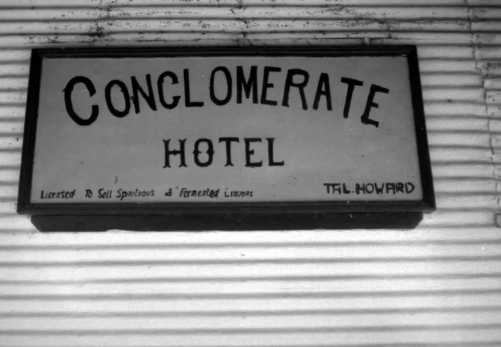
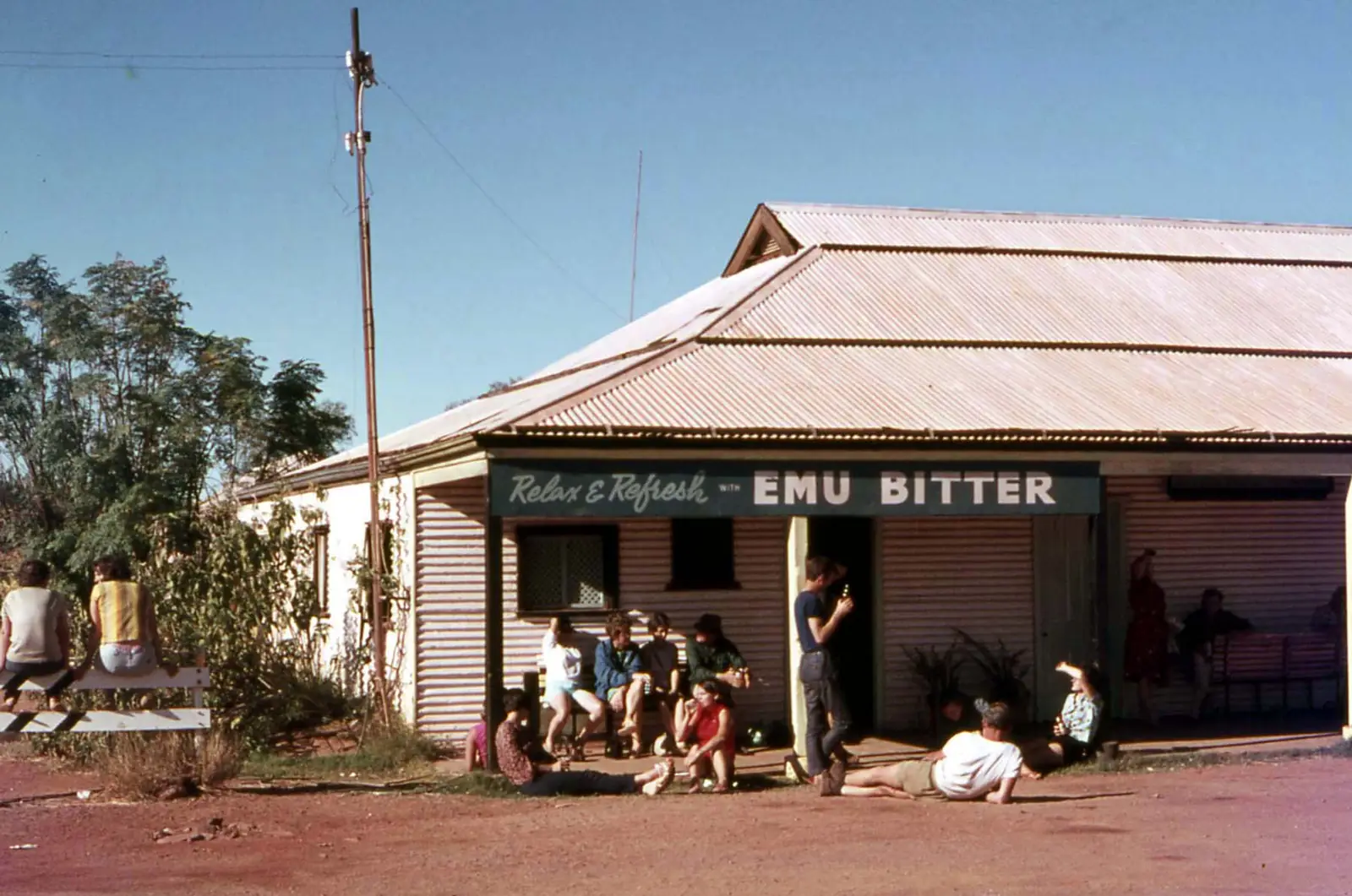
Conglomerate Hotel, Australia 1969Photo: wilford peloquin · CC BY 2.0 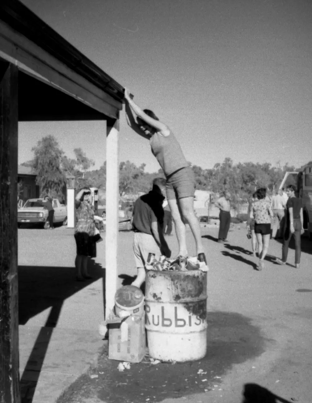
Conglomerate Hotel, Australia 1969Photo: wilford peloquin · CC BY 2.0
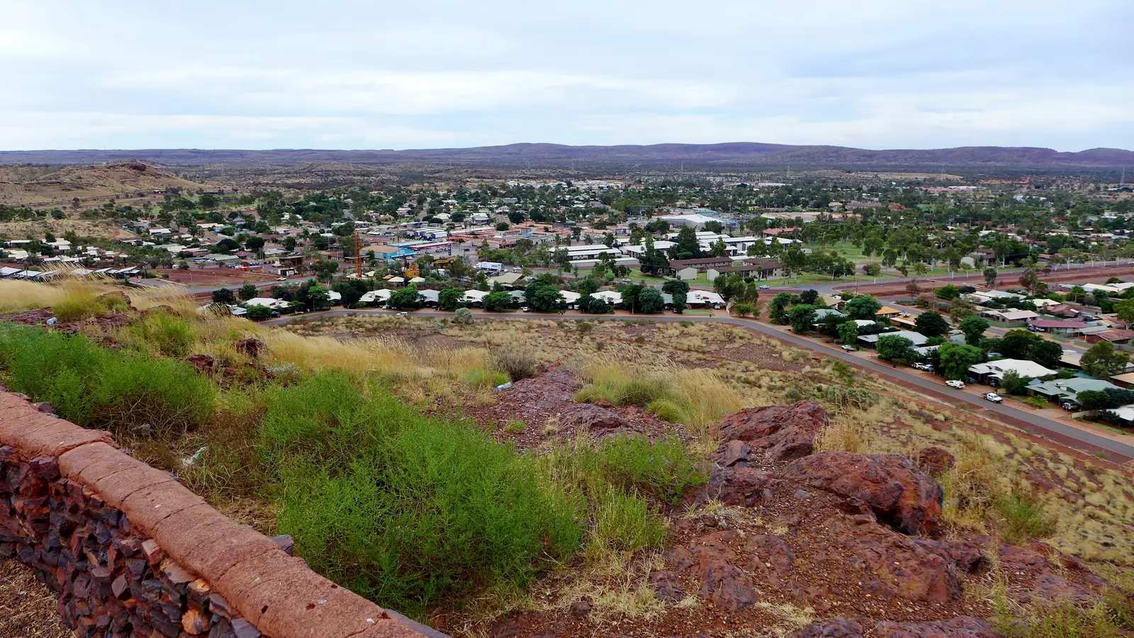
Nullagine sits in the East Pilbara, inside the North West hub, in the Shire of East Pilbara. This is the Marble Bar Road town 191 km north of Newman and 112 km south-east of Marble Bar — not a Kimberley suburb. The township hugs the Nullagine River. Australia’s North West: established 1899 as a gold-rush town and the site of Australia’s first known diamond find. The shire page dates the gold rush 1895–1914 and repeats the diamond claim.
The ABS publishes two 2021 geographies. Use urban centre Nullagine (L) UCL522052: 147 people, median age 38, sex split 53.5% male / 46.5% female, Aboriginal and/or Torres Strait Islander people 90 (61.2%). Australia’s North West’s “just under 150” matches that town figure. Suburbs-and-localities SAL51165 counted 1,159, 81.2% male — treat the SAL as a wide locality with mine-related population, not a main-street count. Newman is 191 km south on the shire itinerary. Check the Main Roads WA travel map and the shire road report after rain before you treat Marble Bar Road as open.
Where it is, and how far
Nullagine is the mid-point the shire names on the north–south East Pilbara run between Newman and Marble Bar. The shire itinerary: about 2.5 hours from Newman via Marble Bar Road, with fuel, water and supplies before you leave. Once you leave that road, the shire says a 4WD is required for most tourist sites. Garden Pool, Lynas Lookout and nearby petroglyphs are the exceptions accessible by 2WD in good conditions.
| Place | Distance from Nullagine (sourced) |
|---|---|
| Newman | 191 km south (shire Nullagine and caravan-park pages); about 2.5 hours (shire itinerary) |
| Marble Bar | 112 km north-west / the shire wording is 112 km south-east of Marble Bar |
| Seven Sisters cultural site | about 10 km (shire page; Palyku Country — no unguided entry) |
| Perth | Australia’s North West’s Mantingunya-related wording on a partner page is not used here; a Perth kilometre was not on the shire Nullagine page |
Tom Price and Halls Creek are North West neighbours on this site, not 20-minute side roads.
Facts at a glance
Population. ABS 2021 Census, Urban Centres and Localities UCL522052 Nullagine (L): 147 people. Median age 38. 33 families, 71 private dwellings. Average household size 2.9. SAL SAL51165: 1,159 people. Use the Nullagine (L) UCL QuickStats for the town.
Climate. Bureau of Meteorology NULLAGINE, 004027, commenced 1897, location 21.89°S, 120.11°E, elevation 380 m, closed 9 March 2004, latest available data 31 March 2004. Mean maximum temperature (77 years, 1898–1984): December 39.7 °C hottest mean month, January 39.4 °C, July 24.0 °C, annual 32.9 °C. Mean minimum: January 24.2 °C, July 7.5 °C, annual 16.6 °C. Mean rainfall (94 years, 1897–2004): annual 325.7 mm; February 69.4 mm wettest mean month; September 1.6 mm driest. For a still-open nearby station, use Marble Bar, 004106: January mean maximum 41.0 °C, December 42.1 °C, July 27.6 °C, annual rainfall 402.9 mm. See Nullagine weather.
Visitor information. There is no Nullagine VIC on the sourced pages. Australia’s North West: pick up an area map from the Newman or Port Hedland Visitor Centres, or from the Nullagine Hotel. Shire Newman office, corner Kalgan and Newman Drives, (08) 9175 8000, 8:30am–4:30pm weekdays. Marble Bar Administration Office, 20 Francis Street, (08) 9176 1008. 24-hour on-call Nursing Post in the main street on the shire town page.
Traditional Owners
The Shire of East Pilbara Nullagine page names an Important Cultural Site: The Seven Sisters (Palyku Country) about 10 km from town, of high cultural significance to the local Irrungadji Aboriginal community. Visitors must not enter without an Aboriginal guide or ranger; no photography; no camping. Contact the Department of Planning, Lands and Heritage or the Budadee Aboriginal Rangers. Palyku-Jartayi Aboriginal Corporation RNTBC states that the Palyku determination area includes a portion of the East Pilbara Shire and the town of Nullagine. Australia’s North West names Mantingunya Arts & Culture Centre in town. This guide uses those official sentences rather than flattening Martu, Nyamal or other Pilbara groups onto the townsite from neighbouring pages. Confirm wording at the hotel, the art centre or the Newman office.
History
Australia’s North West: Nullagine was established in 1899 as a gold-rush town and was the site of Australia’s first known diamond find. The shire: diamonds are held to have been first discovered in Australia here, but the gold rush between 1895 and 1914 sealed the town’s reputation; it remains a favourite for panners and detector users. Obtain all appropriate prospecting licences before you arrive. The shire itinerary names remnants of historic gold-mining days and old steam engines on the Australia’s North West main-street rest stop.
Lynas Lookout commemorates Bill Lynas, a decorated First World War soldier who served at Gallipoli and on the Western Front, earning the Military Cross with two Bars and the Distinguished Service Order; after the war he returned to mining and became a key figure in the Nullagine community. That is shire interpretive-sign wording.
Cameleer routes of past eras and Indigenous art sites are named as cultural sites in the district. Stay on permitted access.
Things to do
Welcome Rest Stop — Australia’s North West: main street, free Wi-Fi, shaded playground, public toilets, dump facilities, old steam engines.
Lynas Lookout — Gallop Road, 360-degree views, shade, barbecue, interpretive signage. Access is steep and not suitable for vehicles with trailers.
Garden Pool — birdwatching and photography; 2WD in good conditions on the shire list.
Nullagine Dam — north of town off Marble Bar Road; dirt roads to a viewing point; check conditions.
Mantingunya Arts & Culture Centre — named by Australia’s North West. The shire also points to Martumili for Nullagine artists online.
Nullagine Hotel (The Nully) — meals, rooms, a central gathering place.
Conglomerate Gorge, Beaton’s Creek Gorge, Daylight Pools, Skull Springs, Amethyst Mine — Australia’s North West 4WD list. Warlu Way Geoheritage Route: stromatolites about 3.5 billion years old and Cretaceous mesas between Nullagine and Marble Bar.
Seven Sisters — Palyku Country, about 10 km: no unguided entry.
See things to do in Nullagine. Prospecting is not a free-for-all; licences first.
Where to stay
The shire and Australia’s North West name:
- Nullagine Caravan Park — 5 Gallop Road, 18 powered sites, 7 unpowered sites, bathroom and laundry, EZY dump, full-time caretaker. Book online or call (08) 9175 8000. After-hours emergencies 0418 780 453 (text preferred).
- Nullagine Hotel (The Nully) — rooms, meals, named on the shire itinerary and Australia’s North West.
Those are official named types, not a ranked inventory. Confirm seasonal park closure with the shire.
- How to choose: Nullagine accommodation
- Camping detail: Nullagine caravan parks
- Operator enquiries: feature your business
If Nullagine is full, Newman is 191 km south and Marble Bar 112 km along the same road.
Caravan and camping
Vans use Nullagine as the East Pilbara mid-point overnight. Official named camps are the shire caravan park and the main-street rest-stop dump (a dump facility is not automatically an overnight). Ask the caretaker and Newman office for stay limits. Read Nullagine caravan parks and outback camping.
After rain, the Nullagine River and Marble Bar Road are the constraint. Shire road report first, then Main Roads.
Fuel and services
Australia’s North West fuel-stops table lists ULP and diesel at the Nullagine Hotel on Marble Bar Road. The same organisation’s town page names the General Store for groceries, fuel and fishing tackle. This guide does not list bowser prices. Fill up here if they are open; otherwise fill in Newman or Marble Bar. There is a 24-hour on-call Nursing Post in the main street. Mobile reception is limited on the shire tips list. For current questions, use (08) 9175 8000 and Shire of East Pilbara.
Road access
The Marble Bar Road is the spine through Nullagine between Newman and Marble Bar. The shire: carry extra fuel, water and emergency supplies; never rely on old mud maps; tracks alter with rainfall and river flooding. After rain, check the Shire of East Pilbara road report and Main Roads WA. Do not drive around closed signs to keep a gorge photograph. 4WD for most sites off the main road.
South: Newman, then choices toward Tom Price or the Great Northern Highway. North-west: Marble Bar. Halls Creek is a Kimberley neighbour on this site, not a Nullagine side road.
Nearby parks and towns
Parks and named nature sites:
- Nullagine River and wet-season waterways (shire)
- Garden Pool, Nullagine Dam, Lynas Lookout
- Conglomerate Gorge and Warlu Way geoheritage (Australia’s North West)
- Seven Sisters / Palyku Country — guided only
Towns on this site:
- Marble Bar — 112 km; jasper bar, hottest-town record
- Newman — 191 km; shire seat
- Tom Price — Hamersley Range neighbour
- Halls Creek — Kimberley side of the North West hub
When to go, and how long
Nullagine’s December mean maximum of 39.7 °C and January 39.4 °C are extreme for a lookout walk at midday; July’s 24.0 °C mean maximum is still warm by southern Goldfields standards. July’s 7.5 °C mean minimum is why a river-country camp can need a layer. Annual rainfall 325.7 mm on the closed-station table is summer-wet: February 69.4 mm, September 1.6 mm. The shire says the river and wet season provide the spectacular scenery. Two hours at the rest stop, hotel and Lynas Lookout (if you are not towing) is the minimum. A night lets you use the caravan park if the shire has confirmed it is open. Two nights only if you are adding Garden Pool, a licensed prospecting day or a 4WD gorge the road report agrees with.
Operators who want a checked listing: feature your business. The listings slot on this hub stays empty until then.
Plan this trip
Tell us the dates, who you are travelling with and where you need help. We reply with planning notes for Nullagine — we are not a booking agent.
Events and road-conditions newsletter
Occasional notes on outback festivals, race days and official road-condition sources — not a daily blast. We use these details only to send the newsletter.
Western Australia · North West
Nullagine accommodation
Where to stay in Nullagine: Shire of East Pilbara caravan park at 5 Gallop Road and the Nullagine Hotel. Confirm seasonal park closure at (08) 9175 8000. East Pilbara, not the Kimberley.
Read · 3 min
Western Australia · North West
Nullagine caravan parks
Camping in Nullagine: Shire of East Pilbara caravan park with 18 powered and 7 unpowered sites, plus the main-street rest-stop dump. Confirm seasonal closure. East Pilbara, not the Kimberley.
Read · 3 min
Western Australia · North West
Nullagine weather
Nullagine climate from BOM Nullagine (004027): December mean max 39.7 °C, July 24.0 °C, annual rainfall 325.7 mm. Station closed 2004; Marble Bar 004106 remains open.
Read · 4 min
Western Australia · North West
Things to do in Nullagine
Things to do in Nullagine: Lynas Lookout, Garden Pool, Mantingunya Arts, The Nully, Warlu Way gorges and Palyku Seven Sisters site rules. East Pilbara, not the Kimberley.
Read · 4 min
Frequently asked questions
Is Nullagine in the East Pilbara?
Yes. The Shire of East Pilbara places Nullagine 191 km north of Newman and 112 km south-east of Marble Bar on the Marble Bar Road. This guide is that town, not a Kimberley locality of a similar name.
What is Nullagine’s population?
Use the 2021 urban centre Nullagine (L) UCL522052: 147 people, median age 38. Australia’s North West says the town is home to just under 150 people. Suburbs-and-localities SAL51165 counted 1,159, a much wider locality with 81.2% male — treat that as mine-related population beyond the townsite, not a main-street count.
How far is Nullagine from Newman and Marble Bar?
The Shire of East Pilbara Nullagine and caravan-park pages both put Nullagine 191 km north of Newman and 112 km south-east of Marble Bar on the Marble Bar Road. The shire itinerary allows about 2.5 hours from Newman.
What is the weather like in Nullagine?
BOM Nullagine (004027) has a December mean maximum of 39.7 °C, a July mean maximum of 24.0 °C and annual mean rainfall of 325.7 mm. Temperature means use 1898–1984. The station closed on 9 March 2004. Nearby open Marble Bar (004106) remains the still-open East Pilbara table.
Can I camp at Nullagine?
Yes, as named types. The shire lists Nullagine Caravan Park at 5 Gallop Road with 18 powered and 7 unpowered sites, bathroom, laundry and EZY dump facilities. Australia’s North West also names a Welcome Rest Stop dump facility on the main street and the Nullagine Hotel for rooms. Confirm seasonal park closure with the shire on (08) 9175 8000.
Sources and further reading
Facts on this page were checked against these primary and official sources. Conditions change — confirm before you travel or buy.
- Pilbara hospitals and health services — WA Country Health Service
- Nullagine (L) 2021 Census QuickStats (UCL522052) — Australian Bureau of Statistics
- Nullagine 2021 Census QuickStats (SAL51165) — Australian Bureau of Statistics
- Climate statistics for Nullagine (004027) — Bureau of Meteorology
- Climate statistics for Marble Bar (004106) — Bureau of Meteorology
- Nullagine — Shire of East Pilbara — Shire of East Pilbara
- Nullagine Caravan Park — Shire of East Pilbara
- Nullagine — Australia’s North West — Australia's North West
- Fuel Stops — Australia's North West
- About Us — Palyku-Jartayi Aboriginal Corporation — Palyku-Jartayi Aboriginal Corporation RNTBC
- Main Roads WA travel map — Main Roads Western Australia