At a glance
Sourced facts only. Distances and services change — confirm before you travel.
- Local government
- Town of Port Hedland
- Traditional Owners
- Town of Port Hedland Our History: Kariyarra, Ngarla and Nyamal people as Traditional Custodians of the Town of Port Hedland lands. Kariyarra is the language spoken in the Port Hedland region; Ngarla and Nyamal just north and south. Kariyarra name for Hedland: Marapikurrinya.Confirm current wording at the Port Hedland Visitor Centre.
- Nearest regional city
- Australia’s North West Karratha page: Karratha is 240 kilometres south of Port Hedland. Tourism WA Karratha: a three-hour drive. Australia’s North West 3-day itinerary: Port Hedland is 200 km north of Karratha. This hub prints the disagreement.
- Capital
- A sourced Perth kilometre was not on the Australia’s North West Port Hedland itinerary or the Town of Port Hedland Our History page fetched for this rebuild. Australia’s North West puts Karratha 1,535 km north of Perth; do not invent a Port Hedland–Perth figure from that.
- Nearest fuel
- Australia’s North West and the Town of Port Hedland treat Port Hedland plus South Hedland as a regional service city. Confirm the bowser on arrival; this hub does not invent a brand or hours.
- Nearest hospital or clinic
- Hedland Health Campus (WA Country Health Service), 24/7 emergency department, maternity, high dependency, renal dialysis, imaging, pathology, telehealth and named visiting specialists.
- Mobile coverage
- Check Telstra and Optus coverage maps before travel; do not assume a signal on the Great Northern Highway toward Marble Bar or on Eighty Mile Beach.
- Best time to visit
- Australia’s North West 3-day itinerary: May to September for tour options; October to January for turtle nesting at Cemetery Beach. BOM Port Hedland Airport July mean maximum 27.4 °C; March and December 36.8 °C.
Climate
Monthly means from the Bureau of Meteorology station Port Hedland Airport (004032). This is not a forecast. Open. Temperature means 78 years (1948–2026); rainfall 82 years (1942–2026). Commenced 1942. Elevation 6 m. Latest available data 14 November 2026. Summer-peak rain (February 91.2 mm). Do not blend with Karratha Aero.
| Month | Mean max (°C) | Mean min (°C) | Rainfall (mm) |
|---|---|---|---|
| Jan | 36.4 | 25.7 | 61.5 |
| Feb | 36.3 | 25.6 | 91.2 |
| Mar | 36.8 | 24.8 | 54.1 |
| Apr | 35.3 | 21.7 | 20.6 |
| May | 30.8 | 17.4 | 26.6 |
| Jun | 27.7 | 14.3 | 22.2 |
| Jul | 27.4 | 12.5 | 9.8 |
| Aug | 29.4 | 13.4 | 4.7 |
| Sep | 32.6 | 15.7 | 1.3 |
| Oct | 35.2 | 18.8 | 0.9 |
| Nov | 36.3 | 21.6 | 2.5 |
| Dec | 36.8 | 24.3 | 18.7 |
Port Hedland in pictures
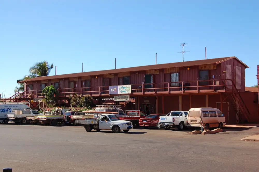
Pier Hotel in Port HedlandPhoto: Bahnfrend · CC BY-SA 3.0 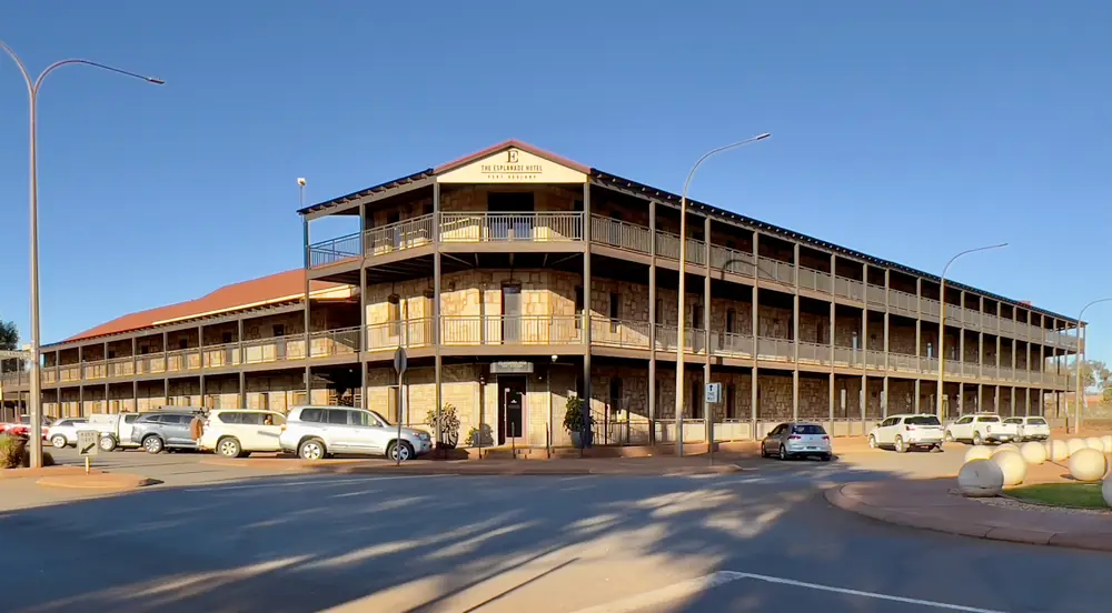
Esplanade Hotel in Port HedlandPhoto: Chris Olszewski · CC BY-SA 4.0 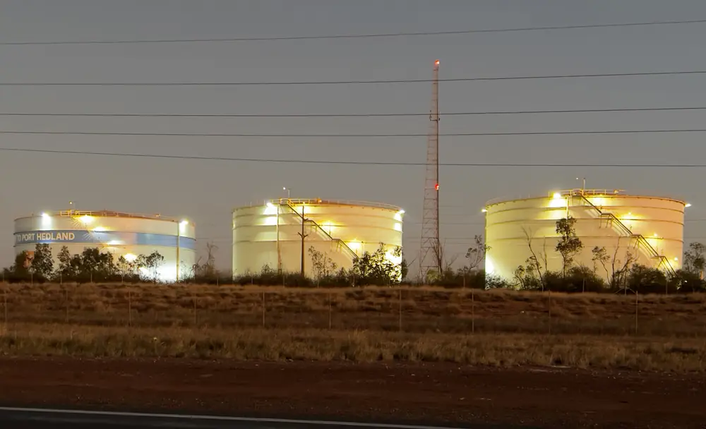
Iron ore tanks at the Port of Port HedlandPhoto: Kgbo · CC BY-SA 4.0 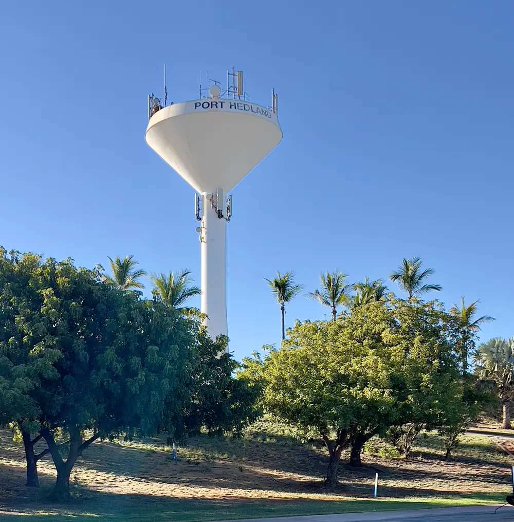
Water tower in Port HedlandPhoto: Kgbo · CC BY-SA 4.0
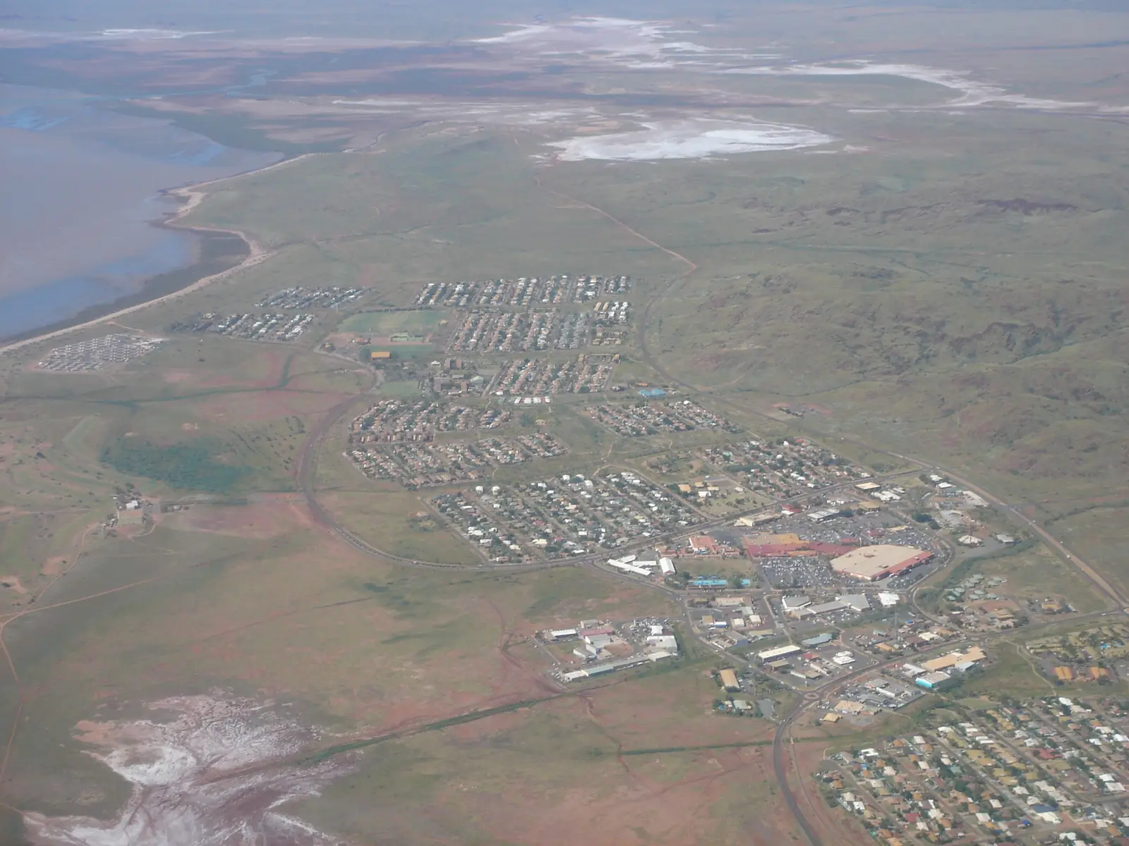
Port Hedland sits on the Pilbara coast in Western Australia’s North West, inside the Town of Port Hedland, where the Great Northern Highway meets the Indian Ocean in the Pilbara. Australia’s North West’s 3-day itinerary: a coastal town 200 km north of Karratha connecting the Pilbara and the Kimberley. The same organisation’s Karratha page puts Karratha 240 kilometres south of Port Hedland. Tourism WA’s Karratha page: a three-hour drive. This hub is that port city — Port Hedland plus South Hedland — not Karratha, not Marble Bar and not Broome. Geraldton and Darwin have no town pages here. Perth is the capital; it has no town page here.
The Town of Port Hedland’s harbour-and-hand sentence is the hinge used here: the Kariyarra word Marapikurrinya refers to the hand-like formation of the tidal creeks coming off the harbour. Australia’s North West: watch giant iron ore ships at Marapikurrinya Park, the world’s largest bulk export port by tonnage on that itinerary. That is a harbour-and-satellite-town story, not a Nickol Bay city reprint of Karratha and not a jasper-bar reprint of Marble Bar.
The ABS publishes two 2021 geographies. Use Significant Urban Area 5010: 15,298 people, median age 32, sex split 52.5% male / 47.5% female, Aboriginal and/or Torres Strait Islander people 2,759 (18.0%). 3,436 families, 7,701 private dwellings, average household 2.7. Town of Port Hedland LGA57280 counted 15,684, median age 32. The Town’s Our History page: South Hedland was established during the 1965 development program and now caters for more than half of the Port Hedland population. Do not mix SUA and LGA. Travellers stop for harbour tours, Cemetery Beach and a highway night. You still need Main Roads WA after rain or a cyclone watch.
Where it is, and how far
Port Hedland is the eastern Pilbara port city on sealed highway. Perth to Darwin via the Pilbara joins the coast here. Australia’s North West names the Port Hedland Visitor Centre in the West End precinct on Wedge Street as the first stop.
Official Karratha measures do not agree. A sourced Perth kilometre was not on the itinerary or Town history pages fetched for this rebuild, so this hub does not invent one.
| Place | Distance from Port Hedland (sourced) |
|---|---|
| Karratha | 240 km south (Australia’s North West Karratha). Three-hour drive (Tourism WA Karratha). 200 km on Australia’s North West 3-day itinerary |
| Perth | Not printed on the sourced Port Hedland itinerary or Town history pages. Australia’s North West puts Karratha 1,535 km north of Perth — a Karratha figure, not averaged onto this harbour |
| South Hedland | Inland satellite; 18 km is a figure this hub does not print because it was not on those official pages. The Town history page: more than half the population |
| Visitor Centre | Wedge Street, West End (Australia’s North West 3-day itinerary; Australia’s North West Pilbara visitor-centre list) |
A Port Hedland–Marble Bar kilometre is printed on this site’s Marble Bar hub; this page does not copy it as a Port Hedland official figure. Use Marble Bar for that table.
Facts at a glance
Population. ABS 2021 Census Significant Urban Area 5010: 15,298 people. Median age 32. Use the SUA QuickStats. LGA LGA57280: 15,684. Do not mix.
Climate. Bureau of Meteorology PORT HEDLAND AIRPORT, 004032, 20.37°S, 118.63°E, elevation 6 m, commenced 1942, status: open, latest available data 14 November 2026. Mean maximum (78 years, 1948–2026): March and December 36.8 °C, July 27.4 °C, annual 33.4 °C. Mean minimum: January 25.7 °C, July 12.5 °C, annual 19.7 °C. Mean rainfall (82 years, 1942–2026): annual 315.4 mm; February 91.2 mm wettest mean month; October 0.9 mm driest. Do not blend Karratha Aero 004083. See Port Hedland weather.
Visitor information. Australia’s North West: Port Hedland Visitor Centre, West End, Wedge Street — maps, tide and shipping times. Town of Port Hedland: 13 McGregor Street, (08) 9158 9300, council@porthedland.wa.gov.au. The visitporthedland.com visitor site noted it was under construction when fetched. Confirm which door is actually open. Roads: Main Roads WA.
Traditional Owners
Town of Port Hedland Our History: the Town acknowledges the Kariyarra, Ngarla and Nyamal people as the Traditional Custodians of the Town of Port Hedland lands. Kariyarra is the language spoken in the Port Hedland region; Ngarla and Nyamal just north and south. Kariyarra name for Hedland: Marapikurrinya — hand-like formation of the tidal creeks (mara - hand, pikurri - pointing straight, nya - a place name marker). Other Kariyarra place names on that page: Kartijirli for Pretty Pool and Pipunjarra for the rock engravings. The same page names the 1946 Strike organised by Aboriginal pastoral workers. Confirm current wording at the Visitor Centre. See visiting Country respectfully.
History
Town of Port Hedland: in April 1863 Captain Peter Hedland aboard the cutter Mystery entered a channel he named Mangrove Harbour; two months later it was renamed Port Hedland by the Surveyor-General. Once a port for pearling and pastoral industries; 1965 started the massive development program when a town of some 1,200 people expanded and South Hedland was established. Australia’s North West: world’s largest bulk export port by tonnage on the 3-day itinerary. Dalgety House Museum tells early settlement and the loss of the SS Koombaa; open May to October, $3 cash.
This is a 1863 harbour town with a 1965 satellite, not a City of Karratha suburb. For the East Pilbara gold towns use Marble Bar and Nullagine. For Karijini use Newman or Tom Price.
Things to do
Australia’s North West’s 3-day itinerary names these in and around Port Hedland:
- Port Hedland Visitor Centre — Wedge Street, West End; tide and shipping times
- Dalgety House Museum — May to October; $3 cash
- Don Rhodes Mining and Transport Museum — open-air machinery on Port Hedland Road
- Koombana Lookout — harbour, town and coastline
- Marapikurrinya Park — ore ships; pop-up food vendors in shipping containers
- Seafarer’s Centre harbour tour and Tower Tour — launch vessel or elevated views
- Silver Star Café — 1939 railway carriage on Edgar Street
- Courthouse Gallery+Studio — West End
- Spinifex Hill Studios — Hedditch Street, South Hedland
- Redbank Bridge Lookout — Dampier Salt piles at sunset
- Cemetery Beach — turtle nesting October to January; Care for Hedland volunteers
- Pretty Pool (Kartijirli) — low-tide swim on the itinerary
- Spoilbank Marina — public art trail, playground, aquapark, jetty, boat ramp
- Port Hedland Golf Club — 18 holes, sand greens
- Staircase to the Moon — Cooke Point; check moonrise at the Visitor Centre
- Matt Dann Theatre & Cinema — evening programme on the itinerary
Nearby, not in-town: Marble Bar is the East Pilbara heat town. Broome is the Kimberley gateway further up the highway. Eighty Mile Beach is named on this site’s Marble Bar hub as north-east of Port Hedland — not a Port Hedland main-street walk.
See things to do in Port Hedland.
Where to stay
Australia’s North West’s 3-day itinerary names Hospitality Port Hedland, Hedland Hotel, Discovery Parks – Port Hedland and an RV Overflow Area. The Town of Port Hedland facilities list names RV Overflow Camping. Those are official named types. This hub does not reprint dollar figures that date. If Port Hedland is full, Karratha parks are a separate City of Karratha list — a different LGA.
- How to choose: Port Hedland accommodation
- Camping detail: Port Hedland caravan parks
- Operator enquiries: feature your business
Caravan and camping
Vans use Port Hedland as a Great Northern Highway / North West Coastal Highway night between the Pilbara inland and the Kimberley. Official named camping on the itinerary starts with Discovery Parks – Port Hedland and the RV Overflow Area. Ask on arrival for stay limits. Read Port Hedland caravan parks and outback camping. Do not camp on Cemetery Beach turtle dunes or treat Marapikurrinya Park as a van bay.
Fuel and services
Australia’s North West and the Town treat Port Hedland plus South Hedland as the regional service city between Karratha and Broome. This guide does not invent a bowser brand. Confirm the pump is actually open.
Hedland Health Campus (WACHS): 24/7 emergency department, aged care, allied health, ambulatory care, mental health, drug and alcohol, day surgery, high dependency, inpatient unit, medical imaging, outpatient clinics, maternity and obstetric service, paediatric unit, pathology, Patient Assisted Travel Scheme, pharmacy, population health, renal dialysis, special care nursery, visiting specialists and telehealth. Karratha Health Campus is a different city. For maps use the Visitor Centre. Roads: Main Roads WA.
Town facilities Australia’s North West and the Town list include Wanangkura Stadium, JD Hardie Youth and Community Hub, South Hedland Aquatic Centre, Gratwick Aquatic Centre, Matt Dann Theatre & Cinema and libraries. Those are civic buildings, not a second harbour tour.
Road access
The Great Northern Highway from Newman and the North West Coastal Highway from Karratha are sealed. Perth to Darwin via the Pilbara uses this harbour as the coastal join. After rain or a cyclone watch, Main Roads first. Road trains and ore traffic are the packing problem, not a 4WD track into town.
West: Karratha, then the City of Karratha coastal towns. East/north: Broome on the Kimberley side. Inland: Marble Bar, Nullagine, Newman. Derby is further into the Kimberley from Broome, not a Port Hedland suburb.
Nearby parks and towns
Port Hedland does not sit inside a Parks WA park named on the sourced itinerary. Named nature on that itinerary is harbour, tidal flats, Cemetery Beach turtles and Pretty Pool.
Towns on this site:
- Karratha — City of Karratha, 200–240 km south on official pages
- Marble Bar — East Pilbara neighbour
- Nullagine — East Pilbara gold town
- Newman — Great Northern Highway inland
- Broome — Kimberley gateway
- Tom Price — Karijini gateway
- Roebourne — City of Karratha heritage town west of this harbour
When to go, and how long
Australia’s North West: May to September for tour options; October to January if you are visiting for turtle nesting at Cemetery Beach. Dalgety House is May to October. BOM Port Hedland Airport’s March and December mean maximum of 36.8 °C is hot Pilbara summer. July’s 27.4 °C mean maximum and 12.5 °C mean minimum is the coolest mean-max month on that open table. February’s 91.2 mm is the wettest mean month on a 315.4 mm annual table.
A West End morning covers the Visitor Centre, Marapikurrinya Park and a museum if it is in season. A second day is the Seafarer’s tour plus South Hedland’s Spinifex Hill Studios. A third is Cemetery Beach, Pretty Pool and Spoilbank on the itinerary’s own three-day split. Marble Bar is a separate inland day.
Operators who want a checked listing: feature your business. The listings slot on this hub stays empty until then.
Plan this trip
Tell us the dates, who you are travelling with and where you need help. We reply with planning notes for Port Hedland — we are not a booking agent.
Events and road-conditions newsletter
Occasional notes on outback festivals, race days and official road-condition sources — not a daily blast. We use these details only to send the newsletter.
Western Australia · North West
Port Hedland accommodation
Where to stay in Port Hedland: Australia’s North West names Hospitality Port Hedland, Hedland Hotel, Discovery Parks – Port Hedland and an RV Overflow Area. Confirm before you unhitch. Port plus South Hedland, not Karratha.
Read · 3 min
Western Australia · North West
Port Hedland caravan parks
Camping in Port Hedland: Australia’s North West names Discovery Parks – Port Hedland and an RV Overflow Area. The Town facilities list names RV Overflow Camping. Cemetery Beach is not a free camp.
Read · 3 min
Western Australia · North West
Port Hedland weather
Port Hedland climate from open BOM Port Hedland Airport (004032): March and December mean max 36.8 °C, July 27.4 °C, annual rainfall 315.4 mm with February 91.2 mm. Do not blend with Karratha Aero.
Read · 4 min
Western Australia · North West
Things to do in Port Hedland
Things to do in Port Hedland: Marapikurrinya Park ore ships, Cemetery Beach turtles, Spoilbank Marina, Spinifex Hill Studios in South Hedland. This is Port plus South Hedland, not Karratha or Marble Bar.
Read · 3 min
Frequently asked questions
Is Port Hedland the same as Karratha or South Hedland?
This hub is the Town of Port Hedland city page covering Port Hedland and South Hedland together, matching ABS Significant Urban Area 5010. South Hedland is the inland satellite the Town’s Our History page says was established during the 1965 development program and now caters for more than half of the Port Hedland population. Karratha is a separate City of Karratha city 200–240 km south on official pages. Marble Bar and Broome are different towns.
How far is Port Hedland from Karratha and Perth?
Australia’s North West Karratha page: Karratha is 240 kilometres south of Port Hedland. Tourism WA Karratha: a three-hour drive. Australia’s North West’s 3-day Port Hedland itinerary: 200 km north of Karratha. A sourced Perth kilometre was not on those Port Hedland itinerary or Town history pages, so this hub does not invent one. Australia’s North West puts Karratha itself 1,535 km north of Perth.
What is Port Hedland’s population?
15,298 people at the 2021 Census for Significant Urban Area 5010, median age 32, Aboriginal and/or Torres Strait Islander people 2,759 (18.0%). That SUA is Port plus South Hedland. Town of Port Hedland LGA57280 counted 15,684. Do not mix the two.
What is there to do in Port Hedland?
Australia’s North West 3-day itinerary names the Port Hedland Visitor Centre on Wedge Street, Dalgety House Museum (May to October, $3 cash), Don Rhodes Mining and Transport Museum, Koombana Lookout, Marapikurrinya Park and giant ore ships, Seafarer’s Centre harbour and tower tours, Courthouse Gallery+Studio, Spinifex Hill Studios in South Hedland, Redbank Bridge Lookout, Cemetery Beach turtles (October to January), Pretty Pool (low tide), Spoilbank Marina, Port Hedland Golf Club, and Staircase to the Moon at Cooke Point.
What is the weather like in Port Hedland?
BOM Port Hedland Airport (004032, open): March and December mean maximum 36.8 °C, July 27.4 °C, annual rainfall 315.4 mm (82 years, 1942–2026). February is the wettest mean month at 91.2 mm; October the driest at 0.9 mm. Do not blend with Karratha Aero.
Can I camp at Port Hedland?
Yes, as named types. Australia’s North West’s 3-day itinerary names Discovery Parks – Port Hedland and an RV Overflow Area among stay types, plus Hospitality Port Hedland and Hedland Hotel as rooms. The Town of Port Hedland facilities list names RV Overflow Camping. Confirm on arrival. This hub does not invent extra parks or reprint dollar figures.
Sources and further reading
Facts on this page were checked against these primary and official sources. Conditions change — confirm before you travel or buy.
- Port Hedland 2021 Census QuickStats (SUA 5010) — Australian Bureau of Statistics
- Port Hedland 2021 Census QuickStats (LGA57280) — Australian Bureau of Statistics
- Climate statistics for Port Hedland Airport (004032) — Bureau of Meteorology
- 3 days in Port Hedland — Australia's North West
- Our History — Town of Port Hedland
- Port Hedland Visitor Centre — Town of Port Hedland
- Karratha — Australia's North West
- Hedland Health Campus — WA Country Health Service
- The Pilbara — Australia's North West
- Main Roads WA travel map — Main Roads Western Australia