At a glance
Sourced facts only. Distances and services change — confirm before you travel.
- Local government
- Shire of Leonora
- Nearest regional city
- Leonora, a further 135 km south (Shire of Leonora information package). Kalgoorlie 368 km south (Shire of Leonora Leinster Township page).
- Nearest fuel
- Shire township page names a self-serve service station. Confirm it is open to visitors. Fill in Leonora if it is not.
- Nearest hospital or clinic
- Silver Chain Nursing Post staffed by two nurses five days a week, plus a resident doctor, on the Shire of Leonora township page. Leonora Hospital is the WACHS Goldfields hospital.
- Mobile coverage
- Check Telstra and Optus coverage maps before travel; do not assume a signal off the highway.
- Best time to visit
- Cooler BOM Leinster Aero mean maxima May–August (July 19.1 °C).
Climate
Monthly means from the Bureau of Meteorology station Leinster Aero (012314). This is not a forecast. Open station. Temperature 32 years (1994–2026); rainfall 30 years (1994–2026). Latest available data 14 November 2026.
| Month | Mean max (°C) | Mean min (°C) | Rainfall (mm) |
|---|---|---|---|
| Jan | 37.5 | 23.4 | 38.1 |
| Feb | 35.7 | 22.3 | 38.7 |
| Mar | 32.2 | 19.4 | 36.5 |
| Apr | 28.0 | 15.5 | 23.4 |
| May | 23.3 | 10.3 | 13.1 |
| Jun | 19.3 | 7.4 | 14.7 |
| Jul | 19.1 | 6.2 | 14.4 |
| Aug | 21.8 | 7.9 | 9.4 |
| Sep | 25.8 | 11.0 | 5.7 |
| Oct | 29.9 | 15.0 | 11.2 |
| Nov | 32.8 | 18.4 | 17.1 |
| Dec | 35.9 | 21.5 | 24.1 |
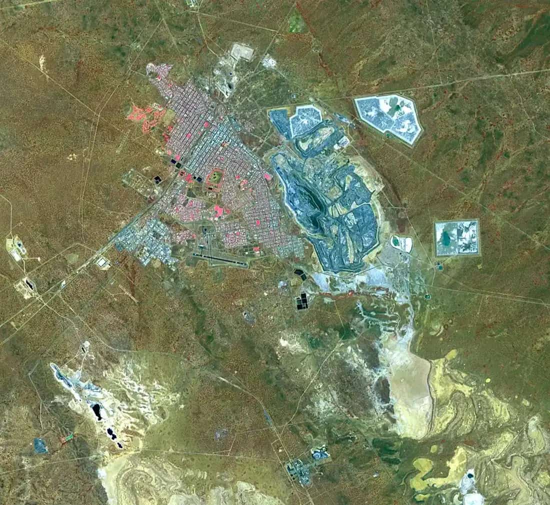
Leinster sits in Western Australia’s northern Goldfields, inside the Golden Outback hub, in the Shire of Leonora. This is the nickel town on the Goldfields Highway, 368 km north of Kalgoorlie-Boulder on the shire township page — not Leinster in Ireland. The shire: first established in 1976 as a company town supporting the nickel mine of the Agnew Gold Mining Company, now run by BHP Nickel West, named from nearby Leinster Downs Station. Golden Outback’s Northern Goldfields page links this highway as the “short cut” toward WA’s North West.
The ABS publishes two 2021 geographies. Use urban centre Leinster (L) UCL522042: 395 people, median age 30, sex split 50.1% male / 49.9% female. Suburbs-and-localities SAL50844 counted 716, median age 31, 60.6% male — a wider locality that can include mine-related population beyond the residential streets. Travellers stop for fuel, a supermarket night and the caravan park if it is taking visitors. Kalgoorlie is 368 km south on the shire township page; that figure is not a live road-report. Check the Main Roads WA travel map after rain before you treat the Goldfields Highway as open.
Where it is, and how far
Leinster is north of Leonora and south of Wiluna on the Goldfields Highway. The shire information package puts Leonora 832 km north-east of Perth and 230 km north of Kalgoorlie, with Leinster a further 135 km north of Leonora. Sandstone sits west on that network; Laverton is east of Leonora rather than a Leinster suburb. A Perth kilometre for Leinster itself was not on the township page, so this hub does not invent one.
| Place | Distance from Leinster (sourced) |
|---|---|
| Kalgoorlie | 368 km south (shire Leinster Township page) |
| Leonora | 135 km south (shire information package) |
| Agnew | named on the township history as the gold-mining company that built the town; a kilometre was not on that page |
| Wiluna | on the Goldfields Highway north (this site); a kilometre was not on the township page used here |
Meekatharra is a Murchison neighbour on this site, not a 20-minute side road.
Facts at a glance
Population. ABS 2021 Census, Urban Centres and Localities UCL522042 Leinster (L): 395 people. Median age 30. 79 families, 238 private dwellings. Average household size 2.7. SAL SAL50844: 716 people. The shire township page separately describes a population of around 1000, 283 houses, some 800 single-person quarters, 700 residents and 700 FIFO personnel. That is shire wording, not a Census geography. Use the Leinster (L) UCL QuickStats for the town.
Climate. Bureau of Meteorology LEINSTER AERO, 012314, commenced 1994, location 27.84°S, 120.70°E, elevation 497 m, Open, latest available data 14 November 2026. Mean maximum (32 years, 1994–2026): January 37.5 °C, July 19.1 °C, annual 28.4 °C. Mean minimum: January 23.4 °C, July 6.2 °C, annual 14.9 °C. Mean rainfall (30 years, 1994–2026): annual 248.3 mm; February 38.7 mm wettest mean month; September 5.7 mm driest. Full columns: BOM Leinster Aero. See Leinster weather.
Visitor information. There is no separate VIC building named on the sourced Leinster pages. Use the Shire of Leonora, 16 Tower Street, Leonora, (08) 9037 6044, admin@leonora.wa.gov.au, and the Leinster supermarket / tavern contacts on the accommodation page. Leonora CRC, 60 Tower Street, (08) 9037 7521.
Traditional Owners
Tjiwarl Aboriginal Corporation describes Tjiwarl Country as more than 13,000 square kilometres of land and waters situated roughly between Leinster and Wiluna, including Mount Keith, Yeelirrie, Albion Downs, Altona, Booylgoo Springs, Depot Springs, Agnew, Kaluwiri, Yakabindie and Wanjarri Nature Reserve. The WA Government’s Tjiwarl Palyakuwa ILUA page places the determination roughly between Wiluna and Leonora. The shire township page names pastoral stations around Leinster — Leinster Downs, Pinnacles, Yakabindie, Yeelirrie and Weebo — without a townsite nation label. This guide prints those official lists rather than flattening Tjiwarl onto the Leinster residential streets. Confirm current wording at 16 Tower Street, Leonora.
History
The shire township page is the sourced town story. Large-scale mining in the area began in 1897 when the East Murchison United Company (EMU) worked alluvial gold. WMC Resources Ltd purchased the operation in 1989, renamed it Leinster Nickel Operations and began recommissioning. Leinster itself was established in 1976 as a company town for the nickel mine of the Agnew Gold Mining Company, later BHP Nickel West. It takes the name from nearby Leinster Downs Station. Before mining, the land was pastoral.
The shire information package repeats the 1976 nickel townsite and a residential population of approximately 700 plus FIFO. Built on a sand dune, the township page says local and native plants and shady gums give an oasis impression. Residents’ nicknames on that page are home of the wedge-tail eagle and jewel of the northern goldfields — shire wording, not a wildlife guarantee.
Things to do
Leinster is a working mining town. The sourced visitor list is short. Do not invent lookouts.
Town facilities the shire names — supermarket, post office, self-serve service station, coffee shop, tavern, Olympic-size swimming pool, indoor sporting stadium, 18-hole golf course. Confirm which are open to travellers rather than residents and mine staff.
Leinster Caravan Park and Lodge — the named visitor stays. See things to do in Leinster.
Agnew and pastoral country — named in the town history. They are not a self-drive museum unless the shire or a station says you may visit.
Leonora and Gwalia — Hoover House and the Gwalia Museum are a Leonora day, 135 km south on the shire package.
Wanjarri Nature Reserve — named on the Tjiwarl Country list. Access belongs to Parks WA / the corporation, not to a Leinster kerb.
Golden Outback’s Northern Goldfields page names wildflowers July to September and dark-sky nights for the region. That is regional wording, not a Leinster festival.
Where to stay
The Shire of Leonora accommodation page names, under Leinster:
- Leinster Caravan Park — booked through the Leinster Supermarket, 0436 661 725, leinster.supermarket@au.issworld.com
- Leinster Lodge — booked through the Leinster Tavern, (08) 9037 9556, leinster.lodge@au.issworld.com
The township page repeats those two. Leonora motels on the same shire list are 135 km south, not in-town rooms. Those are official named types, not a ranked inventory. Confirm they take travellers, not only mine personnel.
- How to choose: Leinster accommodation
- Camping detail: Leinster caravan parks
- Operator enquiries: feature your business
If Leinster is full, Leonora is the shire seat with more named rooms.
Caravan and camping
Vans use Leinster as a Goldfields Highway overnight between Leonora and Wiluna. The official named park is the Leinster Caravan Park, booked at the supermarket. Ask whether powered sites are available to the public. Read Leinster caravan parks and outback camping.
After rain, the highway is still the constraint. Main Roads first.
Fuel and services
The township page names a comprehensive supermarket, self-serve service station, post office, coffee shop, hairdressing salon and nursery. There is a resident doctor, a Silver Chain Nursing Post staffed by two nurses five days a week, and a St John Ambulance sub-centre on call 24 hours. This guide does not list bowser brands. Fill up here if the service station is open; otherwise fill in Leonora. A 395-person urban centre will not match Kalgoorlie for a hospital. For current questions, use Shire of Leonora and (08) 9037 6044.
Road access
The Goldfields Highway is the sealed spine through Leinster between Leonora and Wiluna. Golden Outback calls this the North West “short cut”. After rain, check Main Roads WA. Do not drive around closed signs to keep a lodge booking. Mine traffic and road trains share the road; pull over.
South: Leonora, Gwalia, then Kalgoorlie. West: Sandstone. North: Wiluna. East toward Laverton is via Leonora on the sourced network, not a Leinster back street.
Nearby parks and towns
Parks and named nature sites:
- Wanjarri Nature Reserve (named on Tjiwarl Country; confirm access)
- Pastoral stations named by the shire — not automatically visitor stays
- Northern Goldfields wildflower country, July–September (Golden Outback regional page)
Towns on this site:
- Leonora — 135 km south; Hoover House, Gwalia
- Sandstone — west
- Wiluna — north on the highway
- Laverton — Explorers Hall of Fame
- Meekatharra — Murchison neighbour
When to go, and how long
Leinster Aero’s January mean maximum of 37.5 °C is hot working weather. July’s 19.1 °C mean maximum is the comfortable season on paper; July’s 6.2 °C mean minimum is why a van night needs a layer. Annual rainfall 248.3 mm, with September’s 5.7 mm the driest mean month. Two hours for fuel, supermarket and a photograph of the oasis gums is the minimum. A night lets you use the caravan park or lodge if they have confirmed a traveller booking. Two nights only if you are using Leinster as a rest day on the Goldfields Highway and Main Roads agrees. This is not a sculpture-trail town like Menzies.
Operators who want a checked listing: feature your business. The listings slot on this hub stays empty until then.
Plan this trip
Tell us the dates, who you are travelling with and where you need help. We reply with planning notes for Leinster — we are not a booking agent.
Events and road-conditions newsletter
Occasional notes on outback festivals, race days and official road-condition sources — not a daily blast. We use these details only to send the newsletter.
Western Australia · Golden Outback
Leinster accommodation
Where to stay in Leinster: Leinster Caravan Park booked at the supermarket and Leinster Lodge booked at the tavern, as named by the Shire of Leonora. Confirm visitor access. This is WA nickel country, not Ireland.
Read · 3 min
Western Australia · Golden Outback
Leinster caravan parks
Camping in Leinster: Leinster Caravan Park booked through the supermarket, as named by the Shire of Leonora. Confirm visitor access. No extra park names are invented here.
Read · 3 min
Western Australia · Golden Outback
Leinster weather
Leinster climate from BOM Leinster Aero (012314): January mean max 37.5 °C, July 19.1 °C, annual rainfall 248.3 mm. Station open. Check Main Roads WA for the week you drive the Goldfields Highway.
Read · 4 min
Western Australia · Golden Outback
Things to do in Leinster
Things to do in Leinster: a working Shire of Leonora nickel town on the Goldfields Highway. Official list is town facilities, the caravan park and lodge, and nearby Leonora–Gwalia — not invented lookouts.
Read · 3 min
Frequently asked questions
Is this Leinster in Western Australia or Ireland?
This guide is Leinster in the Shire of Leonora, Western Australia’s northern Goldfields, a nickel town on the Goldfields Highway. It takes its name from nearby Leinster Downs Station. It is not the Irish province.
What is Leinster’s population?
Use the 2021 urban centre Leinster (L) UCL522042: 395 people, median age 30. Suburbs-and-localities SAL50844 counted 716, a wider locality that can include mine-related population. The Shire of Leonora township page separately describes a population of around 1000, and 700 residents plus 700 fly-in-fly-out personnel — that is shire wording, not a Census geography.
How far is Leinster from Kalgoorlie and Leonora?
The Shire of Leonora Leinster Township page puts the town 368 km north of Kalgoorlie. The shire information package puts Leinster a further 135 km north of Leonora. A Perth kilometre for Leinster itself was not on those pages.
What is the weather like in Leinster?
BOM Leinster Aero (012314) has a January mean maximum of 37.5 °C, a July mean maximum of 19.1 °C and annual mean rainfall of 248.3 mm. The station is listed open from 1994. September is the driest mean month at 5.7 mm.
Can I stay at Leinster?
Yes, as named types. The Shire of Leonora accommodation page lists the Leinster Caravan Park, booked through the supermarket, and Leinster Lodge, booked through the tavern on (08) 9037 9556. Confirm those are open to visitors, not only to mine personnel.
Sources and further reading
Facts on this page were checked against these primary and official sources. Conditions change — confirm before you travel or buy.
- Goldfields hospitals and health services — WA Country Health Service
- Leinster (L) 2021 Census QuickStats (UCL522042) — Australian Bureau of Statistics
- Leinster 2021 Census QuickStats (SAL50844) — Australian Bureau of Statistics
- Climate statistics for Leinster Aero (012314) — Bureau of Meteorology
- Leinster Township — Shire of Leonora
- Accommodation — Shire of Leonora
- Tjiwarl country — Tjiwarl Aboriginal Corporation
- Tjiwarl Palyakuwa Indigenous Land Use Agreement — Government of Western Australia
- Northern Goldfields — Australia's Golden Outback
- Main Roads WA travel map — Main Roads Western Australia