At a glance
Sourced facts only. Distances and services change — confirm before you travel.
- Local government
- Shire of Yalgoo
- Nearest regional city
- Mount Magnet is the next Murchison town on this site toward Cue. Paynes Find is the shire’s Great Northern Highway community.
- Capital
- 497 km north of Perth (Shire of Yalgoo History page). Shire caravan-park page: six hours’ drive north of Perth or just two hours east of Geraldton.
- Nearest fuel
- Shire Fuel and Supplies page names a 24-hour self-serve fuel station at the old railway station, Piesse Street, operated by Refuel Australia, (08) 9920 8000.
- Nearest hospital or clinic
- Yalgoo Nursing Post (WA Country Health Service Midwest hospitals page). Acute and emergency services during open hours.
- Mobile coverage
- Check Telstra and Optus coverage maps before travel; do not assume a signal off the highway.
- Best time to visit
- Cooler BOM Yalgoo mean maxima May–August (July 18.2 °C on the 1897–1975 temperature series).
Climate
Monthly means from the Bureau of Meteorology station Yalgoo (007091). This is not a forecast. Closed 28 July 2026 on the table used here; latest available data 31 July 2015. Temperature maxima 78 years (1897–1975); rainfall 1896–2014. Nearby open Mount Magnet Aero (007600) is a separate airfield table — do not blend.
| Month | Mean max (°C) | Mean min (°C) | Rainfall (mm) |
|---|---|---|---|
| Jan | 37.2 | 20.7 | 15.8 |
| Feb | 36.3 | 20.7 | 25.0 |
| Mar | 33.5 | 18.6 | 25.0 |
| Apr | 28.5 | 14.5 | 20.7 |
| May | 23.0 | 10.1 | 31.6 |
| Jun | 19.2 | 7.7 | 41.3 |
| Jul | 18.2 | 6.2 | 34.8 |
| Aug | 20.0 | 6.8 | 25.5 |
| Sep | 24.0 | 8.7 | 11.7 |
| Oct | 27.5 | 11.4 | 8.1 |
| Nov | 32.1 | 15.2 | 8.0 |
| Dec | 35.5 | 18.4 | 11.8 |
Yalgoo in pictures
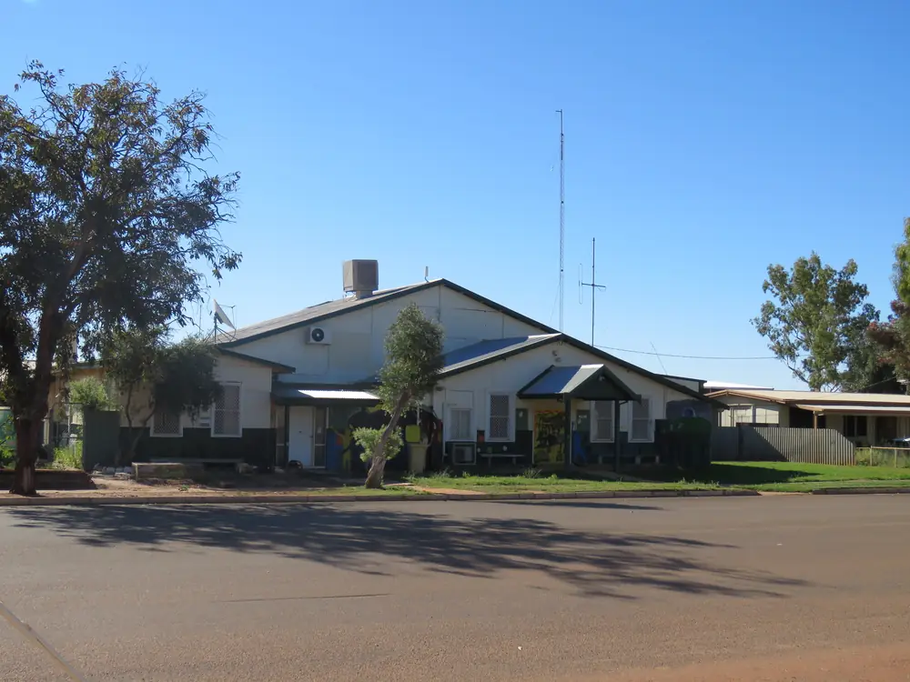
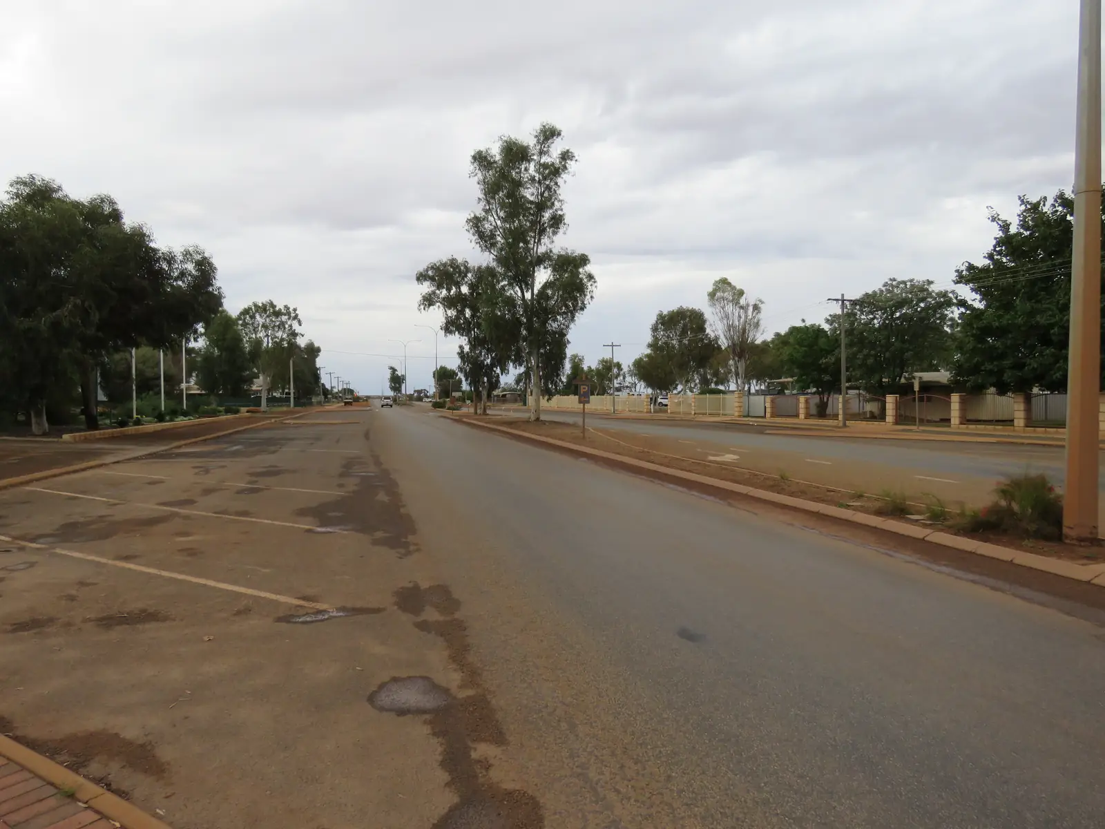
Former Yalgoo Shire Office and Hall, September 2021Photo: Calistemon · CC BY-SA 4.0 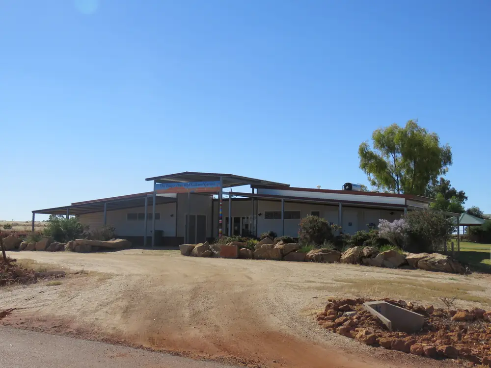
The Yalgoo Arts and Cultural Centre, September 2021Photo: Calistemon · CC BY-SA 4.0 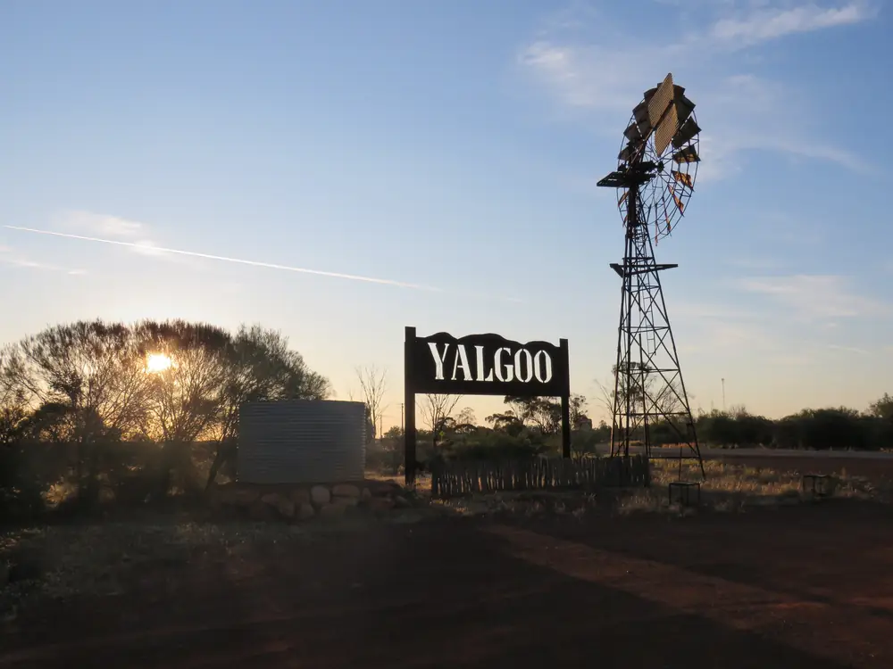
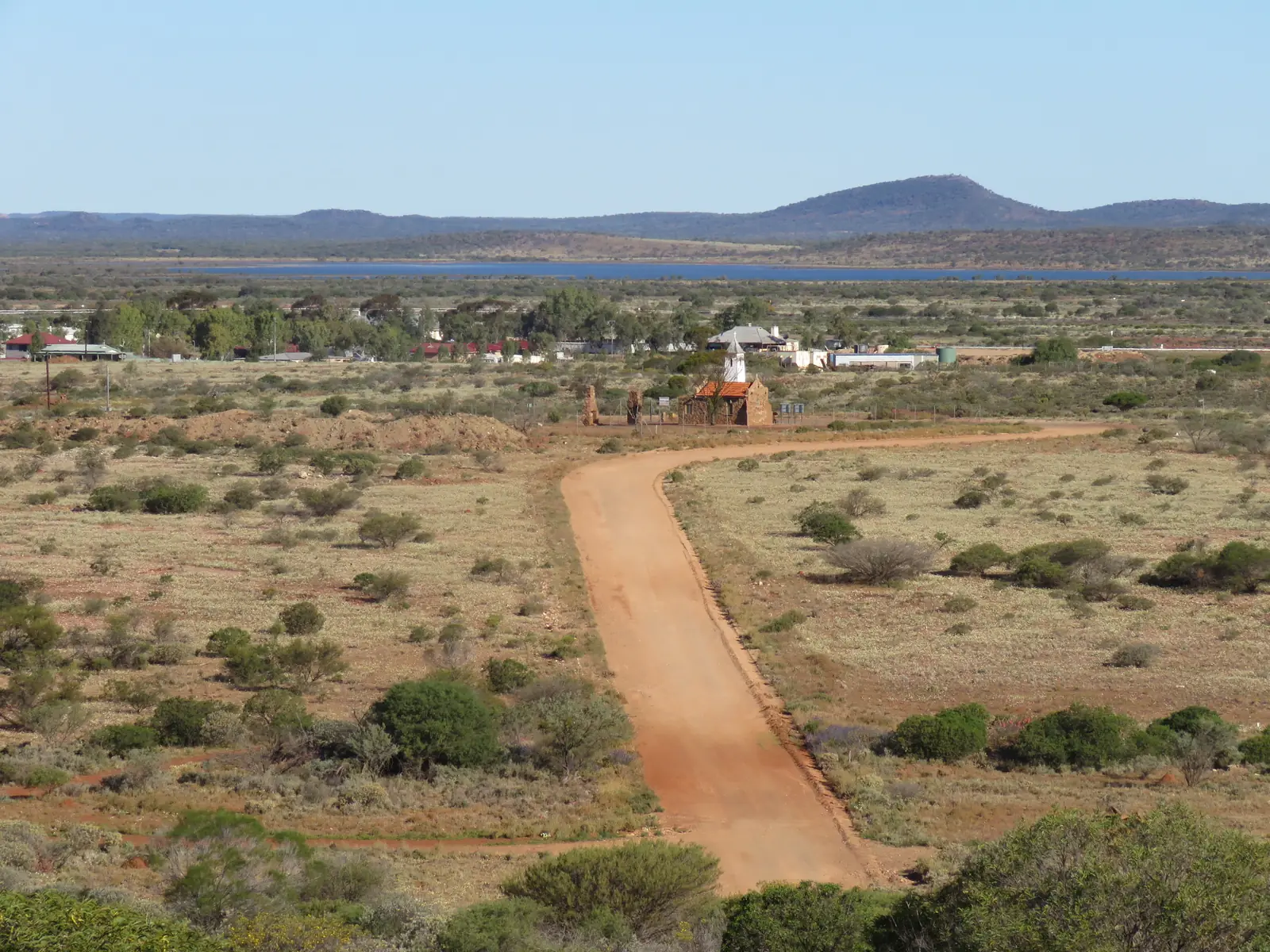
Yalgoo entrance sign on the eastern end of town, October 2025 01Photo: Calistemon · CC BY-SA 4.0 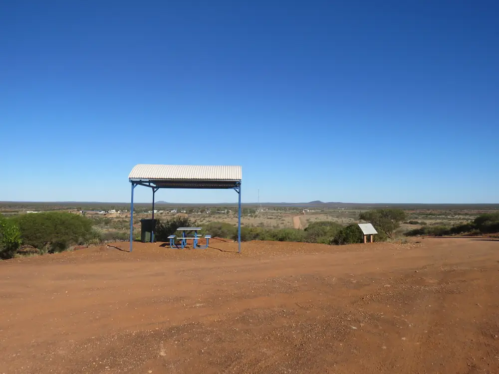
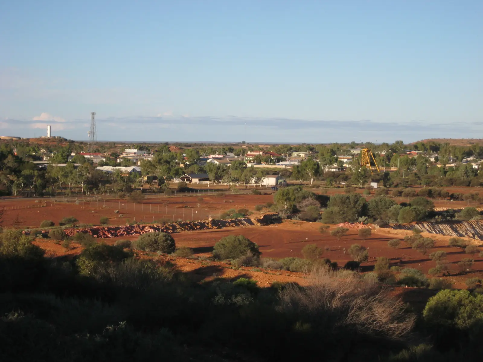
Yalgoo Lookout with the town in the background, September 2021Photo: Calistemon · CC BY-SA 4.0
Yalgoo sits in the Murchison inside the Golden Outback hub, the seat of the Shire of Yalgoo. Australia’s Golden Outback places the town on the Geraldton to Mount Magnet Road, east of Mullewa, with other access from the Morawa Yalgoo Road or the Yalgoo Ninghan Road. The shire History page puts it 497 km north of Perth, a tiny settlement on the road from Geraldton to Mount Magnet. This is Murchison gold-and-pastoral country between Geraldton, Paynes Find and Mount Magnet — not a Wheatbelt suburb and not a coastal town.
Golden Outback describes sealed access into the townsite. The shire tourism page is explicit that most Gascoyne Murchison Outback Pathways are gravel, so check the Main Roads WA travel map after rain before you leave the Geraldton–Mount Magnet Road. The Australian Bureau of Statistics does not publish a 2021 Urban Centre (UCL) named Yalgoo. Use suburbs-and-localities SAL51662: 313 people.
Where it is, and how far
Yalgoo is west of Mount Magnet and east of Mullewa and Geraldton on the regional road network Golden Outback names. Paynes Find is the shire’s other community, renowned on that page for wildflowers and the Paynes Find Gold Battery. A separate Yalgoo–Paynes Find kilometre was not on the sourced pages, so this hub does not invent one.
| Place | Distance or time from Yalgoo (sourced) |
|---|---|
| Perth | 497 km north (shire History page); six hours’ drive (caravan-park page); 6.5 hours (Golden Outback chapel listing) |
| Geraldton | two hours east from Geraldton on the caravan-park page |
| Mount Magnet | on the Geraldton–Mount Magnet Road (Golden Outback); a kilometre figure was not on that page |
| Jokers Tunnel | 10 km south (shire Jokers Tunnel page) |
| Paynes Find | same shire; kilometre not on the sourced Golden Outback or shire attraction pages |
Sandstone and Meekatharra are Murchison neighbours on this site, not 20-minute side roads. The Perth to Darwin drive uses the Great Northern Highway through Mount Magnet rather than treating Yalgoo as a default Darwin waypoint; Yalgoo is the Geraldton–Magnet alternative.
Facts at a glance
Population. Australian Bureau of Statistics 2021 Census, Suburbs and Localities SAL51662 Yalgoo: 313 people. Median age 34. Sex split 71.7% male / 28.3% female. Aboriginal and/or Torres Strait Islander people 63 (20.1%); Indigenous status not stated 44.4%. 27 families, 92 private dwellings. Local government area LGA59350: 340 people. No UCL. The shire History page separately describes Yalgoo town itself as around 120 people, with 400 throughout the shire — that is shire wording, not a Census geography. The SAL figure can include mine-related population beyond the main street. Use the Yalgoo SAL QuickStats for the locality.
Climate. Bureau of Meteorology YALGOO, 007091, commenced 1896, location 28.34°S, 116.68°E, elevation 318 m, closed 28 July 2026, latest available data 31 July 2015. Mean maximum temperature (78 years, 1897–1975): January 37.2 °C, July 18.2 °C, annual 27.9 °C. Mean minimum: January 20.7 °C, July 6.2 °C, annual 13.2 °C. Mean rainfall (103 years, 1896–2014): annual 258.0 mm; June 41.3 mm wettest mean month; November 8.0 mm driest. Full columns: BOM Yalgoo. For a still-open nearby airfield, use Mount Magnet Aero, 007600. See Yalgoo weather.
Visitor information. There is no separate VIC building named on the sourced Golden Outback page. The Yalgoo Caravan Park page places a tourist information centre in the park on Gibbons Street, 0472 830 088, cpark@yalgoo.wa.gov.au. Shire office, 37 Gibbons Street, (08) 9962 8042, pa@yalgoo.wa.gov.au. Chapel key: Golden Outback says ask the shire office during office hours.
Shire area. History page: approximately 33,257.9 square kilometres. Original Yalgoo Road District gazetted 1896.
Traditional Owners
The shire History page discusses the town name’s Aboriginal origins without naming a single nation for the townsite. Some sources, that page says, claim yalguru meaning blood, suggesting initiation rites; others suggest Eyalgru meaning bloodwood. The Courthouse Museum page mentions Aboriginal artefacts from the local area in the displays. This guide follows those official sentences rather than flattening several language groups onto one plaque label. Confirm current wording at 37 Gibbons Street. Buy art from a named art centre if one is open — the shire lists Yalgoo Art Culture Centre among community pages — not from an unnamed roadside stall.
History
The shire History page is the sourced town story. Europeans passed through as early as 1854; pastoralists moved in during the 1870s. In 1892 five prospectors — Knight, Parsons, Rice, Moxon and Evans — discovered gold and established the Emerald Reward Mine behind the old shire offices. Yalgoo was declared a separate goldfield in 1895. By the following year it was a thriving town with seven hotels serving a tent city. The railway from Mullewa opened in 1898 and closed in 1978; the station on the south side of town remains. The Emerald Reward mine closed in 1908. Golden Outback repeats the 1890s alluvial-gold founding and names the railway station, cemetery, Monsignor Hawes, the convent chapel, Jokers Tunnel and the Courthouse Museum as reminders.
The Dominican Chapel of St Hyacinth is the Monsignor John Hawes building. The shire chapel page: Hawes designed the wood and stone chapel in 1920 for the Dominican Sisters and travelled by horseback from Mullewa to oversee construction. Golden Outback’s chapel listing says the convent chapel was built in 1919. Both official sentences are printed here rather than merged into one year. The courthouse, the shire museum page says, was moved from Day Dawn near Cue in 1921. The old police station and gaol next door were built in 1896.
Things to do
Dominican Chapel of St Hyacinth — rubble stone, tiled roof, shingled bell tower on Golden Outback’s listing; key from the shire office during office hours. Do not treat a locked door as a 24-hour museum.
Railway Station Complex — south side of town on the History page. The shire railway page: largest station on the Murchison line, Public Works Department under Chief Architect John Grainger; toilet facilities and an information bay adjacent; currently undertaking renovations; call the shire for opening hours.
Courthouse Museum — gold-rush photographs, domestic items, Aboriginal artefacts; restored police station and gaol next door. Call the shire for hours.
Jokers Tunnel — 10 km south, carved through rock by the Joker mining syndicate; daylight hours; no disabled access on that page; fauna.
Paynes Find Gold Battery — Golden Outback and the shire attractions list: established 1911, described as the only working battery in the State. That is a Paynes Find day, not a main-street Yalgoo stop. Confirm tours locally.
Gascoyne Murchison Outback Pathways — Yalgoo is a stop on the Wool Wagon Pathway and the Miner’s Pathway. Shire: majority gravel; 4WD strongly recommended for the Kingsford Smith Mail Run and Wool Wagon Pathway.
Wildflowers late July to September — white, cream, yellow and pink everlastings on both shire tourism and Golden Outback pages. Emus in town, wedge-tailed eagles, goannas and kangaroos are named on the tourism page without a guaranteed sighting.
Station stays and a meteorite crater on Dalgaranga Station sit on the attractions list. Confirm access; a crater kilometre from town was not on that listing.
A fuller order of a day: things to do in Yalgoo.
Where to stay
Golden Outback names hotel rooms, caravan parks, camping sites and working cattle station stays. The shire caravan-park page is the named in-town stay. The station-stay page names Nalbarra Station, Melangata Station, Gabyon Station and Tardie Station. A June 2026 shire public notice concerned the lease of the Yalgoo Hotel — treat the hotel as a type to confirm at the shire, not as a walk-up guarantee.
- Shire park: Yalgoo Caravan Park, Gibbons Street, 0472 830 088
- How to choose: Yalgoo accommodation
- Parks: Yalgoo caravan parks
- Feature your business
If Yalgoo is full, Mount Magnet is the next named highway-style town on this site to the east.
Caravan and camping
The caravan park on Gibbons Street is the named van option: powered and unpowered sites, drive-through sites, rammed-earth units, dump point, camp kitchen, pets welcome on the park page (not in units). Station stays are separate. Jokers Tunnel and the chapel are not camps. After rain, pathway gravel is a Main Roads and shire-conditions question. Read Yalgoo caravan parks and caravanning in the outback.
Fuel and services
The shire Fuel and Supplies page names a 24-hour self-serve fuel station at the old railway station, Piesse Street, operated by Refuel Australia, (08) 9920 8000. Cards with a PIN; the page names Caltex as the branding on that listing. Confirm it is still offered. This guide does not invent a supermarket. The shire contact block also names a nursing post, police station, post office and St John Ambulance among community service pages. Fill here before gravel pathways. See fuel, permits and road conditions.
Road access
Geraldton–Mount Magnet Road is the sealed spine Golden Outback names through Yalgoo. Other approaches: Morawa Yalgoo Road, Yalgoo Ninghan Road. Main Roads WA travel map, 138 138.
East: Mount Magnet, then the Great Northern Highway toward Cue and Meekatharra if you are joining the Perth to Darwin run. West: Mullewa and Geraldton. South-east toward Paynes Find is a shire road, not a default Darwin highway. Outback Pathways are mostly gravel. Do not drive around closed signs to keep a chapel visit.
Nearby parks and towns
Explore Parks WA did not return a national park inside Yalgoo townsite in this research. Nature stops are shire sites: Jokers Tunnel, wildflower verges in season, Dalgaranga crater on the attractions list.
On this site:
- Mount Magnet — east on the Geraldton–Magnet road
- Cue — further east then north on the Great Northern Highway; the courthouse in Yalgoo came from Day Dawn
- Meekatharra — Murchison service town further north
- Sandstone — eastern Goldfields–Murchison neighbour
Paynes Find is the shire partner town on Golden Outback’s page.
When to go, and how long
January mean maximum 37.2 °C at the closed Yalgoo station is hot for a chapel-and-courthouse walk at midday. July 18.2 °C mean maximum is the walking season; July mean minimum 6.2 °C is why a van night needs a layer. Annual rain 258.0 mm on the 1896–2014 table still includes winter-wet months (June 41.3 mm mean). Late July to September is the sourced wildflower window.
Two hours covers chapel exterior, railway station photograph and the courthouse if it is open. A night at the caravan park lets you add Jokers Tunnel. Two nights only if a station stay or Paynes Find battery tour is actually running. See Yalgoo weather. Operators: feature your business.
Plan this trip
Tell us the dates, who you are travelling with and where you need help. We reply with planning notes for Yalgoo — we are not a booking agent.
Events and road-conditions newsletter
Occasional notes on outback festivals, race days and official road-condition sources — not a daily blast. We use these details only to send the newsletter.
Western Australia · Golden Outback
Things to do in Yalgoo
Things to do in Yalgoo: Dominican Chapel of St Hyacinth, railway station complex, Courthouse Museum, Jokers Tunnel, Paynes Find Gold Battery and Gascoyne Murchison pathways.
Read · 4 min
Western Australia · Golden Outback
Yalgoo accommodation
Where to stay in Yalgoo: Yalgoo Caravan Park units and sites named by the shire, plus Nalbarra, Melangata, Gabyon and Tardie station stays. Confirm the hotel and park before you arrive.
Read · 4 min
Western Australia · Golden Outback
Yalgoo caravan parks
Camping in Yalgoo: Yalgoo Caravan Park powered, unpowered and drive-through sites named by the shire, plus station-stay camping. Confirm at the park on Gibbons Street.
Read · 4 min
Western Australia · Golden Outback
Yalgoo weather
Yalgoo climate from BOM Yalgoo (007091): January mean max 37.2 °C, July 18.2 °C, annual rainfall 258.0 mm. Station closed 2026; temperature means 1897–1975. Mount Magnet Aero remains a nearby open airfield table.
Read · 4 min
Frequently asked questions
What is Yalgoo’s population?
313 people at the 2021 Census for suburbs-and-localities SAL51662. Median age 34. The Shire of Yalgoo local government area counted 340 (LGA59350). The ABS does not publish a 2021 Urban Centre (UCL) named Yalgoo on the QuickStats pages used here. The shire History page separately describes the town itself as around 120 people.
How far is Yalgoo from Perth and Geraldton?
The Shire of Yalgoo History page puts the town 497 km north of Perth on the road from Geraldton to Mount Magnet. The shire caravan-park page describes a comfortable six hours’ drive north of Perth or just two hours east of Geraldton. Golden Outback’s chapel listing says 6.5 hours’ drive north of Perth.
What is the weather like in Yalgoo?
BOM Yalgoo (007091) has a January mean maximum of 37.2 °C, a July mean maximum of 18.2 °C and annual mean rainfall of 258.0 mm. Temperature means use 1897–1975. Rainfall means use 1896–2014. The station is listed closed 28 July 2026, with latest available data 31 July 2015. Nearby open airfield temperatures are at Mount Magnet Aero.
Can I go inside the Dominican convent chapel?
Australia’s Golden Outback says the chapel can be well appreciated from outside, and that the key is available from the Yalgoo Shire Office during office hours if you want to look inside. Confirm at 37 Gibbons Street, (08) 9962 8042, rather than assuming the door is open.
Is Yalgoo on a sealed highway?
Golden Outback places Yalgoo on the Geraldton to Mount Magnet Road, east of Mullewa, with other access from the Morawa Yalgoo Road or the Yalgoo Ninghan Road. The shire tourism page warns that most Gascoyne Murchison Outback Pathways are gravel. Check the Main Roads WA travel map.
Sources and further reading
Facts on this page were checked against these primary and official sources. Conditions change — confirm before you travel or buy.
- Midwest hospitals and health services — WA Country Health Service
- Yalgoo 2021 Census QuickStats (SAL51662) — Australian Bureau of Statistics
- Yalgoo 2021 Census QuickStats (LGA59350) — Australian Bureau of Statistics
- Climate statistics for Yalgoo (007091) — Bureau of Meteorology
- Climate statistics for Mount Magnet Aero (007600) — Bureau of Meteorology
- History — Shire of Yalgoo — Shire of Yalgoo
- Tourism — Shire of Yalgoo — Shire of Yalgoo
- Attractions — Shire of Yalgoo — Shire of Yalgoo
- Dominican Chapel of St Hyacinth — Shire of Yalgoo
- Railway Station Complex — Shire of Yalgoo
- Courthouse Museum — Shire of Yalgoo
- Jokers Tunnel — Shire of Yalgoo
- Yalgoo Caravan Park — Shire of Yalgoo
- Station Stay Holidays — Shire of Yalgoo
- Fuel and Supplies — Shire of Yalgoo
- Yalgoo and Paynes Find — Australia’s Golden Outback — Australia's Golden Outback
- Chapel of The Dominican Convent — Australia’s Golden Outback — Australia's Golden Outback
- Main Roads WA travel map — Main Roads Western Australia