At a glance
Sourced facts only. Distances and services change — confirm before you travel.
- Managing agency
- Parks and Wildlife Service, Department of Biodiversity, Conservation and Attractions (WA), in joint management with Traditional Owners
- Size
- 47,655 hectaresDEC 2009–10 Annual Report area used in published park tables. Parks WA's current visitor page does not reprint a size.
- Nearest towns
- Exmouth (gateway). Coral Bay is the southern Ningaloo village in the Shire of Carnarvon — a separate hub on this site.
- Access
- Sealed Minilya–Exmouth Road to the cape. Yardie Creek Road serves the west-coast beaches and campgrounds. Charles Knife Canyon and Shothole Canyon are unsealed drives. Parks WA: One K and Boat Harbour campgrounds south of the Yardie Creek crossing are 4WD only.
- Traditional Owners
- Baiyungu, Thalanyji and Yinigurdira people (Parks WA acknowledgement for Cape Range National Park and adjoining Ningaloo Marine Park)
- Best time to visit
- Parks WA: walks only April–September; summer can exceed 45 °C. Whale sharks March–August (Parks WA Ningaloo). Humpbacks June–November on the Ningaloo Marine Park page; Tourism WA prints August–October — this guide prints both.
Climate
Monthly means from the Bureau of Meteorology station Learmonth Airport (005007). This is not a forecast. Nearest open BOM table for the cape — not in Exmouth town. Australia’s Coral Coast puts Learmonth Airport 25 minutes outside town. Temperature 52 years (1975–2026); rainfall 62 years (1945–2026). Latest available data 14 November 2026. Elevation 5 m. Do not blend with Onslow Airport or Carnarvon Airport.
| Month | Mean max (°C) | Mean min (°C) | Rainfall (mm) |
|---|---|---|---|
| Jan | 38.1 | 23.1 | 29.2 |
| Feb | 37.6 | 24.1 | 38.1 |
| Mar | 36.6 | 23.1 | 42.5 |
| Apr | 33.4 | 20.4 | 19.1 |
| May | 28.7 | 16.0 | 40.8 |
| Jun | 24.9 | 13.2 | 42.9 |
| Jul | 24.5 | 11.4 | 20.4 |
| Aug | 26.6 | 12.3 | 11.8 |
| Sep | 29.7 | 13.9 | 2.4 |
| Oct | 33.0 | 16.4 | 1.4 |
| Nov | 34.6 | 18.5 | 1.8 |
| Dec | 37.1 | 21.0 | 5.6 |
Cape Range National Park in pictures
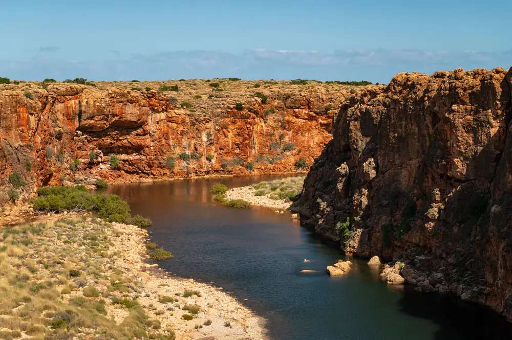
Yardie Creek gorge in Cape Range National ParkPhoto: Joshua Tagicakibau · CC BY-SA 4.0 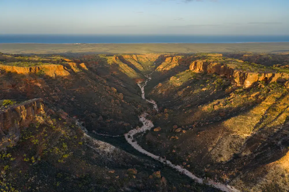
Charles Knife Canyon in Cape Range National Park near ExmouthPhoto: Joshua Tagicakibau · CC BY-SA 4.0 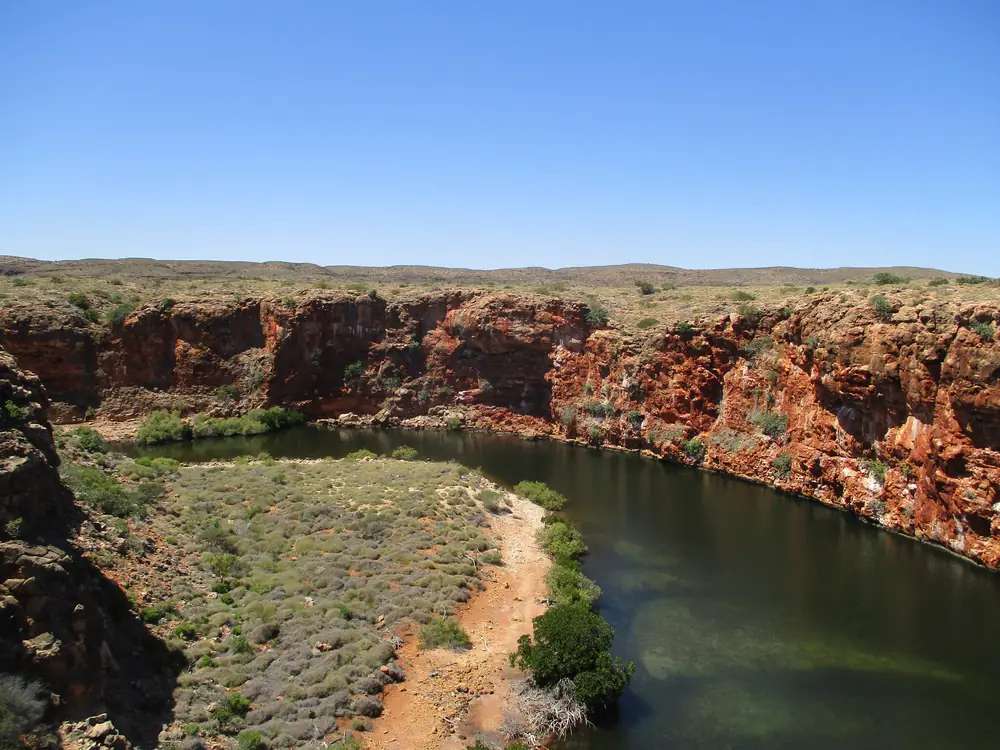
Yardie Creek water and cliffs in Cape Range National ParkPhoto: Gfievet · CC BY-SA 4.0 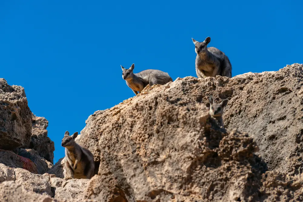
Black-flanked rock-wallabies at Yardie Creek in Cape Range National ParkPhoto: Joshua Tagicakibau · CC BY-SA 4.0
Parks WA recognises and acknowledges Baiyungu, Thalanyji and Yinigurdira people as the Traditional Owners of Cape Range National Park and adjoining Ningaloo Marine Park. The department says it is proud to be in joint management with Traditional Owners to look after these areas.
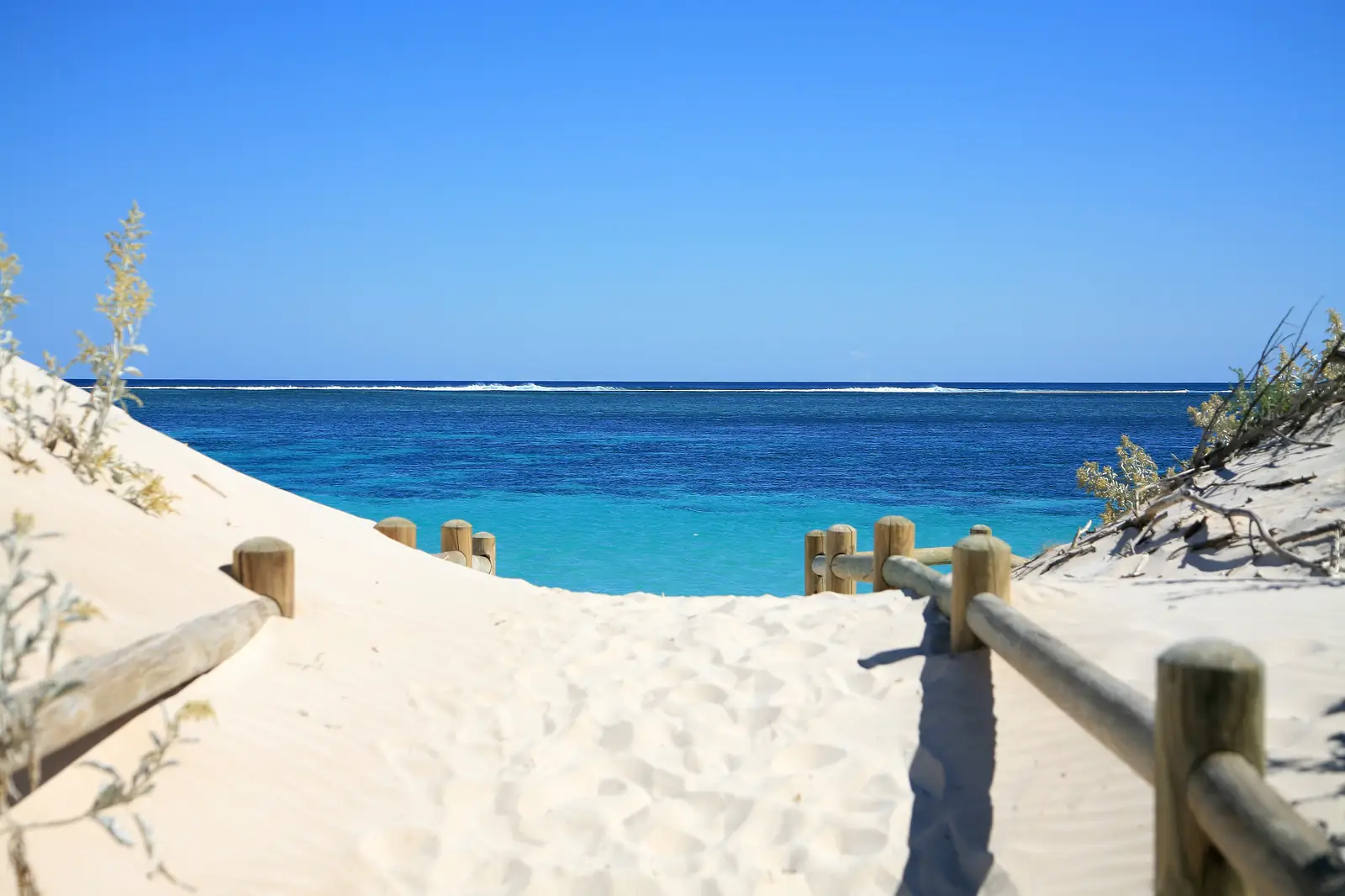
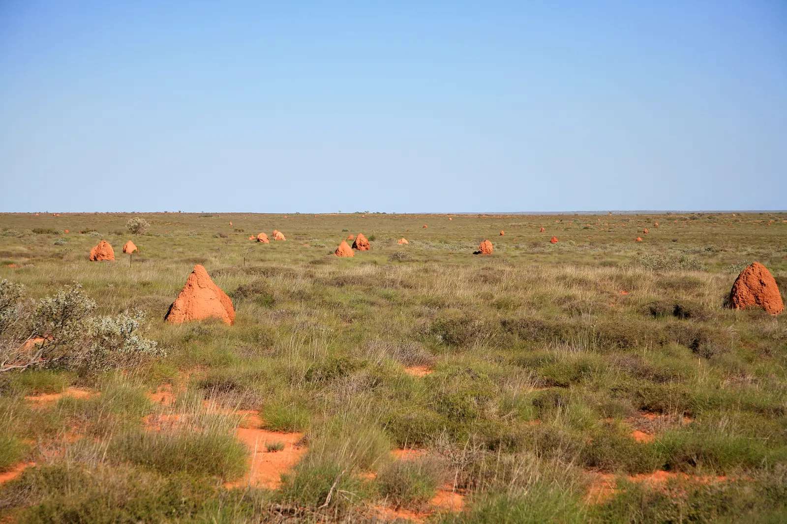
Cape Range is the limestone range and arid coastal plain on the western side of the North West Cape, inside the Ningaloo Coast World Heritage Area. Parks WA: raw, natural, nature at its best — the range adjoins the waters of Ningaloo Marine Park. Exmouth is the service town. Coral Bay is the southern village on the same reef, not a suburb of this park. This page is the national park, not the marine park; snorkel sites sit in both stories because the reef starts metres from these beaches.
Highlights
Parks WA names these as the reasons people come:
- Yardie Creek — a permanent water source between sheer cliffs (Yardie Creek Gorge). Explore on foot or join a boat tour. Parks WA: a visit is a must.
- Turquoise Bay — snorkel close to shore, coral and fish, an exceptionally beautiful beach and bay.
- Oyster Stacks — five isolated islets on the reef; snorkel at high tide only.
- Charles Knife Canyon and Shothole Canyon — unsealed drives into the eastern canyons. Parks WA: park entry fees do not apply on those two drives.
- Milyering Discovery Centre — stop for Cape Range and Ningaloo information. Phone listed on Parks WA: +61 8 9947 8070.
- Mangrove Bay — bird hide as the tide moves.
- Bloodwood Creek — snorkel, swim, whale watching; lookout north of the carpark.
- Osprey Bay — swim, snorkel, kayak; bookable campground.
Wildlife Parks WA lists for the range: kangaroos, emus, echidnas, birds and black-flanked rock wallabies.
Walks and drives
| Trail or drive | Parks WA notes |
|---|---|
| Yardie Gorge Trail | 2 km walk overlooking Yardie Creek; black-footed wallabies, euros, red kangaroos; views to Ningaloo Reef |
| Mandu Mandu Walk | 3 km loop along the gorge rim then into the gorge; steep in sections; go early; rock wallabies |
| Charles Knife Canyon | Winding unsealed road from the main road south of Exmouth to Charles Knife Lookout |
| Shothole Canyon | Unsealed road along the canyon floor in one of the most rugged areas of the park |
| Tantabiddi, Bundegi, Osprey kayak trails | Ningaloo Marine Park kayak moorings; see the Ningaloo Coast page |
Wear suitable footwear. Parks WA: if taking an extended walk, let someone know your expected time of return. Consider a PLB.
Camping
Parks WA lists beach and dune campgrounds in the park, bookable (camping fees apply, separate from entry):
- Osprey Bay, Yardie Creek, Kurrajong, Neds, North Mandu, Bungarra, Mesa, Tulki Beach
- One K (about 1 km south of the Yardie Creek crossing) and Boat Harbour (3 km south of Yardie Creek) — 4WD only
- North Kurrajong — reserved for outdoor education providers and commercial tour operator groups
- Sal Salis — privately operated eco-tent retreat; entry for guests only
This guide does not invent extra camps or dollar camping rates Parks WA did not print on the park page. Book on Park Stay WA and read alerts before you treat a campground as open. Nearby Nyinggulara National Park and Warroora Coast campgrounds have had cyclone-damage closures on the same Parks WA alert stack — those are not Cape Range sites; check the named park.
No dogs. No drinking water assumed — carry it.
Safety and access
Parks WA safety information covers bushwalking, swimming, surfing, fishing, paddling, kayaking, snorkelling and diving.
- Heat. Temperatures can soar to over 45 °C in summer. Walks April–September only.
- Western Shield. 1080 baiting is ongoing. 1080 is poisonous to humans and will kill domestic cats and dogs. Pets are not permitted.
- Reef. When you step from a Cape Range beach into the water you are in Ningaloo Marine Park. Follow sanctuary-zone signs. See the Ningaloo Coast page for zoning and wildlife windows.
- Roads. The highway onto the cape is sealed. After rain or a cyclone warning, Main Roads WA still matters for floodways and whether canyon tracks are sensible.
Best time
April–September is Parks WA’s walk window and the cooler stretch on the Learmonth Airport table (July mean maximum 24.5 °C). March–August is the Parks WA whale-shark window on the adjoining marine park. Humpbacks: Parks WA Ningaloo prints June–November; Tourism WA prints August–October. Turtle hatchlings: Parks WA February–March. Summer is a heat and cyclone-season packing problem, not a gorge-walk season.
BOM Learmonth is an airport 25 minutes from Exmouth, not a beach thermometer. Do not blend it with Coral Bay (no BOM station of that name on the WA list used for this site’s rebuild) or Carnarvon Airport.
Nearby towns and parks
- Exmouth — fuel, hospital, Ningaloo Visitor Centre
- Ningaloo Coast — marine park, World Heritage reef, no park entry fee
- Coral Bay — southern Ningaloo village
- Carnarvon — Gascoyne River town further south
- Kennedy Range — inland sandstone plateau, not this cape
Plan the cape with the outback Western Australia road trip and outback safety.
Plan this trip
Tell us the dates, who you are travelling with and where you need help. We reply with planning notes for Cape Range National Park — we are not a booking agent.
Frequently asked questions
Do I need a 4WD for Cape Range National Park?
Most west-coast beaches, Turquoise Bay, Yardie Creek and the main campgrounds are reached on Yardie Creek Road. Parks WA lists One K and Boat Harbour campgrounds, south of the Yardie Creek crossing, as 4WD only. Charles Knife Canyon and Shothole Canyon are unsealed canyon drives. Check Parks WA alerts and Main Roads WA before you go.
How much is entry to Cape Range National Park?
Parks WA: standard park entry fees apply. A standard vehicle (12 or fewer occupants) is $17, concession $10; a large vehicle is $8 per person, concession $3.50; a motorcycle is $10 with no concession. Camping fees are extra and bookable. Charles Knife Canyon and Shothole Canyon are listed as not attracting park entry fees.
Can I snorkel at Turquoise Bay without a boat?
Yes. Parks WA describes Turquoise Bay as a place to snorkel with coral and fish close to shore, on an exceptionally beautiful beach. It sits in Cape Range National Park beside Ningaloo Marine Park. Park entry fees apply for the national park. Follow tide and current signs — Parks WA flags a drift at Turquoise Bay on visitor material.
Are dogs allowed in Cape Range National Park?
No. Parks WA: no dogs or other pets. Western Shield 1080 baiting is underway in and around the park; 1080 will kill domestic dogs and cats.
When is the best time to walk in Cape Range?
Parks WA: walks should only be attempted between April and September. Temperatures can soar to over 45 °C in summer. BOM Learmonth Airport’s January mean maximum is 38.1 °C; July 24.5 °C.
Sources and further reading
Facts on this page were checked against these primary and official sources. Conditions change — confirm before you travel or buy.
- Cape Range National Park — Parks and Wildlife Service, DBCA
- Ningaloo Marine Park — Parks and Wildlife Service, DBCA
- Nyinggulu (Ningaloo) Coast visitor guide — Parks and Wildlife Service, DBCA
- Climate statistics for Learmonth Airport (005007) — Bureau of Meteorology
- Park alerts — Parks and Wildlife Service, DBCA
- Main Roads WA travel map — Main Roads Western Australia