At a glance
Sourced facts only. Distances and services change — confirm before you travel.
- Population
- 529 people (UCL121008, 2021 Census)
- Local government
- Moree Plains Shire
- Traditional Owners
- Gomeroi (Visit NSW Boggabilla page)Tourism Moree records the Garriya (Rainbow Serpent) story at Boobera Lagoon, west of Boggabilla — culturally significant water, not a swimming hole.
- Nearest regional city
- Moree, 115 km south (Visit NSW). Goondiwindi is 13 km north on that page (8.5 km on Moree Plains Shire mapping) — Queensland, no town page on this site.
- Nearest fuel
- Confirm bowsers in Boggabilla or Moree; this guide does not name a brand
- Mobile coverage
- Check Telstra and Optus coverage maps before travel; do not assume a signal on Macintyre floodplain roads.
- Best time to visit
- May–September (cooler BOM Moree Aero mean maxima). Check Live Traffic NSW when the Macintyre is up.
Climate
Monthly means from the Bureau of Meteorology station Moree Aero (053115). This is not a forecast. Open. Nearest complete open NSW table — BOM publishes no Boggabilla climate-averages table. Commenced 1995. Elevation 213 m. Rainfall 30 years (1995–2026). Goondiwindi Airport 041521 is closed 1 August 2015; do not blend the two.
| Month | Mean max (°C) | Mean min (°C) | Rainfall (mm) |
|---|---|---|---|
| Jan | 34.6 | 20.6 | 73.8 |
| Feb | 33.4 | 19.8 | 65.4 |
| Mar | 31.3 | 17.6 | 60.2 |
| Apr | 27.3 | 12.8 | 25.4 |
| May | 22.7 | 8.5 | 32.7 |
| Jun | 19.0 | 6.0 | 35.5 |
| Jul | 18.4 | 4.6 | 34.3 |
| Aug | 20.7 | 5.5 | 26.8 |
| Sep | 24.8 | 9.0 | 33.5 |
| Oct | 28.4 | 13.1 | 51.7 |
| Nov | 31.0 | 16.5 | 74.6 |
| Dec | 33.1 | 18.7 | 64.3 |
Boggabilla in pictures
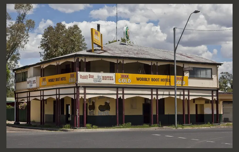
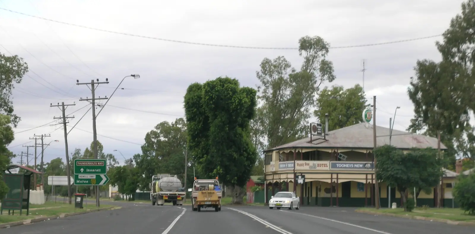
Boggabilla Wobbly Boot Hotel-1Photo: Sheba_Also 43,000 photos · CC BY-SA 2.0 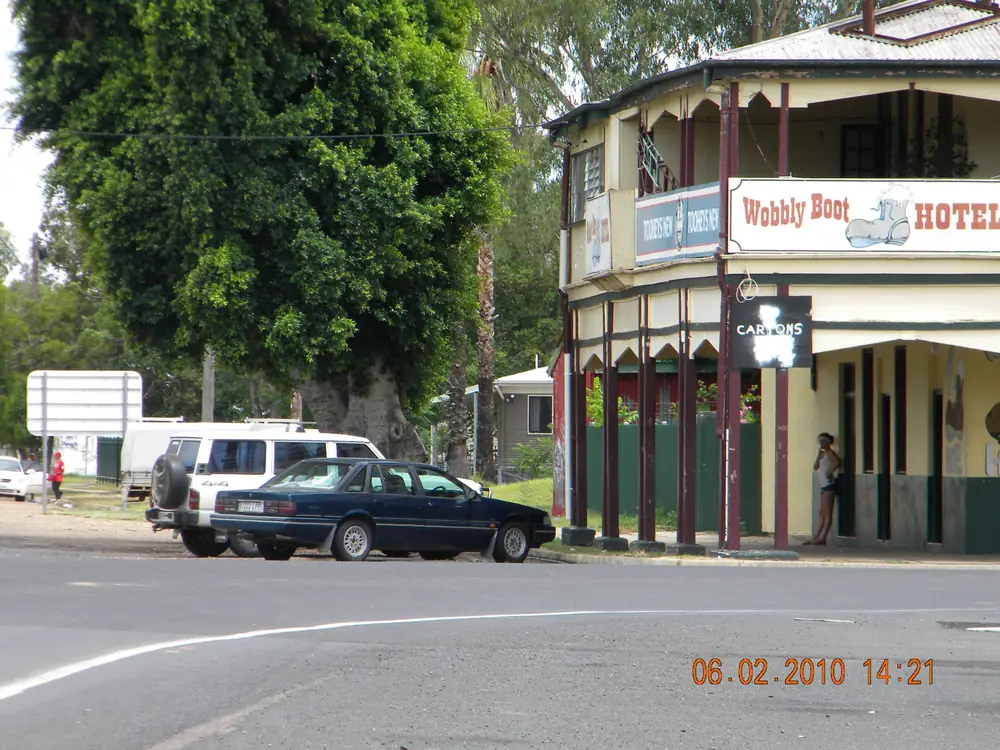
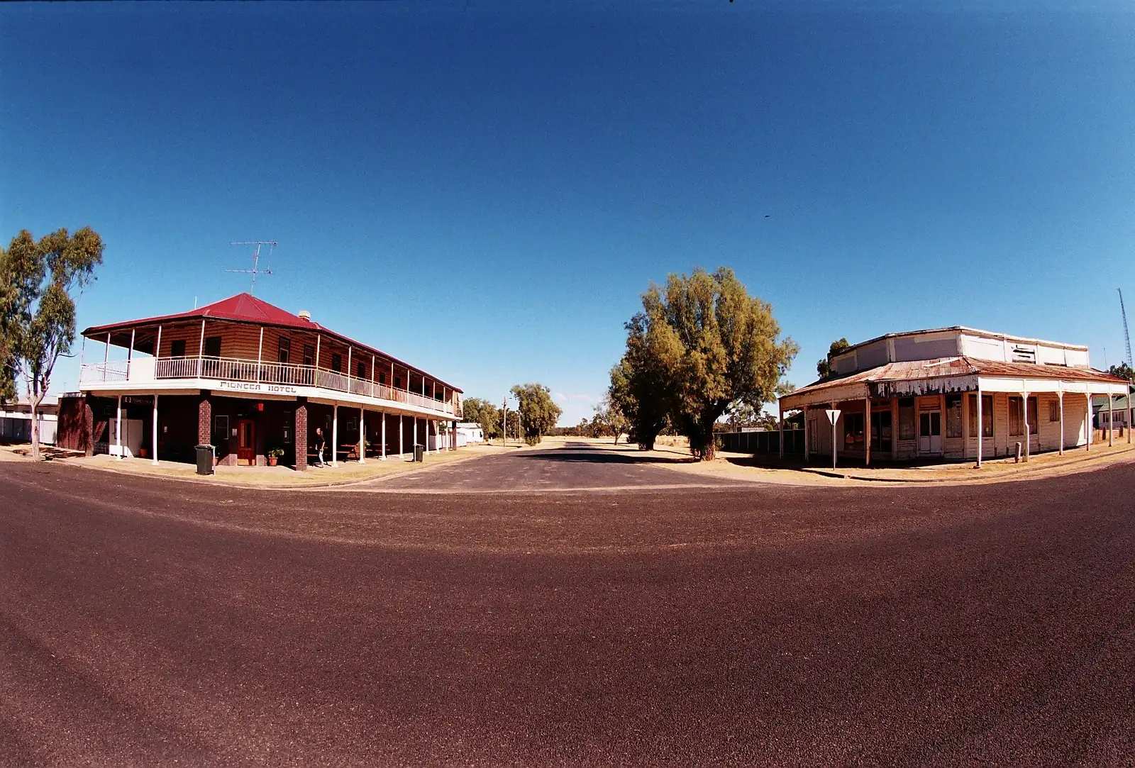
Boggabilla PubPhoto: Lobster1 · CC BY-SA 3.0 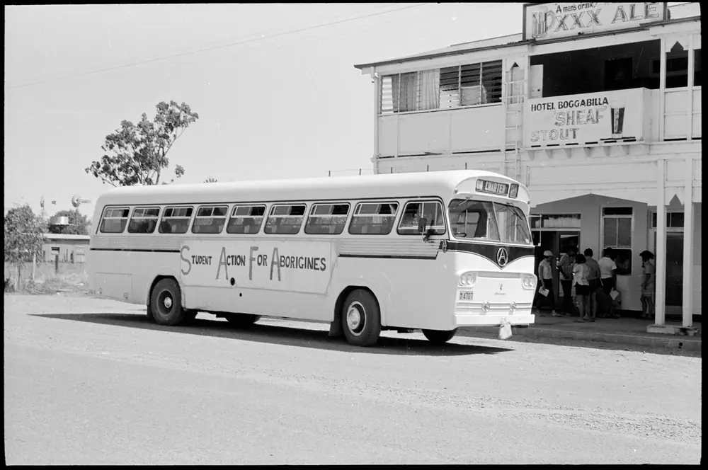
Student Action for Aborigines bus outside the Hotel Bogabilla in February 1965Photo: Noel Hazard · CC BY 4.0
This page is the NSW town. Boggabilla sits on the Macintyre River in New England North West, opposite Goondiwindi in Queensland. Visit NSW puts it 13 km south of Goondiwindi and 115 km north of Moree. Moree Plains Shire’s mapping used in this rebuild also puts Goondiwindi 8.5 km from Boggabilla and Toomelah 14 km. Those are two official border-gap figures. Goondiwindi has no town page on this site. Do not look for /outback-towns/queensland/goondiwindi. Name the Queensland town; do not invent a path.
The 2021 Census Urban Centre (UCL121008) is the town count: 529 people, median age 38, sex split 52.7% male / 47.3% female. 93 families, 238 private dwellings. Aboriginal and Torres Strait Islander people 230 (43.5%). The wider SAL10440 locality is 1,022 people, median age 36, Indigenous 418 (40.9%). Visit NSW’s 650 / 58% Indigenous wording is not the Census. This hub uses ABS.
Where it is, and how far
Boggabilla is a NSW border town on the Macintyre, in Moree Plains Shire, on the Newell Highway corridor north of Moree. Boomi is a Macintyre locality west of here on that town’s own guide (Visit NSW: about one hour west of Goondiwindi). Mungindi is the Barwon/Macintyre border town further west. Pilliga sits south toward the forest. This hub does not invent Boggabilla–Boomi or Boggabilla–Mungindi kilometres those pages do not print as a pair.
Toomelah is a community 14 km from Boggabilla on Moree Plains mapping — named as a neighbour, not a tourism product this hub will invent.
| Place | Distance from Boggabilla (sourced) |
|---|---|
| Goondiwindi (Qld) | 13 km (Visit NSW Boggabilla page); 8.5 km (Moree Plains Shire mapping) — two official figures; no town page |
| Moree | 115 km south (Visit NSW Boggabilla page) |
| Toomelah | 14 km (Moree Plains Shire mapping) |
| Moree Aero (BOM open station) | climate table for this town; Visit NSW’s 115 km is the town figure, not BOM’s kilometre |
| Goondiwindi Airport (BOM, closed) | 28.52°S 150.33°E — closest named table, not a town drive time |
Facts at a glance
Population. ABS 2021 UCL121008 (town): 529. Median age 38. Indigenous 230 (43.5%). UCL QuickStats. Wider SAL10440: 1,022. SAL QuickStats. Do not use Visit NSW’s 650 / 58% as Census.
Climate. BOM does not publish a Boggabilla row. Closest named table: GOONDIWINDI AIRPORT, 041521, 28.52°S, 150.33°E, elevation 218 m, commenced 1991, closed 1 August 2015. Mean maximum (22 years, 1991–2015): January 34.0 °C, July 19.1 °C, annual 27.2 °C. Mean rainfall (20 years, 1991–2015): annual 619.4 mm. Open NSW station: MOREE AERO, 053115, 29.49°S, 149.85°E, elevation 213 m, open: January 34.6 °C, July 18.4 °C, annual rainfall 577.2 mm (30 years, 1995–2026). See Boggabilla weather.
Visitor information. Visit NSW’s Boggabilla page. Moree Visitor Information Centre, 67 Alice Street, (02) 6757 3350, on this site’s Moree guide. Moree Plains Shire Council. Live Traffic NSW.
Traditional Owners
Visit NSW’s Boggabilla page uses Gomeroi and the wording “full of creeks”. This hub repeats that Visit NSW sentence. It does not flatten other language names onto the townsite.
Tourism Moree records the Garriya (Rainbow Serpent) story at Boobera Lagoon, west of Boggabilla, north of Moree. That is culturally significant water, not a swimming hole, not a listed spa attraction. If you go near it at all, treat it as Country, stay on public access, and take local advice. See visiting Country respectfully and this site’s Moree things to do.
History
Boggabilla grew as the NSW settlement on the Macintyre opposite the Queensland town of Goondiwindi. Visit NSW names Euraba Artists and Papermakers, a motel, and the Town & Country Club. Moree Plains names the Wobbly Boot Hotel. This hub does not invent a founding year, a bridge-opening date, or a visitor count. Toomelah is a community neighbour on council mapping, not a tourism strip.
Do not write this page as a second Goondiwindi. Customs, Queensland tourism desks and Queensland parks live across the river. This is NSW, Moree Plains Shire, Newell Highway north of Moree.
Things to do
Visit NSW and Tourism Moree / Moree Plains name:
- Euraba Artists and Papermakers — Visit NSW; confirm hours
- Town & Country Club and a motel — Visit NSW hospitality types, not a review
- Wobbly Boot Hotel — Moree Plains named pub
- Boobera Lagoon — west of Boggabilla; culturally significant; not a swimming hole
- Moree artesian baths — 115 km south on Visit NSW; managed pools at the Moree Artesian Aquatic Centre, not a Boggabilla spa this hub will invent
Macintyre River banks are public where signed. This is not a crocodile-free swimming review and it is not Boobera Lagoon.
See things to do in Boggabilla.
Where to stay
Visit NSW names a motel and the Town & Country Club. Moree Plains names the Wobbly Boot Hotel. This hub does not invent a room inventory or a star rating. If Boggabilla is full, Moree is 115 km south. Goondiwindi rooms sit in Queensland — named, not linked.
- How to choose: Boggabilla accommodation
- Camping detail: Boggabilla caravan parks
- Operator enquiries: feature your business
Caravan and camping
The Newell Highway is sealed. This page does not invent a Boggabilla town caravan park Visit NSW does not name. Moree and Boomi hold named parks on those hubs. Boobera Lagoon is not a campground. Read Boggabilla caravan parks.
Fuel and services
A town of 529 people (UCL) will not match Moree. This guide does not list bowser brands. Fill in Moree if you are unsure, or use named highway services you can see — do not invent a brand. Moree VIC (02) 6757 3350. Live Traffic NSW for the Newell.
Road access
Newell Highway sealed north to the border and south to Moree. Live Traffic NSW is the NSW authority. Queensland road reports apply once you cross into Goondiwindi — still no town page here. Boomi and Mungindi are Macintyre/Barwon neighbours on shire roads that can close after rain — check those towns’ own Live Traffic notes.
Nearby parks and towns
There is no national-park hub in Boggabilla’s main street on the official pages used here. Boobera Lagoon is Country, not a park swimming hole.
Towns on this site:
- Moree — 115 km south (Visit NSW)
- Boomi — Macintyre locality
- Mungindi — border town further west
- Pilliga
Named, not linked: Goondiwindi (Qld), Toomelah.
When to go, and how long
Goondiwindi Airport’s January mean maximum of 34.0 °C (closed 2015) and Moree Aero’s open-station January 34.6 °C are hot for an unshaded riverbank. July’s 19.1 °C / 18.4 °C mean maxima are the travelling season on paper. Annual rain around 580–620 mm on those two tables is enough to raise the Macintyre — Live Traffic NSW, not a swimming forecast. Boobera Lagoon does not become a picnic default in any month.
An hour covers Euraba if it is open and a pub meal if the Wobbly Boot or Town & Country Club is serving. A Moree artesian night is a Moree itinerary, 115 km south. Do not treat Goondiwindi as a NSW town hub on this site.
Operators who want a checked listing: feature your business. The listings slot on this hub stays empty until then.
Plan this trip
Tell us the dates, who you are travelling with and where you need help. We reply with planning notes for Boggabilla — we are not a booking agent.
Events and road-conditions newsletter
Occasional notes on outback festivals, race days and official road-condition sources — not a daily blast. We use these details only to send the newsletter.
New South Wales · New England North West
Boggabilla accommodation
Where to stay in Boggabilla NSW from Visit NSW and Moree Plains: motel, Town & Country Club, Wobbly Boot Hotel. Moree is 115 km south. Goondiwindi has no town page on this site.
Read · 3 min
New South Wales · New England North West
Boggabilla caravan parks
Caravan and camping around Boggabilla NSW: Visit NSW does not name a town caravan park here. Use Moree (115 km south) and Boomi. Boobera Lagoon is not a campground. Goondiwindi has no town page.
Read · 3 min
New South Wales · New England North West
Boggabilla weather
Boggabilla climate from BOM Goondiwindi Airport (041521, closed 2015): January mean max 34.0 °C, annual rain 619.4 mm. Moree Aero 053115 remains open. This is the NSW town, not a Goondiwindi hub.
Read · 3 min
New South Wales · New England North West
Things to do in Boggabilla
Boggabilla things to do from Visit NSW and Tourism Moree: Euraba Artists and Papermakers, Town & Country Club, Wobbly Boot Hotel. Boobera Lagoon is culturally significant, not a swimming hole. No Goondiwindi town page.
Read · 3 min
Frequently asked questions
How far is Boggabilla from Goondiwindi and Moree?
Visit NSW’s Boggabilla page puts the town 13 km south of Goondiwindi and 115 km north of Moree. Moree Plains Shire’s mapping used in this rebuild also puts Goondiwindi 8.5 km from Boggabilla and Toomelah 14 km. Those are two official figures for the border gap. Confirm the day’s drive on Live Traffic NSW. This hub does not invent a Goondiwindi town path.
What is Boggabilla’s population?
Use the 2021 Urban Centre for the town (UCL121008): 529 people, median age 38, Aboriginal and Torres Strait Islander people 230 (43.5%). The wider suburbs-and-localities geography (SAL10440) is 1,022 people, Indigenous 418 (40.9%). Visit NSW’s 650 / 58% Indigenous wording is not the Census — this hub uses ABS.
Whose Country is this?
Visit NSW’s Boggabilla page uses Gomeroi and the wording “full of creeks”. Tourism Moree records the Garriya (Rainbow Serpent) story at Boobera Lagoon, west of Boggabilla — culturally significant water, not a swimming hole.
What weather record should I use?
BOM does not publish a Boggabilla climate-averages table. The closest named table is Goondiwindi Airport (041521), closed 1 August 2015: January mean maximum 34.0 °C, July 19.1 °C, annual rainfall 619.4 mm. The nearest open NSW station used here is Moree Aero (053115): January 34.6 °C, July 18.4 °C, annual rainfall 577.2 mm. Visit NSW’s 115 km north of Moree is the town figure, not BOM’s kilometre.
Sources and further reading
Facts on this page were checked against these primary and official sources. Conditions change — confirm before you travel or buy.
- Boggabilla 2021 Census QuickStats (UCL121008) — Australian Bureau of Statistics
- Boggabilla 2021 Census QuickStats (SAL10440) — Australian Bureau of Statistics
- Climate statistics for Goondiwindi Airport (041521) — Bureau of Meteorology
- Climate statistics for Moree Aero (053115) — Bureau of Meteorology
- Boggabilla — Destination NSW
- Tourism Moree — Tourism Moree
- Live Traffic NSW — Transport for NSW
- Moree Plains Shire Council — Moree Plains Shire Council