At a glance
Sourced facts only. Distances and services change — confirm before you travel.
- Population
- 351 people (UCL122064, 2021 Census)
- Local government
- Coonamble Shire
- Traditional Owners
- Kamilaroi and Wailwan people (Coonamble Shire Community Strategic Plan 2025–2035)The LGA wording covers Coonamble, Gulargambone and Quambone. Confirm current wording at Cafe 2828 / the Information Centre.
- Nearest regional city
- Dubbo, 115 kilometres south on Visit NSW’s Gulargambone page
- Capital
- Sydney, 550 kilometres south-east on Visit NSW’s Gulargambone page
- Nearest fuel
- Confirm bowsers in Gulargambone or Coonamble; this guide does not name a brand
- Nearest hospital or clinic
- Visit NSW names a new multi-purpose health service among community achievements, and the caravan-park listing places the park behind the police station and hospital. Confirm the service name with NSW Health.
- Mobile coverage
- Check Telstra and Optus coverage maps before travel; do not assume a signal on shire back roads.
- Best time to visit
- May–September (cooler BOM Coonamble Airport mean maxima). Gulargambone has no separate open BOM table.
Climate
Monthly means from the Bureau of Meteorology station Coonamble Airport AWS (051161). This is not a forecast. Open. Nearest complete open table in Coonamble Shire — not a Gulargambone town station. Commenced 1997. Elevation 181 m. Temperature 29 years (1997–2026); rainfall 25 years (1997–2026).
| Month | Mean max (°C) | Mean min (°C) | Rainfall (mm) |
|---|---|---|---|
| Jan | 35.4 | 20.5 | 45.2 |
| Feb | 34.0 | 19.5 | 51.8 |
| Mar | 31.2 | 17.2 | 56.0 |
| Apr | 26.4 | 12.1 | 35.4 |
| May | 21.6 | 7.5 | 36.3 |
| Jun | 17.8 | 5.1 | 45.0 |
| Jul | 17.2 | 3.7 | 31.2 |
| Aug | 19.4 | 4.2 | 24.0 |
| Sep | 23.9 | 7.5 | 29.3 |
| Oct | 27.8 | 11.6 | 40.8 |
| Nov | 30.9 | 15.5 | 60.0 |
| Dec | 33.3 | 18.0 | 63.6 |
Gulargambone in pictures
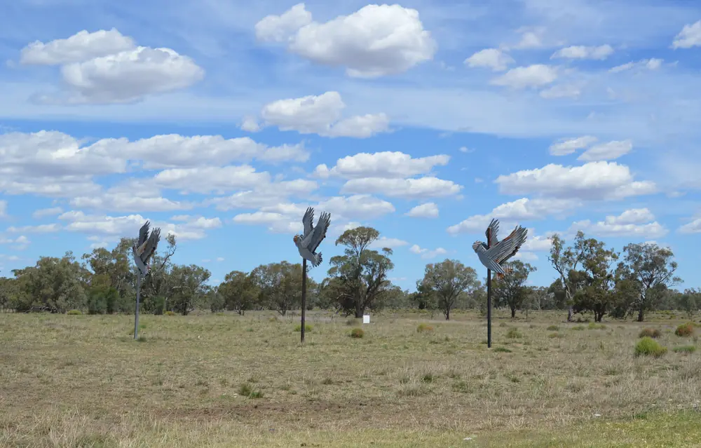
Giant galah sculptures near GulargambonePhoto: Mattinbgn · CC BY 3.0 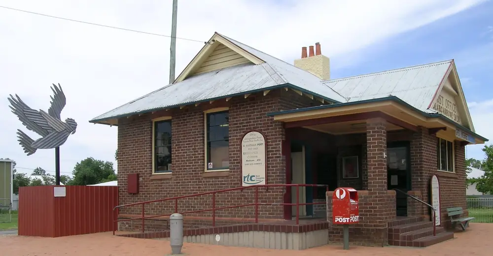
Sculptured galahs and the Gulargambone post officePhoto: Cgoodwin · CC BY-SA 3.0 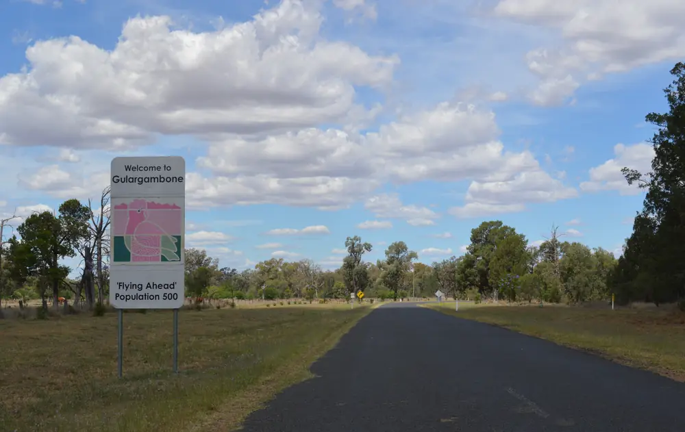
Town entry sign, GulargambonePhoto: Mattinbgn · CC BY 3.0 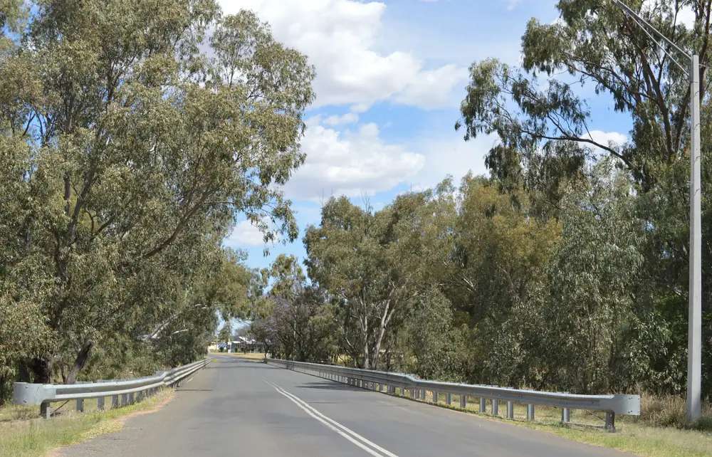
Castlereagh River bridge at GulargambonePhoto: Mattinbgn · CC BY 3.0
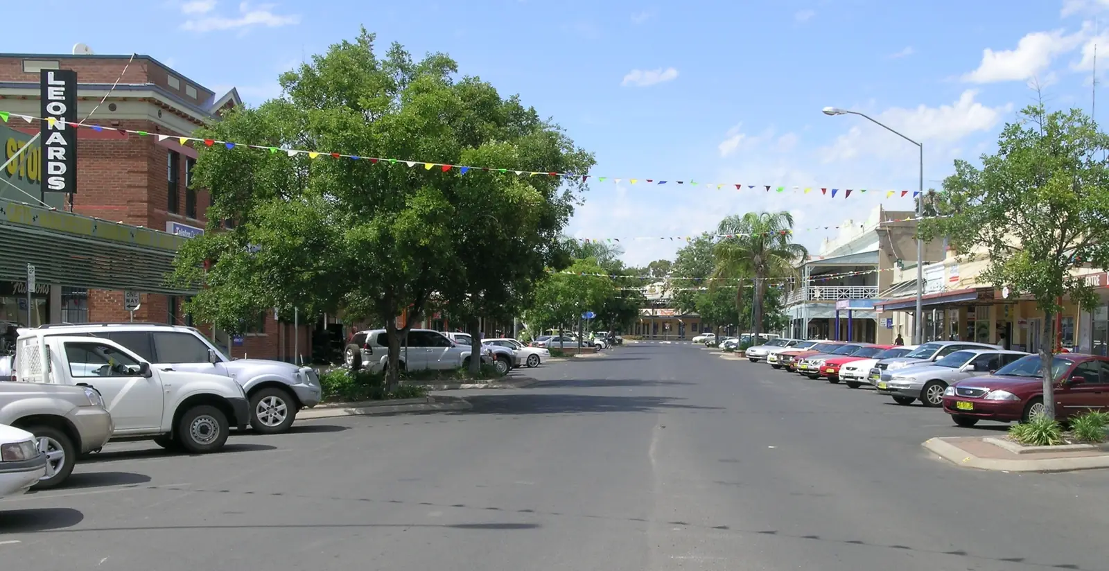
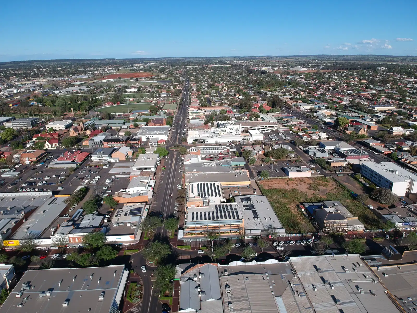
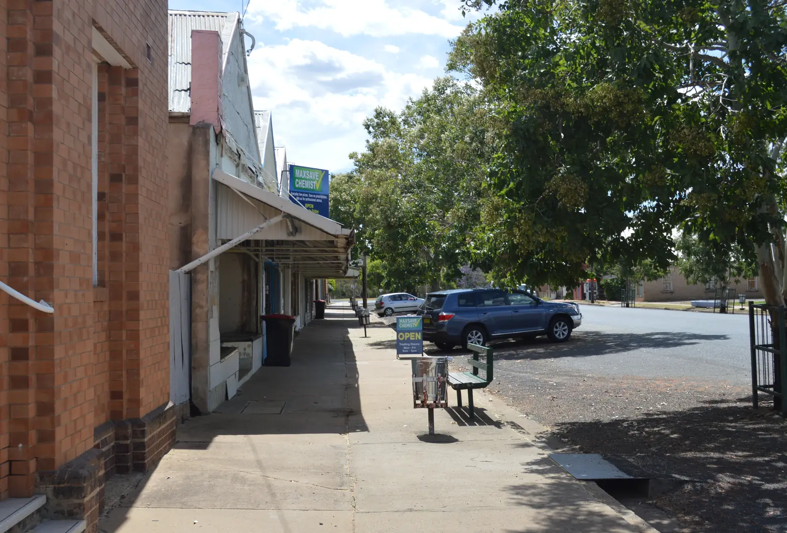
Gulargambone is a Castlereagh Highway village in Coonamble Shire, 115 kilometres north of Dubbo and 550 kilometres north-west of Sydney on Visit NSW’s destination page. That page is the Destination NSW listing used here: established on the banks of the Castlereagh River in 1883, encompassed by the Warrumbungle Mountains, an Aboriginal word meaning “watering hole for many galahs”, primarily agricultural, and home to corrugated-iron galahs, shop-window murals, a community-owned post office and the 2828 cafe, craft shop and gallery. This hub is the galah village. It is not Coonamble’s nickname-capital street, not Coonabarabran’s Dark Sky Park town, and not a Newell Highway city.
Use the urban-centre Census for the village. The 2021 urban centre Gulargambone (L), UCL122064, counted 351 people, median age 42, sex split 50.4% male / 49.6% female. 76 families, 168 private dwellings. Aboriginal and/or Torres Strait Islander people were 152 (43.3%) of the UCL. Suburbs-and-localities SAL11798 counted 528, median age 43, 127 families, 259 dwellings, Indigenous 163 (30.9%). Visit NSW’s “500 spirited Australians” sentence is tourism copy, not QuickStats. Do not add the codes together. Read the ABS UCL QuickStats.
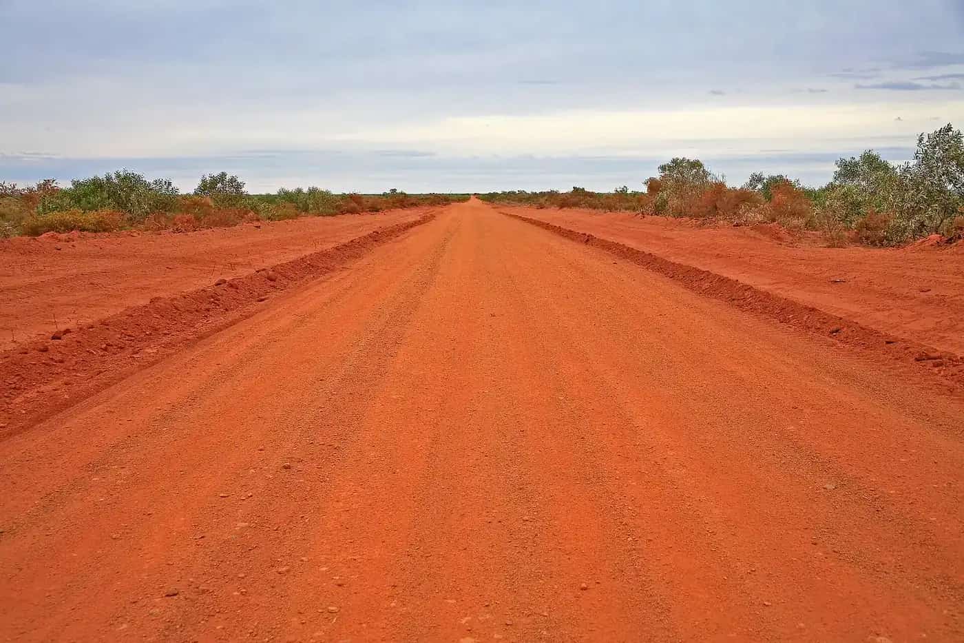
The Castlereagh Highway is sealed in ordinary weather. After rain, you still need Live Traffic NSW. Fill in Gulargambone or Coonamble before you treat a Warrumbungle or Marshes spur as a sedan loop.
Where it is, and how far
Gulargambone sits on the Castlereagh Highway between Dubbo / Gilgandra to the south and Coonamble to the north. Visit NSW’s Coonamble page uses Gilgandra and Gulargambone as the charming towns on the scenic drive north from Dubbo, less than two hours for that whole Coonamble run. The Gulargambone-specific kilometres used here are 115 km north of Dubbo, 550 km north-west of Sydney, and approximately 45 km from Coonamble on the hotel listing.
| Place | Distance from Gulargambone (sourced) |
|---|---|
| Dubbo | 115 km south (Visit NSW Gulargambone page) |
| Sydney | 550 km south-east / north-west of Sydney on that page |
| Coonamble | approximately 45 km (Visit NSW Gulargambone Hotel listing) |
| Coonamble Airport AWS (BOM) | 30.98°S, 148.38°E, elevation 181 m — shire airport table, not a Gulargambone drive time |
Gilgandra is named on Visit NSW’s Coonamble drive, not linked. Quambone is named on that Coonamble page for the Sundowner Hotel, not linked.
Facts at a glance
Population. ABS 2021 UCL122064: 351 people. Median age 42. 43.3% Aboriginal and/or Torres Strait Islander. SAL 528. Gulargambone UCL QuickStats.
Climate. No Gulargambone row on the BOM NSW monthly-statistics list used here. Use COONAMBLE AIRPORT AWS, 051161, open, commenced 1997, elevation 181 m. Mean maximum (29 years, 1997–2026): January 35.4 °C, July 17.2 °C, annual 26.6 °C. Mean minimum: January 20.5 °C, July 3.7 °C, annual 11.9 °C. Mean rainfall (25 years): annual 529.9 mm. That is the shire airport table. See Gulargambone weather.
Visitor information. Visit NSW names the 2828 community tourism project — a cafe, craft shop and gallery. Coonamble Shire’s visit page covers Gulargambone with Coonamble and Quambone; the shire Information & Exhibition Centre is at 120 Castlereagh Street, Coonamble, (02) 6827 1900. Gulargambone Hotel (02) 6825 1237.
Traditional Owners
Coonamble Shire’s Community Strategic Plan 2025–2035 acknowledges the Kamilaroi and Wailwan people as traditional custodians, and locates the LGA — township of Coonamble and villages of Gulargambone and Quambone — on the traditional Indigenous lands of the Wailwan and Kamilaroi people. Visit NSW’s Gulargambone page records the place-name as an Aboriginal word meaning watering hole for many galahs. NSW Aboriginal Land Council lists a Weilwan Local Aboriginal Land Council in Gulargambone — a land-council address, not a substitute for the shire acknowledgement. Confirm wording at 2828.
History
Visit NSW: established on the Castlereagh in 1883, primarily agricultural. In 2000 the community formed GRTC Inc (Gulargambone Rural Transaction Centre Incorporated) and opened the first community-owned Post Office. Other achievements on that page: a new multi-purpose health service, murals depicting Gulargambone’s history in shop windows, and new highway signage. Watch for corrugated-iron Galahs on the side of the road. The 2828 project is the named cafe, craft shop and gallery.
Visit NSW’s Coonamble page adds that in nearby Gulargambone you can take a selfie with corrugated-iron galahs and admire vivid murals by 10 acclaimed artists.
This facts file does not invent a wool-boom visitor number those pages do not print.
Things to do
Corrugated-iron galahs — roadside sculptures on Visit NSW. Photograph from formed access. They are the village’s signature, not a national-park walk.
Murals — shop windows on the destination page; ten acclaimed artists on the Coonamble page.
2828 — cafe, craft shop and gallery. Hours change. Ask in Bourbah Street.
Community-owned Post Office — the GRTC story. A working post office, not a museum with opening hours this page will invent.
Gulargambone Hotel — 18 Bourbah Street, counter lunches, beer garden, gaming room, five motel-type rooms on Visit NSW.
Castlereagh River — the 1883 banks Visit NSW names. After flood, stay off closed banks.
Warrumbungle Ranges and Macquarie Marshes — named on the caravan-park listing as the ideal stopover en route, and on Coonamble’s page as neighbouring wonders. They are not Gulargambone footpaths. Use Coonamble and Coonabarabran.
See things to do in Gulargambone.
Where to stay
Visit NSW names:
- Gulargambone Hotel/Motel — 18 Bourbah Street, approximately 45 km from Coonamble, five motel-type rooms, (02) 6825 1237, gulargambonehotel@hotmail.com
- Gulargambone Caravan Park — Skuthorpe Street, shady park, grassy drive-through sites, free barbecue, camp kitchen, pizza oven, pet friendly with dog and cat units and a dog yard, set among jacarandas, behind the police station and hospital
Ask Coonamble Shire (02) 6827 1900 if those listings have changed.
- How to choose: Gulargambone accommodation
- Camping detail: Gulargambone caravan parks
- Operator enquiries: feature your business
If Gulargambone is full, Coonamble is approximately 45 km north and Dubbo is 115 km south. Those are distance facts, not booking guarantees.
Caravan and camping
Vans use Gulargambone as a quieter Castlereagh overnight than Coonamble or Dubbo. The sourced park is Gulargambone Caravan Park on Skuthorpe Street. Ask about stay limits. Read Gulargambone caravan parks and outback camping.
After rain, the Castlereagh is the constraint. Live Traffic NSW first.
Fuel and services
A UCL of 351 people will not match Dubbo or Coonamble for a full supermarket aisle. This guide does not list bowser brands. Confirm fuel in town or fill in Coonamble / Dubbo. Visit NSW names a new multi-purpose health service among community achievements and places the caravan park behind the hospital; confirm the current service name with NSW Health rather than inventing a hospital title. Coonamble Health Service at 150 Castlereagh Street, Coonamble, remains the shire’s 24-hour emergency listing on NSW Health. For visitor questions, use Coonamble Shire and (02) 6827 1900.
Road access
The Castlereagh Highway is the sealed spine through Gulargambone between Dubbo / Gilgandra and Coonamble. Visit NSW’s Coonamble approach also uses the Newell Highway as far as Gilgandra. Freight road. Pull over for road trains. After rain, Live Traffic NSW. Do not drive around closed signs to keep a galah photograph.
North: Coonamble, then Walgett and Lightning Ridge. South: Dubbo. East: Warrumbungle country via Coonabarabran — kilometre from Gulargambone not printed on the destination page used here.
Nearby parks and towns
Parks and named nature sites:
- Castlereagh River banks (Visit NSW 1883 setting)
- Warrumbungle Ranges — named neighbour; Dark Sky Park on Coonamble’s Visit NSW page
- Macquarie Marshes — named stopover on the caravan-park listing; NPWS access rules on the Coonamble hub
- Pilliga Forest — named on Coonamble’s page
Towns on this site:
- Coonamble — approximately 45 km; nicknames, tower, rodeo
- Dubbo — 115 km
- Coonabarabran — Warrumbungles
- Baradine and Pilliga — forest pair
Named, not linked: Gilgandra, Quambone.
When to go, and how long
Coonamble Airport’s January mean maximum of 35.4 °C is hot for a galah selfie at midday. July’s 17.2 °C mean maximum is the walking season on paper; July’s 3.7 °C mean minimum is why a caravan-park night needs a layer. Annual rainfall 529.9 mm on that airport table. Forty-five minutes covers the roadside galahs and Bourbah Street. A night lets you use the hotel or Skuthorpe Street park if confirmed. Two nights only if you are adding Coonamble’s tower, a booked Marshes tour, or a Warrumbungle day and Live Traffic NSW agrees.
Operators who want a checked listing: feature your business. The listings slot on this hub stays empty until then.
Plan this trip
Tell us the dates, who you are travelling with and where you need help. We reply with planning notes for Gulargambone — we are not a booking agent.
Events and road-conditions newsletter
Occasional notes on outback festivals, race days and official road-condition sources — not a daily blast. We use these details only to send the newsletter.
New South Wales · Explorer Country
Gulargambone accommodation
Where to stay in Gulargambone: Visit NSW names five motel rooms at the Gulargambone Hotel and Gulargambone Caravan Park on Skuthorpe Street. Confirm before you arrive. Coonamble is overflow.
Read · 3 min
New South Wales · Explorer Country
Gulargambone caravan parks
Camping in Gulargambone: Visit NSW names Gulargambone Caravan Park on Skuthorpe Street — drive-through sites, camp kitchen, pet friendly. Confirm stay limits. No extra parks invented.
Read · 3 min
New South Wales · Explorer Country
Gulargambone weather
Gulargambone climate from the nearest complete open BOM table, Coonamble Airport AWS (051161): January mean max 35.4 °C, July 17.2 °C, annual rainfall 529.9 mm. No Gulargambone town station on the NSW list used here.
Read · 4 min
New South Wales · Explorer Country
Things to do in Gulargambone
Things to do in Gulargambone: corrugated-iron galahs, shop-window murals by 10 artists, 2828 cafe and gallery, community-owned post office story. Warrumbungles and Marshes are neighbouring days.
Read · 3 min
Frequently asked questions
How far is Gulargambone from Dubbo, Sydney and Coonamble?
Visit NSW’s Gulargambone page puts the village 115 kilometres north of Dubbo and 550 kilometres north-west of Sydney, on the Castlereagh Highway. The Gulargambone Hotel listing puts the hotel approximately 45 kilometres from Coonamble.
What is Gulargambone’s population?
351 people at the 2021 Census for the urban centre Gulargambone (L), UCL122064, median age 42. Suburbs-and-localities SAL11798 counted 528, median age 43. Visit NSW’s older ‘500 spirited Australians’ sentence is not a Census figure. Do not mix the geographies.
What does Gulargambone mean?
Visit NSW’s Gulargambone page says Gulargambone is an Aboriginal word meaning "watering hole for many galahs". The Visit NSW caravan-park listing also prints "place of plenty galahs" / "place of many Galahs". Use the destination-page wording first; confirm at Cafe 2828.
Where should I stay in Gulargambone?
Visit NSW names the Gulargambone Hotel/Motel (five motel-type rooms at 18 Bourbah Street) and Gulargambone Caravan Park (Skuthorpe Street). Confirm on (02) 6825 1237 for the hotel. Coonamble is the shire overflow.
What is the weather like in Gulargambone?
There is no Gulargambone BOM monthly-statistics table on the NSW list used here. Use open Coonamble Airport AWS (051161): January mean maximum 35.4 °C, July 17.2 °C, annual rainfall 529.9 mm. That is the shire airport table, not a blended Gulargambone mean.
Whose Country is Gulargambone on?
Coonamble Shire’s Community Strategic Plan 2025–2035 acknowledges the Kamilaroi and Wailwan people as traditional custodians of the land on which it meets and operates, and locates the LGA — Coonamble, Gulargambone and Quambone — on Wailwan and Kamilaroi Country. Confirm wording at Cafe 2828.
Sources and further reading
Facts on this page were checked against these primary and official sources. Conditions change — confirm before you travel or buy.
- Gulargambone (L) 2021 Census QuickStats (UCL122064) — Australian Bureau of Statistics
- Gulargambone 2021 Census QuickStats (SAL11798) — Australian Bureau of Statistics
- Climate statistics for Coonamble Airport AWS (051161) — Bureau of Meteorology
- Gulargambone — Destination NSW
- Gulargambone Hotel — Destination NSW
- Gulargambone Caravan Park — Destination NSW
- Coonamble, Warrumbungle area — Destination NSW
- Visit Coonamble — Coonamble Shire Council
- Coonamble Shire Community Strategic Plan 2025–2035 — Coonamble Shire Council
- Live Traffic NSW — Transport for NSW