At a glance
Sourced facts only. Distances and services change — confirm before you travel.
- Local government
- Warren Shire
- Traditional Owners
- Wayilwan people (Warren Shire visitor guide). NPWS places Macquarie Marshes Nature Reserve on the traditional land of the Wailwan People.Confirm current wording at the Warren and Macquarie Marshes Visitor Information Centre, Window on the Wetlands Centre, 2 Coonamble Road.
- Nearest regional city
- 126 km north-west of Dubbo (Warren Shire visitor guide). Council things-to-do page: one hour’s drive north-west of Dubbo. NSW Health: just over an hour from Dubbo. Great Western Plains table in the same visitor guide: Dubbo–Warren 1 hour 15 minutes.
- Capital
- 536 km north-west of Sydney (Warren Shire visitor guide). NSW Health: 6.25 hours’ drive from Sydney.
- Nearest fuel
- Warren Shire’s visitor guide names fuel among town services. Confirm the bowser on arrival; this hub does not invent a brand or hours.
- Nearest hospital or clinic
- Warren Multipurpose Service, Doctor Kater Drive — 24-hour emergency department, 42 beds (NSW Health / Western NSW LHD)
- Mobile coverage
- Check Telstra and Optus coverage maps before travel; do not assume a signal on Gibson Way or unsealed Marshes approaches after rain.
- Best time to visit
- May–September (cooler nearby BOM Nyngan Airport mean maxima). January mean maximum 34.5 °C; July 16.5 °C.
Climate
Monthly means from the Bureau of Meteorology station Nyngan Airport (051039) — nearby open table. This is not a forecast. Open nearby station, not an in-town Warren AWS. Commenced 1879. Elevation 173 m. Temperature 97 years (1920–2025); rainfall 138 years (1879–2026). Warren (Auscott) 051124 is closed; this hub does not blend the closed in-shire series with Nyngan Airport. Monthly columns copied from this site’s Nyngan hub.
| Month | Mean max (°C) | Mean min (°C) | Rainfall (mm) |
|---|---|---|---|
| Jan | 34.5 | 19.7 | 50.5 |
| Feb | 33.4 | 19.3 | 46.5 |
| Mar | 30.6 | 16.5 | 41.8 |
| Apr | 25.7 | 12.0 | 33.7 |
| May | 20.7 | 7.8 | 36.3 |
| Jun | 17.0 | 5.0 | 33.6 |
| Jul | 16.5 | 3.8 | 28.9 |
| Aug | 18.6 | 4.8 | 29.4 |
| Sep | 22.7 | 7.8 | 27.2 |
| Oct | 26.7 | 11.5 | 34.0 |
| Nov | 30.1 | 15.1 | 36.5 |
| Dec | 33.0 | 17.9 | 43.5 |
Warren in pictures
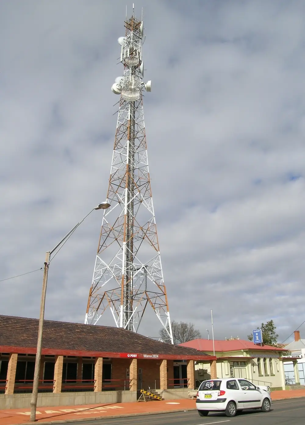
Post office in WarrenPhoto: Cgoodwin · CC BY-SA 3.0 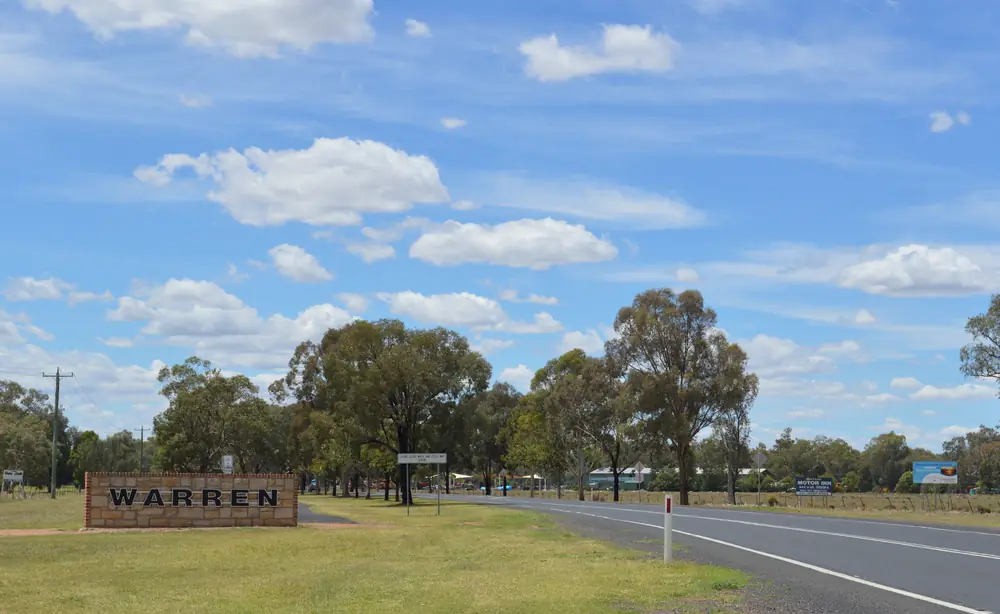
Town entry sign at WarrenPhoto: Mattinbgn · CC BY 3.0 
Warren Shire LibraryPhoto: Aliaretiree · CC BY-SA 4.0 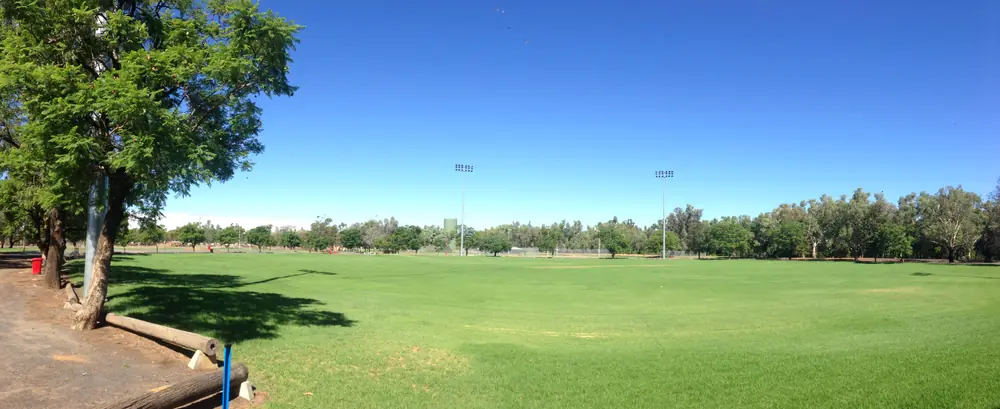
Sporting grounds at WarrenPhoto: Ronjhino · CC BY-SA 4.0
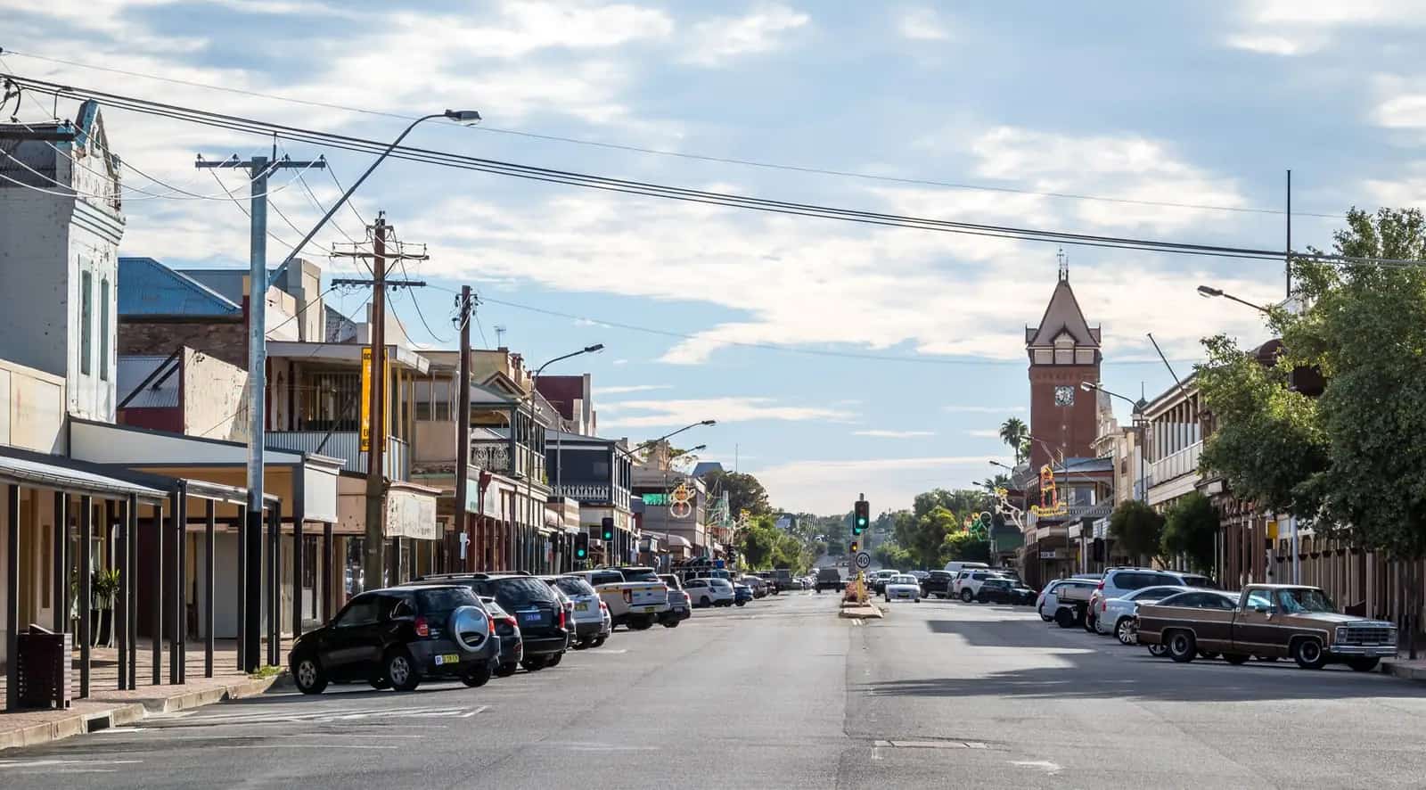
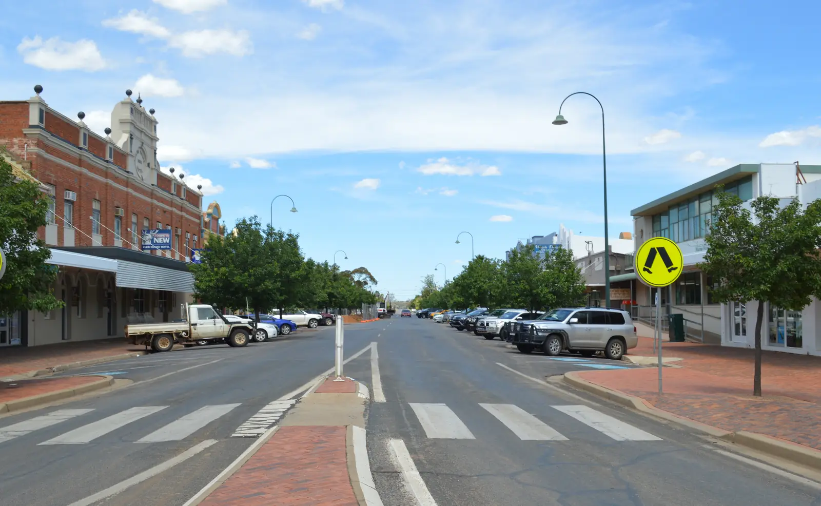
Warren sits on the Macquarie River in Warren Shire, on this site’s outback NSW list even though Destination NSW files the museum under the Dubbo area. Warren Shire’s visitor guide is the official geography used here: 536 km north-west of Sydney, 126 km north-west of Dubbo, 79 km east of Nyngan. This hub is the Macquarie River service town. It is not Warren Victoria, not Warren Queensland, and not a Gilgandra page — Gilgandra is named, not linked. Nevertire and Collie are the shire’s named villages, not second hubs this site invents.
The Australian Bureau of Statistics publishes a 2021 Urban Centre and Locality UCL115153: 1,365 people, median age 51, sex split 47.7% male / 52.3% female. 320 families, 764 private dwellings. Aboriginal and/or Torres Strait Islander people were 289 (21.2%) of the UCL. Suburbs and localities SAL14189 counted 1,272. Use the UCL QuickStats for the urban town figure this hub quotes. Travellers stop for Tiger Bay, the Window on the Wetlands Centre, and a Mitchell or Oxley night toward the Marshes. You still need Live Traffic NSW after rain, because Gibson Way is unsealed and not a default 2WD picnic.
Where it is, and how far
Warren is the Warren Shire town between Dubbo and Nyngan on the Macquarie. Council’s things-to-do page places it in the Orana region of central western NSW, one hour’s drive north-west of Dubbo. NSW Health’s Warren community page: 6.25 hours from Sydney and just over an hour from Dubbo; fly to Dubbo then a connecting bus. The visitor guide’s Great Western Plains table lists Dubbo–Warren 1 hour 15 minutes and Gilgandra–Warren 50 minutes. Print the source you are using; this hub does not pick a favourite.
| Place | Distance from Warren (sourced) |
|---|---|
| Sydney | 536 km north-west (visitor guide); 6.25 hours (NSW Health) |
| Dubbo | 126 km north-west (visitor guide); one hour (council things to do); just over an hour (NSW Health); 1 hour 15 minutes (Great Western Plains table) |
| Nyngan | 79 km east of Nyngan on the visitor guide’s Warren block (Warren sits east of Nyngan) |
| Gilgandra | 85 km west of Gilgandra (visitor guide). Named, not linked |
| Macquarie Marshes | around 100 km north (council); NPWS reserve around 80 km north of Warren and 30 km west of Quambone |
| Nyngan Airport (BOM 051039) | 31.55°S, 147.20°E, elevation 173 m — nearby open table, not a Warren drive time |
Nevertire is the Mitchell Highway village on the visitor guide if you are travelling through Warren to Nyngan or the other way. Collie sits on the Oxley Highway, halfway between Warren and Gilgandra on that guide. Quambone is named, not linked. Narromine and Wellington appear on the same Great Western Plains table and are named, not linked.
Facts at a glance
Population. ABS 2021 UCL115153: 1,365 people. Median age 51. 21.2% Aboriginal and/or Torres Strait Islander. Warren UCL QuickStats. SAL14189 is the smaller suburbs-and-localities count.
Climate. No open in-town Warren monthly table is used here. Nyngan Airport, 051039, 31.55°S, 147.20°E, elevation 173 m, commenced 1879, status: open, is the nearby table copied from this site’s Nyngan hub: January mean maximum 34.5 °C, July 16.5 °C, annual rainfall 445.6 mm (138 years, 1879–2026). January 50.5 mm is the wettest mean month on that table; September 27.2 mm the driest. Warren (Auscott) 051124 is closed. Do not blend. Town elevation on the visitor guide is 198 metres. See Warren weather.
Visitor information. Warren and Macquarie Marshes Visitor Information Centre at the Window on the Wetlands Centre, 2 Coonamble Road (Oxley Highway). Visitor guide: Monday–Friday 8.00am–5.00pm, weekends and most public holidays 10.00am–4.00pm, (02) 6847 6665, discover@warren.nsw.gov.au. Council contact page also lists the VIC at the same site with weekday phone (02) 6847 6600 and after-hours 0408 257 067. Use whichever number the desk confirms. The visitor guide: the Pine Clump school was moved 50 km here in July 1980 and now houses the VIC; a 127-year-old Catholic church was moved onto the grounds in 2014.
Traditional Owners
Warren Shire’s visitor guide: the shire is a meeting place for the nations of the traditional custodians of this land, the Wayilwan people. RiverSmart’s Window on the Wetlands page, linked from the same precinct story, names Wayilwan Country and the Macquarie River / Wambuul. NPWS’s Macquarie Marshes Nature Reserve page: traditional land of the Wailwan People. Council things to do: the Beemunnel is a significant cultural site where Aboriginal families lived in the late 19th and early 20th centuries; the interpretation trail is 1.5 km past the Window on the Wetlands Centre on the Oxley Highway. Visitor guide timeline: Aboriginal families lived at the Beemunnel Reserve 1920–1982; 2016 Beemunnel gazetted as an Aboriginal Place. NSW Health’s Warren page includes Wayilwan elder George Riley: born at the Beemunnel in 1940, lived there until 1975; ring Warren Macquarie Local Aboriginal Land Council to open the gate for the walking trail. Confirm current wording at 2 Coonamble Road. See visiting Country respectfully.
History
Visitor guide timeline: 1818 John Oxley; 1828 Charles Sturt; 1830s first settlers; 1846 Thomas Mitchell; 1847 first race meeting about 6 km east of Warren; June 1861 Warren proclaimed as a town; 1880 first Warren Show (3 May); 1882 railway Dubbo to Nevertire; 1885 Nevertire proclaimed a village; 28 December 1896 Nevertire cyclone; 1898 railway Nevertire to Warren; 1899 the Great Fire destroyed two thirds of Warren; 1901 population 1006 of which 13% were Chinese; 1955 record flood of 10 metres; 1957 Warren Shire formed by amalgamation of Marthaguy and Warren Shires; 1988 Tiger Bay Wetlands opened; 2011 150-year anniversary.
That is a Macquarie farming-and-wetlands founding, not a Newell gold-rush anecdote borrowed from West Wyalong and not a copper-town story borrowed from Cobar. NSW Health: origins dating back to the late 1800s, with history now in a restored heritage building that houses the museum and gallery. Visit NSW: the museum opened in continuous use since March 2023.
Nevertire was originally known as Warren Pond on the visitor guide; Henry Lawson described Nevertire as the edge of the great grey plains. Collie was proclaimed a village in 1893 and was the halfway stop for the Cobb & Co mail run between Gilgandra and Quambone in 1872.
Things to do
Warren Shire and Visit NSW name these in and around Warren:
- Window on the Wetlands Centre — VIC, educational exhibits, café, historic church on the grounds
- Tiger Bay Wetlands — natural backwash from Ewenmar Creek; visitor guide 227 bird species; built up in 1988 as a bicentennial project; self-guided audio walk; scar trees of cultural significance (one remains standing after recent flooding on that wording)
- Beemunnel interpretation trail — 1.5 km past the WoW Centre on the Oxley Highway
- Warren Museum and Art Gallery (The WAM) — 142 Dubbo Street; Visit NSW and council; interactive museum and gallery; council hours Mon–Tue 9am–1pm, Wed–Fri 9am–2pm, Sat 9am–1pm, closed Sunday and public holidays; phone (02) 6813 0997
- Warraan Widji Arts — visitor guide: River Arts Place; Mechanics Institute / Shire Library building 1876; centre established October 2021
- Fishing within 5 km — Oxley Park Wharf; Bob Christensen Reserve / Bryan Egan Weir (1.6 km along Industrial Access Road); Warren Weir Reserve (4.3 km on Wambianna Road); Quinines Reserve (4.6 km on Carinda Road)
- Murals, sculptures and water-tower art — mural map at the VIC; movie posters on the old Federal picture theatre (1938)
- Heritage walking tour — Warren Historical and Family History Society, free by appointment via (02) 6847 6665
- Warren Golf Club — Oxley Highway, grass and sand greens, Gunningbar Creek
- Tilley’s Wines — 1 km from the centre on Darbalara; tasting by arrangement 0419 248 690
- Carter Oval — splash park, skate park, cricket, soccer, athletics
- Macquarie Park — BBQ and playground on the visitor guide
- Macquarie Marshes — around 100 km north on council; NPWS nature reserve around 80 km north of Warren; Burrima Boardwalk 2.1 km, opened 21 October 2023; Monkeygar Creek and Big Terrigal Creek platforms on Gibson Way
Nearby, not in-town: Nevertire pub, hall, cemetery and October rodeo; Collie Hotel and Collie Rodeo; Willie Retreat near the Marshes. Gilgandra is named, not linked.
Where to stay
Warren Shire’s visitor guide names homestays, bed and breakfasts, motel-style rooms, a caravan park and free-camping options as stay types. Council’s things-to-do page names Willie Retreat close to the Macquarie Marshes — ask (02) 6847 6665. Those are official named types, not a ranked motel strip. This hub does not invent motor-inn brands the council and Visit NSW pages used here do not print.
- How to choose: Warren accommodation
- Camping detail: Warren caravan parks
- Operator enquiries: feature your business
If Warren is full, Nyngan is 79 km west on the visitor guide’s geography and Dubbo is the regional-city overflow 126 km south-east.
Caravan and camping
Vans use Warren as a Mitchell or Oxley night. The visitor guide names a caravan park and free camping as types, plus an RV dump point and potable water. Council names fishing and picnic furniture at Bob Christensen Reserve — that is a reserve and boat-ramp sentence, not a stay-limit this hub will invent. Ask the VIC before you unhitch on a river bank. Read Warren caravan parks and outback camping.
NPWS: Macquarie Marshes Nature Reserve has no visitor facilities and access limited to management and research staff except guided walks and kayak tours. Do not unhitch in the reeds.
Fuel and services
Warren is a shire service town. The visitor guide names supermarkets, medical services including a hospital, banking, post office, veterinary clinic, hardware, motor mechanics, fuel, pharmacy, dental, NRMA, tyres and library, plus an RV dump point. NSW Health: hospital, medical centre, baby health, dental, pharmacy, aged care; specialised needs connect to Dubbo just one hour away; two banks, two supermarkets, a veterinary surgery. Warren Multipurpose Service, Doctor Kater Drive, 42 beds, 24-hour emergency department, radiology, residential aged care (NSW Health). Phone (02) 6847 5400 on Healthdirect’s service listing. This guide does not list a bowser brand. Fill here before Gibson Way or a Nyngan–Cobar run.
Council administration: 115 Dubbo Street, (02) 6847 6600. War Memorial Swimming Pool, Stafford Street, October–March on the contact page.
Road access
Approaches are the Oxley Highway (Coonamble Road through the WoW precinct) and the Mitchell Highway via Nevertire toward Nyngan. These are freight roads. Pull over for road trains. After rain, Live Traffic NSW. Council: from Warren take the road to Carinda for just over 100 km then turn right at the telephone tower into Gibson Way; unsealed; not suitable except 4WD after rain; water can cross the road.
East: Dubbo 126 km. West: Nyngan 79 km then Cobar. North: Marshes and Coonamble on this site — Coonamble’s hub names Warren as a western neighbour without a Warren page until this wave. Gilgandra is 85 km east on the visitor guide — named, not linked.
Nearby parks and towns
Parks and named nature sites:
- Tiger Bay Wetlands (Warren Shire)
- Window on the Wetlands Centre
- Beemunnel Aboriginal Place
- Macquarie Marshes Nature Reserve — NPWS, limited access, Wailwan Country, Ramsar 1986, created January 1971, 23,141.29 ha
- Burrima Boardwalk 2.1 km (visitor guide)
Towns on this site:
- Nyngan — 79 km west on the visitor guide
- Dubbo — 126 km south-east
- Coonamble — Castlereagh neighbour that already names Warren
- Cobar — Barrier Highway west of Nyngan
Named, not linked: Gilgandra, Nevertire, Collie, Quambone, Carinda, Narromine, Wellington.
When to go, and how long
Nearby Nyngan Airport January mean maximum of 34.5 °C is hot for a midday Tiger Bay walk. July’s 16.5 °C mean maximum is the walking season on paper; July’s 3.8 °C mean minimum is why a van night needs a layer. Annual rainfall 445.6 mm on 138 years is not desert and not a Top End Wet. The Marshes are an ephemeral wetland — confirm water and Gibson Way at the VIC.
An hour covers the WoW Centre, a Tiger Bay loop and a museum visit if The WAM is open. A night covers fuel, a named stay type and the Beemunnel trail if the Land Council gate is arranged. Two nights if the VIC confirms Burrima and Gibson Way are open that week.
Operators who want a checked listing: feature your business. The listings slot on this hub stays empty until then.
Plan this trip
Tell us the dates, who you are travelling with and where you need help. We reply with planning notes for Warren — we are not a booking agent.
Events and road-conditions newsletter
Occasional notes on outback festivals, race days and official road-condition sources — not a daily blast. We use these details only to send the newsletter.
New South Wales · Outback NSW
Things to do in Warren
Things to do in Warren NSW: Window on the Wetlands, Tiger Bay birdwatching, Beemunnel trail, Warren Museum and Art Gallery, fishing within 5 km, and Macquarie Marshes access rules. Not Warren VIC.
Read · 5 min
New South Wales · Outback NSW
Warren accommodation
Where to stay in Warren NSW: Warren Shire names homestays, B&Bs, motel rooms, a caravan park and free camping as types, plus Willie Retreat near the Macquarie Marshes. Confirm at the WoW Centre.
Read · 3 min
New South Wales · Outback NSW
Warren caravan parks
Camping in Warren NSW: Warren Shire names a caravan park, free-camping options, an RV dump point and potable water. Confirm Bob Christensen Reserve before you unhitch. Not Warren VIC.
Read · 3 min
New South Wales · Outback NSW
Warren weather
Warren climate from nearby BOM Nyngan Airport (051039): January mean max 34.5 °C, July 16.5 °C, annual rainfall 445.6 mm. Open station. Warren Auscott 051124 is closed. Not Warren VIC.
Read · 4 min
Frequently asked questions
How far is Warren from Dubbo, Nyngan and Sydney?
Warren Shire’s visitor guide puts Warren 536 km north-west of Sydney, 126 km north-west of Dubbo, 85 km west of Gilgandra and 79 km east of Nyngan. NSW Health’s Warren community page puts the town 6.25 hours’ drive from Sydney and just over an hour from Dubbo. Council’s things-to-do page says one hour’s drive north-west of Dubbo. The Great Western Plains table in the visitor guide lists Dubbo–Warren as 1 hour 15 minutes and Gilgandra–Warren as 50 minutes. Those pages do not all print the same figure; this hub does not average them.
What is Warren’s population?
1,365 people at the 2021 Census for the Warren Urban Centre and Locality (UCL115153), median age 51. Suburbs and localities SAL14189 counted 1,272. Aboriginal and/or Torres Strait Islander people were 289 (21.2%) of the UCL.
Is this Warren VIC or Warren QLD?
This hub is Warren, New South Wales, the Warren Shire town on the Macquarie River between Dubbo and Nyngan. It is not Warren Victoria and not Warren Queensland.
What is there to do in Warren?
Warren Shire names the Window on the Wetlands Centre and Tiger Bay Wetlands, the Beemunnel interpretation trail 1.5 km past the centre on the Oxley Highway, Warren Museum and Art Gallery at 142 Dubbo Street, fishing spots within 5 km of town, murals and water-tower art, a heritage walking tour by appointment, Warren Golf Club, Tilley’s Wines 1 km from the centre, and the Macquarie Marshes around 100 km north (Burrima Boardwalk, Monkeygar Creek and Big Terrigal Creek platforms). Visit NSW lists the museum as a Dubbo-area attraction.
What is the weather like in Warren?
This hub uses nearby open BOM Nyngan Airport (051039): January mean maximum 34.5 °C, July 16.5 °C, annual rainfall 445.6 mm (138 years, 1879–2026). Warren (Auscott) 051124 is a closed in-shire station; do not blend the two.
Where should I stay in Warren?
Warren Shire’s visitor guide names homestays, bed and breakfasts, motel-style rooms, a caravan park and free-camping options as stay types, plus an RV dump point and potable water. Council’s things-to-do page names Willie Retreat close to the Macquarie Marshes. Confirm at the Window on the Wetlands Centre; this hub does not invent motel brands the official pages do not print.
Sources and further reading
Facts on this page were checked against these primary and official sources. Conditions change — confirm before you travel or buy.
- Warren 2021 Census QuickStats (UCL115153) — Australian Bureau of Statistics
- Warren 2021 Census QuickStats (SAL14189) — Australian Bureau of Statistics
- Climate statistics for Nyngan Airport (051039) — Bureau of Meteorology
- Discover Warren visitor guide — Warren Shire Council
- Things to see and do — Warren Shire Council
- Contact Us — Warren Shire Council
- Warren Museum and Art Gallery — Destination NSW
- Macquarie Marshes Nature Reserve — NSW National Parks and Wildlife Service
- Warren community (Western NSW LHD) — NSW Health
- Live Traffic NSW — Transport for NSW