At a glance
Sourced facts only. Distances and services change — confirm before you travel.
- Local government
- Bland Shire
- Traditional Owners
- Wiradjuri people (Bland Shire Council Acknowledgement of Country and Our Indigenous Culture page)Confirm current wording at the West Wyalong Visitor Information Centre, 6 Shire Street.
- Nearest regional city
- Fly into Wagga Wagga or Griffith, both less than two hours’ drive (Visit NSW). Kilometres to those airports are not printed on that page.
- Capital
- Just over five hours’ drive from Sydney, around six hours from Melbourne and 3.5 hours from Canberra (Visit NSW). Kilometres to those capitals are not printed on that page.
- Nearest fuel
- Bland Shire names fuel stations in West Wyalong and Wyalong. Confirm the bowser on arrival; this hub does not invent a brand or hours.
- Nearest hospital or clinic
- West Wyalong Health Service, 70 Ungarie Road — 24-hour accident and emergency (NSW Health)
- Mobile coverage
- Check Telstra and Optus coverage maps before travel; do not assume a signal on Bland Shire village loops.
- Best time to visit
- May–September (cooler BOM West Wyalong Airport AWS mean maxima). January mean maximum 34.3 °C; July 14.5 °C.
Climate
Monthly means from the Bureau of Meteorology station West Wyalong Airport AWS (050017). This is not a forecast. Open. Commenced 1999. Elevation 257 m. Temperature maxima 28 years (1999–2026); rainfall 25 years (1999–2026). Latest available data 14 November 2026. Wyalong Post Office (073054) is the longer rainfall table — do not blend.
| Month | Mean max (°C) | Mean min (°C) | Rainfall (mm) |
|---|---|---|---|
| Jan | 34.3 | 18.4 | 35.8 |
| Feb | 32.5 | 17.5 | 45.3 |
| Mar | 29.2 | 14.7 | 42.9 |
| Apr | 24.3 | 9.7 | 25.5 |
| May | 19.1 | 5.8 | 35.4 |
| Jun | 15.1 | 3.9 | 44.5 |
| Jul | 14.5 | 3.0 | 40.8 |
| Aug | 16.3 | 3.4 | 38.8 |
| Sep | 20.7 | 5.6 | 35.7 |
| Oct | 24.8 | 9.0 | 44.2 |
| Nov | 28.5 | 13.0 | 54.3 |
| Dec | 31.4 | 15.4 | 48.0 |
West Wyalong in pictures
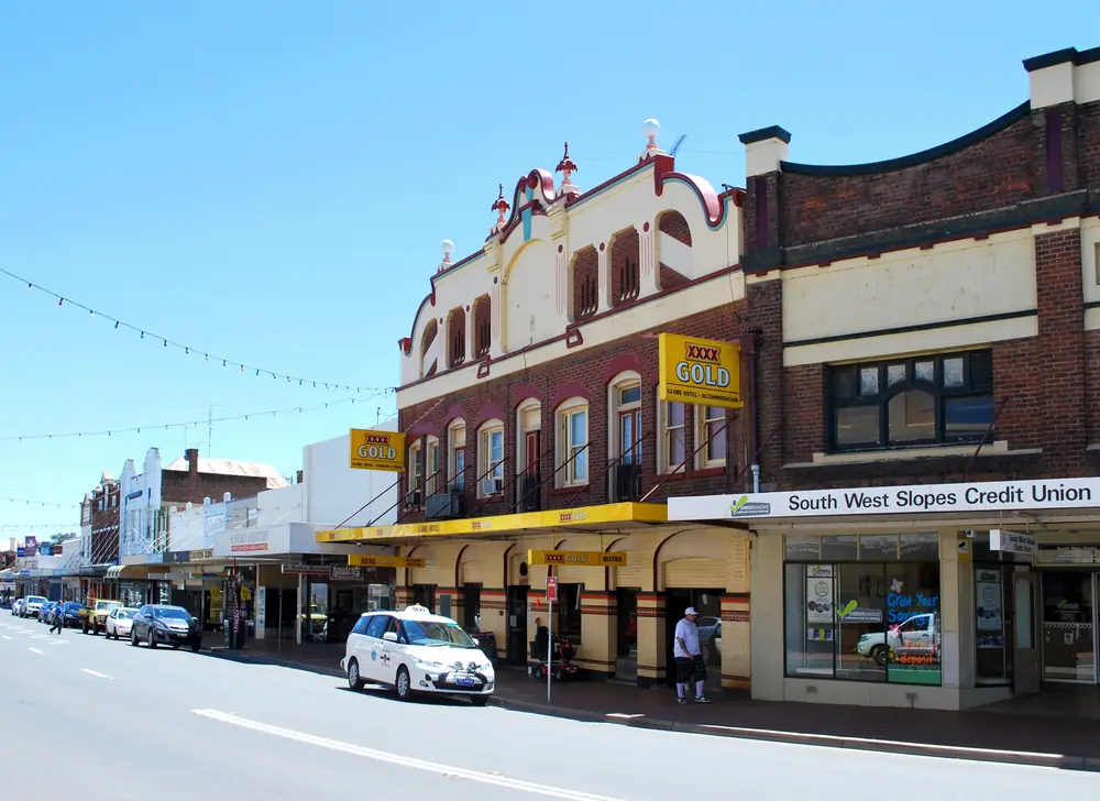
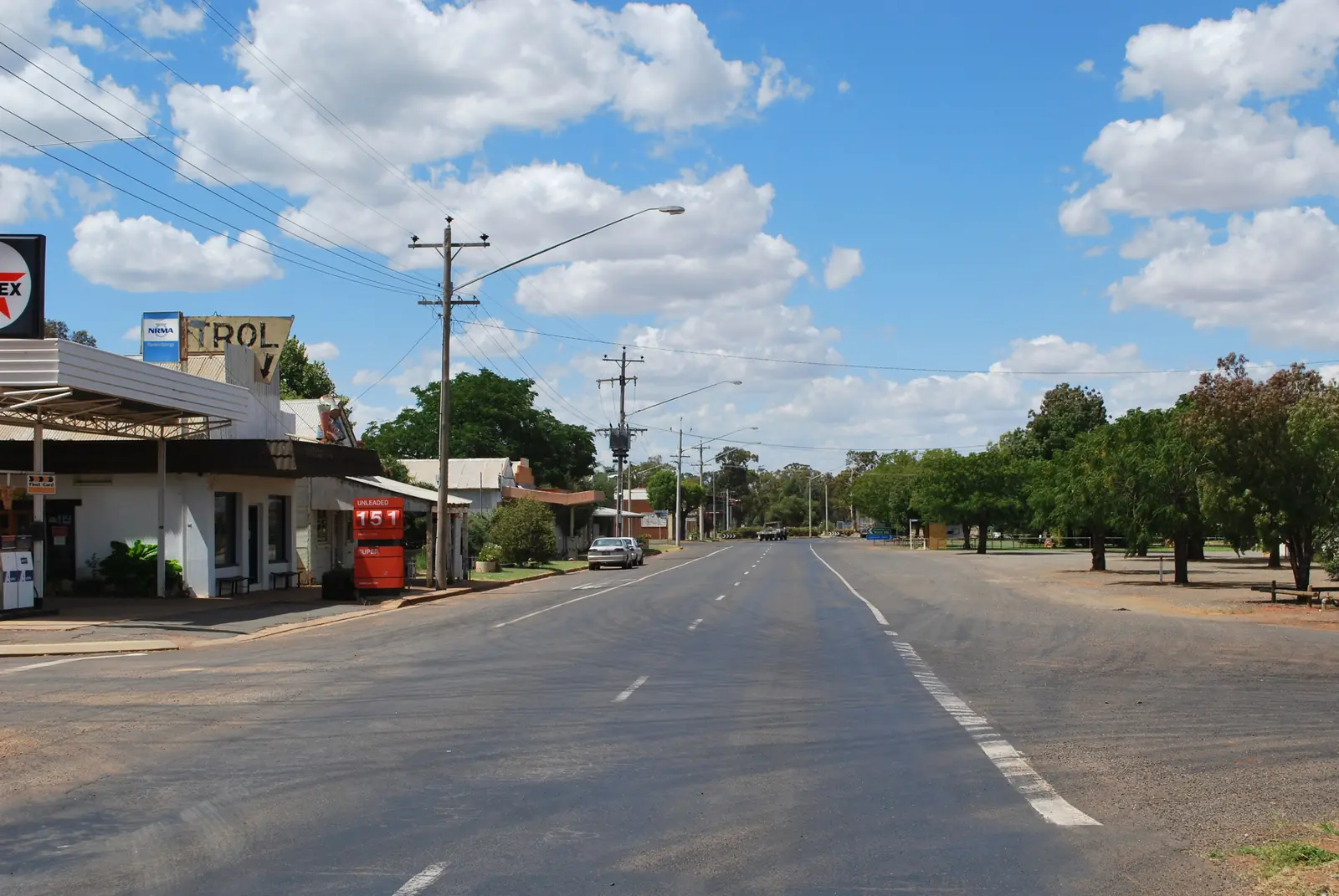
Globe Hotel in West WyalongPhoto: Mattinbgn · CC BY 3.0 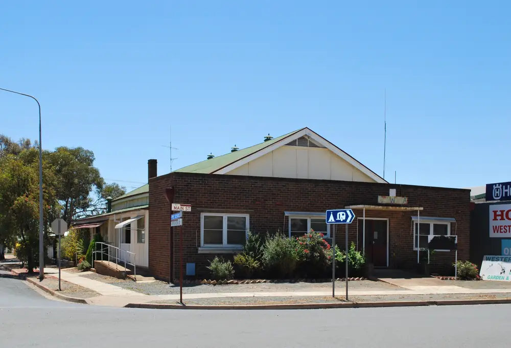
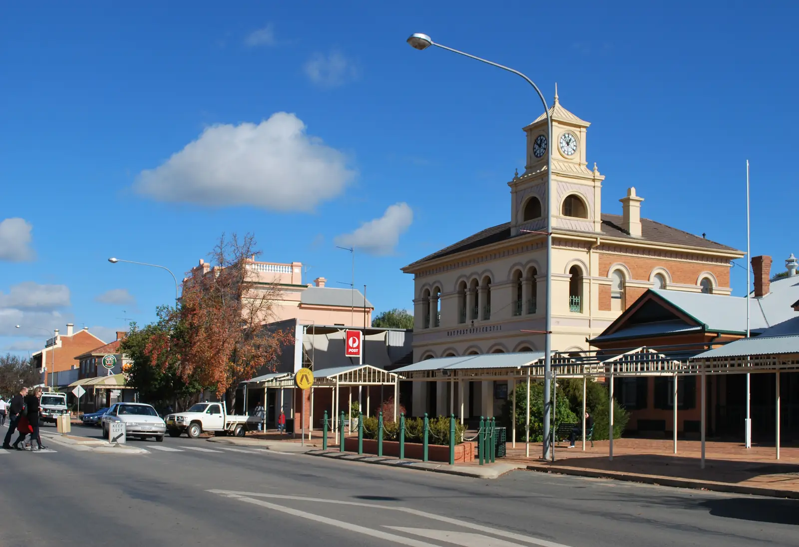
CWA rooms in West WyalongPhoto: Mattinbgn · CC BY 3.0 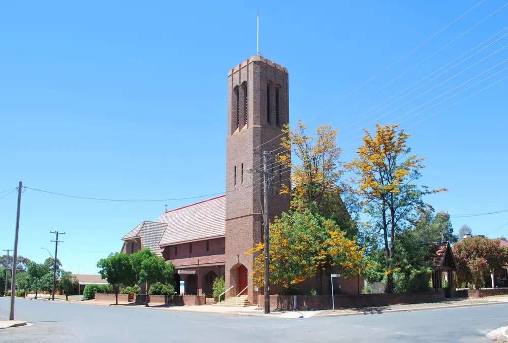
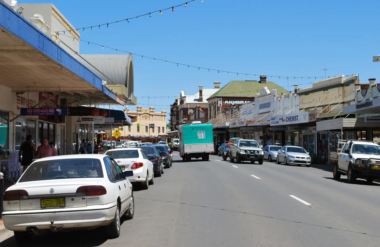
St Barnabas Anglican church in West WyalongPhoto: Mattinbgn · CC BY 3.0 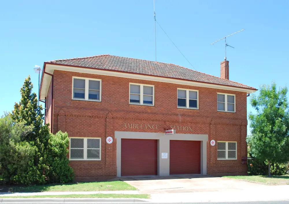
Ambulance station in West WyalongPhoto: Mattinbgn · CC BY 3.0
West Wyalong sits at the Newell Highway and Mid-Western Highway crossroads in Bland Shire, on this site’s Explorer Country list even though Destination NSW files the destination under the Riverina. Visit NSW’s town page is the official listing used here: country charm at the highway junction, gold discovered in 1893, a Main Street nicknamed the Crooked Mile because it was built around gold diggings and tree stumps. This hub is the Bland Shire service town. It is not a Griffith suburb (Griffith has no town page on this site), not Rankins Springs’s bird-hide village, and not a second Wyalong hub. Visit NSW’s West Wyalong Area listing names a Green Corridor walking track leading to the original town of Wyalong. Treat Wyalong as that named original town, not as a page this site invents.
The Australian Bureau of Statistics publishes a 2021 Urban Centre and Locality UCL115158: 2,698 people, median age 42, sex split 48.4% male / 51.6% female. 697 families, 1,449 private dwellings. Aboriginal and/or Torres Strait Islander people were 207 (7.7%) of the UCL. Suburbs and localities SAL14273 counted 3,037. Use the UCL QuickStats for the urban town figure this hub quotes. Travellers stop for the Crooked Mile, the poppet head, fuel and a Newell night. You still need Live Traffic NSW after rain or harvest, because a five-hour run from Sydney is no use if the highway is closed.
Where it is, and how far
West Wyalong is the Bland Shire town Visit NSW places at the crossroads of the Newell and Mid-Western highways. The West Wyalong Area listing also names Goldfields Way as a third approach. Rankins Springs sits west on the Mid-Western Highway on Carrathool Shire’s wording. Griffith is the Riverina city Visit NSW uses for the under-two-hour airport drive — named, not linked. Parkes is not this town.
| Place | Distance from West Wyalong (sourced) |
|---|---|
| Sydney | just over five hours (Visit NSW). Kilometre not printed |
| Melbourne | around six hours (Visit NSW). Kilometre not printed |
| Canberra | 3.5 hours (Visit NSW). Kilometre not printed |
| Wagga Wagga or Griffith airports | less than two hours (Visit NSW). Kilometre not printed |
| West Wyalong Airport AWS (BOM 050017) | 33.94°S, 147.20°E, elevation 257 m — open town table, not a drive time |
A separate West Wyalong–Hay or West Wyalong–Hillston kilometre was not on those sourced town pages, so this hub does not invent one. Carrathool Shire puts Rankins Springs between Goolgowi and West Wyalong; that is a neighbour sentence, not a Bland Shire offset.
Facts at a glance
Population. ABS 2021 UCL115158: 2,698 people. Median age 42. 7.7% Aboriginal and/or Torres Strait Islander. West Wyalong UCL QuickStats. SAL14273 is the larger suburbs-and-localities count.
Climate. Bureau of Meteorology WEST WYALONG AIRPORT AWS, 050017, 33.94°S, 147.20°E, elevation 257 m, commenced 1999, status: open, latest available data 14 November 2026. Mean maximum (28 years, 1999–2026): January 34.3 °C, July 14.5 °C, annual 24.2 °C. Mean minimum (27 years): January 18.4 °C, July 3.0 °C, annual 10.0 °C. Mean rainfall (25 years, 1999–2026): annual 468.5 mm; November 54.3 mm wettest mean month; April 25.5 mm driest. Mean days of rain ≥ 1 mm: 58.1. Wyalong Post Office, 073054, remains open with a longer rainfall series (115 years, 1895–2026, annual 486.2 mm). Do not blend the airport AWS with the post office. See West Wyalong weather.
Visitor information. West Wyalong Visitor Information Centre, 6 Shire Street, inside the Bland Shire Council building / library. Monday–Friday 10am–5pm, Saturday and Sunday 9.30am–3pm. Phone (02) 6979 0247, visitwestwyalong@blandshire.nsw.gov.au. Maps, brochures, souvenirs, local products, free WiFi. Council after-hours emergency 0418 402 350 is a utility contact, not a visitor desk. Roads: Live Traffic NSW.
Traditional Owners
Bland Shire Council’s Our Indigenous Culture page names the Wiradjuri people of NSW as “People of the three rivers” — the Lachlan, Macquarie and Murrumbidgee — and as the largest Indigenous language group in NSW. Council’s Acknowledgement of Country used in business papers asks readers to acknowledge the Wiradjuri people, their elders past and present, traditional custodians of the land we now share. Confirm current wording at 6 Shire Street. See visiting Country respectfully.
History
Visit NSW: gold was discovered in West Wyalong in 1893, and the town sprang to life around diggings. Main Street is nicknamed the Crooked Mile because it was built around gold diggings and tree stumps. The street was sketched by Russell Drysdale in 1949; a bronze easel sculpture now stands at the spot on the corner of the Tatts Hotel. Many original gold-rush buildings remain. The West Wyalong Area listing: walk the crooked mile of the unique main street, originally a bullock track woven around gold diggings and old tree stumps.
That is a gold-and-highway founding, not a river-port story borrowed from Hay and not a copper-town story borrowed from Cobar. Bland Shire’s West Wyalong page: the town stands as the focal point of the shire, its history intertwined with gold discovery and rural prosperity. Visit NSW: the district has a strong agricultural heritage and grows most of NSW’s cereal crops — an official agriculture sentence, not a visitor-number claim.
Wyalong is the named original town on the Green Corridor. This site does not split them into two hubs.
Things to do
Visit NSW and Bland Shire name these in and around West Wyalong:
- Crooked Mile / Main Street — gold-rush alignment; wrought-iron verandahs on Visit NSW
- West Wyalong Heritage Walk — self-guided; pick up a brochure at the visitor centre
- Russell Drysdale easel sculpture — Tatts Hotel corner, 1949 sketch site
- Wyalong Museum — old courthouse; Visit NSW: open daily 2pm–5pm
- True Blue Mining Poppet Head — 25-metre replica at Cooinda Reserve
- Holland Park Pool — named swim; confirm season at the VIC
- Green Corridor walking and cycle track — Bland Shire Play page; Visit NSW: award-winning track leading to original Wyalong
- Bland Shire Art Trail — murals, silo art, sculptures through Tallimba, Ungarie, Weethalle, Mirrool and Barmedman (named villages, not linked)
- Douglas DC-3 Dakota — Lions Park, junction of the Newell and Mid-Western Highways on Visit NSW’s activities list
- Lake Cowal — Visit NSW activities list: largest natural inland lake in New South Wales; a named nature day, not a West Wyalong footpath. Confirm access at the VIC. This hub does not invent a kilometre.
Nearby, not in-town: Barmedman’s mineral pool, Weethalle silo art, Mirrool Silo Kick in October, West Wyalong Rodeo in March, Business West Wyalong Christmas Markets in December — event names on Visit NSW, not a timetable this hub will reprint as if they never move.
See things to do in West Wyalong.
Where to stay
Visit NSW’s destination page names caravan and camping sites, cottages, hotels and motels. Named operators on Visit NSW’s West Wyalong accommodation list include Ardeanal Motel, Country Roads Motor Inn, Club Inn Motel, Mentors Chambers B&B, Ace Caravan Park and West Wyalong Caravan Park. Those are official named types, not a ranked motel strip. Confirm vacancies at 6 Shire Street.
- How to choose: West Wyalong accommodation
- Camping detail: West Wyalong caravan parks
- Operator enquiries: feature your business
If West Wyalong is full, Rankins Springs is the Mid-Western Highway overflow on Carrathool Shire’s list. Condobolin is the Lachlan Shire neighbour on this wave.
Caravan and camping
Vans use West Wyalong as a Newell or Mid-Western Highway night. Official named parks on Visit NSW are Ace Caravan Park (corner Newell and Mid-Western Highway) and West Wyalong Caravan Park (60 Main Street). Bland Shire also records a council lease for West Wyalong Caravan Park on Crown land — a tenure fact, not a booking. Ask on arrival for stay limits, dump points and pets. Read West Wyalong caravan parks and outback camping.
NRMA EV fast chargers sit at the corner of Water and Shire Streets in a caravan carpark opposite the visitor centre on Bland Shire’s VIC page. Council has also posted temporary closures — confirm before you plan a charge as a van night.
Fuel and services
West Wyalong is a highway service town. Bland Shire: there are a number of fuel stations in West Wyalong and Wyalong; fuel up before village loops. This guide does not list a bowser brand or invent hours. West Wyalong Health Service, 70 Ungarie Road, provides 24-hour accident and emergency (NSW Health). A town of 2,698 people will not match Wagga Wagga or Dubbo for a referral hospital. Fill here if you are continuing west toward Rankins Springs or north toward Condobolin.
Visitor questions: (02) 6979 0247. Council (02) 6972 2266. After-hours emergency 0418 402 350.
Road access
The Newell Highway (Melbourne–Brisbane inland spine) and the Mid-Western Highway meet in West Wyalong. Visit NSW’s Area listing also names Goldfields Way. These are freight roads. Pull over for road trains. After rain or harvest, Live Traffic NSW.
West: Rankins Springs then Goolgowi (Kidman Way) — Goolgowi is named, not linked. South-west: Griffith — no town page. East and south: Temora and Cootamundra sit on Visit NSW’s Riverina explore list and do not have town pages here. North: Condobolin is the Lachlan neighbour. Hay and Hillston are the plains and Lachlan neighbours on this site.
Nearby parks and towns
Parks and named nature sites:
- Cooinda Reserve / True Blue poppet head (Visit NSW)
- Green Corridor walking and cycle track (Bland Shire)
- Lake Cowal — Visit NSW activities list; confirm access. Not a national-park campground this hub will timetable
- Holland Park Pool (Visit NSW)
Towns on this site:
- Rankins Springs — Mid-Western Highway, Carrathool bird hides
- Hay — Murrumbidgee plains
- Hillston — Lachlan, Kidman Way
- Condobolin — Lachlan Shire
- Dubbo — Explorer Country regional city
Named, not linked: Wyalong (original town on the Green Corridor), Griffith, Wagga Wagga, Tallimba, Ungarie, Weethalle, Mirrool, Barmedman, Goolgowi.
When to go, and how long
BOM West Wyalong Airport AWS January mean maximum of 34.3 °C is hot for a midday heritage walk. July’s 14.5 °C mean maximum is the walking season on paper; July’s 3.0 °C mean minimum is why a van night needs a layer. Annual rainfall 468.5 mm on 25 years is not desert and not a Top End Wet. November’s 54.3 mm is the wettest mean month on that AWS table.
An hour covers the Crooked Mile, the easel and a poppet-head photograph if Cooinda is open. A night covers fuel, a motel or van site, and the museum’s 2pm–5pm window. Two nights if you are adding the Art Trail villages the VIC confirms are reachable that week.
Operators who want a checked listing: feature your business. The listings slot on this hub stays empty until then.
Plan this trip
Tell us the dates, who you are travelling with and where you need help. We reply with planning notes for West Wyalong — we are not a booking agent.
Events and road-conditions newsletter
Occasional notes on outback festivals, race days and official road-condition sources — not a daily blast. We use these details only to send the newsletter.
New South Wales · Explorer Country
Things to do in West Wyalong
Things to do in West Wyalong: Crooked Mile heritage walk, Russell Drysdale easel, Wyalong Museum, True Blue poppet head, Green Corridor and Bland Shire Art Trail. Bland Shire, not Griffith.
Read · 4 min
New South Wales · Explorer Country
West Wyalong accommodation
Where to stay in West Wyalong: Visit NSW names motels, cottages, hotels and caravan parks including Ace Caravan Park and West Wyalong Caravan Park. Confirm before you unhitch. Bland Shire, not Griffith.
Read · 4 min
New South Wales · Explorer Country
West Wyalong caravan parks
Camping in West Wyalong: Visit NSW names Ace Caravan Park at the highway junction and West Wyalong Caravan Park on Main Street. Confirm before you unhitch. Bland Shire, not Griffith.
Read · 3 min
New South Wales · Explorer Country
West Wyalong weather
West Wyalong climate from BOM West Wyalong Airport AWS (050017): January mean max 34.3 °C, July 14.5 °C, annual rainfall 468.5 mm. Open station. Bland Shire, not a Griffith table.
Read · 4 min
Frequently asked questions
How far is West Wyalong from Sydney and Melbourne?
Visit NSW puts West Wyalong just over five hours’ drive from Sydney, around six hours from Melbourne and 3.5 hours from Canberra. You can also fly into Wagga Wagga or Griffith, both less than two hours’ drive. Those pages do not print kilometre figures for those drives.
What is West Wyalong’s population?
2,698 people at the 2021 Census for the West Wyalong Urban Centre and Locality (UCL115158), median age 42. Suburbs and localities SAL14273 counted 3,037. Aboriginal and/or Torres Strait Islander people were 207 (7.7%) of the UCL.
Is West Wyalong the same town as Wyalong?
This hub is West Wyalong, the Bland Shire administrative centre Visit NSW and council treat as the Newell / Mid-Western Highway stop. Visit NSW’s West Wyalong Area listing names a Green Corridor walking track leading to the original town of Wyalong. This site does not invent a second Wyalong hub. Confirm the twin-town map at 6 Shire Street.
What is there to do in West Wyalong?
Visit NSW names the Crooked Mile main street (built around gold diggings and tree stumps), a Russell Drysdale easel sculpture at the Tatts Hotel, the West Wyalong Heritage Walk, Wyalong Museum in the old courthouse (open daily 2pm–5pm on that page), the 25-metre True Blue Mining Poppet Head at Cooinda Reserve, Holland Park Pool, and the Bland Shire Art Trail through named villages.
What is the weather like in West Wyalong?
BOM West Wyalong Airport AWS (050017, open): January mean maximum 34.3 °C, July 14.5 °C, annual rainfall 468.5 mm (25 years, 1999–2026). Temperature means use 28 years (1999–2026). Wyalong Post Office (073054) is a longer rainfall table; do not blend the two.
Where should I stay in West Wyalong?
Visit NSW’s destination page names caravan and camping sites, cottages, hotels and motels as stay types. Named operators on Visit NSW’s accommodation list include Ace Caravan Park, West Wyalong Caravan Park, Ardeanal Motel, Country Roads Motor Inn, Club Inn Motel and Mentors Chambers B&B. Confirm at the visitor centre before you unhitch.
Sources and further reading
Facts on this page were checked against these primary and official sources. Conditions change — confirm before you travel or buy.
- West Wyalong 2021 Census QuickStats (UCL115158) — Australian Bureau of Statistics
- West Wyalong 2021 Census QuickStats (SAL14273) — Australian Bureau of Statistics
- Climate statistics for West Wyalong Airport AWS (050017) — Bureau of Meteorology
- Climate statistics for Wyalong Post Office (073054) — Bureau of Meteorology
- West Wyalong — Destination NSW
- West Wyalong Area — Destination NSW
- West Wyalong Visitor Information Centre — Bland Shire Council
- West Wyalong — Bland Shire Council
- Our Indigenous Culture — Bland Shire Council
- West Wyalong Health Service — NSW Health
- Live Traffic NSW — Transport for NSW