At a glance
Sourced facts only. Distances and services change — confirm before you travel.
- Local government
- Barkly Regional Council
- Traditional Owners
- Tourism NT names the Marlinja Aboriginal Community surrounding the historic township. NT Place Names records Marlinja as an Aboriginal community in the Newcastle Waters locality, Northern Land Council, managed by local government.Do not flatten Elliott’s Jingili council list onto this townsite. Confirm current wording with Barkly Regional Council and Marlinja before treating a nation label as a Newcastle Waters acknowledgement.
- Nearest regional city
- Elliott, 25 km (Tourism NT Newcastle Waters destination and Historic Township pages). Tourism NT’s destination page also puts the township 282 km north of Tennant Creek. NT Place Names prints 285 kilometres north-north-west of Tennant Creek.
- Capital
- NT Government Stuart Highway rest-stop table prints Darwin 711 km from the Newcastle Waters rest stop. That is a rest-stop kilometre, not a townsite kilometre invented here.
- Nearest fuel
- Tourism NT’s destination page sends travellers to Elliott, 25 km away, for a roadhouse. This hub does not invent a bowser brand at the historic township.
- Nearest hospital or clinic
- Tourism NT names a medical clinic at Elliott, 25 km away. A hospital name for Newcastle Waters is not printed on the sourced Tourism NT or Place Names pages used here.
- Mobile coverage
- Check Telstra and Optus coverage maps before travel; do not assume a signal off the Stuart Highway at the historic township.
- Best time to visit
- May–August cooler Dry on the nearest open BOM table (Elliott 015131: July mean max 28.3 °C, mean min 11.5 °C). Newcastle Waters Post Office (015089) is closed.
Climate
Monthly means from the Bureau of Meteorology station Newcastle Waters Post Office (015089). This is not a forecast. Closed 31 December 1980. Temperature 17 years (1963–1980); rainfall 37 years (1941–1980). Latest available data 1 December 1980. Nearest open station Tourism NT puts 25 km away is Elliott (015131).
| Month | Mean max (°C) | Mean min (°C) | Rainfall (mm) |
|---|---|---|---|
| Jan | 37.3 | 24.1 | 125.5 |
| Feb | 35.6 | 23.7 | 130.9 |
| Mar | 34.7 | 22.6 | 91.7 |
| Apr | 33.3 | 19.4 | 24.6 |
| May | 30.0 | 16.1 | 9.3 |
| Jun | 27.7 | 12.7 | 5.3 |
| Jul | 27.5 | 11.3 | 3.4 |
| Aug | 30.8 | 13.7 | 1.0 |
| Sep | 34.1 | 17.4 | 5.4 |
| Oct | 37.1 | 21.2 | 20.9 |
| Nov | 38.4 | 23.3 | 35.7 |
| Dec | 38.5 | 24.1 | 77.3 |
Newcastle Waters in pictures
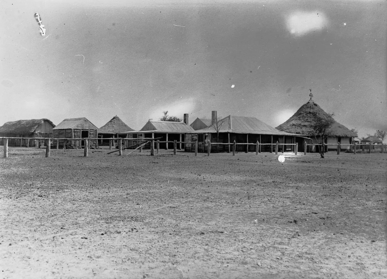
Historic view of Newcastle WatersPhoto: State Library of South Australia · Public domain 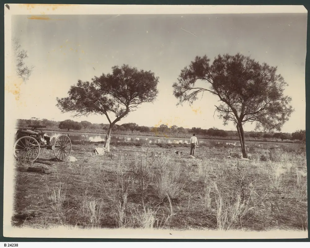
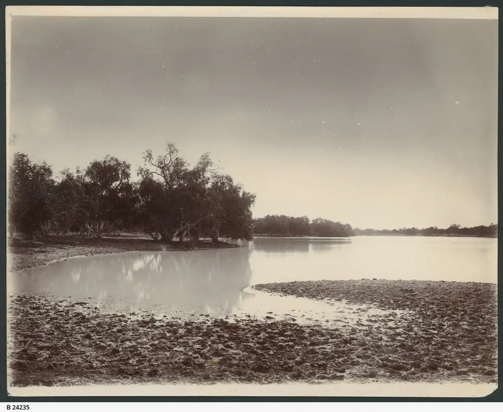
Historic camping ground at Newcastle WatersPhoto: State Library of South Australia · Public domain
Newcastle Waters is a Barkly drovers township in the Top End listing on this site, 3 kilometres off the Stuart Highway and 25 kilometres north of Elliott on Tourism NT’s Historic Township page. Tourism NT’s destination page puts the township 282 km north of Tennant Creek on the Explorers Way. NT Place Names prints 285 kilometres north-north-west of Tennant Creek. This hub is the Northern Territory historic township on Newcastle Waters Station, not Newcastle New South Wales, not a Hunter coal port, and not a Darwin suburb. Darwin is the capital; it has no town page here.
Tourism NT’s destination sentence is the founding story used here. The explorer John McDouall Stuart reached the area in 1861, found a large body of water in Lake Woods nearby, and named it after the Duke of Newcastle, then Secretary for the Colonies. NT Place Names adds that Stuart’s original handwritten journal named the water body Glandfield Lagoon after the then Mayor of Adelaide, and the South Australian Government applied Newcastle Waters after the Secretary for Colonies. That is a lagoon-and-station naming, not a second Elliott wartime camp and not a gold-rush street.
The Australian Bureau of Statistics does not publish a 2021 Urban Centre (UCL) named Newcastle Waters. Use suburbs-and-localities SAL70205: 122 people, median age 25, sex split 50.8% male / 49.2% female. 24 families, 31 private dwellings. QuickStats notes limited tables because of the small population. Tourism NT still describes the historic township as a ghost town that is no longer inhabited. Hold both official sentences: the SAL counts people in the locality geography; the tourism page is talking about the preserved drovers street. You still need the NT Road Report after rain, because a 3 km access off the Stuart is no use if the Track is closed.
Where it is, and how far
Newcastle Waters sits just off the sealed Stuart Highway in the Barkly Tablelands, on the same corridor as our Stuart Highway and Adelaide to Darwin guides. Tourism NT: it is part of the vast, historic Newcastle Waters Station. South on that highway, Elliott is the service town Tourism NT names for a roadhouse, post office, police station and medical clinic. Further south, Tennant Creek is the next large Barkly town on this site. North, Daly Waters and Katherine sit on the same bitumen on those towns’ own guides. This hub does not add Elliott’s Powell Creek telegraph kilometre onto Newcastle Waters and call the sum a town distance.
NT Government’s Stuart Highway rest-stop table lists a Newcastle Waters stop with barbecues, picnic tables, water, shelters, toilet, information bay and 24-hour overnight camping allowed. That table prints Katherine 396 km north, Tennant Creek 274 km south, Attack Creek 202 km south, and Darwin 711 km. Those are rest-stop kilometres. Tourism NT’s township kilometres (282 km from Tennant Creek; 25 km from Elliott; 3 km off the highway) stay in their own column.
| Place | Distance from Newcastle Waters (sourced) |
|---|---|
| Elliott | 25 km (Tourism NT destination and Historic Township pages) |
| Stuart Highway | 3 km (Tourism NT Historic Township) |
| Tennant Creek | 282 km south (Tourism NT destination); 285 km NNW (NT Place Names) |
| Newcastle Waters rest stop to Tennant Creek | 274 km (NT Government rest-stop table) |
| Newcastle Waters rest stop to Darwin | 711 km (NT Government rest-stop table) |
| Newcastle Waters rest stop to Katherine | 396 km (NT Government rest-stop table) |
A separate Newcastle Waters–Daly Waters kilometre was not on those sourced town pages, so this hub does not invent one.
Facts at a glance
Population. ABS 2021 Census SAL70205: 122 people. Median age 25. Limited tables. Use Newcastle Waters QuickStats. Tourism NT’s ghost-town sentence is about the historic street, not a second Census.
Climate. Bureau of Meteorology NEWCASTLE WATERS POST OFFICE, 015089, 17.38°S, 133.40°E, elevation 210 m, commenced 1941, status: closed 31 December 1980, latest available data 1 December 1980. Mean maximum (17 years, 1963–1980): December 38.5 °C (hottest month by mean max), July 27.5 °C, annual 33.8 °C. Mean minimum: January and December 24.1 °C, July 11.3 °C, annual 19.1 °C. Mean rainfall (37 years, 1941–1980): annual 535.9 mm; February 130.9 mm wettest mean month; August 1.0 mm driest. Mean days of rain ≥ 1 mm: 40.1. Nearest open station Tourism NT puts 25 km away: Elliott, 015131. See Newcastle Waters weather.
Visitor information. Tourism NT’s Newcastle Waters destination page and Historic Township listing are the official visitor pages used here. Barkly Regional Council’s Elliott community page is the nearest named council desk. Roads: NT Road Report.
Traditional Owners
Tourism NT’s Historic Township listing: the precinct is surrounded by Newcastle Waters Station and the Marlinja Aboriginal Community. NT Place Names records Marlinja as an Aboriginal community in the Newcastle Waters locality, Northern Land Council, managed by local government, with alternate name Newcastle Waters.
A Traditional Owner nation sentence named for the Newcastle Waters townsite in the same wording Elliott uses for Jingili was not on the Tourism NT Newcastle Waters pages fetched for this rebuild. Barkly Regional Council’s Jingili list sits on the Elliott community page. This guide does not flatten that Elliott sentence onto Newcastle Waters. NT Heritage’s Murranji Track listing names Mudburra people at Murranji Bore and Waterhole (Murmulka) on the stock route west of town — a track site, not a townsite acknowledgement this hub will paste onto the bronze drover. Confirm current wording with Marlinja and Barkly Regional Council. Stay on public roads. See visiting Country respectfully.
History
NT Place Names: this population centre and old drovers town takes its name from the adjacent water body named by John McDouall Stuart in 1861 after the Duke of Newcastle, Henry Pelham. After the pastoral station was established here about 1885, the Federal Government constructed a police station and other facilities before WW2 at the junction of the Stock Routes. A town area on the Ridge was surveyed and gazetted 9 January 1964 (CG 2; NTG 3, 22 January 1964) containing 23.59 hectares.
Tourism NT: Stuart established a basecamp near the present site of the station. With the pastoral industry, a small township sprang up and thrived as a supply point at the junction of major droving routes. The introduction of the road train in the 1960s rendered droving obsolete, and Newcastle Waters quickly became a ghost town. The National Trust has preserved several buildings and created Drovers Memorial Park, its centrepiece a life-sized bronze statue of a drover.
NT Heritage permanently declares the Murranji Track: 230 kilometres through dense lancewood and bullwaddy from Newcastle Waters to Old Top Springs, a shortcut from the Kimberley or Victoria River Districts toward Queensland markets, known as the ghost road of the drovers. First crossing 1885 by Hedley and Morgan; last mob 1967 by Noel “Pic” Willetts. That is a heritage stock-route sentence, not a sealed-highway walk from the bronze statue.
This is a drovers-and-station founding, not an Elliott 1942 army camp (that story sits on Elliott’s own hub, on the edge of this same station) and not a Tennant Creek gold rush.
Things to do
Tourism NT and NT Heritage name these in and around Newcastle Waters:
- Heritage-listed historic township — Tourism NT Historic Township listing; 3 km off the Stuart Highway
- National Trust preserved buildings — Tourism NT destination page
- Drovers Memorial Park — life-sized bronze drover, Tourism NT
- Marlinja community and Newcastle Waters Station as setting — stay on public roads and signed paths; this is a living community and a working station, not a film set
- Murranji Track — NT Heritage; 230 km west toward Old Top Springs; not a 2WD town walk
Nearby, not in-town: Elliott’s roadhouse, clinic and Number 8 bore memorial are 25 km south. Karlu Karlu / Devils Marbles belongs to Tennant Creek’s own guide. Daly Waters pub and airfield sit north on that highway’s own page. See things to do in Newcastle Waters.
Where to stay
Tourism NT does not name a motel or caravan park in the historic township. It sends roadhouse, post office, police station and medical clinic to Elliott, 25 km away. NT Government names 24-hour overnight camping at the Newcastle Waters rest stop on the Stuart Highway table. Those are official named types, not a ranked hotel strip. If you want a room, Elliott is the sourced service town. If you want a van night on bitumen, ask which side of the 3 km access the rest stop actually sits on before you unhitch among ruins.
- How to choose: Newcastle Waters accommodation
- Camping detail: Newcastle Waters caravan parks
- Operator enquiries: feature your business
Caravan and camping
The Stuart Highway is sealed. NT Government allows 24-hour overnight camping at the named Newcastle Waters rest stop, with toilets and water on that table. The heritage precinct is a photograph stop on Tourism NT, not a free camp among National Trust buildings. Read Newcastle Waters caravan parks and outback camping. Wet-season flooding is an NT Road Report question. February’s 130.9 mm mean rain on the closed Newcastle Waters table is still a Barkly Wet pattern.
Fuel and services
A heritage street Tourism NT calls uninhabited will not match Tennant Creek for a hospital. Tourism NT names fuel and clinic services at Elliott, 25 km. This guide does not list a bowser brand at the ruins. Fill in Elliott or Tennant Creek if you are unsure. A hospital name for Newcastle Waters is not on the sourced pages used here. For current questions use Barkly Regional Council’s Elliott desk and the NT Road Report.
Road access
Stuart Highway sealed north–south. The historic township is 3 km off that highway on Tourism NT. NT Road Report is the authority, especially in the Wet. Stay on gazetted roads. Aboriginal land needs the permits those agencies print. The Murranji Track is a heritage stock route, not a default 2WD continuation of the Stuart.
Our Stuart Highway and Adelaide to Darwin guides are the road-trip pages. Droving and stock routes is the cattle-history page.
Nearby parks and towns
Parks and heritage (nearby, not a Kakadu day):
- Murranji Track — NT Heritage, 230 km from Newcastle Waters to Old Top Springs
- Karlu Karlu / Devils Marbles — via Tennant Creek, not a Newcastle Waters main-street walk
Towns on this site:
- Elliott — 25 km south, Tourism NT’s service town
- Tennant Creek — 282 km south on Tourism NT’s destination page
- Daly Waters — north on the Stuart
- Katherine — further north; 396 km from the NT Government Newcastle Waters rest stop
When to go, and how long
The closed Newcastle Waters table’s December mean maximum of 38.5 °C is a Barkly build-up. February’s 130.9 mm is the wettest mean month on that table. July’s 27.5 °C mean maximum and 11.3 °C mean minimum, with August’s 1.0 mm, is the Dry. Elliott’s open table is the one to pack for now: November 39.0 °C, July 28.3 °C / 11.5 °C.
An hour covers the bronze drover and a photograph of National Trust buildings if the 3 km access is open. A night covers the highway rest stop or a room in Elliott. Two full tourist days in the township is more than the sourced main-street list supports unless you are waiting out rain.
Operators who want a checked listing: feature your business. The listings slot on this hub stays empty until then.
Plan this trip
Tell us the dates, who you are travelling with and where you need help. We reply with planning notes for Newcastle Waters — we are not a booking agent.
Events and road-conditions newsletter
Occasional notes on outback festivals, race days and official road-condition sources — not a daily blast. We use these details only to send the newsletter.
Northern Territory · Top End
Newcastle Waters accommodation
Where to stay at Newcastle Waters: Tourism NT sends the roadhouse to Elliott, 25 km south. NT Government names 24-hour camping at the Newcastle Waters rest stop. Barkly historic township, not Newcastle NSW.
Read · 3 min
Northern Territory · Top End
Newcastle Waters caravan parks
Camping at Newcastle Waters: NT Government names 24-hour overnight camping at the Newcastle Waters rest stop. Tourism NT does not name a town caravan park. Confirm before you unhitch. Barkly NT, not NSW.
Read · 3 min
Northern Territory · Top End
Newcastle Waters weather
Newcastle Waters climate from closed BOM Post Office 015089 (December mean max 38.5 °C, annual 535.9 mm) and open Elliott 015131 25 km away. Barkly NT, not Newcastle NSW.
Read · 3 min
Northern Territory · Top End
Things to do in Newcastle Waters
Things to do in Newcastle Waters: National Trust buildings, Drovers Memorial Park, Marlinja setting, Murranji Track heritage. Barkly historic township 25 km north of Elliott, not Newcastle NSW.
Read · 4 min
Frequently asked questions
Is Newcastle Waters in the Northern Territory or New South Wales?
This hub is Newcastle Waters in the Barkly Region of the Northern Territory, 3 km off the Stuart Highway. Tourism NT puts the historic township 25 km north of Elliott and 282 km north of Tennant Creek. It is not Newcastle New South Wales, not a Hunter Valley coal town, and not a Darwin suburb.
How far is Newcastle Waters from Elliott and Tennant Creek?
Tourism NT’s Historic Township page puts Newcastle Waters 25 kilometres north of Elliott and 3 kilometres off the Stuart Highway. Tourism NT’s destination page puts the township 282 km north of Tennant Creek. NT Place Names prints 285 kilometres north-north-west of Tennant Creek. NT Government’s rest-stop table prints the Newcastle Waters rest stop 274 km north of Tennant Creek — a rest-stop figure, not averaged here into a fake town kilometre.
What is Newcastle Waters’ population?
122 people at the 2021 Census for Newcastle Waters suburbs-and-localities (SAL70205), median age 25. QuickStats notes limited tables because of the small population. The ABS does not publish a 2021 Urban Centre named Newcastle Waters. Tourism NT describes the historic township as a ghost town no longer inhabited. Use the SAL figure for the locality; do not treat ruins as a 122-person main street.
What is there to do in Newcastle Waters?
Tourism NT names the National Trust–preserved buildings, Drovers Memorial Park with a life-sized bronze drover, and an insight into a way of life long past. The Historic Township listing calls the place Heritage-Listed and surrounded by Newcastle Waters Station and the Marlinja Aboriginal Community. NT Heritage permanently declares the Murranji Track from Newcastle Waters to Old Top Springs.
What is the weather like in Newcastle Waters?
BOM Newcastle Waters Post Office (015089) is closed 31 December 1980. On that closed table, December mean maximum 38.5 °C, July 27.5 °C, annual rainfall 535.9 mm (37 years, 1941–1980). Nearest open station Tourism NT puts 25 km away is Elliott (015131): November mean maximum 39.0 °C, July 28.3 °C, annual rainfall 603.9 mm.
Can I camp at Newcastle Waters?
NT Government’s Stuart Highway rest-stop table names a Newcastle Waters rest stop with barbecues, picnic tables, water, shelters, toilet, information bay and 24-hour overnight camping allowed. Tourism NT does not name a caravan park in the historic township and sends roadhouse services to Elliott, 25 km away. Confirm the rest stop versus the heritage precinct before you unhitch among ruins.
Sources and further reading
Facts on this page were checked against these primary and official sources. Conditions change — confirm before you travel or buy.
- Newcastle Waters 2021 Census QuickStats (SAL70205) — Australian Bureau of Statistics
- Climate statistics for Newcastle Waters Post Office (015089) — Bureau of Meteorology
- Climate statistics for Elliott (015131) — Bureau of Meteorology
- Newcastle Waters — Tourism NT
- Newcastle Waters Historic Township — Tourism NT
- Newcastle Waters (Place Names Register, id 21684) — NT Place Names Register
- Marlinja (Place Names Register, id 252) — NT Place Names Register
- Murranji Track (Heritage Register) — NT Heritage Register
- Road rest stops in NT — Northern Territory Government
- NT Road Report — Northern Territory Government
- Communities — Elliott — Barkly Regional Council