At a glance
Sourced facts only. Distances and services change — confirm before you travel.
- Local government
- Central Highlands Regional Council
- Traditional Owners
- Not named for the Comet townsite on the sourced Central Queensland Highlands Comet pagesConfirm current wording at a Central Queensland Highlands visitor information centre before treating any label as a townsite acknowledgement.
- Nearest regional city
- Emerald is the Central Highlands service town and the named neighbour on this site. Official Comet pages used here do not print a Comet–Emerald kilometre.
- Nearest fuel
- Confirm a bowser on arrival; this hub does not invent a brand or hours. Emerald is the neighbouring service town on the Capricorn Highway.
- Nearest hospital or clinic
- Confirm with Queensland Health — do not invent a clinic name. This site’s Emerald hub names Emerald Hospital as the Central Highlands referral hospital.
- Mobile coverage
- Check Telstra and Optus coverage maps before travel; do not assume a signal at Comet Weir or Riley’s Crossing.
- Best time to visit
- May–September on Emerald Airport cooler mean maxima; that is a labelled neighbour table, not a Comet street mean. Comet Post Office is rainfall-only.
Climate
Monthly means from the Bureau of Meteorology station Emerald Airport (035264). This is not a forecast. Open temperature table for the named Emerald neighbour. Comet Post Office (035021) is rainfall-only (opened 1895, elevation 170 m). Do not blend the two. Do not use Springsure Comet St — that is a Springsure town station.
| Month | Mean max (°C) | Mean min (°C) | Rainfall (mm) |
|---|---|---|---|
| Jan | 34.6 | 22.3 | 85.9 |
| Feb | 33.8 | 22.1 | 83.5 |
| Mar | 32.9 | 20.6 | 64.3 |
| Apr | 30.0 | 17.0 | 30.8 |
| May | 26.4 | 13.2 | 21.3 |
| Jun | 23.5 | 10.4 | 27.9 |
| Jul | 23.4 | 9.2 | 19.2 |
| Aug | 25.7 | 10.2 | 20.4 |
| Sep | 29.2 | 13.6 | 23.5 |
| Oct | 32.2 | 17.3 | 47.9 |
| Nov | 33.6 | 19.6 | 58.3 |
| Dec | 34.5 | 21.4 | 80.0 |
Comet in pictures
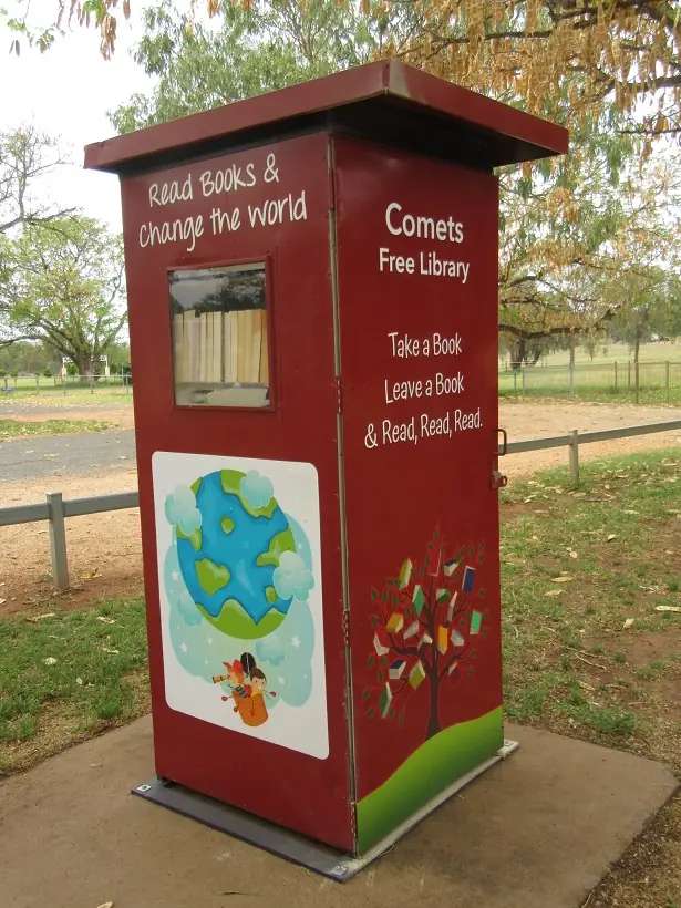
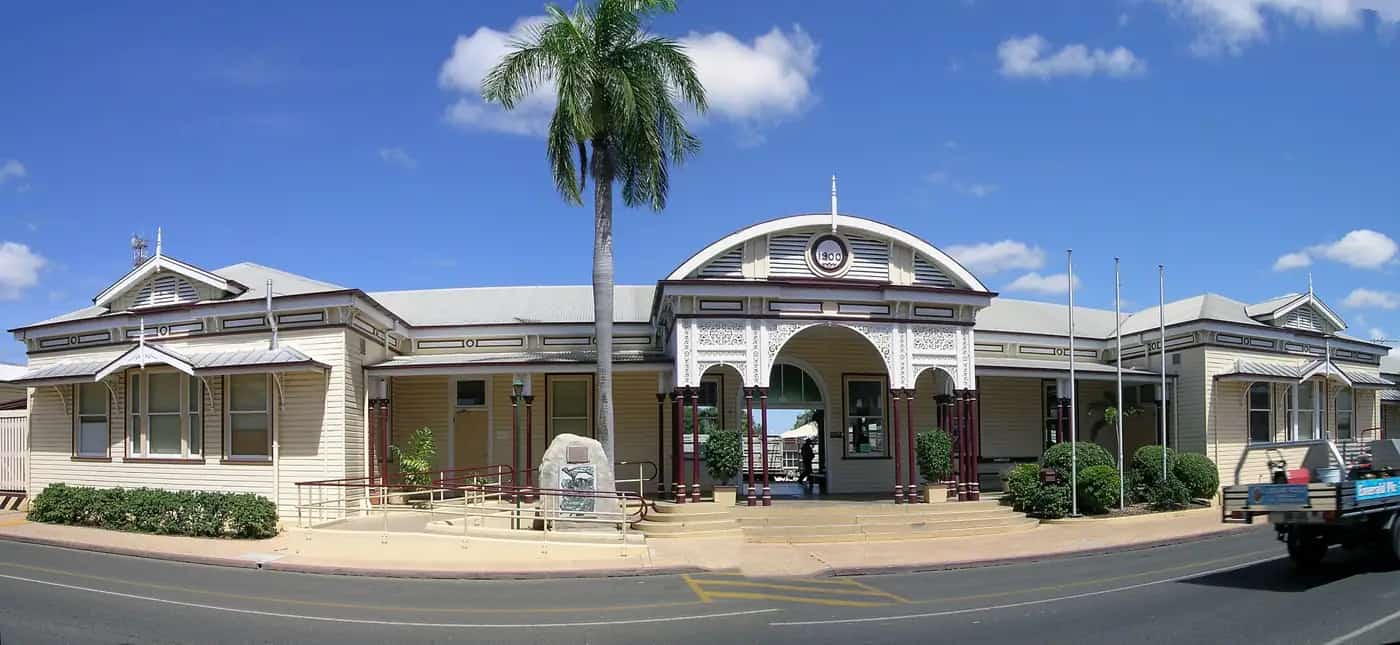
Comet free libraryPhoto: Eureca · CC BY-SA 4.0 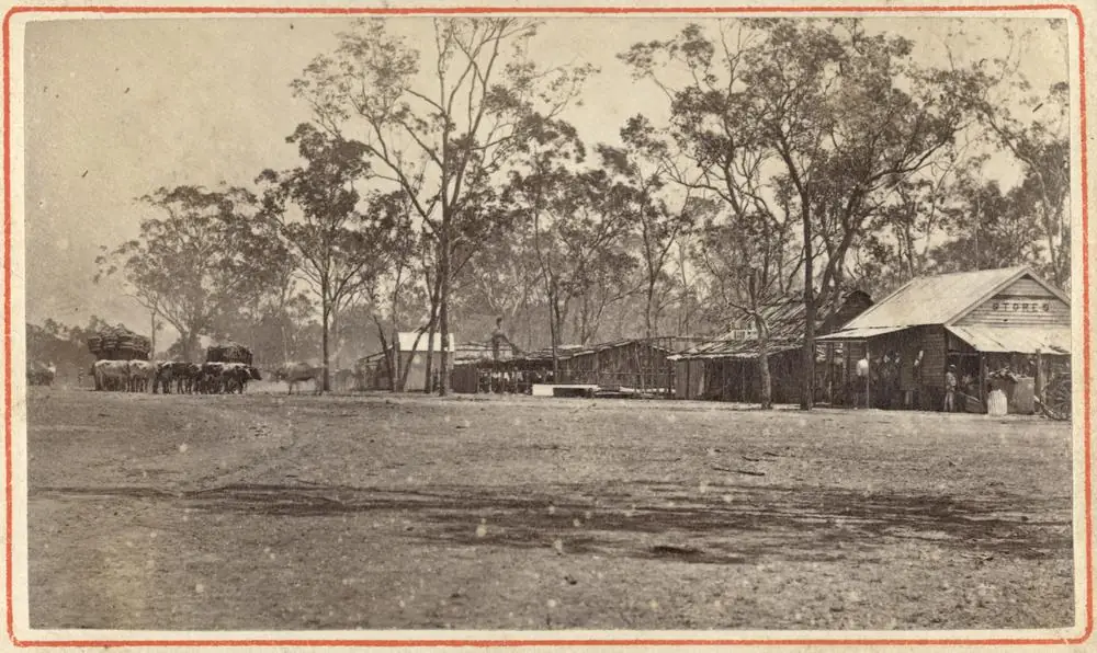
Early view of CometPhoto: John Oxley Library, State Library of Queensland · Public domain
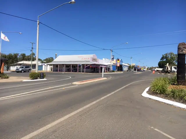
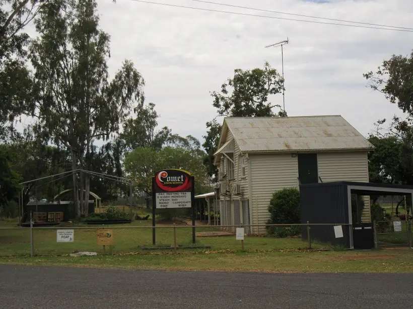
Comet sits in the Central Highlands Region on the Capricorn Highway in this site’s Capricorn–Burnett inventory. Central Queensland Highlands: Comet was named after the Comet River that runs close to the township. The river itself was named by German explorer and naturalist Ludwig Leichhardt during his first expedition through Central Queensland after observing Comet Wilmot in the western sky in December 1844. This hub is Comet, Queensland — not Comet in Western Australia, not a Springsure street (BOM Springsure Comet St is a different town), and not an Emerald suburb page. Official Comet pages used here do not print a Comet–Emerald kilometre. This hub does not invent one.
The 2021 Census counted 360 people in the locality. Travellers stop because Whistle Stop Park holds the DIG L Coolibah display, because Comet Tales strings 16 historical sites, and because the Comet River still takes a fishing line under the railway bridge. You still need QLDTraffic after storms, because a Capricorn Highway pause is no use if the highway is closed.
Where it is, and how far
Comet sits on the Capricorn Highway between Emerald and Blackwater country. Central Queensland Highlands is the sourced town listing. It names fishing on the Comet River, Comet Weir and the Mackenzie River at Riley’s Crossing, and a highway pull-over for Minion Mountain between Comet and Blackwater. It does not print a Comet–Emerald, Comet–Blackwater or Comet–Rockhampton kilometre. This hub does not invent them.
| Place | Distance from Comet (sourced) |
|---|---|
| Emerald | named neighbour on this site and the Central Highlands service town; no kilometre on the Comet pages used here |
| Blackwater | Minion Mountain sits between Comet and Blackwater on the Capricorn Highway (Central Queensland Highlands) — a corridor sentence, not a town-to-town kilometre |
| Comet Weir | named fishing hole on the town page; no walking kilometre printed |
| Riley’s Crossing | Mackenzie River fishing hole on the town page; no kilometre printed |
| Springsure | BOM Springsure Comet St is a Springsure station, not this town |
| Rockhampton / Brisbane | not published on those Comet pages |
Use Emerald as the service-town junction for the Gemfields and Lake Maraboon. Use QLDTraffic for the day you drive.
Facts at a glance
Population. ABS 2021 Census, Suburbs and Localities SAL30656: 360 people. Median age 41. Sex split 55.5% male / 44.5% female. Families 96. Private dwellings 168. Average household size 2.6. Median weekly household income $2,575. The ABS does not publish a 2021 Urban Centre named Comet on the product used here. Use the Comet SAL QuickStats.
Climate. BOM COMET POST OFFICE, 035021, 23.60°S, 148.54°E, elevation 170 m, opened 1895, status Open on the monthly rainfall page fetched for this guide. Rainfall-only. All-years monthly means: annual 578.9 mm; January 99.3 mm wettest; August 17.2 mm driest. BOM does not publish a monthly climate-averages temperature table for that station. The labelled neighbour table used in the glance climate block is Emerald Airport, 035264, commenced 1981, January mean maximum 34.6 °C, July 23.4 °C, July mean minimum 9.2 °C, annual rainfall 558.7 mm. Do not blend Comet rain with Emerald rain. Do not use Springsure Comet St (035065) — that open table belongs to Springsure. Full Emerald columns: BOM Emerald Airport. See Comet weather.
Visitor information. Central Queensland Highlands’ Comet visitor page points travellers to the CQH Visitor Guide and CQH Touring Map. Pick up the free Comet Tales map from a Visitor Information Centre, or use the region’s download. Confirm desk hours at the region’s Emerald visitor information before you treat a map as a staffed Comet office.
Traditional Owners
A Traditional Owner nation named for the Comet townsite was not on the Central Queensland Highlands Comet page, the Comet Tales page, or the Comet visitor-information page fetched for this rebuild. This guide does not copy a neighbouring town’s acknowledgement onto Comet. Confirm current wording at a Central Queensland Highlands visitor information centre before you treat any label as a townsite acknowledgement. See visiting Country respectfully.
History
Central Queensland Highlands is the visitor-history source used here.
The town takes its name from the Comet River. Leichhardt named the river after Comet Wilmot in December 1844. Whistle Stop Park displays the marked Coolibah trunk Leichhardt marked DIG L with a downward arrow during his second exploration of the region in 1847. DIG L indicated to those who followed that he had buried a powder canister under the tree containing letters and journals. The marked area of the tree was later removed and is housed in a purpose-built display at Whistle Stop Park just off the Capricorn Highway.
Also at the park: the old Comet Railway Station houses a display of local memorabilia, including old photographs and heritage railway bridge plans. Empty beer bottles were used in the structure of the railway bridge built in 1914; they were discovered in 2005 when the bridge was reconstructed.
Comet Tales and Walking Trails is an initiative of the Comet community, led by local historian Rosemary McLeod, to record and re-tell the story of the Comet area since European settlement. The walk lists 16 historical sites, including Comet Courthouse 1878, a Frontier Town — Cometville 1878, North Australian Hotel 1878, Comet Weir 1915/16, and Comet Railway Station 1979.
Take a drive to the historic Comet Cemetery and contemplate what may have caused the deaths of 73 people between 1877 and 1879. Central Queensland Highlands’ cemetery listing also notes a Comet Downs cemetery still open for interments, restored with the community in 2009 by Central Highlands Regional Council — a separate cemetery sentence, not a second town-centre walk this hub will merge without the map.
This is a river-and-railway founding, not a sapphire-fossicking main street. The Gemfields sit west of Emerald on this site.
Things to do
Central Queensland Highlands names these in and around Comet:
- Whistle Stop Park — DIG L Coolibah display; old railway station memorabilia; Comet Free Library (bright red cupboard, launched late 2021; take a book, leave a book)
- Comet Tales and Walking Trails — self-guided walk, 16 historical sites; free map
- Comet Cemetery — 73 deaths 1877–1879 on the town page
- Fishing — Comet River under the railway bridge; Comet Weir; Mackenzie River at Riley’s Crossing
- Minion Mountain — Capricorn Highway between Comet and Blackwater; recycled-material Minions by a local miner
- Maria Creek Bore — named as a story of a giant natural soda bottle and coal exploration; follow the region’s link rather than treating it as a Comet main-street tap
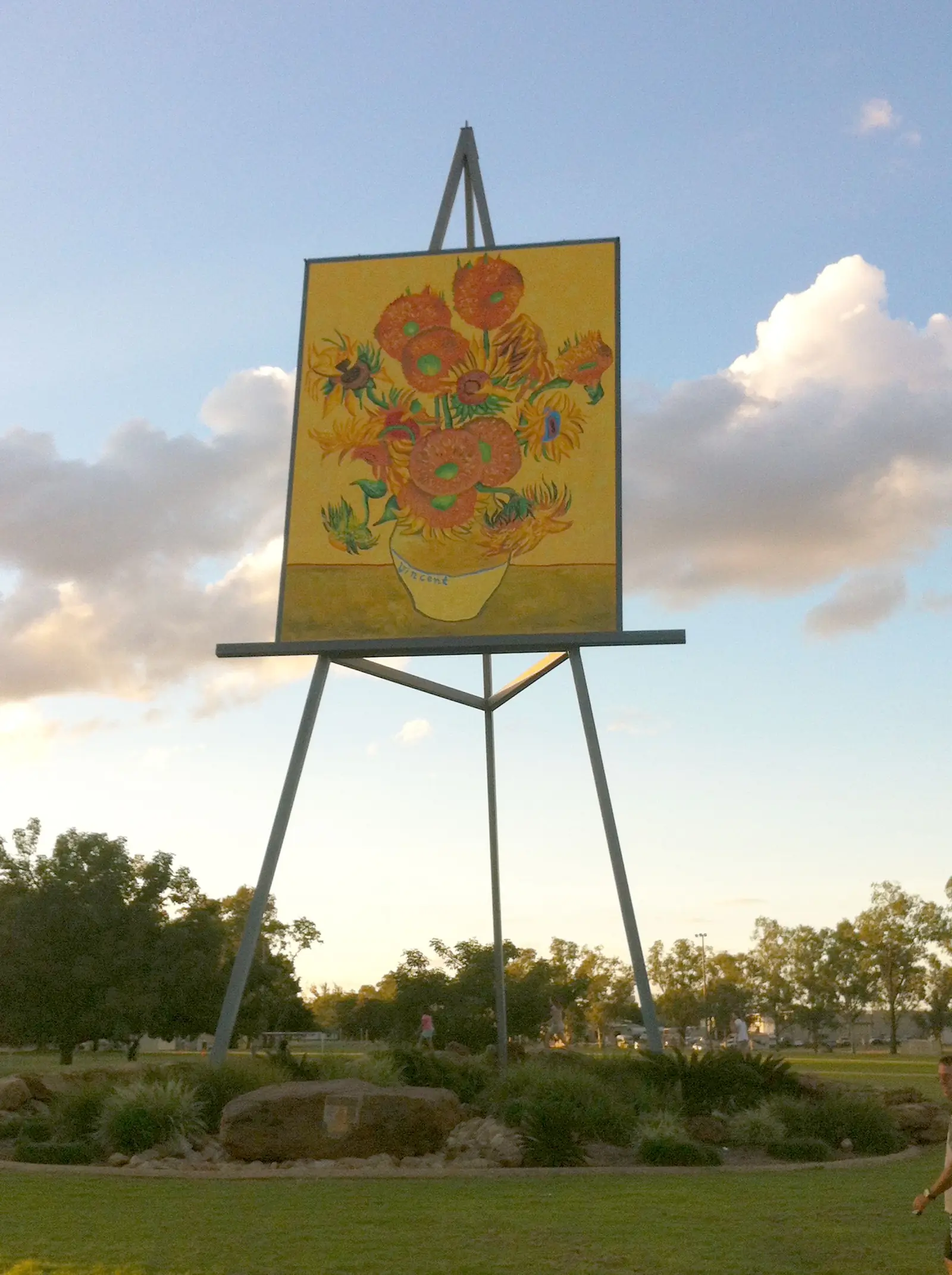
Nearby, not in-town: Emerald for the Big Easel, botanic gardens and Lake Maraboon; Sapphire and Rubyvale for fossicking; Springsure and Rolleston toward Carnarvon Gorge.
Where to stay
Central Queensland Highlands’ Comet visitor-information page: contact us for accommodation options. It does not name a Comet motel, hotel or caravan park on that page. This hub will not invent one. Emerald is the neighbouring stay town on this site.
- How to choose: Comet accommodation
- Camping detail: Comet caravan parks
- Operator enquiries: feature your business
If Comet has no vacancy, you are still on a sealed Capricorn Highway chain through Emerald. That is geography, not a booking guarantee.
Caravan and camping
Vans use Comet as a Capricorn Highway pause. Official named camping in Comet is not printed on the CQH Comet accommodation page fetched here. Do not camp in Whistle Stop Park or at the cemetery. Fishing holes are fishing holes, not free camps. Read Comet caravan parks and outback camping.
After rain, the Capricorn Highway and river banks are the constraint. QLDTraffic first.
Fuel and services
A locality of 360 people will not match Emerald for a supermarket strip. This guide does not list a bowser brand or invent clinic hours. Fill in Emerald if you are unsure. There is no Comet hospital on the sourced pages. This site’s Emerald hub names Emerald Hospital as the Central Highlands referral hospital — confirm with Queensland Health rather than assuming a Comet clinic.
For current questions, use Central Highlands Regional Council and a Central Queensland Highlands visitor desk.
Road access
The Capricorn Highway is the sealed spine through Comet between Emerald and the Blackwater side. Freight road, mining traffic, road trains. After rain, check QLDTraffic and 13 19 40. Do not drive around closed signs to keep a DIG-tree photograph.
West: Emerald, then the Gemfields. East: Minion Mountain toward Blackwater, then Duaringa further toward Rockhampton on this site. South: Springsure and Rolleston are Gregory / Carnarvon Highway towns, not Capricorn Highway suburbs of Comet.
Nearby parks and towns
Named nature and heritage (official pages):
- Whistle Stop Park — DIG L display and railway station
- Comet Tales sites including Comet Weir 1915/16 and the 1914 railway bridge
- Comet River and Mackenzie River fishing holes
- Minion Mountain — highway pull-over between Comet and Blackwater
There is no national park inside Comet on the sourced town pages. Blackdown Tableland is a named neighbour park on this site’s Emerald hub, not a Comet main-street walk.
Towns on this site:
- Emerald — Central Highlands service town
- Springsure — Virgin Rock; do not confuse with Comet St BOM
- Rolleston — Carnarvon Gorge approach; also names Comet River fishing as a Rolleston fact — that is Rolleston’s river hole, not this town’s weir
- Duaringa — further east on the Capricorn
- Sapphire and Rubyvale — Gemfields west of Emerald
When to go, and how long
Emerald Airport’s January mean maximum of 34.6 °C is hot for a cemetery walk at midday — a labelled Emerald table. July’s 23.4 °C mean maximum and 9.2 °C mean minimum are the cooler walking season on that neighbour table. Comet Post Office’s January rainfall mean of 99.3 mm is the wettest month on a 578.9 mm annual table. Two hours covers Whistle Stop Park and a Tales map if those named places are reachable. A night only if a neighbouring named stay in Emerald exists — Comet itself has no sourced hotel on the page used here. Two nights only if you are adding Emerald’s gardens and the Gemfields and QLDTraffic agrees.
Operators who want a checked listing: feature your business. The listings slot on this hub stays empty until then.
Plan this trip
Tell us the dates, who you are travelling with and where you need help. We reply with planning notes for Comet — we are not a booking agent.
Events and road-conditions newsletter
Occasional notes on outback festivals, race days and official road-condition sources — not a daily blast. We use these details only to send the newsletter.
Queensland · Capricorn Burnett
Comet accommodation
Where to stay in Comet Queensland: Central Queensland Highlands says contact the region for options and does not name a Comet motel on that page. Emerald is the neighbouring stay town. Not Comet WA.
Read · 3 min
Queensland · Capricorn Burnett
Comet caravan parks
Camping in Comet Queensland: Central Queensland Highlands’ Comet stay page does not name a town caravan park. Do not camp at Whistle Stop Park or the cemetery. Emerald is the neighbouring van town.
Read · 3 min
Queensland · Capricorn Burnett
Comet weather
Comet climate: BOM Comet Post Office (035021) rainfall-only, annual 578.9 mm. Temperature from Emerald Airport (035264): January mean max 34.6 °C, July 23.4 °C. Not Springsure Comet St, not Comet WA.
Read · 4 min
Queensland · Capricorn Burnett
Things to do in Comet
Things to do in Comet Queensland: Whistle Stop Park DIG L display, Comet Tales 16 sites, cemetery, Comet River fishing, Minion Mountain. Central Highlands, not Comet WA.
Read · 4 min
Frequently asked questions
Is this Comet in Queensland or Western Australia?
This hub is Comet in the Central Highlands Region, Queensland, on the Capricorn Highway. Central Queensland Highlands names the town after the Comet River. It is not Comet WA and not an Emerald suburb page.
How far is Comet from Emerald?
Central Queensland Highlands treats Comet as a Capricorn Highway township beside Emerald. Official Comet pages used here do not print a Comet–Emerald kilometre. This hub does not invent one. Use Emerald as the service-town neighbour on this site.
What is Comet’s population?
360 people at the 2021 Census for Comet suburbs-and-localities (SAL30656). Median age 41. The ABS does not publish a 2021 Urban Centre named Comet on the product used here.
What is there to do in Comet?
Central Queensland Highlands names Whistle Stop Park (Leichhardt DIG L display, old railway station memorabilia, free library launched late 2021), Comet Tales and Walking Trails with 16 historical sites, Comet Cemetery, Minion Mountain between Comet and Blackwater, Maria Creek Bore, and fishing at the Comet River, Comet Weir and Riley’s Crossing on the Mackenzie River.
What is the weather like in Comet?
BOM Comet Post Office (035021) is rainfall-only: opened 1895, elevation 170 m, annual mean 578.9 mm, January 99.3 mm wettest, August 17.2 mm driest. For temperature use Emerald Airport (035264), labelled as a different station: January mean maximum 34.6 °C, July 23.4 °C, annual rainfall 558.7 mm. Do not use Springsure Comet St.
Can I camp at Comet?
Central Queensland Highlands’ Comet accommodation page tells visitors to contact the region for options and does not name a Comet caravan park on that page. This hub does not invent one. Emerald is the neighbouring stay town on this site. Confirm at a Central Queensland Highlands visitor information centre.
Sources and further reading
Facts on this page were checked against these primary and official sources. Conditions change — confirm before you travel or buy.
- Comet 2021 Census QuickStats (SAL30656) — Australian Bureau of Statistics
- Monthly rainfall — Comet Post Office (035021) — Bureau of Meteorology
- Climate statistics for Emerald Airport (035264) — Bureau of Meteorology
- Comet — Central Queensland Highlands — Central Highlands Regional Council (Central Queensland Highlands)
- Comet Tales and Walking Trails — Central Highlands Regional Council (Central Queensland Highlands)
- Comet visitor information — Central Highlands Regional Council (Central Queensland Highlands)
- QLDTraffic — Queensland Government