At a glance
Sourced facts only. Distances and services change — confirm before you travel.
- Population
- 364 people (UCL322035, 2021 Census)Also 610 people at SAL30851 (SAL). Do not mix UCL and SAL in one headcount.
- Local government
- Balonne Shire
- Nearest regional city
- St George 94 km (Explore St George Region Dirranbandi Map 2026)
- Nearest fuel
- Confirm in the service town named under nearest regional city; this guide does not list bowser brands.
- Nearest hospital or clinic
- Confirm with Queensland Health — do not invent a clinic name.
- Mobile coverage
- Check Telstra and Optus coverage maps before travel; do not assume a signal on floodways, parks or unsealed approaches.
- Best time to visit
- May–September on St George Airport (043109) cooler mean maxima (July 19.8 °C; January 35.5 °C). QLDTraffic after rain.
Climate
Monthly means from the Bureau of Meteorology station St George Airport (043109). This is not a forecast. Commenced 1997. Elevation 199 m. Status: Open. Annual mean rainfall 477.0 mm. Dirranbandi has no township table on the monthly index used here. St George Airport is the labelled Balonne Shire comparison.
| Month | Mean max (°C) | Mean min (°C) | Rainfall (mm) |
|---|---|---|---|
| Jan | 35.5 | 22.4 | 53.1 |
| Feb | 33.9 | 21.3 | 61.7 |
| Mar | 32.1 | 19.1 | 50.2 |
| Apr | 28.0 | 13.9 | 23.5 |
| May | 23.3 | 9.2 | 31.9 |
| Jun | 19.9 | 6.5 | 28.6 |
| Jul | 19.8 | 5.3 | 24.6 |
| Aug | 22.3 | 6.4 | 21.4 |
| Sep | 26.6 | 10.7 | 23.9 |
| Oct | 29.9 | 14.8 | 42.9 |
| Nov | 32.4 | 18.2 | 59.2 |
| Dec | 34.3 | 20.5 | 58.2 |
Dirranbandi in pictures
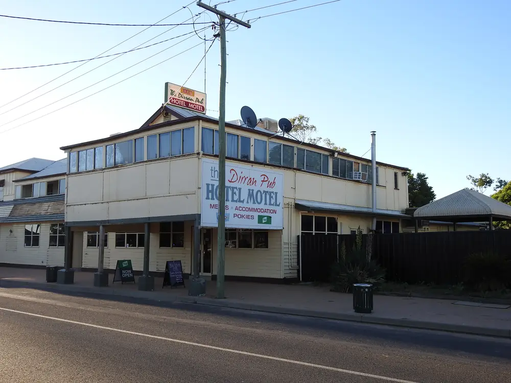
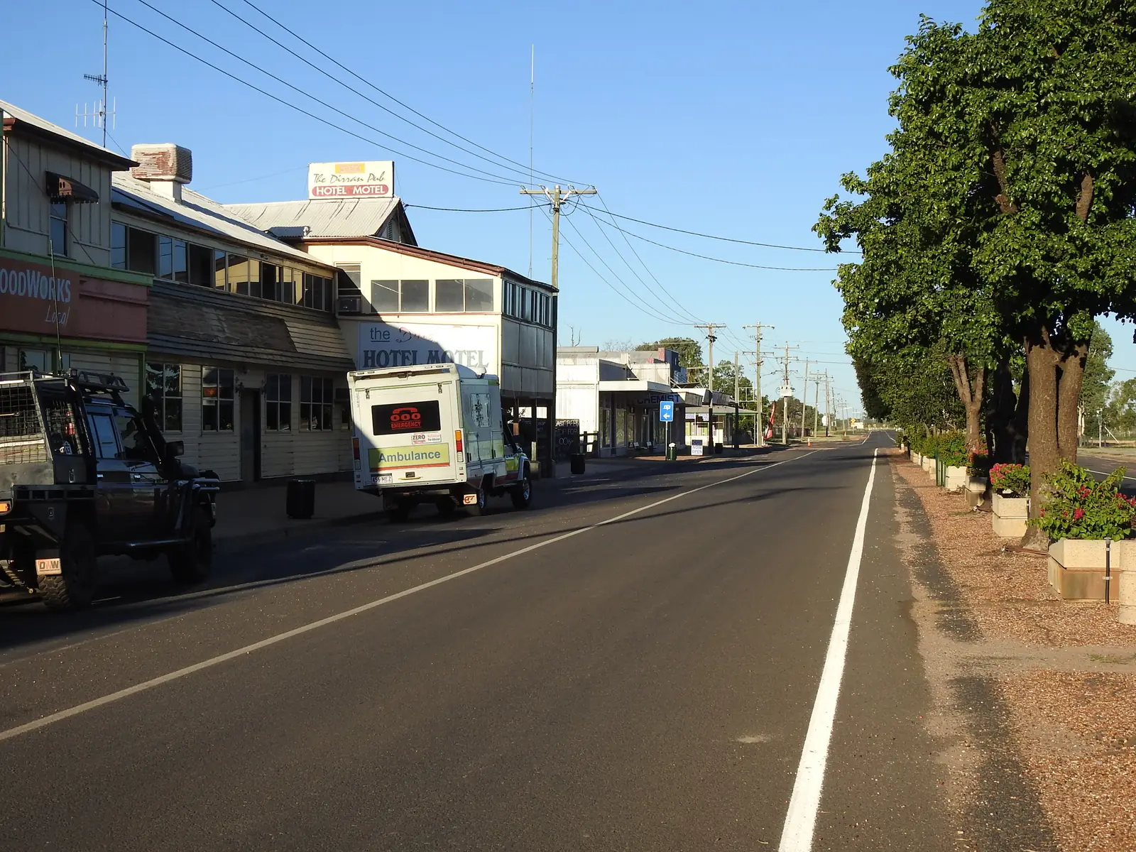
The Dirran Pub in DirranbandiPhoto: Q8682 · CC BY-SA 4.0 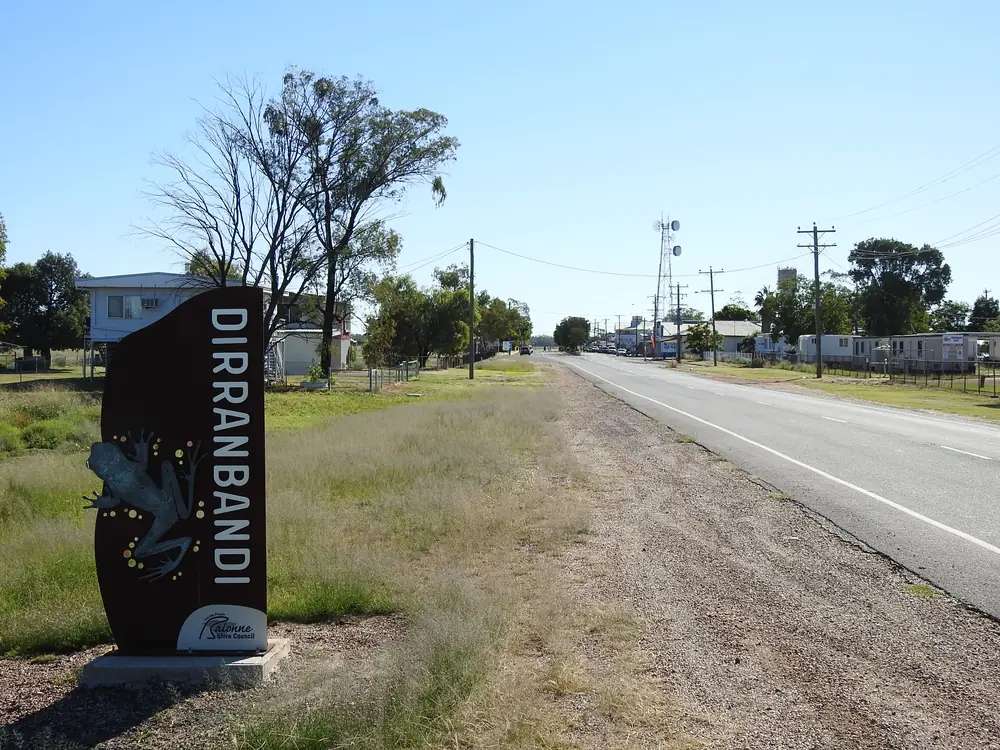
Dirranbandi town signPhoto: Q8682 · CC BY-SA 4.0 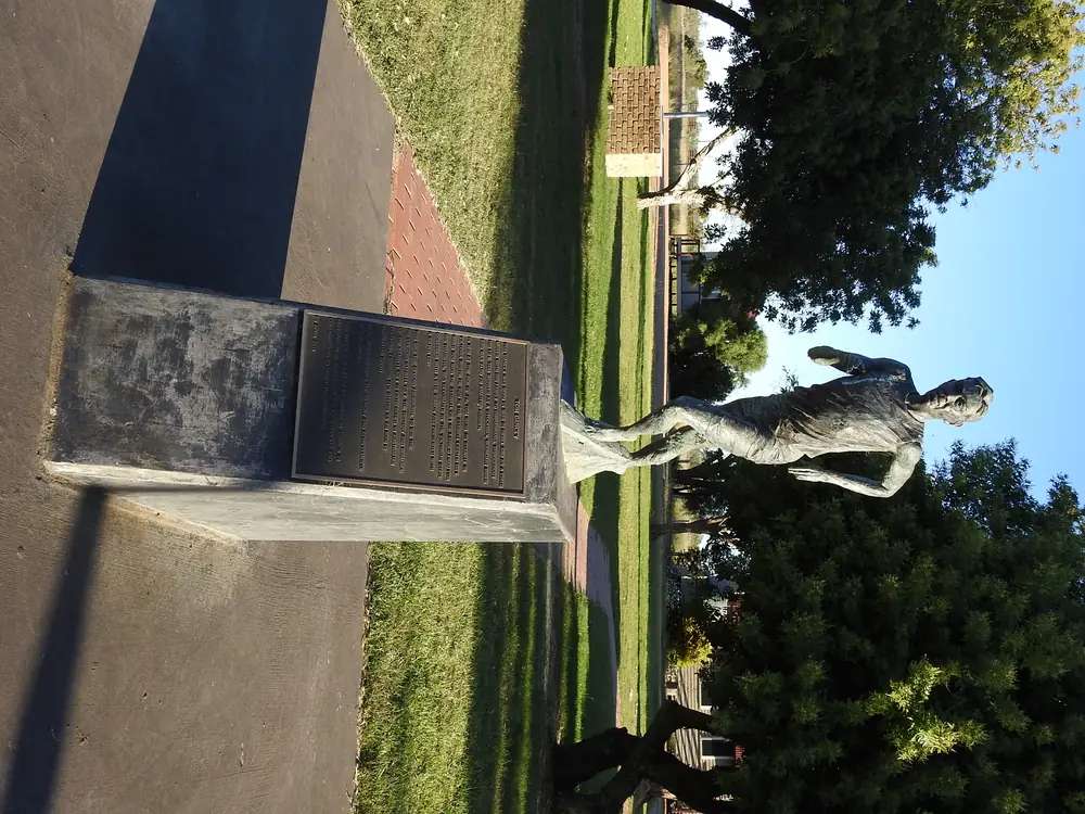
The Tom Dancey statue in DirranbandiPhoto: Q8682 · CC BY-SA 4.0 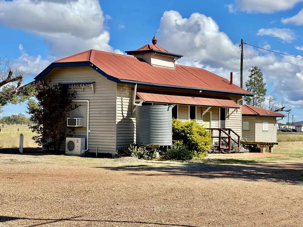
Dirranbandi Railway StationPhoto: Kgbo · CC BY-SA 4.0
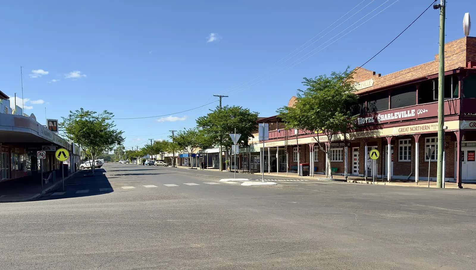
Dirranbandi is a Balonne Shire town in Queensland’s south-west, southwest of St George on the Castlereagh Highway corridor that continues to Hebel and Lightning Ridge. Explore St George Region calls it Dirran to the locals, a small country town that comes alive through the cotton harvest months. Outback Queensland puts Cubbie Station just outside town as the largest irrigated cotton farm in the Southern Hemisphere. Explore St George Region’s Dirranbandi Map 2026 prints St George 94 km, Hebel 65 km, Thallon 65 km, Bollon 105 km, Lightning Ridge 133 km and Mungindi 108 km. The Castlereagh is sealed through town in ordinary weather. You still need QLDTraffic after rain, because a 94 km run to St George is no use if the highway is closed.
The Australian Bureau of Statistics does publish a 2021 Urban Centre (UCL) named Dirranbandi: UCL322035, 364 people, median age 50, sex split 48.6% male / 51.4% female. The wider suburbs-and-localities figure SAL30851 is 610 people, median age 44. This hub uses the UCL for the town and notes the SAL when the question is the whole locality. Small random adjustments apply.
Where it is, and how far
Dirranbandi sits on the Balonne Minor River side of Balonne Shire, on the highway that links St George’s cotton country with the NSW border at Hebel. Explore St George Region’s Dirranbandi page says that as you drive in you pass the town’s levee bank, famous for having saved the town from flooding on more than one occasion. The same organisation’s fishing-loop PDF names a boat ramp on the Balonne Minor River off Charles Street and fishing at Jack Dwyer Park.
Official kilometre figures disagree slightly by product, which is why this table cites each source rather than blending them.
| Place | Distance from Dirranbandi (sourced) |
|---|---|
| St George | 94 km (Dirranbandi Map 2026) |
| Hebel | 65 km (Dirranbandi Map 2026); 66 km (Produce, Parks and Pubs itinerary); Outback Queensland lists Hebel Hotel 62 km |
| Thallon | 65 km (Dirranbandi Map 2026 and Adventure Way Loop) |
| Bollon | 105 km (Dirranbandi Map 2026); 106 km (Adventure Way Loop) |
| Lightning Ridge | 133 km (Dirranbandi Map 2026) |
| Mungindi | 108 km (Dirranbandi Map 2026) |
Nindigully is the Moonie River pub stop on the St George–Thallon corridor, not a Dirranbandi suburb. Cunnamulla is the next large Queensland service town west via Bollon on the Adventure Way.
Facts at a glance
Population. ABS 2021 Census, Urban Centres and Localities UCL322035: 364 people. Median age 50. 82 families, 238 private dwellings. Wider locality SAL30851: 610 people, 150 families, 357 private dwellings. Use the Dirranbandi UCL QuickStats for the town.
Climate. BOM lists DIRRANBANDI, 044117 (about 28.59°S, 148.23°E, rainfall from May 1997) and closed DIRRANBANDI HIGH SCHOOL, 044030 (December 1888 to April 2010) on the Queensland rainfall-station directory. BOM does not publish a monthly climate-averages table for either site. The nearest published all-years table is St George Airport, 043109, commenced 1997, elevation 199 m, January mean maximum 35.5 °C, July 19.8 °C, July mean minimum 5.3 °C, annual mean rainfall 477.0 mm (26 years, 1997–2026). Full columns: BOM St George Airport. See Dirranbandi weather.
Visitor information. Explore St George Region points travellers to the St George Region Visitor Information Centre, 114 St George’s Terrace, (07) 4620 8877. Outback Queensland puts local travel tips at the Dirranbandi Rural Transaction Centre in the 1913 Station Master’s residence on the rail precinct, with library, Country Universities Centre and post-office facilities. Queensland Parks’ Culgoa page has listed that RTC at (07) 4625 8411 on the tourism-links extract used for this site’s Hebel guide — confirm the number when you call.
Traditional Owners
Explore St George Region’s visitor guide publishes a generic Acknowledgement of Country for the shire and does not name a single nation for the Dirranbandi townsite. The same organisation’s Adventure Way Loop names Gwamu/Kooma people on the Bollon Cultural Walk in this shire. The National Native Title Tribunal records Kooma People #4 Part A (QCD2014/012) as a consent determination covering land in Balonne Shire, among other local government areas, with the Kooma Aboriginal Corporation RNTBC. This hub follows those official sentences rather than flattening several Condamine–Balonne nations onto one town label. Confirm wording with the St George visitor centre.
History
Outback Queensland’s Dirranbandi page centres on the Dirranbandi Rail and River Precinct: the end point of the South West rail line and home to Australia’s last ever mail train service. Railway Park holds the original waiting room, parcels office and the 1913 Station Master’s residence, now the Rural Transaction Centre. That is the official rail story this hub will print. It does not invent a gazettal year the sourced pages did not give.
Explore St George Region’s town page adds the levee bank that has saved the town from flooding more than once — a flood-history note, not a hydrology paper. Cotton harvest is the seasonal pulse both Outback Queensland and the council tourism site describe. Cubbie Station sits just outside town on those pages as the largest irrigated cotton farm in the Southern Hemisphere. Dirranbandi Outback Tours is the named way to see it. Book. The farm is not a public lookout.
Things to do
Cubbie Station tour — Outback Queensland and Explore St George Region: behind-the-scenes tours through Dirranbandi Outback Tours. Adventure Way Loop says the town booms during cotton harvest, when a Cubbie tour is a must. Hours are seasonal. Confirm.
Mosaic Walk — Outback Queensland: a colourful trail of community-made artworks underfoot. Explore St George Region places a mosaic walkway on the opposite side of Railway Street as an artistic interpretation of the town’s history. Accessible as a paved walkway on that page.
Murals — Outback Queensland: keep an eye out for murals dotted around town while you wander the main street.
Dirranbandi Rail and River Precinct / Railway Park — waiting room, parcels office, 1913 Station Master’s residence / RTC. End of the South West rail line; last mail train story.
Jack Dwyer Memorial Park — Outback Queensland: picnic or a quiet cast from the pontoon; Murray Cod or Yellowbelly may be landed. Explore St George Region names a river walk and Jack Dwyer Memorial Park at 9 Charles Street. Queensland fisheries rules apply. After flood, stay off closed banks.
Dirranbandi Bakery — named on Explore St George Region’s town page and Adventure Way Loop (27–29 Railway Street on the town page). Russian-born baker Natalia is named there. Hours change.
Dirranbandi Beersheba Memorial and Dirran Servo are listed as see-and-do pins on the Explore St George Region Dirranbandi page. Confirm what is open.
See things to do in Dirranbandi.
Culgoa Floodplain National Park is a 4WD park on the Queensland–NSW border. Queensland Parks puts it about 230 km from St George. Hebel is the jumping-off point named on that town’s council page, not a Dirranbandi main-street walk.
Where to stay
Outback Queensland names Dirranbandi Retreat and Caravan Park about 2 km from town. Explore St George Region’s Adventure Way Loop says Dirranbandi offers a caravan park, two motels and a hotel. The council town page names Dirranbandi Caravan Park, 45 Kirby Street. Those are official named types, not a ranked inventory. Confirm at (07) 4620 8877.
- How to choose: Dirranbandi accommodation
- Camping detail: Dirranbandi caravan parks
- Operator enquiries: feature your business
If Dirranbandi is full, St George is 94 km on the 2026 map and has more rooms. Hebel is 65 km toward Lightning Ridge. That is a distance fact, not a booking guarantee.
Caravan and camping
Vans use Dirranbandi as a cotton-country overnight on the Castlereagh and as a step toward Hebel or Bollon. Official named camping is the Dirranbandi Retreat and Caravan Park / Dirranbandi Caravan Park on the council and Outback Queensland lists. Ask the St George VIC for stay limits, dump points and whether river camping at Jack Dwyer is even allowed — the sourced pages name a picnic and a pontoon, not a free camp. Read Dirranbandi caravan parks and outback camping.
After rain, the Balonne Minor and the levee story are the constraint. QLDTraffic first.
Fuel and services
A UCL of 364 people will not match St George for a hospital or a supermarket aisle, but it is larger than Hebel. Explore St George Region names Dirran Servo. This guide does not list bowser brands. Fill up here if the servo is open, or in St George. The RTC on the rail precinct is the named community hub for post office, library and travel tips. For current questions, use Balonne Shire Council and (07) 4620 8877.
Road access
The Castlereagh Highway is the sealed spine through Dirranbandi between St George’s south-west approaches and Hebel. Adventure Way Loop also uses the Thallon–Dirranbandi road at 65 km. The Dirranbandi Map 2026 marks Dirranbandi–Hebel Road. These are freight roads. Pull over for road trains. After rain, check QLDTraffic and 13 19 40. Balonne also points to emergency.balonne.qld.gov.au. Do not drive around closed signs to keep a Cubbie tour.
North-east: St George, then Roma or Cunnamulla. South: Hebel and Lightning Ridge — Live Traffic NSW once you cross. West: Bollon on the Adventure Way. East: Thallon and Nindigully.
Nearby parks and towns
Parks and named nature sites:
- Jack Dwyer Memorial Park and Balonne Minor River pontoon (Outback Queensland / Explore St George Region)
- Culgoa Floodplain National Park — 4WD, from the Hebel side on council wording; about 230 km from St George on the park page
Towns on this site:
- St George — 94 km; Balonne River, four-highway crossroads
- Hebel — 65 km; border town, Historical Circle
- Nindigully — Moonie River locality on the St George–Thallon corridor
- Lightning Ridge — 133 km; NSW opal fields
- Cunnamulla — west via Bollon on the Adventure Way
Thallon and Bollon have town guides on this site in the same Wave 3 set.
When to go, and how long
St George Airport’s January mean maximum of 35.5 °C is hot for a Mosaic Walk at midday. July’s 19.8 °C mean maximum is the comfortable walking season; July’s 5.3 °C mean minimum is why a van night needs a layer. Cotton harvest is the seasonal pulse on the official pages — confirm whether Cubbie tours are running. Two hours at the rail precinct, mosaic walk and Jack Dwyer pontoon is the minimum. A night lets you use a powered site if the VIC has confirmed it. Two nights only if a station tour is booked and QLDTraffic agrees.
Operators who want a checked listing: feature your business. The listings slot on this hub stays empty until then.
Plan this trip
Tell us the dates, who you are travelling with and where you need help. We reply with planning notes for Dirranbandi — we are not a booking agent.
Events and road-conditions newsletter
Occasional notes on outback festivals, race days and official road-condition sources — not a daily blast. We use these details only to send the newsletter.
Queensland · South West
Dirranbandi accommodation
Where to stay in Dirranbandi: Dirranbandi Retreat and Caravan Park plus a caravan park, two motels and a hotel as named by Outback Queensland and Explore St George Region.
Read · 4 min
Queensland · South West
Dirranbandi caravan parks
Camping in Dirranbandi: Dirranbandi Retreat and Caravan Park and Dirranbandi Caravan Park as named by Outback Queensland and Explore St George Region. Confirm at the VIC.
Read · 3 min
Queensland · South West
Dirranbandi weather
Dirranbandi climate: BOM stations 044117 and 044030 have no monthly averages table. Use St George Airport (043109): January mean max 35.5 °C, July 19.8 °C, 477.0 mm rain.
Read · 5 min
Queensland · South West
Things to do in Dirranbandi
Things to do in Dirranbandi: Cubbie Station tours, Mosaic Walk, last mail-train precinct, Jack Dwyer Park fishing and named murals. Confirm at the St George VIC.
Read · 5 min
Frequently asked questions
How far is Dirranbandi from St George, Hebel and Thallon?
Explore St George Region’s Dirranbandi Map 2026 prints St George 94 km, Hebel 65 km and Thallon 65 km. The same organisation’s Produce, Parks and Pubs itinerary puts Hebel 66 km from Dirranbandi. Adventure Way Loop puts Thallon to Dirranbandi at 65 km and Dirranbandi to Bollon at 106 km.
What is Dirranbandi’s population?
364 people at the 2021 Census for Dirranbandi urban centre (UCL322035). The wider suburbs-and-localities figure is 610 people (SAL30851). This hub uses the UCL for the town.
What is Cubbie Station?
Outback Queensland and Explore St George Region describe Cubbie Station, just outside town, as the largest irrigated cotton farm in the Southern Hemisphere. Tours are named through Dirranbandi Outback Tours. Book; do not treat the farm gate as a public lookout.
Where is the visitor centre for Dirranbandi?
Use the St George Region Visitor Information Centre, 114 St George’s Terrace, St George, phone (07) 4620 8877, or the Dirranbandi Rural Transaction Centre in the 1913 Station Master’s residence on the rail precinct.
What is the weather like in Dirranbandi?
BOM lists Dirranbandi (044117) and closed Dirranbandi High School (044030) as rainfall stations but does not publish a monthly climate-averages table for either. Use St George Airport (043109): January mean maximum 35.5 °C, July 19.8 °C, annual rainfall 477.0 mm.
Can I camp at Dirranbandi?
Yes, as named types. Outback Queensland names Dirranbandi Retreat and Caravan Park about 2 km from town. Explore St George Region’s Adventure Way Loop says the town offers a caravan park, two motels and a hotel. Confirm at the St George visitor centre.
Sources and further reading
Facts on this page were checked against these primary and official sources. Conditions change — confirm before you travel or buy.
- Dirranbandi 2021 Census QuickStats (UCL322035) — Australian Bureau of Statistics
- Dirranbandi 2021 Census QuickStats (SAL30851) — Australian Bureau of Statistics
- Climate statistics for St George Airport (043109) — Bureau of Meteorology
- Outback Queensland — Dirranbandi — Outback Queensland Tourism Association
- Explore St George Region — Dirranbandi — Balonne Shire Council
- Dirranbandi Map 2026 (PDF) — Balonne Shire Council
- Adventure Way Loop itinerary — Balonne Shire Council
- Produce, Parks and Pubs itinerary — Balonne Shire Council
- Culgoa Floodplain National Park — Queensland Parks and Wildlife Service
- QLDTraffic — Queensland Government