At a glance
Sourced facts only. Distances and services change — confirm before you travel.
- Local government
- Charters Towers Regional Council
- Traditional Owners
- Visit Charters Towers’ history page names Gudjal people west to White Mountains National Park. That is Charters Towers wording covering the highway west, not a Pentland native-title determination printed on the Pentland town page.
- Nearest regional city
- Visit Charters Towers: 107 km west of Charters Towers and 140 km east of Hughenden. Visit Hughenden’s getting-here table lists Hughenden–Pentland 138 km. This hub does not pick one.
- Nearest fuel
- Visit Charters Towers’ Pentland accommodation page names fuel in the township. QPWS White Mountains: fuel and basic supplies 27 km east at Pentland. Confirm the bowser on arrival; this hub does not invent a brand.
- Mobile coverage
- Check Telstra and Optus coverage maps before travel; QPWS says mobile coverage is unreliable in White Mountains National Park.
- Best time to visit
- QPWS White Mountains: cooler months April to September. Charters Towers Airport Comparison (034084) January mean maximum 33.8 °C, July 25.1 °C. QLDTraffic after rain.
Climate
Monthly means from the Bureau of Meteorology station Charters Towers Airport Comparison (034084). This is not a forecast. Open. Labelled nearby temperature table — Pentland Post Office (030040) is rainfall-only and closed 31 May 2025. Do not blend. Commenced 1942. Elevation 290 m. Annual mean rainfall 651.3 mm.
| Month | Mean max (°C) | Mean min (°C) | Rainfall (mm) |
|---|---|---|---|
| Jan | 33.8 | 22.4 | 150.5 |
| Feb | 33.0 | 22.3 | 147.8 |
| Mar | 32.1 | 21.0 | 77.6 |
| Apr | 30.4 | 18.4 | 27.9 |
| May | 27.5 | 15.2 | 26.7 |
| Jun | 25.2 | 12.7 | 17.6 |
| Jul | 25.1 | 11.7 | 22.9 |
| Aug | 27.0 | 12.3 | 13.9 |
| Sep | 30.4 | 15.1 | 8.3 |
| Oct | 33.1 | 18.2 | 18.1 |
| Nov | 34.2 | 20.5 | 60.4 |
| Dec | 34.7 | 21.9 | 79.6 |
Pentland, Queensland (Flinders Highway) in pictures
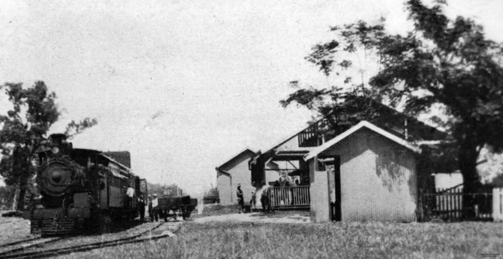
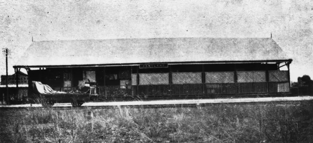
Mail train at Pentland railway station, 1929Photo: Queenslander · Public domain 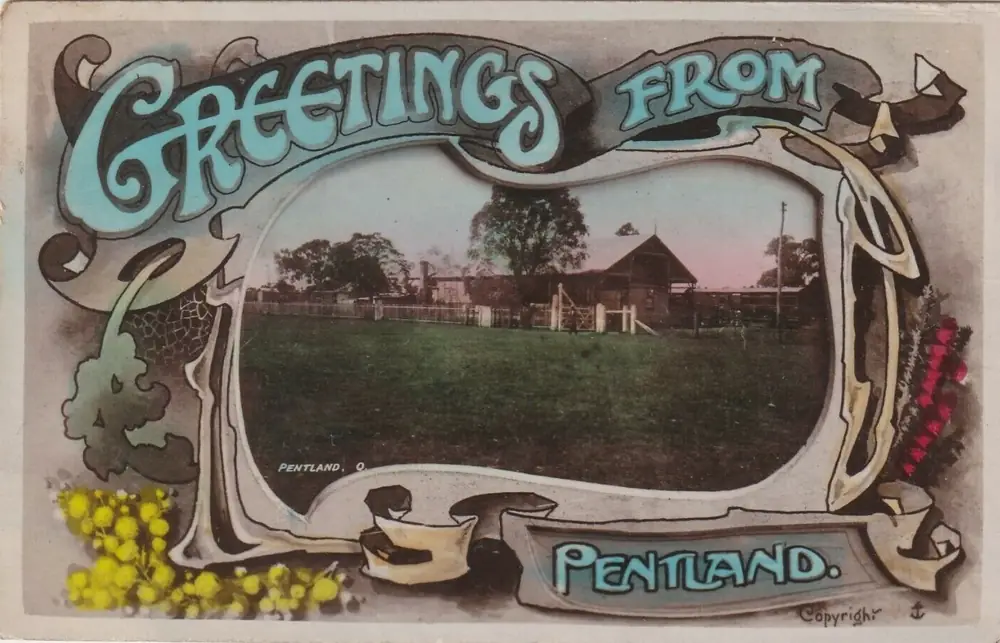
Greetings from Pentland postcard of the railway stationPhoto: Aussie~mobs · Public domain
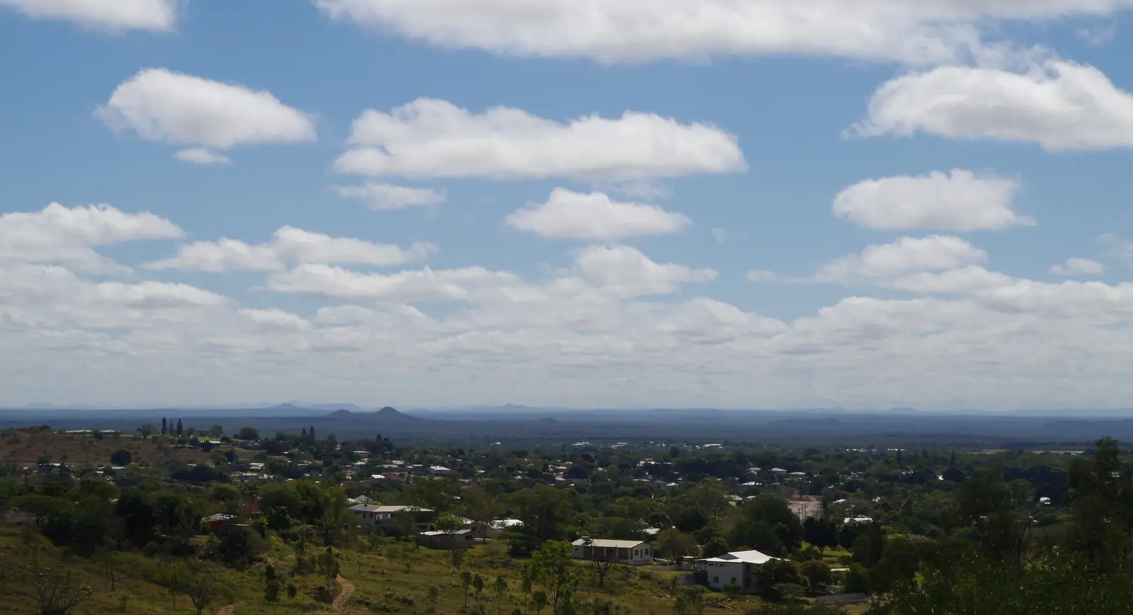
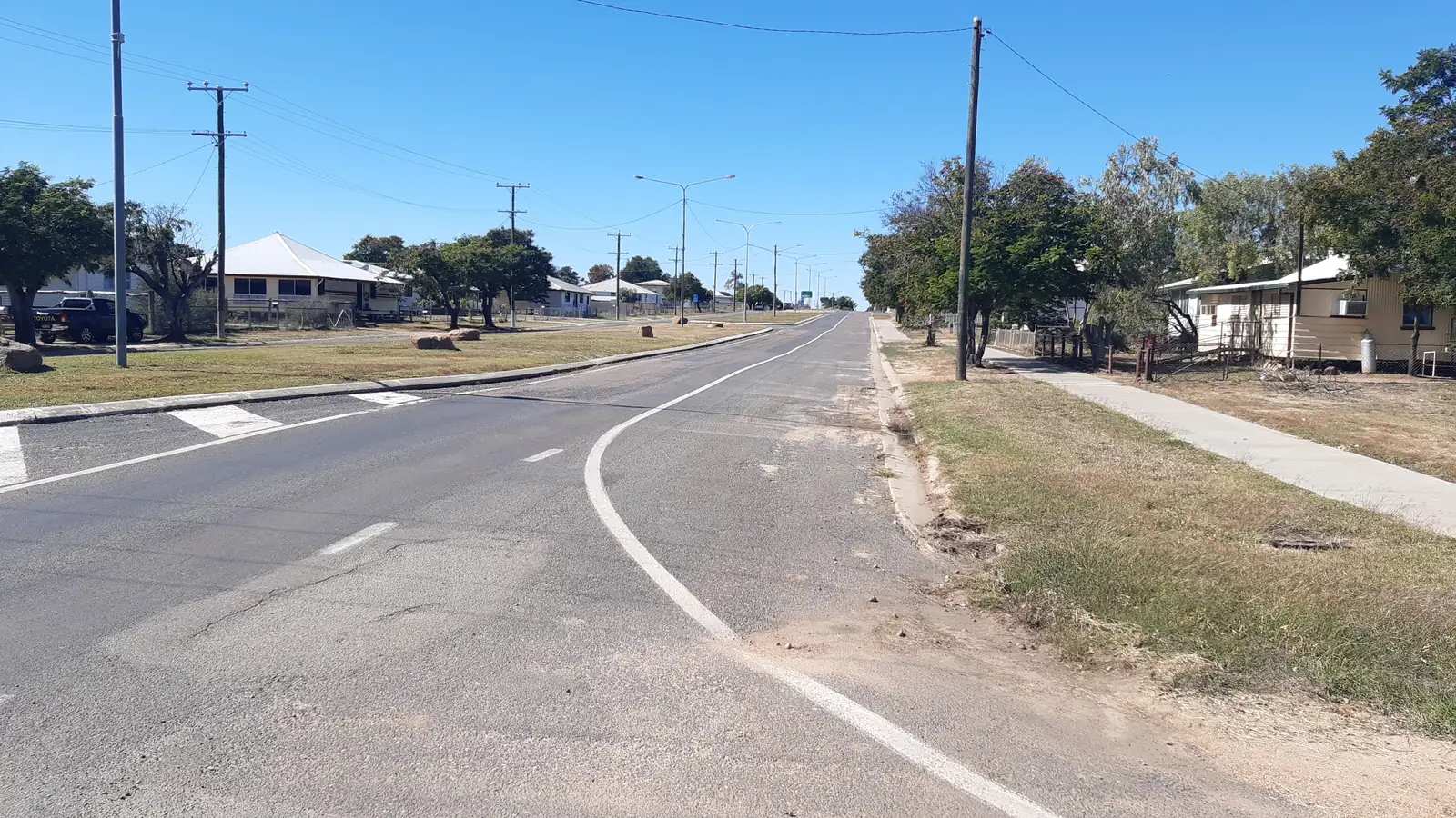
Pentland, Queensland sits in the Charters Towers Region on the Flinders Highway between Charters Towers and Hughenden. Visit Charters Towers is the source for that placement: heading west from Charters Towers you travel through Balfes Creek and Homestead before Pentland. This is not a South Australian town page and not a Charters Towers suburb.
Visit Charters Towers puts Pentland 107 km west of Charters Towers and 140 km east of Hughenden. Visit Hughenden’s getting-here table lists Hughenden–Pentland 138 km. This hub prints both Hughenden figures rather than inventing a compromise.
The 2021 Census counted 248 people in the locality. Visit Charters Towers’ estimated population of 250 is a tourism line. Travellers stop for fuel, the Pentland Caravan Park & Cafe, the Pentland Hotel Motel, the historic railway station, Norwood Lockup, and Burra Range Lookout on the highway toward Torrens Creek. You still need QLDTraffic after rain.
Where it is, and how far
Pentland is the Flinders Highway township west of Charters Towers. Official pages used here do not agree on a single Pentland–Hughenden kilometre. Queensland Parks’ White Mountains page locates the park, not the township, 80 km east of Hughenden and 140 km west of Charters Towers. This hub does not add those park figures into a homemade town-to-town total.
| Place | Distance from Pentland (official pages used here) |
|---|---|
| Charters Towers | 107 km east (Visit Charters Towers Pentland page) |
| Hughenden | Visit Charters Towers: 140 km west. Visit Hughenden getting-here: 138 km. Do not pick one. |
| Torrens Creek | not published as a Pentland kilometre on those town pages. QPWS White Mountains: fuel 23 km west of the park at Torrens Creek and 27 km east at Pentland — print that wording; do not add 23+27 as a town-to-town kilometre |
| White Mountains National Park | QPWS: approximately 80 km east of Hughenden and 140 km west of Charters Towers on the Flinders Highway. Burra Range lookout is on the highway |
| Townsville | not published as a Pentland kilometre. Visit Hughenden’s getting-here page puts Hughenden 376 km west of Townsville — that figure is for Hughenden, not Pentland |
| Mount Isa | not published as a Pentland kilometre. The same table puts Hughenden 519 km east of Mount Isa |
| Brisbane | not published on those pages |
Use QLDTraffic for the day you drive. Do not add a Pentland–Townsville total from the Hughenden figure.
Facts at a glance
Population. Australian Bureau of Statistics 2021 Census, Suburbs and Localities SAL32295, Pentland (Qld): 248 people. Median age 50. Sex split 56.0% male / 44.0% female (140 male, 110 female). Families 54. Private dwellings 194. Average household size 2. Median weekly household income $751. Aboriginal and/or Torres Strait Islander people 19 (7.7% of the locality). Use the ABS SAL QuickStats page. The ABS does not publish a 2021 Urban Centre named Pentland. Visit Charters Towers’ “estimated population of 250” is a tourism line, not a substitute Census.
Climate. Bureau of Meteorology station PENTLAND POST OFFICE, 030040, opened 1885, status Closed 31 May 2025, 20.52°S, 145.40°E, elevation 403 m. The Climate Data Online monthly rainfall table fetched for this guide prints all-years means: annual 666.7 mm; January 158.3 mm wettest mean month; August 12.3 mm driest. Median annual 617.3 mm. Highest annual total in that table 1574.8 mm; lowest 95.4 mm. BOM does not publish a temperature climate-averages table for this site. For a Flinders Highway comparison table, use Charters Towers Airport Comparison, 034084, clearly labelled as a different station. See Pentland weather.
Visitor information. Pentland does not have its own visitor information centre on the Visit Charters Towers pages used here. Use the Charters Towers Visitor Information Centre, 74 Mosman Street, phone (07) 4761 5533, Monday–Friday 8:30am–4:00pm, Saturday, Sunday and public holidays 9:00am–12:00pm. For White Mountains, Queensland Parks also lists the Flinders Discovery Centre, 37 Gray Street, Hughenden, (07) 4741 2970.
Traditional Owners
Visit Charters Towers’ history page names Gudjal people (pronounced Goodjal) as Traditional Owners, especially along the Burdekin and Broughton Rivers, the basalt lagoons, and west to White Mountains National Park. Neighbouring nations named on that page are Gugu Badhun, Yirandali and Jangga. That is Charters Towers wording covering the highway west. The Pentland town page used here does not print a separate native-title determination for the township. This guide does not flatten one gold-city sentence onto every verandah. Visit as a guest; see visiting Country respectfully.
History
Visit Charters Towers: Pentland was established in the mid-1850s, becoming a critical rail and communication junction in this period. The discovery of gold, followed by the rise of the timber and cattle industries, assisted in maintaining the township’s early thriving position. Today the small town, with an estimated population of 250 on that page, offers historical and natural attractions. The same page says the town is fast becoming known for resident artists and storytellers, and recommends a cuppa as you wander the art galleries.
This hub does not invent a peak gold population, a railway-opening year beyond “mid-1850s rail and communication junction,” or a 2026 gallery roster the visitor page does not name. The historic photographs on this page show the railway station in 1936, a 1929 mail train, and a 1909 postcard of the station — sourced Commons files, not a claim that the 2026 building is identical.
Things to do
Historic railway station and Norwood Lockup. Named on Visit Charters Towers’ Pentland page. Confirm access at the Charters Towers Visitor Information Centre; this is not a ticketed museum with published hours on that page.
Art galleries. Visit Charters Towers recommends wandering the art galleries. Named operators change. Ask (07) 4761 5533.
Burra Range Lookout. Visit Charters Towers: between Pentland and Torrens Creek, a bird’s-eye view of White Mountains National Park; look for wildflowers and wattle in spring. Queensland Parks: Burra Range lookout, on the Flinders Highway where the highway crosses the Great Dividing Range, is accessible to 2WD vehicles; sheltered picnic tables and rubbish bins are provided by the Department of Transport and Main Roads. That is a highway stop, not a 4WD gorge.
White Mountains National Park. QPWS: 112,000 ha, 14 ecosystems in the Desert Uplands. Canns Camp Creek camping is via Poison Valley Road, 4WD only, often inaccessible November to April. No domestic animals. Never drive rain-affected park roads. This site has no White Mountains park page — use parks.qld.gov.au. See Pentland things to do.
Horse races. Visit Charters Towers: time your visit so you can try your luck at the horse races. Confirm the current year’s date at the visitor centre rather than treating a destination sentence as a 2026 ticket.
Wetlands behind the town. Pentland Caravan Park & Cafe listing: bird watchers should visit the wetlands behind the town.
Desert Uplands Trail / Lake Buchanan. Visit Charters Towers’ Pentland accommodation page: for those with 4x4 capabilities, a drive on the Desert Uplands Trail to Lake Buchanan, a shallow salt lake about a metre deep when full and covering an area of approximately 350 square kilometres, water almost four times saltier than the ocean. Ask for the “Five Regional Drives” publication at the Charters Towers Visitor Information Centre. That is a 4WD question, not a main-street walk.
Where to stay
Visit Charters Towers names Pentland Caravan Park & Cafe, 1 Taylor Street, Flinders Highway — powered sites, cabin accommodation, swimming pool, phone (07) 4788 1148. It also names Pentland Hotel Motel, 32 Main Street, Flinders Highway — 8 air-conditioned motel rooms with ensuite, free unpowered caravan parking, meals, beer garden. Those are official names, not prices or ratings.
- How to choose a type of stay: Pentland accommodation
- Parks and camping: Pentland caravan parks
- Operator enquiries: feature your business
If Pentland is full, Charters Towers is 107 km east and Hughenden is the Flinders Shire centre on the west of the highway. Torrens Creek is the next named Flinders Highway overnight toward Hughenden. That is geography, not a booking guarantee.
Caravan and camping
Vans use Pentland because it sits on the sealed Flinders Highway. Official named camping on the pages used here is the caravan park’s powered sites and cabins, the hotel motel’s free unpowered parking, and QPWS Canns Camp Creek (4WD, booked). Confirm stay limits. Read Pentland caravan parks and outback camping.
After rain, the Flinders Highway and Poison Valley Road are the constraint. January’s Pentland Post Office mean of 158.3 mm is not a drizzle. QLDTraffic first. QPWS: never drive on rain-affected White Mountains roads.
Fuel and services
Visit Charters Towers’ Pentland accommodation page names food, beverages, a well appointed caravan park, fuel. QPWS White Mountains: fuel and basic supplies 27 km east at Pentland (from the park). Confirm the bowser on arrival. This guide does not list brands or hours.
A locality of 248 people will not match Charters Towers for a supermarket strip. There is a hospital-level difference between Charters Towers (2021 urban centre 8,040 people) and Pentland. For anything beyond basic travel needs, use Charters Towers 107 km east. Chemical-toilet dump points for White Mountains are named by QPWS at Charters Towers and Hughenden, not as a Pentland street facility on those pages.
For current questions, use (07) 4761 5533.
Road access
The Flinders Highway is the named sealed spine. Visit Charters Towers places Pentland on the Overlander’s Way — this site does not have a page at that marketing name, so the highway is linked through the towns it actually joins. It is a freight road with wet-season floodways. Check QLDTraffic and 13 19 40.
East: Homestead (Visit Charters Towers: 73 km west of Charters Towers) and Balfes Creek (named on the Pentland page, no town page here — named, not linked), then Charters Towers 107 km. West: Burra Range lookout, Torrens Creek, then Hughenden. South of the highway: Desert Uplands Trail only if the visitor centre still interprets it for 4WD. Ravenswood is the gold town east of Charters Towers, south of the Flinders Highway — a different corridor.
Rail. Visit Charters Towers names the historic railway station. Treat the live Queensland Rail Travel timetable as the stop list; this hub does not invent a 2026 Pentland platform time. See outback by train.
Nearby parks and towns
Named nature sites (official pages):
- White Mountains National Park — QPWS park page; no site park page
- Burra Range lookout — 2WD, on the Flinders Highway
- Wetlands behind town — named on the caravan-park listing
Towns on this site:
- Charters Towers — 107 km east
- Homestead — Flinders Highway east, 73 km west of Charters Towers on Visit Charters Towers
- Ravenswood — gold town east of Charters Towers, south of the Flinders Highway
- Torrens Creek — west on the Flinders Highway
- Prairie — further west toward Hughenden
- Hughenden — Flinders Shire centre
When to go, and how long
January’s Pentland Post Office rainfall mean of 158.3 mm is the wet-season core on paper. August’s 12.3 mm is the driest month on that table. QPWS White Mountains: best time April to September; Poison Valley Road may be boggy November to April. Charters Towers Airport’s January mean maximum of 33.8 °C is the nearby heat warning, not a Pentland township mean.
Forty-five minutes at the hotel or caravan-park cafe (if open) plus Burra Range lookout is the minimum. A night lets you use Pentland as a Flinders Highway overnight if a room or site has been confirmed. Two nights if you are adding Canns Camp Creek when QPWS says the road is open. Three nights if QLDTraffic or race weekend forces a buffer.
Operators who want a checked listing: feature your business. The listings slot on this hub stays empty until then.
Plan this trip
Tell us the dates, who you are travelling with and where you need help. We reply with planning notes for Pentland, Queensland (Flinders Highway) — we are not a booking agent.
Events and road-conditions newsletter
Occasional notes on outback festivals, race days and official road-condition sources — not a daily blast. We use these details only to send the newsletter.
Queensland · Outback North
Pentland accommodation
Where to stay in Pentland Qld: Visit Charters Towers names Pentland Caravan Park & Cafe at 1 Taylor Street and Pentland Hotel Motel at 32 Main Street. Confirm before you unhitch.
Read · 3 min
Queensland · Outback North
Pentland caravan parks
Camping in Pentland Qld: Visit Charters Towers names Pentland Caravan Park & Cafe and hotel unpowered parking. QPWS names Canns Camp Creek in White Mountains. Confirm before you unhitch.
Read · 3 min
Queensland · Outback North
Pentland weather
Pentland climate from BOM station 030040: annual mean rainfall 666.7 mm, January 158.3 mm, August 12.3 mm. Closed 31 May 2025. No local temperature table — Charters Towers Airport is labelled nearby.
Read · 4 min
Queensland · Outback North
Things to do in Pentland
Things to do in Pentland, Queensland: historic railway station, Norwood Lockup, Burra Range lookout, White Mountains, wetlands and races. Flinders Highway, not SA.
Read · 4 min
Frequently asked questions
Is this Pentland in Queensland or somewhere else?
This hub is Pentland, Queensland, on the Flinders Highway in the Charters Towers Region, between Charters Towers and Hughenden. Visit Charters Towers puts it 107 km west of Charters Towers. It is not a South Australian town page.
How far is Pentland from Charters Towers and Hughenden?
Visit Charters Towers puts Pentland 107 km west of Charters Towers and 140 km east of Hughenden. Visit Hughenden’s getting-here table lists Hughenden–Pentland 138 km. Queensland Parks’ White Mountains page puts the park 140 km west of Charters Towers and 80 km east of Hughenden. This hub does not pick a single Hughenden kilometre those pages disagree on.
What is Pentland’s population?
248 people at the 2021 Census for Pentland (Qld) suburbs-and-localities (SAL32295). Median age 50. Visit Charters Towers’ estimated population of 250 is a tourism line, not the Census count. The ABS does not publish a 2021 Urban Centre named Pentland.
What is the weather like in Pentland?
BOM Pentland Post Office (030040) monthly rainfall means: annual 666.7 mm, January 158.3 mm wettest, August 12.3 mm driest. Station opened 1885, closed 31 May 2025. BOM does not publish a temperature climate-averages table for this station. Charters Towers Airport Comparison (034084) is the labelled nearby temperature table.
Whose Country is Pentland on?
Visit Charters Towers’ history page names Gudjal people west to White Mountains National Park, sharing borders with Gugu Badhun, Yirandali and Jangga peoples. That is Charters Towers wording covering the highway west. The Pentland town page used here does not print a separate determination. Visit respectfully.
Can I stay in Pentland?
Yes, as named types. Visit Charters Towers names Pentland Caravan Park & Cafe at 1 Taylor Street (powered sites, cabins, pool) and Pentland Hotel Motel at 32 Main Street (motel rooms and free unpowered caravan parking). Confirm before you unhitch.
Sources and further reading
Facts on this page were checked against these primary and official sources. Conditions change — confirm before you travel or buy.
- Pentland (Qld) 2021 Census QuickStats (SAL32295) — Australian Bureau of Statistics
- Monthly rainfall — Pentland Post Office (030040) — Bureau of Meteorology
- Climate statistics for Charters Towers Airport (034084) — Bureau of Meteorology
- Visit Charters Towers — Pentland — Visit Charters Towers
- Visit Charters Towers — Pentland Caravan Park & Cafe — Visit Charters Towers
- Visit Charters Towers — Pentland Hotel Motel — Visit Charters Towers
- Visit Hughenden — Getting here — Flinders Shire Council (Visit Hughenden)
- White Mountains National Park — visiting safely — Queensland Parks and Wildlife Service
- White Mountains National Park — things to do — Queensland Parks and Wildlife Service
- QLDTraffic — Queensland Government