At a glance
Sourced facts only. Distances and services change — confirm before you travel.
- Local government
- District Council of Peterborough
- Traditional Owners
- Not named for the Peterborough townsite on the sourced SATC and council pagesSATC’s Heritage Rail Trail is a railway history product. Parks SA names Adnyamathanha for Ikara-Flinders Ranges National Park further north. Confirm wording at the visitor desk before using a single nation label.
- Nearest regional city
- Yongala is 10 km west (District Council attractions page). Port Augusta is the SA crossroads this site names; a Peterborough–Port Augusta kilometre is not printed on the SATC brochure or council location page used here.
- Capital
- Approximately 250 km north of Adelaide (District Council of Peterborough location page)
- Nearest fuel
- SATC treats Peterborough as a large Heritage Rail Trail town with hospitality. Confirm bowsers in town; this guide does not name a brand.
- Nearest hospital or clinic
- Peterborough Soldiers’ Memorial Hospital and Health Service, 23 Hurlstone Street, (08) 8651 0400, 24-hour accident and emergency (SA Health). Emergencies 000.
- Mobile coverage
- Check Telstra and Optus coverage maps before travel; coverage is generally good in town and can drop on Barrier Highway stretches east.
- Best time to visit
- Cooler months; BOM Yongala January mean max 30.9 °C, July 12.9 °C (no Peterborough climate-averages table)
Climate
Monthly means from the Bureau of Meteorology station Yongala (019062). This is not a forecast. BOM does not publish a Peterborough climate-averages table. Nearest open table used here is Yongala, 10 km west on the council attractions page. Temperature 99 years (1926–2026); rainfall 142 years (1881–2026). Elevation 521 m. Do not blend with Yunta Airstrip or Hawker.
| Month | Mean max (°C) | Mean min (°C) | Rainfall (mm) |
|---|---|---|---|
| Jan | 30.9 | 13.6 | 22.8 |
| Feb | 30.2 | 13.5 | 20.8 |
| Mar | 27.2 | 10.9 | 16.6 |
| Apr | 22.0 | 7.3 | 24.7 |
| May | 17.2 | 4.7 | 34.0 |
| Jun | 13.6 | 2.9 | 38.8 |
| Jul | 12.9 | 2.3 | 38.7 |
| Aug | 14.5 | 2.6 | 42.3 |
| Sep | 18.1 | 4.1 | 37.4 |
| Oct | 22.0 | 6.3 | 32.7 |
| Nov | 25.8 | 9.3 | 28.9 |
| Dec | 28.7 | 11.7 | 24.4 |
Peterborough in pictures
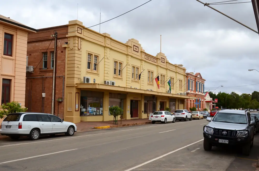
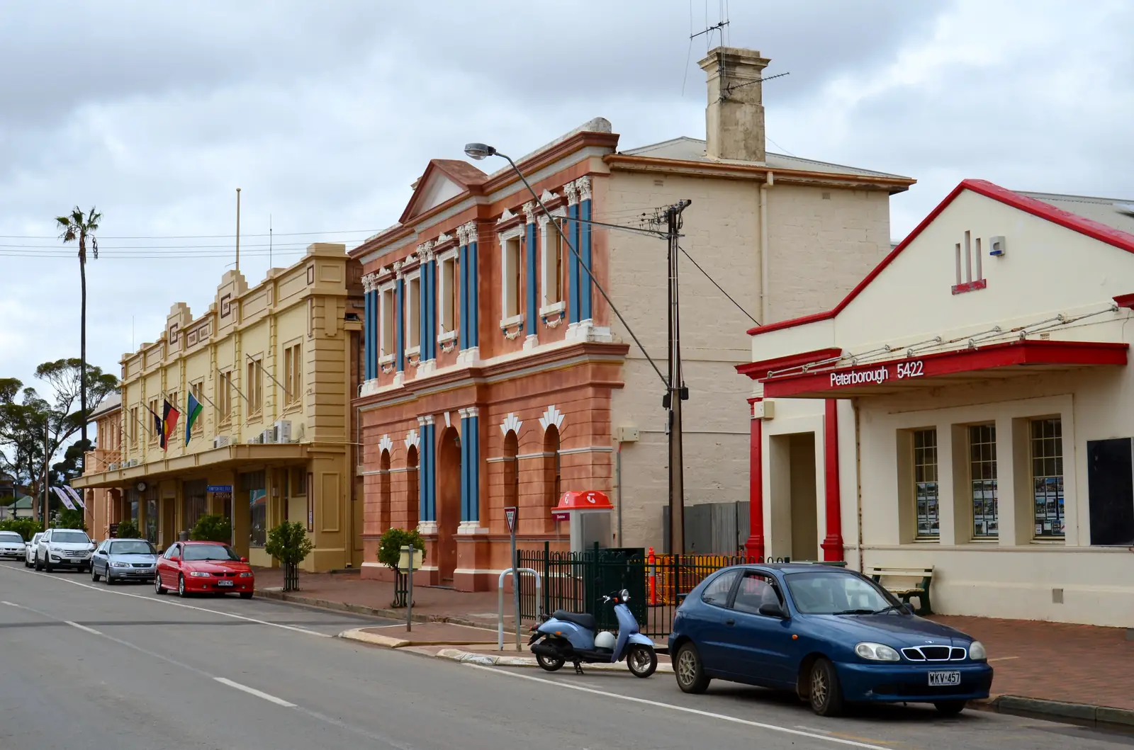
Former Peterborough Town HallPhoto: Bahnfrend · CC BY-SA 4.0 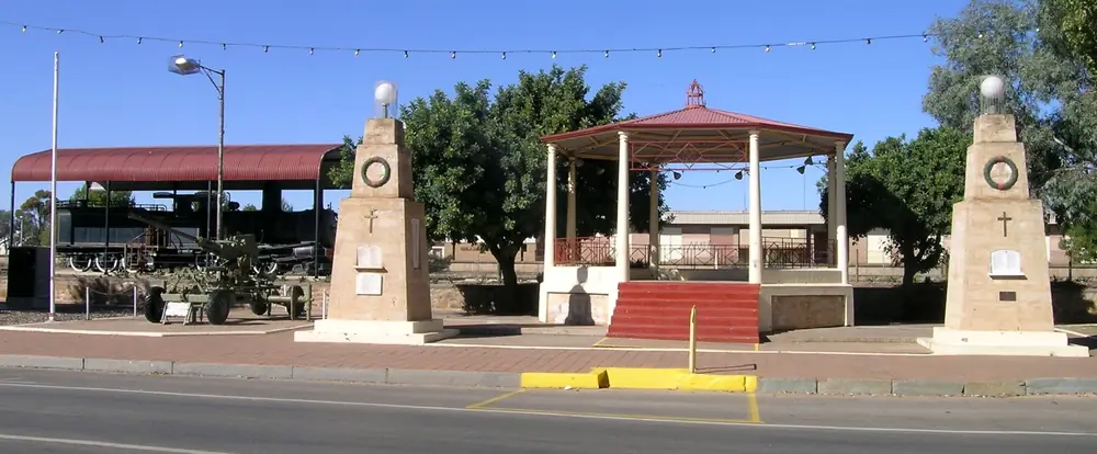
Y class locomotive and rotunda on Main Street, PeterboroughPhoto: Cgoodwin · CC BY-SA 3.0 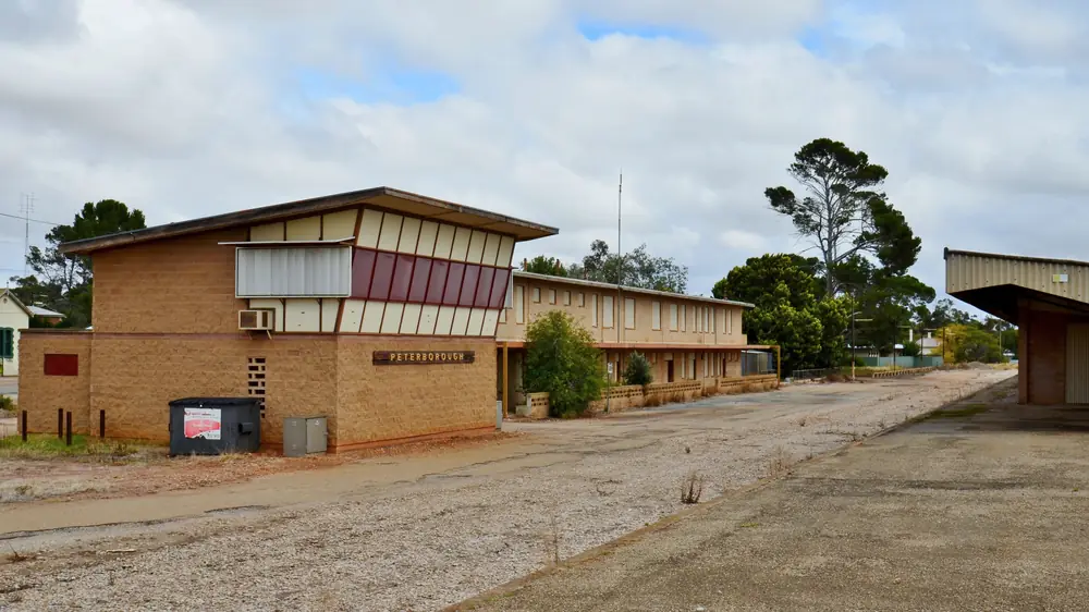
Peterborough railway stationPhoto: Bahnfrend · CC BY-SA 4.0 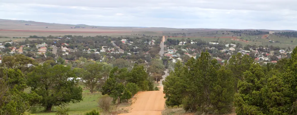
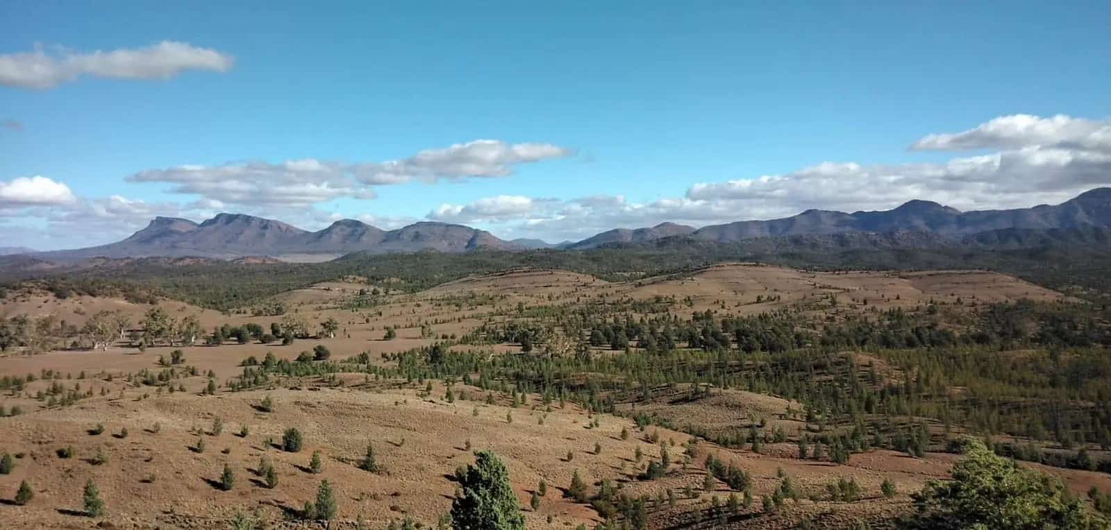
Peterborough from Greg Duggan Nature Reserve lookoutPhoto: Christallkeks · CC BY 4.0
Peterborough is a mid-north railway town in the District Council of Peterborough, the Steamtown hinge SATC’s Heritage Rail Trail still asks you to slow down for on the run from Broken Hill and Cockburn toward Port Pirie. SATC’s destination listing places it in the heart of South Australia’s Mid North, with a strong railway heritage from when the town was a major hub in the early twentieth century. The District Council location page puts it approximately 250 km north of Adelaide in the Southern Flinders. This hub is South Australia, not Peterborough in the United Kingdom, and not a Flinders gorge town like Hawker. Yunta, Olary and Cockburn already name this page from the Barrier Highway; those live pages are not rewritten here.
The 2021 Census counted 1,428 people in the Peterborough urban centre (UCL415035), median age 55, sex split 50.1% male / 49.9% female. 319 families, 961 private dwellings, average 1.8 people per household. Suburbs-and-localities SAL41143 counted 1,490. Use UCL for the town. The council location page quotes an approximate 2,000 people for the district of 2,995 km² — a different geography that extends to Yongala, Oodlawirra, Nackara and Dawson.
This site groups Peterborough with Flinders Ranges towns. SATC’s Explorers Way map also marks Peterborough on the wider Flinders / outback diagram. Council tourist-info still lists Silver to Sea Way (Prev. HRT) beside the Heritage Rail Trail.
Where it is, and how far
Peterborough sits where SATC’s trail leaves the dry Barrier Highway plains and the climate, on that brochure, begins a long descent toward Gulf St Vincent. Council town-entry signs stand on four roads: to Terowie, to Broken Hill, to Jamestown, and to Orroroo. Yongala is 10 km west on the council attractions page. Black Rock Gallery is 25 km north toward Orroroo (currently closed on that page). Willangi 4WD and 2WD tracks are 16 km out on Dawson Road.
SATC’s Heritage Rail Trail is a 395 km / 245 miles self-drive (the same brochure also calls the relic line a 400 km piece of history). Those are trail lengths, not a Peterborough–Broken Hill offset this hub will invent.
| Place | Official note |
|---|---|
| Adelaide | Approximately 250 km south (District Council location page) |
| Yongala | 10 km west (council attractions page); BOM climate table used here |
| Black Rock Gallery | 25 km north toward Orroroo (council; currently closed) |
| Willangi tracks | 16 km on Dawson Road (council) |
| Broken Hill / Cockburn / Olary / Yunta | Named SATC trail towns east — kilometres not printed on that brochure |
| Port Pirie | Named SATC trail end west — kilometre not printed on that brochure |
Sealed highways: Traffic SA. Unsealed Willangi / park tracks: DIT outback road warnings 1300 361 033.
Facts at a glance
Population. ABS 2021 UCL415035: 1,428 people. Median age 55. Use the Peterborough UCL QuickStats. SAL41143 is the wider suburb count.
Climate. No Peterborough BOM table on the South Australia site-name list used here. Use YONGALA, 019062, 10 km west: 33.03°S, 138.76°E, elevation 521 m, commenced 1881, status open, latest available data 14 October 2026. January mean maximum 30.9 °C, July 12.9 °C, annual rainfall 361.6 mm (temperature 99 years, 1926–2026; rainfall 142 years, 1881–2026). August 42.3 mm is the wettest mean month; March 16.6 mm the driest. Full columns: Peterborough weather. Do not blend with Yunta Airstrip or Hawker.
Visitor information. SATC’s Heritage Rail Trail brochure points Peterborough’s Visitor Information Carriage to Main Street, (08) 8651 2708, open 7 days 9 am to 5 pm (may vary). The council attractions page locates the VIC at Steamtown, 2 Telford Avenue, (08) 8651 3355, and states it is closed until further notice. Confirm before you treat a desk as open. SATC destination product: maketrackstopeterborough.com.au.
Traditional Owners
SATC’s Heritage Rail Trail is a railway story. The council attractions and location pages used here do not name a Traditional Owner group for the Peterborough townsite. Parks SA names Adnyamathanha for Ikara-Flinders Ranges National Park further north — a park sentence, not a Peterborough main-street acknowledgement. This hub does not flatten that label onto Steamtown. Confirm wording at the visitor desk. Read visiting Country respectfully.
History
SATC’s timeline is the public history used here. 1875: Port Pirie to Crystal Brook, the first section of a narrow-gauge line intended for grain-growers and pastoralists. The line reached Gladstone (1876) and Jamestown (1878), then Petersburg (today called Peterborough) in December 1880. November 1884: a South Australian Bill to extend from Peterborough to Cockburn on the NSW border. January 1887: that narrow-gauge South Australian line reached Cockburn. 12 January 1888: the Silverton Tramway opened so Broken Hill ore could cross the border and run to Port Pirie.
1911–1934: SATC says the line became the busiest single-track railway in the world. 1923: a record 102 trains passed in and out of Peterborough station in a single 24-hour period. At its zenith SATC puts Peterborough at over 100 railway movements a day — so much steam the brochure says the local climate was minutely changed. The Roundhouse stabled up to 35 steam locomotives. 9 January 1970: the last narrow-gauge train left Broken Hill’s Sulphide Street. The modern standard-gauge corridor still carries some 50 trains a week, including the Indian Pacific, metres from the old formation.
The Social History Museum’s council wording is the Petersburg to Peterborough story. This hub does not invent a wartime renaming date the official pages used here do not print.
Things to do
SATC and the District Council name a long in-town list. Confirm opening before you build a day around Steamtown:
- Steamtown Heritage Rail Centre — SATC: Roundhouse, locos, carriages, Sound and Light Show (Tourism Hall of Fame winner on the brochure). Council: 3-gauge turntable, “the only one left in the world,” 2 Telford Avenue. Council: closed until further notice. Confirm (08) 8651 3355.
- Town Carriage Museum — council: Main Street, timeline of the town, virtual steam-train journey; 7 days 9 am–4 pm weekdays, 9 am–1 pm weekends.
- The Burg — council: 185 Main Street, 1:148 model of the late-1960s railyards (70 buildings, 50 lights), 19-metre mural.
- Social History Museum — YMCA upstairs, Petersburg to Peterborough, Lionel Noble room.
- Printing Works — 9–11 Jervois Street, guided tours Tuesday to Friday 10 am–1 pm on the council page.
- Meldonfield Miniatures, Federation Quilt, Town Hall and Keith Payne VC display, heritage walk, Y Class locomotive in Town Square, Bob the Dog sculpture.
- Greg Duggan Nature Reserve and Tank Hill Lookout — council: 10 acres, top of Government Road.
- Yongala Heritage Trail — 10 km west; SATC trail question names the Yongala Heritage Wall.
- Willangi 4WD and 2WD tracks — 16 km, Dawson Road, on the council list and SATC destination page (Wallangi spelling on SATC).
- SATC trail food — local Southern Flinders lamb from Mercer’s butchers, Peterborough, on the brochure’s refreshment list.
See things to do in Peterborough.
Jamestown’s R.M. Williams story is the next SATC trail town west — named, not linked. Hawker and Quorn are the Flinders service towns if you leave the rail trail for Ikara.
Where to stay
Official pages name types, not a ranked motel strip:
- SATC’s trail brochure: plenty of accommodation including one of Australia’s most lovely caravan parks. That is a type, not a brand this hub will invent.
- Council tourist-info lists RV Parks as a menu item without printing a park name on the location page used here.
- SATC destination copy treats Peterborough as a stop with heritage stays implied by the town’s size — still not a booking sheet.
Confirm on the day. See Peterborough accommodation and Peterborough caravan parks. Operators: feature your business.
Caravan and camping
Vans use Peterborough as the Barrier Highway / RM Williams Way overnight SATC describes — a crossroads for travellers towing caravans from all points of the compass on that brochure. Ask the visitor desk (if open) or council what is designated. Willangi is a named bush-camping / track product 16 km out, not a town street park. Read outback camping.
Fuel and services
A town of 1,428 people will match a mid-north service centre better than Yunta’s 60. Confirm fuel in town before you treat Peterborough as a guaranteed bowser. This guide does not list brands. SATC’s food list for the trail names meals in Broken Hill, Silverton, Cockburn, Peterborough, Jamestown, Gladstone and Port Pirie.
Peterborough Soldiers’ Memorial Hospital and Health Service, 23 Hurlstone Street, (08) 8651 0400, has 24-hour accident and emergency on SA Health’s page, with six beds listed on the regional hospitals index for medical, post-surgical, rehabilitation, palliative and transitional care. Emergencies 000.
For current questions use the District Council (08) 8651 3566, council@peterborough.sa.gov.au, and Traffic SA.
Road access
The Barrier Highway east toward Yunta, Olary, Cockburn and Broken Hill is sealed. SATC: flood-prone plains, low bridges, wildlife, road trains, possibly the Indian Pacific; some 50 trains a week on the modern corridor. West, SATC’s trail continues toward Yongala, Jamestown, Gladstone, Crystal Brook and Port Pirie — named, not linked except where this site already has pages. North, council signs the road to Orroroo; Hawker is the Flinders service town if you keep going. Quorn and Port Augusta are the southern Flinders / gulf crossroads.
Check Traffic SA after rain. Closed means closed. Unsealed Willangi and park legs are DIT.
Nearby parks and towns
Parks:
- Ikara-Flinders Ranges National Park — SATC destination copy names the nearby Flinders Ranges; Hawker is the park service town on this site
- Greg Duggan Nature Reserve — council, in town, 10 acres
Towns on this site:
- Yunta, Olary, Cockburn — SATC rail-trail neighbours east
- Broken Hill and Silverton — trail start / tramway
- Hawker and Quorn — Flinders Ranges service towns
- Port Augusta — gulf crossroads if you leave the trail
- Orroroo — signed north from town-entry
- Terowie — signed south; Barrier Highway rail town
Named, not linked: Jamestown, Yongala, Gladstone, Crystal Brook, Oodla Wirra, Manna Hill, Dawson, Nackara.
When to go, and how long
Yongala’s January mean maximum of 30.9 °C is hot for a railyard model at midday, milder than Coober Pedy Airport’s 36.9 °C. July’s 12.9 °C mean maximum is the comfortable walking season on paper; July’s 2.3 °C mean minimum is why a van night at 521 m needs a layer. Annual rainfall 361.6 mm; August 42.3 mm is the wettest mean month on this table — a southern winter-rain pattern, not a Dry-season postcard.
A half day covers the Town Carriage Museum, The Burg and a heritage walk if Steamtown is still closed. A full day plus the Sound and Light Show is SATC’s own sermon when that show is running. Confirm. Two nights if you are adding Yongala, Willangi or the trail east to Yunta.
Operators who want a checked listing: feature your business. The listings slot on this hub stays empty until then.
Plan this trip
Tell us the dates, who you are travelling with and where you need help. We reply with planning notes for Peterborough — we are not a booking agent.
Events and road-conditions newsletter
Occasional notes on outback festivals, race days and official road-condition sources — not a daily blast. We use these details only to send the newsletter.
South Australia · Flinders Ranges
Peterborough accommodation
Where to stay in Peterborough SA: SATC names plenty of accommodation including a caravan park type. Council lists RV Parks. No invented motel brands. Confirm. Not Peterborough UK.
Read · 3 min
South Australia · Flinders Ranges
Peterborough caravan parks
Camping in Peterborough SA: SATC names a caravan-park type among plenty of accommodation. Council lists RV Parks. Willangi bush camping 16 km out. Confirm. Not Peterborough UK.
Read · 3 min
South Australia · Flinders Ranges
Peterborough weather
Peterborough SA climate from BOM Yongala (019062), 10 km west: January mean max 30.9 °C, July 12.9 °C, annual rainfall 361.6 mm. No Peterborough BOM table. Not Peterborough UK.
Read · 4 min
South Australia · Flinders Ranges
Things to do in Peterborough
Things to do in Peterborough: SATC Steamtown and Heritage Rail Trail, Town Carriage Museum, The Burg railyard model, printing works, Yongala 10 km west. Confirm Steamtown opening. Not Peterborough UK.
Read · 4 min
Frequently asked questions
Is this Peterborough South Australia or Peterborough in the UK?
This hub is Peterborough in the District Council of Peterborough, South Australia, approximately 250 km north of Adelaide on the council location page. SATC’s Heritage Rail Trail names it as the Steamtown town between the Barrier Highway plains and Port Pirie. It is not Peterborough in Cambridgeshire, and it is not a second South Australian Peterborough.
What is Peterborough’s population?
1,428 people at the 2021 Census for the Peterborough urban centre (UCL415035), median age 55, sex split 50.1% male / 49.9% female. Suburbs-and-localities SAL41143 counted 1,490. Use UCL for the town. The council location page quotes an approximate 2,000 people for the whole district — a different geography.
Is Steamtown open?
SATC’s Heritage Rail Trail brochure still names Steamtown as the trail’s must-see, with the Roundhouse, daily tours and a Sound and Light Show. The District Council attractions page fetched for this rebuild states the Visitor Information Centre, Steamtown Heritage Rail Centre and the Sound and Light Show are closed until further notice. Confirm at (08) 8651 3355 or visitpeterboroughsa.com.au before you treat a tour as bookable.
How far is Peterborough from Adelaide and Yongala?
The District Council location page puts Peterborough approximately 250 km north of Adelaide. The council attractions page puts Yongala 10 km west. SATC’s Heritage Rail Trail brochure does not print a Peterborough–Broken Hill or Peterborough–Port Augusta kilometre on the pages used here.
What weather record should I use?
BOM does not publish a Peterborough climate-averages table. This guide uses Yongala (019062), 10 km west on the council attractions page: January mean maximum 30.9 °C, July 12.9 °C, annual rainfall 361.6 mm. Do not blend with Yunta Airstrip or Hawker.
Why do Yunta, Olary and Cockburn name Peterborough?
SATC’s Heritage Rail Trail follows the narrow-gauge ore line from Broken Hill / Silverton to Port Pirie. A November 1884 South Australian Bill planned to extend the line from Peterborough to Cockburn. The narrow-gauge South Australian line reached Cockburn from Peterborough in January 1887. Those Barrier Highway pages already link here; this hub does not rewrite them.
Sources and further reading
Facts on this page were checked against these primary and official sources. Conditions change — confirm before you travel or buy.
- Peterborough 2021 Census QuickStats (UCL415035) — Australian Bureau of Statistics
- Peterborough (SA) 2021 Census QuickStats (SAL41143) — Australian Bureau of Statistics
- Climate statistics for Yongala (019062) — Bureau of Meteorology
- Heritage Rail Trail brochure — South Australian Tourism Commission
- Peterborough South Australia — South Australian Tourism Commission
- Attractions — District Council of Peterborough
- Location — District Council of Peterborough
- Peterborough Soldiers’ Memorial Hospital and Health Service — SA Health
- Explorers Way Road Trip — South Australian Tourism Commission
- Traffic SA — Government of South Australia
- Outback road warnings — Department for Infrastructure and Transport SA