At a glance
Sourced facts only. Distances and services change — confirm before you travel.
- Population
- 60 people (SAL41695, 2021 Census)
- Local government
- Pastoral Unincorporated Area (Outback Communities Authority)
- Traditional Owners
- Not named for the Yunta townsite on the sourced SATC and Parks SA pagesSATC’s Heritage Rail Trail is a railway history product. Confirm Country wording at Broken Hill VIC or with Native Title bodies before using a single nation label.
- Nearest regional city
- Broken Hill is the large service city this site names east on the Barrier Highway. SATC does not print a Yunta–Broken Hill kilometre on the Heritage Rail Trail brochure used here.
- Capital
- A Yunta–Adelaide kilometre is not printed on the SATC Heritage Rail Trail brochure used here.
- Nearest fuel
- Confirm in town on the day. SATC names Yunta as a railway township worth exploring; it does not print a bowser brand.
- Nearest hospital or clinic
- Confirm with SA Health — no Yunta hospital on the SA Health list used here. Broken Hill is the large hospital city east; Port Augusta is the SA crossroads west of this corridor.
- Mobile coverage
- Check Telstra and Optus coverage maps before travel; do not assume a signal on the Barrier Highway plains.
- Best time to visit
- Cooler months; BOM Yunta Airstrip January mean max 34.1 °C, July 15.7 °C
Climate
Monthly means from the Bureau of Meteorology station Yunta Airstrip (020062). This is not a forecast. Open. Temperature 28 years (1998–2026); rainfall 26 years (1998–2026). Elevation 300 m. Older Yunta 020026 closed 31 December 1996 — do not blend.
| Month | Mean max (°C) | Mean min (°C) | Rainfall (mm) |
|---|---|---|---|
| Jan | 34.1 | 16.7 | 21.6 |
| Feb | 32.4 | 15.8 | 17.3 |
| Mar | 29.0 | 13.2 | 20.9 |
| Apr | 24.5 | 9.2 | 11.1 |
| May | 19.3 | 5.7 | 11.7 |
| Jun | 15.9 | 3.8 | 17.1 |
| Jul | 15.7 | 3.2 | 14.3 |
| Aug | 17.8 | 4.1 | 14.0 |
| Sep | 22.1 | 6.6 | 16.1 |
| Oct | 25.3 | 9.5 | 23.2 |
| Nov | 28.4 | 12.5 | 30.5 |
| Dec | 31.3 | 14.6 | 16.9 |
Yunta in pictures
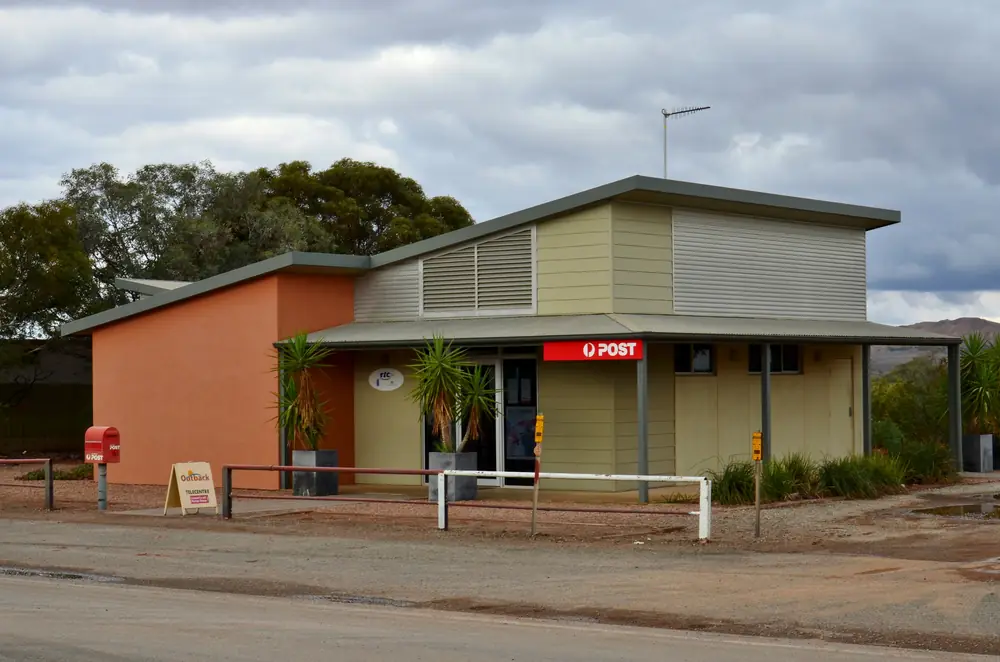
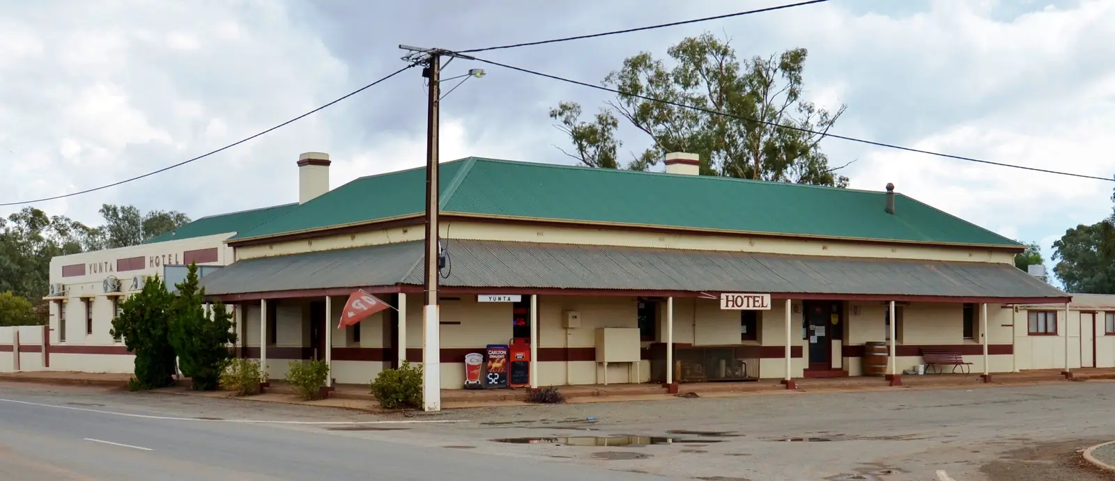
Yunta Post OfficePhoto: Bahnfrend · CC BY-SA 4.0 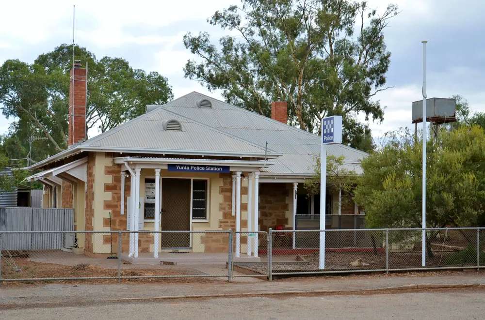
Yunta police stationPhoto: Bahnfrend · CC BY-SA 4.0 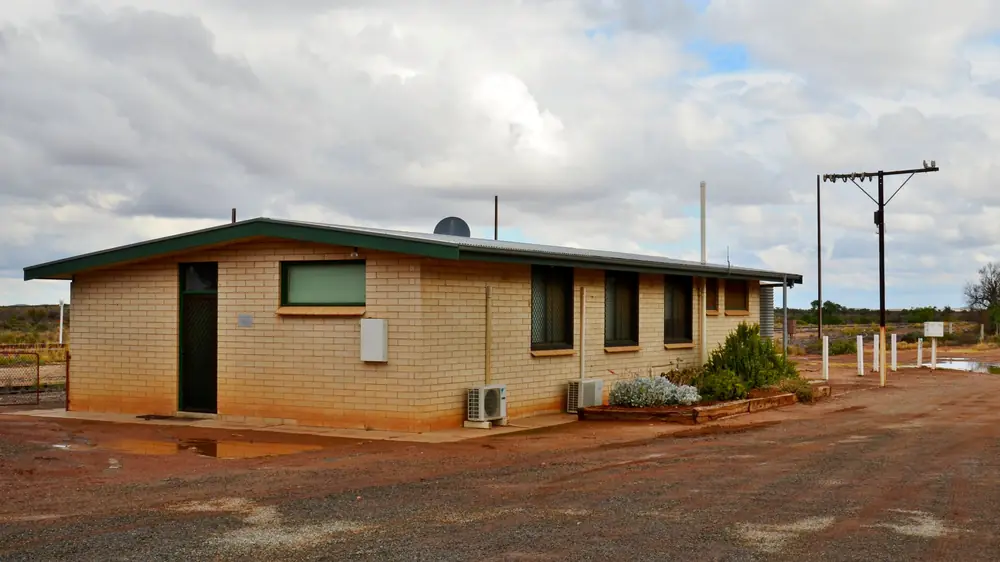
Railway station building at YuntaPhoto: Bahnfrend · CC BY-SA 4.0 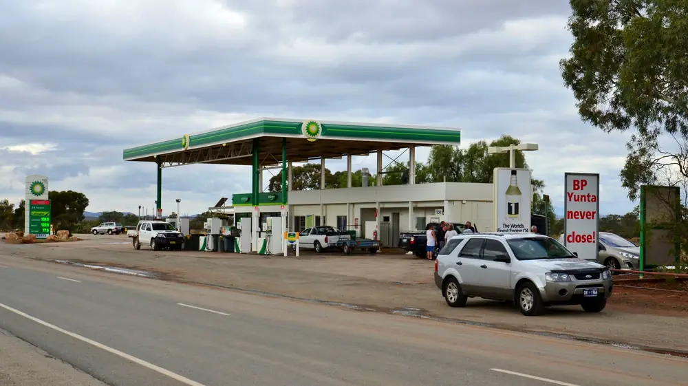
BP roadhouse at YuntaPhoto: Bahnfrend · CC BY-SA 4.0
Yunta is a Barrier Highway locality in unincorporated outback South Australia, one of the railway townships SATC’s Heritage Rail Trail still wants you to slow down for. The brochure follows the remains of the narrow-gauge line that opened in 1888 to haul Broken Hill ore toward Port Pirie, and names Yunta, Oodla Wirra, Manna Hill, Olary and Cockburn as the small agricultural outposts that became substantial railway towns. SATC’s trail question for Yunta is the plaque in Yunta Centenary Park — when was the town proclaimed? That is the official visitor prompt, not a main-street theme park.
The Australian Bureau of Statistics does not publish a 2021 Urban Centre (UCL) named Yunta on the pages used here. Use suburbs-and-localities SAL41695: 60 people, median age 52, sex split 61.8% male / 38.2% female. QuickStats notes limited tables because of the small population. 11 families, 56 private dwellings.
This site groups Yunta with Outback SA towns. Local government is the Pastoral Unincorporated Area under the Outback Communities Authority. SATC’s Explorers Way map also marks Yunta on the wider Flinders / outback diagram. Peterborough is named on the same SATC rail trail as the Steamtown hub — use Peterborough.
Where it is, and how far
Yunta sits on the sealed Barrier Highway between the South Australian mid-north and Broken Hill. SATC describes a plain of dry, flood-prone country flanked with low ranges — the barrier the highway is named for — and tells you to look for the low railway embankment beside the bitumen and low bridges built against flash floods. East of Yunta on that same SATC list sit Olary and Cockburn toward the NSW border. West, the brochure continues toward Peterborough and Port Pirie.
| Place | Official note |
|---|---|
| Broken Hill | Large service city east on the Barrier Highway (this site’s Broken Hill guide). SATC does not print a Yunta kilometre on the trail brochure used here |
| Olary and Cockburn | Next named SATC rail-trail townships toward the border |
| Arkaroola | Operator: more remote approach via Yunta on the Barrier Highway; do your homework |
| Adelaide | Not printed as a Yunta figure on that SATC brochure |
Sealed highway: Traffic SA. Unsealed Arkaroola / park tracks: DIT outback road warnings and Parks SA 1300 361 033.
Facts at a glance
Population. ABS 2021 SAL41695: 60 people. Median age 52. Use the Yunta SAL QuickStats.
Climate. Bureau of Meteorology YUNTA AIRSTRIP, 020062, commenced 1998, location 32.57°S, 139.56°E, elevation 300 m, status open. January mean maximum 34.1 °C, July 15.7 °C, annual rainfall 204.8 mm (temperature 28 years, 1998–2026; rainfall 26 years). Full columns: Yunta weather. Older Yunta (020026) closed 31 December 1996. Do not blend.
Visitor information. SATC Heritage Rail Trail brochure points Broken Hill VIC to Bromide Street, Broken Hill and Peterborough’s visitor carriage to (08) 8651 2708. There is no SATC-accredited VIC in Yunta on the pages used here. OCA publishes Yunta community newsletters on its news page — a community channel, not a tourist desk.
Traditional Owners
SATC’s Heritage Rail Trail is a railway story. It does not name a Traditional Owner group for the Yunta townsite on the brochure used here. This hub does not borrow a neighbouring nation’s label. Confirm wording at the Broken Hill VIC or with Native Title bodies before you print a Welcome to Country for the highway. Read visiting Country respectfully.
History
SATC’s timeline is the public history used here. November 1884: a South Australian Bill to extend the line from Peterborough to Cockburn on the NSW border. NSW would not let South Australian locomotives across. 30 May 1885: BHP interests at Silverton formed the Silverton Tramway Company to build a private line to Cockburn. 12 January 1888: that tramway opened so ore could cross the border and run to Port Pirie. SATC says freighting ore by steam required small towns — Yunta among them. January 1970: the last narrow-gauge train left Broken Hill’s Sulphide Street. Some towns are a shadow of themselves; SATC still says they are worth exploring. Look for steel water tanks and the occasional Victorian station. A few pubs continue to serve.
This site’s Silverton guide tells the same gauge-break story from the NSW side. Use that page for Silverton; use this page for the South Australian highway town.
Things to do
Official pages support:
- Yunta Centenary Park plaque — SATC trail question: when was Yunta proclaimed?
- Railway relics beside the Barrier Highway — SATC: embankment, low bridges, water tanks, station buildings. Stay off operating rail and private yards.
- Heritage Rail Trail as a whole — SATC: 14 townships, Broken Hill to Port Pirie. Continue to Olary and Cockburn, or east to Broken Hill’s Sulphide Street Railway and Historical Museum.
- Arkaroola via the Barrier Highway — operator warning only. Not a 2WD itinerary published here.
Where to stay
SATC’s trail brochure does not print a Yunta motel inventory. It says a few pubs along the route continue to serve, and that these townships have stories and hospitality. That is a type, not a booking. Confirm on the day. Broken Hill is the large room market east. Do not invent a hotel name SATC did not list.
- How to choose: Yunta accommodation
- Camping detail: Yunta caravan parks
- Operators: feature your business
Caravan and camping
Vans use Yunta as a Barrier Highway overnight so they are not arriving in Broken Hill after a dusk plains run. SATC names Centenary Park as the plaque stop — that is not automatically a legal overnight. Ask OCA, the progress association via OCA, or the Broken Hill VIC what is designated. Read Yunta caravan parks.
Fuel and services
A town of 60 people will not match Broken Hill for a hospital or a supermarket. Confirm fuel in town before you treat Yunta as a guaranteed bowser. This guide does not list brands.
SA Health’s hospital list used here does not name a Yunta hospital. Emergencies 000. Broken Hill is the large hospital city east on this corridor. Port Augusta is the SA crossroads if you have already left the Barrier Highway west.
For current questions use OCA (1800 640 542) and Traffic SA.
Road access
The Barrier Highway is sealed. SATC: do not hurry across it; watch for emus, hawks and kangaroos; you might see the Indian Pacific. Road trains use the freight corridor. After rain, SATC’s own description of flood-prone plains is the warning — check Traffic SA. Unsealed legs toward Arkaroola are DIT.
East: Olary, Cockburn, Broken Hill, Silverton. West: SATC’s Peterborough / Port Pirie rail story. North-west: Flinders approaches SATC marks on Explorers Way.
Nearby parks and towns
Parks:
- Mutawintji National Park — from Broken Hill, not a Yunta suburb
- Vulkathunha-Gammon Ranges — Arkaroola / Copley country if you take the remote Barrier Highway approach the operator names
Towns on this site:
- Broken Hill — mining city, National Heritage listed on SATC’s brochure
- Olary and Cockburn — next SATC rail-trail stops
- Silverton — tramway town
- Arkaroola — remote approach warning
- Port Augusta — if you leave this highway for the Stuart or Eyre
- Peterborough — SATC Heritage Rail Trail Steamtown hinge west
- Terowie — Barrier Highway rail town south of Peterborough
When to go, and how long
Yunta Airstrip’s January mean maximum of 34.1 °C is hot for a Centenary Park plaque at midday. July’s 15.7 °C mean maximum is the comfortable walking season on paper; July’s 3.2 °C mean minimum is why a van night needs a layer. Annual rainfall 204.8 mm; November 30.5 mm is the wettest mean month on this table.
Forty-five minutes for the plaque and railway relics is the minimum. A night only if you have confirmed a legal site or room. Two nights in town is more than the sourced main-street list supports unless you are waiting on an Arkaroola road opening.
Operators who want a checked listing: feature your business. The listings slot on this hub stays empty until then.
Plan this trip
Tell us the dates, who you are travelling with and where you need help. We reply with planning notes for Yunta — we are not a booking agent.
South Australia · Outback SA
Things to do in Yunta
Things to do in Yunta: SATC Heritage Rail Trail plaque at Centenary Park, railway relics on the Barrier Highway, then Olary, Cockburn or Broken Hill. No invented lookouts.
Read · 3 min
South Australia · Outback SA
Yunta accommodation
Where to stay in Yunta: SATC Heritage Rail Trail names pubs along the route as a type, not a motel inventory. Confirm on the day. Broken Hill is the large room market.
Read · 3 min
South Australia · Outback SA
Yunta caravan parks
Camping in Yunta: SATC does not name a commercial caravan park brand. Confirm designated sites with OCA. Broken Hill is the large park market. No invented names.
Read · 3 min
South Australia · Outback SA
Yunta weather
Yunta climate from BOM Yunta Airstrip (020062): January mean max 34.1 °C, July 15.7 °C, annual rainfall 204.8 mm. Older Yunta 020026 closed 1996.
Read · 4 min
Frequently asked questions
How far is Yunta from Broken Hill and Adelaide?
SATC’s Heritage Rail Trail brochure follows the Barrier Highway and the old narrow-gauge line between Broken Hill / Silverton and Port Pirie, and names Yunta as one of the railway townships. It does not print a Yunta–Broken Hill or Yunta–Adelaide kilometre on the pages used here. This hub does not invent those figures.
What is Yunta’s population?
60 people at the 2021 Census for Yunta suburbs-and-localities (SAL41695). Median age 52. Sex split 61.8% male / 38.2% female. QuickStats notes limited tables because of the small population. The ABS does not publish a 2021 Urban Centre (UCL) named Yunta on the pages used here.
Why stop in Yunta?
SATC’s Heritage Rail Trail asks when Yunta was proclaimed according to the plaque in Yunta Centenary Park, and describes Yunta, Oodla Wirra, Manna Hill, Olary and Cockburn as railway townships that grew to support ore trains from Broken Hill to Port Pirie. Arkaroola’s getting-here page also names a more remote approach via Yunta on the Barrier Highway.
What weather record should I use?
BOM Yunta Airstrip (020062): January mean maximum 34.1 °C, July 15.7 °C, annual rainfall 204.8 mm. The older Yunta station (020026) closed 31 December 1996. Do not blend the two tables.
Can I get to Arkaroola from Yunta?
Arkaroola’s getting-here page lists an approach via Yunta on the Barrier Highway as somewhat more remote, requiring you to be prepared and do your homework. This hub does not turn that sentence into a track notesheet. Check DIT outback road warnings (1300 361 033).
Is there a hospital in Yunta?
SA Health’s hospital list used here does not name a Yunta hospital. Confirm current clinic arrangements locally. Broken Hill is the large service city east on this corridor; emergencies 000.
Sources and further reading
Facts on this page were checked against these primary and official sources. Conditions change — confirm before you travel or buy.
- Yunta 2021 Census QuickStats (SAL41695) — Australian Bureau of Statistics
- Climate statistics for Yunta Airstrip (020062) — Bureau of Meteorology
- Climate statistics for Yunta (020026) — Bureau of Meteorology
- Heritage Rail Trail brochure — South Australian Tourism Commission
- Getting to Arkaroola Village — Arkaroola
- Explorers Way Road Trip — South Australian Tourism Commission
- Outback road warnings — Department for Infrastructure and Transport SA
- Traffic SA — Government of South Australia
- Outback Communities Authority — Outback Communities Authority