At a glance
Sourced facts only. Distances and services change — confirm before you travel.
- Local government
- District Council of Peterborough
- Traditional Owners
- Not named for the Terowie townsite on the sourced SATC brochure, Peterborough council or SLSA plaque pagesSATC’s Heritage Rail Trail is a railway history product centred on Peterborough as the neighbour hub. Parks SA names Adnyamathanha for Ikara-Flinders Ranges National Park further north. Visit Orroroo names Ngadjuri for Orroroo. Do not flatten those sentences onto Terowie.
- Nearest regional city
- Peterborough. District Council of Peterborough signs a town-entry road to Terowie. A Terowie–Peterborough kilometre was not printed on the sourced council attractions page used here.
- Capital
- District Council of Peterborough puts Peterborough approximately 250 km north of Adelaide. A Terowie townsite–Adelaide kilometre was not on the sourced SATC brochure or SLSA plaque record.
- Nearest fuel
- SATC treats neighbouring Peterborough as a large Heritage Rail Trail town with hospitality. Confirm bowsers in Terowie on arrival; this guide does not name a brand.
- Nearest hospital or clinic
- Peterborough Soldiers’ Memorial Hospital and Health Service is the named neighbour hospital on this site’s Peterborough hub. A hospital name for Terowie was not on the sourced SLSA or council pages used here. Emergencies 000.
- Mobile coverage
- Check Telstra and Optus coverage maps before travel; coverage can drop on Barrier Highway stretches.
- Best time to visit
- Cooler months; BOM Yongala January mean max 30.9 °C, July 12.9 °C (no Terowie climate-averages table)
Climate
Monthly means from the Bureau of Meteorology station Yongala (019062). This is not a forecast. BOM’s SA named list has no Terowie climate table. Nearest open table used here is Yongala, 10 km west of Peterborough on the District Council attractions page. Temperature 99 years (1926–2026); rainfall 142 years (1881–2026). Elevation 521 m. Do not invent a Terowie–Yongala kilometre. Do not blend with Yunta Airstrip.
| Month | Mean max (°C) | Mean min (°C) | Rainfall (mm) |
|---|---|---|---|
| Jan | 30.9 | 13.6 | 22.8 |
| Feb | 30.2 | 13.5 | 20.8 |
| Mar | 27.2 | 10.9 | 16.6 |
| Apr | 22.0 | 7.3 | 24.7 |
| May | 17.2 | 4.7 | 34.0 |
| Jun | 13.6 | 2.9 | 38.8 |
| Jul | 12.9 | 2.3 | 38.7 |
| Aug | 14.5 | 2.6 | 42.3 |
| Sep | 18.1 | 4.1 | 37.4 |
| Oct | 22.0 | 6.3 | 32.7 |
| Nov | 25.8 | 9.3 | 28.9 |
| Dec | 28.7 | 11.7 | 24.4 |
Terowie in pictures
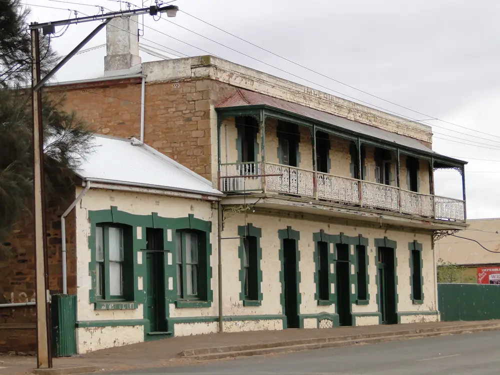
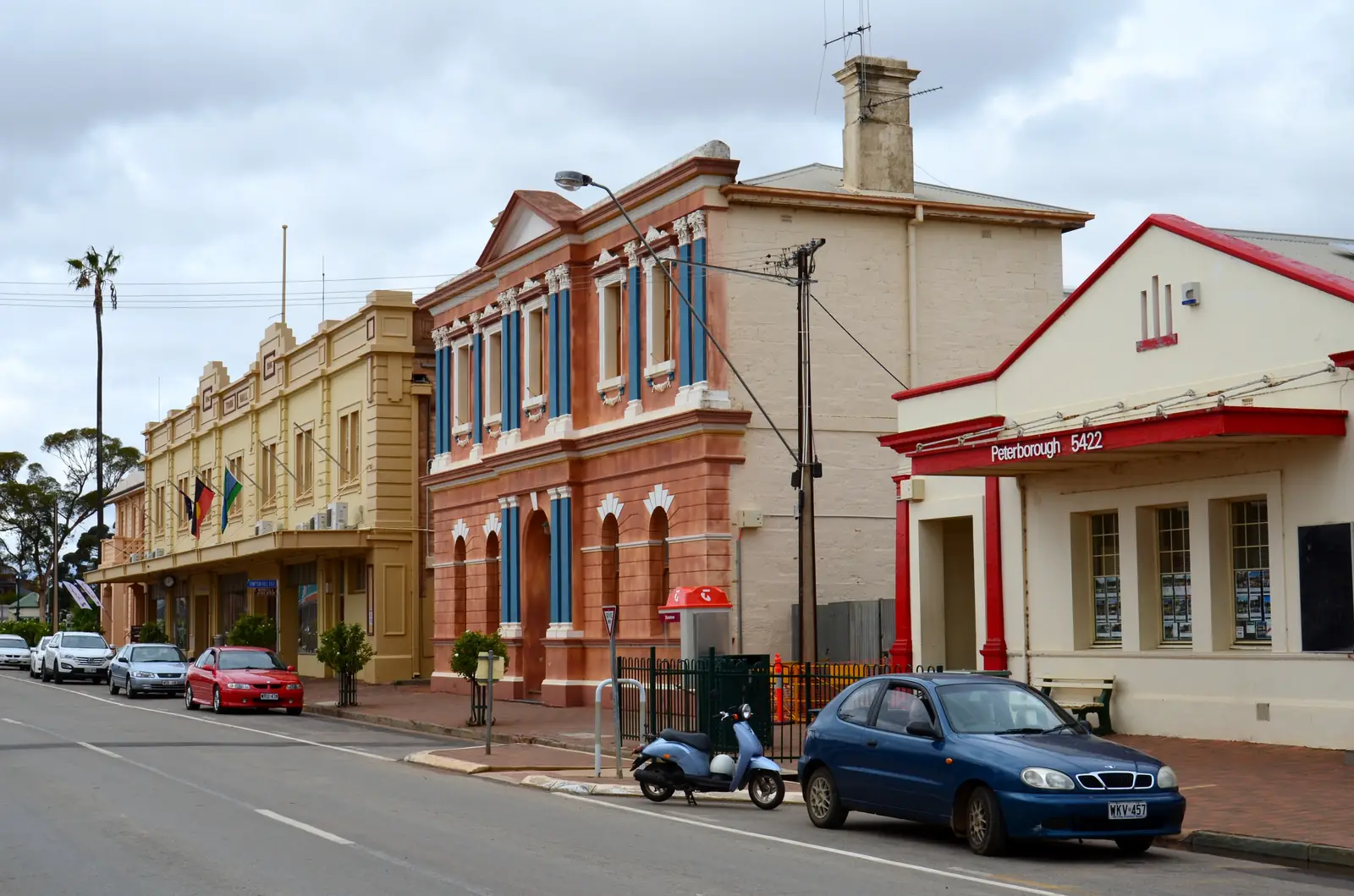
Former Imperial Hotel in TerowiePhoto: Peterdownunder · CC BY-SA 3.0 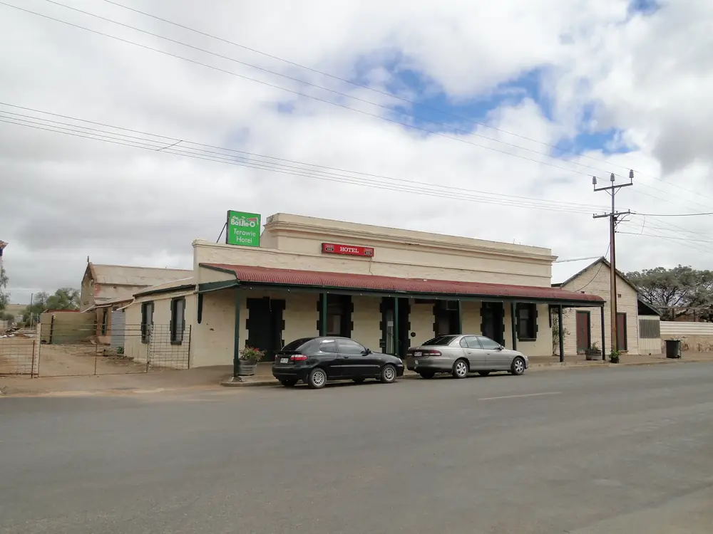
Former Terowie HotelPhoto: Peterdownunder · CC BY-SA 3.0 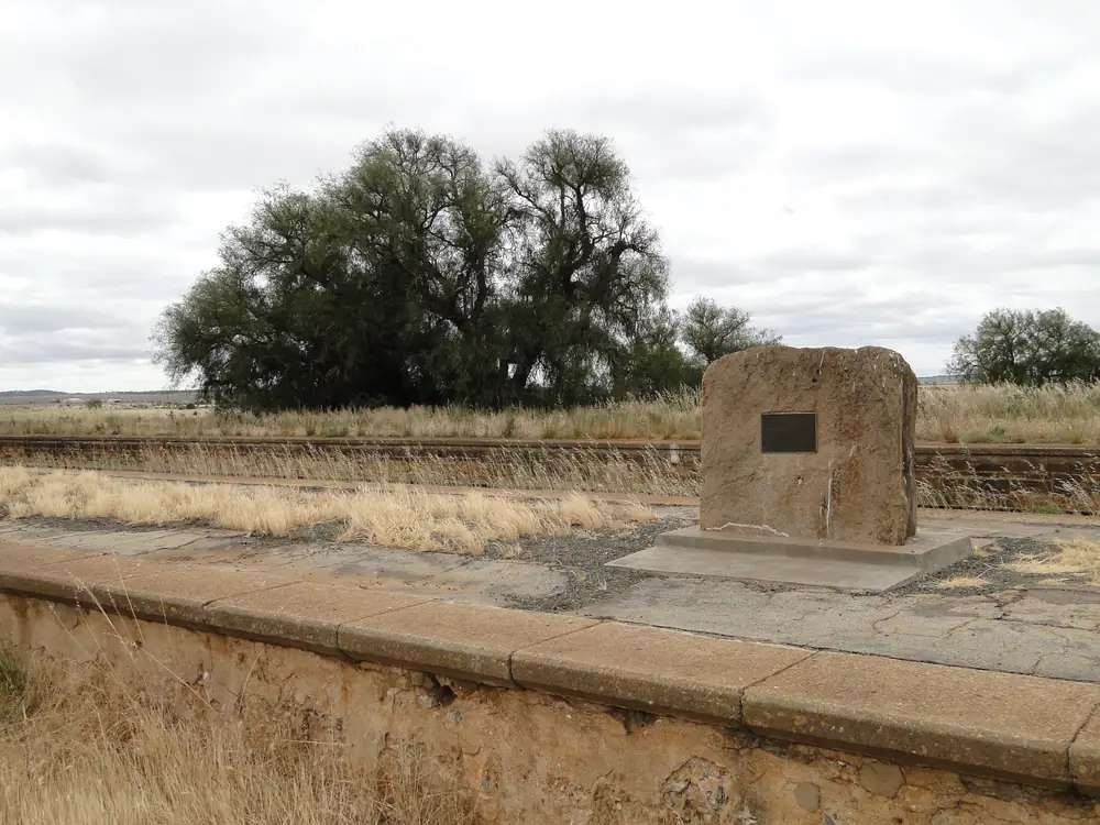
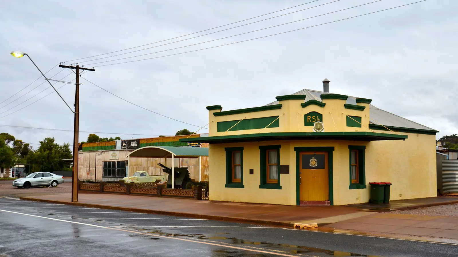
MacArthur monument on Terowie station platformPhoto: Peterdownunder · CC BY-SA 3.0 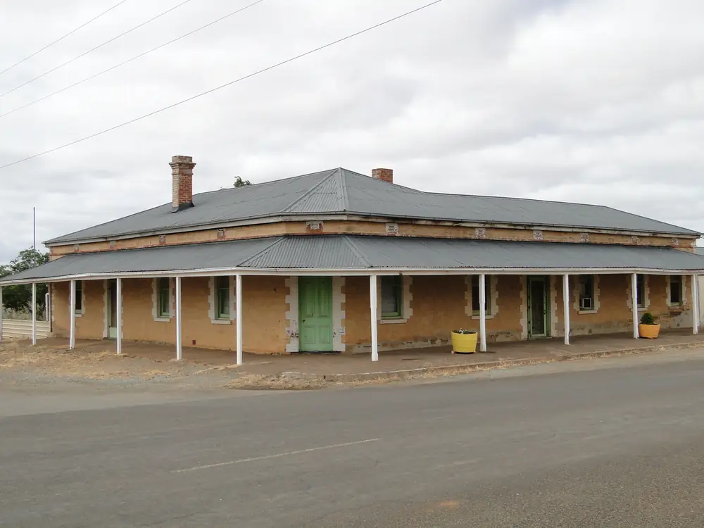
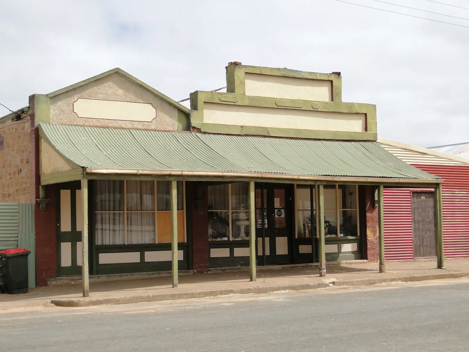
Old hotel building in TerowiePhoto: Peterdownunder · CC BY-SA 3.0
Terowie is a Barrier Highway rail town in the Flinders Ranges listing on this site, the neighbour District Council of Peterborough still signs a town-entry road to Terowie. Peterborough is the Steamtown hinge SATC’s Heritage Rail Trail asks you to slow down for. This hub is south of that railyard, not a second Peterborough main street and not a New South Wales town. Yongala is 10 km west of Peterborough on the council attractions page — a climate neighbour, not a Terowie suburb.
The State Library of South Australia’s catalogue record B 76990 is the wartime sentence used here. It records a plaque commemorating U.S. General Douglas McArthur’s visit on 20 March 1942, Terowie Railway Station, when he changed trains on his way to Adelaide and made a speech regarding the Battle of the Philippines. Written on the plaque, as the catalogue quotes it: “I came out of Bataan and I shall return” — his first press interview in Australia, 20.3.1942. This guide keeps the catalogue’s McArthur spelling when quoting that plaque, and uses MacArthur in running text as the usual modern spelling. That is a station-platform story, not a Steamtown Roundhouse.
The 2021 Census counted 135 people in Terowie suburbs-and-localities (SAL41439), median age 56, sex split 54.8% male / 45.2% female. 28 families, 94 private dwellings, 1.8 people per household. Aboriginal and Torres Strait Islander people 10 (7.4%). The ABS does not publish a 2021 Urban Centre named Terowie on the pages used here.
SATC’s Heritage Rail Trail brochure names 14 townships from Broken Hill to Port Pirie. Terowie is not on that printed list. This hub does not flatten the trail’s 14-town scavenger hunt onto the platform. Peterborough remains the trail neighbour; Yunta is the Barrier Highway trail town further east.
Where it is, and how far
Terowie sits on the public sealed Barrier Highway approach to Peterborough from the south. Council town-entry signs at Peterborough stand on four roads: to Terowie, to Broken Hill, to Jamestown, and to Orroroo. A Terowie–Peterborough kilometre was not printed on that attractions page, so this hub does not invent one. District Council of Peterborough puts Peterborough approximately 250 km north of Adelaide — a Peterborough kilometre, not a Terowie townsite kilometre.
SATC’s Heritage Rail Trail is 395 km / 245 miles (the same brochure also calls the relic line a 400 km piece of history). Those are trail lengths for the 14 named towns, not a Terowie offset.
| Place | Distance from Terowie (sourced) |
|---|---|
| Peterborough | Road signed to Terowie from Peterborough town-entry (District Council of Peterborough). No kilometre on that attractions page. |
| Adelaide via Peterborough | Peterborough approximately 250 km north of Adelaide (Peterborough council location page) — not a Terowie townsite kilometre |
| Yongala | 10 km west of Peterborough (council attractions); BOM table used here |
| Yunta | Barrier Highway trail neighbour east of Peterborough on SATC’s 14-town list |
Facts at a glance
Population. ABS 2021 SAL41439: 135 people. No UCL. Use SAL QuickStats.
Climate. BOM’s SA named list has no Terowie table. YONGALA, 019062, 33.03°S, 138.76°E, elevation 521 m, commenced 1881, status open, latest available data 14 October 2026. Mean maximum (99 years, 1926–2026): January 30.9 °C, July 12.9 °C, annual 21.9 °C. Mean rainfall (142 years, 1881–2026): annual 361.6 mm. See Terowie weather.
Visitor information. SLSA plaque record and Peterborough’s visitor carriage on SATC’s trail brochure (Main Street, Peterborough, (08) 8651 2708) are the official listings used here. Roads: Traffic SA.
Traditional Owners
A Traditional Owner nation named for the Terowie townsite was not on the SATC brochure, Peterborough council or SLSA plaque pages fetched for this rebuild. Visit Orroroo names Ngadjuri for neighbouring Orroroo. Parks SA names Adnyamathanha for Ikara-Flinders Ranges National Park. This guide does not flatten those sentences onto the platform. Stay on public highways. See visiting Country respectfully.
History
SLSA B 76990: 20 March 1942, Terowie Railway Station, a change of trains on the way to Adelaide, a Philippines speech, a plaque that quotes “I came out of Bataan and I shall return” as the first press interview in Australia. That is the official catalogue wording. This hub does not invent a museum hour or a train-timetable re-enactment.
Peterborough’s own SATC story is different: a hissing hub of more than 100 railway movements a day at its zenith, Steamtown Roundhouse, Sound and Light Show. Keep the 1942 platform in Terowie and the Roundhouse in Peterborough.
SATC’s trail timeline still matters as neighbour context: the narrow-gauge line reached Petersburg (today Peterborough) in December 1880; a November 1884 Bill planned the extension to Cockburn. Terowie is the southern rail town the Peterborough council still signs, not a 14th scavenger-hunt stop this brochure forgot to print.
Things to do
Official named things to do are modest. This is a locality of 135 people.
- Terowie Railway Station plaque — SLSA B 76990, 20 March 1942
- Barrier Highway stop — sealed approach to Peterborough
- Peterborough Steamtown — neighbour trail hinge; confirm opening on that hub (council has listed closures)
- Orroroo Giant Gum and Pekina Creek — north of Peterborough on the signed Orroroo road, not a Terowie street
Where to stay
A motel or caravan-park brand named for Terowie was not on the sourced pages used here. SATC treats Peterborough as the large trail town with hospitality and, on that brochure, a caravan park. Confirm locally. If you need a named park tonight, start with Peterborough’s own accommodation page.
- How to choose: Terowie accommodation
- Camping detail: Terowie caravan parks
- Operator enquiries: feature your business
Caravan and camping
The Barrier Highway is sealed. This guide does not invent a Terowie van park. Read Terowie caravan parks and outback camping. SATC still warns that Barrier Highway plains are flood-prone — that warning sits with the trail east of Peterborough; still check Traffic SA.
Fuel and services
A locality of 135 people will not match Peterborough for a hospital. Confirm fuel on arrival; this guide does not list brands. Peterborough Soldiers’ Memorial Hospital and Health Service is the named neighbour hospital on that hub. Emergencies 000. For trail questions use Peterborough’s visitor carriage (08) 8651 2708 on SATC’s brochure.
Road access
Barrier Highway sealed. Peterborough council signs the road to Terowie. East of Peterborough, SATC’s trail continues toward Yunta, Olary, Cockburn and Broken Hill. North, the signed road to Orroroo. Check Traffic SA after rain. Closed means closed.
Nearby parks and towns
Parks (nearby, not in-town):
- Ikara-Flinders Ranges National Park — via Hawker, not a Terowie street
Towns on this site:
- Peterborough — signed neighbour
- Orroroo — signed from Peterborough
- Yunta — Barrier Highway trail town east
- Hawker and Quorn
Named, not linked: Yongala, Jamestown, Oodla Wirra.
When to go, and how long
Yongala’s January mean maximum of 30.9 °C is hot for a platform photograph at midday. July’s 12.9 °C mean maximum and 2.3 °C mean minimum is the cooler walking season on paper. August 42.3 mm is the wettest mean month.
An hour covers the plaque if it is still on the station the SLSA catalogue describes. A night belongs in Peterborough unless a local stay exists when you ask. Two full tourist days in Terowie is more than the sourced main-street list supports.
Operators who want a checked listing: feature your business. The listings slot on this hub stays empty until then.
Plan this trip
Tell us the dates, who you are travelling with and where you need help. We reply with planning notes for Terowie — we are not a booking agent.
Events and road-conditions newsletter
Occasional notes on outback festivals, race days and official road-condition sources — not a daily blast. We use these details only to send the newsletter.
South Australia · Flinders Ranges
Terowie accommodation
Where to stay at Terowie: no motel or park brand was named on sourced SATC, council or SLSA pages. Neighbouring Peterborough is the trail town SATC treats as having hospitality.
Read · 3 min
South Australia · Flinders Ranges
Terowie caravan parks
Camping at Terowie: no caravan-park brand was named on sourced SATC, council or SLSA pages. Neighbouring Peterborough is the trail town SATC treats as having a park.
Read · 3 min
South Australia · Flinders Ranges
Terowie weather
Terowie SA climate from BOM Yongala (019062): January mean max 30.9 °C, July 12.9 °C, annual rainfall 361.6 mm. No Terowie BOM table. Barrier Highway south of Peterborough.
Read · 3 min
South Australia · Flinders Ranges
Things to do in Terowie
Things to do in Terowie: SLSA plaque for General McArthur’s 20 March 1942 railway-station interview, then Peterborough next door. Not a 14-town Heritage Rail Trail stop.
Read · 3 min
Frequently asked questions
Is Terowie on the Barrier Highway in South Australia?
Yes. This hub is Terowie in the District Council of Peterborough, South Australia. Council town-entry signs at Peterborough stand on four roads, one of them to Terowie. It is not a New South Wales town page and not a second Peterborough main street.
What is Terowie’s population?
135 people at the 2021 Census for Terowie suburbs-and-localities (SAL41439), median age 56, sex split 54.8% male / 45.2% female. 28 families, 94 private dwellings, 1.8 people per household. Aboriginal and Torres Strait Islander people 10 (7.4%). The ABS does not publish a 2021 Urban Centre named Terowie on the pages used here.
Why is Terowie known for General MacArthur?
The State Library of South Australia records a plaque at Terowie Railway Station commemorating U.S. General Douglas McArthur’s visit on 20 March 1942, when he changed trains on his way to Adelaide and made a speech regarding the Battle of the Philippines. The plaque text the catalogue quotes: “I came out of Bataan and I shall return” — his first press interview in Australia, 20.3.1942. The catalogue uses the plaque’s McArthur spelling.
Is Terowie one of SATC’s 14 Heritage Rail Trail townships?
No. SATC’s Heritage Rail Trail brochure names 14 townships from Broken Hill to Port Pirie. Terowie is not on that printed list. Neighbouring Peterborough is the Steamtown hinge of that trail. This hub does not flatten the 14-town list onto Terowie.
What is the weather like in Terowie?
BOM’s SA named list has no Terowie table. This guide uses Yongala (019062): January mean maximum 30.9 °C, July 12.9 °C, annual rainfall 361.6 mm (142 years, 1881–2026). Temperature means use 99 years (1926–2026). Latest available data 14 October 2026.
Can I camp in Terowie?
A caravan-park brand named for Terowie was not on the sourced SATC brochure, Peterborough council attractions page or SLSA plaque record used here. Neighbouring Peterborough is the trail town SATC treats as having hospitality and a caravan park. Confirm locally rather than assuming a 24-hour park sheet.
Sources and further reading
Facts on this page were checked against these primary and official sources. Conditions change — confirm before you travel or buy.
- Terowie 2021 Census QuickStats (SAL41439) — Australian Bureau of Statistics
- Climate statistics for Yongala (019062) — Bureau of Meteorology
- Plaque commemorating General Douglas McArthur's visit (B 76990) — State Library of South Australia
- Heritage Rail Trail brochure — South Australian Tourism Commission
- Attractions — District Council of Peterborough
- Location — District Council of Peterborough
- Traffic SA — Government of South Australia