At a glance
Sourced facts only. Distances and services change — confirm before you travel.
- Local government
- District Council of Streaky Bay
- Traditional Owners
- Not named for the Poochera townsite on the sourced Streaky Bay council town-centre pageParks SA names Gawler Ranges People for Gawler Ranges National Park on this site’s Minnipa hub. Do not flatten that park sentence onto Poochera.
- Nearest regional city
- Minnipa is the Eyre Highway neighbour east on this site. SATC’s Pildappa listing is 15 km off the Eyre Highway via Minnipa. A Poochera–Minnipa kilometre was not printed on the sourced Streaky Bay council pages used here.
- Capital
- Parks SA puts Gawler Ranges National Park about six hours’ drive north-west of Adelaide. A Poochera townsite–Adelaide kilometre was not on the sourced council town-centre page.
- Nearest fuel
- Confirm in town. SATC treats neighbouring Minnipa as the highway turn-off for Pildappa Rock. This guide does not name a Poochera bowser brand or hours.
- Nearest hospital or clinic
- A hospital name for Poochera was not on the sourced Streaky Bay council pages used here. Emergencies 000. Neighbouring Minnipa’s hub notes the Wudinna VIC number SATC prints on the Pildappa listing: 08 8680 2969.
- Mobile coverage
- Check Telstra and Optus coverage maps before travel; Parks SA says mobile coverage in Gawler Ranges National Park is patchy — that is a park sentence, not a Poochera main-street guarantee.
- Best time to visit
- Parks SA: late autumn and winter for neighbouring Gawler Ranges. BOM Minnipa PIRSA January mean maximum 33.0 °C; July 16.2 °C, with winter-peak rain. BOM has no Poochera table.
Climate
Monthly means from the Bureau of Meteorology station Minnipa PIRSA (018195). This is not a forecast. BOM’s SA named list has no Poochera climate table. Nearest named table used here is Minnipa PIRSA, the Eyre Highway neighbour east. Open station. Elevation 165 m, commenced 1996. Temperature 30 years (1996–2026); rainfall 27 years (1996–2026). Latest available data 14 November 2026. Do not blend with Wudinna Aero 018083 or Ceduna AMO 018012.
| Month | Mean max (°C) | Mean min (°C) | Rainfall (mm) |
|---|---|---|---|
| Jan | 33.0 | 16.0 | 12.7 |
| Feb | 32.2 | 15.9 | 18.3 |
| Mar | 29.0 | 14.3 | 19.8 |
| Apr | 24.9 | 12.2 | 14.6 |
| May | 20.2 | 9.7 | 27.9 |
| Jun | 16.7 | 7.4 | 38.9 |
| Jul | 16.2 | 6.7 | 36.5 |
| Aug | 17.9 | 6.8 | 37.8 |
| Sep | 21.9 | 8.3 | 25.0 |
| Oct | 25.4 | 10.4 | 23.8 |
| Nov | 28.4 | 12.5 | 21.5 |
| Dec | 30.7 | 14.3 | 19.4 |
Poochera in pictures
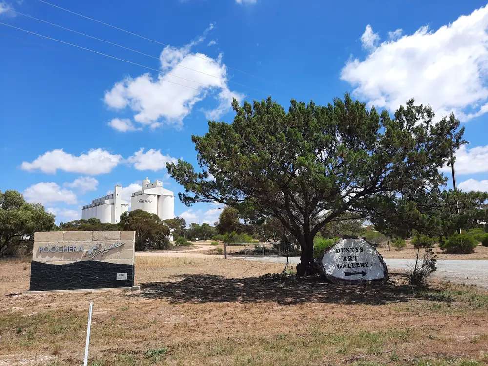
Grain silos at PoocheraPhoto: Gnangcomapp · CC BY-SA 4.0 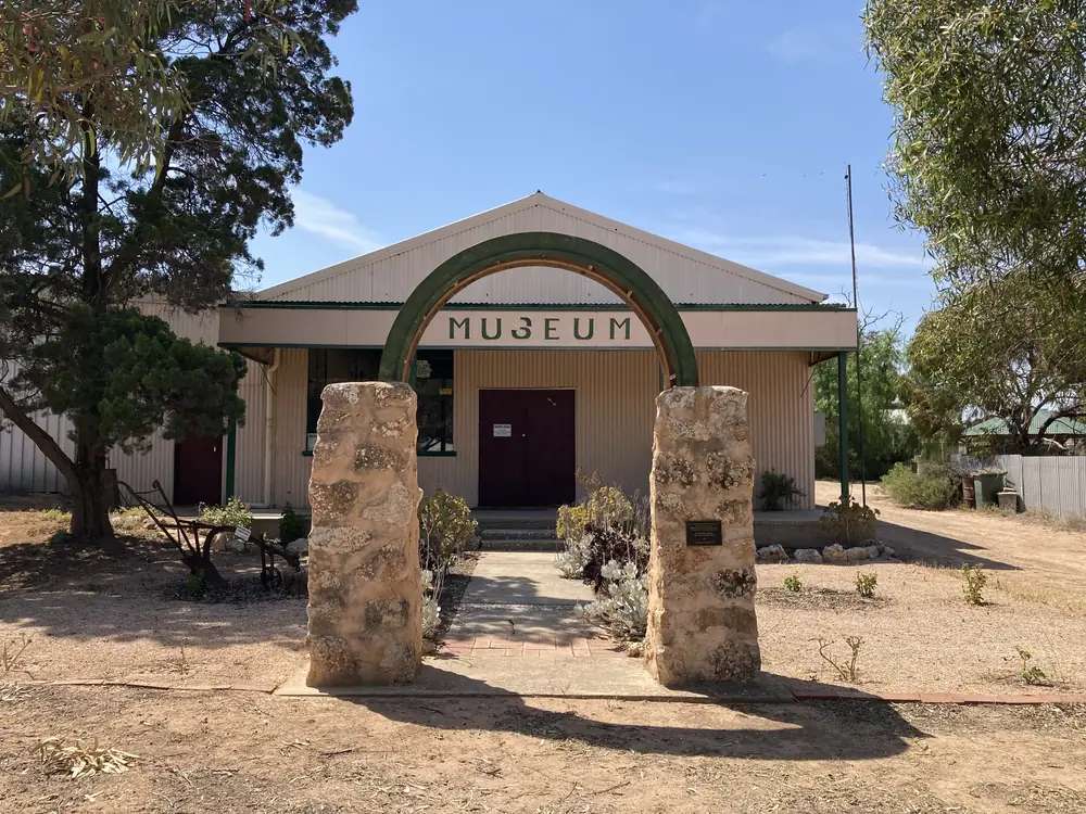
Poochera Museum entryPhoto: Chuq · CC BY-SA 4.0
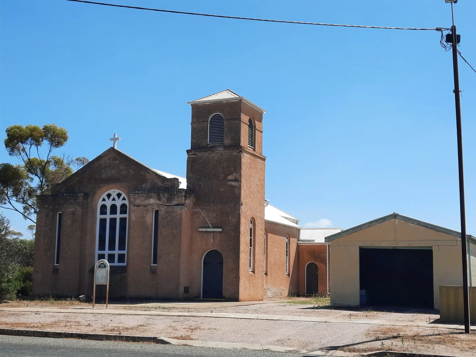
Poochera is an Eyre Highway town in the Outback SA listing on this site, a District Council of Streaky Bay locality west of Minnipa. Council’s town-centre page puts the park on Main Street, Poochera SA 5655, right behind and forming part of the Poochera Museum. This hub is the highway museum stop, not a Ceduna suburb, not a Nullarbor roadhouse, and not a second Minnipa granite street. SATC’s Pildappa Rock listing belongs to Minnipa — 15 km off the Eyre Highway via Minnipa — and is not flattened onto this main street.
The Australian Bureau of Statistics counted 67 people in Poochera suburbs-and-localities (SAL41181) at the 2021 Census, median age 38, sex split 57.8% male / 42.2% female. 16 families, 31 private dwellings, 2.8 people per household. The ABS does not publish a 2021 Urban Centre named Poochera on the pages used here. Small-population QuickStats tables are limited. This hub does not invent extra Census columns.
Where it is, and how far
Poochera sits on the public sealed Eyre Highway, on the same corridor as our Eyre Highway guide, west of Minnipa and east of Penong toward Ceduna. Wudinna and Kimba sit east of Minnipa on that highway’s own pages. A Poochera–Minnipa kilometre was not printed on the sourced Streaky Bay council pages, so this hub does not invent one.
Parks SA names Minnipa as a road-access town for Gawler Ranges National Park, 40 km north of the Eyre Highway on that Parks page. That is a Minnipa / park sentence, not a Poochera gorge walk.
| Place | Distance from Poochera (sourced) |
|---|---|
| Minnipa | Eyre Highway neighbour east. SATC: Pildappa Rock 15 km off the Eyre Highway via Minnipa. No Poochera–Minnipa kilometre on sourced council pages. |
| Gawler Ranges National Park | 40 km north of the Eyre Highway (Parks SA, via Minnipa / Wudinna / Kimba access wording) |
| Adelaide via the park | Parks SA: the park about six hours’ drive north-west of Adelaide — not a Poochera townsite kilometre |
| Town centre | Main Street, Poochera SA 5655 (council) |
| Oval precinct | Oval Road, east on Kent Street to Oval Road (council) |
Facts at a glance
Population. ABS 2021 SAL41181: 67 people. No UCL. Use SAL QuickStats.
Climate. BOM’s SA named list has no Poochera table. MINNIPA PIRSA, 018195, 32.84°S, 135.15°E, elevation 165 m, commenced 1996, status open, latest available data 14 November 2026. Mean maximum (30 years, 1996–2026): January 33.0 °C, July 16.2 °C, annual 24.7 °C. Mean minimum: January 16.0 °C, July 6.7 °C, annual 11.2 °C. Mean rainfall (27 years, 1996–2026): annual 284.8 mm. June 38.9 mm wettest; January 12.7 mm driest. See Poochera weather.
Visitor information. District Council of Streaky Bay town-centre gazebo. Museum by appointment — numbers on the museum door. Historical Society (08) 8626 3014, Renna Street. Roads: Traffic SA.
Traditional Owners
A Traditional Owner nation named for the Poochera townsite was not on the Streaky Bay council town-centre page fetched for this rebuild. Parks SA names the Gawler Ranges People as recognised Traditional Owners of Gawler Ranges National Park on this site’s Minnipa hub. This guide does not flatten that park sentence onto Main Street. Stay on public highways. See visiting Country respectfully.
History
Council’s town-centre page is the visitor wording used here: take a wander around the museum with its unique history and old machinery located within the park, especially the hut made entirely of kerosene cans. The gazebo provides local visitor information. The museum is open by appointment only.
Poochera & District Historical Society Inc is listed on the same council directory, category Arts & Culture, address Renna Street, Poochera 5655, phone (08) 8626 3014. That is a society listing, not a 1870s telegraph-station story borrowed from the Stuart Highway.
This is an Eyre Highway agricultural locality, not Ceduna’s west-coast fishing street and not Minnipa’s Pildappa granite.
Things to do
Official named things to do sit at the town centre, the museum and the oval.
- Poochera Museum and kerosene-can hut — council town centre, by appointment
- Gazebo visitor information — same page
- Public BBQ, seating, toilets — town-centre park
- Oval precinct — lawns, football oval, tennis and netball courts, sporting club rooms; Oval Road via Kent Street
- Pildappa Rock — SATC, via Minnipa, not a Poochera main-street walk
- Gawler Ranges National Park — Parks SA access from Minnipa, Wudinna or Kimba
Where to stay
District Council of Streaky Bay names Poochera Caravan Park: 12 powered sites, 12 non-powered sites, pet friendly, work phone (08) 8626 3257, mobile 0412 698 822. That is an official named type, not a ranked motel strip. If the park is full, Minnipa and Wudinna sit east on this site.
- How to choose: Poochera accommodation
- Camping detail: Poochera caravan parks
- Operator enquiries: feature your business
Caravan and camping
The Eyre Highway is sealed. Council names the caravan park. Confirm stay limits, dump points and whether big rigs fit. Read Poochera caravan parks and outback camping. The town-centre BBQ is a picnic facility, not a free camp this guide will invent.
Fuel and services
A locality of 67 people will not match Ceduna for a hospital. Confirm fuel in town; this guide does not list brands. A hospital name for Poochera is not on the sourced council pages used here. Emergencies 000. Museum appointments: numbers on the door. Historical Society (08) 8626 3014. Caravan park (08) 8626 3257.
Road access
Eyre Highway sealed east–west. Traffic SA is the authority. Stay on gazetted roads. Gawler Ranges tracks close after rain on Parks SA — that is a park sentence via Minnipa, not a Poochera street.
Our Eyre Highway guide is the road-trip page.
Nearby parks and towns
Parks (nearby, not in-town):
- Gawler Ranges National Park — Parks SA access from Minnipa, Wudinna or Kimba
Towns on this site:
- Minnipa — east, Pildappa turn-off
- Wudinna — further east
- Kimba — further east again
- Penong — west toward Ceduna
- Ceduna — west-coast town, not this suburb
- Streaky Bay — District Council of Streaky Bay foreshore seat
- Wirrulla — Eyre Highway west toward Ceduna, same council, inland jetty
When to go, and how long
Parks SA for neighbouring Gawler Ranges: late autumn and winter. BOM Minnipa PIRSA’s January mean maximum of 33.0 °C is the hottest month on the nearest named table. July’s 16.2 °C mean maximum and 6.7 °C mean minimum, with June’s 38.9 mm, is the winter-rain pattern.
An hour covers the museum if you booked the door numbers, the kerosene-can hut and the gazebo. A night covers the named caravan park if a site exists — twelve powered and twelve unpowered on the council directory, pet friendly, (08) 8626 3257. Pildappa and the Gawler Ranges are Minnipa plans, not Poochera main-street walks. The oval precinct on Oval Road remains a community sports ground with tennis, netball, cricket and football on that council page, not a second visitor attraction this hub will timetable.
Operators who want a checked listing: feature your business. The listings slot on this hub stays empty until then.
Plan this trip
Tell us the dates, who you are travelling with and where you need help. We reply with planning notes for Poochera — we are not a booking agent.
Events and road-conditions newsletter
Occasional notes on outback festivals, race days and official road-condition sources — not a daily blast. We use these details only to send the newsletter.
South Australia · Outback SA
Poochera accommodation
Where to stay in Poochera: District Council of Streaky Bay names Poochera Caravan Park, 12 powered and 12 non-powered sites, pet friendly. Confirm before you unhitch. Not a Ceduna suburb.
Read · 3 min
South Australia · Outback SA
Poochera caravan parks
Camping in Poochera: District Council of Streaky Bay names Poochera Caravan Park, 12 powered and 12 non-powered sites, pet friendly. Confirm before you unhitch. Not a Ceduna suburb.
Read · 3 min
South Australia · Outback SA
Poochera weather
Poochera climate from BOM Minnipa PIRSA (018195): January mean max 33.0 °C, July 16.2 °C, annual rainfall 284.8 mm. No Poochera BOM table. Not a Ceduna AMO blend.
Read · 3 min
South Australia · Outback SA
Things to do in Poochera
Things to do in Poochera: Streaky Bay council museum and kerosene-can hut, gazebo visitor info, oval precinct. Pildappa and Gawler Ranges sit with Minnipa. Not a Ceduna suburb.
Read · 3 min
Frequently asked questions
Is Poochera a Ceduna suburb?
No. Poochera is a District Council of Streaky Bay locality on the Eyre Highway west of Minnipa, postcode 5655 on the council town-centre and oval pages. [Ceduna](/outback-towns/south-australia/ceduna) is a different west-coast town on this site. Poochera is not a Ceduna suburb and not a second Minnipa granite street.
What is Poochera’s population?
67 people at the 2021 Census for Poochera suburbs-and-localities (SAL41181), median age 38, sex split 57.8% male / 42.2% female. 16 families, 31 private dwellings, 2.8 people per household. The ABS does not publish a 2021 Urban Centre named Poochera on the pages used here. Small-population tables are limited.
What is there to do in Poochera?
District Council of Streaky Bay’s Poochera Town Centre page: the park sits right behind and forms part of the Poochera Museum, with old machinery and a hut made entirely of kerosene cans; the gazebo provides local visitor information; public BBQ, seating and toilets. The museum is open by appointment only — phone numbers are on the museum door. The oval precinct names tennis, netball, cricket and football.
How far is Poochera from Minnipa and Ceduna?
A Poochera–Minnipa or Poochera–Ceduna kilometre was not printed on the sourced Streaky Bay council pages used here. SATC’s Pildappa listing puts that granite 15 km off the Eyre Highway via Minnipa. Confirm the day’s drive on Traffic SA rather than inventing a highway offset.
What is the weather like in Poochera?
BOM’s SA named list has no Poochera table. This guide uses Minnipa PIRSA (018195, open): January mean maximum 33.0 °C, July 16.2 °C, annual rainfall 284.8 mm (27 years, 1996–2026). Temperature means use 30 years (1996–2026). Latest available data 14 November 2026. Do not blend with Ceduna AMO.
Can I camp in Poochera?
Yes, as named types. District Council of Streaky Bay’s business directory names Poochera Caravan Park: 12 powered sites, 12 non-powered sites, pet friendly, phone (08) 8626 3257. Confirm sites when you arrive rather than assuming a 24-hour park sheet.
Sources and further reading
Facts on this page were checked against these primary and official sources. Conditions change — confirm before you travel or buy.
- Poochera 2021 Census QuickStats (SAL41181) — Australian Bureau of Statistics
- Climate statistics for Minnipa PIRSA (018195) — Bureau of Meteorology
- Poochera Town Centre — District Council of Streaky Bay
- Poochera Oval Precinct — District Council of Streaky Bay
- Poochera Caravan Park — District Council of Streaky Bay
- Poochera & District Historical Society Inc — District Council of Streaky Bay
- Traffic SA — Government of South Australia