At a glance
Sourced facts only. Distances and services change — confirm before you travel.
- Local government
- District Council of Kimba
- Traditional Owners
- Not named for the Kimba townsite on the sourced SATC visitor-outlet or council About pagesSATC says the name is derived from an Aboriginal word meaning “Bush Fire” without naming a nation. Parks SA names the Gawler Ranges People for Gawler Ranges National Park. Confirm wording at the council visitor outlet.
- Nearest regional city
- District Council of Kimba: Port Augusta 155 km; Whyalla 120 km; Ceduna 315 km
- Capital
- District Council of Kimba: 475 km from Adelaide
- Nearest fuel
- Confirm in town. SATC and council treat Kimba as an Eyre Highway service town. Do not assume 24-hour bowsers.
- Nearest hospital or clinic
- Kimba District Hospital and Aged Care, 13–15 Martin Terrace, 24-hour emergency department, (08) 8627 2400 (SA Health). Emergencies 000.
- Mobile coverage
- Check Telstra and Optus coverage maps before travel; Parks SA notes patchy coverage in Gawler Ranges National Park.
- Best time to visit
- Cooler months for the Eyre Highway; Parks SA Gawler Ranges late autumn–winter. BOM Kimba January mean max 31.7 °C
Climate
Monthly means from the Bureau of Meteorology station Kimba (018040). This is not a forecast. Open station in town. Temperature 55–57 years (1967–2026); rainfall 104 years (1920–2026). Elevation 280 m. Latest available data 13 November 2026. Winter-peak rain (August 41.3 mm), not a Top End Wet.
| Month | Mean max (°C) | Mean min (°C) | Rainfall (mm) |
|---|---|---|---|
| Jan | 31.7 | 15.8 | 18.9 |
| Feb | 31.2 | 16.0 | 20.5 |
| Mar | 28.1 | 14.1 | 17.1 |
| Apr | 24.0 | 11.3 | 22.2 |
| May | 19.4 | 8.4 | 34.7 |
| Jun | 16.0 | 6.0 | 41.0 |
| Jul | 15.5 | 5.0 | 41.2 |
| Aug | 17.0 | 5.5 | 41.3 |
| Sep | 20.4 | 7.2 | 35.4 |
| Oct | 24.0 | 9.3 | 30.1 |
| Nov | 27.1 | 12.0 | 23.5 |
| Dec | 29.4 | 14.0 | 20.2 |
Kimba in pictures
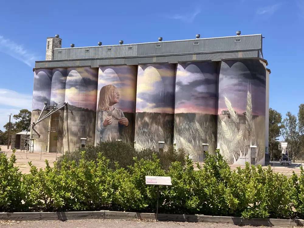
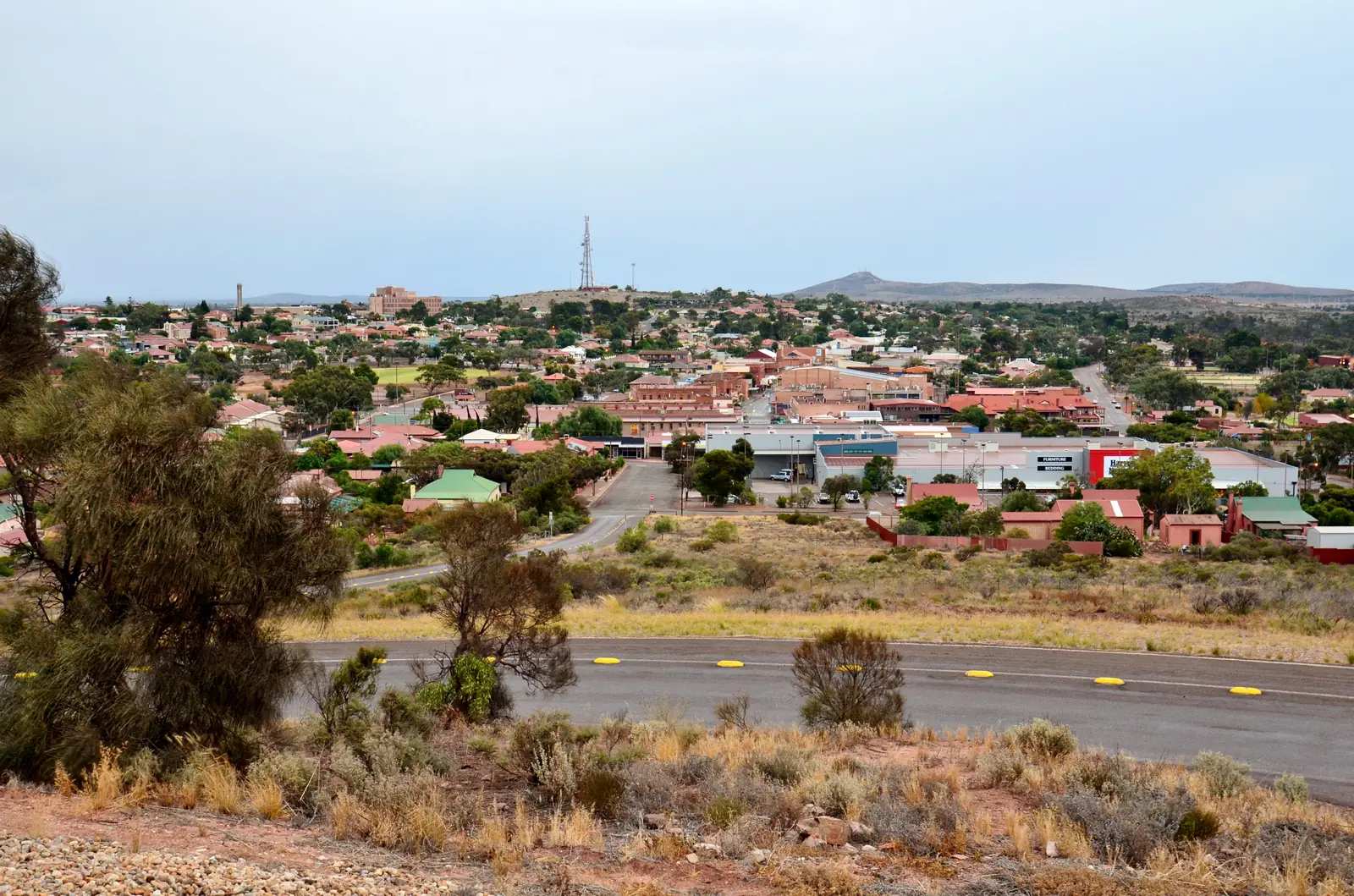
Silo art at Kimba, South AustraliaPhoto: Chuq · CC BY-SA 4.0 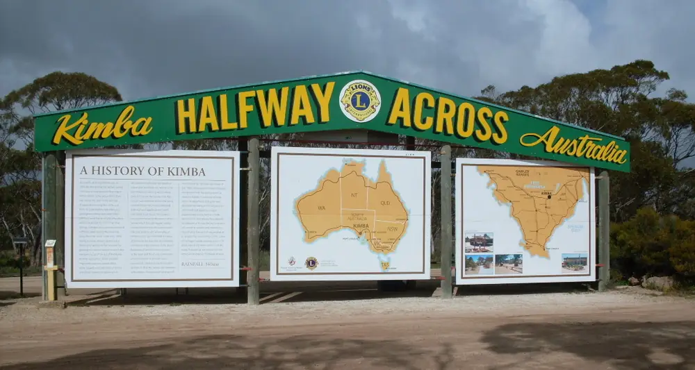
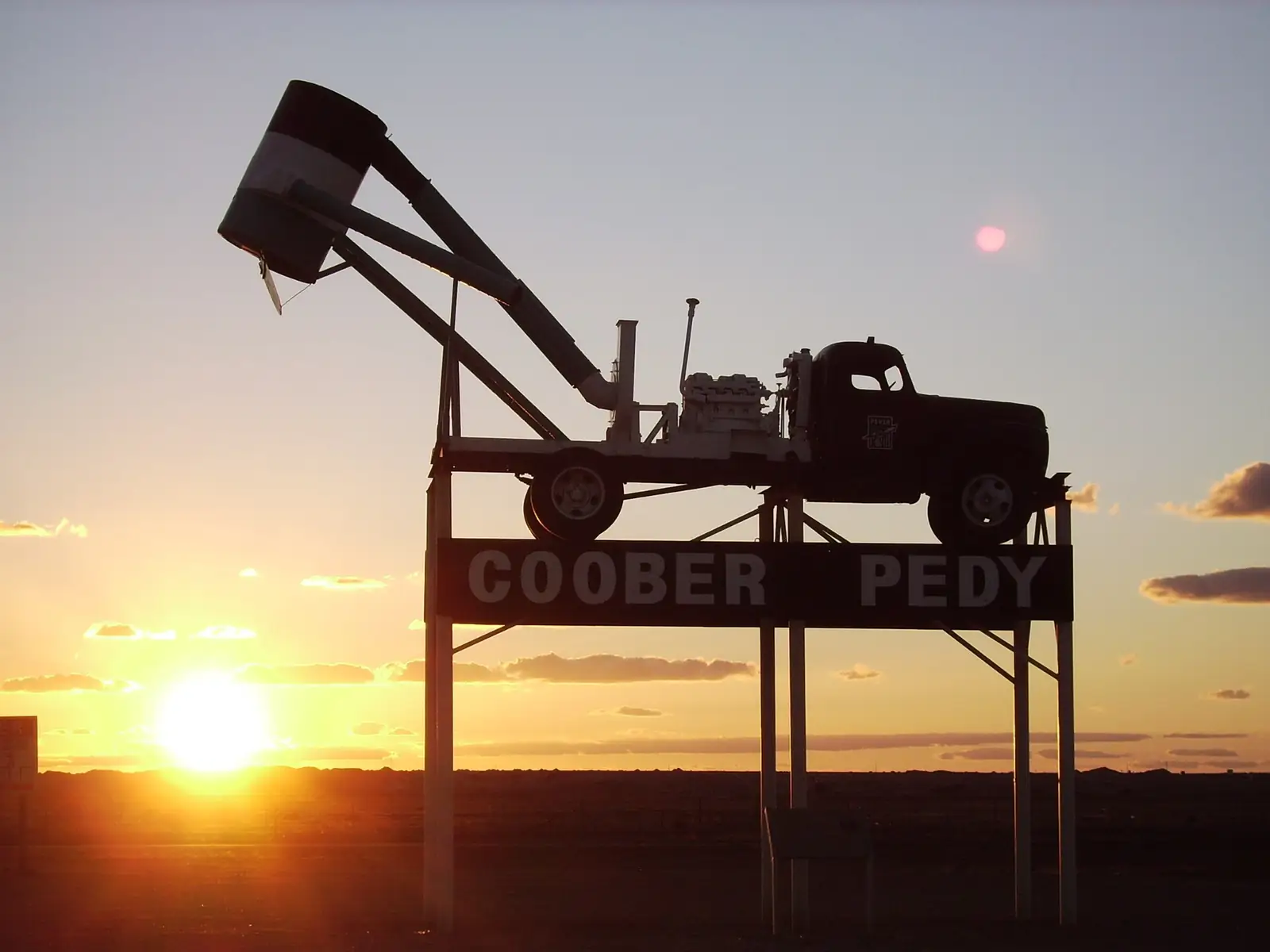
Halfway Across Australia sign at KimbaPhoto: Thom Devereux · CC BY-SA 4.0 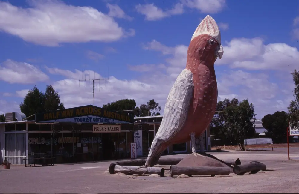
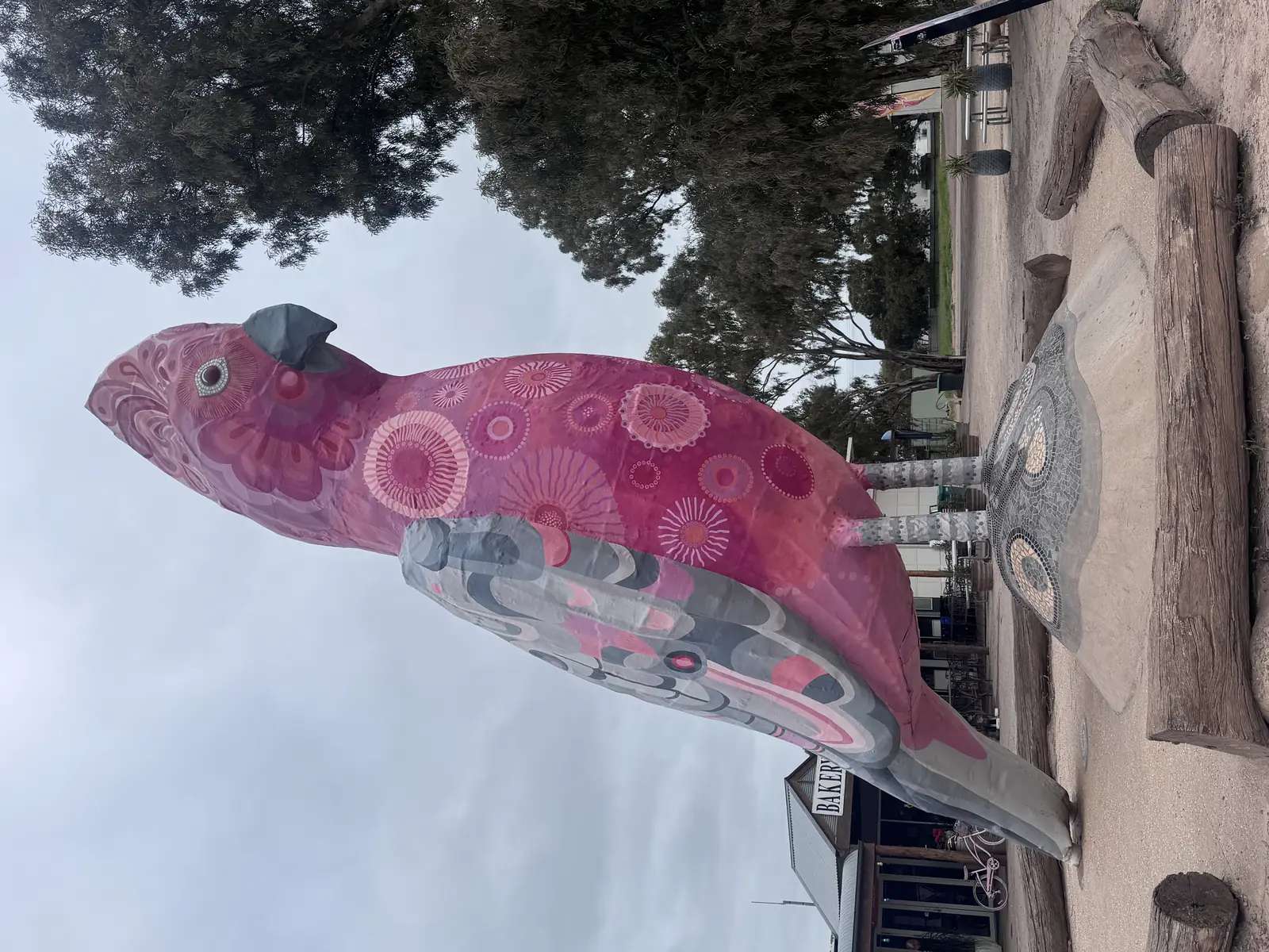
The Big Galah, KimbaPhoto: Adam Eales · CC BY-SA 2.0 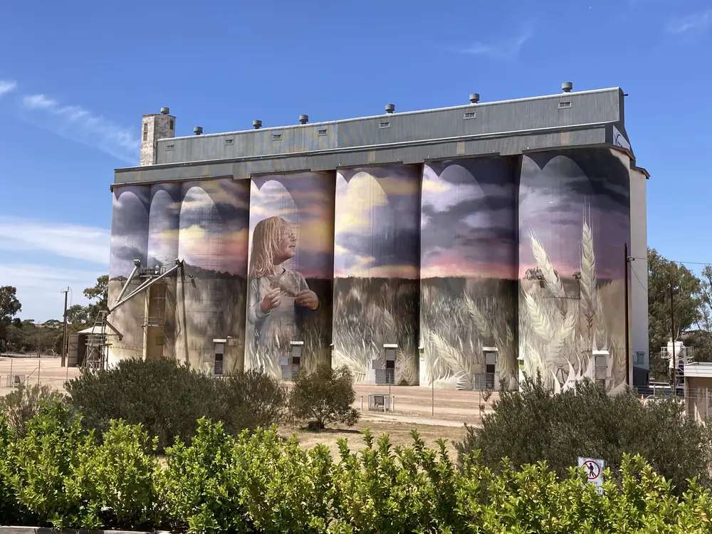
Silo art at Kimba, South AustraliaPhoto: Chuq · CC BY-SA 4.0
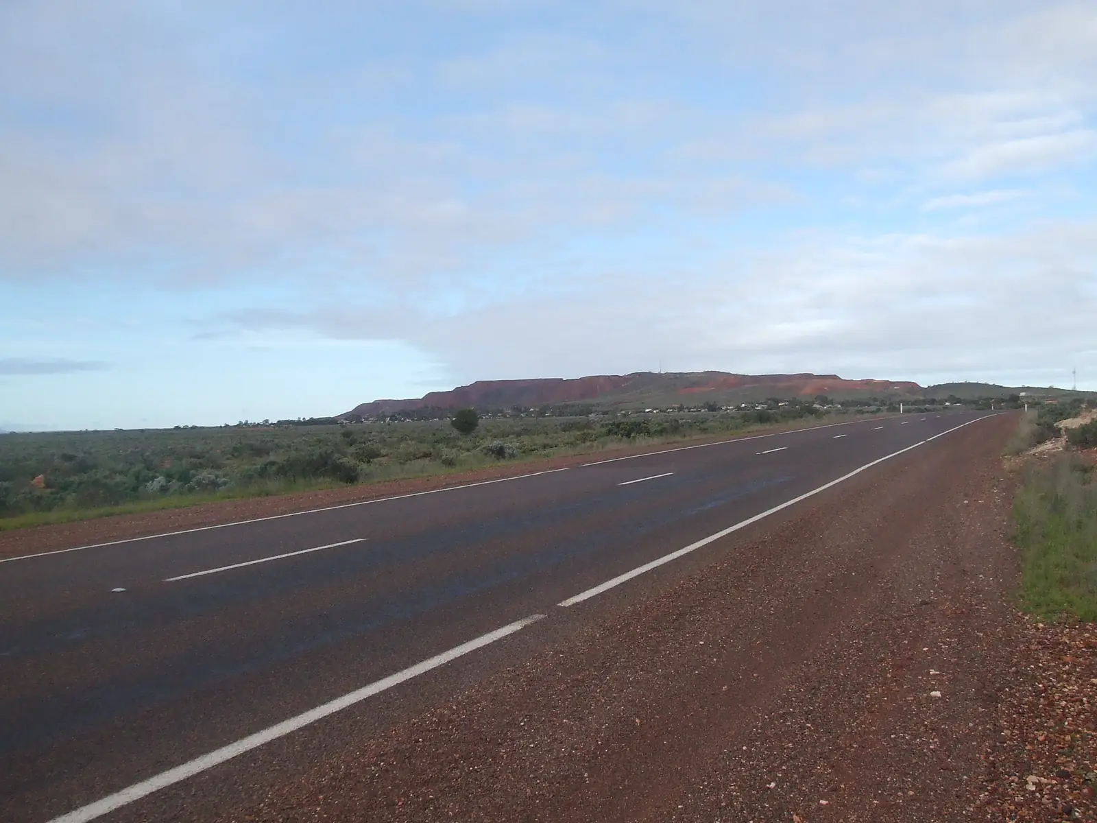
Kimba sits on the Eyre Highway (National Highway One) on north-eastern Eyre Peninsula, inside the District Council of Kimba. SATC’s visitor-outlet listing and the council’s About page both place it halfway across Australia on that highway. The council’s Big Galah page puts an 8-metre bird in front of the Halfway Across Australia Gem Shop. This hub is that South Australian wheat-and-highway town, not Kimba in Queensland, and not a treeless Nullarbor roadhouse. Ceduna is the last major service town further west. Whyalla is on a different highway — the Lincoln Highway — even though the council lists it 120 km away.
The 2021 Census counted 608 people in both the Kimba urban centre (UCL421019) and suburbs-and-localities (SAL40694): median age 50, sex split 51.9% male / 48.1% female, 155 families, 389 private dwellings, average household size 2.1. The local government area (LGA43220) counted 1,037. Use 608 for the town. SATC’s destination copy prints 1300 for the community; the council About page prints around 1,211 in the district and about 650 in the town. Those are not the ABS urban-centre figure.
Where it is, and how far
The District Council of Kimba About page is the kilometre table used here: 475 km from Adelaide, 155 km from Port Augusta, 315 km from Ceduna, plus Cleve 75 km, Kyancutta 90 km, Whyalla 120 km. Iron Knob’s Progress Association independently lists Kimba 90 km SW of that iron-ore town — a neighbour figure, not a substitute for council’s own table.
Parks SA’s Gawler Ranges National Park is 40 km north of the Eyre Highway, with road access from Iron Knob, Kimba, Wudinna or Minnipa.
| Place | Distance from Kimba (sourced) |
|---|---|
| Adelaide | 475 km (District Council of Kimba About page) |
| Port Augusta | 155 km (same) |
| Ceduna | 315 km (same) |
| Whyalla | 120 km (same) |
| Cleve | 75 km (same) |
| Kyancutta | 90 km (same) |
| Gawler Ranges National Park | Parks SA: 40 km north of the Eyre Highway; access includes Kimba |
Sealed highway: Traffic SA. Park tracks: Parks SA and DIT outback road warnings.
Facts at a glance
Population. ABS 2021 UCL421019 / SAL40694: 608 people. Median age 50. LGA 1,037. Use Kimba UCL QuickStats.
Climate. Bureau of Meteorology KIMBA, 018040, 33.14°S, 136.41°E, elevation 280 m, commenced 1920, status open, latest available data 13 November 2026. Mean maximum (57 years, 1967–2026): January 31.7 °C, July 15.5 °C, annual 23.7 °C. Mean minimum (55 years): February 16.0 °C, July 5.0 °C, annual 10.4 °C. Mean rainfall (104 years, 1920–2026): annual 345.9 mm; August 41.3 mm wettest mean month. Mean days of rain ≥ 1 mm: 59.4. See Kimba weather.
Visitor information. SATC: District Council of Kimba & Visitor Information Outlet, Cross Street, weekdays 9am–5pm, (08) 8627 2026, council@kimba.sa.gov.au. SATC also names Lions/Apex/Central Park on Park Terrace (electric BBQ, shade, toilets, playground) and The Gums on the Eyre Highway (picnic and electric BBQ).
Traditional Owners
SATC’s visitor-outlet listing states the name Kimba is derived from an Aboriginal word, with the meaning of “Bush Fire”. It does not name a nation for the townsite on that page. Parks SA’s Gawler Ranges National Park page states the Gawler Ranges People are recognised as Traditional Owners of that park Country, native title 2011, foundation families from some, but not all, Barngarla, Kokatha and Wirangu People. This hub does not flatten the park sentence onto Cross Street. Confirm wording at the council visitor outlet. Read visiting Country respectfully.
History
SATC: a pioneering town established in 1915; pastoral leases from 1872; pioneer farmers grew the first crops in 1908; the district is now one of the major wheat producing areas in South Australia. The council About page matches the 1915 township proclamation and dates agriculture opening to 1876. SATC also records Edward John Eyre’s 18 June 1840 expedition toward King George Sound, camping at Refuge Rocks, now locally called Secret Rocks. This is a wheat-and-highway founding, not an iron-ore town borrowed from Iron Knob and not a Far West Coast whale village borrowed from Fowlers Bay.
The Kimba and Gawler Ranges Historical Society museum on SATC ( 15307 Eyre Highway ) showcases early agricultural life: Pioneer House dating back to 1908, one-teacher school, pioneer store, tractor collection, blacksmith shop.
Things to do
Council’s tourist-information list and SATC name these in and around Kimba:
- The Big Galah — council: 8 metres, in front of the Halfway Across Australia Gem Shop, full renovation 2021
- Halfway Across Australia Sign — named on the council attractions list
- Town tourist walk, murals and mosaic — council list
- Roora Nature Trails — council list
- Edward John Eyre sculptures — council list
- Kimba & Gawler Ranges Historical Society — SATC; 15307 Eyre Highway; agricultural collections
- Lions/Apex/Central Park and The Gums — SATC picnic stops
- Gawler Ranges National Park — Parks SA access from Kimba
This site’s big things page also names Kimba’s Big Galah as the halfway-across-Australia marker. See things to do in Kimba.
Where to stay
This hub does not invent a motel chain or a star rating. Named stay types on official pages used here:
- Town hotel/motel and cabin types — confirm at the Cross Street visitor outlet (08 8627 2026). SATC’s English visitor-outlet page does not publish a ranked hotel list.
- Picnic / rest stops at Central Park and The Gums are SATC picnic wording, not a powered-site sheet
- Gawler Ranges National Park camping — Parks SA fees, book before you go
How to choose: Kimba accommodation. Camping detail: Kimba caravan parks. Operator enquiries: feature your business.
Caravan and camping
A van can sit on sealed Eyre Highway bitumen through Kimba in ordinary weather. Confirm a legal town park or a room at the visitor outlet rather than treating The Gums picnic area as a caravan park SATC did not name that way. Park camps in the Gawler Ranges are park camps. Read Kimba caravan parks.
Fuel and services
Kimba is a genuine service town on the Eyre Highway, not a 25-person junction. Confirm bowsers and hours on the day. Kimba District Hospital and Aged Care, 13–15 Martin Terrace, (08) 8627 2400, 24-hour emergency department, volunteer ambulance and RFDS access (SA Health). Emergencies 000. Whyalla Hospital remains the larger gulf hospital 120 km away on the council table.
This guide does not list bowser brands.
Road access
Eyre Highway sealed from Port Augusta through Kimba toward Ceduna and the Nullarbor. Traffic SA. Lincoln Highway to Whyalla is a different road even though Whyalla is 120 km on the council page. Parks SA park tracks: 4WD recommended for all highlights. Our Nullarbor guide is the crossing page west of Ceduna.
Nearby parks and towns
Parks and named nature:
- Gawler Ranges National Park — access from Kimba
Towns on this site:
- Iron Knob — iron-ore neighbour; no fuel there
- Whyalla — 120 km, steel city
- Port Augusta — 155 km
- Ceduna — 315 km west
- Outback SA hub
When to go, and how long
BOM Kimba’s January mean maximum of 31.7 °C is a hot wheat-belt afternoon at 280 m. July 15.5 °C / 5.0 °C, with August 41.3 mm, is the cool, slightly wetter winter. Parks SA prefers late autumn and winter in the Gawler Ranges. See Kimba weather.
An hour covers the Big Galah photograph and a museum visit if those named hours match the day. A night covers fuel and a highway sleep. The Gawler Ranges are a separate park day.
Operators who want a checked listing: feature your business. The listings slot stays empty until then.
Plan this trip
Tell us the dates, who you are travelling with and where you need help. We reply with planning notes for Kimba — we are not a booking agent.
Events and road-conditions newsletter
Occasional notes on outback festivals, race days and official road-condition sources — not a daily blast. We use these details only to send the newsletter.
South Australia · Outback SA
Kimba accommodation
Where to stay in Kimba: SATC names picnic parks, not a ranked motel strip. Confirm rooms at the District Council visitor outlet, 08 8627 2026. Eyre Highway halfway stop, not Kimba QLD.
Read · 3 min
South Australia · Outback SA
Kimba caravan parks
Camping in Kimba: SATC names Central Park and The Gums as picnic stops, not a powered-site sheet. Confirm a legal park at 08 8627 2026. Gawler Ranges camps are separate park stays.
Read · 3 min
South Australia · Outback SA
Kimba weather
Kimba climate from BOM Kimba (018040): January mean max 31.7 °C, July 15.5 °C, annual rainfall 345.9 mm with August 41.3 mm. Open station. Eyre Highway wheat town, not a gulf blend.
Read · 3 min
South Australia · Outback SA
Things to do in Kimba
Things to do in Kimba: 8-metre Big Galah, Halfway Across Australia Sign, Historical Society museum, Roora trails and Gawler Ranges access. Eyre Highway, not Kimba QLD.
Read · 3 min
Frequently asked questions
Is Kimba halfway across Australia?
SATC’s District Council of Kimba visitor-outlet listing and the council’s own About page place the town on the Eyre Highway, National Highway One, and SATC describes Kimba’s community as situated halfway across Australia. The council’s Big Galah page puts the 8-metre bird in front of the Halfway Across Australia Gem Shop. This hub is South Australia, not Kimba in Queensland.
How far is Kimba from Adelaide, Port Augusta and Ceduna?
The District Council of Kimba About page puts Kimba 475 km from Adelaide, 155 km from Port Augusta and 315 km from Ceduna. It also lists Cleve 75 km, Kyancutta 90 km and Whyalla 120 km.
What is Kimba’s population?
608 people at the 2021 Census for both the Kimba urban centre (UCL421019) and the suburbs-and-localities page (SAL40694). Median age 50. Do not use the District Council LGA figure of 1,037 as the town count. SATC’s visitor-outlet copy prints 1300 for the community; that is destination wording, not the ABS town figure.
What is there to do in Kimba?
The District Council tourist-information list names a town tourist walk, murals and mosaic, the Big Galah (8 metres, renovated 2021), Roora Nature Trails, the Halfway Across Australia Sign, Edward John Eyre sculptures, and conservation parks. SATC lists the Kimba and Gawler Ranges Historical Society museum at 15307 Eyre Highway. Parks SA lists Kimba as a road-access town for Gawler Ranges National Park.
Where is the visitor information outlet?
SATC lists the District Council of Kimba and Visitor Information Outlet on Cross Street, Kimba, weekdays 9am–5pm, phone (08) 8627 2026, council@kimba.sa.gov.au.
What weather record should I use?
BOM Kimba (018040, open): January mean maximum 31.7 °C, July 15.5 °C, annual rainfall 345.9 mm. August is the wettest mean month at 41.3 mm.
Sources and further reading
Facts on this page were checked against these primary and official sources. Conditions change — confirm before you travel or buy.
- Kimba 2021 Census QuickStats (UCL421019) — Australian Bureau of Statistics
- Kimba 2021 Census QuickStats (SAL40694) — Australian Bureau of Statistics
- Kimba 2021 Census QuickStats (LGA43220) — Australian Bureau of Statistics
- Climate statistics for Kimba (018040) — Bureau of Meteorology
- About Council — District Council of Kimba
- The Big Galah — District Council of Kimba
- District Council of Kimba & Visitor Information Outlet — South Australian Tourism Commission
- Kimba & Gawler Ranges Historical Society — South Australian Tourism Commission
- Gawler Ranges National Park — National Parks and Wildlife Service SA
- Kimba District Hospital and Aged Care — SA Health
- Traffic SA — Government of South Australia
- Outback road warnings — Department for Infrastructure and Transport SA