At a glance
Sourced facts only. Distances and services change — confirm before you travel.
- Local government
- Wudinna District Council
- Traditional Owners
- Gawler Ranges People named by Parks SA for Gawler Ranges National Park — not flattened onto the Wudinna townsiteParks SA: the Gawler Ranges People are the recognised Traditional Owners of the park, having attained native title in 2011, described as a distinct group of foundation families made up of some, but not all, of the Barngarla, Kokatha and Wirangu peoples. A Traditional Owner nation named for the Wudinna townsite was not on the SATC Mount Wudinna listing. Confirm at the VIC.
- Nearest regional city
- Parks SA names Wudinna as a road-access town for Gawler Ranges National Park, 40 km north of the Eyre Highway. A Wudinna–Port Augusta kilometre is not printed on the SATC Mount Wudinna page.
- Capital
- Parks SA puts the park about six hours’ drive north-west of Adelaide. A Wudinna townsite–Adelaide kilometre is not printed on the SATC Mount Wudinna listing.
- Nearest fuel
- Confirm in town. SATC treats Wudinna as an Eyre Highway services town via the hotel-motel and VIC listings. Do not assume 24-hour bowsers.
- Nearest hospital or clinic
- A Wudinna hospital URL did not return on the SA Health fetch used here. Emergencies 000. Confirm at the Wudinna VIC, 08 8680 2969.
- Mobile coverage
- Check Telstra and Optus coverage maps before travel; Parks SA says mobile coverage in Gawler Ranges National Park is patchy and unreliable, especially in low-lying areas.
- Best time to visit
- Parks SA: late autumn and winter for the Gawler Ranges. BOM Wudinna Aero January mean maximum 33.5 °C; July 17.0 °C, with winter-peak rain.
Climate
Monthly means from the Bureau of Meteorology station Wudinna Aero (018083). This is not a forecast. Open station. Elevation 86 m, commenced 1999. Temperature 27 years (1999–2026); rainfall 26 years (1999–2026). Latest available data 14 November 2026. Inland Eyre Peninsula table, hotter in January than Ceduna AMO or Eucla. Do not blend with Minnipa PIRSA 018195.
| Month | Mean max (°C) | Mean min (°C) | Rainfall (mm) |
|---|---|---|---|
| Jan | 33.5 | 15.6 | 14.1 |
| Feb | 32.8 | 15.0 | 16.3 |
| Mar | 29.6 | 13.1 | 17.6 |
| Apr | 25.5 | 10.3 | 16.5 |
| May | 20.9 | 8.2 | 23.5 |
| Jun | 17.4 | 6.7 | 40.1 |
| Jul | 17.0 | 6.0 | 35.1 |
| Aug | 18.7 | 5.6 | 34.2 |
| Sep | 22.8 | 7.1 | 22.9 |
| Oct | 26.2 | 8.9 | 21.8 |
| Nov | 29.2 | 11.7 | 22.3 |
| Dec | 31.3 | 13.5 | 17.6 |
Wudinna in pictures
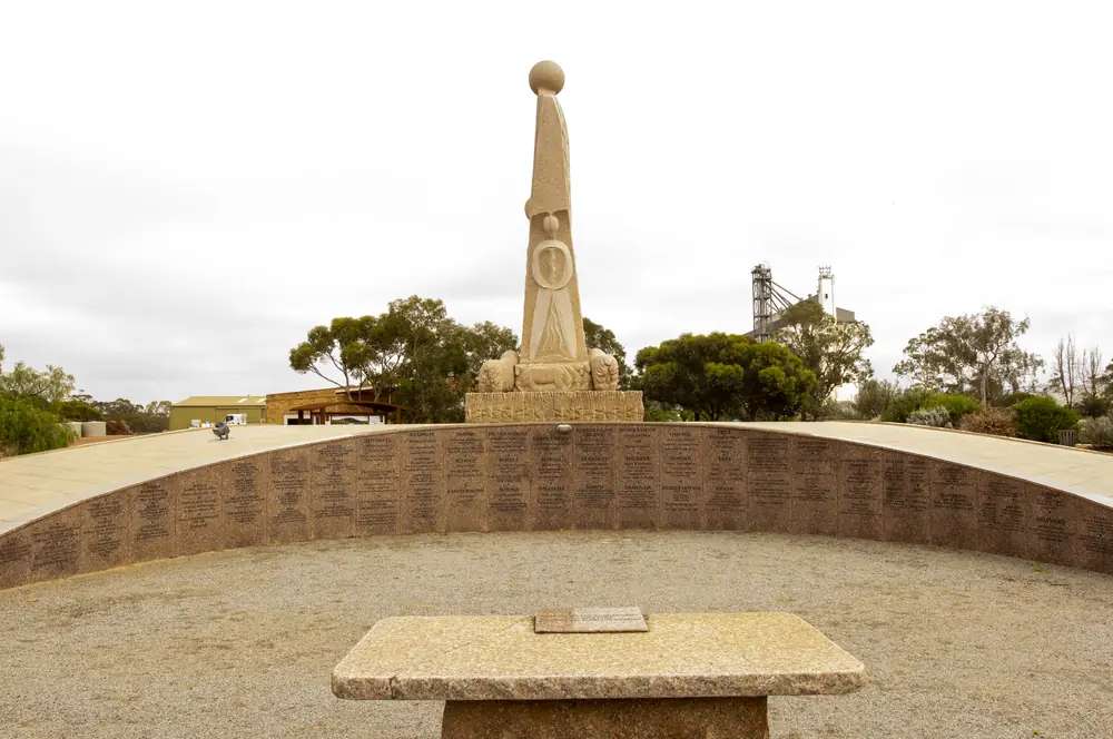
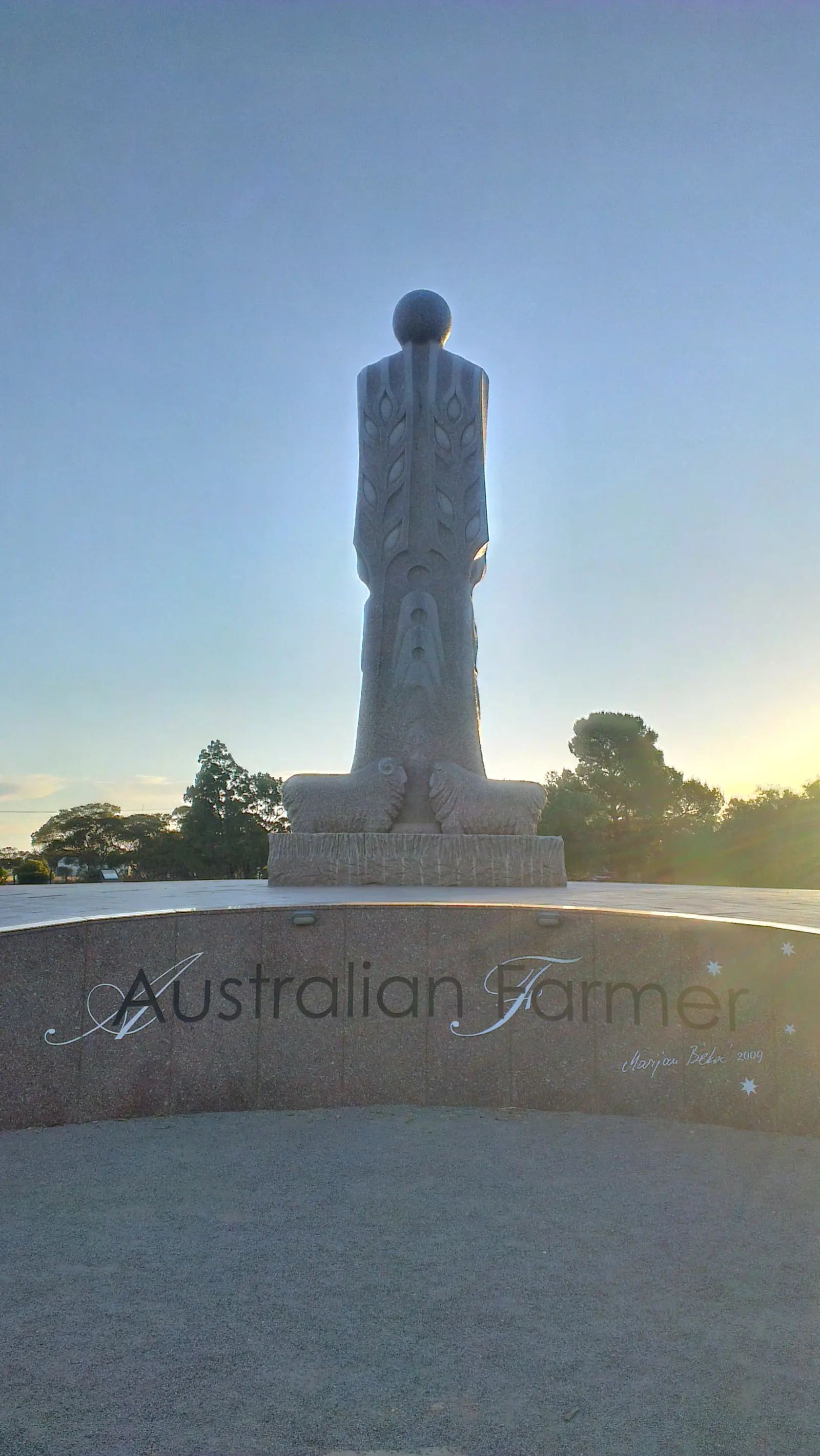
Australian Farmer statue and inscribed wall in WudinnaPhoto: Gnangarra · CC BY 2.5 au 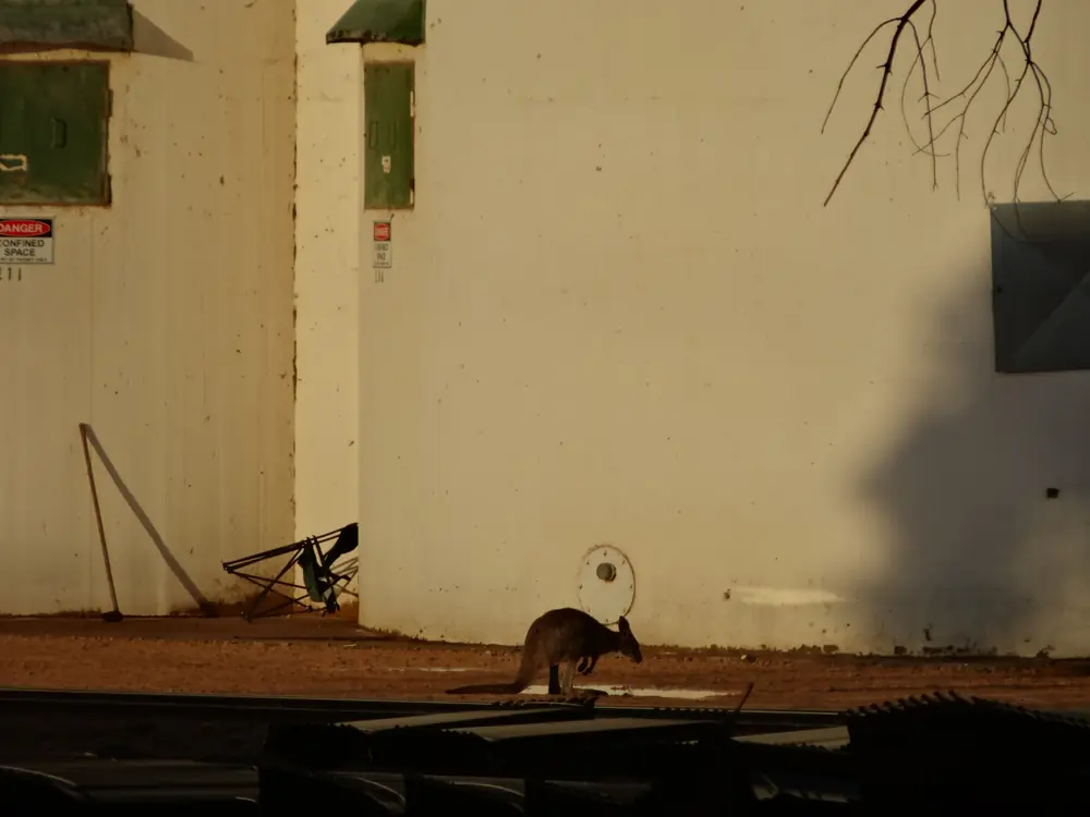
Kangaroo at the Wudinna grain silosPhoto: denisbin · CC BY-SA 2.0 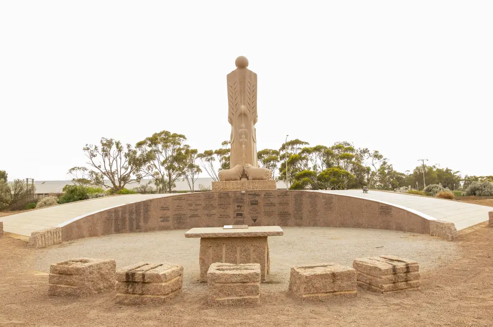
Australian Farmer statue from the highway in WudinnaPhoto: Gnangarra · CC BY 2.5 au 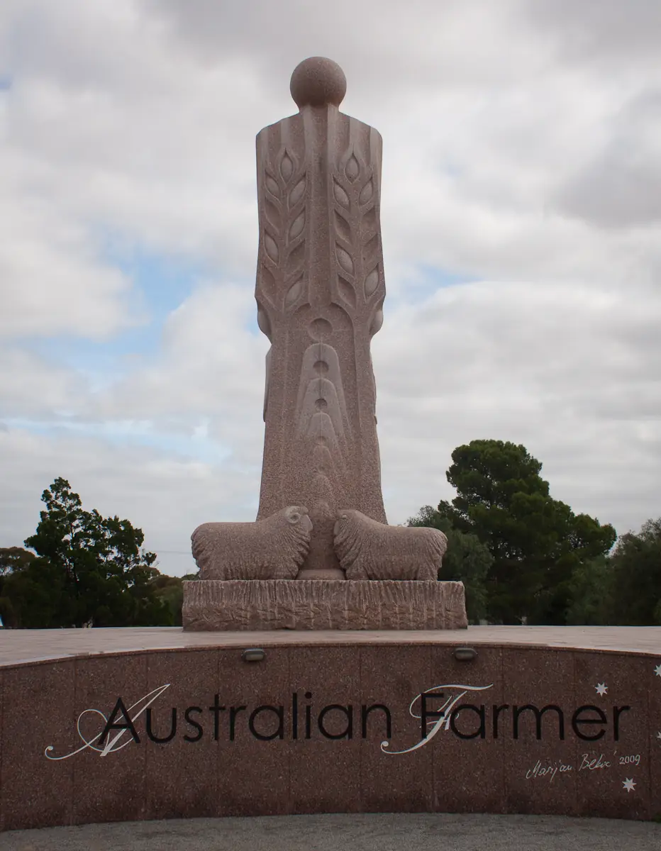
Australian Farmer statue in WudinnaPhoto: Stephen Edmonds · CC BY-SA 3.0
Wudinna sits on the Eyre Highway on South Australia’s Eyre Peninsula, inside Wudinna District Council. SATC’s Mount Wudinna listing is the geography used here: access through the town of Wudinna, 10 kilometres off National Highway One, postcode 5652. This is the South Australian granite town, not Wudinna in Victoria, not a Ceduna suburb, and not a Nullarbor roadhouse borrowed from Nundroo. Parks SA names Wudinna, with Minnipa and Kimba, as a road-access town for Gawler Ranges National Park.
The Australian Bureau of Statistics does not publish a 2021 Urban Centre (UCL) named Wudinna on the pages used here. Use suburbs-and-localities SAL41659: 594 people, median age 45, sex split 47.1% male / 52.9% female. 158 families, 317 private dwellings, 2.3 people per household. Travellers stop for granite, a highway night and a park approach. You still need Traffic SA after rain, because a sealed highway is no use if a floodway is closed, and Parks SA closes Gawler Ranges tracks after rain.
This site groups Wudinna with Outback SA towns. SATC’s Mount Wudinna listing is the visitor-centre number used here: 08 8680 2969, info@wudinnatelecentre.com.au, pointing at wudinna.sa.gov.au.
Where it is, and how far
Wudinna is on the sealed Eyre Highway (A1) through Eyre Peninsula wheat-and-granite country, east of Minnipa and west of the longer run toward Port Augusta. SATC does not print a Wudinna–Adelaide or Wudinna–Ceduna kilometre on the Mount Wudinna page. Parks SA puts Gawler Ranges National Park about six hours’ drive north-west of Adelaide and 40 km north of the Eyre Highway.
| Place | Official note |
|---|---|
| Mount Wudinna | SATC: 10 km off National Highway One through Wudinna; 261 m above ground level |
| Ucontitchie Hill | SATC: 32 km south-west of the Wudinna township; 37 m |
| Polda Rock Reserve | SATC: six kilometres east of Wudinna |
| Gawler Ranges National Park | Parks SA: 40 km north of the Eyre Highway; access from Iron Knob, Kimba, Wudinna or Minnipa |
| Minnipa | Neighbour west on the Eyre Highway; SATC Pildappa Rock is 15 km off the highway via Minnipa |
| Adelaide | Parks SA six-hour park figure; no Wudinna townsite kilometre on the SATC monolith page |
| Ceduna / Nullarbor | West on the same sealed highway; this site’s Nullarbor table starts that crossing at Ceduna |
Sealed highway: Traffic SA. Unsealed park tracks: Parks SA and DIT outback road warnings. Parks SA also prints 1300 361 033.
Facts at a glance
Population. ABS 2021 Census SAL41659: 594 people. Median age 45. Use Wudinna QuickStats.
Climate. Bureau of Meteorology WUDINNA AERO, 018083, 33.04°S, 135.45°E, elevation 86 m, commenced 1999, status: open, latest available data 14 November 2026. Mean maximum (27 years, 1999–2026): January 33.5 °C, July 17.0 °C, annual 25.4 °C. Mean minimum: January 15.6 °C, August 5.6 °C, annual 10.1 °C. Mean rainfall (26 years, 1999–2026): annual 274.9 mm; June 40.1 mm (wettest mean month); January 14.1 mm driest on that table. This is an inland Eyre Peninsula table, hotter in January than Ceduna AMO or Eucla. See Wudinna weather. Minnipa PIRSA (018195) is a different station. Do not blend.
Visitor information. SATC Mount Wudinna listing: 08 8680 2969, info@wudinnatelecentre.com.au. SATC Hotel Motel: 15-17 Burton Terrace, 08 8680 2019.
Traditional Owners
Parks SA’s Gawler Ranges National Park page: the Gawler Ranges People are the recognised Traditional Owners, having attained native title in 2011. Parks SA describes them as a distinct group of foundation families made up of some, but not all, of the Barngarla, Kokatha and Wirangu peoples. That sentence is for the park. A Traditional Owner nation named for the Wudinna townsite was not on the SATC Mount Wudinna, Ucontitchie Hill or Polda Rock listings fetched for this rebuild. This guide does not flatten the park sentence onto Burton Terrace. Confirm current wording at the VIC. Read visiting Country respectfully.
History and granite country
SATC’s Wudinna Hotel Motel listing: the hotel has been at the heart of the Eyre Peninsula since 1926. SATC’s Mount Wudinna listing is a granite monolith story, not a Nullarbor telegraph anecdote. Polda Rock Reserve, SATC: an attractive water reserve that originally supplied the Wudinna Township; much of the original infrastructure, including the hand-constructed stone channel, remains intact. This hub does not invent a gazettal year SATC did not print.
Commons photographs used on this hub show a granite statue inscribed Australian Farmer. A SATC product page for that statue did not return on the fetch used here. Confirm the story at the VIC rather than treating a caption as a visitor-centre script.
Things to do
SATC names these in and around Wudinna:
- Mount Wudinna — SATC: one of Australia’s largest granite monoliths; 10 km off Highway One; interpretive trail; picnic, barbecue, toilets, architecturally designed shelter; bus and caravan parking; walk to 261 metres; camping is not permitted; pets on a leash
- Ucontitchie Hill — SATC: 32 km south-west; 37 m; wave structures and tafoni; steep; gold-coin donation in an honesty box; not for children or the elderly on that listing
- Polda Rock Reserve — SATC: six kilometres east; two kilometre walking trail; bird watching, short walks, picnics; pets on a leash
- Gawler Ranges National Park — Parks SA: Organ Pipes, campgrounds, 40 km north of the highway; access from Wudinna. See this site’s Gawler Ranges guide
- Lake Gairdner — related park guide on this site, not a Wudinna street
Nearby, not in-town: SATC’s Pildappa Rock listing is 15 kilometres off the Eyre Highway via Minnipa. Use the Minnipa hub.
Where to stay
SATC names Wudinna Hotel Motel, 15-17 Burton Terrace, 08 8680 2019, wudinnahotelmotel.com.au: 32 rooms, since 1926, bar, bistro, restaurant, carpark, family friendly, games room, free wifi. SATC names Access, Budget, Standard, Deluxe Rooms or Villas. SATC lists a from–to price range; this hub does not reprint dollar figures that date.
A SATC caravan-park product page did not return on the fetch used here. Confirm powered sites at the VIC. Parks SA campgrounds sit in Gawler Ranges National Park, not on Burton Terrace. Mount Wudinna: camping is not permitted.
- How to choose: Wudinna accommodation
- Camping detail: Wudinna caravan parks
- Operators: feature your business
Caravan and camping
Vans use Wudinna as an Eyre Highway overnight and a Gawler Ranges jump-off. Official named camping starts with whatever the VIC can confirm in town, then Parks SA’s six Gawler Ranges campgrounds (40 km north of the highway on Parks SA). SATC’s Pildappa listing names camping at neighbouring Pildappa Park Campground via Minnipa. Ask the VIC for stay limits. Read Wudinna caravan parks.
Fuel and services
A town of 594 people will not match Ceduna for a supermarket aisle, but it is a larger highway town than a Nullarbor roadhouse. Fill in town if you are heading west toward Ceduna and the Nullarbor gaps. This guide does not list brands or prices. Do not assume 24-hour bowsers.
A Wudinna hospital URL did not return on the SA Health fetch used here. Emergencies 000. Confirm clinic hours at the VIC 08 8680 2969.
For current questions use the VIC, Wudinna District Council and Traffic SA.
Road access
The Eyre Highway is sealed. SATC: roads to Mount Wudinna are well sign-posted and suitable for cars, caravans and buses. Parks SA: Gawler Ranges tracks can close after rain; a 4WD is recommended to see all of the park’s highlights. Dogs are not permitted in the park on Parks SA (accredited assistance dogs excepted).
East: toward Kimba and Port Augusta. West: Minnipa, then the longer run toward Ceduna and the Nullarbor crossing.
Nearby parks and towns
Parks:
- Gawler Ranges National Park — Parks SA; Wudinna is a named access town
- Lake Gairdner — related park guide on this site
Towns on this site:
- Minnipa — SATC Pildappa Rock
- Ceduna — last major SA Nullarbor service town further west
- Port Augusta — Eyre / Stuart / Augusta junction
- Penong — Windmill Museum, further west toward the Nullarbor
- Poochera — Eyre Highway west of Minnipa, Streaky Bay council museum stop
When to go, and how long
Wudinna Aero’s January mean maximum of 33.5 °C is hotter than Ceduna AMO or Eucla. July’s 17.0 °C mean maximum is the cooler visiting season Parks SA describes for the Gawler Ranges (late autumn and winter); August’s 5.6 °C mean minimum is why a room matters. Annual rainfall 274.9 mm, winter-wetter than the far north (June 40.1 mm mean).
A fuel stop is the minimum. A night covers Mount Wudinna and Polda Rock. Two nights if you are adding Ucontitchie Hill and a Gawler Ranges campground already booked.
Operators who want a checked listing: feature your business. The listings slot on this hub stays empty until then.
Plan this trip
Tell us the dates, who you are travelling with and where you need help. We reply with planning notes for Wudinna — we are not a booking agent.
Events and road-conditions newsletter
Occasional notes on outback festivals, race days and official road-condition sources — not a daily blast. We use these details only to send the newsletter.
South Australia · Outback SA
Things to do in Wudinna
Things to do in Wudinna: SATC names Mount Wudinna granite monolith, Ucontitchie Hill and Polda Rock. Parks SA names Wudinna as a Gawler Ranges approach. Not Wudinna VIC.
Read · 4 min
South Australia · Outback SA
Wudinna accommodation
Where to stay in Wudinna: SATC names Wudinna Hotel Motel, 32 rooms, 15-17 Burton Terrace, since 1926. Confirm caravan sites at the VIC. This is SA, not Wudinna VIC.
Read · 4 min
South Australia · Outback SA
Wudinna caravan parks
Camping in Wudinna: SATC did not return a live caravan-park product page. Confirm in-town sites at the VIC. Parks SA Gawler Ranges campgrounds sit 40 km north of the highway. Mount Wudinna camping is not permitted.
Read · 3 min
South Australia · Outback SA
Wudinna weather
Wudinna climate from BOM Wudinna Aero (018083): January mean max 33.5 °C, July 17.0 °C, annual rainfall 274.9 mm. Inland Eyre Peninsula. Not Wudinna VIC.
Read · 3 min
Frequently asked questions
Is this Wudinna in South Australia or Victoria?
This hub is Wudinna on the Eyre Highway in South Australia, in Wudinna District Council. SATC’s Mount Wudinna listing puts the granite monolith 10 kilometres off National Highway One through the town of Wudinna, postcode 5652. It is not Wudinna in Victoria.
How far is Mount Wudinna and Gawler Ranges National Park?
SATC: Mount Wudinna is 10 kilometres off National Highway One; the walk to the top reaches 261 metres above ground level. Parks SA: Gawler Ranges National Park is about six hours’ drive north-west of Adelaide and 40 km north of the Eyre Highway, with road access from Iron Knob, Kimba, Wudinna or Minnipa.
What is Wudinna’s population?
594 people at the 2021 Census for Wudinna suburbs-and-localities (SAL41659), median age 45, 47.1% male / 52.9% female. 158 families, 317 private dwellings, 2.3 people per household. The ABS does not publish a 2021 Urban Centre named Wudinna on the pages used here.
What is there to do in Wudinna?
SATC names Mount Wudinna (granite monolith, camping not permitted), Ucontitchie Hill 32 kilometres south-west (37 metres, gold-coin donation), and Polda Rock Reserve six kilometres east (two kilometre walking trail). Parks SA names Wudinna as a Gawler Ranges National Park approach. A SATC product page for the Australian Farmer statue did not return on the fetch used here.
Where can I stay?
SATC names Wudinna Hotel Motel at 15-17 Burton Terrace, 08 8680 2019, 32 rooms, established 1926. A SATC caravan-park product page did not return on the fetch used here. Confirm sites at the VIC, 08 8680 2969.
What is the weather like in Wudinna?
BOM Wudinna Aero (018083, open): January mean maximum 33.5 °C, July 17.0 °C, annual rainfall 274.9 mm (26 years, 1999–2026). June is the wettest mean month at 40.1 mm. Temperature means use 27 years (1999–2026).
Sources and further reading
Facts on this page were checked against these primary and official sources. Conditions change — confirm before you travel or buy.
- Wudinna 2021 Census QuickStats (SAL41659) — Australian Bureau of Statistics
- Climate statistics for Wudinna Aero (018083) — Bureau of Meteorology
- Mount Wudinna — South Australian Tourism Commission
- Ucontitchie Hill — South Australian Tourism Commission
- Polda Rock Reserve — South Australian Tourism Commission
- Wudinna Hotel Motel — South Australian Tourism Commission
- Gawler Ranges National Park — National Parks and Wildlife Service SA
- Outback road warnings — Department for Infrastructure and Transport SA
- Traffic SA — Government of South Australia