At a glance
Sourced facts only. Distances and services change — confirm before you travel.
- Local government
- Shire of Coolgardie
- Nearest regional city
- Kalgoorlie-Boulder is the Goldfields service city north of Kambalda on this site. A Kambalda–Kalgoorlie kilometre was not on the sourced Golden Outback or shire pages used here.
- Nearest fuel
- This hub does not list bowser brands. Fill before unsealed woodlands legs; Kalgoorlie-Boulder is the service city.
- Nearest hospital or clinic
- Kalgoorlie Health Campus (WA Country Health Service Goldfields hospitals page) is the regional hospital.
- Mobile coverage
- Check Telstra and Optus coverage maps before travel; do not assume a signal off the highway.
- Best time to visit
- Cooler BOM Kalgoorlie-Boulder Airport mean maxima May–August (July 16.9 °C). That is the airport table, not a Kambalda town AWS.
Climate
Monthly means from the Bureau of Meteorology station Kalgoorlie-Boulder Airport (012038). This is not a forecast. Nearest complete open table used here — a Kambalda-named BOM climate-averages table was not found in this research. Kalgoorlie-Boulder Airport commenced 1939, open. Temperature 85 years (1939–2026); rainfall 85 years (1939–2026). Do not treat this as a Kambalda town AWS.
| Month | Mean max (°C) | Mean min (°C) | Rainfall (mm) |
|---|---|---|---|
| Jan | 33.7 | 18.4 | 25.9 |
| Feb | 32.2 | 18.0 | 31.6 |
| Mar | 29.5 | 16.2 | 26.0 |
| Apr | 25.3 | 12.8 | 20.6 |
| May | 20.8 | 8.7 | 23.7 |
| Jun | 17.6 | 6.4 | 27.7 |
| Jul | 16.9 | 5.1 | 23.9 |
| Aug | 18.8 | 5.9 | 21.7 |
| Sep | 22.5 | 8.2 | 14.1 |
| Oct | 26.1 | 11.3 | 16.1 |
| Nov | 29.1 | 14.2 | 19.7 |
| Dec | 32.2 | 16.7 | 15.7 |
Kambalda in pictures
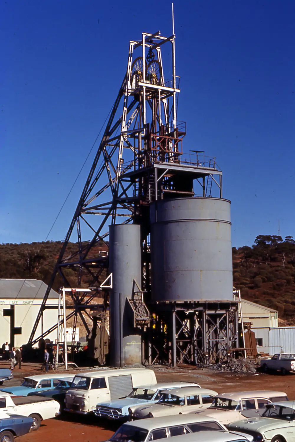
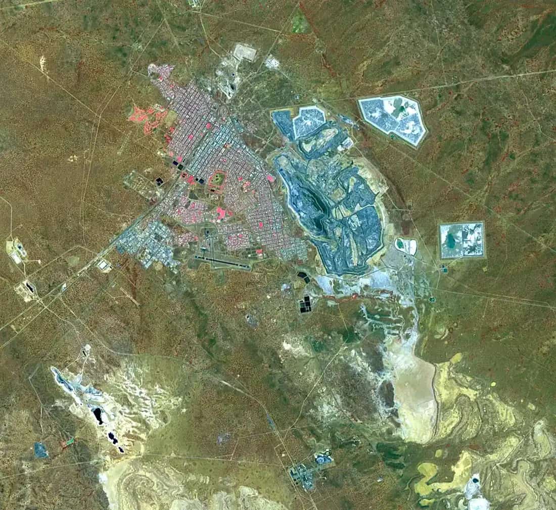
Kambalda, Australia 1969Photo: wilford peloquin · CC BY 2.0
Kambalda sits in Western Australia’s Goldfields, inside the Golden Outback hub, in the Shire of Coolgardie. This is the nickel town south of Kalgoorlie-Boulder, not a Victorian locality of the same name. Australia’s Golden Outback calls it Australia’s first nickel town, built by Western Mining in the 1960s, made up of two separate towns seven kilometres apart — Kambalda East and Kambalda West — surrounded by salt lakes and bushland. The shire History page adds that Kambalda was established in 1897 as a gold-mining town until 1966, when nickel deposits were developed by Western Mining Corporation.
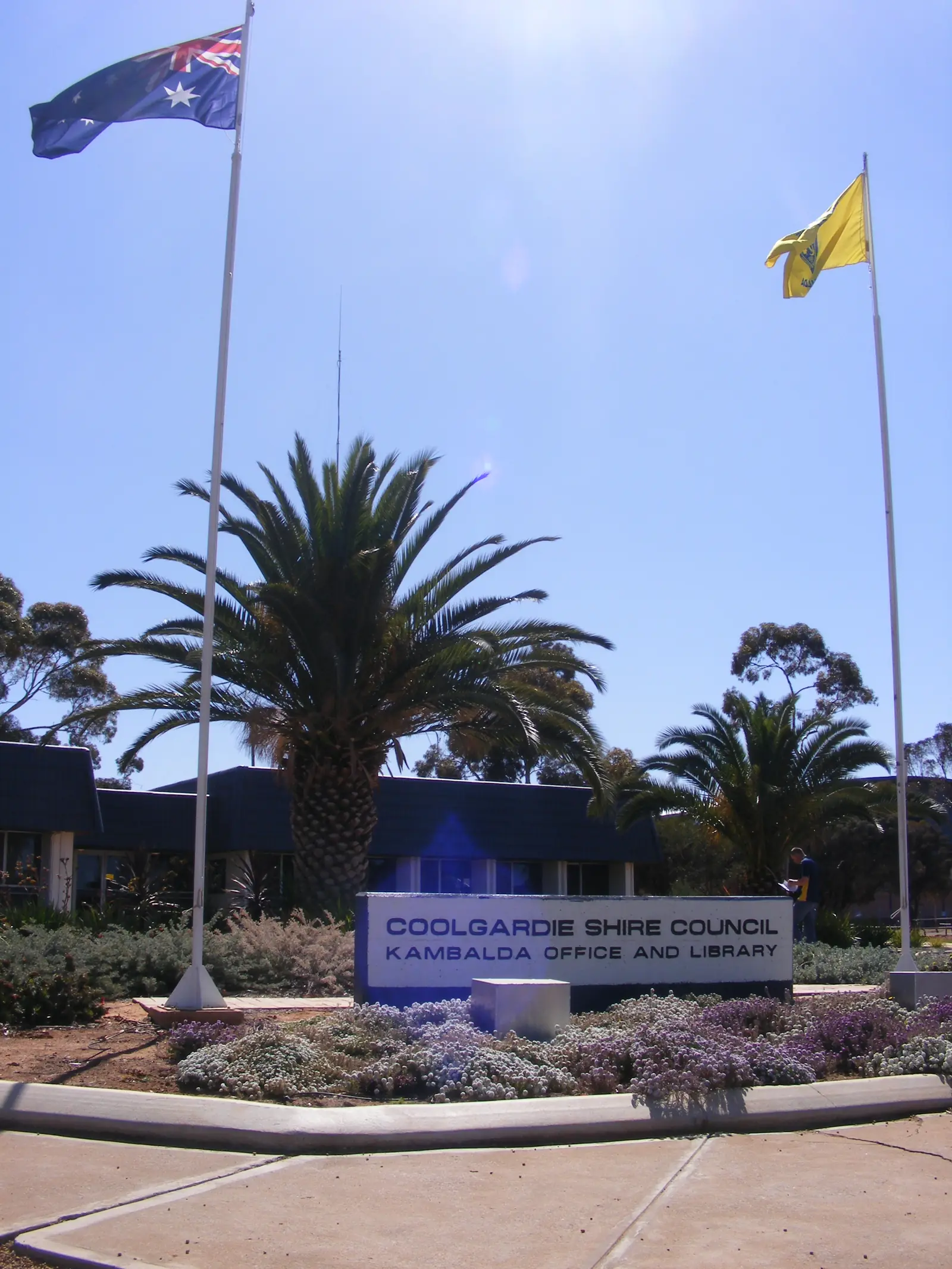
The Shire of Coolgardie offices include Irish Mulga Drive, Kambalda WA 6442 as well as Bayley Street, Coolgardie. East and West sit on sealed Goldfields highways around Lake Lefroy. After rain, check the Main Roads WA travel map before you treat the lookout as a guaranteed next stop; January heat still needs water even when the salt lake is the reason you came. A Perth or Kalgoorlie kilometre was not on the sourced Golden Outback or shire pages used here, so this hub does not invent one.
Where it is, and how far
Kambalda East and Kambalda West lie seven kilometres apart on Golden Outback’s town page. Red Hill Lookout is in East Kambalda on the shire Green Trail paragraph, accessed via Gordon Adams Road. Coolgardie is the heritage gold-rush neighbour in the same shire. Kalgoorlie-Boulder is the large service city to the north. Widgiemooltha sits toward Norseman on the shire History page, on the southern shoreline of Lake Lefroy.
| Place | Distance from Kambalda (sourced) |
|---|---|
| Kambalda East to Kambalda West | seven kilometres (Golden Outback) |
| Lake Lefroy | 40 kilometre salt pan (Golden Outback); lookout via Gordon Adams Road (shire) |
| Coolgardie | same shire; a Kambalda–Coolgardie kilometre was not on the sourced pages |
| Kalgoorlie-Boulder | south of that city on Golden Outback and shire geography; kilometre not on those pages |
Leonora and Laverton are northern Goldfields towns on this hub, not Kambalda suburbs. Warburton is much further along inland routes. The Perth to Darwin drive uses the Great Northern Highway, not Kambalda; Goldfields travellers more often use the Great Eastern Highway through Coolgardie.
Facts at a glance
Population. The ABS does not publish a single 2021 Urban Centre named “Kambalda”. Use the two official geographies:
- Kambalda East (L) Urban Centres and Localities UCL521027: 802 people. Median age 34. Sex split 54.6% male / 45.4% female. Aboriginal and/or Torres Strait Islander people 24 (3.0%). Suburbs and localities SAL50717 prints the same 802. East UCL QuickStats.
- Kambalda West Suburbs and Localities SAL50718: 1,666 people. Median age 36. Sex split 50.8% male / 49.2% female. Aboriginal and/or Torres Strait Islander people 107 (6.4%). 407 families, 843 private dwellings. No UCL named Kambalda West was found in this research. West SAL QuickStats.
Do not add those figures into a third “official Kambalda population”. They are two localities.
Climate. A Bureau of Meteorology climate table named Kambalda was not found in this research. Use nearby open Kalgoorlie-Boulder Airport, 012038, commenced 1939, location 30.78°S, 121.45°E, elevation 365 m, status: open. Mean maximum (85 years, 1939–2026): January 33.7 °C, July 16.9 °C, annual 25.4 °C. Mean minimum: January 18.4 °C, July 5.1 °C, annual 11.8 °C. Mean rainfall (85 years, 1939–2026): annual 265.2 mm; February 31.6 mm wettest mean month; September 14.1 mm driest. Full columns: BOM Kalgoorlie-Boulder Airport. See Kambalda weather.
Visitor information. The Coolgardie Visitor Centre / Goldfields Exhibition is the shire’s named visitor desk on Coolgardie pages (visitorscounter@coolgardie.wa.gov.au, (08) 9026 6090 at Warden Finnerty’s Residence hours on the attractions page). Shire contact: (08) 9080 2111, mail@coolgardie.wa.gov.au, Irish Mulga Drive, Kambalda.
Traditional Owners
Parks and Wildlife’s Goldfields Woodlands National Park page recognises Kaalamaya people as Traditional Owners of that park. The shire Green Trail paragraph names Cave Hill as a place of importance to the Kalaamaya people. This guide follows those official sentences for those parks. A shire sentence that names a single nation for the Kambalda East or West townsites only was not found in this research; we do not invent one. The shire History page’s Nyunbuning and Kurl-Kurti wording belongs to Coolgardie’s naming story, not automatically to Kambalda. Confirm current wording at the Coolgardie Visitor Centre.
History
The shire History page is the sourced town story. Kambalda, established in 1897, was a gold-mining town until 1966, when the first of many large nickel deposits was found. Western Mining Corporation’s development marked the beginning of Western Australia’s nickel boom. Golden Outback: Australia’s first nickel town, built by Western Mining in the 1960s and designed by one of the country’s most innovative town planners; today two townsites seven kilometres apart.
The attractions page records Kambalda Pioneer Cemetery, initially known as the Red Hill Cemetery until the name Kambalda was gazetted in 1897. Five individual graves; the same page notes a mystery of two graves belonging to one person. That cemetery is a gold-rush remainder, not the 1960s nickel suburb.
Coolgardie remains the shire’s gold-rush showpiece. Kambalda’s visitor story on the tourism pages is nickel, Red Hill and Lake Lefroy.
Things to do
Red Hill Lookout and walk trail — shire: Kambalda’s best attraction, Gordon Adams Road, views of Lake Lefroy. Golden Outback: sweeping views of a 40 kilometre salt pan and surrounding mining; bush trails around the hill with mining history and rare flora and fauna. Stay on formed trails. Active mining country sits in the same view.
Lake Lefroy — shire: expansive salt lake, part of an ancient river system, used for land sailing and land-speed record attempts; Pacrim Land Sailing in 2007 is named on that page. Golden Outback: cabins, land yacht hire and tuition by prior arrangement. Do not drive onto the lake unless an operator or the shire says you may.
Nullarbor Links — shire: Kambalda’s Silver Lake Par 4 hole on the world’s longest golf course. Widgiemooltha’s Golden Eagle hole is the other Coolgardie Shire hole.
Kambalda Pioneer Cemetery — five graves, Red Hill Cemetery name until 1897.
Green Trail / Great Western Woodlands — shire: pick up a map at the Coolgardie Visitor Centre, stop at Red Hill, continue to Cave Hill in Goldfields Woodlands National Park, then Burra Rock (4WD, or 2WD unsealed from Coolgardie). Parks WA: no dogs, no park entry fee, Kalgoorlie Parks and Wildlife office (08) 9080 5555.
A fuller order of a day: things to do in Kambalda.
Where to stay
The shire Camping and RVs page names a free 48-hour stop for fully self-contained vehicles at the Kambalda Recreation Centre, pool and skate park on Barnes Drive. Dump point and tap water. Leave No Trace. Rangers patrol. A named tourist caravan park or motel strip for Kambalda was not on the shire visitor pages fetched for this research. Golden Outback tells you to search accommodation by location. Coolgardie and Kalgoorlie-Boulder hold the wider room list.
- How to choose: Kambalda accommodation
- Parks: Kambalda caravan parks
- Feature your business
If Kambalda has no vacancy of the type you need, Coolgardie and Kalgoorlie-Boulder are the shire and city fallbacks. That is geography, not a booking guarantee.
Caravan and camping
The sourced in-town van offer is the 48-hour self-contained stop on Barnes Drive, not a powered holiday park. Coolgardie has a matching 48-hour stop on Woodward Street. Park camping at Goldfields Woodlands, Burra Rock, Victoria Rock, Rowles Lagoon and Credo follows Parks and shire reserve rules — no dogs in several of those parks. Red Hill Lookout is not a camp. Read Kambalda caravan parks and caravanning in the outback.
Fuel and services
The shire administration sits in Kambalda as well as Coolgardie. This guide does not list bowser brands. Kalgoorlie-Boulder is the Goldfields service city. Coolgardie is the heritage stop with the visitor centre. Fill before unsealed woodlands legs. Aquatic and recreation facilities are named on the shire community pages. See fuel, permits and road conditions. For current questions, (08) 9080 2111.
Road access
Kambalda sits on the Goldfields sealed network south of Kalgoorlie-Boulder and Coolgardie. Main Roads WA travel map, 138 138. Road trains, heat, animals at dusk.
North: Coolgardie and Kalgoorlie-Boulder. South: Widgiemooltha toward Norseman on the shire History page. Unsealed spurs to Cave Hill, Burra Rock and Victoria Rock are park-conditions questions. Do not drive around closed signs to keep a lookout photograph. The Perth to Darwin highway is a different corridor; Kambalda is a Goldfields loop town.
Nearby parks and towns
Parks and named nature sites:
- Red Hill Lookout and Lake Lefroy (shire and Golden Outback)
- Goldfields Woodlands National Park — Cave Hill, Burra Rock, Victoria Rock, Holland Track (Parks WA and shire)
- Rowles Lagoon Conservation Park — 73 km north of Coolgardie on the shire parks page
- Wallaroo Rock Conservation Park — 64 km west of Coolgardie, 39 km 4WD track off the Great Eastern Highway
On this site:
- Coolgardie — gold-rush streetscape, Goldfields Exhibition, Warden Finnerty’s Residence
- Kalgoorlie-Boulder — Super Pit, service city
- Leonora — northern Goldfields, Gwalia
- Laverton — Golden Quest country
- Warburton — further inland, not a Kambalda suburb
When to go, and how long
January mean maximum 33.7 °C at Kalgoorlie-Boulder Airport is still hot for Red Hill at midday, even though it is cooler than Murchison January means. July 16.9 °C mean maximum is the walking season; July mean minimum 5.1 °C is why a 48-hour RV night needs a layer. Annual rain 265.2 mm. Parks WA notes spectacular spring wildflowers in Goldfields Woodlands.
Two hours covers Red Hill and a cemetery stop. A night lets you use the Barnes Drive 48-hour pad if you are self-contained. Two nights only if Cave Hill or Burra Rock is open and you have a park camp or a Coolgardie / Kalgoorlie room. See Kambalda weather. Operators: feature your business.
Plan this trip
Tell us the dates, who you are travelling with and where you need help. We reply with planning notes for Kambalda — we are not a booking agent.
Events and road-conditions newsletter
Occasional notes on outback festivals, race days and official road-condition sources — not a daily blast. We use these details only to send the newsletter.
Western Australia · Golden Outback
Kambalda accommodation
Where to stay in Kambalda: the shire’s free 48-hour self-contained RV stop on Barnes Drive. Named tourist motels were not on the shire visitor pages fetched here — confirm in Coolgardie and Kalgoorlie-Boulder.
Read · 4 min
Western Australia · Golden Outback
Kambalda caravan parks
Camping in Kambalda: the shire’s free 48-hour self-contained stop on Barnes Drive, plus Goldfields Woodlands and reserve camps named by Parks WA and the Shire of Coolgardie. Confirm before you unhitch.
Read · 4 min
Western Australia · Golden Outback
Kambalda weather
No Kambalda-named BOM table was found. Nearby Kalgoorlie-Boulder Airport (012038) has January mean max 33.7 °C, July 16.9 °C and annual rainfall 265.2 mm. Use Main Roads WA after rain.
Read · 4 min
Western Australia · Golden Outback
Things to do in Kambalda
Things to do in Kambalda: Red Hill Lookout over Lake Lefroy, pioneer cemetery, Nullarbor Links Silver Lake hole, land sailing and Goldfields Woodlands day trips named by the shire.
Read · 4 min
Frequently asked questions
Is this Kambalda in Western Australia or Victoria?
This guide is Kambalda in the Shire of Coolgardie, Western Australia’s Goldfields, south of Kalgoorlie-Boulder. It is not a Victorian locality of the same name.
What is Kambalda’s population?
The ABS publishes two 2021 geographies, not one town figure. Kambalda East urban centre UCL521027 (same count as SAL50717) had 802 people, median age 34. Kambalda West suburbs-and-localities SAL50718 had 1,666 people, median age 36. No 2021 UCL named Kambalda West was found in this research.
What is the weather like in Kambalda?
A Kambalda-named BOM climate table was not found in this research. Use nearby open Kalgoorlie-Boulder Airport (012038): January mean maximum 33.7 °C, July 16.9 °C, annual rainfall 265.2 mm. That is an airport table for the Goldfields city, not a Kambalda town AWS.
Where is Red Hill Lookout?
The Shire of Coolgardie Trails and Tracks page says Kambalda’s best attraction is Red Hill Lookout, accessed via Gordon Adams Road, with views of Lake Lefroy. Australia’s Golden Outback adds bush trails around the hill and describes Lake Lefroy as a 40 kilometre salt pan.
Can I camp at Kambalda?
Yes, as a named type. The shire Camping and RVs page lists a free 48-hour stop for fully self-contained vehicles at the Kambalda Recreation Centre, pool and skate park on Barnes Drive, with dump point and tap water. Permits are not required on that page. It is not a powered caravan park.
Sources and further reading
Facts on this page were checked against these primary and official sources. Conditions change — confirm before you travel or buy.
- Goldfields hospitals and health services — WA Country Health Service
- Kambalda East (L) 2021 Census QuickStats (UCL521027) — Australian Bureau of Statistics
- Kambalda East 2021 Census QuickStats (SAL50717) — Australian Bureau of Statistics
- Kambalda West 2021 Census QuickStats (SAL50718) — Australian Bureau of Statistics
- Climate statistics for Kalgoorlie-Boulder Airport (012038) — Bureau of Meteorology
- History — Shire of Coolgardie — Shire of Coolgardie
- Coolgardie and Kambalda — Australia’s Golden Outback — Australia's Golden Outback
- Trails and Tracks — Shire of Coolgardie
- Attractions — Shire of Coolgardie — Shire of Coolgardie
- Camping and RVs — Shire of Coolgardie
- National Parks and Reserves — Shire of Coolgardie
- Goldfields Woodlands National Park — Parks and Wildlife Service, DBCA
- Main Roads WA travel map — Main Roads Western Australia