At a glance
Sourced facts only. Distances and services change — confirm before you travel.
- Local government
- Shire of Northampton
- Traditional Owners
- Shire of Northampton: the town has long been known by the Aboriginal people as Mooniemia. The Shire’s Strategic Community Plan 2025–2035 acknowledges the Yamatji People as Traditional Owners of the land the plan covers.Tourism WA’s destination page names Indigenous peoples and rock art at Bowes River Road without a nation name. Shire documents name Nanda for Gidamarra Spring at Kalbarri — that Kalbarri sentence is not flattened onto this townsite.
- Nearest regional city
- Geraldton. Tourism WA puts Northampton 40 minutes north of Geraldton by car. The Shire Strategic Community Plan puts the town 50 km north of Geraldton. Geraldton has no town page in this rebuild.
- Capital
- 475 km from Perth (Shire of Northampton About Us and Strategic Community Plan). Tourism WA: a five-hour and 20-minute road trip from Perth that can include the Indian Ocean Drive.
- Nearest fuel
- Tourism WA treats Northampton as a dining-and-stay base on the road north of Geraldton. Confirm bowsers on arrival; this hub does not invent a brand or hours.
- Mobile coverage
- Check Telstra and Optus coverage maps before travel; do not assume a signal on every side road to Horrocks or Port Gregory.
- Best time to visit
- Tourism WA names spring wildflowers and the Airing of the Quilts Festival in October. BOM Nabawa (008028, not in town) February mean maximum 34.3 °C; July 18.4 °C; June mean rain 95.8 mm.
Climate
Monthly means from the Bureau of Meteorology station Nabawa (008028). This is not a forecast. Open station. Not in Northampton — Nabawa is the nearest complete open table, in Chapman Valley. Elevation 145 m, commenced 1905. Temperature 60 years (1912–1973); rainfall 114 years (1905–2026). Latest available data 02 November 2026. Do not blend with Geraldton Airport.
| Month | Mean max (°C) | Mean min (°C) | Rainfall (mm) |
|---|---|---|---|
| Jan | 34.1 | 17.8 | 6.9 |
| Feb | 34.3 | 18.3 | 13.0 |
| Mar | 32.3 | 17.1 | 14.8 |
| Apr | 28.2 | 14.4 | 22.0 |
| May | 23.4 | 11.1 | 59.6 |
| Jun | 19.7 | 9.2 | 95.8 |
| Jul | 18.4 | 7.6 | 90.1 |
| Aug | 19.3 | 7.4 | 64.4 |
| Sep | 22.0 | 8.1 | 35.3 |
| Oct | 25.1 | 10.0 | 20.2 |
| Nov | 29.1 | 13.3 | 10.6 |
| Dec | 32.0 | 15.8 | 6.7 |
Northampton in pictures
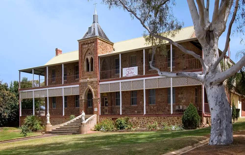
Former Sacred Heart Convent in NorthamptonPhoto: Michal Lewi · CC BY-SA 4.0 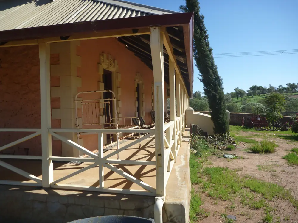
Verandah of Chiverton House in NorthamptonPhoto: Sam Wilson · CC BY-SA 4.0 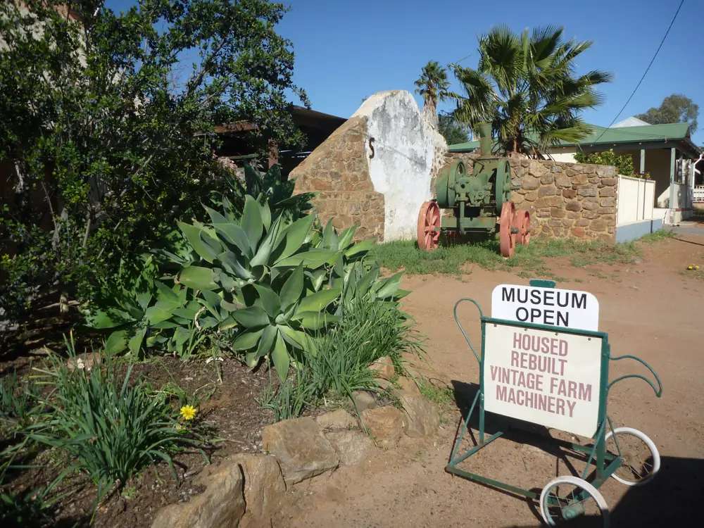
Entrance to Chiverton House Museum in NorthamptonPhoto: Sam Wilson · CC BY-SA 4.0 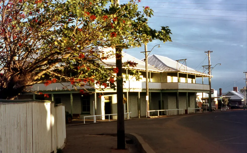
Two-storey verandah hotel on a Northampton streetPhoto: Wilford Peloquin · CC BY 2.0
Northampton sits in Western Australia’s Midwest, inside the Shire of Northampton, 40 minutes north of Geraldton on Tourism WA and 475 km from Perth on the Shire About Us page. Tourism WA: it is one of Western Australia’s oldest towns, declared a townsite in 1864, with a five-hour and 20-minute road trip from Perth that can include the Indian Ocean Drive. This hub is the Western Australian heritage town, not a Kalbarri suburb, not a Geraldton suburb, and not Northampton in England. Geraldton and Kalbarri have no town pages here. Perth is the capital; it has no town page here either.
This site files the town under Golden Outback. Tourism WA’s destination page sits in the Ningaloo Reef and the Coral Coast grouping, 40 minutes north of Geraldton. Australia’s Coral Coast names Northampton as a gateway to Kalbarri, Horrocks and Port Gregory. Those are brand sentences, not a reason to invent a Coral Coast region kebab on this rebuild.
The 2021 Census urban centre UCL521038 counted 821 people, median age 57. Suburbs-and-localities SAL51158 counted 830. The Shire local government area LGA56790 counted 3,227, matching the Shire About Us Census figure. Travellers stop for stone buildings, a railway precinct, quilts in October and a beach day at Horrocks. You still need Main Roads WA after winter rain.
Where it is, and how far
Northampton is the Shire’s inland heritage town on the sealed road north of Geraldton. The Strategic Community Plan puts the town 50 km north of Geraldton; Tourism WA’s Saint Mary’s listing repeats 50 kilometres north of Geraldton for the church. Tourism WA’s destination page uses 40 minutes instead of a kilometre. Those figures are printed separately; this hub does not average them into a fake Geraldton radius.
Horrocks is 22 kilometres north-west of Northampton, a one-hour drive north of Geraldton, or 5.5 hours north of Perth, on Tourism WA’s Horrocks Beach page. Port Gregory’s Pink Lake is the other named coastal stop on the destination page. Kalbarri is in the same Shire; it has no town page here.
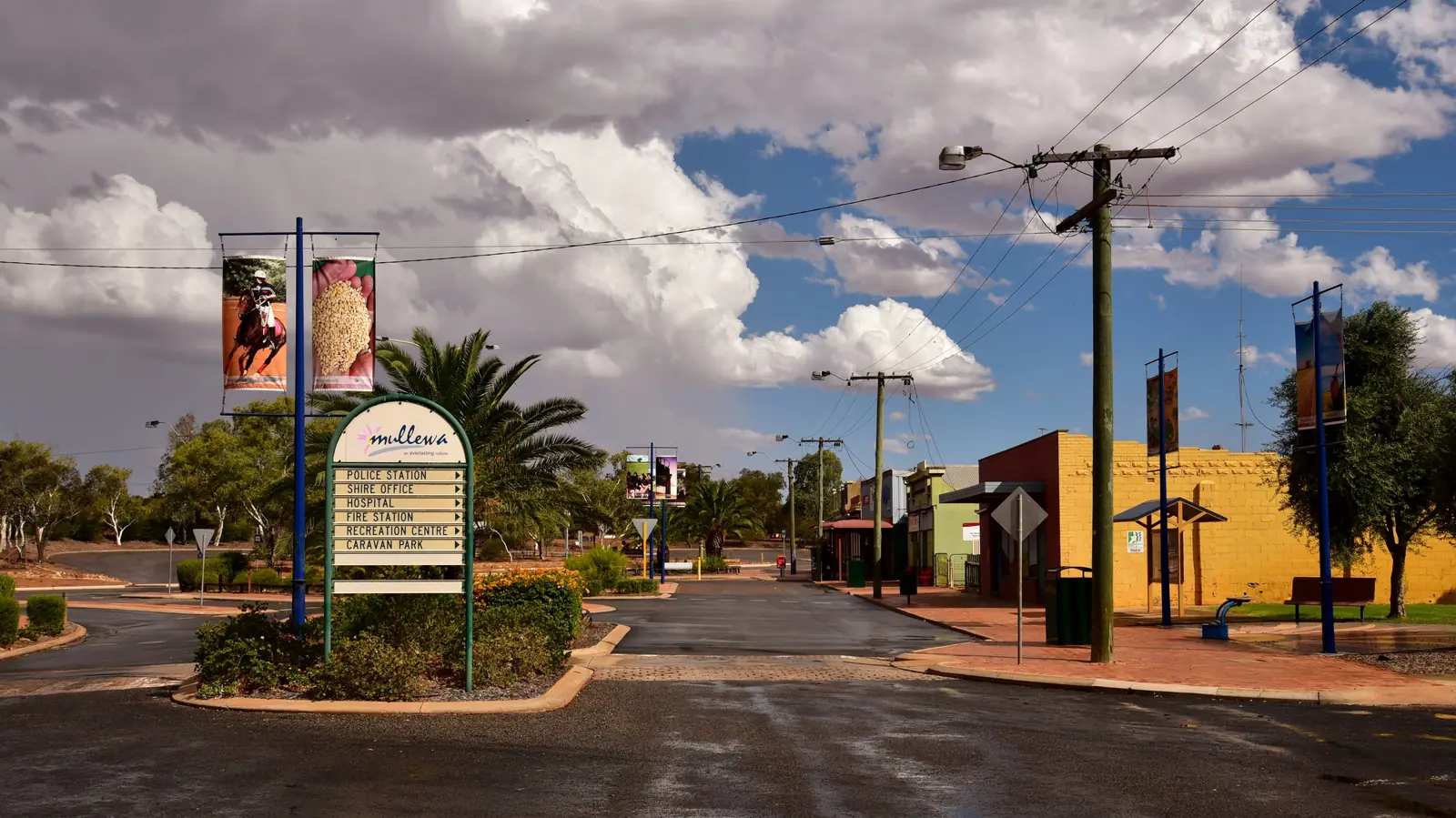
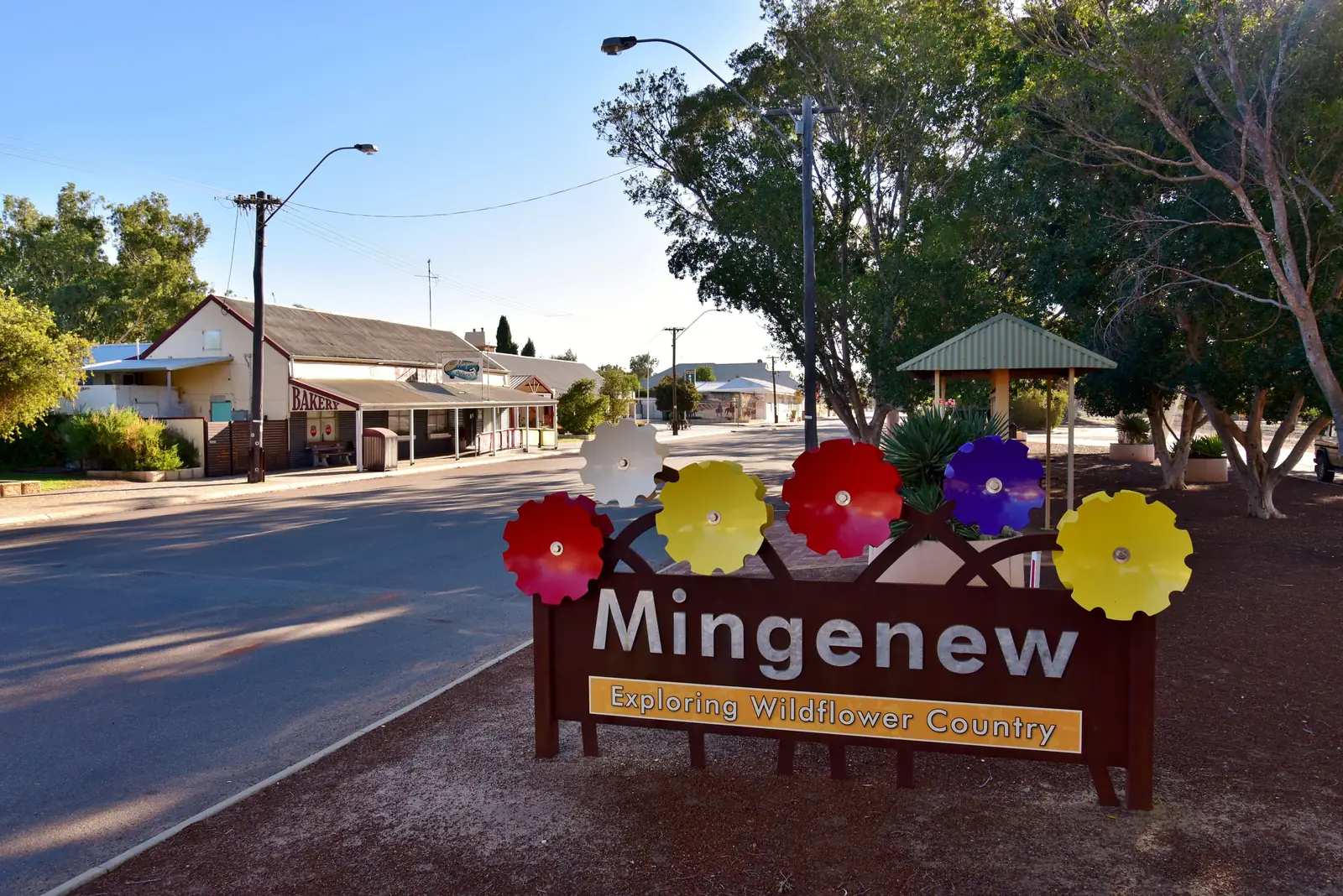
Mullewa is the inland Wave 7 neighbour this site may link. Mingenew and Morawa are the Midwest wildflower neighbours south-east. Yalgoo and Mount Magnet sit further east on the Murchison road. A Northampton–Mullewa kilometre was not on the sourced town pages, so this hub does not invent one.
| Place | Distance or time (sourced) |
|---|---|
| Perth | 475 km (Shire About Us; Strategic Community Plan). Tourism WA: five hours 20 minutes by road, and the drive can include Indian Ocean Drive |
| Geraldton | 40 minutes north (Tourism WA destination). Town 50 km north of Geraldton (Shire Strategic Community Plan) |
| Horrocks Beach | 22 km north-west of Northampton; one hour north of Geraldton; 5.5 hours north of Perth (Tourism WA Horrocks) |
| Saint Mary’s in Ara Coeli | 50 km north of Geraldton (Tourism WA attraction listing) |
| Shire area | 12.499 sq/km on the Shire About Us statistics table |
Facts at a glance
Population. ABS 2021 Census UCL521038: 821 people, median age 57, 10.4 percent Aboriginal and/or Torres Strait Islander (85 people). SAL51158: 830. LGA56790: 3,227. Use Northampton urban-centre QuickStats.
Climate. Bureau of Meteorology NABAWA, 008028, 28.50°S, 114.79°E, elevation 145 m, commenced 1905, status: open, latest available data 02 November 2026. This station is not in Northampton. Mean maximum (60 years, 1912–1973): February 34.3 °C, July 18.4 °C, annual 26.5 °C. Mean minimum: February 18.3 °C, August 7.4 °C, annual 12.5 °C. Mean rainfall (114 years, 1905–2026): annual 441.2 mm; June 95.8 mm wettest; December 6.7 mm driest. Mean days of rain ≥ 1 mm: 55.7. See Northampton weather.
Visitor information. Tourism WA: the Northampton Visitor Centre is on Hampton Road next to the RSL museum — look for the big tank on the lawn. Shire About Us: the centre is in the RSL complex on the corner of Hampton Roads and Essex Street. Shire office: 199 Hampton Road, 9934 1202. Australia’s Coral Coast also names the old Police Station (1882) as a tourist-bureau building on the heritage walk — that is a Coral Coast sentence, printed beside the RSL wording rather than merged. Roads: Main Roads WA.
Traditional Owners
The Shire About Us page: Northampton has long been known by the Aboriginal people as Mooniemia. The Strategic Community Plan 2025–2035 respectfully acknowledges the Yamatji People, who are the Traditional Owners and First People of the land that plan covers.
Tourism WA: long before the townsite was declared in 1864, the area was home to Indigenous peoples — you will find their ancient rock art on the outcrops at Bowes River Road. That destination sentence does not name a nation for the townsite.
Shire documents name Nanda for Gidamarra Spring at Kalbarri. That is a Kalbarri heritage sentence. This guide does not flatten it onto the Northampton townsite. Confirm current wording at the Visitor Centre. See visiting Country respectfully.
History
Shire About Us: Northampton was known as “The Mines” until 1864, when the townsite was gazetted. Local government commenced in 1871. Lead was first discovered in the area in 1847, with copper then being discovered by Drummonds Shepherd in 1854. A convict hiring station was established at Port Gregory from 1853–1856. The first railway commenced in 1874 and was completed in 1879, running from Geraldton to Northampton, later extended to Ajana in 1913.
Tourism WA: European settlement began in 1848 when lead and later copper was mined here. Those two official timelines sit beside each other; this hub does not pick a single “founding year” the pages do not share.
Tourism WA’s Railway Precinct sentence: remnants of Western Australia’s first government railway line, including station buildings, equipment and rolling stock. Australia’s Coral Coast names the Gwalla Railway Station walk trail and the Mary Street Railway Precinct, opened in 1913.
Australia’s Coral Coast: Northampton was classified as a historic town by the National Trust of Australia in 1993.
Things to do
Tourism WA and Australia’s Coral Coast name these in and around Northampton:
- Railway Precinct — first government railway remnants (Tourism WA)
- Chiverton House Museum — artefacts, photographs, restored farm machinery, herbarium (Tourism WA)
- Motors and Machinery Shed — 200-plus classic and antique motors, trucks and tractors (Tourism WA)
- Hampton Road Heritage Walk — Coral Coast names 37 historically significant buildings; start notes include the old Police Station (1882)
- Saint Mary’s in Ara Coeli — Tourism WA: the largest parish church designed by Hawes; foundation stone May 1936, opened September the same year; rough hammer-dressed red sandstone with a green-tiled roof; 50 km north of Geraldton
- Sacred Heart Convent — Coral Coast names Hawes for the convent and Our Lady in Ara Coeli Church
- Gwalla Church and cemetery ruins (Coral Coast)
- Airing of the Quilts Festival in October (Tourism WA)
- Spring wildflower drives — Yerina Springs Road, West Binnu Road, Ogilvie Sandplain, Oakabella and Chapman Valley Road (Tourism WA)
- Bowes River Road rock art (Tourism WA) — confirm access before you walk onto outcrops
- Port Gregory Pink Lake and Horrocks Beach (Tourism WA)
Nearby, not a Northampton main-street walk: Kalbarri’s gorges and cliffs sit in the same Shire and have no town page here. Mullewa is the inland neighbour.
See things to do in Northampton.
Where to stay
Tourism WA: bed and breakfasts, farm stays, hotels, motels, caravan parks and backpacker accommodation. Those are official named types, not a ranked motel strip. This hub does not invent a hotel brand or a star rating. If Northampton is full in wildflower season or in October, Geraldton is the larger unnamed city 40 minutes south on that destination page.
- How to choose: Northampton accommodation
- Camping detail: Northampton caravan parks
- Operator enquiries: feature your business
Caravan and camping
Vans use Northampton as a Midwest heritage night with a beach option at Horrocks. Official named stay type on Tourism WA includes caravan parks. Ask on arrival. Do not camp on the heritage walk or in church grounds. Read Northampton caravan parks and outback camping.
Fuel and services
A town of 821 people will not match Geraldton for a hospital. Tourism WA treats Northampton as a dining-and-stay base. This guide does not list a bowser brand or invent clinic hours. Confirm fuel on arrival. Fill in Geraldton if you are heading north toward Kalbarri with a long gap in mind — Kalbarri is in the Shire, but this hub does not invent a Kalbarri kilometre the destination pages did not print for the townsite.
Shire office: 199 Hampton Road, 9934 1202. Visitor Centre: Hampton Road / Essex Street RSL complex on the Shire page; Hampton Road next to the RSL museum on Tourism WA. Roads: Main Roads WA.
Road access
The sealed road north of Geraldton is the ordinary-weather approach Tourism WA describes as 40 minutes. The Perth drive is five hours 20 minutes and can include Indian Ocean Drive. After winter rain, check Main Roads before you treat a wildflower side road as 2WD-sensible. Horrocks is 22 km north-west on Tourism WA.
East toward Mullewa and Yalgoo is inland Wheatbelt and Murchison country on this site. North toward Kalbarri stays in the Shire and has no town page here.
Nearby parks and towns
Northampton does not sit inside a Parks WA park named on the sourced town pages. Kalbarri National Park is the Shire landscape to the north; it has no park page in this rebuild, so this hub names it and does not invent a path.
Towns on this site:
- Mullewa — inland Wave 7 neighbour
- Mingenew — Midwest wildflower and rail town
- Morawa — Midwest wildflower town, Monsignor Hawes
- Yalgoo — Murchison, Monsignor Hawes chapel
- Mount Magnet — further east
- Cue — further along that goldfields road
- Golden Outback — region hub on this site
Geraldton, Kalbarri, Horrocks and Port Gregory are named on official pages and have no town pages here.
See best time to visit the outback and Northampton weather before you pack for February heat or a June wet week.
Plan this trip
Tell us the dates, who you are travelling with and where you need help. We reply with planning notes for Northampton — we are not a booking agent.
Events and road-conditions newsletter
Occasional notes on outback festivals, race days and official road-condition sources — not a daily blast. We use these details only to send the newsletter.
Western Australia · Golden Outback
Northampton accommodation
Where to stay in Northampton: Tourism WA names bed and breakfasts, farm stays, hotels, motels, caravan parks and backpackers. Confirm before you unhitch. This is WA Midwest, not Northampton in England.
Read · 3 min
Western Australia · Golden Outback
Northampton caravan parks
Camping in Northampton: Tourism WA names caravan parks among stay types. Do not camp on the heritage walk. Confirm before you unhitch. This is WA Midwest, not Northampton in England.
Read · 3 min
Western Australia · Golden Outback
Northampton weather
Northampton climate from BOM Nabawa (008028), not in town: February mean max 34.3 °C, July 18.4 °C, annual rainfall 441.2 mm with June 95.8 mm. Open station. WA Midwest, not an English table.
Read · 4 min
Western Australia · Golden Outback
Things to do in Northampton
Things to do in Northampton: Railway Precinct, Chiverton House, Motors and Machinery Shed, Hampton Road walk, St Mary’s, October quilts, Horrocks Beach. This is WA Midwest, not Northampton in England.
Read · 4 min
Frequently asked questions
Is this Northampton in Western Australia or Northampton in England?
This hub is Northampton in the Shire of Northampton, Western Australia, on the road 40 minutes north of Geraldton (Tourism WA) and 475 km from Perth (Shire About Us). It is a Midwest heritage town, not the English county town, not a Kalbarri suburb, and not a Geraldton suburb. Geraldton and Kalbarri have no town pages in this rebuild.
How far is Northampton from Perth and Geraldton?
The Shire of Northampton About Us page and Strategic Community Plan put the Shire 475 km from Perth. Tourism WA’s destination page: Northampton is 40 minutes north of Geraldton by car, and from Perth it is a five-hour and 20-minute road trip that can include the Indian Ocean Drive. The Strategic Community Plan also puts the town 50 km north of Geraldton. Those figures are printed separately; this hub does not average them.
What is Northampton’s population?
821 people at the 2021 Census for Northampton urban centre (UCL521038), median age 57. Suburbs-and-localities SAL51158 counted 830, also median age 57. The Shire of Northampton local government area (LGA56790) counted 3,227, matching the Shire About Us Census figure. Aboriginal and/or Torres Strait Islander people: 10.4 percent in the urban centre (85 people).
What is there to do in Northampton?
Tourism WA names the Railway Precinct (remnants of Western Australia’s first government railway), Chiverton House Museum, the Motors and Machinery Shed with 200-plus classic and antique motors, spring wildflower drives, and the Airing of the Quilts Festival in October. Nearby, Tourism WA names Port Gregory’s Pink Lake and Horrocks Beach, 22 km north-west of Northampton. Australia’s Coral Coast names a Hampton Road Heritage Walk, Sacred Heart Convent and Our Lady in Ara Coeli Church associated with Monsignor John Hawes, and Gwalla Church ruins.
What is the weather like in Northampton?
There is no complete in-town BOM averages table. This hub uses BOM Nabawa (008028, open), which is not in Northampton: February mean maximum 34.3 °C, July 18.4 °C, annual rainfall 441.2 mm (114 years, 1905–2026). June 95.8 mm is the wettest mean month. Temperature means use 60 years (1912–1973).
Can I camp in Northampton?
Yes, as named types. Tourism WA’s destination page names bed and breakfasts, farm stays, hotels, motels, caravan parks and backpacker accommodation. Confirm the park on arrival. This hub does not invent extra park brands or prices.
Sources and further reading
Facts on this page were checked against these primary and official sources. Conditions change — confirm before you travel or buy.
- Northampton 2021 Census QuickStats (UCL521038) — Australian Bureau of Statistics
- Northampton 2021 Census QuickStats (SAL51158) — Australian Bureau of Statistics
- Northampton LGA 2021 Census QuickStats (LGA56790) — Australian Bureau of Statistics
- Climate statistics for Nabawa (008028) — Bureau of Meteorology
- Northampton — Tourism Western Australia
- Northampton Visitor Centre — Tourism Western Australia
- Horrocks Beach — Tourism Western Australia
- Saint Mary’s in Ara Coeli – Northampton — Tourism Western Australia
- Northampton — Australia's Coral Coast
- About Us — Shire of Northampton
- Strategic Community Plan 2025–2035 — Shire of Northampton
- Main Roads WA travel map — Main Roads Western Australia