At a glance
Sourced facts only. Distances and services change — confirm before you travel.
- Local government
- Shire of Halls Creek
- Traditional Owners
- Gija community (Tourism WA Warmun; Warmun Art Centre; Shire of Halls Creek art-galleries page)Purnululu National Park is Kija and Jaru Country on this site’s park page. Confirm current community wording before travel.
- Nearest regional city
- Halls Creek is the closest populated town on the Shire of Halls Creek communities page. Tourism WA: two-hour drive south from Kununurra, or 1 hour 45 minutes north of Halls Creek. Warmun Art Centre: 200 km south of Kununurra.
- Capital
- 3,009 km northeast of Perth (Shire of Halls Creek Warmun paragraph)
- Nearest fuel
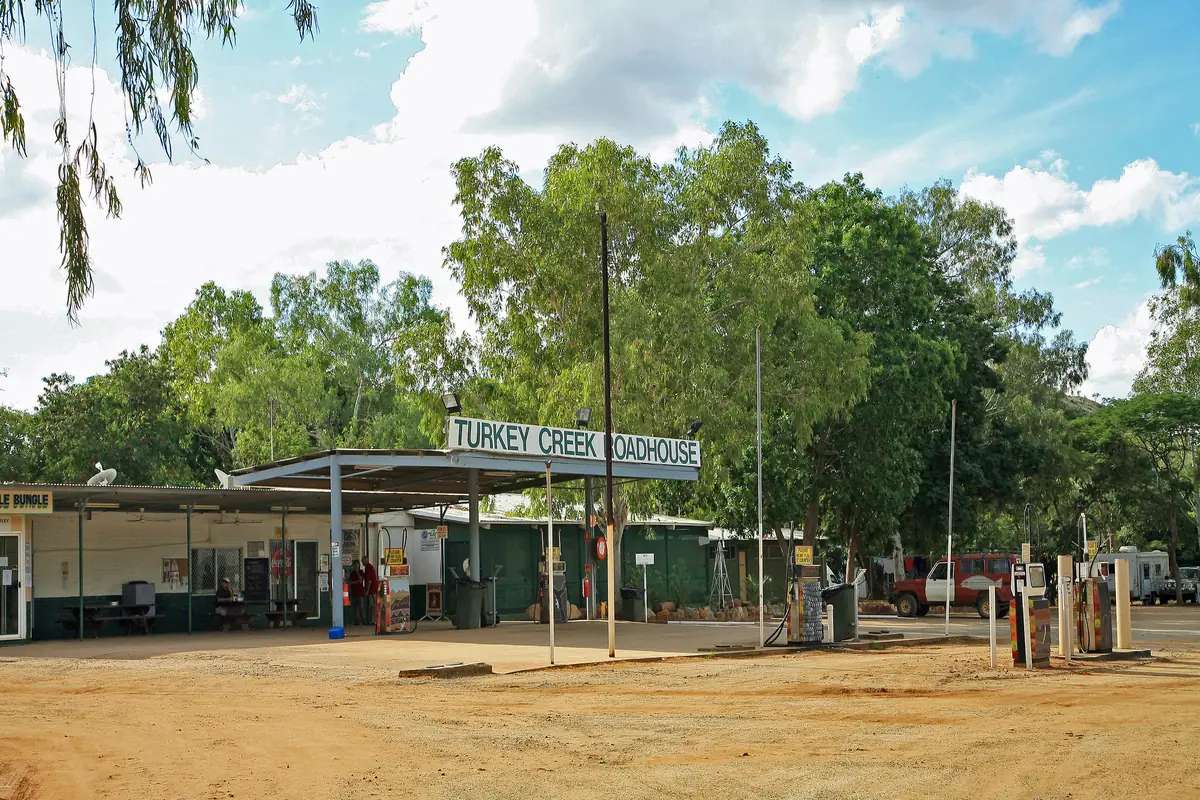
- Tourism WA names Turkey Creek Roadhouse as community-owned with a general store. A bowser brand is not printed on that page; confirm on arrival.
- Mobile coverage
- Check Telstra and Optus coverage maps before travel; do not assume a signal on the Spring Creek Track into Purnululu.
- Best time to visit
- Dry season for Purnululu access (Parks WA typically April–December on this site’s park page); BOM Warmun Wet is November–March
Climate
Monthly means from the Bureau of Meteorology station Warmun (002032). This is not a forecast. Open station. Temperature 61 years (1962–2025); rainfall 109 years (1897–2025). Latest available data 28 May 2025. Nearest listed alternates Argyle Aerodrome 48.5 km, Old Halls Creek 144.2 km, Kununurra Aero 146.1 km — do not blend.
| Month | Mean max (°C) | Mean min (°C) | Rainfall (mm) |
|---|---|---|---|
| Jan | 37.1 | 24.8 | 182.1 |
| Feb | 36.1 | 24.3 | 176.3 |
| Mar | 36.0 | 23.4 | 117.7 |
| Apr | 35.3 | 20.8 | 24.9 |
| May | 32.2 | 17.2 | 9.8 |
| Jun | 29.6 | 13.9 | 6.2 |
| Jul | 29.6 | 12.8 | 5.7 |
| Aug | 32.4 | 14.9 | 1.2 |
| Sep | 36.2 | 19.4 | 4.5 |
| Oct | 38.7 | 23.0 | 23.3 |
| Nov | 39.3 | 25.0 | 64.2 |
| Dec | 38.3 | 25.2 | 118.5 |
Warmun, also known as Turkey Creek, sits on the Great Northern Highway in the north-west of Western Australia, inside the Shire of Halls Creek. Tourism WA’s destination page is the visitor sentence used here: Warmun is the closest settlement to Purnululu National Park. Take the two-hour drive south from Kununurra or the 1 hour 45 minute drive north of Halls Creek. Warmun Art Centre’s contact page puts the gallery 200 km south of Kununurra. This hub is the community, not a second Kununurra and not a Halls Creek suburb. The Bungle Bungle Range is a nearby park, not the town.
The 2021 Census publishes matching counts for suburbs-and-localities SAL51533 and Urban Centre UCL522064: 457 people, median age 26, sex split 51.1% male / 48.9% female. 104 families, 138 private dwellings. Aboriginal and Torres Strait Islander people 409 (89.5%). The Shire of Halls Creek communities page still prints the 2016 figure 366. Use the Census.
Tourism WA: throughout the 1800s, Warmun was a regular stop on the old stock route between Wyndham and Halls Creek. Today the modern Turkey Creek Roadhouse is owned and operated by the Warmun Community. You still need Main Roads WA after rain, because a two-hour run from Kununurra is no use if the highway is closed.
Where it is, and how far
Warmun sits on the public sealed Great Northern Highway between Kununurra and Halls Creek. The shire communities page: Warmun is 3,009 km northeast of Perth; the closest populated town is Halls Creek. The same shire page puts the shire approximately 2,850 km to the north-east of Perth and 362 km south of Kununurra — those are shire figures, not Warmun drive times this hub will average with Tourism WA’s two hours.
Purnululu access is the Spring Creek Track off the Great Northern Highway, about 53 km of high-clearance 4WD on this site’s park page. Caravans and trailers are not permitted on that track. Scenic flights from Warmun are the Tourism WA alternative. This hub does not invent a Warmun-to-visitor-centre kilometre Parks WA does not print for the community.
| Place | Distance from Warmun (sourced) |
|---|---|
| Kununurra | two-hour drive south from Kununurra to Warmun (Tourism WA); art centre 200 km south of Kununurra (Warmun Art Centre) |
| Halls Creek | 1 hour 45 minutes south of Warmun on Tourism WA’s wording (“north of Halls Creek”) |
| Perth | 3,009 km northeast (Shire of Halls Creek Warmun paragraph) |
| Warmun Art Centre from the roadhouse | about 2 km south-west on the Great Northern Highway, then left at the sign (Warmun Art Centre contact page) |
A separate Warmun–Halls Creek kilometre was not on those sourced pages, so this hub does not invent one.
Facts at a glance
Population. ABS 2021 Census SAL51533 / UCL522064: 457 people. Median age 26. Indigenous 409 (89.5%). Use SAL QuickStats or UCL QuickStats.
Climate. WARMUN, 002032, 17.02°S, 128.22°E, elevation 203 m, commenced 1897, status open, latest available data 28 May 2025. Mean maximum (61 years, 1962–2025): November 39.3 °C (hottest month by mean max), June and July 29.6 °C, annual 35.1 °C. Mean minimum: December 25.2 °C, July 12.8 °C, annual 20.4 °C. Mean rainfall (109 years, 1897–2025): annual 721.5 mm. Mean days of rain ≥ 1 mm: 42.7. See Warmun weather.
Visitor information. Tourism WA’s Warmun page is the official destination listing used here. Warmun Art Centre: 08 9168 7496, gallery@warmunart.com.au. Shire of Halls Creek: +61 8 9168 6007, 7 Thomas Street, Halls Creek. Roads: Main Roads WA.
Traditional Owners
Tourism WA, Warmun Art Centre and the Shire of Halls Creek art-galleries page name Gija people for this community. Tourism WA: the art centre displays unique expressions of Gija country and Ngarrangkarni (Dreaming) stories. Warmun Art Centre: owned and governed by Gija people with 100 per cent of income returning to the community. The shire galleries page repeats ochre-and-pigment wording and names founding artists including Rover Thomas, Queenie McKenzie, George Mung Mung and Paddy Jaminji.
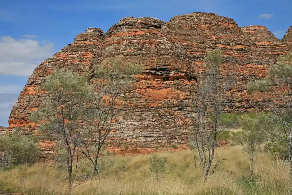
Purnululu is nearby park Country. This site’s park page: the park is the Country of the Kija and Jaru peoples; Purnululu means “sandstone” in the Kija language. This guide keeps community wording and park wording on their own pages rather than flattening park groups onto the townsite. Stay on the public highway unless Warmun Art Centre has arranged a verbal permit. See visiting Country respectfully and buying Aboriginal art ethically.
History
Shire of Halls Creek: the area was settled by European pastoralists in the 19th century but the community was established in 1901 when the state government built a ration depot at Turkey Creek. Tourism WA: throughout the 1800s Warmun was a regular stop on the old stock route between Wyndham and Halls Creek; Turkey Creek would quench the thirst of weary cattlemen with a “Kimberley cool” beer packed in wet sacks because there was no refrigeration.
Warmun Art Centre: the centre was established in 1998 by late founding members of the contemporary painting movement in Warmun such as Rover Thomas, Queenie McKenzie, Madigan Thomas and Hector Jandany. The shire: Ngalangangpum School was built in 1979 at the community’s request so students could stay in town rather than board in Wyndham, with later upgrades including secondary schooling in 1990. This hub does not invent a visitor count or extra businesses.
Things to do
Official pages name these in and around Warmun:
- Warmun Art Centre — Tourism WA / art centre / shire; Gija-owned gallery, studio and shop; verbal permit by phone 08 9168 7496; about 2 km from the roadhouse on the art centre’s getting-there note. Do not invent opening hours — the contact page says “during opening hours” only.
- Turkey Creek Roadhouse — Tourism WA: community-owned; general store, fast food, restaurant, motel, caravan park
- The Eagle and the Crow (Warrarnanj and Wangkarnal) Tour — Tourism WA: Gija Traditional Owner Peter Thomas (“Goloou”), 1.5 to 2-hour tagalong from the roadhouse. Confirm by phone; this hub does not invent a price or a daily timetable.
- Scenic helicopter flights — Tourism WA: scenic open-door helicopter flights and one or two-day tours depart regularly from Warmun as a type. Confirm the day’s operator; do not invent a brand.
- Purnululu National Park — closest settlement on Tourism WA; 4WD Spring Creek Track; park usually Dry-season only
Nearby, not in-town: Wolfe Creek Crater is a Halls Creek-side park day on that town’s hub. Wyndham is the port neighbour of Kununurra. Do not treat community streets as a sightseeing loop without permission.
Where to stay
Tourism WA names motel accommodation and a caravan park at the community-owned Turkey Creek Roadhouse. Those are named types, not a motel strip this hub will invent. If the roadhouse is full, Kununurra is two hours north on Tourism WA and Halls Creek is 1 hour 45 minutes south.
- How to choose: Warmun accommodation
- Camping detail: Warmun caravan parks
- Operator enquiries: feature your business
Caravan and camping
The Great Northern Highway is sealed. Tourism WA names a caravan park at Turkey Creek Roadhouse. Purnululu park camps (Walardi and Kurrajong on this site’s park page) are a separate 4WD park day; vans stay off the Spring Creek Track. Read Warmun caravan parks and outback camping. Do not camp in the community without the roadhouse arrangement.
Fuel and services
A community of 457 people will not match Kununurra for a hospital. Tourism WA names a general store, fast food and restaurant at Turkey Creek Roadhouse. A bowser brand is not printed on that destination page, so this hub does not invent one — confirm fuel on arrival. A hospital or clinic name for Warmun was not on the sourced Tourism WA, art-centre or shire pages fetched for this rebuild. Halls Creek and Kununurra are the regional service towns. Fill in those towns if you are unsure about the next bowser.
Shire office: +61 8 9168 6007. Art centre: 08 9168 7496. Roads: Main Roads WA. The shire notes 391 km of sealed roads and 1,449 km of unsealed roads in the shire, with seasonal flooding — a shire maintenance sentence, not a Warmun street inventory.
Road access
Great Northern Highway sealed north–south. Main Roads WA is the authority, especially in the Wet when 721.5 mm of annual mean rain arrives in a few months (January mean 182.1 mm). Purnululu’s Spring Creek Track is high-clearance 4WD, no trailers, and generally closed in the Wet on this site’s park page. Stay on gazetted roads. Aboriginal land and community streets need the verbal permit the art centre prints.
Our Perth to Darwin, Kimberley road trip and Savannah Way guides are the road-trip pages. Do not add a Stuart Highway kilometre and call the sum a Warmun distance.
Nearby parks and towns
Parks:
- Purnululu National Park — Kija and Jaru Country on the park page; World Heritage; Warmun is the closest settlement on Tourism WA
- Wolfe Creek Crater — via Halls Creek, not a Warmun main-street attraction
Towns on this site:
- Halls Creek — shire seat, 1 hour 45 minutes on Tourism WA
- Kununurra — two hours north on Tourism WA
- Wyndham — Kimberley port neighbour of Kununurra
When to go, and how long
Warmun’s November mean maximum of 39.3 °C is the build-up. January’s 37.1 °C sits under 182.1 mm of January mean rain. June and July’s 29.6 °C mean maximum, with August’s 1.2 mm mean rain, is the Dry on the 1897–2025 rain table. Purnululu is generally a Dry-season park. Crocodile and heat briefs still apply in every month on Kimberley waterways.
An hour covers the roadhouse and, if the gallery has arranged a verbal permit, the art centre. A night covers a roadhouse room or van site if they exist that day. Purnululu and a helicopter flight are separate park days, not a Warmun main-street add-on.
Operators who want a checked listing: feature your business. The listings slot on this hub stays empty until then.
Plan this trip
Tell us the dates, who you are travelling with and where you need help. We reply with planning notes for Warmun — we are not a booking agent.
Events and road-conditions newsletter
Occasional notes on outback festivals, race days and official road-condition sources — not a daily blast. We use these details only to send the newsletter.
Western Australia · North West
Things to do in Warmun
Things to do in Warmun (Turkey Creek): Warmun Art Centre with a verbal permit, community-owned Turkey Creek Roadhouse, named Gija tagalong tour, Purnululu as a nearby park. Official wording only.
Read · 4 min
Western Australia · North West
Warmun accommodation
Where to stay in Warmun: Tourism WA names motel rooms and a caravan park at the community-owned Turkey Creek Roadhouse. Confirm before you unhitch. Do not invent extra lodges.
Read · 3 min
Western Australia · North West
Warmun caravan parks
Camping in Warmun: Tourism WA names a caravan park at the community-owned Turkey Creek Roadhouse. Purnululu park camps are a separate 4WD park day. Confirm before you unhitch.
Read · 3 min
Western Australia · North West
Warmun weather
Warmun climate from BOM Warmun (002032): November mean max 39.3 °C, June and July 29.6 °C, annual rainfall 721.5 mm. Open station. Purnululu Wet closures and Main Roads WA.
Read · 4 min
Frequently asked questions
Is Warmun the same place as Turkey Creek?
Yes. Tourism WA’s Warmun destination page says the community is also known as Turkey Creek. The Shire of Halls Creek communities page uses Warmun Community (also known as Turkey Creek). This hub is that Gija community on the Great Northern Highway in the Shire of Halls Creek, not a Halls Creek suburb and not Kununurra.
How far is Warmun from Kununurra and Halls Creek?
Tourism WA: take the two-hour drive south from Kununurra or the 1 hour 45 minute drive north of Halls Creek. Warmun Art Centre’s contact page puts the art centre 200 km south of Kununurra. The shire communities page names Halls Creek as the closest populated town and prints Warmun 3,009 km northeast of Perth. This hub does not invent a Warmun–Halls Creek kilometre those pages do not print.
What is Warmun’s population?
457 people at the 2021 Census for both Warmun suburbs-and-localities (SAL51533) and the Warmun Urban Centre (UCL522064). Median age 26. Aboriginal and Torres Strait Islander people 409 (89.5%). The Shire of Halls Creek still prints the 2016 census figure 366 on its communities page — use the 2021 Census.
Do I need a permit to visit Warmun Art Centre?
Warmun Art Centre’s contact page: as the art centre is part of an Aboriginal community, visitors need a verbal permit to enter, which the gallery can quickly arrange over the phone on 08 9168 7496. The same page invites visitors during opening hours without printing a timetable. Do not invent hours. Stay on the public highway unless you have that permission.
What is the weather like in Warmun?
BOM Warmun (002032, open): November mean maximum 39.3 °C (hottest month by mean max), June and July 29.6 °C, annual rainfall 721.5 mm (109 years, 1897–2025). January mean rainfall 182.1 mm; August 1.2 mm. Temperature means use 61 years (1962–2025). Latest available data 28 May 2025.
Can I camp at Warmun?
Yes, as a named type. Tourism WA says Turkey Creek Roadhouse is owned and operated by the Warmun Community and offers motel accommodation and a caravan park, plus a general store, fast food and a restaurant. Confirm on arrival. Do not camp in the community without that arrangement. Purnululu park camps are a separate 4WD park day.
Sources and further reading
Facts on this page were checked against these primary and official sources. Conditions change — confirm before you travel or buy.
- Warmun 2021 Census QuickStats (SAL51533) — Australian Bureau of Statistics
- Warmun (L) 2021 Census QuickStats (UCL522064) — Australian Bureau of Statistics
- Climate statistics for Warmun (002032) — Bureau of Meteorology
- Warmun — Tourism Western Australia
- Warmun Art Centre — Tourism Western Australia
- Contact — Warmun Art Centre — Warmun Art Centre
- About Warmun Art — Warmun Art Centre
- Communities — Shire of Halls Creek — Shire of Halls Creek
- Art Galleries — Shire of Halls Creek — Shire of Halls Creek
- The Eagle and the Crow (Warrarnanj and Wangkarnal) Tour — Tourism Western Australia
- Purnululu National Park — Parks and Wildlife Service, DBCA
- Main Roads WA travel map — Main Roads Western Australia