At a glance
Sourced facts only. Distances and services change — confirm before you travel.
- Population
- 425 people (UCL122036, 2021 Census)
- Local government
- Walgett Shire
- Traditional Owners
- Gamilaroi burial traditions named on the NSW Government Collarenebri Aboriginal Cemetery listingWalgett’s town guide on this site places Walgett Shire on Gamilaraay (Kamilaroi) Country. Confirm a Collarenebri-only sentence at 37 Wilson Street.
- Nearest regional city
- Walgett, an easy 50-minute drive south-west along the Gwydir Highway (Explore Lightning Ridge). A Collarenebri–Walgett kilometre is not printed on that page.
- Nearest fuel
- Confirm bowsers in Collarenebri or Walgett; this guide does not name a brand
- Nearest hospital or clinic
- Collarenebri Health Service, 62 Walgett Street — 24-hour emergency (NSW Health / Western NSW LHD)
- Mobile coverage
- Check Telstra and Optus coverage maps before travel; do not assume a signal on Barwon floodplain roads.
- Best time to visit
- May–September (cooler BOM Collarenebri Albert St mean maxima). Walgett Shire heats the artesian baths 6am to 9pm daily on the page fetched — confirm before travel.
Climate
Monthly means from the Bureau of Meteorology station Collarenebri (Albert St) (048031). This is not a forecast. Open. Commenced 1884. Elevation 145 m. Temperature 97 years (1907–2024); rainfall 127 years (1884–2024).
| Month | Mean max (°C) | Mean min (°C) | Rainfall (mm) |
|---|---|---|---|
| Jan | 35.6 | 20.6 | 68.1 |
| Feb | 34.4 | 20.4 | 57.0 |
| Mar | 32.0 | 17.5 | 49.4 |
| Apr | 27.6 | 12.6 | 33.9 |
| May | 22.8 | 8.3 | 34.8 |
| Jun | 19.1 | 5.5 | 34.6 |
| Jul | 18.5 | 4.2 | 33.7 |
| Aug | 20.9 | 5.2 | 26.4 |
| Sep | 25.0 | 8.8 | 26.1 |
| Oct | 28.9 | 13.1 | 37.8 |
| Nov | 32.1 | 16.5 | 47.6 |
| Dec | 34.7 | 19.0 | 52.2 |
Collarenebri in pictures
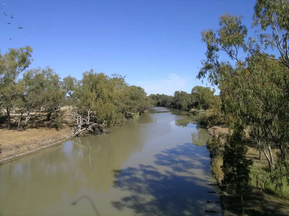
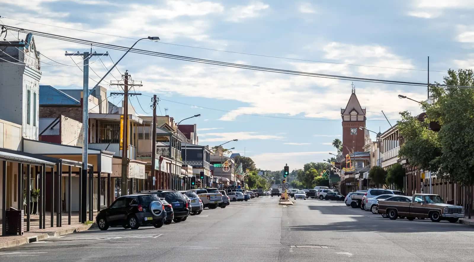
View of CollarenebriPhoto: Cgoodwin · CC BY-SA 3.0 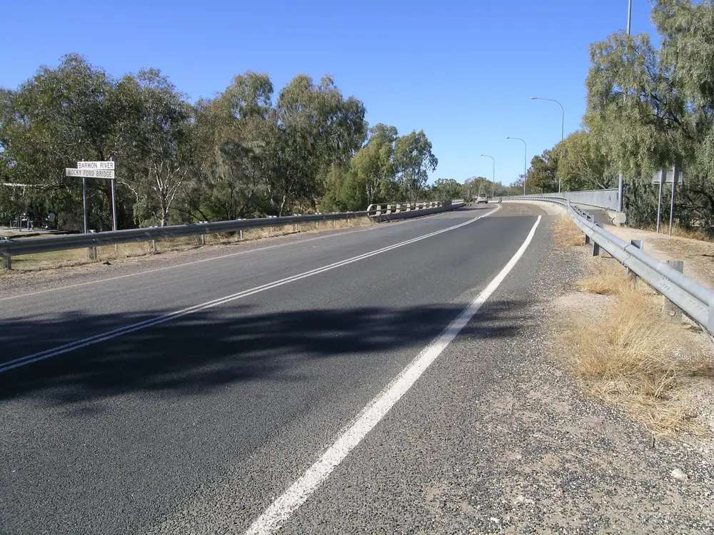
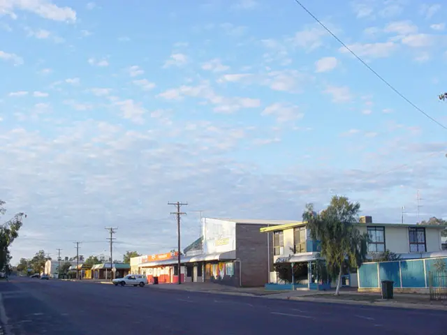
View of CollarenebriPhoto: Cgoodwin · CC BY-SA 3.0 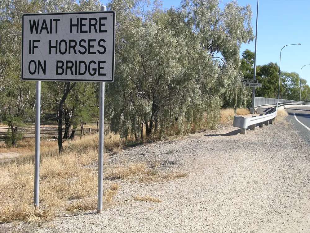
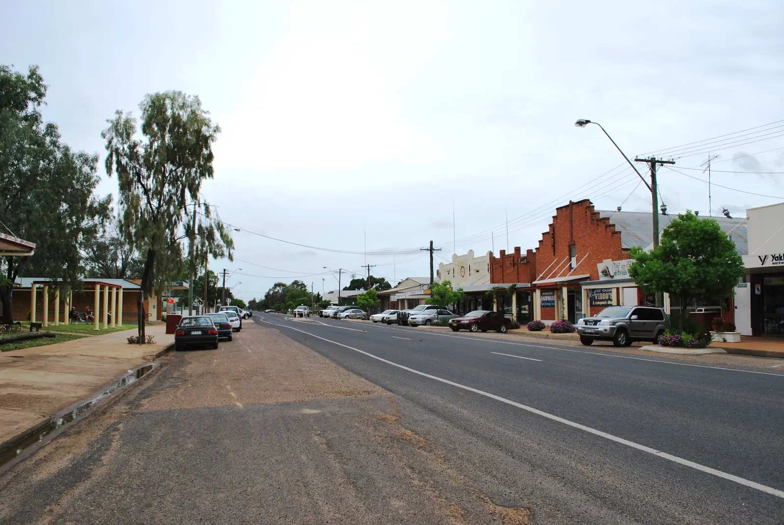
View of CollarenebriPhoto: Cgoodwin · CC BY-SA 3.0 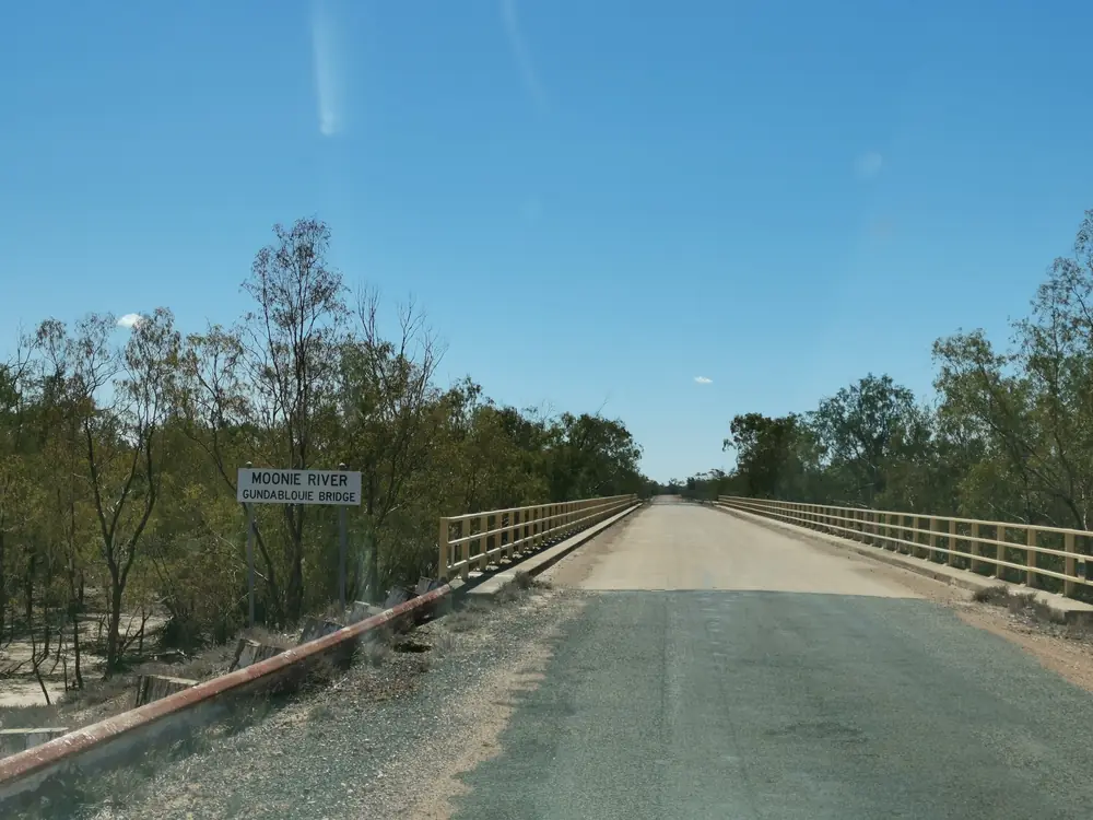
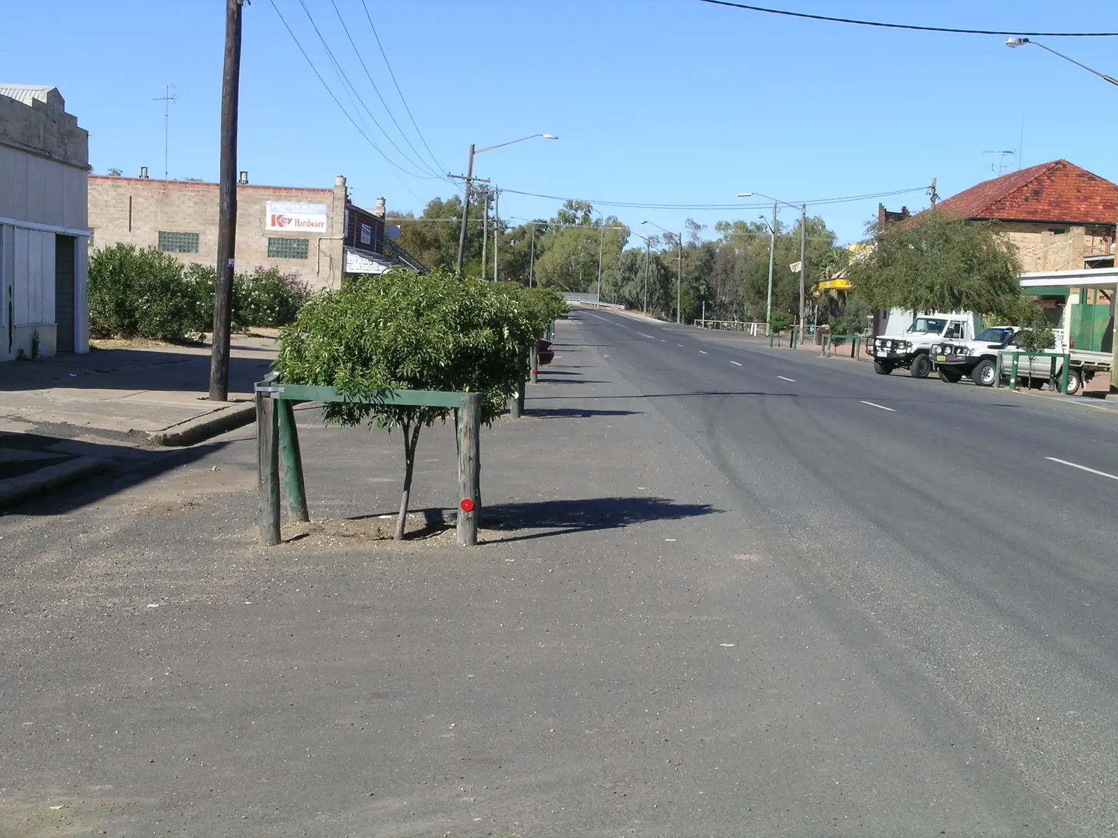
Gundablouie Bridge over Moonie River in Collarenebri NSWPhoto: Cleary97 · CC0
Collarenebri sits on the Barwon River in Walgett Shire, on the Gwydir Highway through outback NSW. Explore Lightning Ridge puts it an easy 50-minute drive north-east of Walgett. It is a river town between Walgett and the Queensland-leaning border country around Mungindi, not a suburb of Lightning Ridge and not a second Moree. The Gwydir Highway is sealed through town in ordinary weather. When the Barwon is up, Live Traffic NSW decides whether Explore Lightning Ridge’s 50-minute Walgett drive is actually open.
Use the urban-centre Census for the town. The 2021 urban centre Collarenebri (L), UCL122036, counted 425 people, median age 40, sex split 48.6% male / 51.4% female. Suburbs-and-localities SAL10969 counted 634, median age 39, 48.8% male / 51.2% female. Aboriginal and/or Torres Strait Islander people were 41.2% of the UCL and 35.3% of the SAL. Do not add those codes together. Read the ABS UCL QuickStats.
Travellers stop for the artesian baths, the Barwon, the free camp over the bridge, and — only with permission — the heritage Aboriginal cemetery. This hub is the Walgett Shire town. Brewarrina is the fish-trap neighbour further down the same river system, not a Collarenebri suburb.
Where it is, and how far
Collarenebri is on the Gwydir Highway where that sealed road meets the Barwon. Explore Lightning Ridge is the source for the 50-minute Walgett drive. The NSW Government Barwon River listing names boat ramps at Walgett and Collarenebri. BOM’s Mungindi Post Office table lists Collarenebri (Albert St) 048031 as 73.6 km from that station — a climate-station figure, not a touring kilometre. This hub does not invent a Sydney, Lightning Ridge or Moree kilometre that is not on the sourced pages. Fill and plan in Walgett or Moree if you need a larger service town.
| Place | Distance from Collarenebri (sourced) |
|---|---|
| Walgett | 50-minute drive south-west on the Gwydir Highway (Explore Lightning Ridge) |
| Mungindi (BOM station-to-station) | 73.6 km from Mungindi Post Office to Collarenebri Albert St (BOM Mungindi table; not a driving distance) |
| Collarenebri artesian baths | in the main street (Walgett Shire) |
| Free camp | just over the bridge on the Gwydir Highway (Walgett Shire) |
Lightning Ridge is the opal neighbour in the same shire. Moree is the artesian-centre neighbour on the Gwydir corridor, not a 20-minute side road on any page used here.
Facts at a glance
Population. ABS 2021 Census, Urban Centres and Localities UCL122036: 425 people. Median age 40. Families 78. Private dwellings 224. Use the UCL for the town. SAL10969 (locality) is 634 people, 130 families, 337 private dwellings. QuickStats notes small random adjustments for confidentiality.
Climate. Bureau of Meteorology station COLLARENEBRI (ALBERT ST), 048031. Location 29.54°S, 148.58°E, elevation 145 m. Commenced 1884. Status: open. Mean maximum (97 years, 1907–2024): January 35.6 °C, July 18.5 °C, annual 27.6 °C. Mean minimum: January 20.6 °C, July 4.2 °C, annual 12.6 °C. Mean rainfall (127 years, 1884–2024): annual 495.7 mm. September is the driest mean month at 26.1 mm; January is the wettest at 68.1 mm. Full columns: BOM Collarenebri (Albert St). See Collarenebri weather.
Visitor information. Collarenebri Visitor Information Centre, 37 Wilson Street, (02) 6756 2104, tourism@walgett.nsw.gov.au on the Explore Lightning Ridge Collarenebri page. Walgett Visitor Information Centre, 88 Fox Street, and Lightning Ridge Visitor Information Centre, Lions Park, Morilla Street, sit in the same shire network. Walgett Shire’s baths page uses (02) 6828 6100.
Traditional Owners
The NSW Government’s Collarenebri Aboriginal Cemetery listing describes distinctive Gamilaroi burial traditions and a site owned by Collarenebri Local Aboriginal Land Council. Heritage NSW’s inventory repeats that grave decoration and alignment are consistent with Gamilaroi burial practice, and names Isabel Flick OAM, buried there. This hub follows those official sentences. Walgett’s guide on this site treats the shire as Gamilaraay (Kamilaroi) Country. Confirm a single-nation sentence for the townsite at 37 Wilson Street. The cemetery is not a self-serve lookout. Read visiting Country respectfully.
History
This hub does not invent a gazettal year that was not on the visitor and heritage pages fetched. What those pages do record is a Barwon crossing on the Gwydir Highway, a living Aboriginal community, and a cemetery in use from 1907, added to the New South Wales State Heritage Register in December 2014. Heritage NSW: graves decorated with shattered (“crystalled”) glass and objects; Bel’s Way named for Isabel Flick’s campaign for the access road; a statue of Isabel at the gate.
Walgett Shire’s baths page places Collarenebri in the same Great Artesian Basin story as Lightning Ridge, Burren Junction and Walgett: water described as about two million years old, held at a constant 41.5 °C on that shire page. The Collarenebri bath was funded as part of the Murray–Darling Basin Economic Development Program. That is a basin and funding fact, not a spa rating. See the Great Artesian Basin.
Paddle-steamer Walgett is the river-port story on this site’s Walgett page. Collarenebri is the next named boat-ramp town on the NSW Government Barwon listing.
Things to do
Collarenebri Artesian Bore Baths — Walgett Shire: open, heated 6am to 9pm daily, in the main street, close to amenities. Parking for caravans and motorhomes opposite the hotel near the river on Walgett Street. Shower before you enter; no camping on the reserve; children under 16 with an adult; the reserve is an alcohol-free zone. Limit soaks in water that hot. Phone (02) 6828 6100.
Barwon River — NSW Government: fishing for yellowbelly, Murray cod and European carp; kayaking and canoeing; boat ramps at Walgett and Collarenebri. NSW fisheries rules apply. After flood, stay off closed banks.
Collarenebri free camp — Walgett Shire: just over the bridge on the Gwydir Highway, sites on the Barwon, showers, toilets and dump point, a short walk from the baths. Explore Lightning Ridge: RV-friendly campground with amenities and potable water.
Tattersalls Hotel — named on Explore Lightning Ridge for meals and cold beer after a river session. Hours change. Confirm in town.
Collarenebri Aboriginal Cemetery — Gundabloui Road. Heritage-listed, Land Council owned. Ask first. This is not a Car Door Tour stop.
See things to do in Collarenebri.
Lightning Ridge opal fields and Moree’s aquatic centre are real, and this site has guides, but they are other towns. Do not treat them as a Collarenebri afternoon unless Live Traffic NSW and your remaining daylight agree.
Where to stay
Official named stay types on the Walgett Shire and Explore Lightning Ridge pages used here:
- Collarenebri free camp — over the Gwydir Highway bridge, Barwon sites, showers, toilets, dump point
- Hotel rooms — Tattersalls Hotel is the named pub on the Explore Lightning Ridge Collarenebri page; confirm whether rooms are offered when you call
- Walgett Street parking — Walgett Shire names ample parking for caravans and motorhomes opposite the hotel near the river. That is a parking note, not a campground booking
Those are official named types, not a ranked inventory. Confirm at (02) 6756 2104. This page will not invent extra motels.
- How to choose: Collarenebri accommodation
- Camping detail: Collarenebri caravan parks
- Operator enquiries: feature your business
If Collarenebri is full, Walgett is a 50-minute drive on Explore Lightning Ridge’s wording and Lightning Ridge is the shire’s larger visitor town. That is a geography fact, not a booking guarantee.
Caravan and camping
Vans use Collarenebri as a quieter Gwydir Highway overnight than Lightning Ridge. The official named camp is the free camp over the bridge. Walgett Shire says the baths reserve is not a camp site — no camping, caravanning or fire lighting there. Ask the Collarenebri VIC for stay limits. Read Collarenebri caravan parks and outback camping. After rain, the constraint is the Barwon. Live Traffic NSW first.
Fuel and services
A town of 425 people (UCL) will not match Moree for fuel, groceries or a hospital. This guide does not list bowser brands or 24-hour claims. Explore Lightning Ridge names the hotel for meals. Walgett Shire names the baths in the main street and the free camp over the bridge. Confirm a bowser, a shop and a mechanic when you arrive, or fill in Walgett, Lightning Ridge or Moree. Carry water. January’s mean maximum at Collarenebri Albert St is 35.6 °C.
For current questions, use Walgett Shire (02) 6828 6100 or the Collarenebri VIC (02) 6756 2104.
Road access
The Gwydir Highway is the sealed spine through Collarenebri. It is a freight road. After rain on the Barwon, check Live Traffic NSW. Do not drive around closed signs to keep a bath booking.
South-west: Walgett, then the Castlereagh toward Lightning Ridge or south toward Dubbo. East toward Moree on the same highway. North and west toward Mungindi and Brewarrina are different Barwon roads; this hub does not invent those kilometres. Road trains use the Gwydir. See road trains and outback road rules.
Nearby parks and towns
There is no national park inside Collarenebri on the visitor pages used here. The Barwon banks and the baths reserve are the named nature sites in town.
Towns on this site:
- Walgett — 50 minutes; Namoi–Barwon junction, Freedom Ride history
- Lightning Ridge — black opal, shire neighbour
- Mungindi — NSW/Qld border town on the Barwon
- Brewarrina — Baiame’s Ngunnhu on the same river system
- Moree — artesian aquatic centre on the Gwydir corridor
When to go, and how long
January’s mean maximum of 35.6 °C is hot for a river walk at midday. July’s 18.5 °C mean maximum is the comfortable walking season; July’s 4.2 °C mean minimum is why a river camp needs a layer. Annual rainfall 495.7 mm is wetter than the Darling villages west of Bourke and still flood country. See Collarenebri weather.
One night covers the baths, a river sit and the main street. Two nights if you have arranged a respectful cemetery visit and want a slower Barwon morning. Two full tourist days on Wilson Street is more than the sourced main-street list supports unless you are using Collarenebri as a rest day between Lightning Ridge and Moree.
Operators who want a checked listing: feature your business. The listings slot stays empty until then.
Plan this trip
Tell us the dates, who you are travelling with and where you need help. We reply with planning notes for Collarenebri — we are not a booking agent.
Events and road-conditions newsletter
Occasional notes on outback festivals, race days and official road-condition sources — not a daily blast. We use these details only to send the newsletter.
New South Wales · Outback NSW
Collarenebri accommodation
Where to stay in Collarenebri: Walgett Shire free camp on the Barwon, hotel rooms to confirm at Tattersalls, and nearby Walgett or Lightning Ridge if the village is full.
Read · 4 min
New South Wales · Outback NSW
Collarenebri caravan parks
Camping in Collarenebri: Walgett Shire free camp over the Gwydir Highway bridge, dump point and showers. The artesian baths reserve is not a campsite.
Read · 4 min
New South Wales · Outback NSW
Collarenebri weather
Collarenebri climate from BOM Collarenebri (Albert St) 048031: January mean max 35.6 °C, July 18.5 °C, annual rainfall 495.7 mm. Open station; use Live Traffic NSW after rain on the Barwon.
Read · 4 min
New South Wales · Outback NSW
Things to do in Collarenebri
Things to do in Collarenebri: Walgett Shire artesian bore baths, Barwon River fishing and boat ramp, free camp over the bridge, and the heritage Aboriginal cemetery with permission.
Read · 5 min
Frequently asked questions
How far is Collarenebri from Walgett and Mungindi?
Explore Lightning Ridge puts Collarenebri an easy 50-minute drive north-east of Walgett along the Gwydir Highway. BOM’s Mungindi Post Office table lists Collarenebri (Albert St) as 73.6 km away as a station-to-station figure, not a driving distance. This hub does not invent a Walgett kilometre that is not on those official pages.
What is Collarenebri’s population?
425 people at the 2021 Census for the urban centre Collarenebri (L) UCL122036, median age 40. Suburbs-and-localities SAL10969 counted 634. Do not mix the two geographies.
Are the Collarenebri artesian baths open?
Walgett Shire’s Collarenebri Artesian Baths page, fetched for this guide, states: THE COLLARENEBRI BORE BATHS ARE OPEN. The baths are heated from 6am to 9pm daily. Confirm before you travel; hours change.
What is the weather like in Collarenebri?
BOM Collarenebri (Albert St) 048031 monthly means: January mean maximum 35.6 °C, July 18.5 °C, annual rainfall 495.7 mm. Status open. See the Collarenebri weather page.
Can I visit the Aboriginal cemetery?
It is a State Heritage Register site owned by Collarenebri Local Aboriginal Land Council. The NSW Government listing asks visitors to approach it with respect. It is not a casual lookout. Ask at the Collarenebri Visitor Information Centre or the Land Council before you go.
Whose Country is Collarenebri on?
The NSW Government cemetery listing describes distinctive Gamilaroi burial traditions. Walgett’s town guide on this site places Walgett Shire on Gamilaraay (Kamilaroi) Country. Confirm a Collarenebri-only sentence at 37 Wilson Street rather than flattening several Barwon groups onto one label.
Sources and further reading
Facts on this page were checked against these primary and official sources. Conditions change — confirm before you travel or buy.
- Collarenebri (L) 2021 Census QuickStats (UCL122036) — Australian Bureau of Statistics
- Collarenebri 2021 Census QuickStats (SAL10969) — Australian Bureau of Statistics
- Climate statistics for Collarenebri (Albert St) (048031) — Bureau of Meteorology
- Collarenebri Artesian Baths — Walgett Shire Council
- Collarenebri — Walgett Shire / Explore Lightning Ridge
- Barwon River — NSW Government
- Collarenebri Aboriginal Cemetery — NSW Government
- Collarenebri Aboriginal Cemetery (State Heritage Inventory) — Heritage NSW
- Live Traffic NSW — Transport for NSW
- Collarenebri Health Service — NSW Government / Western NSW Local Health District