At a glance
Sourced facts only. Distances and services change — confirm before you travel.
- Local government
- Cobar Shire
- Traditional Owners
- Ngiyampaa Country (this site’s Cobar hub and NPWS Mount Grenfell Historic Site, jointly managed with the Ngiyampaa people). Confirm wording at the Great Cobar Museum and Visitor Information Centre.Visit Cobar’s Nymagee village paragraph used here does not print a separate townsite acknowledgement.
- Nearest regional city
- 100 km south of Cobar (Visit Cobar). Visit NSW’s Four Corners listing also places Nymagee south of Cobar and southwest of Nyngan. A Nymagee–Nyngan kilometre is not printed on those pages.
- Capital
- Visit Cobar and Visit NSW pages used here do not print a Nymagee–Sydney kilometre. Cobar’s hub records about 710 km west of Sydney for Cobar — that is Cobar, not a Nymagee offset this page will invent.
- Nearest fuel
- This guide does not name a Nymagee bowser. Fill in Cobar before the 100 km run south; confirm at the Cobar Visitor Information Centre.
- Nearest hospital or clinic
- Cobar Health Service, Woodiwiss Avenue — 24-hour emergency (this site’s Cobar hub). No Nymagee clinic is named on the pages used here.
- Mobile coverage
- Check Telstra and Optus coverage maps before travel; Visit NSW’s Four Corners listing names a Telstra booster on that farm, which is not a village-wide coverage claim.
- Best time to visit
- May–September (cooler nearby BOM Cobar MO mean maxima). January mean maximum 34.6 °C; July 16.0 °C.
Climate
Monthly means from the Bureau of Meteorology station Cobar MO (048027) — nearby open table. This is not a forecast. Open nearby station, not an in-town Nymagee AWS. Commenced 1962. Elevation 260 m. Temperature 64 years; rainfall 63 years (1962–2026). Do not blend with Cobar Airport AWS. Monthly columns copied from this site’s Cobar hub. Visit Cobar puts Nymagee 100 km south of Cobar.
| Month | Mean max (°C) | Mean min (°C) | Rainfall (mm) |
|---|---|---|---|
| Jan | 34.6 | 20.9 | 43.7 |
| Feb | 33.5 | 20.2 | 42.6 |
| Mar | 30.3 | 17.3 | 36.3 |
| Apr | 25.4 | 12.9 | 27.1 |
| May | 20.1 | 9.0 | 33.6 |
| Jun | 16.6 | 6.2 | 29.7 |
| Jul | 16.0 | 5.1 | 27.7 |
| Aug | 18.2 | 6.3 | 26.1 |
| Sep | 22.4 | 9.2 | 24.2 |
| Oct | 26.4 | 12.9 | 34.7 |
| Nov | 29.7 | 16.0 | 36.8 |
| Dec | 32.8 | 18.8 | 35.3 |
Nymagee in pictures
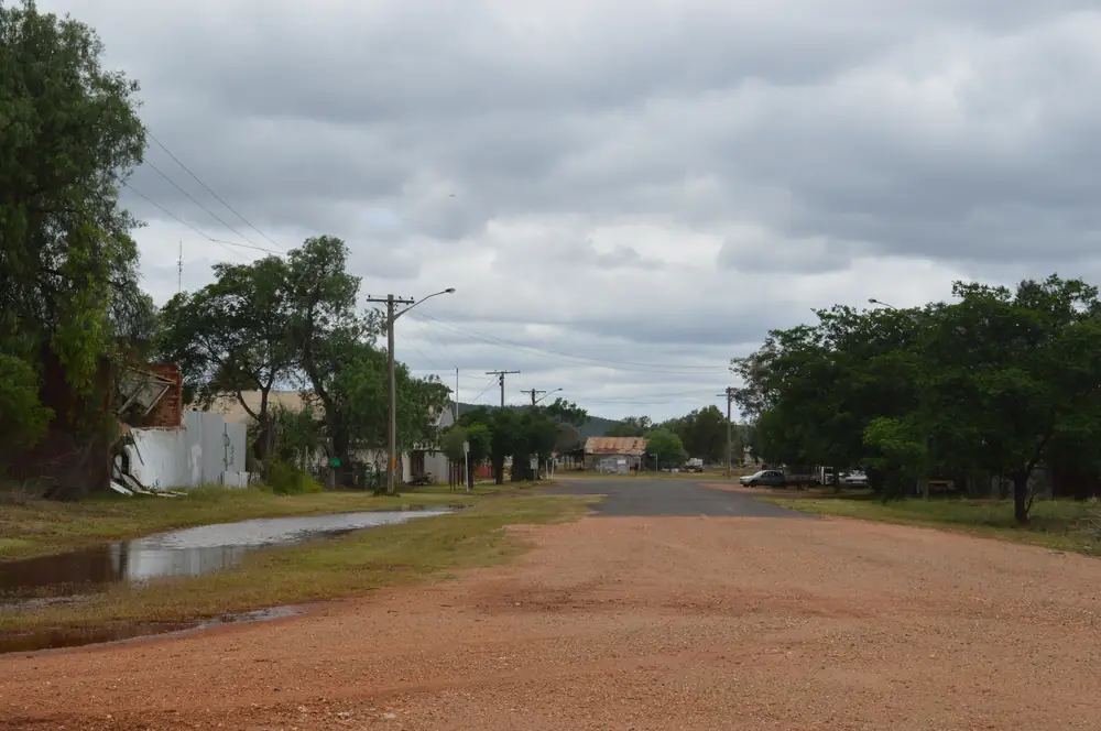
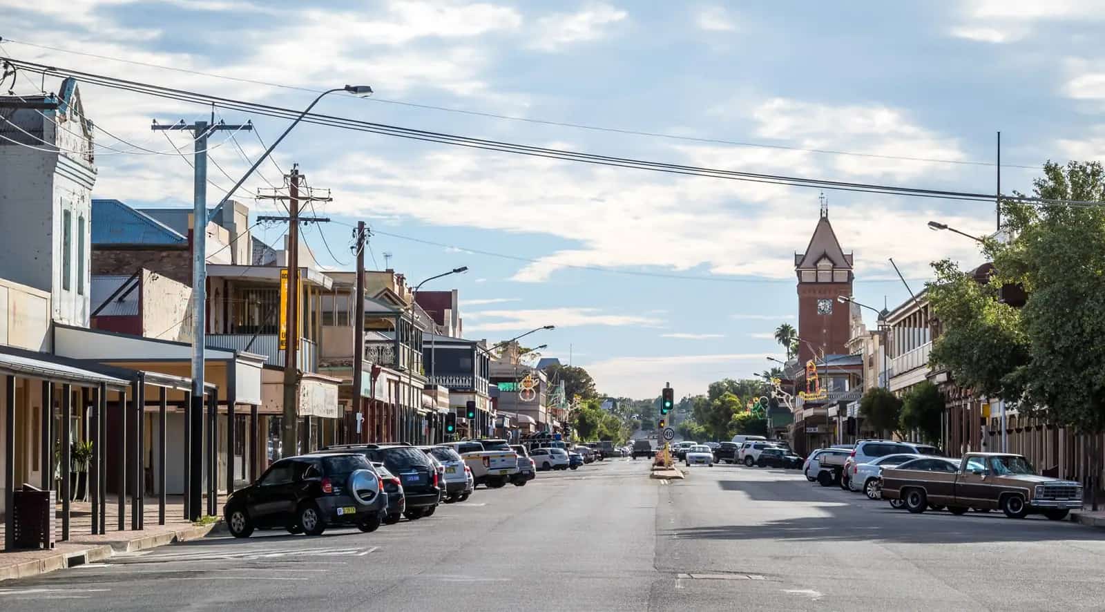
Graham Street in NymageePhoto: Mattinbgn · CC BY 3.0 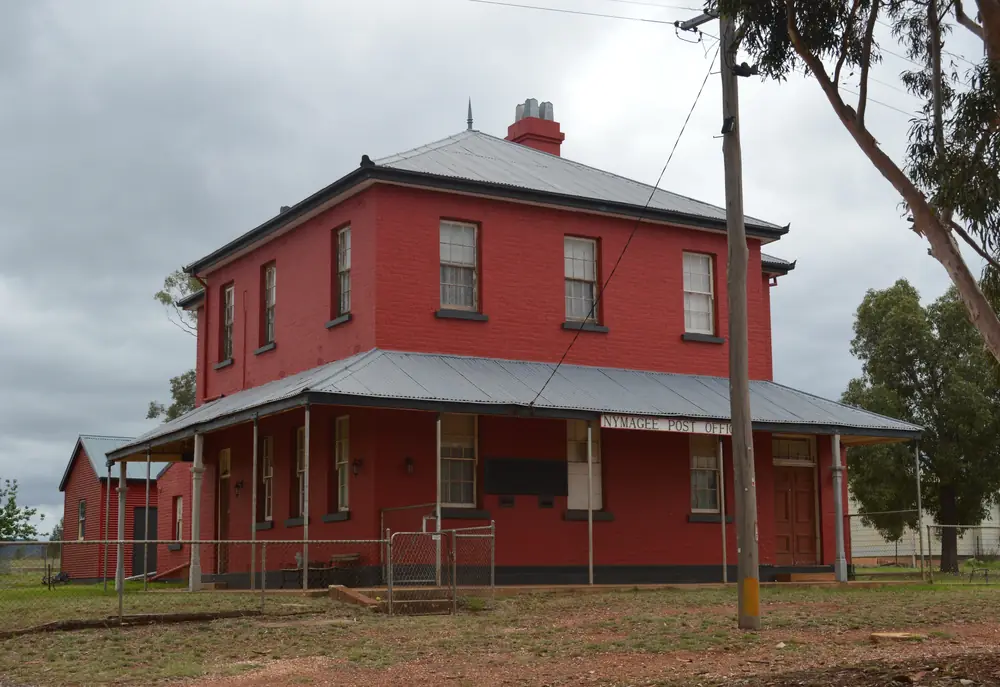
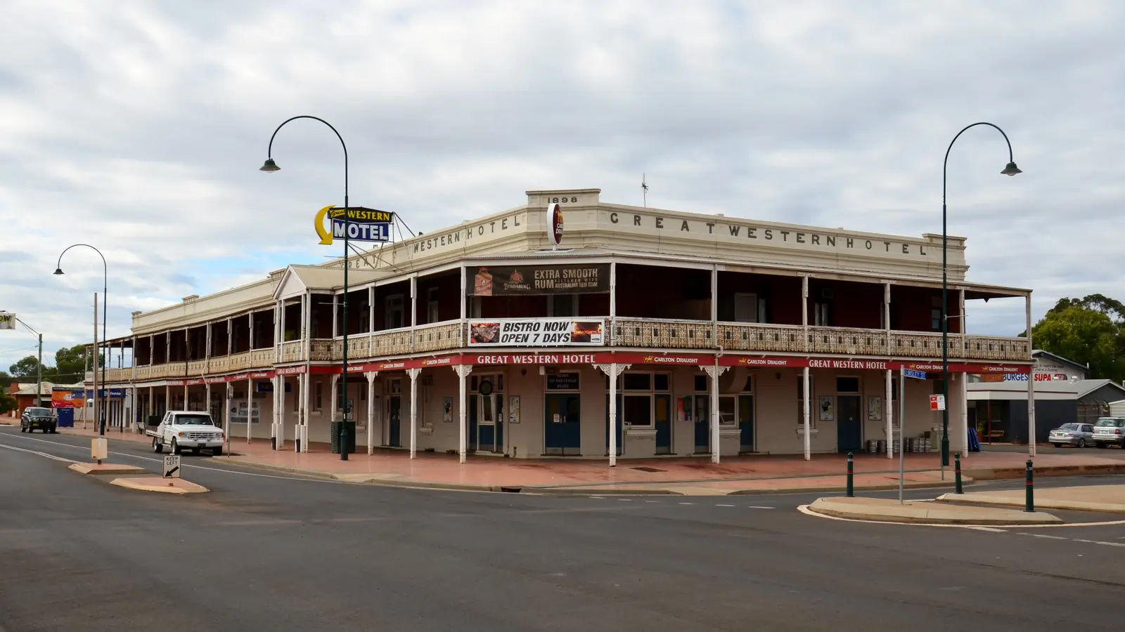
Post office in NymageePhoto: Mattinbgn · CC BY 3.0 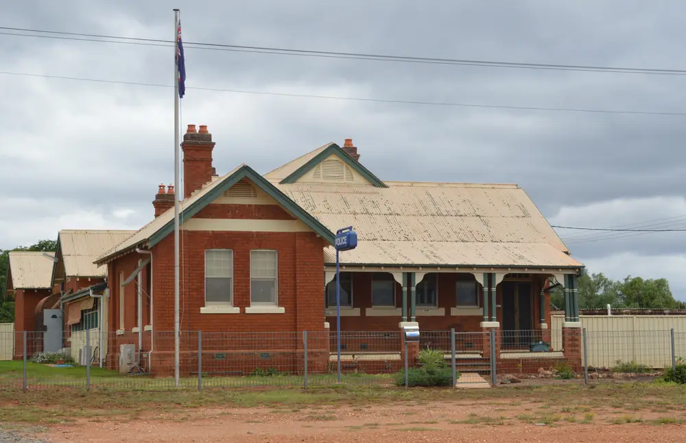
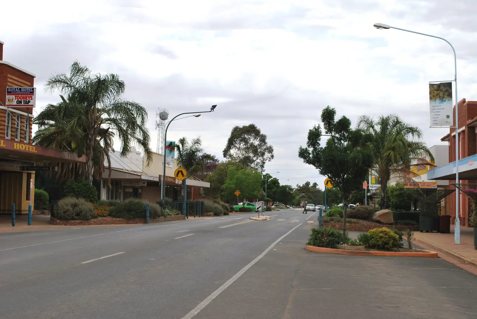
Police station in NymageePhoto: Mattinbgn · CC BY 3.0 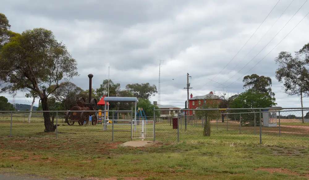
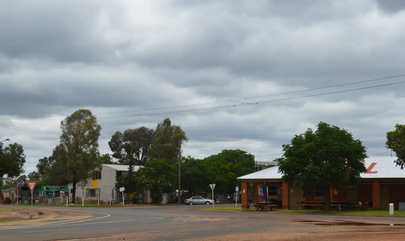
Nymagee ParkPhoto: Mattinbgn · CC BY 3.0
Nymagee sits 100 km south of Cobar in Cobar Shire, on this site’s outback NSW list. Visit Cobar’s villages page is the official listing used here: a small rural town, a historical mining town surrounded by hills and spectacular views, home to the story of Clancy of the Overflow. This hub is the Cobar Shire village. It is not a Nyngan suburb (Nyngan is Bogan Shire; Visit NSW only uses southwest-of-Nyngan as a direction), not a second Cobar hub, and not Condobolin’s Lachlan river street.
The Australian Bureau of Statistics does not publish a 2021 Urban Centre (UCL) named Nymagee on the QuickStats pages used here. Use suburbs-and-localities SAL13058: 96 people, median age 52, sex split 52.6% male / 47.4% female. 22 families, 50 private dwellings. ABS Note 2: due to the small population, limited information has been provided. This hub therefore does not invent an Indigenous percentage the SAL table does not print. Read the ABS SAL QuickStats. Travellers stop for the Metropolitan Hotel, the Overflow story, and a farm stay. You still need Live Traffic NSW after rain, because a 100 km run south of Cobar is no use if the road is closed, and a locality of 96 people will not match Cobar for a spare room at 9pm.
Where it is, and how far
Nymagee is the Cobar Shire village Visit Cobar places 100 km south of Cobar in western NSW. Visit NSW’s Four Corners listing: small historic village, south of Cobar and southwest of Nyngan, rich in mining history. Condobolin and Lake Cargelligo are the Lachlan neighbours on this wave — a Nymagee–Condobolin kilometre was not on the sourced pages, so this hub does not invent one.
| Place | Distance from Nymagee (sourced) |
|---|---|
| Cobar | 100 km south of Cobar (Visit Cobar) |
| The Overflow station | about 32 km south-east of Nymagee (Visit Cobar; Visit NSW Nymagee Hotel) |
| Four Corners Farm Stay | 10 km from the village, Burthong Road (Visit NSW) |
| Nyngan | southwest of Nyngan as a direction (Visit NSW Four Corners). Kilometre not printed |
| Sydney | kilometre not printed on Visit Cobar or Visit NSW pages used here |
| Cobar MO (BOM 048027) | nearby open table used on this site’s Cobar hub — not a Nymagee drive time |
Mount Hope is 160 km south of Cobar on the same Visit Cobar villages page — named, not linked. Euabalong is 230 km south of Cobar on that page — named, not linked. Canbelego is the other named mining village. None of those are Nymagee.
Facts at a glance
Population. ABS 2021 SAL13058: 96 people. Median age 52. No UCL. Limited tables. Nymagee SAL QuickStats.
Climate. No Nymagee row on the BOM monthly-statistics pages used here. Use COBAR MO, 048027, copied from this site’s Cobar hub: commenced 1962, elevation 260 m, status: open. January mean maximum 34.6 °C, July 16.0 °C, annual rainfall 397.2 mm. September 24.2 mm is the driest mean month on that table; January 43.7 mm the wettest. Do not blend Cobar MO with Cobar Airport AWS. Nymagee is 100 km south of that station. See Nymagee weather.
Visitor information. There is no Nymagee VIC on the pages used here. Cobar Visitor Information Centre: visitcobar@cobar.nsw.gov.au, (02) 6836 2448 on Visit Cobar. Cobar Shire Council: 36 Linsley Street, (02) 6836 5888. Roads: Live Traffic NSW.
Traditional Owners
This site’s Cobar hub places Cobar Shire on Ngiyampaa Country. NPWS’s Mount Grenfell Historic Site is jointly managed with the Ngiyampaa people. Visit Cobar’s Nymagee paragraph does not print a separate townsite acknowledgement. Confirm current wording at the Great Cobar Museum and Visitor Information Centre. Mount Grenfell is a Cobar Shire art site, not a Nymagee main-street walk. See visiting Country respectfully.
History
Visit Cobar: Nymagee is a historical mining town surrounded by hills. The Metropolitan Hotel was originally built in 1880, burnt down in 1939, and the current pub was completed in 1941 and still operating. Visit NSW’s Nymagee Hotel listing: a meeting point and watering hole since the early 1900s; the pub is the heart of the town.
Visit Cobar and Visit NSW both name Clancy of the Overflow, the Banjo Paterson poem, and the sheep station The Overflow about 32 km south-east of Nymagee. That is a literature-and-station sentence. This hub does not reprint the poem, does not invent a homestead visiting hour, and does not treat a working station as a default museum. Ask Cobar VIC whether any access is offered; do not arrive unannounced.
That is a Cobar Shire mining-village founding, not a Macquarie wetlands story borrowed from Warren and not a Lachlan lake story borrowed from Lake Cargelligo.
Things to do
Visit Cobar and Visit NSW name these in and around Nymagee:
- Metropolitan Hotel / Nymagee Hotel — Visit Cobar: family-friendly pub, meals, accommodation, 0448 373 854, Facebook as Metropolitan Hotel Nymagee. Visit NSW lists the same phone and Hartwood Street
- Hills and views — Visit Cobar’s surrounding-hills sentence. Stay on public, formed access. This hub does not invent a lookout name
- The Overflow station — about 32 km south-east; a named place in a poem, not a booked tour unless the VIC says so
- Four Corners Farm Stay — 10 km from the village, 23,000-acre working sheep farm on Visit NSW; bush walking, farm views, campfire and starry nights on that listing’s wording
Nearby, not in-town: Cobar Great Cobar Heritage Centre, Fort Bourke lookout and Mount Grenfell. Nyngan Big Bogan. Mount Hope pub 160 km south of Cobar — named, not linked.
Where to stay
Named stays on the pages used here:
- Metropolitan Hotel — Visit Cobar: accommodation and meals, 0448 373 854
- Four Corners Farm Stay — Visit NSW: cabins, budget dongers, tent/camping sites, powered and unpowered sites, Burthong Road, 0438 683 626, fourcorners4@bigpond.com
Those are official named operators, not a ranked motel strip. A locality of 96 people is not Cobar’s Barrier Highway room count. Confirm vacancies before you leave Cobar.
- How to choose: Nymagee accommodation
- Camping detail: Nymagee caravan parks
- Operator enquiries: feature your business
If Nymagee is full, Cobar is the shire overflow 100 km north. Condobolin and Lake Cargelligo are the Lachlan neighbours on this site.
Caravan and camping
Vans use Nymagee as a quiet night south of Cobar. The sourced camping is Four Corners Farm Stay — powered and unpowered sites on Visit NSW. The Metropolitan Hotel is rooms, not a van park. Visit Cobar’s Euabalong honesty-box park is 230 km south of Cobar, not Nymagee. Ask 0438 683 626 and Cobar VIC. Read Nymagee caravan parks and outback camping. Do not unhitch on a station driveway.
Fuel and services
A locality of 96 people will not match Cobar for a hospital or a guaranteed bowser. Cobar Health Service on Woodiwiss Avenue provides 24-hour emergency on this site’s Cobar hub. This guide does not name a Nymagee clinic or a Nymagee fuel brand. Fill in Cobar before the 100 km run south. Visitor questions: Cobar VIC (02) 6836 2448. Pub questions: 0448 373 854.
Road access
Visit Cobar does not print the road name for the Cobar–Nymagee run on the villages paragraph used here. Treat it as a remote shire road: sealed in ordinary weather is a hope, not a sourced surface claim this hub will invent. After rain, Live Traffic NSW. Pull over for road trains and mine traffic that still uses Cobar Shire roads.
North: Cobar 100 km. Direction toward Nyngan: southwest on Visit NSW’s Four Corners wording — kilometre not printed. Toward the Lachlan: Condobolin and Lake Cargelligo on this site without a sourced kilometre. Mount Hope 160 km south of Cobar — named, not linked.
Nearby parks and towns
Parks and named nature sites:
- Surrounding hills on Visit Cobar’s Nymagee paragraph — formed public access only
- Mount Grenfell Historic Site — Ngiyampaa art site in Cobar Shire; a Cobar-side park day, not a Nymagee footpath
- Four Corners Farm Stay bush walking on Visit NSW’s listing — a booked farm, not a national park
Towns on this site:
- Cobar — 100 km north
- Condobolin — Lachlan Shire
- Lake Cargelligo — Lachlan lake town
- Nyngan — Bogan Shire, direction only on Visit NSW
- Canbelego — Cobar Shire gold locality, Mount Boppy country on Visit Cobar
Named, not linked: Mount Hope, Euabalong, Canbelego, The Overflow station as a private property.
When to go, and how long
Nearby Cobar MO January mean maximum of 34.6 °C is hot for a midday village photograph. July’s 16.0 °C mean maximum is the walking season on paper; July’s 5.1 °C mean minimum is why a van night at Four Corners needs a layer. Annual rainfall 397.2 mm on the Cobar hub is dry inland, not a Top End Wet. September’s 24.2 mm is the driest mean month on that table.
Forty-five minutes covers a pub meal if the Metropolitan is serving and a photograph of the hills Visit Cobar names. A night covers the pub room or Four Corners if confirmed. Two nights only if you booked the farm stay and Cobar VIC has a Mount Grenfell plan for a separate Cobar day — do not flatten Nymagee into Cobar.
Operators who want a checked listing: feature your business. The listings slot on this hub stays empty until then.
Plan this trip
Tell us the dates, who you are travelling with and where you need help. We reply with planning notes for Nymagee — we are not a booking agent.
Events and road-conditions newsletter
Occasional notes on outback festivals, race days and official road-condition sources — not a daily blast. We use these details only to send the newsletter.
New South Wales · Outback NSW
Nymagee accommodation
Where to stay in Nymagee: Visit Cobar names Metropolitan Hotel rooms; Visit NSW names Four Corners Farm Stay 10 km out. Confirm before you leave Cobar. Not a Nyngan suburb.
Read · 3 min
New South Wales · Outback NSW
Nymagee caravan parks
Camping in Nymagee: Visit NSW names Four Corners Farm Stay 10 km from the village — powered and unpowered sites, cabins and camping. No town park brand is invented here.
Read · 3 min
New South Wales · Outback NSW
Nymagee weather
Nymagee climate from nearby BOM Cobar MO (048027): January mean max 34.6 °C, July 16.0 °C, annual rainfall 397.2 mm. Open station. No in-town Nymagee monthly table. Cobar Shire.
Read · 4 min
New South Wales · Outback NSW
Things to do in Nymagee
Things to do in Nymagee: Cobar Shire mining village 100 km south of Cobar — Metropolitan Hotel, Clancy of the Overflow country and Four Corners Farm Stay. Not a Nyngan suburb.
Read · 3 min
Frequently asked questions
How far is Nymagee from Cobar?
Visit Cobar puts Nymagee 100 km south of Cobar in western NSW. Visit NSW’s Four Corners Farm Stay listing also calls Nymagee a small historic village south of Cobar and southwest of Nyngan. Those pages do not print a Nymagee–Sydney kilometre.
What is Nymagee’s population?
96 people at the 2021 Census for suburbs and localities SAL13058, median age 52. ABS notes that limited information is provided because of the small population. There is no Urban Centre and Locality named Nymagee on the QuickStats pages used here.
What is there to do in Nymagee?
Visit Cobar names a historical mining town surrounded by hills, the Metropolitan Hotel (built 1880, burnt 1939, current building 1941 — meals and accommodation), and the sheep station The Overflow about 32 km south-east, the station featured in Banjo Paterson’s poem Clancy of the Overflow. Visit NSW’s Nymagee Hotel listing repeats the Overflow sentence. Four Corners Farm Stay is 10 km from the village on Visit NSW.
What is the weather like in Nymagee?
This hub uses nearby open BOM Cobar MO (048027): January mean maximum 34.6 °C, July 16.0 °C, annual rainfall 397.2 mm (63 years of rainfall on the Cobar hub). There is no Nymagee monthly table on the pages used here. Do not blend Cobar MO with Cobar Airport AWS.
Where should I stay in Nymagee?
Visit Cobar: the Metropolitan Hotel offers accommodation and meals, 0448 373 854. Visit NSW names Four Corners Farm Stay 10 km from Nymagee on Burthong Road — 23,000-acre working sheep farm with cabins, tent/camping sites, and powered and unpowered caravan sites, 0438 683 626. Confirm before you unhitch; a locality of 96 people is not a motel strip.
Is Nymagee a suburb of Nyngan?
No. Nymagee is a Cobar Shire village 100 km south of Cobar on Visit Cobar. Visit NSW places it southwest of Nyngan as a direction, not as a Nyngan suburb. Nyngan is Bogan Shire.
Sources and further reading
Facts on this page were checked against these primary and official sources. Conditions change — confirm before you travel or buy.
- Nymagee 2021 Census QuickStats (SAL13058) — Australian Bureau of Statistics
- Climate statistics for Cobar MO (048027) — Bureau of Meteorology
- Our Villages — Visit Cobar — Cobar Shire Council
- Nymagee Hotel — Destination NSW
- Four Corners Farm Stay — Destination NSW
- Cobar — Destination NSW
- Mount Grenfell Historic Site — NSW National Parks and Wildlife Service
- Live Traffic NSW — Transport for NSW