At a glance
Sourced facts only. Distances and services change — confirm before you travel.
- Local government
- Barkly Regional Council
- Traditional Owners
- NT Place Names records Three Ways Roadhouse in the Warumungu locality. NT Government’s Attack Creek Historical Reserve, 74 km north of Tennant Creek on the same Stuart Highway, commemorates a hostile encounter with Warumungu Aboriginal people on Stuart’s 1860 expedition.A Traditional Owner sentence named specifically for the roadhouse townsite was not on the Tourism NT camping page or Place Names extract fetched for this rebuild. Do not flatten Tennant Creek’s Jurnkkurakurr wording onto the junction without an official sentence that names Three Ways.
- Nearest regional city
- Tennant Creek. Tourism NT’s camping page: drive 17 minutes north along the Stuart Highway from Tennant Creek. NT Government rest-stop table: Reverend John Flynn Memorial 25 km north of Tennant Creek.
- Capital
- NT Government rest-stop table prints Darwin 960 km from the Reverend John Flynn Memorial rest stop. That is a memorial/rest-stop kilometre, not a townsite kilometre invented here.
- Nearest fuel
- Tourism NT names Threeways Roadhouse & Tourist Park at the junction, with motel rooms and a dining hall. NT Place Names: a full service roadhouse since Shell developed the site in 1972. Confirm the bowser on arrival; this hub does not invent hours.
- Nearest hospital or clinic
- A hospital name for Three Ways is not printed on the sourced Tourism NT, Place Names or NT Government rest-stop pages used here. Tennant Creek is the next named service town 17 minutes south on Tourism NT.
- Mobile coverage
- Check Telstra and Optus coverage maps before travel; do not assume a signal on the Barkly Highway gaps east of the junction.
- Best time to visit
- Tourism NT camping around Tennant Creek: cooler months April to September. BOM Tennant Creek Airport January mean maximum 36.8 °C; July 24.8 °C.
Climate
Monthly means from the Bureau of Meteorology station Tennant Creek Airport (015135). This is not a forecast. Open station. Nearest named open BOM table; Tourism NT puts Three Ways 17 minutes north of Tennant Creek. Temperature 57 years (1969–2026); rainfall 55 years (1969–2026). Latest available data 14 November 2026. BOM’s NT named list has no Three Ways climate table.
| Month | Mean max (°C) | Mean min (°C) | Rainfall (mm) |
|---|---|---|---|
| Jan | 36.8 | 25.0 | 117.3 |
| Feb | 35.8 | 24.5 | 119.7 |
| Mar | 34.6 | 23.4 | 61.4 |
| Apr | 31.9 | 20.5 | 14.7 |
| May | 27.7 | 16.4 | 9.2 |
| Jun | 24.7 | 13.0 | 5.4 |
| Jul | 24.8 | 12.4 | 6.3 |
| Aug | 27.7 | 14.5 | 2.4 |
| Sep | 31.9 | 18.5 | 7.8 |
| Oct | 35.1 | 21.9 | 20.4 |
| Nov | 36.6 | 23.9 | 40.7 |
| Dec | 37.3 | 25.0 | 78.1 |
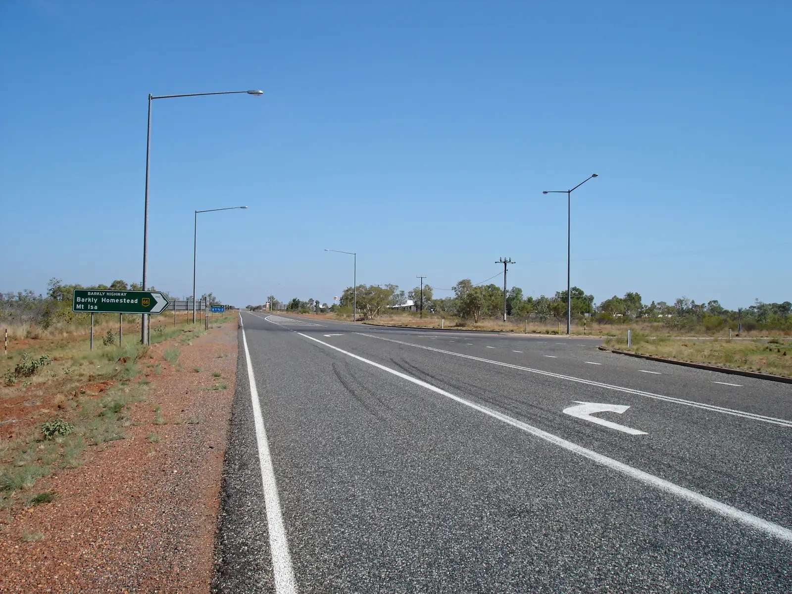
Three Ways is the Stuart Highway / Barkly Highway junction in the Top End listing on this site, 17 minutes north of Tennant Creek on Tourism NT’s camping page. NT Place Names records Three Ways Roadhouse at that intersection, locality Warumungu, Barkly local government. NT Government’s rest-stop table prints the Reverend John Flynn Memorial 25 km north of Tennant Creek. This hub is the three-direction roadhouse junction, not a Darwin suburb, not a Queensland town, and not a second Tennant Creek gold street. Darwin is the capital; it has no town page here.
NT Place Names’ origin sentence is the geography used here. The roadhouse gets its name from its strategic location: south on the Stuart Highway toward Alice Springs and Adelaide; north on the Stuart toward Katherine and Darwin; east on the Barkly Highway toward Camooweal and Mount Isa. The roadhouse has been an important stop since the 1960s, when it first dispensed fuel from 44-gallon drums. In 1972, Shell developed the site into a full service roadhouse. That is a junction-and-bowser founding, not a 1930s gold rush.
The Australian Bureau of Statistics does not publish a 2021 Urban Centre or SAL named Three Ways. NT Place Names puts the point of interest in the Warumungu locality. Warumungu SAL70282 counted 146 people at the 2021 Census. That is a large rural geography. This hub does not flatten 146 onto the roadhouse. You still need the NT Road Report after rain, because a Barkly Highway night is no use if the tableland is closed.
Where it is, and how far
Three Ways sits on the public sealed Stuart Highway and the sealed Barkly Highway, on the same corridors as our Stuart Highway, Adelaide to Darwin and Barkly Highway guides. South, Tennant Creek is the next large Barkly town on this site. Further south, Karlu Karlu / Devils Marbles belongs to Tennant Creek’s own guide — this hub does not add 17 minutes to that park kilometre and call the sum a Three Ways distance. North, Attack Creek Historical Reserve is 74 km north of Tennant Creek on NT Parks (72 km on the rest-stop table). East, NT Government’s Barkly rest-stop list is the official junction table.
| Place | Distance from Three Ways (sourced) |
|---|---|
| Tennant Creek | 17 minutes north of town to the roadhouse (Tourism NT camping); Flynn Memorial 25 km north of Tennant Creek (NT Government rest stops) |
| 41 Mile Bore | 70 km east (NT Government Barkly rest-stop table: Threeways 70 km) |
| Frewena rest stop | 132 km east (NT Government: Threeways 132 km) |
| NT / Queensland border rest stop | 434 km east (NT Government: Threeways 434 km) |
| Attack Creek Historical Reserve | 74 km north of Tennant Creek (NT Parks); 47 km north of Flynn Memorial (NT Government rest stops) |
| Flynn Memorial to Darwin | 960 km (NT Government rest-stop table) |
A separate Three Ways–Alice Springs kilometre was not on those sourced junction pages, so this hub does not invent one.
Facts at a glance
Population. No 2021 SAL or UCL named Three Ways. Warumungu SAL70282 is the containing locality: 146 people. Do not use that figure as a roadhouse headcount.
Climate. TENNANT CREEK AIRPORT, 015135, 19.64°S, 134.18°E, elevation 376 m, commenced 1969, status open, latest available data 14 November 2026. Mean maximum (57 years, 1969–2026): December 37.3 °C (hottest month by mean max), June 24.7 °C coolest mean max — not July (24.8 °C). Mean minimum: January and December 25.0 °C, July 12.4 °C, annual 19.9 °C. Mean rainfall (55 years, 1969–2026): annual 482.7 mm. Mean days of rain ≥ 1 mm: 37.6. See Three Ways weather.
Visitor information. Tourism NT’s Tennant Creek camping page and NT Place Names are the official junction listings used here. Roads: NT Road Report. Barkly Highway east: this site’s Barkly Highway guide.
Traditional Owners
NT Place Names records the roadhouse in the Warumungu locality. NT Parks’ Attack Creek page, 74 km north of Tennant Creek on the same Stuart Highway: the reserve commemorates where Stuart turned back from his 1860 expedition after a hostile encounter with Warumungu Aboriginal people.
A Traditional Owner nation sentence named for the Three Ways townsite was not on the Tourism NT camping page or the Place Names extract fetched for this rebuild. Tennant Creek’s own hub uses Jurnkkurakurr / Warumungu wording for that town. This guide does not flatten that town sentence onto the junction. Confirm current wording in Tennant Creek. Stay on public highways. See visiting Country respectfully.
History
NT Place Names: Threeways Roadhouse has been an important stop since the 1960s, fuel from 44-gallon drums, Shell full service roadhouse from 1972. It serves as a crossroads for freight, tourism and long-distance travel across northern and central Australia.
NT Government names a Reverend John Flynn Memorial rest stop 25 km north of Tennant Creek on the Stuart. Territory Stories (NT Government archives) describes a memorial cairn erected by the Royal Flying Doctor Service at the junction of the Stuart and Barkly Highways near Tennant Creek. Attack Creek, further north, is the 1860 Stuart story on NT Parks — a different memorial, a different year.
This is a highway-junction founding, not a gold-rush naming and not an Elliott 1942 army camp.
Things to do
Official named things to do are practical. This is a roadhouse junction, not a museum town.
- Choose a direction — NT Place Names’ three-way list: Stuart south, Stuart north, Barkly east
- Threeways Roadhouse & Tourist Park — Tourism NT: meals in the dining hall, bar, pool, motel rooms, powered and unpowered sites
- Reverend John Flynn Memorial — NT Government rest-stop table, 25 km north of Tennant Creek
- Attack Creek Historical Reserve — NT Parks, 74 km north of Tennant Creek; 24-hour roadside camping; fires are not allowed
- Tennant Creek — 17 minutes south on Tourism NT; Nyinkka Nyunyu and Battery Hill sit on that town’s own guide
See things to do in Three Ways.
Where to stay
Tourism NT names Threeways Roadhouse & Tourist Park with motel rooms and powered and unpowered sites. NT Government names the Flynn Memorial rest stop. Those are official named types, not a ranked motel strip. If the roadhouse is full, Tennant Creek is 17 minutes south.
- How to choose: Three Ways accommodation
- Camping detail: Three Ways caravan parks
- Operator enquiries: feature your business
Caravan and camping
Both highways are sealed. Tourism NT names powered and unpowered sites at the roadhouse; the park is pet-friendly if your animal is on a lead, on that camping page. NT Government allows rest-stop overnight at named Stuart and Barkly stops. Read Three Ways caravan parks and outback camping. Wet-season flooding is an NT Road Report question.
Fuel and services
A junction Tourism NT treats as a 17-minute hop from Tennant Creek will not match that town for a hospital. Tourism NT names fuel-and-meal services at the roadhouse type. NT Place Names records a full service roadhouse since 1972. This guide does not list other bowser brands or invent clinic hours. Fill in Tennant Creek if you are unsure. A hospital name for Three Ways is not on the sourced pages used here.
Road access
Stuart Highway sealed north–south. Barkly Highway sealed east to Queensland. NT Road Report is the authority. Queensland’s side is QLDTraffic once you cross. Time zone: Queensland is 30 minutes ahead of the NT on this site’s Barkly Highway guide. Stay on gazetted roads.
Nearby parks and towns
Parks (nearby, not in-town):
- Attack Creek Historical Reserve — 74 km north of Tennant Creek, NT Parks
- Karlu Karlu / Devils Marbles — via Tennant Creek, not a Three Ways main-street walk
Towns on this site:
- Tennant Creek — 17 minutes south (Tourism NT)
- Elliott — further north on the Stuart
- Renner Springs — Stuart Highway between Elliott and Three Ways
- Wycliffe Well — Stuart Highway south of Tennant Creek
- Barrow Creek — telegraph reserve further south on the Stuart
- Camooweal — Barkly Highway into Queensland
- Mount Isa — further east
When to go, and how long
Tourism NT camping around Tennant Creek: April to September cooler months; October to March days up to and above 40 °C and potential flooding. BOM Tennant Creek Airport’s December mean maximum of 37.3 °C is the hottest month on that table. June’s 24.7 °C mean maximum and July’s 12.4 °C mean minimum, with August’s 2.4 mm, is the Dry.
An hour covers fuel, a Flynn Memorial photograph if that rest stop is the one you want, and a choice of three highways. A night covers the named roadhouse park if a site exists. The Barkly east is a full day, not a town walk — NT Government puts the Queensland border rest stop 434 km from Threeways.
Operators who want a checked listing: feature your business. The listings slot on this hub stays empty until then.
Plan this trip
Tell us the dates, who you are travelling with and where you need help. We reply with planning notes for Three Ways — we are not a booking agent.
Events and road-conditions newsletter
Occasional notes on outback festivals, race days and official road-condition sources — not a daily blast. We use these details only to send the newsletter.
Northern Territory · Top End
Things to do in Three Ways
Things to do at Three Ways: Stuart/Barkly junction, Threeways Roadhouse, Reverend John Flynn Memorial, Attack Creek Historical Reserve. Not a Darwin suburb. 17 minutes north of Tennant Creek.
Read · 3 min
Northern Territory · Top End
Three Ways accommodation
Where to stay at Three Ways: Tourism NT names Threeways Roadhouse & Tourist Park motel rooms plus powered and unpowered sites. 17 minutes north of Tennant Creek. Confirm before you unhitch.
Read · 3 min
Northern Territory · Top End
Three Ways caravan parks
Camping at Three Ways: Tourism NT names Threeways Roadhouse & Tourist Park powered and unpowered sites. NT Government names the Flynn Memorial rest stop. Confirm before you unhitch.
Read · 3 min
Northern Territory · Top End
Three Ways weather
Three Ways climate from BOM Tennant Creek Airport (015135), 17 minutes south: December mean max 37.3 °C, June 24.7 °C, annual rainfall 482.7 mm. Open station. Barkly junction, not Darwin.
Read · 3 min
Frequently asked questions
Is Three Ways a Darwin suburb?
No. NT Place Names records Three Ways Roadhouse at the intersection of the Stuart Highway and the Barkly Highway, locality Warumungu, Barkly local government. Tourism NT’s camping page puts the roadhouse 17 minutes north of Tennant Creek. It is not a Darwin suburb and not a second Tennant Creek main street.
How far is Three Ways from Tennant Creek and down the Barkly Highway?
Tourism NT: drive 17 minutes north along the Stuart Highway from Tennant Creek. NT Government rest-stop table: Reverend John Flynn Memorial 25 km north of Tennant Creek. The same table’s Barkly Highway list prints 41 Mile Bore as Threeways 70 km, Frewena Threeways 132 km, and the NT/QLD border Threeways 434 km.
What is Three Ways’ population?
The ABS does not publish a 2021 Urban Centre or suburbs-and-localities named Three Ways. NT Place Names puts the roadhouse in the Warumungu locality (SAL70282), a large rural geography of 146 people at the 2021 Census. This hub does not flatten that 146 onto the roadhouse.
What is there to do at Three Ways?
NT Place Names: the junction offers three directions — south on the Stuart (Alice Springs, Adelaide), north on the Stuart (Katherine, Darwin), east on the Barkly (Camooweal, Mount Isa, Queensland). Tourism NT names Threeways Roadhouse & Tourist Park. NT Government names the Reverend John Flynn Memorial rest stop 25 km north of Tennant Creek. Attack Creek Historical Reserve is 74 km north of Tennant Creek on NT Parks.
What is the weather like at Three Ways?
BOM Tennant Creek Airport (015135, open), the nearest named table: December mean maximum 37.3 °C, June 24.7 °C, annual rainfall 482.7 mm (55 years, 1969–2026). Temperature means use 57 years (1969–2026). Latest available data 14 November 2026.
Can I camp at Three Ways?
Yes, as named types. Tourism NT’s camping page names Threeways Roadhouse & Tourist Park with powered and unpowered sites and motel rooms. NT Government’s rest-stop table names the Reverend John Flynn Memorial stop 25 km north of Tennant Creek. Confirm sites when you arrive rather than assuming a 24-hour park sheet.
Sources and further reading
Facts on this page were checked against these primary and official sources. Conditions change — confirm before you travel or buy.
- Three Ways Roadhouse (Place Names Register, id 18953) — NT Place Names Register
- Camping around Tennant Creek — Tourism NT
- Road rest stops in NT — Northern Territory Government
- Attack Creek Historical Reserve — Northern Territory Government
- Climate statistics for Tennant Creek Airport (015135) — Bureau of Meteorology
- Warumungu 2021 Census QuickStats (SAL70282) — Australian Bureau of Statistics
- NT Road Report — Northern Territory Government