At a glance
Sourced facts only. Distances and services change — confirm before you travel.
- Local government
- Barkly Regional Council
- Traditional Owners
- Not named for the Wycliffe Well townsite on the sourced Tourism NT destination pageNT Parks names Kaytete, Warumungu, Warlpiri and Alyawarra as traditional owners of Karlu Karlu / Devils Marbles Conservation Reserve, 100 km south of Tennant Creek. Do not flatten that reserve sentence onto the roadhouse.
- Nearest regional city
- Tennant Creek, 130 km north (Tourism NT destination copy). Alice Springs 380 km south on the same Tourism NT wording.
- Capital
- A Darwin kilometre named for the Wycliffe Well townsite was not on the sourced Tourism NT destination page. Darwin is the capital; it has no town page here.
- Nearest fuel
- Tourism NT: as the highway developed after the war, Wycliffe Well became a roadhouse supplying fuel and provisions. Confirm the bowser on arrival; this hub does not invent a brand or hours.
- Nearest hospital or clinic
- A hospital name for Wycliffe Well is not printed on the sourced Tourism NT or NT Parks pages used here. Tennant Creek is the next named service town 130 km north on Tourism NT.
- Mobile coverage
- Check Telstra and Optus coverage maps before travel; do not assume a signal in the ranges either side of the highway.
- Best time to visit
- NT Parks for neighbouring Karlu Karlu: cooler months April to September. BOM Ali Curung January mean maximum 37.9 °C; June 24.1 °C. BOM has no Wycliffe Well table.
Climate
Monthly means from the Bureau of Meteorology station Ali Curung (015502). This is not a forecast. BOM’s NT named list has no Wycliffe Well climate table. Nearest named table used here is Ali Curung. Open station. Temperature 21 years (1988–2014); rainfall 28 years (1967–2015). Latest available data 14 December 2015. BOM lists Ali Curung 152.1 km from Tennant Creek Airport and 78.8 km from Barrow Creek. Do not blend with Tennant Creek Airport.
| Month | Mean max (°C) | Mean min (°C) | Rainfall (mm) |
|---|---|---|---|
| Jan | 37.9 | 23.8 | 76.7 |
| Feb | 36.8 | 23.3 | 98.3 |
| Mar | 35.4 | 21.0 | 34.1 |
| Apr | 32.2 | 16.6 | 19.1 |
| May | 27.5 | 11.9 | 19.1 |
| Jun | 24.1 | 8.3 | 5.7 |
| Jul | 24.3 | 7.4 | 5.3 |
| Aug | 27.0 | 9.1 | 4.1 |
| Sep | 32.3 | 14.7 | 9.5 |
| Oct | 35.2 | 18.7 | 20.8 |
| Nov | 36.9 | 21.5 | 30.5 |
| Dec | 37.7 | 23.2 | 60.0 |
Wycliffe Well in pictures

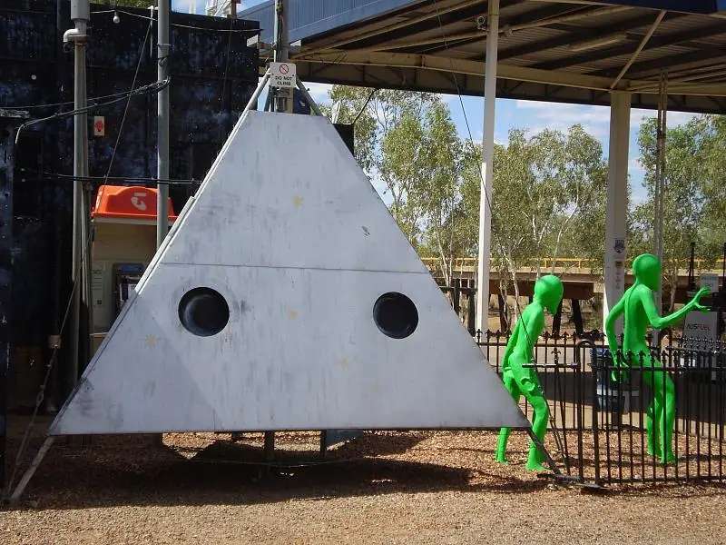
UFO-themed service station at Wycliffe WellPhoto: Frans-Banja Mulder · CC BY 3.0 
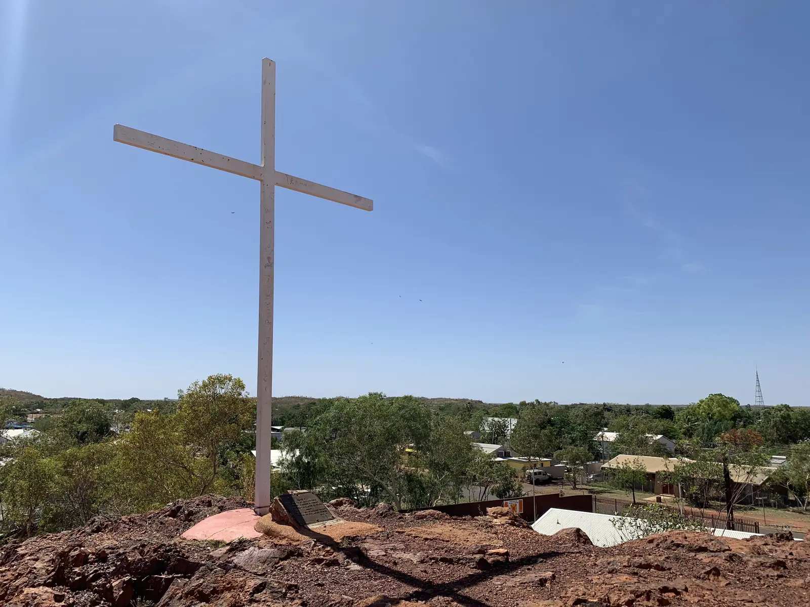
Wycliffe Well on the Stuart HighwayPhoto: AwOiSoAk KaOsIoWa · CC BY-SA 3.0 
Alien murals at Wycliffe WellPhoto: Wycliffewellvisitor · CC0 
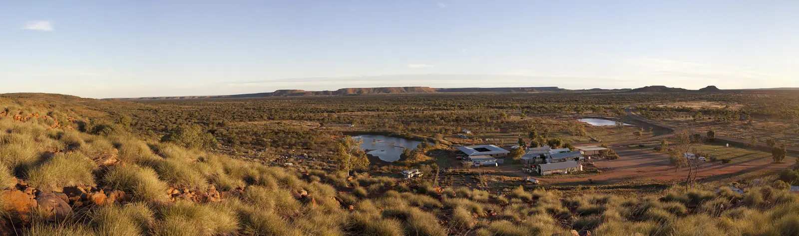
Wycliffe Well from the highwayPhoto: Pavel Špindler · CC BY 3.0
Wycliffe Well is a Stuart Highway holiday-park stop in the Red Centre listing on this site, 130 km south of Tennant Creek and 380 km north of Alice Springs on Tourism NT’s destination copy. The English destination slug returned 404 on the fetch used here; the same Tourism NT destination, including an English history paragraph, remains live on language variants. This hub is the highway park south of Tennant Creek, not a Darwin suburb, not a Queensland town, and not a second Tennant Creek gold street. Darwin is the capital; it has no town page here.
Tourism NT’s history sentence is the geography used here. Wycliffe Well began as a market garden to supply the troops going to and from Darwin during World War II. As the highway developed further after the war, it became a roadhouse supplying fuel and provisions to travellers. Eventually as tourism increased, it has transformed into a substantial and well equipped holiday park. That is a garden-then-bowser founding, not an 1872 telegraph-station story borrowed from Barrow Creek.
The Australian Bureau of Statistics does not publish a 2021 Urban Centre or SAL named Wycliffe Well. The containing locality on the ABS map used here is Davenport (NT). Davenport SAL70076 counted 145 people at the 2021 Census. That is a large rural geography. This hub does not flatten 145 onto the roadhouse. You still need the NT Road Report after rain.
Where it is, and how far
Wycliffe Well sits on the public sealed Stuart Highway, on the same corridor as our Stuart Highway and Adelaide to Darwin guides. North, Tennant Creek is 130 km on Tourism NT. South, Barrow Creek is the next named telegraph reserve on this site; NT Parks puts that reserve 282 km north of Alice Springs. Karlu Karlu / Devils Marbles is 100 km south of Tennant Creek on NT Parks — nearby, not a Wycliffe Well main-street walk.
NT Government’s rest-stop table prints Devils Marbles 103 km south of Tennant Creek and Bonney Well 89 km south of Tennant Creek. Those are rest-stop kilometres, not a Wycliffe Well townsite kilometre invented here.
| Place | Distance from Wycliffe Well (sourced) |
|---|---|
| Tennant Creek | 130 km north (Tourism NT destination copy) |
| Alice Springs | 380 km south (Tourism NT destination copy) |
| Karlu Karlu / Devils Marbles | 100 km south of Tennant Creek (NT Parks); 103 km south of Tennant Creek as a rest stop (NT Government) |
A separate Wycliffe Well–Karlu Karlu kilometre was not on those sourced pages, so this hub does not invent one.
Facts at a glance
Population. No 2021 SAL or UCL named Wycliffe Well. Davenport (NT) SAL70076 is the containing locality: 145 people. Do not use that figure as a roadhouse headcount.
Climate. BOM’s NT named list has no Wycliffe Well table. ALI CURUNG, 015502, 21.00°S, 134.40°E, elevation 375 m, commenced 1967, status open, latest available data 14 December 2015. Mean maximum (21 years, 1988–2014): January 37.9 °C (hottest month by mean max), June 24.1 °C coolest mean max — not July (24.3 °C). Mean minimum: January 23.8 °C, July 7.4 °C, annual 16.6 °C. Mean rainfall (28 years, 1967–2015): annual 386.6 mm. Mean days of rain ≥ 1 mm: 32.9. See Wycliffe Well weather.
Visitor information. Tourism NT’s destination copy and NT Parks’ Karlu Karlu page are the official listings used here. Karlu Karlu phone: 08 8951 8250. Roads: NT Road Report.
Traditional Owners
A Traditional Owner nation named for the Wycliffe Well townsite was not on the Tourism NT destination page fetched for this rebuild. NT Parks’ Karlu Karlu page: this name is shared by the Kaytete, Warumungu, Warlpiri and Alyawarra traditional owners of the area. Traditional owners ask that the karlu (marbles) are not climbed. Ownership of the reserve was officially given back on 27 October 2008. The reserve is now jointly managed. That is a park sentence. This guide does not flatten it onto the roadhouse. Confirm current wording at Karlu Karlu. Stay on public highways. See visiting Country respectfully.
History
Tourism NT: market garden for troops on the Darwin run in World War II, then a roadhouse as the highway developed, then a holiday park as tourism increased. The destination copy also says Wycliffe Well has built a reputation around extraterrestrial sightings. This hub reports that official wording; it does not invent a sighting log.
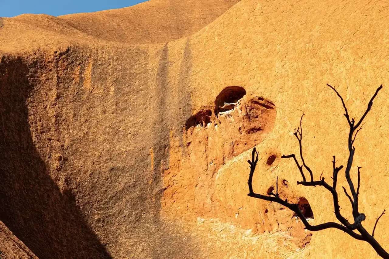
Karlu Karlu, nearby on NT Parks, is a different story: gigantic boulders, jointly managed, recognised in August 2026 as a Dark Sky Sanctuary by DarkSky International — the third in Australia and the first in the NT on that Parks page. That is a reserve fact, not a Wycliffe Well main-street observatory this hub will timetable.
Things to do
Official named things to do sit at the park and next door at Karlu Karlu.
- Holiday park stop — Tourism NT: substantial and well equipped holiday park; fuel and provisions as a roadhouse type
- Karlu Karlu / Devils Marbles — NT Parks, 100 km south of Tennant Creek; short walks, geological features, wildlife, camping; Visitor Pass required
- Davenport Ranges National Park (Iytwelepenty) — named by Tourism NT as nearby; this site’s Tennant Creek guide already treats it as a high-clearance 4WD park with no services
- Dark sky at Karlu Karlu — NT Parks, August 2026 sanctuary listing; no light pollution on that page
See things to do in Wycliffe Well.
Where to stay
Tourism NT names a holiday park at Wycliffe Well after the roadhouse years. NT Parks names a book-ahead campground at Karlu Karlu. Those are official named types, not a ranked motel strip. If the park is full, Tennant Creek is 130 km north.
- How to choose: Wycliffe Well accommodation
- Camping detail: Wycliffe Well caravan parks
- Operator enquiries: feature your business
Caravan and camping
The Stuart Highway is sealed. Tourism NT describes a holiday park. NT Parks requires online booking for Karlu Karlu camping; pets are permitted in the day-use carpark only on a lead and are not permitted in the campground; generators are not permitted; drones are not permitted. Read Wycliffe Well caravan parks and outback camping. Wet-season flooding is an NT Road Report question.
Fuel and services
A stop Tourism NT treats as 130 km south of Tennant Creek will not match that town for a hospital. Tourism NT names fuel-and-provision services as the roadhouse type. This guide does not list other bowser brands or invent clinic hours. Fill in Tennant Creek if you are unsure. A hospital name for Wycliffe Well is not on the sourced pages used here.
Road access
Stuart Highway sealed north–south. NT Road Report is the authority. Stay on gazetted roads. Karlu Karlu is off the Stuart; NT Parks: stay on designated roads and tracks. Iytwelepenty / Davenport Ranges is a 4WD park on this site’s Tennant Creek wording, not a Wycliffe Well street.
Nearby parks and towns
Parks (nearby, not in-town):
- Karlu Karlu / Devils Marbles — 100 km south of Tennant Creek, NT Parks
- Davenport Ranges National Park (Iytwelepenty) — named by Tourism NT as nearby; confirm access on NT Parks before you treat it as a day trip
Towns on this site:
- Tennant Creek — 130 km north (Tourism NT)
- Barrow Creek — south on the Stuart, telegraph reserve
- Three Ways — north of Tennant Creek, Barkly junction
- Ti Tree — further south toward Alice Springs
When to go, and how long
NT Parks for Karlu Karlu: April to September cooler months; heat warning October to April, days can exceed 40 °C. BOM Ali Curung’s January mean maximum of 37.9 °C is the hottest month on the nearest named table. June’s 24.1 °C mean maximum and July’s 7.4 °C mean minimum, with August’s 4.1 mm, is the Dry.
An hour covers fuel and a Karlu Karlu photograph if that reserve is the one you want. A night covers the named holiday park if a site exists. Iytwelepenty is a separate 4WD plan, not a town walk.
Operators who want a checked listing: feature your business. The listings slot on this hub stays empty until then.
Plan this trip
Tell us the dates, who you are travelling with and where you need help. We reply with planning notes for Wycliffe Well — we are not a booking agent.
Events and road-conditions newsletter
Occasional notes on outback festivals, race days and official road-condition sources — not a daily blast. We use these details only to send the newsletter.
Northern Territory · Red Centre
Things to do in Wycliffe Well
Things to do in Wycliffe Well: Tourism NT holiday park and UFO reputation, Karlu Karlu 100 km south of Tennant Creek, Davenport Ranges named nearby. Not a Darwin page.
Read · 4 min
Northern Territory · Red Centre
Wycliffe Well accommodation
Where to stay at Wycliffe Well: Tourism NT names a holiday park. NT Parks names a book-ahead campground at Karlu Karlu. Confirm before you unhitch. Not a Darwin page.
Read · 3 min
Northern Territory · Red Centre
Wycliffe Well caravan parks
Camping at Wycliffe Well: Tourism NT names a holiday park. NT Parks names a book-ahead campground at Karlu Karlu. Confirm before you unhitch. Not a Darwin page.
Read · 3 min
Northern Territory · Red Centre
Wycliffe Well weather
Wycliffe Well climate from BOM Ali Curung (015502): January mean max 37.9 °C, June 24.1 °C, annual rainfall 386.6 mm. No Wycliffe Well BOM table. Not a Darwin table.
Read · 4 min
Frequently asked questions
Is Wycliffe Well a Darwin suburb?
No. Tourism NT’s destination copy puts Wycliffe Well 130 km south of Tennant Creek and 380 km north of Alice Springs on the Stuart Highway. It is not a Darwin suburb and not a second Tennant Creek main street. Darwin is the capital; it has no town page here.
How far is Wycliffe Well from Tennant Creek and Alice Springs?
Tourism NT: 130 km south of Tennant Creek and 380 km north of Alice Springs. NT Parks puts neighbouring Karlu Karlu / Devils Marbles Conservation Reserve 100 km south of Tennant Creek. Confirm the day’s drive on the NT Road Report.
What is Wycliffe Well’s population?
The ABS does not publish a 2021 Urban Centre or suburbs-and-localities named Wycliffe Well. The containing locality on the ABS map used here is Davenport (NT) SAL70076, 145 people at the 2021 Census. That is a large rural geography. This hub does not flatten 145 onto the roadhouse.
What is there to do at Wycliffe Well?
Tourism NT: Wycliffe Well has built a reputation around extraterrestrial sightings. Located nearby is Karlu Karlu / Devils Marbles Conservation Reserve and the gateway to Davenport Ranges National Park (Iytwelepenty). NT Parks: Karlu Karlu is 100 km south of Tennant Creek; traditional owners ask that the karlu are not climbed; an NT Parks Visitor Pass is required.
What is the weather like at Wycliffe Well?
BOM’s NT named list has no Wycliffe Well table. This guide uses Ali Curung (015502, open): January mean maximum 37.9 °C, June 24.1 °C, annual rainfall 386.6 mm (28 years, 1967–2015). Temperature means use 21 years (1988–2014). Latest available data 14 December 2015.
Can I camp at Wycliffe Well?
Yes, as named types. Tourism NT’s destination copy describes a substantial and well equipped holiday park after the wartime market garden became a roadhouse. NT Parks names a book-ahead campground at Karlu Karlu. Confirm sites when you arrive rather than assuming a 24-hour park sheet.
Sources and further reading
Facts on this page were checked against these primary and official sources. Conditions change — confirm before you travel or buy.
- Wycliffe Well (Tourism NT destination) — Tourism NT
- Karlu Karlu / Devils Marbles Conservation Reserve — Northern Territory Government
- Climate statistics for Ali Curung (015502) — Bureau of Meteorology
- Davenport (NT) 2021 Census QuickStats (SAL70076) — Australian Bureau of Statistics
- Road rest stops in NT — Northern Territory Government
- NT Road Report — Northern Territory Government