At a glance
Sourced facts only. Distances and services change — confirm before you travel.
- Population
- 174 people (SAL30304, 2021 Census)
- Local government
- Balonne Shire
- Nearest regional city
- St George 112 km (Explore St George Region Bollon Town Map 2026)
- Nearest fuel
- Confirm in the service town named under nearest regional city; this guide does not list bowser brands.
- Nearest hospital or clinic
- Confirm with Queensland Health — do not invent a clinic name.
- Mobile coverage
- Check Telstra and Optus coverage maps before travel; do not assume a signal on floodways, parks or unsealed approaches.
- Best time to visit
- May–September on Bollon Mary St (044010) cooler mean maxima (July 19.2 °C; January 35.7 °C). QLDTraffic after rain.
Climate
Monthly means from the Bureau of Meteorology station Bollon Mary St (044010). This is not a forecast. Commenced 1885. Elevation 187 m. Status: Open. Annual mean rainfall 460.7 mm. Town station.
| Month | Mean max (°C) | Mean min (°C) | Rainfall (mm) |
|---|---|---|---|
| Jan | 35.7 | 21.7 | 62.8 |
| Feb | 34.4 | 21.1 | 52.9 |
| Mar | 32.1 | 18.4 | 50.3 |
| Apr | 27.9 | 13.2 | 30.6 |
| May | 23.1 | 8.7 | 31.6 |
| Jun | 19.6 | 5.8 | 29.6 |
| Jul | 19.2 | 4.3 | 27.0 |
| Aug | 21.6 | 5.7 | 21.4 |
| Sep | 25.7 | 9.3 | 24.1 |
| Oct | 29.7 | 13.8 | 35.8 |
| Nov | 32.9 | 17.4 | 42.7 |
| Dec | 35.1 | 20.0 | 51.1 |
Bollon in pictures
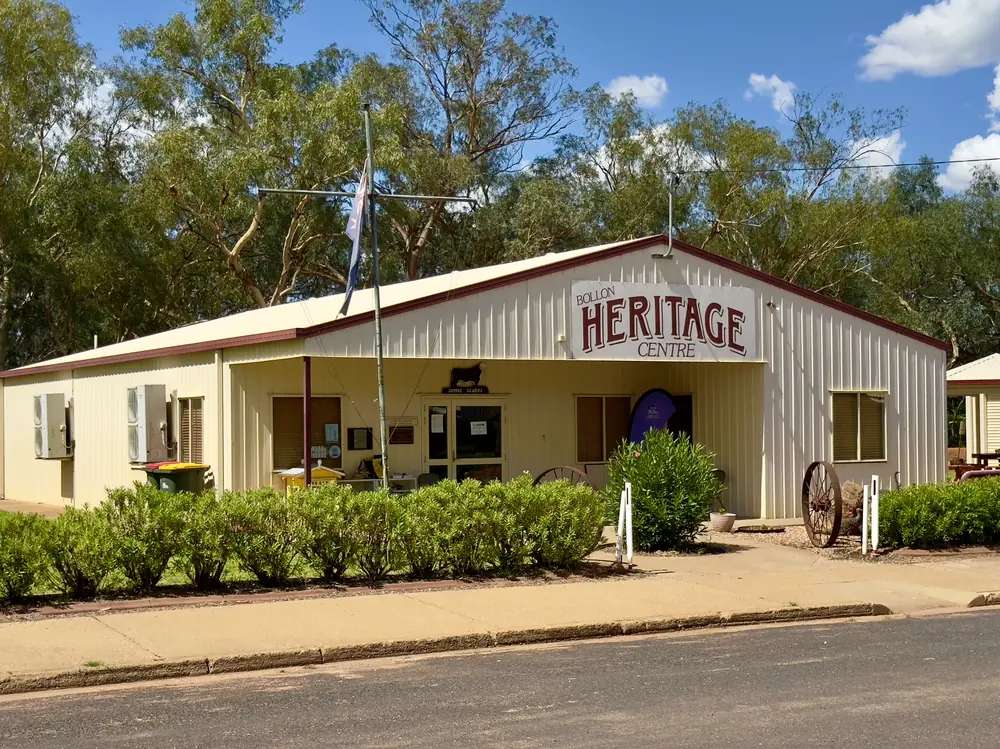
Bollon Heritage CentrePhoto: Chris Olszewski · CC BY-SA 4.0 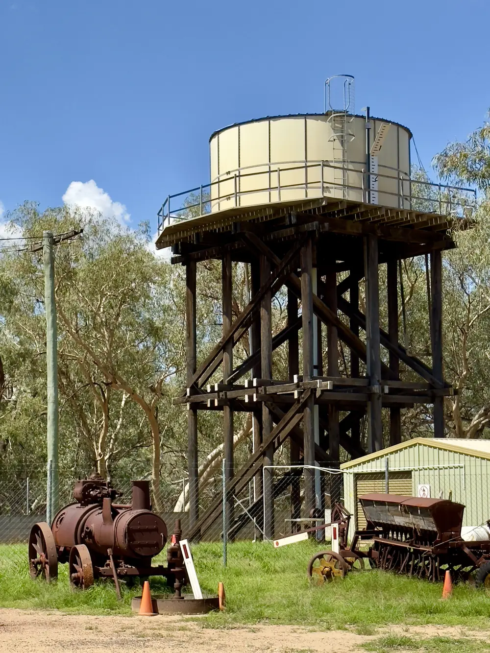
Bollon water towerPhoto: Chris Olszewski · CC BY-SA 4.0 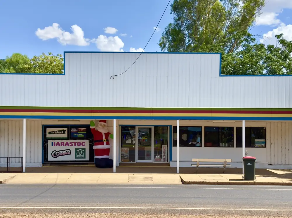
Shop at BollonPhoto: Chris Olszewski · CC BY-SA 4.0 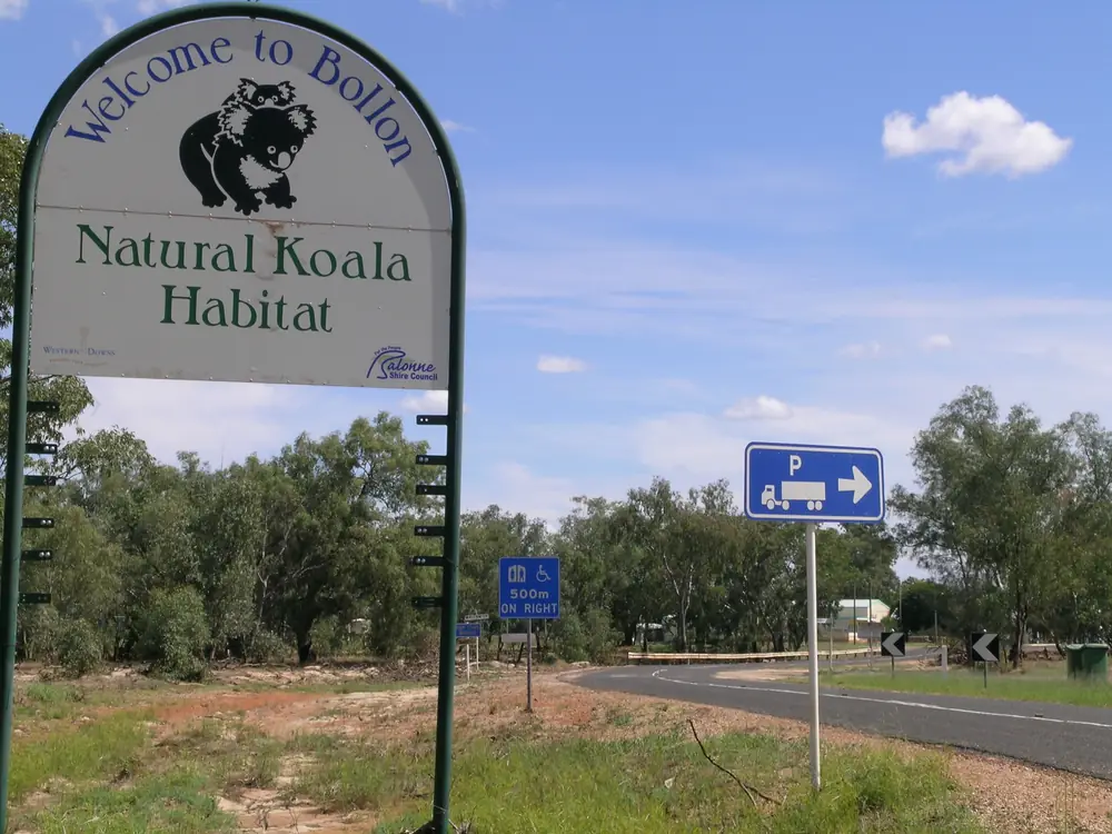
A view over BollonPhoto: Cgoodwin · CC BY-SA 3.0
Bollon sits on Wallam Creek west of St George, where the Adventure Way (Balonne Highway) crosses Balonne Shire’s red-soil western run through Queensland’s south-west. Outback Queensland says that as you head west the soil deepens to a rich red, and that the name is believed to come from the word Bolion, meaning stone tomahawk or axe. Explore St George Region’s Bollon Town Map 2026 prints St George 112 km, Cunnamulla 181 km, Mitchell 209 km and Thargomindah 377 km. Dirranbandi Map 2026 prints Bollon 105 km; Adventure Way Loop puts Dirranbandi to Bollon at 106 km. The Balonne Highway is sealed through town in ordinary weather. You still need QLDTraffic after rain, because a 112 km run to St George is no use if the highway is closed.
The Australian Bureau of Statistics does not publish a 2021 Urban Centre (UCL) named Bollon. Use suburbs-and-localities SAL30304: 174 people, median age 47, sex split 54.9% male / 45.1% female. QuickStats also prints 48 families and 151 private dwellings. Small random adjustments apply. Travellers stop for Wallam Creek camping, Nullawokka First Nations Gallery, the Heritage Centre, and a booked Thrushton National Park day if the dirt roads are dry.
Where it is, and how far
Bollon sits on the Adventure Way between St George’s cotton and grape country and Cunnamulla on the Warrego. Explore St George Region names it as one of seven shire towns with St George, Dirranbandi, Hebel, Nindigully, Thallon and Mungindi. Queensland Parks puts Thrushton National Park 40 km north-east of Bollon and 102 km west of St George. Official kilometre figures disagree slightly by product, which is why this table cites each source rather than blending them.
| Place | Distance from Bollon (sourced) |
|---|---|
| St George | 112 km (Bollon Town Map 2026 and St George Map 2026) |
| Cunnamulla | 181 km (Bollon Town Map 2026) |
| Mitchell | 209 km (Bollon Town Map 2026); St George Map 2026 prints Mitchell 210 km from St George |
| Thargomindah | 377 km (Bollon Town Map 2026) |
| Dirranbandi | 105 km (Dirranbandi Map 2026); 106 km (Adventure Way Loop); Outback Queensland lists Dirranbandi Retreat 99 km |
| Hebel | Outback Queensland lists Hebel Hotel 114 km |
| Thrushton National Park | 40 km north-east (Queensland Parks); fuel and supplies page also prints Bollon 40 km from the park |
Charleville is further north-west of this corridor, not a 20-minute side road. Roma is the Warrego service centre if you are arriving from Brisbane via Mitchell.
Facts at a glance
Population. ABS 2021 Census, Suburbs and Localities SAL30304: 174 people. Median age 47. 48 families, 151 private dwellings. No UCL. Use the Bollon SAL QuickStats.
Climate. Bureau of Meteorology station BOLLON MARY ST, 044010, commenced 1885, location 28.03°S, 147.48°E, elevation 187 m, status open. Mean maximum temperature (111 years, 1907–2026): January 35.7 °C, July 19.2 °C, annual 28.1 °C. Mean minimum (109 years, 1907–2026): January 21.7 °C, July 4.3 °C, annual 13.3 °C. Mean rainfall (139 years, 1885–2026): annual 460.7 mm; January 62.8 mm wettest mean month; August 21.4 mm driest. Mean days of rain ≥ 1 mm: 42.6 a year. Full columns: BOM Bollon Mary St. See Bollon weather.
Visitor information. There is no Bollon VIC on the sourced pages. Use the St George Region Visitor Information Centre, 114 St George’s Terrace, (07) 4620 8877, vic@balonne.qld.gov.au. Queensland Parks’ Thrushton tourism-links page also names the Cunnamulla Fella Information Centre at 2 Jane Street, (07) 4655 8470, if you are continuing west on the Adventure Way.
Traditional Owners
Explore St George Region’s Bollon Town Map 2026 prints Nullawokka First Nations Gallery & Tours on Guwamu/Kooma Country. The same organisation’s Adventure Way Loop and Bollon town page name cultural tours with Bill Speedy, a Gwamu/Kooma elder, booked through the gallery, and a Bollon Cultural Walk with a descendant of the local Gwamu/Kooma people. The Nullawokka listing also uses Kooma. This hub follows those official spellings rather than flattening several Condamine–Balonne nations onto one label. Confirm a sentence you want on a plaque with the St George visitor centre.
History
Outback Queensland’s name note — Bolion, stone tomahawk or axe — is the official tourism etymology this hub will print. It does not invent a gazettal year the sourced pages did not give.
The Bollon Heritage Centre on Main Street, on Explore St George Region’s listing, showcases stories of early pioneers and settlers, agriculture, medical, schooling, social gatherings and Aboriginal culture. Outback Queensland: pastoral history and a long connection to sheep, shearing and life on the land. The 2023 St George visitor guide adds that country surrounding Bollon and between the Moonie, Balonne and Narran Rivers was regarded as some of the best sheep country within the state, and that shearing displays at the Heritage Centre are a tribute to that era.
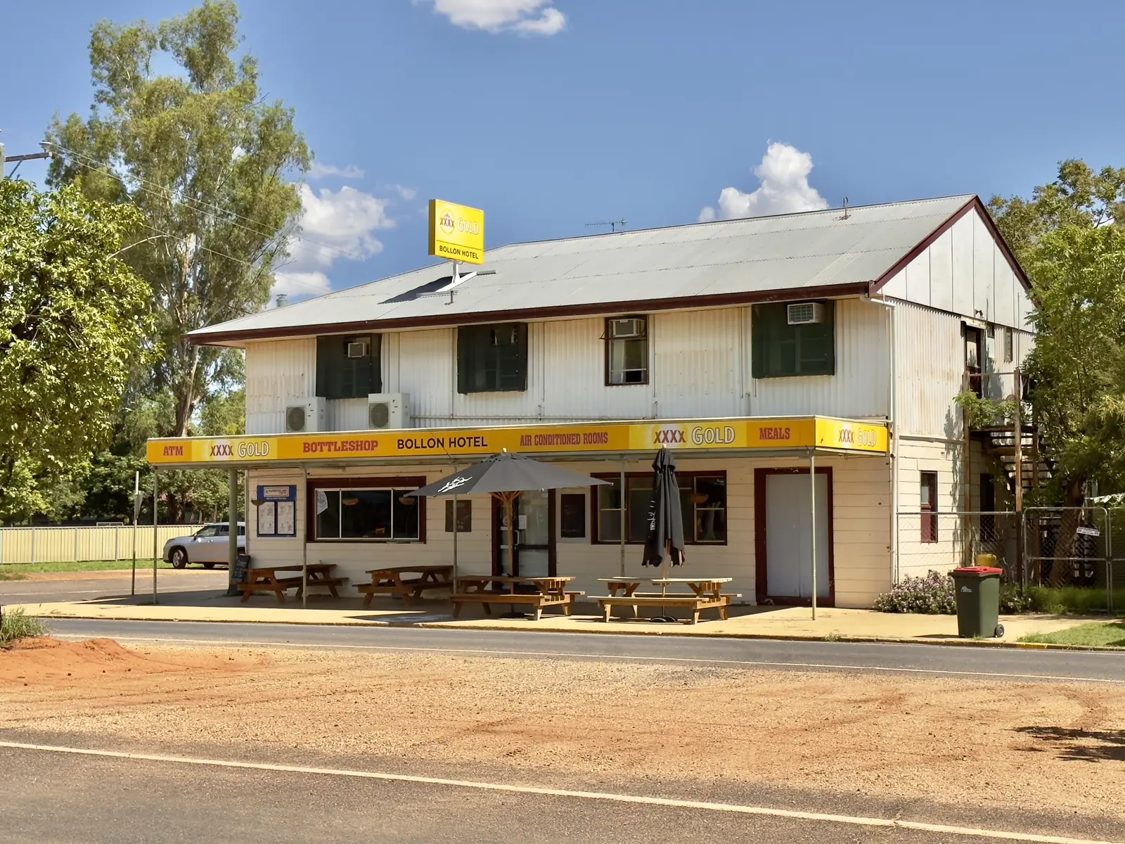
Explore St George Region’s hotel listing is also a history source, even though the building is closed: the Bollon Hotel was the fourth hotel on the site dating back to 1953; the site had continual use as a hotel for more than 130 years. The same listing: Please note that the Bollon Hotel burnt down on 22 February 2025 and it is currently closed. That is why this hub will not send you there for a room or a meal. Confirm what is open on Main Street with (07) 4620 8877.
Wallam Creek’s campsite machinery display includes an old drilling rig from 1951 on Outback Queensland’s town page.
Things to do
Wallam Creek walkway and camp. Outback Queensland: picnic spots, birdlife, resident Muscovy ducks, and a chance of a koala among the gums. A 1.2 km path leads to the main street. Adventure Way Loop: creek-side walkway featuring Aboriginal dreamtime artwork. The 2026 town map pins a River Walk, Dream Time Walk, Scar Tree, Machinery Display and Walter Austin Memorial Park.
Nullawokka First Nations Gallery & Tours. Explore St George Region’s listing: 22A Main Street; historic bank building on that listing; Monday–Friday 9.00am–1.00pm printed, call ahead; phone 0413 062 068, nullawokka@outlook.com. Exclusive 4WD tour limited to 4 passengers, bush medicine, scar trees, animal tracking, gourmet bush tucker lunch. Adventure Way Loop also names a two-hour Bollon Cultural Walk. Book. Do not treat Country as a self-guided fossick.
Bollon Heritage Centre — Main Street. Confirm hours at the St George VIC.
Little Mulga Mailbox — Outback Queensland: a local shop tucked inside the post office.
Wallam Creek Homestead–Bollon Service Station — Explore St George Region: 69–73 Main Street, coffee, food, pantry, batteries, rural and produce supplies, gifts and gas; open 7 days; 0428 688 226. Outback Queensland names Wallam Creek General Store for a meal or to stock up before heading west.
Thrushton National Park — gazetted 1990; mulga, spinifex, ironbark, cypress pine, kurrajong; Neabul Creek lined with river red gums and coolibahs; at least 100 bird species; koalas and echidnas; ruins of Thrushton homestead (the house originally part of the Dunkeld Inn, moved on carts drawn by 40 horses in 1921). 4WD, dry weather, permit camping. See things to do in Bollon.
Explore St George Region also says Bollon is famous for emus strolling the streets. That is a camera note, not a wildlife guarantee.
Where to stay
Outback Queensland and Explore St George Region name:
- Wallam Creek Free Campsite, William Street — toilets, showers, barbecue, rubbish disposal, no bookings, RV-friendly, a few days along the creek on those pages. Pets: Outback Queensland’s attraction listing says pet friendly — enquire.
Queensland Parks names:
- Thrushton Homestead and Thrushton Woolshed camping — permit required, 4WD only, no facilities, no caravans on the park camping pages, no pets, no generators, no campfires.
Outback Queensland’s Bollon stay list also names Dirranbandi Retreat and Caravan Park at 99 km and Hebel Hotel at 114 km as nearby, not in-town. Adventure Way Loop still prints the Bollon Hotel as a stay option; the later council hotel listing records the 22 February 2025 fire and closure. Do not treat that itinerary line as a booking. Confirm at (07) 4620 8877.
- How to choose: Bollon accommodation
- Camping detail: Bollon caravan parks
- Operator enquiries: feature your business
If you need a motel room, St George is 112 km east on the 2026 map and Dirranbandi is 105–106 km. Those are distance facts, not booking guarantees.
Caravan and camping
Vans use Bollon as an Adventure Way overnight on Wallam Creek — quieter than St George, with a named free camp rather than a commercial park strip. Official named camping in town is Wallam Creek. Ask the St George VIC for stay limits, dump points and whether the creek camp is open after flood. Thrushton is a park booking, not a sedan overflow. Read Bollon caravan parks and outback camping.
After rain, the Balonne Highway and Thrushton’s dirt roads are the constraint. QLDTraffic first. Balonne also points to emergency.balonne.qld.gov.au.
Fuel and services
A locality of 174 people will not match St George for a hospital or a supermarket aisle. Explore St George Region names Wallam Creek Homestead–Bollon Service Station at 69–73 Main Street, open seven days. This guide does not list bowser brands. Confirm fuel when you arrive. Fill up here if the servo is open, or in St George or Cunnamulla. Queensland Parks: fuel and supplies for Thrushton are in Bollon 40 km away or St George 102 km away — national park bases are not service stations. For current questions, use Balonne Shire Council and (07) 4620 8877.
Road access
The Balonne Highway / Adventure Way is the sealed spine through Bollon between St George and Cunnamulla. It is a freight road. Pull over for road trains. After rain, check QLDTraffic and 13 19 40. Do not drive around closed signs to keep a Wallam Creek night.
Queensland Parks’ Thrushton access: best via the Mitchell–Bollon Road; Homeboin turnoff 51 km north of Bollon or 156 km south of Mitchell. From Bollon: 14 km east on the Balonne Highway, left at Mourilyan Road, 17 km north to the southern boundary; leave station gates as you find them. From St George: Middle Road turnoff 51 km west, then 36.3 km and Rutherglen Road 14.5 km to the north-eastern corner. Dry weather. 4WD recommended. Do not cross bore drains in a vehicle.
East: St George 112 km, then Roma or Dirranbandi. West: Cunnamulla 181 km, then Eulo and Thargomindah. North: Mitchell 209 km on the town map. South-east: Dirranbandi 105–106 km.
Nearby parks and towns
Parks and named nature sites:
- Wallam Creek walkway, camp and Walter Austin Memorial Park (Outback Queensland / Explore St George Region)
- Thrushton National Park — 40 km north-east, 4WD, permit camping
Towns on this site:
- St George — 112 km; Balonne River, four-highway crossroads
- Dirranbandi — 105–106 km; cotton, Cubbie Station, rail precinct
- Hebel — 114 km on Outback Queensland’s stay list; border town
- Thallon and Nindigully — grain silos and Moonie River pub on the same shire loop
- Cunnamulla — 181 km; Warrego, Cunnamulla Fella
- Mitchell — 209 km; Great Artesian Spa
When to go, and how long
Bollon Mary Street’s January mean maximum of 35.7 °C is hot for a 1.2 km creek walk at midday. July’s 19.2 °C mean maximum is the comfortable walking season; July’s 4.3 °C mean minimum is why a creek camp needs a layer. Annual rainfall 460.7 mm is similar to St George Airport’s 477.0 mm — wet enough that Wallam Creek and Thrushton dirt can close. Queensland Parks: cooler months April to September are the best times to visit Thrushton; summer days can exceed 40 °C. Two hours at Nullawokka (if a weekday morning), the Heritage Centre and the creek is the minimum. A night lets you use Wallam Creek if the VIC has confirmed it. Two nights only if a cultural tour is booked, or Thrushton is dry, booked, and QLDTraffic agrees. Be self-sufficient in the park: at least 7 litres of water per person per day, extra four or five days of supplies.
Operators who want a checked listing: feature your business. The listings slot on this hub stays empty until then.
Plan this trip
Tell us the dates, who you are travelling with and where you need help. We reply with planning notes for Bollon — we are not a booking agent.
Events and road-conditions newsletter
Occasional notes on outback festivals, race days and official road-condition sources — not a daily blast. We use these details only to send the newsletter.
Queensland · South West
Bollon accommodation
Where to stay in Bollon: Wallam Creek Free Campsite, plus Dirranbandi and St George rooms. The Bollon Hotel burnt down on 22 February 2025 and is closed.
Read · 4 min
Queensland · South West
Bollon caravan parks
Camping in Bollon: Wallam Creek Free Campsite on William Street, plus Thrushton National Park permit camps 40 km north-east. Confirm at the St George VIC.
Read · 4 min
Queensland · South West
Bollon weather
Bollon climate from BOM Bollon Mary St (044010, open): January mean max 35.7 °C, July 19.2 °C, annual rainfall 460.7 mm. Use QLDTraffic for the week you drive.
Read · 4 min
Queensland · South West
Things to do in Bollon
Things to do in Bollon: Wallam Creek walkway, Nullawokka First Nations Gallery, Heritage Centre and Thrushton National Park 40 km north-east. Confirm at the St George VIC.
Read · 5 min
Frequently asked questions
How far is Bollon from St George, Dirranbandi and Cunnamulla?
Explore St George Region’s Bollon Town Map 2026 prints St George 112 km, Cunnamulla 181 km, Mitchell 209 km and Thargomindah 377 km. Dirranbandi Map 2026 prints Bollon 105 km from Dirranbandi. Adventure Way Loop puts Dirranbandi to Bollon at 106 km.
What is Bollon’s population?
174 people at the 2021 Census for Bollon suburbs-and-localities (SAL30304). The ABS does not publish a 2021 Urban Centre (UCL) named Bollon.
Can I camp at Wallam Creek?
Yes. Outback Queensland and Explore St George Region name Wallam Creek Free Campsite on William Street as an RV-friendly free camp with toilets, showers, barbecue and a 1.2 km walk to the main street. No bookings. Confirm stay limits at the St George visitor centre.
Is the Bollon Hotel open?
Explore St George Region’s hotel listing: Please note that the Bollon Hotel burnt down on 22 February 2025 and it is currently closed. Do not plan a room or a meal there. Ask the St George visitor centre what is open.
What is the weather like in Bollon?
BOM Bollon Mary St (044010) is open: January mean maximum 35.7 °C, July 19.2 °C, annual rainfall 460.7 mm (139 years, 1885–2026).
How far is Thrushton National Park?
Queensland Parks puts Thrushton 40 km north-east of Bollon and 102 km west of St George. Access is dry-weather 4WD. Camping needs a permit. Pets are not permitted.
Sources and further reading
Facts on this page were checked against these primary and official sources. Conditions change — confirm before you travel or buy.
- Bollon 2021 Census QuickStats (SAL30304) — Australian Bureau of Statistics
- Climate statistics for Bollon Mary St (044010) — Bureau of Meteorology
- Outback Queensland — Bollon — Outback Queensland Tourism Association
- Wallam Creek Free Campsite, Bollon — Outback Queensland Tourism Association
- Explore St George Region — Bollon — Balonne Shire Council
- Bollon Town Map 2026 (PDF) — Balonne Shire Council
- Adventure Way Loop itinerary — Balonne Shire Council
- Bollon Hotel — Closed — Balonne Shire Council
- Nullawokka First Nations Gallery & Tours — Balonne Shire Council
- Bollon Heritage Centre — Balonne Shire Council
- Wallam Creek Homestead-Bollon Service Station — Balonne Shire Council
- Thrushton National Park — Queensland Parks and Wildlife Service
- Visiting Thrushton safely — Queensland Parks and Wildlife Service
- QLDTraffic — Queensland Government