At a glance
Sourced facts only. Distances and services change — confirm before you travel.
- Population
- 150 people (UCL322027, 2021 Census)Also 214 people at SAL30601 (SAL). Do not mix UCL and SAL in one headcount.
- Local government
- Mareeba Shire
- Traditional Owners
- Wakaman People — Queensland Government native-title media statement, 18 August 2023 (on-country sitting at Chillagoe)Queensland Parks’ caves culture page does not name a single nation. Confirm wording at The Hub.
- Nearest regional city
- Cairns is the named approach on this hub’s distance FAQ
- Nearest fuel
- Confirm in the service town named under nearest regional city; this guide does not list bowser brands.
- Nearest hospital or clinic
- Confirm with Queensland Health — do not invent a clinic name.
- Mobile coverage
- Check Telstra and Optus coverage maps before travel; do not assume a signal on floodways, parks or unsealed approaches.
- Best time to visit
- Dry season about May–September (Queensland Parks wet-season roads December–March on far-north/Gulf pages). Mareeba Airport (031210) January mean maximum 31.2 °C, July 25.2 °C. QLDTraffic in the wet.
Climate
Monthly means from the Bureau of Meteorology station Mareeba Airport (031210). This is not a forecast. Commenced 2000. Elevation 472 m. Status: Open. Annual mean rainfall 894.9 mm. Chillagoe (030140) is rainfall-only and is not on BOM’s Queensland monthly-statistics index. Mareeba Airport is the labelled Mareeba Shire comparison — not a Chillagoe town gauge. Queensland Parks describes Chillagoe seasons separately on the caves visiting-safely page.
| Month | Mean max (°C) | Mean min (°C) | Rainfall (mm) |
|---|---|---|---|
| Jan | 31.2 | 21.5 | 243.1 |
| Feb | 30.7 | 21.5 | 216.7 |
| Mar | 29.9 | 20.8 | 163.4 |
| Apr | 28.6 | 19.3 | 47.7 |
| May | 26.9 | 17.0 | 13.3 |
| Jun | 25.5 | 15.4 | 10.1 |
| Jul | 25.2 | 14.2 | 8.8 |
| Aug | 26.4 | 14.1 | 7.1 |
| Sep | 28.6 | 15.6 | 6.7 |
| Oct | 30.8 | 17.6 | 15.4 |
| Nov | 31.9 | 19.3 | 38.8 |
| Dec | 32.1 | 20.9 | 128.8 |
Chillagoe in pictures
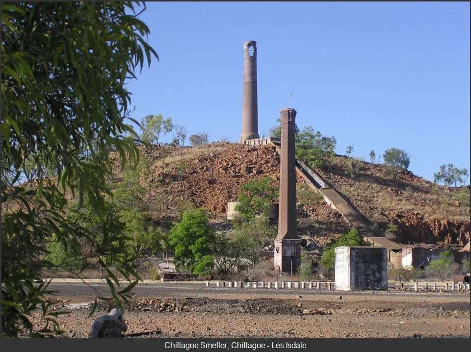
Chillagoe smelter ruinsPhoto: Les Isdale · CC BY 4.0 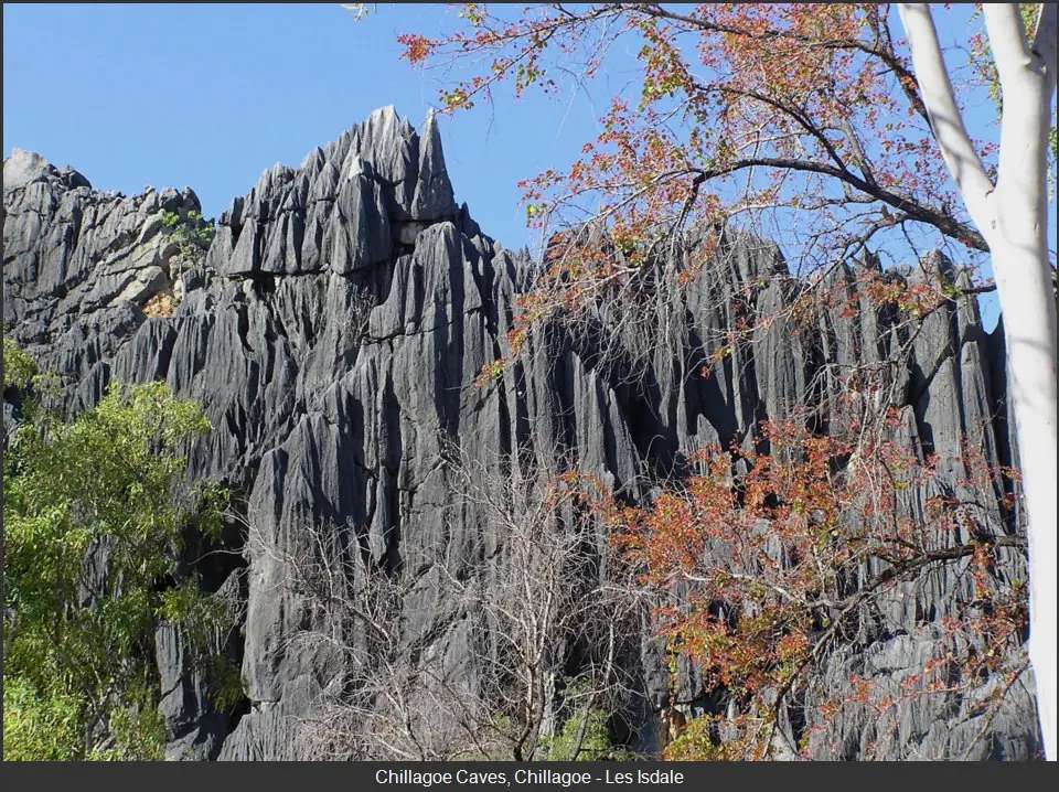
Chillagoe CavesPhoto: Les Isdale · CC BY 4.0 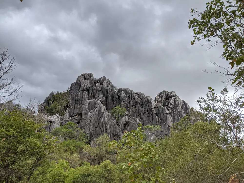
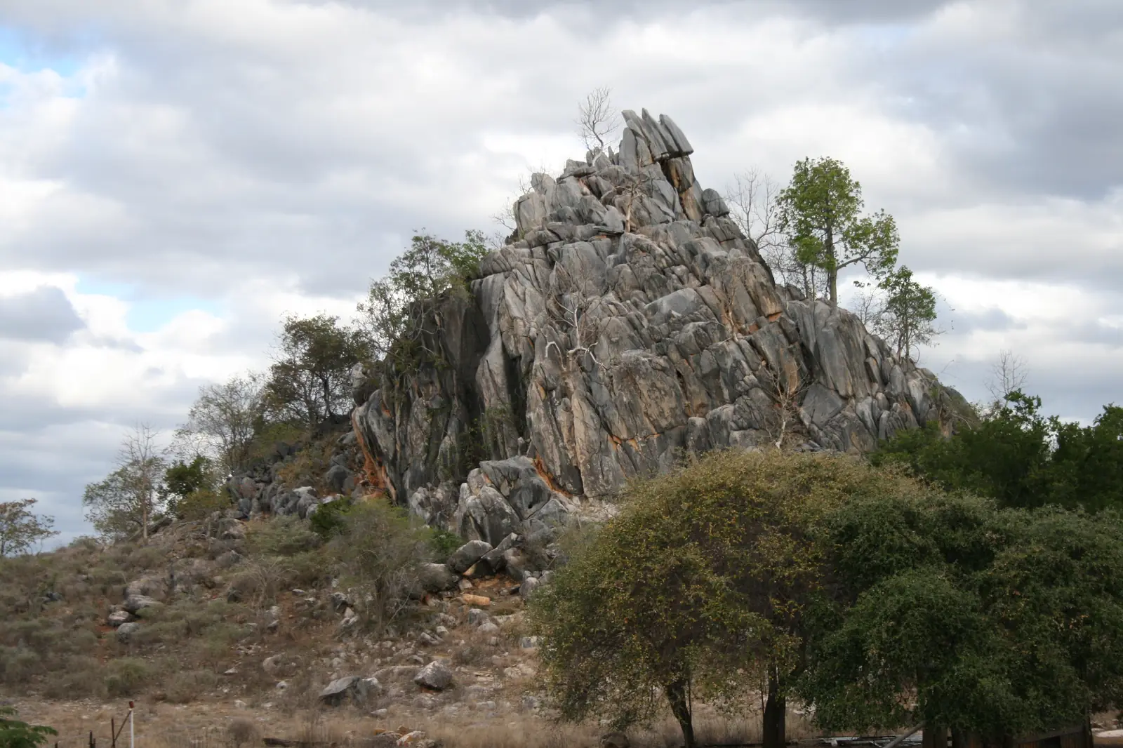
Chillagoe-Mungana Caves National ParkPhoto: Daniel Montesinos · CC BY-SA 4.0 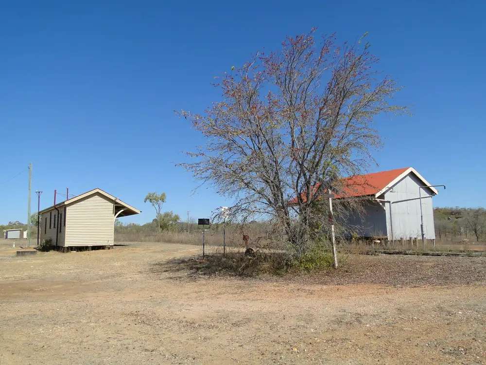
Chillagoe's railway station buildingsPhoto: Peterdownunder · CC BY-SA 4.0
Chillagoe sits in Mareeba Shire on the Savannah fringe west of the Atherton Tablelands, in Queensland’s outback north. Queensland Parks’ Chillagoe-Mungana Caves National Park pages put the town 215 km west of Cairns, around a 3-hour drive. The Savannah Way organisation lists Chillagoe on an Alternate Route of the Savannah Way, reached from Mareeba via Dimbulah and Almaden on a mostly sealed road.
The 2021 Census counted 150 people in the urban centre and 214 in the wider locality. Travellers stop for ranger-guided limestone caves, self-guided karst walks, Mungana rock art and a viewing area over the historic smelters. You still need QLDTraffic in the wet, because Queensland Parks says conventional access is possible in dry weather but roads may be impassable in the summer wet season (December to March on that page). See wet season and road closures.
Where it is, and how far
Chillagoe is the Mareeba Shire limestone town west of the Tablelands. Queensland Parks: access from the northern end of the Atherton Tableland via Mareeba and Dimbulah; the road is sealed to Almaden; over the final 32 km there are both sealed and unsealed sections. A southern Tablelands route via Herberton has more unsealed sections. Another route leads from Undara Volcanic National Park: west along the Gulf Developmental Road for 30 km toward Mount Surprise, then the narrow unsealed Ootaan Road for 140 km to the Burke Developmental Road near Almaden — about 3 hours, four-wheel-drive recommended on that page.
| Place | Distance from Chillagoe (official pages used here) |
|---|---|
| Cairns | 215 km west, around 3 hours (Queensland Parks park and visiting-safely pages). A Queensland Government native-title statement also says approximately 200 km west of Cairns |
| Atherton Tableland accommodation belt | about 110 km east (Queensland Parks things-to-do page) |
| Donna Cave car park | 1.8 km from Chillagoe (Queensland Parks visiting-safely) |
| Balancing Rock car park | 2.5 km (same page) |
| Chillagoe Smelters viewing area | 2.3 km (same page) |
| Royal Arch Cave car park | about 6 km (same page) |
| Mungana / The Archways | 17 km west of Chillagoe (same page) |
| Mareeba / Mount Garnet / Georgetown | named neighbours on this site; no Chillagoe kilometre for those towns on the park pages used here |
| Brisbane | not published on those pages |
Use QLDTraffic for the day you drive. The Burke Developmental Road spelling on Queensland Parks pages is the named freight spine; Savannah Way’s alternate route uses Ootan / Ootaan Road toward Almaden.
Facts at a glance
Population. Australian Bureau of Statistics 2021 Census, Urban Centres and Localities UCL322027, Chillagoe (L): 150 people. Median age 50. Sex split 53.8% male / 46.2% female (84 male, 72 female). Families 36. Private dwellings 103. Average household size 2. Median weekly household income $784. Aboriginal and/or Torres Strait Islander people 36 (24.0%) on that UCL QuickStats table. Use the ABS UCL QuickStats page. The suburbs-and-localities geography (SAL30601) counted 214 people, median age 49, sex split 51.2% male / 48.8% female (109 male, 104 female), 42 families, 143 private dwellings, median weekly household income $772, Aboriginal and/or Torres Strait Islander people 39 (18.2%). Do not mix the two.
Climate. Bureau of Meteorology station CHILLAGOE, 030140, opened 1902, closed 22 October 2015, 17.15°S, 144.52°E, elevation 364 m. The Climate Data Online monthly rainfall table fetched for this guide prints all-years means: annual 869.3 mm; January 226.4 mm wettest mean month; February 218.2 mm; July 4.0 mm driest. Median annual 867.8 mm. Highest annual total in that table 1796.8 mm; lowest 316.3 mm. Means on a closed station do not update with new years. BOM does not publish a temperature climate-averages table for this site on the product used here. Queensland Parks’ visiting-safely page: two seasons — wet December to the end of March, dry April until November; mean annual rainfall 850 mm on that park page; summer temperatures usually 25°C to 35°C; October and November can be very hot and dry; winter months from May until August can be cool at night. See Chillagoe weather.
Visitor information. Chillagoe Hub Information Centre, 21–23 Queen Street, Chillagoe QLD 4871, phone (07) 4094 7111, email ChillagoeCaveBooking@des.qld.gov.au, opening hours 8:00am to 3:30pm every day except Christmas Day — Queensland Parks’ about page and Tropical Tablelands Tourism’s visitor-centres listing. Operated by Queensland Parks and Wildlife Service. Pre-book cave tours, then drop in to pay; preferred payment eftpos on the visiting-safely page.
Traditional Owners
A Queensland Government media statement of 18 August 2023 records that the Federal Court recognised the non-exclusive native title rights of the Wakaman People at an on-country sitting in Chillagoe. The statement describes Wakaman Country as the savannah lands west of the Great Dividing Range in far North Queensland, bounded by Mungana and Chillagoe in the north; Mount Surprise to the south; Almaden in the east; and Dagworth in the west. Visit as a guest; see visiting Country respectfully.
Queensland Parks’ nature-culture-history page for the caves does not name a single Aboriginal nation. It states that Aboriginal people of this area have lived here for thousands of years, with evidence of occupation at Mount Mulligan dating back as far as 37,000 years, and it describes European settlement from the Hodgkinson Goldfields rush of 1876. This hub follows the Queensland Government native-title statement for the Wakaman determination at Chillagoe, and does not invent a park-page nation the QPWS culture text does not print.
History
Queensland Parks’ culture page is the mining-history source used here. Chillagoe Station was established by William Atherton in the late 1880s. Deposits of copper, silver, lead, mica and some gold were found in surrounding areas. Early small blast furnaces at Muldiva, Calcifer and Mungana processed ore; mining magnate John Moffatt (printed John Mofatt on that park page) was the driving force. Heavy machinery came by horse-drawn wagons from Port Douglas.
In the late 1890s the railway was extended from Mareeba to Chillagoe. By 1901, when the railway was completed, Chillagoe was a flourishing town and the Chillagoe Smelters began operations. The mines, railway and smelters provided work for up to 1000 people on that page. Ownership passed to the Queensland Government in 1919. The smelters operated until 1943 and treated 1.25 million tons of ore, yielding 60,000 tons of copper, 50,000 tons of lead, 181 tons of silver and five tons of gold. Buildings and equipment were auctioned in 1950. The smelters are listed on the Queensland Heritage Register. A restricted access area has been declared over the site: observe from the elevated viewing area only.
Things to do
Ranger-guided cave tours. Queensland Parks: Donna, Trezkinn and Royal Arch caves, daily except Christmas Day, tickets in advance from The Hub. Access to those three caves is only possible on a ranger-guided tour. Numbers are limited. Phone (07) 4094 7111. Cave temperatures are approximately 22°C on the visiting-safely page.
Self-guided caves and walks. Queensland Parks things-to-do: walking opportunities ranging from 440 m to 9 km. Savannah Way’s Chillagoe page names The Archways (220 m / 30 mins / Easy), Pompeii Cave, Bauhinia Cave, Balancing Rock (440 metre moderate track, 2.5 km south), and the Royal Arch track (9 km / 2.5 hours / Easy) from Balancing Rock car park past the Wullumba Aboriginal rock art site. Always take at least two torches in self-guided caves; never cave alone.
Aboriginal rock art. Queensland Parks: at Mungana, a small gallery 1.2 km along the gravel road to The Archways; Wullumba art site a short walk from Balancing Rock car park, 2.5 km from Chillagoe. Stay on designated paths. Do not touch imagery.
Chillagoe Smelters viewing area, 2.3 km from town. Restricted access. Asbestos and other toxic contaminants. Serious injury, disease or death could result from entering the fenced area.
Birdwatching and wildlife. More than 75 bird species recorded around Chillagoe on the park things-to-do page, including pale-headed rosellas, apostle birds and blue-faced honeyeaters. Agile wallabies along walking tracks at dusk. Bats and white-rumped swiftlets in caves — avoid disturbing colonies; swiftlets nest November to February.
A fuller order of a day is on things to do in Chillagoe.
Nearby, not in the main street: Undara Volcanic National Park on the Savannah Way toward Mount Surprise. Mungana is 17 km west, not a Chillagoe footpath.
Where to stay
Queensland Parks’ things-to-do page: camping is not permitted in Chillagoe-Mungana Caves National Park. Motel, hotel, caravan park and camping accommodation is available in the Chillagoe township. A range of accommodation and camping is also available on the Atherton Tableland (about 110 km east). Savannah Way: Chillagoe has a selection of caravan parks and accommodation. Those are official named types, not a ranked inventory. Confirm at The Hub, (07) 4094 7111.
- How to choose a type of stay: Chillagoe accommodation
- Parks and camping: Chillagoe caravan parks
- Operator enquiries: feature your business
If Chillagoe is full, Mareeba is the larger shire centre on this site; the Tablelands belt is about 110 km east on the park page. That is geography, not a booking guarantee.
Caravan and camping
Vans use Chillagoe as a Savannah Way alternate-route overnight before or after cave tours. Official named camping on the pages used here is in the township (caravan park and camping as types). There is no park camping. Confirm dump-point rules at The Hub. Read Chillagoe caravan parks and outback camping.
After rain, the last unsealed kilometres west of Almaden are the constraint. January’s closed-station mean of 226.4 mm is not a drizzle. QLDTraffic first. Pets are not permitted in the national park.
Fuel and services
Queensland Parks visiting-safely: fuel, mechanical repairs and supplies are available at Chillagoe. That page does not print bowser brands, hours or prices, and this hub does not invent them. Fill up with a plan before you leave Mareeba if you are arriving after dark on a wet Sunday. A town-centre count of 150 people will not match Mareeba for a supermarket strip.
For current questions, use The Hub (07) 4094 7111, Mareeba Shire and QLDTraffic. Tropical Tablelands Tourism also lists the Mareeba Heritage Museum & Tourist Information Centre, 345 Byrnes Street, Mareeba.
Road access
The Burke Developmental Road via Mareeba and Dimbulah is the named sealed-to-Almaden spine. Conventional vehicles in dry weather; wet-season closures are real. Check QLDTraffic and 13 19 40. Do not drive around closed signs to keep a cave-tour booking.
East: Mareeba, then Cairns 215 km. South-east: Herberton / southern Tablelands, more unsealed. South: Ootaan Road 4WD toward Mount Surprise and Undara. West: Mungana 17 km. Further Savannah Way towns on this site: Mount Garnet, Georgetown, Forsayth.
Nearby parks and towns
Named nature and culture sites (official pages):
- Chillagoe-Mungana Caves National Park — Donna, Trezkinn, Royal Arch, Balancing Rock, The Archways
- Mungana Aboriginal art site and Wullumba art site
- Chillagoe Smelters viewing area (restricted access)
- Undara Volcanic National Park — further south-west on the Savannah Way
Towns on this site:
- Mareeba — shire centre on the Burke Developmental Road
- Mount Garnet — Kennedy Highway / Savannah Way
- Mount Surprise — Ootaan Road / Savannah Way
- Georgetown — Etheridge headquarters
- Forsayth — Etheridge rail town
When to go, and how long
Queensland Parks: park open year-round, though roads may be impassable December to March. January’s Chillagoe rainfall mean of 226.4 mm on the closed BOM table is the wet-season core on paper. July’s 4.0 mm is the driest month. Guided cave tours run daily except Christmas Day — a dry-season habit for 2WD visitors, not a closed cave season if the road is open.
The Hub’s 8:00am–3:30pm desk is the booking constraint: arriving at dusk without a pre-booked tour is how people miss Donna Cave. Forty-five minutes at Balancing Rock and the smelters viewing area is the minimum if tours are full. A night lets you take a morning cave tour. Two nights if you are adding Mungana, the Royal Arch walk and a second cave. Three nights if QLDTraffic or a wet-season cell forces a buffer.
Operators who want a checked listing: feature your business. The listings slot on this hub stays empty until then.
Plan this trip
Tell us the dates, who you are travelling with and where you need help. We reply with planning notes for Chillagoe — we are not a booking agent.
Events and road-conditions newsletter
Occasional notes on outback festivals, race days and official road-condition sources — not a daily blast. We use these details only to send the newsletter.
Queensland · Outback North
Chillagoe accommodation
Where to stay in Chillagoe: motel, hotel, caravan park and camping types named by Queensland Parks. Confirm at The Hub. No invented operator names.
Read · 4 min
Queensland · Outback North
Chillagoe caravan parks
Camping in Chillagoe: caravan park and camping types in town as named by Queensland Parks. No park camping. Confirm at The Hub.
Read · 4 min
Queensland · Outback North
Chillagoe weather
Chillagoe climate from closed BOM station 030140: annual mean rainfall 869.3 mm, January 226.4 mm, July 4.0 mm. No local temperature table — Queensland Parks describes 25–35°C summers.
Read · 5 min
Queensland · Outback North
Things to do in Chillagoe
Things to do in Chillagoe: ranger-guided Donna, Trezkinn and Royal Arch caves, self-guided karst walks, Mungana rock art and the Chillagoe Smelters viewing area.
Read · 6 min
Frequently asked questions
How far is Chillagoe from Cairns?
Queensland Parks’ Chillagoe-Mungana Caves National Park pages put Chillagoe 215 km west of Cairns, around a 3-hour drive, via Mareeba and Dimbulah. A Queensland Government native-title media statement also describes Chillagoe as approximately 200 km west of Cairns.
What is Chillagoe’s population?
150 people at the 2021 Census for the Chillagoe urban centre (UCL322027). Median age 50. The suburbs-and-localities figure (SAL30601) is 214 people and is not the town-centre count.
Do I need to book the cave tours?
Yes. Queensland Parks: ranger-guided tours of Donna, Trezkinn and Royal Arch caves run daily except Christmas Day. Tickets must be purchased in advance from Queensland Parks staff at The Hub, 21–23 Queen Street. Phone (07) 4094 7111, 8:00am to 3:30pm.
What is the weather like in Chillagoe?
BOM Chillagoe (030140) monthly rainfall means: annual 869.3 mm, January 226.4 mm wettest, July 4.0 mm driest. The station closed on 22 October 2015. BOM does not publish a Chillagoe temperature climate-averages table on the product used here. Queensland Parks describes wet season December to March and summer temperatures usually 25°C to 35°C.
Whose Country is Chillagoe on?
A Queensland Government media statement of 18 August 2023 records the Federal Court native-title determination for the Wakaman People, held on-country at Chillagoe. It describes Wakaman Country as savannah lands west of the Great Dividing Range, bounded by Mungana and Chillagoe in the north. Queensland Parks’ park culture page does not name a single nation for the caves.
Sources and further reading
Facts on this page were checked against these primary and official sources. Conditions change — confirm before you travel or buy.
- Climate statistics for Mareeba Airport (031210) — Bureau of Meteorology
- Chillagoe (L) 2021 Census QuickStats (UCL322027) — Australian Bureau of Statistics
- Chillagoe 2021 Census QuickStats (SAL30601) — Australian Bureau of Statistics
- Monthly rainfall — Chillagoe (030140) — Bureau of Meteorology
- Chillagoe-Mungana Caves National Park — Queensland Parks and Wildlife Service
- Visiting safely — Chillagoe-Mungana Caves National Park — Queensland Parks and Wildlife Service
- Things to do — Chillagoe-Mungana Caves National Park — Queensland Parks and Wildlife Service
- Nature, culture and history — Chillagoe-Mungana Caves National Park — Queensland Parks and Wildlife Service
- About — Chillagoe-Mungana Caves National Park — Queensland Parks and Wildlife Service
- Chillagoe Alternate Route — Savannah Way
- North Queensland’s Wakaman People have Native Title recognised — Queensland Government
- Visitor Information Centres — Atherton Tablelands — Tropical Tablelands Tourism
- QLDTraffic — Queensland Government