At a glance
Sourced facts only. Distances and services change — confirm before you travel.
- Population
- 87 people (SAL30952, 2021 Census)QuickStats notes limited tables because of the small population.
- Local government
- Etheridge Shire
- Traditional Owners
- Ewamian — Unearth Etheridge / this hub’s sourced Country FAQ
- Nearest regional city
- Forsayth is the named Etheridge neighbour on this hub’s distance FAQ
- Nearest fuel
- Confirm in the service town named under nearest regional city; this guide does not list bowser brands.
- Nearest hospital or clinic
- Confirm with Queensland Health — do not invent a clinic name.
- Mobile coverage
- Check Telstra and Optus coverage maps before travel; do not assume a signal on floodways, parks or unsealed approaches.
- Best time to visit
- Dry season about May–September (Queensland Parks wet-season roads December–March on far-north/Gulf pages). Georgetown Airport (030124) January mean maximum 33.9 °C, July 28.8 °C. QLDTraffic in the wet.
Climate
Monthly means from the Bureau of Meteorology station Georgetown Airport (030124). This is not a forecast. Commenced 2004. Elevation 302 m. Status: Open. Annual mean rainfall 843.4 mm. Einasleigh Township is not on the monthly index used here. Georgetown Airport is the labelled Etheridge Shire comparison on the Einasleigh weather page.
| Month | Mean max (°C) | Mean min (°C) | Rainfall (mm) |
|---|---|---|---|
| Jan | 33.9 | 23.4 | 257.4 |
| Feb | 33.3 | 22.9 | 214.4 |
| Mar | 33.5 | 22.0 | 137.1 |
| Apr | 32.9 | 19.5 | 23.1 |
| May | 30.5 | 16.6 | 12.8 |
| Jun | 28.9 | 14.0 | 7.7 |
| Jul | 28.8 | 13.2 | 10.2 |
| Aug | 30.5 | 13.7 | 1.4 |
| Sep | 33.7 | 17.0 | 5.7 |
| Oct | 36.3 | 20.6 | 14.0 |
| Nov | 36.9 | 22.9 | 77.6 |
| Dec | 36.3 | 23.7 | 143.2 |
Einasleigh in pictures
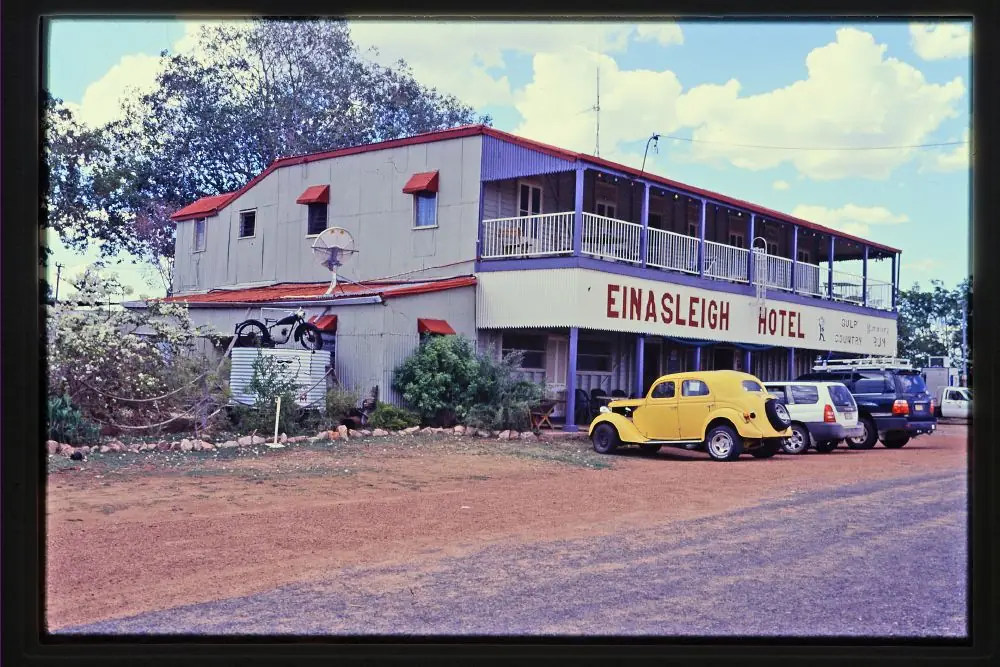
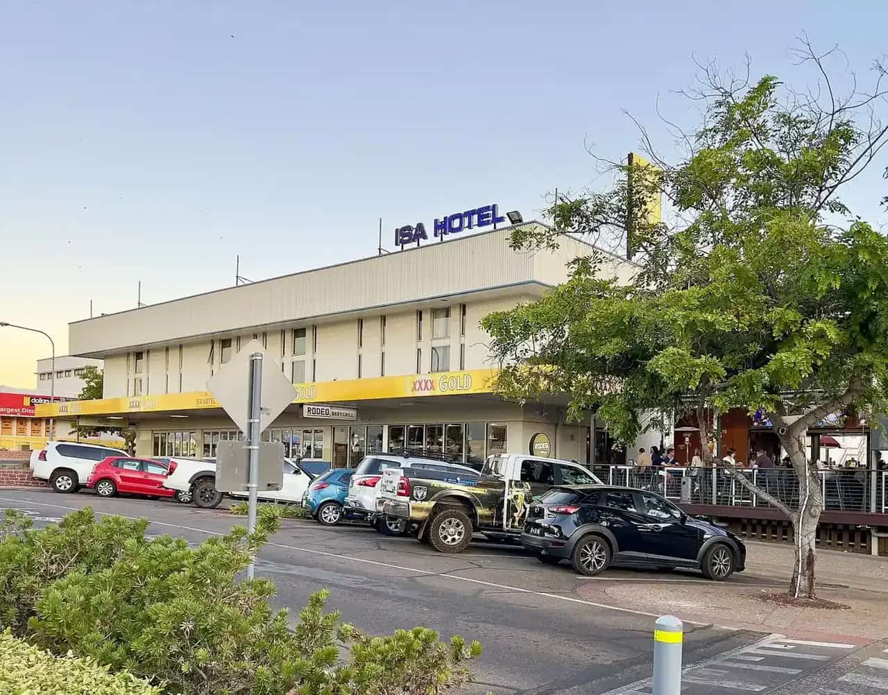
Einasleigh HotelPhoto: Heritage branch staff · CC BY 3.0 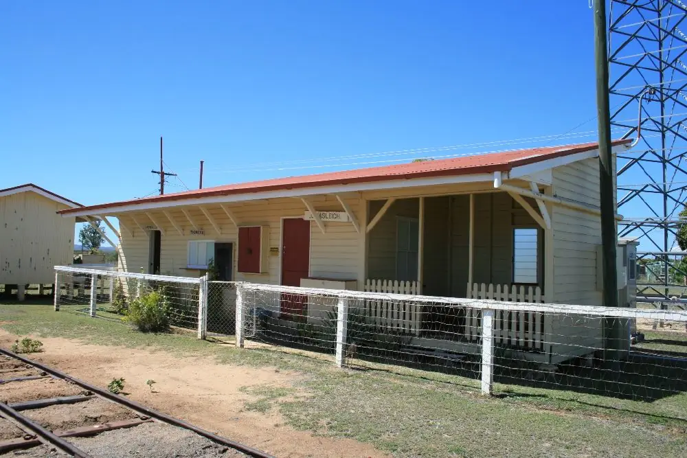
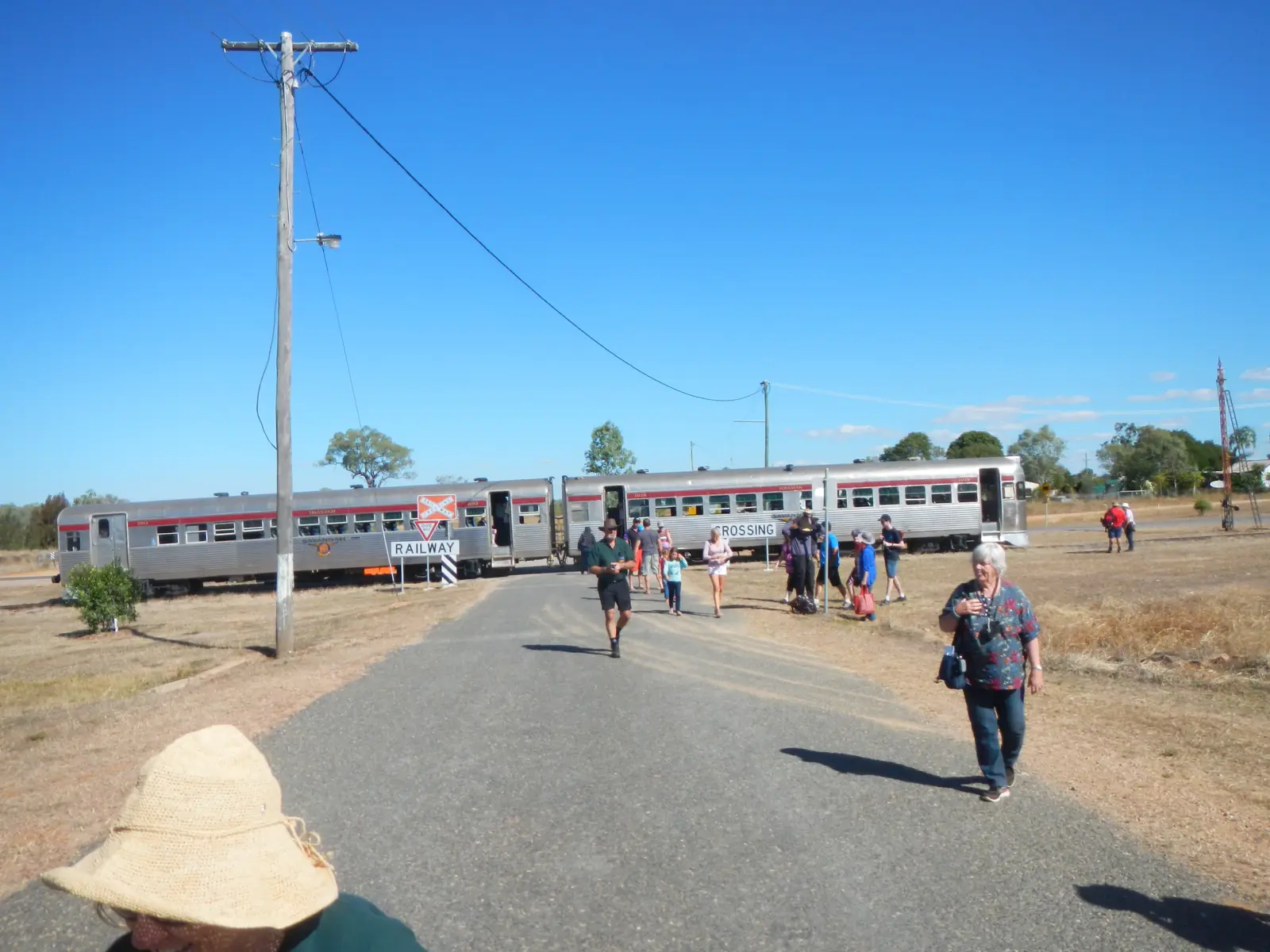
Einasleigh's railway stationPhoto: Heritage branch staff · CC BY 3.0 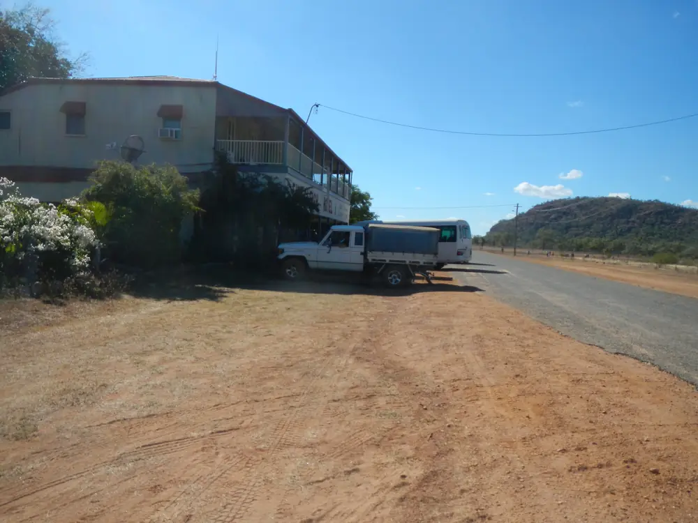
A view over EinasleighPhoto: Lobster1 · CC BY-SA 3.0 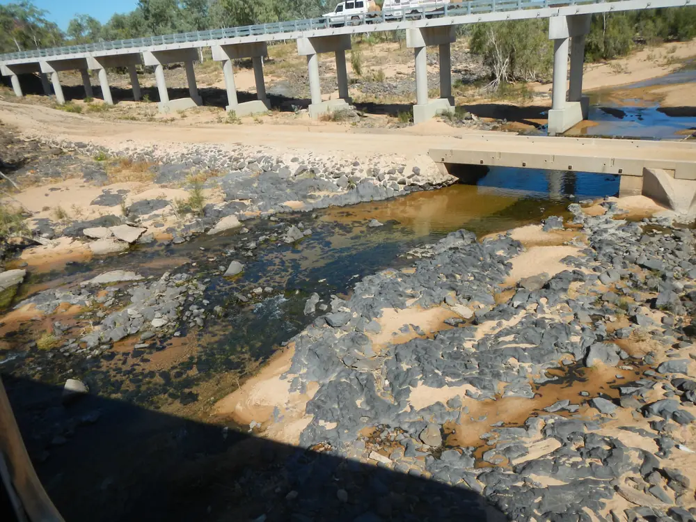
Old and new crossings of the Einasleigh RiverPhoto: Lobster1 · CC BY-SA 3.0
Einasleigh sits on the eastern edge of the Newcastle Range, on the banks of the Copperfield River, in Etheridge Shire in Far North Queensland. Unearth Etheridge — Etheridge Shire Council’s tourism site — uses those words, and its gorges page also names the Einasleigh River at Copperfield Gorge. This guide keeps both official river names rather than picking one and pretending the other page is wrong. The township is on Ewamian Country in the Outback North directory.
This is not a city. Unearth Etheridge calls Einasleigh the smallest town in the region. The 2021 Census counted 87 people in the locality. Travellers stop for Copperfield Gorge, the heritage-listed Einasleigh Hotel, and a Savannahlander pub-side pause on official pages. You still need QLDTraffic in the wet, because a 72 km run to Forsayth is no use if the road is closed.
Where it is, and how far
Einasleigh is the copper-and-gorge township on Etheridge’s Gems and Gorges loop, between Forsayth and the Lynd Junction. The map is the kilometre source used here. This hub does not invent an Einasleigh–Georgetown or Einasleigh–Cairns figure those pages do not print.
| Place | Distance from Einasleigh (Etheridge Gems and Gorges map) |
|---|---|
| Forsayth | 72 km / about one hour |
| Lynd Junction (Kennedy Developmental Road / Gregory Developmental Road) | 76 km / about 1.15 hours |
| Georgetown | not published as an Einasleigh kilometre on that map; Georgetown to Forsayth is 45 km on the same map |
| Cobbold Gorge | not published as an Einasleigh kilometre on that map; Cobbold is 45 km from Forsayth |
| Cairns or Brisbane | not published on the Etheridge pages used here |
Greenvale is the Gregory Developmental Road neighbour further toward Charters Towers. Mount Surprise sits on the Savannah Way, not on this gorge-loop kilometre table.
Facts at a glance
Population. Australian Bureau of Statistics 2021 Census, Suburbs and Localities SAL30952, Einasleigh: 87 people. Median age 47. Sex split 62.9% male / 37.1% female. Families 18. Private dwellings 76. Average household size 2.1. Median weekly household income $1,156. The ABS does not publish a 2021 Urban Centre (UCL) named Einasleigh. QuickStats notes limited information because of the small population, and small random adjustments for privacy. Use the Einasleigh SAL QuickStats.
Climate. Bureau of Meteorology station EINASLEIGH TOWNSHIP, 030014, opened 1908, closed 21 September 2008, 18.52°S, 144.09°E, elevation 458 m. The Climate Data Online monthly rainfall table fetched for this guide prints all-years means: annual 746.5 mm; January 200.4 mm and February 200.0 mm the wettest mean months; August 5.3 mm driest. Median annual 673.8 mm. Highest annual total in that table 2073.0 mm; lowest 281.4 mm. Means on a closed station do not update with new years. BOM does not publish a temperature climate-averages table for Einasleigh. For a still-open nearby temperature table, use Georgetown Airport, 030124. See Einasleigh weather.
Visitor information. There is no Einasleigh VIC on the Unearth Etheridge town page. Use the TerrEstrial Centre, 20 Low Street, Georgetown, (07) 4079 9092. The Einasleigh town page prints the same Georgetown contact block.
Traditional Owners
Ewamian people are named for Einasleigh on a Traditional Owner corporation page. Ewamian People Aboriginal Corporation states that the Ewamian People are the Traditional Owners of an area of north-western Queensland extending over the Gilbert and Einasleigh River catchments, including Georgetown, Mount Surprise, Forsayth and Einasleigh. Ewamian Country includes Undara Volcanic National Park, Cobbold Gorge and Talaroo Hot Springs. Visit as a guest; see visiting Country respectfully.
History
Unearth Etheridge’s Einasleigh page is the town-origin source used here. The township, originally named Copperfield, was laid out in 1900 by the mining warden on a new township reserve near the Einasleigh Company’s copper mine. Although the company had been formed only the previous year, two hotels, a store, a billiard room, and butcher and baker shops were already being built, and funds were being collected for a school. The town briefly became the largest population centre in the shire during construction of the Chillagoe Company’s Etheridge Railway in 1907–10. After the mine closed in the 1920s, the township almost disappeared and was saved from extinction only by its location on the railway.
The same page records the mineral story behind that townsite. Richard Daintree found the Einasleigh copper deposit in 1866 — one of the earliest mineral discoveries in north Queensland. It was initially too remote to develop and was abandoned after Daintree’s death. The Chillagoe Company rediscovered the shaft and began developing it in 1900 through the Einasleigh Copper Mines Company. A small blast furnace was erected in 1902, but until the Etheridge Railway opened in 1910 operations proved uneconomical because of high transport costs. The mine closed when the Chillagoe Smelters shut in 1914. Acquired by the Queensland Government in 1919, it returned to production the following year as the Einasleigh State Mine, and finally closed in 1922 as ore reserves depleted and the world copper price dropped.
Unearth Etheridge also places the town at the foot of Red Rock Hill and the Caterpillar Range, on the old Chillagoe to Forsayth railway. This hub stops where Etheridge stops. It does not invent a surviving smelter tour.
Things to do
Copperfield Gorge is the reason most people turn off the Forsayth loop. Unearth Etheridge’s gorges page: sheer walls dropping into a sandy riverbed revealing lava-flow layers; a popular swimming spot; free; tours that share the history can be booked through Cobbold Gorge Tours and the Savannahlander. The town page: formed thousands of years ago when lava flows carved through basalt; self-guided; walk, climb down carefully, swim or fish. Watch your step and do not walk too close to the edge.
The Einasleigh Hotel is named as heritage-listed, with meals and accommodation, a stone’s throw from the gorge. The Gems and Gorges map says the Savannahlander stops right outside the pub. Etheridge’s current Einasleigh page adds that the train is presently unable to make the entire Cairns–Forsayth trip and that a bus covers the sections it cannot. Confirm the live pattern at savannahlander.com.au.
The park behind the pub is named with a shaded adventure playground, free electric barbecues, a tennis court, the History Memorial Tree (names of former residents on the leaves; six stories on the town page’s “while in” list), and a monument to men who lost their lives in the Blackhawk Training Disaster as they helped establish the park. The Einasleigh cemetery is described as well maintained. The “while in Einasleigh” list also names a photograph in the stocks outside the police station, with a note to refrain from throwing things at the person in them.
Easter@Einasleigh — horse racing and rodeo over the Easter weekend — is the main event on the town page. Annual campdraft and horse sports are also named. Confirm the current year’s program at the TerrEstrial rather than treating a tourism sentence as a ticket.
A fuller order of a day is on things to do in Einasleigh.
Where to stay
Unearth Etheridge’s accommodation directory names Einasleigh stays as the Einasleigh Hotel (accommodation and meals, 07 4062 5222) and Silk’s Rest (camping and amenities, 07 4062 5266). The town page repeats those two names and calls the township an essential stop for people who want one of the truly small towns of the outback. Those names belong on the official stay page. This page does not publish prices or ratings.
- How to choose: Einasleigh accommodation
- Camping: Einasleigh caravan parks
- Phone the TerrEstrial: (07) 4079 9092
- Operator enquiries: feature your business
If Einasleigh is full, Forsayth is 72 km on the Etheridge map and Georgetown sits beyond Forsayth on the same loop. That is geography, not a booking guarantee.
Caravan and camping
Vans use Einasleigh because the map names a caravan park and a town-hall park with free barbecues and public toilets in Baroota Street. Etheridge’s stay directory names Silk’s Rest for camping. Confirm stay limits at 20 Low Street. Read Einasleigh caravan parks and outback camping.
After rain, the Forsayth–Einasleigh road is the constraint. January’s closed-station mean of 200.4 mm is not a drizzle. QLDTraffic first.
Fuel and services
A locality of 87 people will not match Georgetown for fuel, groceries or a hospital. Etheridge’s Info and Services list for Einasleigh names only the Einasleigh Hotel (refreshments, meals, accommodation, miniature collection, 07 4062 5222) and Silk’s Rest (camping, 0740625266). This guide does not invent a bowser, a supermarket or a clinic that the shire list does not print. Fill up in Georgetown, or confirm fuel at Forsayth’s Goldfield’s Hotel pump (named on Outback Queensland’s Forsayth listing) before you commit the 72 km.
The Gems and Gorges map notes public toilets at the Town Hall in Baroota Street. For current questions, use the TerrEstrial (07) 4079 9092 and Etheridge Shire Council (07) 4079 9090.
Road access
The named loop is Forsayth–Einasleigh–Lynd Junction on the Gems and Gorges map. The Lynd Junction is the junction of the Kennedy Developmental Road and the Gregory Developmental Road, with the Oasis Roadhouse named on that map. Check QLDTraffic and 13 19 40. Do not drive around closed signs to keep a gorge swim.
North-west: Forsayth, then Georgetown and the Savannah Way. South: Lynd Junction, then choices toward Charters Towers on the Gregory Developmental Road via Greenvale, or the Kennedy Developmental Road. Cobbold Gorge is a Forsayth-side spur, not an Einasleigh main-street walk.
Nearby parks and towns
Parks and gorges (official pages):
- Copperfield Gorge — free, self-guided, beside town
- Cobbold Gorge — guided only, from Forsayth
- Undara Volcanic National Park — lava tubes by guided tour only
Towns on this site:
- Forsayth — 72 km; Savannahlander terminus
- Georgetown — TerrEstrial Centre
- Mount Surprise — Undara and O’Brien’s Creek
- Greenvale — Gregory Developmental Road
When to go, and how long
January’s closed-station rainfall mean of 200.4 mm is the wet-season core on paper. August’s 5.3 mm is the driest month on that table. Easter@Einasleigh is the named crowd weekend; rooms and camps will not behave like a quiet Tuesday. Two hours at the gorge, the park and the hotel verandah is the minimum. A night lets you swim at a cooler hour if the gorge has water. Two nights only if you are adding Forsayth, Cobbold or the Lynd Junction and QLDTraffic agrees. Three tourist days in a town of 87 is more than the sourced main-street list supports unless Easter racing is the reason you came.
Operators who want a checked listing: feature your business. The listings slot on this hub stays empty until then.
Plan this trip
Tell us the dates, who you are travelling with and where you need help. We reply with planning notes for Einasleigh — we are not a booking agent.
Events and road-conditions newsletter
Occasional notes on outback festivals, race days and official road-condition sources — not a daily blast. We use these details only to send the newsletter.
Queensland · Outback North
Einasleigh accommodation
Where to stay in Einasleigh: the heritage-listed hotel and Silk’s Rest camping as named by Etheridge Shire. Confirm at the TerrEstrial Centre in Georgetown.
Read · 3 min
Queensland · Outback North
Einasleigh caravan parks
Camping in Einasleigh: Silk’s Rest as named by Etheridge Shire, plus the map’s caravan-park type. Confirm at the TerrEstrial in Georgetown. Not a city park strip.
Read · 3 min
Queensland · Outback North
Einasleigh weather
Einasleigh climate from BOM Einasleigh Township (030014): annual mean rainfall 746.5 mm, January 200.4 mm, August 5.3 mm. Station closed 2008; no local temperature averages table.
Read · 4 min
Queensland · Outback North
Things to do in Einasleigh
Things to do in Einasleigh: self-guided Copperfield Gorge, the heritage-listed hotel, History Memorial Tree and Easter@Einasleigh as named by Etheridge Shire.
Read · 5 min
Frequently asked questions
Is Einasleigh a city?
No. Unearth Etheridge calls Einasleigh the smallest town in the shire. The 2021 Census counted 87 people in Einasleigh suburbs-and-localities (SAL30952). The ABS does not publish a 2021 Urban Centre (UCL) named Einasleigh.
How far is Einasleigh from Forsayth?
Etheridge Shire’s Gems and Gorges map puts Einasleigh 72 km (about one hour) from Forsayth, and the Lynd Junction 76 km (about 1.15 hours) from Einasleigh.
What is Copperfield Gorge?
Unearth Etheridge’s gorges page places Copperfield Gorge alongside Einasleigh township, with sheer walls dropping into a sandy riverbed that shows lava-flow layers. It is free and open to the public. The town page places the gorge on the Copperfield River at the edge of town and describes the visit as self-guided.
What is Einasleigh’s population?
87 people at the 2021 Census for Einasleigh suburbs-and-localities (SAL30952). Median age 47. QuickStats notes limited tables because of the small population.
What is the weather like in Einasleigh?
BOM Einasleigh Township (030014) monthly rainfall means: annual 746.5 mm, January 200.4 mm, August 5.3 mm. The station closed 21 September 2008. BOM does not publish a temperature climate-averages table for Einasleigh.
Whose Country is Einasleigh on?
Ewamian People Aboriginal Corporation names the Ewamian People as Traditional Owners of an area including Georgetown, Mount Surprise, Forsayth and Einasleigh, across the Gilbert and Einasleigh River catchments.
Sources and further reading
Facts on this page were checked against these primary and official sources. Conditions change — confirm before you travel or buy.
- Einasleigh 2021 Census QuickStats (SAL30952) — Australian Bureau of Statistics
- Monthly rainfall — Einasleigh Township (030014) — Bureau of Meteorology
- Climate statistics for Georgetown Airport (030124) — Bureau of Meteorology
- Unearth Etheridge — Einasleigh — Etheridge Shire Council
- Unearth Etheridge — Gorges — Etheridge Shire Council
- Unearth Etheridge — Accommodation — Etheridge Shire Council
- Unearth Etheridge — Info and Services — Etheridge Shire Council
- Lava Tubes, Gems and Gorges Trail map — Etheridge Shire Council
- Ewamian People Aboriginal Corporation — About — Ewamian People Aboriginal Corporation
- Savannahlander — Cairns Kuranda Steam
- QLDTraffic — Queensland Government