At a glance
Sourced facts only. Distances and services change — confirm before you travel.
- Local government
- Shire of Ashburton
- Traditional Owners
- Yinhawangka People in the Paraburdoo region (Shire of Ashburton History and Heritage; 2021/22 Annual Report). Visit Ashburton also names Banjima, Tinhawangka, Kurrama and Innawonga as Traditional Owners and Custodians of Karijini National Park.
- Nearest regional city
- Tom Price, 80 km north (Visit Ashburton Paraburdoo destination page and destination-guide table). Visit Ashburton’s Tom Price information page also prints just over 80 kilometres.
- Capital
- 1,390 km from Perth (Visit Ashburton destination-guide Paraburdoo distance table). The same guide’s Tom Price table prints Perth via Paraburdoo as 1,607 km — that figure is from Tom Price, not this townsite.
- Nearest fuel
- Visit Ashburton treats Paraburdoo as a place to refuel before Karijini. Confirm the bowser on arrival; this hub does not invent a brand or hours.
- Nearest hospital or clinic
- Paraburdoo Hospital (WA Country Health Service Pilbara hospitals page), 24/7 emergency department and telehealth.
- Mobile coverage
- Check Telstra and Optus coverage maps before travel; do not assume a signal off the sealed Tom Price road or inside Karijini.
- Best time to visit
- Visit Ashburton peak season April to September. BOM Paraburdoo Aero July mean maximum 25.0 °C; January and December 40.8 °C. Parks WA Karijini heat is a separate gorge-walk problem.
Climate
Monthly means from the Bureau of Meteorology station Paraburdoo Aero (007185). This is not a forecast. Open town airfield table. Temperature 30 years (1996–2026); rainfall 44 years (1974–2026). Latest available data 14 November 2026. Commenced 1974. Elevation 424 m. Do not blend with closed Tom Price 005072.
| Month | Mean max (°C) | Mean min (°C) | Rainfall (mm) |
|---|---|---|---|
| Jan | 40.8 | 26.2 | 57.7 |
| Feb | 39.3 | 25.4 | 72.8 |
| Mar | 37.3 | 23.9 | 49.6 |
| Apr | 33.9 | 20.1 | 23.2 |
| May | 29.1 | 14.8 | 18.1 |
| Jun | 25.2 | 11.4 | 22.9 |
| Jul | 25.0 | 9.9 | 12.3 |
| Aug | 27.7 | 11.3 | 9.7 |
| Sep | 31.6 | 14.2 | 4.1 |
| Oct | 36.1 | 18.5 | 3.9 |
| Nov | 38.4 | 21.6 | 8.6 |
| Dec | 40.8 | 24.9 | 26.4 |
Paraburdoo in pictures
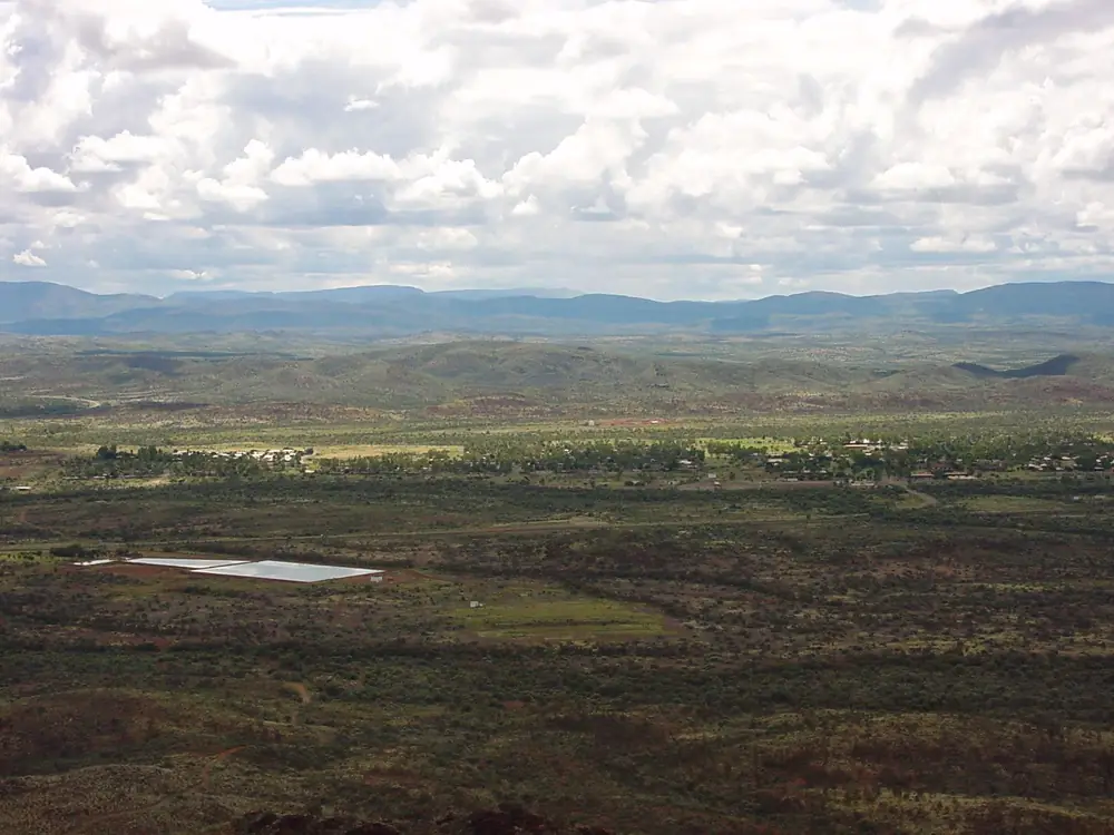
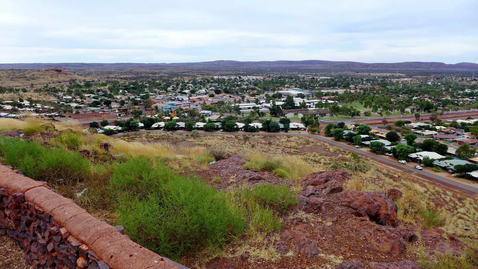
Paraburdoo townsite from the hillPhoto: Public Domain Images · Public domain 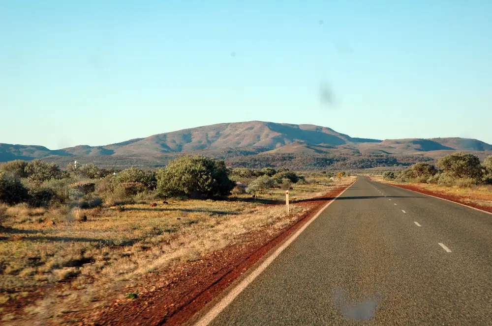
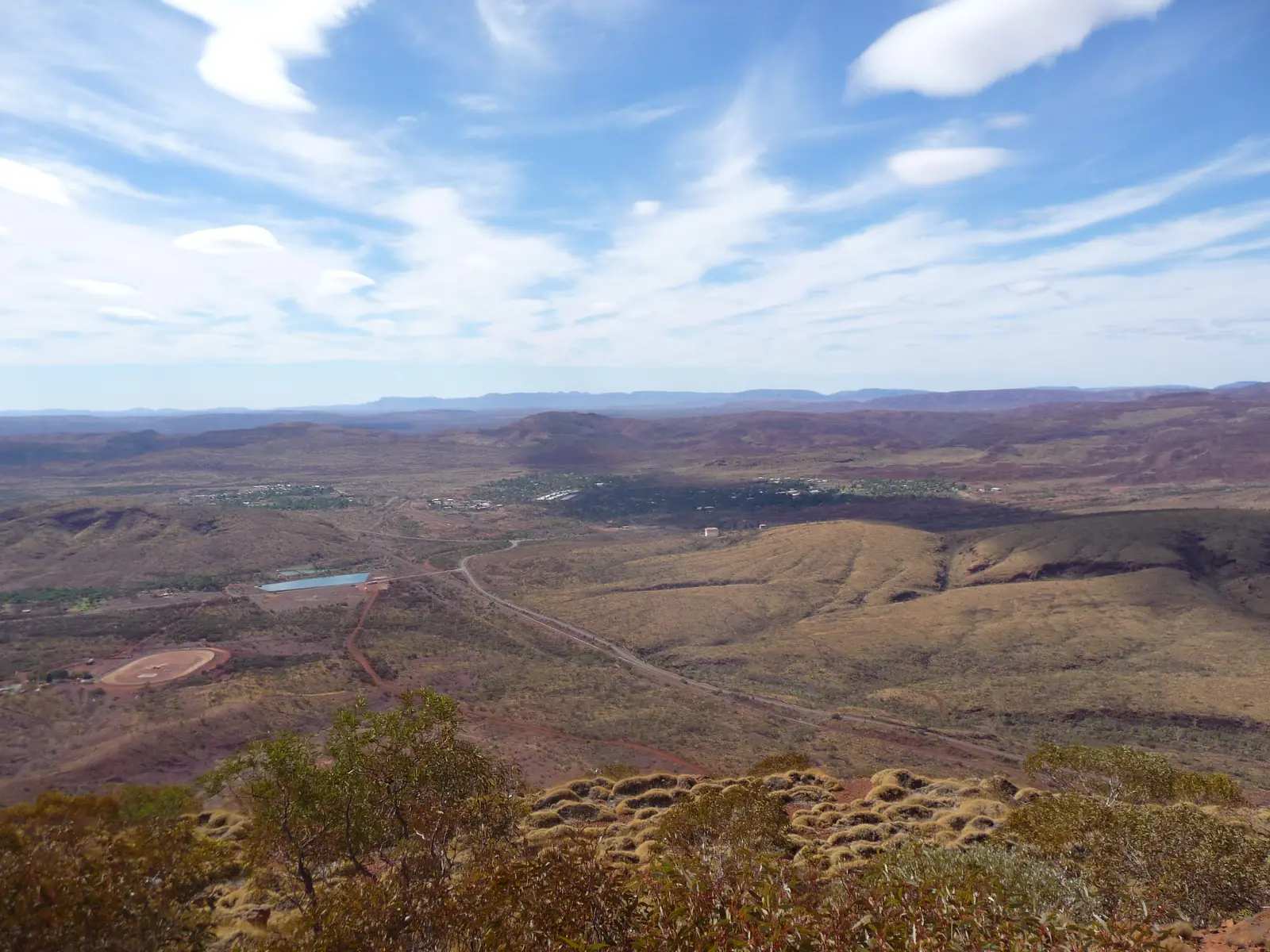
Iron-red highway just outside ParaburdooPhoto: KeresH · CC BY-SA 3.0 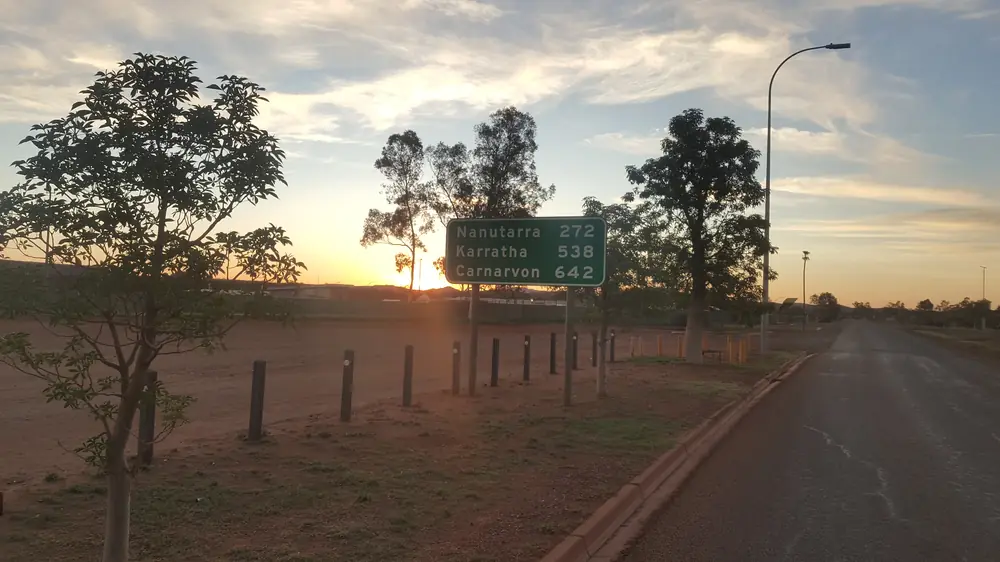
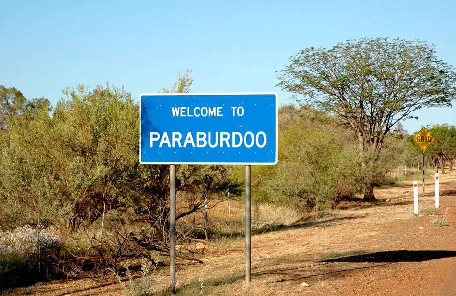
Road distance sign leaving ParaburdooPhoto: Shkuru Afshar · CC BY-SA 4.0 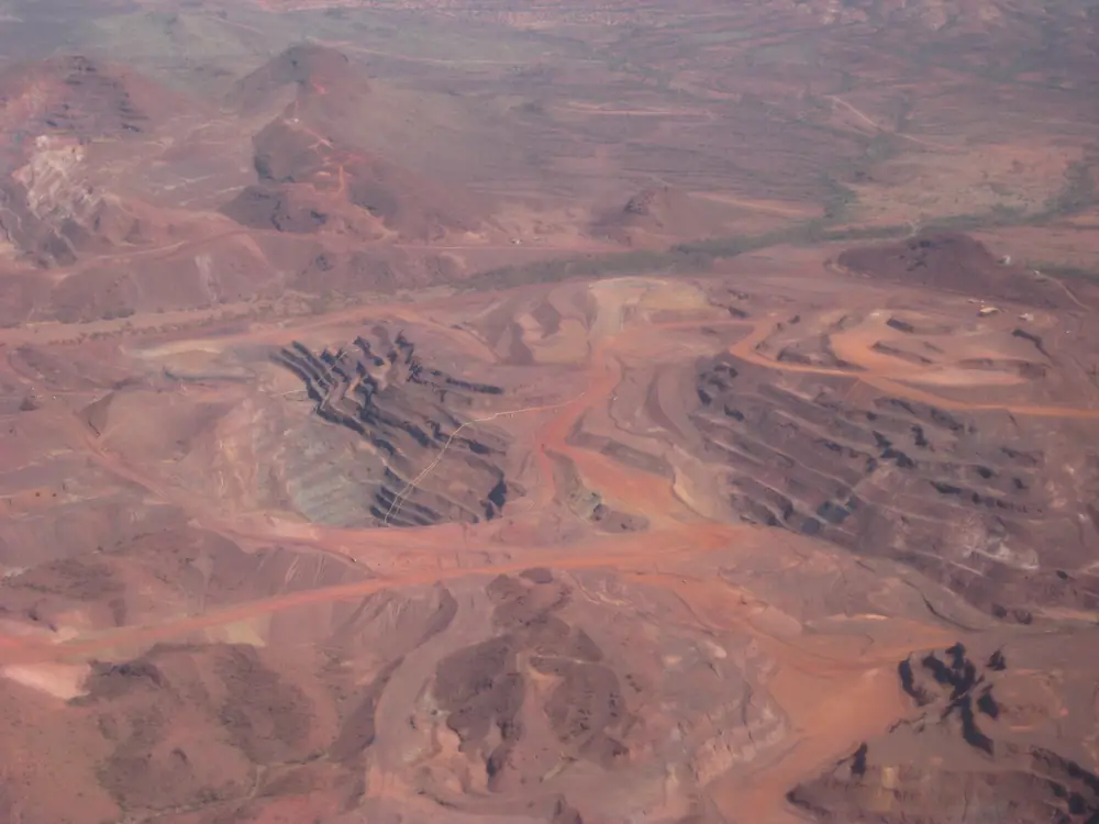
Aerial view of the Paraburdoo iron-ore minePhoto: Calistemon · CC BY-SA 3.0
Paraburdoo sits in the Shire of Ashburton in Western Australia’s north-west, an iron-ore town in the Pilbara, not a Queensland locality and not a suburb of Tom Price. Visit Ashburton’s destination page puts it 80 km from Tom Price. The information page describes a sealed road linking Nanutarra Roadhouse and Tom Price, just over 80 kilometres from Tom Price. Nanutarra Roadhouse has no town page on this site; it is named as a roadhouse, not linked.
Visit Ashburton: the origin of the name comes from the local Aboriginal word Pirupardu, meaning meat feathers. The town was originally built in the early 1960s as a mining town and remains a small mining town today. The 2021 Census counted 1,319 people in the urban centre. Travellers use Paraburdoo for the airport, a fuel stop before Karijini National Park, the Red Dog statue, and the Resilience Sculpture. You still need Main Roads WA after rain, because a sealed Pilbara road is no use if a floodway is closed.
Where it is, and how far
Paraburdoo is the southern Ashburton iron-ore town on the sealed Tom Price road. Visit Ashburton’s information page: Paraburdoo Airport is the closest airport to Karijini National Park and is located 9 kilometres from the township. Tourism WA’s Paraburdoo Airport listing puts the nearest towns at Paraburdoo (10 minutes’ drive) and Tom Price (45 minutes’ drive), with Karijini under two hours by road from the airport. Those are different measures; this hub does not average them.
Official Karijini kilometres from Paraburdoo do not agree. Print the discrepancy rather than inventing a compromise.
| Place | Distance from Paraburdoo (sourced) |
|---|---|
| Tom Price | 80 km (Visit Ashburton destination page and destination-guide table). Information page: just over 80 kilometres |
| Paraburdoo Airport | 9 km (Visit Ashburton information page and destination-guide table). Tourism WA: 10 minutes |
| Perth | 1,390 km (Visit Ashburton destination-guide Paraburdoo table). Flight: 1 hr 50 min on the same guide’s Paraburdoo panel; Tourism WA airport listing: generally one hour and 45 minutes |
| Karijini National Park / visitor centre | Visit Ashburton Karijini Visitor Centre page: Paraburdoo just 100 kilometres from Karijini. Destination-guide Paraburdoo table: Karijini Visitor Centre 165 km, Karijini Retreat 136 km. Tourism WA Fortescue Falls: around 150 km from Paraburdoo |
| Millstream Chichester National Park (via Tom Price) | 256 km (Visit Ashburton destination-guide Paraburdoo table) |
| Nanutarra Roadhouse | 274 km (same table). Named as a roadhouse; no town page here |
| Onslow | 387 km (same table). Onslow’s own table in that guide prints 391 km via Nanutarra–Munjina Road. Print both |
| Exmouth | 540 km (Paraburdoo table) |
Do not add a Paraburdoo–Newman kilometre from Tom Price’s table. Newman is the East Pilbara neighbour on this site. Pannawonica is the Shire of Ashburton closed mining town on this site. Karratha, Carnarvon and Exmouth now have town pages on this site.
Facts at a glance
Population. Australian Bureau of Statistics 2021 Census, Urban Centres and Localities UCL515029: 1,319 people. Median age 35. Sex split 57.4% male / 42.6%. Families 233. Private dwellings 594. Average household size 2.5. Median weekly household income $3,215. Use the ABS UCL QuickStats page. Suburbs and Localities SAL51201 counted 1,324 people (median age 35, 57.3% male / 42.7% female, 114 Aboriginal and/or Torres Strait Islander people, 8.6%). Do not mix UCL and SAL in one headcount.
Climate. Bureau of Meteorology PARABURDOO AERO, 007185, 23.17°S, 117.75°E, elevation 424 m, commenced 1974, status: open, latest available data 14 November 2026. Mean maximum (30 years, 1996–2026): January and December 40.8 °C, July 25.0 °C, annual 33.8 °C. Mean minimum: January 26.2 °C, July 9.9 °C, annual 18.5 °C. Mean rainfall (44 years, 1974–2026): annual 318.0 mm; February 72.8 mm wettest mean month; October 3.9 mm driest. Mean days of rain ≥ 1 mm: 31.9. This is a Pilbara summer-storm table, not a Kimberley Wet. See Paraburdoo weather.
Visitor information. Visit Ashburton: visitor and tourism information can be collected from the Shire office, Ashburton Avenue, Paraburdoo WA 6754, (08) 9190 2220. The visitor-centres index also says information can be obtained from the Shire Library. The main booked desk for Karijini is the Tom Price Visitor Centre, Central Road, (08) 9188 5488, Monday–Friday 8:30am–5:00pm, Saturday, Sunday and public holidays 8:30am–12:30pm, closed Sundays and public holidays November–March. Email Visitor.Centre@ashburton.wa.gov.au. Roads: Main Roads WA.
Traditional Owners
The Shire of Ashburton History and Heritage page names the Yinhawangka People in the Paraburdoo region, with Muntulgura Guruma in the Tom Price region, Thalanyji in the Onslow region, and Kurrama in the Pannawonica region. The 2021/22 Annual Report repeats Paraburdoo: Yinhawangka. Yinhawangka Aboriginal Corporation’s public office wording places a Paraburdoo Mall address; this guide does not invent a tour product from that address.
Visit Ashburton’s Paraburdoo information and attractions pages acknowledge the Banjima, Tinhawangka, Kurrama and Innawonga Peoples as Traditional Owners and Custodians of Karijini National Park. Parks WA’s Karijini page recognises Banyjima, Innawonga and Kurrama people as Traditional Owners of the park (and elsewhere on the same page names Banjima, Innawongka and Eastern Guruma). Spellings differ across official pages. This guide prints them as sourced and does not flatten a Karijini park acknowledgement onto the Paraburdoo townsite in place of the Shire’s Yinhawangka wording. Visit as a guest; see visiting Country respectfully.
History
Visit Ashburton is the source for the town-founding sentence used here. Paraburdoo was originally built in the early 1960s as a mining town and remains a small mining town today. The name Pirupardu / meat feathers is the destination-page etymology. The destination guide adds visits from the Royal Family, the birthplace of Red Dog, and UFO sightings as a history line — this hub does not invent dates or a sighting narrative those pages do not print.
Red Dog. Visit Ashburton attractions: Red Dog was born in Paraburdoo in 1971 and travelled thousands of kilometres across the Northwest. The Red Dog Statue was unveiled in 2023 at the tourist information bay on Camp Road.
Resilience Sculpture. Visit Ashburton: 3 kilometres outside Paraburdoo on the road to Tom Price, created by WA sculptor Alex Micke in collaboration with the local community, from steel plate shaped during controlled blasts and banded iron formation stone excavated on the mine site locally. It weighs almost nine tonnes.
This is a 1960s iron-ore town, not a gold-rush streetscape and not a coastal pearling story. For the park gorges, use the Karijini page rather than treating Paraburdoo’s Camp Road as a gorge walk.
Things to do
Visit Ashburton names these in and around Paraburdoo:
- Red Dog Statue — Camp Road tourist information bay; unveiled 2023; birthplace 1971
- Radio Hill Lookout — panoramic views over the town, accessed from Camp Road
- Federation Park — upgraded 2011; two covered playgrounds and a fenced area
- Paraburdoo Skate Park — nearby on the attractions page
- Kelly’s Pool — approximately 8 km out of town; picnics along the water; swimming is not permitted
- Resilience Sculpture — 3 km toward Tom Price; meandering path at the top of a small hill
Nearby, not in-town: Karijini National Park is the gorge day. Parks WA: Western Australia’s second-largest national park; park entry fees apply; no dogs. Visit Ashburton peak season April to September. Tom Price remains the named gateway on Visit Ashburton’s Karijini how-to-get-there wording. Millstream Chichester National Park is 256 km via Tom Price on the destination-guide Paraburdoo table.
See things to do in Paraburdoo.
Where to stay
Visit Ashburton’s accommodation page names Paraburdoo Inn (08) 9189 5303, Rocklea Palms (08) 9189 5018, and Paraburdoo Caravan Park, Lot 1 Camp Road — limited sites, bookings not taken, check-in at Rocklea Palms, 0409 662 254. Cheela Plains Station Stay is named 90 kilometres west of Paraburdoo on the Nanutarra–Munjina Road — a station stay, not an in-town motel. Those are official named types, not a ranked strip. If Paraburdoo is full, Tom Price is the 80 km neighbour with the visitor centre.
- How to choose: Paraburdoo accommodation
- Camping detail: Paraburdoo caravan parks
- Operator enquiries: feature your business
Caravan and camping
Vans use Paraburdoo as a sealed overnight before Karijini or Tom Price. Official named camping in town is the Paraburdoo Caravan Park on Camp Road as Visit Ashburton prints it — limited sites, no bookings. Cheela Plains is 90 km west. Ask on arrival for stay limits, dump points and pets. Read Paraburdoo caravan parks and outback camping. Do not camp at Kelly’s Pool or treat the sculpture path as a free camp.
Fuel and services
A town of 1,319 people is large enough for fuel, a shopping centre named on Visit Ashburton’s destination-guide map, Australia Post / chemist, and Paraburdoo Hospital with a 24/7 emergency department on the WA Country Health Service Pilbara hospitals page. Visit Ashburton’s information page: Paraburdoo is an ideal place to refuel yourself when travelling from the West and your vehicle before embarking on your Karijini adventure. This guide does not list a bowser brand or invent clinic hours. Fill here if you are heading into the park; Parks WA and Visit Ashburton both treat Karijini as a carry-water, gorge-safety problem.
The destination-guide town map also names a drive-in, swimming pool, golf course / club, and ANZAC memorial garden as town facilities. Confirm they are actually open; a map pin is not a 2026 timetable.
For maps and Karijini permits, use the Tom Price Visitor Centre. Roads: Main Roads WA.
Road access
The road Tom Price–Paraburdoo is sealed on Visit Ashburton. The information page also names the sealed link toward Nanutarra Roadhouse. Tourism WA: car hire at the airport; bus transfers between Paraburdoo and Tom Price. Qantas daily flights from Perth on Visit Ashburton and Tourism WA; Tourism WA also names Virgin Australia on Thursdays and Fridays. Flight schedules change — treat the airline, not this hub, as current.
These are mine and freight roads. Road trains, fatigue and wildlife are the hazards. After rain, check Main Roads. Do not treat a Karijini park road as a sedan guarantee; Parks WA and Visit Ashburton both warn about flash flooding in gorges.
West: Nanutarra Roadhouse on the destination-guide table, then the North West Coastal Highway. North: Tom Price, then Karijini. East: Newman is the East Pilbara town on this site — do not invent the kilometre. Perth to Darwin via the Pilbara is the long corridor.
Nearby parks and towns
Named nature on official pages:
- Karijini National Park — Hamersley Range; park entry fees; Tom Price visitor centre for advice
- Millstream Chichester National Park — 256 km via Tom Price on the Paraburdoo table
Towns on this site:
- Tom Price — 80 km north, Karijini gateway, Tom Price Visitor Centre
- Newman — East Pilbara iron-ore neighbour
- Pannawonica — Shire of Ashburton closed mining town, 348 km on the Visit Ashburton map pad
Onslow is the Ashburton coast town on this site; Exmouth, Carnarvon and Karratha now have town pages too.
When to go, and how long
Visit Ashburton peak season April to September. BOM Paraburdoo Aero’s January and December mean maximum of 40.8 °C is why Parks WA tells Karijini walkers to drink plenty of water and why gorge walks in summer are a heat problem. July’s 25.0 °C mean maximum and 9.9 °C mean minimum is the cooler dry-season packing. February’s 72.8 mm is the wettest mean month on a 318.0 mm annual table — storm rain, not a tropical Wet.
An hour covers Red Dog, Radio Hill and the sculpture if those named places are reachable. A night covers fuel, a named room or van site, and an early airport or Karijini start. A Karijini day is a separate park day from Tom Price or the park campgrounds, not a Paraburdoo footpath.
Operators who want a checked listing: feature your business. The listings slot on this hub stays empty until then.
Plan this trip
Tell us the dates, who you are travelling with and where you need help. We reply with planning notes for Paraburdoo — we are not a booking agent.
Events and road-conditions newsletter
Occasional notes on outback festivals, race days and official road-condition sources — not a daily blast. We use these details only to send the newsletter.
Western Australia · North West
Paraburdoo accommodation
Where to stay in Paraburdoo: Visit Ashburton names Paraburdoo Inn, Rocklea Palms and Paraburdoo Caravan Park. Cheela Plains is 90 km west. Confirm before you unhitch. WA Pilbara, not Queensland.
Read · 3 min
Western Australia · North West
Paraburdoo caravan parks
Camping in Paraburdoo: Visit Ashburton names Paraburdoo Caravan Park on Camp Road (limited sites, no bookings) and Cheela Plains 90 km west. Confirm before you unhitch. WA, not Queensland.
Read · 3 min
Western Australia · North West
Paraburdoo weather
Paraburdoo climate from BOM Paraburdoo Aero (007185): January mean max 40.8 °C, July 25.0 °C, annual rainfall 318.0 mm. Open airfield. WA Pilbara, not a Queensland table.
Read · 4 min
Western Australia · North West
Things to do in Paraburdoo
Things to do in Paraburdoo: Red Dog statue on Camp Road, Radio Hill Lookout, Kelly’s Pool (no swimming), Resilience Sculpture, and Karijini as a park day. WA Pilbara, not Queensland.
Read · 4 min
Frequently asked questions
Is Paraburdoo in Western Australia or Queensland?
This hub is Paraburdoo in the Shire of Ashburton, Western Australia, in the Pilbara. Visit Ashburton puts the town 80 km from Tom Price on a sealed road linking Nanutarra Roadhouse and Tom Price. It is not a Queensland town page.
How far is Paraburdoo from Tom Price, Perth and Karijini?
Visit Ashburton’s Paraburdoo destination page and destination-guide table put Tom Price 80 km north. The same guide’s Paraburdoo table puts Perth 1,390 km away and the airport 9 km from town. Karijini figures disagree on official pages used here: the Karijini Visitor Centre page puts Paraburdoo just 100 kilometres from the park; the destination-guide Paraburdoo table puts Karijini Visitor Centre 165 km and Karijini Retreat 136 km; Tourism WA’s Fortescue Falls listing uses around 150 km from Paraburdoo. This hub does not pick one.
What is Paraburdoo’s population?
1,319 people at the 2021 Census for the urban centre (UCL515029), median age 35. The suburbs-and-localities count is 1,324 (SAL51201). Do not mix the two.
Whose Country is Paraburdoo on?
The Shire of Ashburton History and Heritage page and the 2021/22 Annual Report name the Yinhawangka People in the Paraburdoo region. Visit Ashburton’s Paraburdoo pages acknowledge Banjima, Tinhawangka, Kurrama and Innawonga as Traditional Owners and Custodians of Karijini National Park. Parks WA Karijini wording names Banyjima, Innawonga and Kurrama for the park. This guide prints those names as sourced and does not flatten one park sentence onto the townsite.
What is the weather like in Paraburdoo?
BOM Paraburdoo Aero (007185, open): January and December mean maximum 40.8 °C, July 25.0 °C, annual rainfall 318.0 mm. February is the wettest mean month at 72.8 mm; October the driest at 3.9 mm. Temperature means use 30 years (1996–2026); rainfall 44 years (1974–2026).
Can I stay in Paraburdoo?
Yes, as named types. Visit Ashburton names Paraburdoo Inn, Rocklea Palms, and Paraburdoo Caravan Park at Lot 1 Camp Road (limited sites, bookings not taken; check-in at Rocklea Palms). Cheela Plains Station Stay is named 90 kilometres west of Paraburdoo, not an in-town park. Confirm on arrival.
Sources and further reading
Facts on this page were checked against these primary and official sources. Conditions change — confirm before you travel or buy.
- Paraburdoo 2021 Census QuickStats (UCL515029) — Australian Bureau of Statistics
- Paraburdoo 2021 Census QuickStats (SAL51201) — Australian Bureau of Statistics
- Climate statistics for Paraburdoo Aero (007185) — Bureau of Meteorology
- Paraburdoo — Shire of Ashburton (Visit Ashburton)
- Paraburdoo — Information — Shire of Ashburton (Visit Ashburton)
- Paraburdoo — Attractions — Shire of Ashburton (Visit Ashburton)
- Paraburdoo — Accommodation — Shire of Ashburton (Visit Ashburton)
- Visit Ashburton destination guide — Shire of Ashburton (Visit Ashburton)
- History and Heritage — Shire of Ashburton
- Karijini National Park — Parks and Wildlife Service WA
- Karijini Visitor Centre — Shire of Ashburton (Visit Ashburton)
- Paraburdoo Airport — Tourism Western Australia
- Fortescue Falls — Tourism Western Australia
- Pilbara hospitals and health services — WA Country Health Service
- Main Roads WA travel map — Main Roads Western Australia