At a glance
Sourced facts only. Distances and services change — confirm before you travel.
- Local government
- Shire of Ashburton
- Traditional Owners
- Kurrama People (Visit Ashburton Pannawonica destination page). The Shire of Ashburton History and Heritage page names Kurrama in the Pannawonica region. Robe River Rodeo: held on Robe River Kuruma country.Confirm current wording with Tom Price Visitor Centre, (08) 9188 5488.
- Nearest fuel
- Visit Ashburton names a service station among town amenities. Confirm the bowser on arrival; this hub does not invent a brand or hours.
- Mobile coverage
- Check Telstra and Optus coverage maps before travel; do not assume a signal on Millstream–Yarraloola Road or at Robe River picnic spots.
- Best time to visit
- Visit Ashburton peak season April to September. BOM Pannawonica July mean maximum 26.7 °C; January 41.0 °C. Temperature means end 2005 on that table; rainfall continues.
Climate
Monthly means from the Bureau of Meteorology station Pannawonica (005069). This is not a forecast. Open station. Temperature means 33/32 years (1971–2005) only — the temperature record on that table ends 2005. Rainfall 48 years (1971–2026). Latest available data 20 October 2026. Do not blend with Karratha Aero. Summer-peak rain (February 106.4 mm).
| Month | Mean max (°C) | Mean min (°C) | Rainfall (mm) |
|---|---|---|---|
| Jan | 41.0 | 25.2 | 83.1 |
| Feb | 39.7 | 25.2 | 106.4 |
| Mar | 38.5 | 24.4 | 71.3 |
| Apr | 35.6 | 21.7 | 18.9 |
| May | 30.6 | 17.4 | 31.4 |
| Jun | 27.0 | 14.0 | 34.4 |
| Jul | 26.7 | 12.7 | 13.4 |
| Aug | 28.8 | 13.7 | 7.2 |
| Sep | 32.3 | 15.9 | 1.6 |
| Oct | 36.1 | 19.0 | 1.7 |
| Nov | 38.5 | 21.5 | 6.4 |
| Dec | 40.5 | 24.0 | 28.7 |
Pannawonica in pictures
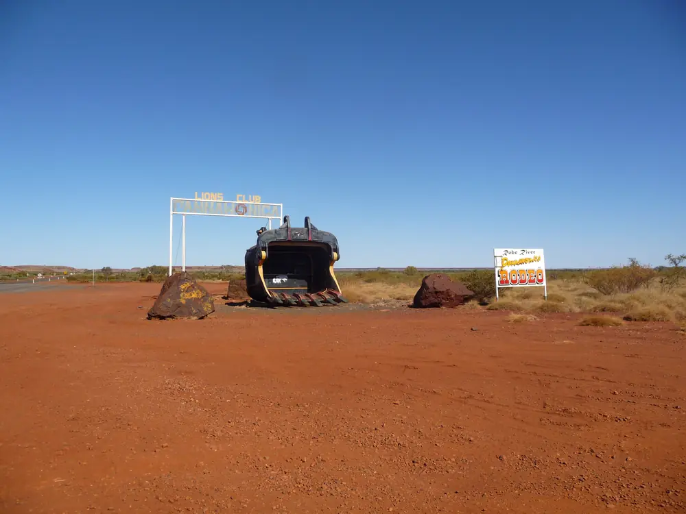
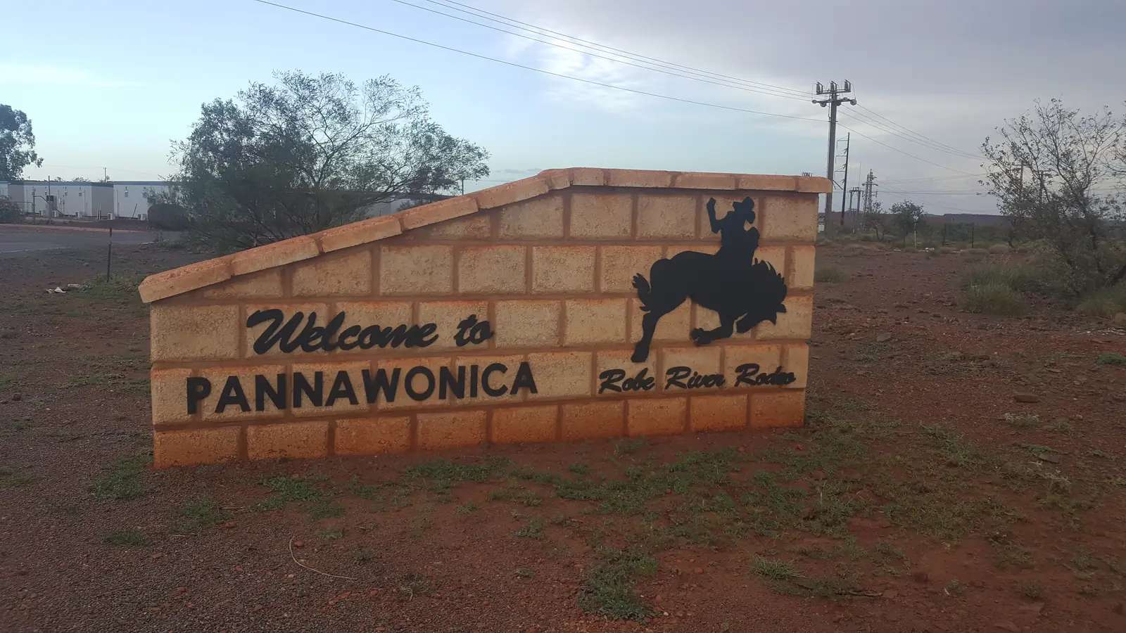
Town sign at PannawonicaPhoto: Five Years · CC BY-SA 3.0 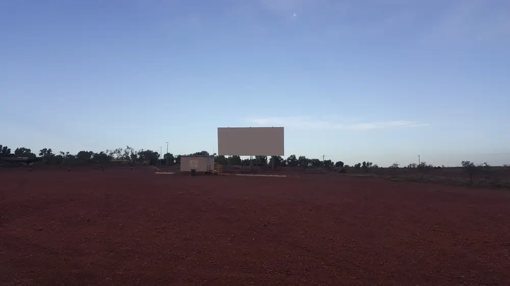
Drive-in cinema in PannawonicaPhoto: Shkuru Afshar · CC BY-SA 4.0 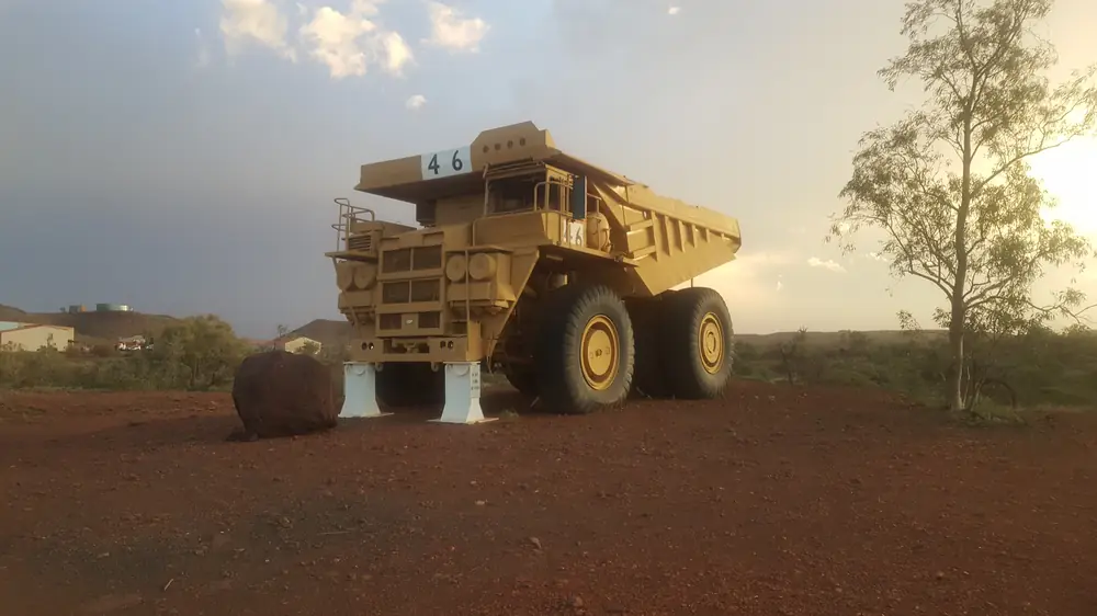
Giant truck display in PannawonicaPhoto: Shkuru Afshar · CC BY-SA 4.0 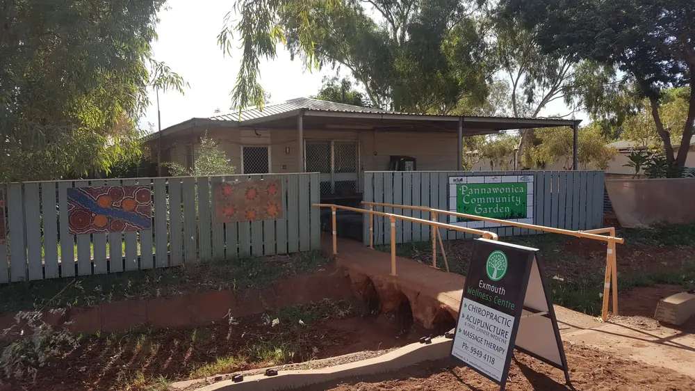
Community garden in PannawonicaPhoto: Shkuru Afshar · CC BY-SA 4.0
Pannawonica sits in Western Australia’s North West, inside the Shire of Ashburton, as a closed iron-ore town on a 47 km sealed road off the North West Coastal Highway, between the Onslow turn-off and Fortescue Roadhouse. Visit Ashburton: 1,423 km north of Perth via Geraldton and Carnarvon. The Visit Ashburton Pannawonica map pad prints Perth 1,338 km. This hub prints both and does not average them. Neighbour town pages on this site: Karratha, Port Hedland, Exmouth and Carnarvon. Geraldton has no town page here — named, not linked. This hub is that Pilbara mining town — not a Queensland locality, not a Karratha suburb, and not a Tom Price or Paraburdoo reprint. Perth is the capital; it has no town page here.
Visit Ashburton’s closed-town sentence is the hinge used here: Pannawonica is primarily designed for mining activities. Visitors are more than welcome, however accommodation is often reserved for mining staff, and long-term or permanent stays for tourists may be limited. That is a FIFO-and-rodeo story, not a Karijini gorge walk borrowed from Tom Price and not a beach town borrowed from Onslow.
The ABS publishes matching 2021 geographies. Use urban centre Pannawonica (L) UCL521041: 685 people, median age 30, sex split 52.3% male / 47.7% female, Aboriginal and/or Torres Strait Islander people 53 (7.7%). 36 families, 129 private dwellings, average household 2.9, median weekly household income $2,388, median weekly rent $28, median monthly mortgage $0. Suburbs-and-localities SAL51198 counted the same 685. The Shire town page prints a 700-strong community and population of 700 — Shire wording, not the Census. Do not mix them. Travellers stop for Robe River, the Boot Tree and a transit night. You still need Main Roads WA after rain.
Where it is, and how far
Pannawonica is the western Ashburton iron-ore town on a sealed spur off the North West Coastal Highway. Visit Ashburton information: approximately 2 hours from either Onslow or Karratha. Range page: 200 km from Onslow. Destination-guide Onslow table: 204 km. Map pad and Tom Price destination-guide table: Tom Price 268 km via access road.
Official Perth kilometres do not agree. Print the discrepancy.
| Place | Distance from Pannawonica (sourced) |
|---|---|
| Perth | 1,423 km via Geraldton and Carnarvon (Visit Ashburton destination page). Map pad: 1,338 km |
| North West Coastal Highway turn-off | 47 km sealed (Visit Ashburton) |
| Onslow | 200 km (range page). 204 km (destination-guide Onslow table). Approximately 2 hours (information page) |
| Karratha | Approximately 2 hours (information page). Map pad: 199 km |
| Tom Price | 268 km via access road (map pad; destination-guide Tom Price table) |
| Paraburdoo | 348 km (map pad) |
| Port Hedland | 315 km (map pad) |
| Millstream Chichester | 1.5 hours along Millstream–Yarraloola Road (destination page). Map pad: 92 km. Destination-guide attraction line: 146 km from Python Pool & Millstream |
| Karijini (via access road) | 363 km (map pad) |
| Exmouth | 444 km (map pad). No town page here |
Do not invent a Pannawonica–Newman kilometre. Newman is the East Pilbara neighbour on this site.
Facts at a glance
Population. ABS 2021 Census Urban Centres UCL521041: 685 people. Median age 30. 36 families, 129 private dwellings. Use the UCL QuickStats. SAL SAL51198 counted the same 685.
Climate. Bureau of Meteorology PANNAWONICA, 005069, 21.64°S, 116.33°E, elevation 200 m, commenced 1971, status: open, latest available data 20 October 2026. Mean maximum (33 years, 1971–2005): January 41.0 °C, July 26.7 °C, annual 34.6 °C. Mean minimum (32 years, 1971–2005): January and February 25.2 °C, July 12.7 °C, annual 19.6 °C. Mean rainfall (48 years, 1971–2026): annual 406.6 mm; February 106.4 mm wettest mean month; September 1.6 mm driest. Mean days of rain ≥ 1 mm: 30.6. Median (decile 5) annual rainfall: 389.8 mm. Temperature means on that table end in 2005; rainfall continues. Do not blend with another station. See Pannawonica weather.
Visitor information. Visit Ashburton’s Tom Price Visitor Centre is the booked Shire desk: Central Road, Tom Price, (08) 9188 5488, Visitor.Centre@ashburton.wa.gov.au. The Pannawonica map pad names visitor information / library / Shire office among town amenities. Roads: Main Roads WA. For Millstream–Yarraloola Road, also check the Shire of Ashburton road report.
Traditional Owners
Visit Ashburton’s Pannawonica destination page: we acknowledge the traditional owners and custodians of the land Pannawonica is situated on, the Kurrama People. The origin of the name ‘Pannawonica’ comes from the local Kurrama people meaning ‘the hill that comes from the sea.’ The Shire of Ashburton History and Heritage page names Kurrama in the Pannawonica region, with Yinhawangka in Paraburdoo, Muntulgura Guruma in Tom Price and Thalanyji in Onslow — those sentences are not flattened onto Fortescue Place. Robe River Rodeo: the event is held on Robe River Kuruma country. Confirm current wording at the Tom Price Visitor Centre. See visiting Country respectfully.
History
Visit Ashburton: the town as we know it today was built in 1970 to house employees of an iron ore mine. The Shire: gazetted as a town in 1972. The destination page’s folktale is the naming story used here: Pannawonica Hill was once an island over which two local groups were in dispute, until a sea spirit decided to resolve the dispute by moving the hill inland. As the hill was dragged over the land it left a deep indentation or scar which became the Robe River.
This is a 1970s closed mining town, not a gold-rush streetscape and not a coastal pearling story. For the park pools, use Millstream Chichester National Park rather than treating Pannawonica Drive as a gorge walk.
Things to do
Visit Ashburton names these in and around Pannawonica:
- Robe River — space and shade for a dip; picnic spots
- The Boot Tree — local tradition; leave a boot
- Robe River Rodeo — population more than doubles; information page: every September; rodeo grounds on the outskirts with free camping for visitors
- Public swimming pool — popular in summer
- Open-air cinema — free when they are showing a movie
- Library, supermarket, tavern, hotel, service station — named amenities, not a walking-tour timetable
Nearby, not in-town: Millstream Chichester National Park is 1.5 hours along Millstream–Yarraloola Road. Visit Ashburton: that road is unsuitable for buses, caravans, trailers or two wheel drive vehicles; travel only in well prepared 4WD; notify Pannawonica Police or the Millstream Ranger. Karijini National Park is 363 km via access road on the map pad — a Tom Price / Paraburdoo day, not a Pannawonica footpath. Tourism WA’s Rail Access Roads listing names the Pannawonica to Cape Lambert Road as a permit drive toward Millstream; obtain a free permit at pilbararailaccessroad.riotinto.com or a local visitor centre.
See things to do in Pannawonica.
Where to stay
Visit Ashburton: visitors are welcome, however accommodation is often reserved for mining staff, and long-term or permanent stays for tourists may be limited. The destination guide names a 4-bay transit caravan park. Accommodation page: Pannawonica Caravan Transit Park, Fortescue Place, limited sites, book via SpacetoCo; Pannawonica Tavern, 192 Pannawonica Drive, 1800 992 777. Rodeo-grounds free camping is named for the Robe River Rodeo weekend. Those are official named types. This hub does not reprint dollar figures that date. If Pannawonica is full, Onslow is the coast neighbour and Tom Price is 268 km inland.
- How to choose: Pannawonica accommodation
- Camping detail: Pannawonica caravan parks
- Operator enquiries: feature your business
Caravan and camping
Vans use Pannawonica as a sealed North West Coastal Highway spur night — not as a caravan route into Millstream. Official named camping is the 4-bay transit park on Fortescue Place plus rodeo-grounds free camping when that event is on. Visit Ashburton: Millstream–Yarraloola Road is unsuitable for caravans. Ask on arrival for stay limits. The Shire news story: Transit Park Site bookings via SpacetoCo. Read Pannawonica caravan parks and outback camping. Do not camp at Robe River picnic spots or treat the Boot Tree as a free camp.
Fuel and services
Visit Ashburton names a library, supermarket, tavern, hotel and service station. The Shire adds a post office and bank. The map pad names a petrol station, Australia Post, shopping centre, swimming pool, drive-in, golf course and medical centre. This guide does not invent a bowser brand or clinic hours. Fill here if you are heading toward Millstream; Visit Ashburton treats Pannawonica as a good place to refuel and obtain supplies before that park.
A 24-hour hospital was not named on the sourced town pages, so this hub does not invent one. For maps use the Tom Price Visitor Centre. Roads: Main Roads WA.
Road access
The 47 km sealed spur off the North West Coastal Highway is the ordinary 2WD approach Visit Ashburton names. Geraldton and Carnarvon sit on that Perth run — named, not linked. Perth to Darwin via the Pilbara is the long corridor.
Millstream–Yarraloola Road is a different problem: 4WD only on Visit Ashburton; notify police or the ranger; check the Shire road report. Tourism WA’s Rail Access Roads: free permit for private rail roads connecting Pannawonica with Cape Lambert. These are mine and freight roads. Road trains, fatigue, wildlife and cyclones are the hazards. After rain, check Main Roads. Do not drive around closed signs to keep a Robe River swim.
Nearby parks and towns
Named nature on official pages:
- Robe River picnic and swimming spots — short drive; not a national park page
- Millstream Chichester National Park — 1.5 hours / 92 km / 146 km on official pages; 4WD from this town
- Karijini National Park — 363 km via access road on the map pad; Tom Price remains the named gateway
Towns on this site:
- Onslow — Ashburton coast, 200–204 km
- Tom Price — 268 km via access road, Karijini gateway
- Paraburdoo — 348 km on the map pad
- Newman — East Pilbara neighbour on this site
- Karratha — approximately 2 hours / 199 km on Visit Ashburton
- Port Hedland — 315 km on the map pad
Geraldton has no town page here — named, not linked.
When to go, and how long
Visit Ashburton peak season April to September. The information page puts the Robe River Rodeo in September. BOM Pannawonica’s January mean maximum of 41.0 °C is why a Robe River dip is a heat plan, not a slogan. July’s 26.7 °C mean maximum and 12.7 °C mean minimum is the cooler dry-season packing. February’s 106.4 mm is the wettest mean month on a 406.6 mm annual table — storm rain, not a Kimberley Wet. Temperature means on that table stop in 2005.
An hour covers the Boot Tree and a supermarket if those named places are reachable. A night covers fuel and a transit bay if a site exists. Millstream is a separate 4WD park day, not a Pannawonica footpath. The rodeo weekend is an event, not a second town.
Operators who want a checked listing: feature your business. The listings slot on this hub stays empty until then.
Plan this trip
Tell us the dates, who you are travelling with and where you need help. We reply with planning notes for Pannawonica — we are not a booking agent.
Events and road-conditions newsletter
Occasional notes on outback festivals, race days and official road-condition sources — not a daily blast. We use these details only to send the newsletter.
Western Australia · North West
Pannawonica accommodation
Where to stay in Pannawonica: Visit Ashburton names a closed town with limited tourist stays, a 4-bay caravan transit park on Fortescue Place, and Pannawonica Tavern. Confirm before you unhitch.
Read · 3 min
Western Australia · North West
Pannawonica caravan parks
Camping in Pannawonica: Visit Ashburton names a 4-bay caravan transit park on Fortescue Place and rodeo-grounds free camping. Millstream–Yarraloola Road is unsuitable for caravans. Confirm before you unhitch.
Read · 3 min
Western Australia · North West
Pannawonica weather
Pannawonica climate from BOM Pannawonica (005069): January mean max 41.0 °C, July 26.7 °C, annual rainfall 406.6 mm with February 106.4 mm. Temperature means end 2005. WA Pilbara, not Queensland.
Read · 3 min
Western Australia · North West
Things to do in Pannawonica
Things to do in Pannawonica: Robe River picnic and swim, the Boot Tree, Robe River Rodeo, pool and free open-air cinema. Millstream is a 4WD park day, not a town walk. This is WA, not Queensland.
Read · 4 min
Frequently asked questions
Is Pannawonica in Western Australia or Queensland?
This hub is Pannawonica in the Shire of Ashburton, Western Australia, in the Pilbara. Visit Ashburton puts the town 47 km on a sealed road off the North West Coastal Highway, between the Onslow turn-off and Fortescue Roadhouse. It is not a Queensland town page.
How far is Pannawonica from Perth, Onslow and Tom Price?
Visit Ashburton’s destination page: 1,423 km north of Perth via Geraldton and Carnarvon. The Visit Ashburton Pannawonica map pad prints Perth 1,338 km. Range page: 200 km from Onslow. Destination-guide Onslow table: 204 km. Map pad: Tom Price 268 km, which matches the destination-guide Tom Price table’s Pannawonica (via access road) 268 km. This hub does not pick a Perth kilometre.
What is Pannawonica’s population?
Use the 2021 urban centre Pannawonica (L) UCL521041: 685 people, median age 30. Suburbs-and-localities SAL51198 counted the same 685. The Shire of Ashburton town page prints a 700-strong community and a population of 700 — that is Shire wording, not the Census figure.
Can tourists stay in Pannawonica?
Visit Ashburton: Pannawonica is a closed town; visitors are welcome, however accommodation is often reserved for mining staff, and long-term or permanent stays for tourists may be limited. The destination guide names a 4-bay transit caravan park. Visit Ashburton accommodation: Pannawonica Caravan Transit Park, Fortescue Place, limited sites, and Pannawonica Tavern, 192 Pannawonica Drive, 1800 992 777. Rodeo-grounds free camping is named for the Robe River Rodeo weekend.
What is the weather like in Pannawonica?
BOM Pannawonica (005069, open): January mean maximum 41.0 °C, July 26.7 °C, annual rainfall 406.6 mm (48 years, 1971–2026). February is the wettest mean month at 106.4 mm. Temperature means on that table use 1971–2005 only; do not blend with another station.
Whose Country is Pannawonica on?
Visit Ashburton’s Pannawonica destination page acknowledges the Kurrama People and prints the origin of the name as ‘the hill that comes from the sea.’ The Shire of Ashburton History and Heritage page names Kurrama in the Pannawonica region. Robe River Rodeo: the event is held on Robe River Kuruma country.
Sources and further reading
Facts on this page were checked against these primary and official sources. Conditions change — confirm before you travel or buy.
- Pannawonica (L) 2021 Census QuickStats (UCL521041) — Australian Bureau of Statistics
- Pannawonica 2021 Census QuickStats (SAL51198) — Australian Bureau of Statistics
- Climate statistics for Pannawonica (005069) — Bureau of Meteorology
- Pannawonica — Visit Ashburton
- Pannawonica — Visit Ashburton
- Pannawonica - About — Visit Ashburton
- Pannawonica - Accommodation — Visit Ashburton
- Pannawonica — Shire of Ashburton
- Pannawonica Transit Park Site bookings now on SpacetoCo — Shire of Ashburton
- History and Heritage — Shire of Ashburton
- Visit Ashburton destination guide — Visit Ashburton
- Pannawonica map pad — Visit Ashburton
- Rail Access Roads - Pilbara — Tourism Western Australia
- FAQ — Robe River Rodeo
- Main Roads WA travel map — Main Roads Western Australia