At a glance
Sourced facts only. Distances and services change — confirm before you travel.
- Population
- 73 people (SAL13125, 2021 Census)
- Local government
- Unincorporated Far West (Unincorporated Area of Outback NSW)
- Traditional Owners
- Malyangapa peopleVisit Corner Country Packsaddle Shelter. Confirm current wording with Visit Corner Country / Milparinka Heritage and Tourism Association.
- Nearest regional city
- Broken Hill, 175 km south (Packsaddle Roadhouse operator site)
- Nearest fuel
- Packsaddle Roadhouse — diesel and petrol named on Visit Corner Country’s Corner Country checklist and the operator site
- Nearest hospital or clinic
- Confirm with NSW Health — do not invent a clinic name. Broken Hill is the named service city on this corridor.
- Mobile coverage
- Packsaddle Roadhouse names 3G Telstra at the cabins. Check Telstra and Optus coverage maps before travel; do not assume a signal on the Silver City Highway or station tracks.
- Best time to visit
- May–September (cooler BOM Fowlers Gap AWS mean maxima)
Climate
Monthly means from the Bureau of Meteorology station Fowlers Gap AWS (046128). This is not a forecast. Open. Nearest complete open table used here — not a Packsaddle town station. Commenced 2004. Elevation 181 m. Temperature 22 years (2004–2026); rainfall 21 years (2004–2026).
| Month | Mean max (°C) | Mean min (°C) | Rainfall (mm) |
|---|---|---|---|
| Jan | 36.8 | 22.4 | 33.1 |
| Feb | 34.8 | 20.8 | 24.8 |
| Mar | 31.4 | 17.9 | 32.2 |
| Apr | 26.5 | 12.8 | 13.1 |
| May | 21.0 | 8.1 | 15.9 |
| Jun | 17.3 | 5.4 | 17.5 |
| Jul | 17.2 | 4.5 | 16.2 |
| Aug | 19.8 | 5.9 | 10.9 |
| Sep | 24.2 | 9.4 | 16.5 |
| Oct | 28.3 | 13.4 | 18.1 |
| Nov | 31.1 | 16.7 | 25.3 |
| Dec | 34.3 | 19.8 | 19.8 |
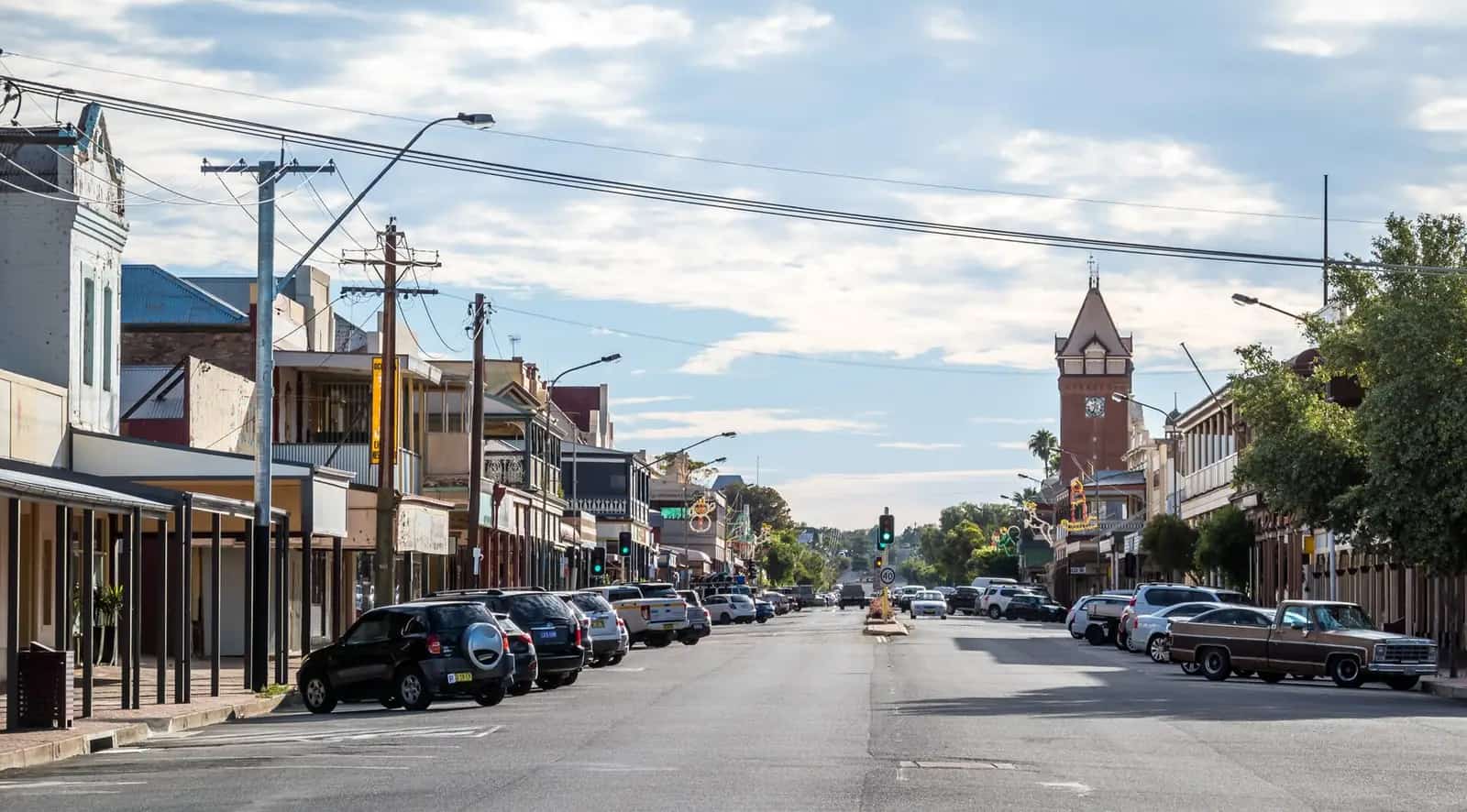
Packsaddle sits on the Silver City Highway in the Unincorporated Area of Outback NSW — Visit Corner Country’s phrase for the far north-west that is not inside a shire. The Packsaddle Roadhouse operator site puts it 175 kilometres north of Broken Hill. This site’s Corner Country guide already treats the roadhouse as the fuel and meal stop between Broken Hill and Milparinka. This hub is the locality. It is not Tibooburra’s granite-tor town, not the Albert goldfield precinct, and not a second Mutawintji visitor centre. Travellers stop because the next named fuel on Visit Corner Country’s checklist, if you skip this bowser, is Tibooburra to the north or Broken Hill to the south — Milparinka is explicitly without fuel on that list.
The Australian Bureau of Statistics does not publish a 2021 Urban Centre (UCL) named Packsaddle on the QuickStats pages used here. Use suburbs-and-localities SAL13125: 73 people, median age 38, sex split 40.0% male / 60.0% female. 18 families, 22 private dwellings. QuickStats notes limited tables because of the small population, and that medians may be affected by confidentiality. Read the ABS SAL QuickStats. A Census locality of 73 people is pastoral country with a roadhouse, not a high street.
The highway is the spine of the Sturt’s Steps Touring Route — about 1,100 km of sealed and unsealed roads from Broken Hill through Packsaddle, Milparinka, Tibooburra and Cameron Corner, recognised by the NSW Government and Visit Corner Country. After rain you still need Live Traffic NSW. A 175 km run to Broken Hill is no use if the Silver City Highway is closed.
Where it is, and how far
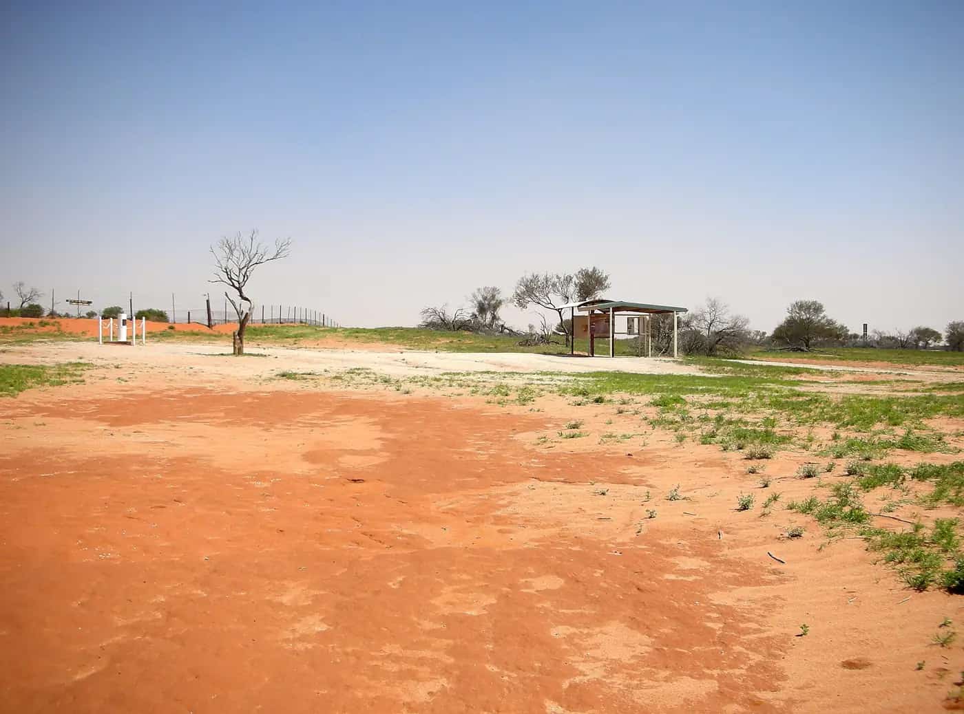
Packsaddle is on the Silver City Highway between Broken Hill and Milparinka, in Unincorporated Far West NSW, postcode 2880 on the operator contact page. Visit Corner Country’s Packsaddle Shelter describes Packsaddle Creek as an ephemeral watercourse that rises in the hills east of the highway and flows west toward the South Australian border and Lake Starvation. That is landscape, not a swimming hole this hub will invent.
| Place | Distance from Packsaddle (sourced) |
|---|---|
| Broken Hill | 175 km south (Packsaddle Roadhouse operator site) |
| Milparinka | on the Broken Hill–Milparinka 294 km Silver City Highway run (Visit Corner Country). A separate Packsaddle–Milparinka kilometre was not on that table |
| Tibooburra | next named fuel north on Visit Corner Country’s checklist; kilometre from Packsaddle not printed on the pages used here |
| Cameron Corner | Broken Hill to the Corner about 476 km (Visit Corner Country). Packsaddle is a named stop on that corridor, not a Corner offset we invented |
| Fowlers Gap AWS (BOM 046128) | 31.09°S, 141.70°E, elevation 181 m — climate station at Fowlers Gap, not a Packsaddle drive time |
White Cliffs is the opal neighbour Visit Corner Country names at the junction of the White Cliffs (Henry Roberts) Road and the Silver City Highway — a side road from this corridor, not a Packsaddle main street. Silverton sits west of Broken Hill, not on the northbound Sturt’s Steps run.
Facts at a glance
Population. ABS 2021 SAL13125: 73 people. Median age 38. Limited tables. No UCL. Packsaddle SAL QuickStats.
Climate. No Packsaddle row on the BOM NSW monthly-statistics list used here. Use FOWLERS GAP AWS, 046128, open, commenced 2004, elevation 181 m. Mean maximum (22 years, 2004–2026): January 36.8 °C, July 17.2 °C, annual 26.9 °C. Mean minimum (22 years): January 22.4 °C, July 4.5 °C, annual 13.1 °C. Mean rainfall (21 years): annual 232.8 mm. Mean days of rain ≥ 1 mm: 27.4. That is the Fowlers Gap table. See Packsaddle weather.
Visitor information. There is no Packsaddle VIC on the sourced pages. Use Visit Corner Country and the Packsaddle Shelter on Sturt’s Steps. Broken Hill is the city desk on the southbound run; Tibooburra’s NPWS visitor centre at 51 Briscoe Street is the Sturt National Park desk further north.
Traditional Owners
Visit Corner Country’s Packsaddle Shelter page opens: welcome to the Packsaddle where the traditional owners are the Malyangapa people. This hub uses that townsite wording. This site’s Corner Country region guide also names Wadigali, Malyangapa, Wangkumara and other Aboriginal peoples for the wider far north-west; this page does not flatten that regional list onto the roadhouse. Confirm current wording with Visit Corner Country.
History
Visit Corner Country’s shelter page is the sourced history used here.
The forerunner was the Packsaddle Hotel, built in 1887 by Alex Scott on a stock route between Queensland and South Australia, serving stockmen, shearers and the mail coach to the Albert goldfields. In 1898 the hotel was destroyed by fire.
The Packsaddle Roadhouse was established in 1958 by Bill Vickers on a site that was originally part of Packsaddle Station. The same page records early pastoral Packsaddle Station as including country now known as Mount Arrowsmith, Pimpara Lake, Wyndonga and Yelka, a shearing shed at a waterhole named the Duckhole on Packsaddle Creek, and wells worked by a horse works because there was no permanent water. Sir Sidney Kidman acquired the Packsaddle lease before it expired; the country was then divided into the properties that exist today.
Visit Corner Country also records two name stories: a packsaddle lost during the Burke and Wills expedition, or an oddly shaped hill north of the creek. It is explicit that Sturt’s 1845 expedition crossed Packsaddle Creek travelling from Flood’s Creek toward Milparinka’s Evelyn Creek. The NSW Government’s Sturt’s Steps page treats Packsaddle as a named point on the 1,100 km circular route that approximates that expedition.
A judge’s “licensed hell” line on the same shelter page is historical colour about drunken brawls at the old hotel, not a current trading review.
Things to do
Packsaddle Roadhouse — fuel, meals, bar, dining room and outdoor area on the operator site. Phone (08) 8091 2539. Operator hours on the contact page: Monday–Saturday 8 am–midnight; Sunday 8 am–10 pm. Confirm before you rely on a late meal.
Packsaddle Shelter — Sturt’s Steps interpretive shelter. Landscape, Sturt, Burke and Wills, the hotel fire and the station story.
Yarning circle — Visit Corner Country’s art-trail note: large granite slabs by Ian Marr near the roadhouse, inscribed with historical facts including the names of the men in Sturt’s expedition and shanty towns along the coach routes.
Packsaddle Creek — ephemeral; after rain stay off closed banks. Reaching Lake Starvation, on that shelter page, requires a huge flood, perhaps more than one in one hundred years. That is a catchment fact, not a day-walk.
See things to do in Packsaddle.
What not to plan as a Packsaddle footpath. Milparinka’s courthouse, Depot Glen and Poole’s grave are a separate stop further north. Tibooburra and Sturt National Park are the Corner Country base. Mutawintji appears on the shelter’s Burke and Wills paragraph as the Bynguano Ranges the Victorian Exploring Expedition reached from Menindee — a historical neighbour, not a Packsaddle loop this hub will timetable. White Cliffs is the Henry Roberts Road turn, not a roadhouse annex.
Where to stay
The operator accommodation page names:
- 16 rooms — 2 family, 4 double, 10 twin singles, sleep up to 36
- Air-conditioning, TV, fridge, tea and coffee, shared bathrooms
- Free continental breakfast in the Wool Shed
- Powered camping — contact for the current price
- Unpowered camping free, with shower and toilet amenities
Those are operator-named types, not a ranked inventory and not prices this hub will invent. Confirm on (08) 8091 2539 or packsaddleroadhouse@bigpond.com.
- How to choose: Packsaddle accommodation
- Camping detail: Packsaddle caravan parks
- Operator enquiries: feature your business
If the roadhouse is full, Broken Hill is 175 km south. Tibooburra has hotels, a motel and a caravan park on that hub. Milparinka has the Albert Hotel. Those are neighbouring towns, not a booking guarantee.
Caravan and camping
Vans use Packsaddle as the Silver City Highway overnight between Broken Hill and Corner Country. Official named camping on the operator page is powered sites (ask the price) and unpowered camping free, with amenities. Visit Corner Country does not name a second village caravan park. Do not treat the highway verge or Packsaddle Creek as a free camp this page will invent. Read Packsaddle caravan parks and outback camping.
After rain, the Silver City Highway and unsealed Sturt’s Steps sections close. Live Traffic NSW first. See fuel, permits and road conditions.
Fuel and services
Visit Corner Country’s checklist lists diesel and petrol at Packsaddle Roadhouse, plus TJ’s Service Station and Tibooburra Food & Fuel in Tibooburra, and the Cameron Corner Store. It notes that fuel and drinking water are not available at Milparinka. This site’s Tibooburra hub already names Packsaddle Roadhouse as the next fuel south of Tibooburra. Fill here if you are stretching north or south. This guide does not print a cents-per-litre figure.
A locality of 73 people will not match Broken Hill for groceries or a hospital. This hub does not invent a clinic. Confirm medical help with NSW Health; Broken Hill is the corridor’s service city. Operator contact: Silver City Highway, Packsaddle NSW 2880, (08) 8091 2539. Hours on that contact page as above — treat them as operator-stated, not a 24-hour guarantee.
There is no second bowser named on the sourced pages. Carry a reserve, as Corner Country pages already advise. See outback safety.
Road access
The Silver City Highway is the sealed spine through Packsaddle between Broken Hill and Tibooburra on the NSW Government Sturt’s Steps description (the circular 1,100 km route still includes unsealed sections toward Cameron Corner). Visit Corner Country: the route was designed by the Milparinka Heritage and Tourism Association in 2008 and funded in 2020 to expand along the now-sealed Silver City Highway. Pull over for road trains. After rain, check Live Traffic NSW. Do not drive around a closed sign to keep a roadhouse booking.
South: Broken Hill, then Silverton or the Barrier Highway. North: Milparinka (no fuel on Visit Corner Country), Tibooburra, then the unsealed run to Cameron Corner. White Cliffs is the Henry Roberts Road junction named on the touring-route page. Station tracks are not the highway; the NSW Government Sturt’s Steps page warns that not all GPS software works out here and has been known to send people up a rarely used station track. Stay on the main roads. Carry water and food for a few days.
Nearby parks and towns
Parks and named nature sites:
- Packsaddle Creek (Visit Corner Country shelter)
- Sturt National Park — Tibooburra gateway, not a Packsaddle day-walk
- Mutawintji National Park — named on the shelter’s Burke and Wills paragraph as the Bynguano Ranges from Menindee, not as a Packsaddle kilometre
Towns on this site:
- Broken Hill — 175 km south; service city
- Milparinka — heritage precinct, no fuel on Visit Corner Country
- Tibooburra — next named fuel north
- Cameron Corner — three-state marker
- White Cliffs — Henry Roberts Road
- Silverton — west of Broken Hill
See the Corner Country region guide and the Outback NSW road trip.
When to go, and how long
Fowlers Gap AWS January mean maximum of 36.8 °C is hot working weather for a highway stop at midday — hotter than Broken Hill’s January mean on other hubs, and hotter than Coonamble Airport’s 35.4 °C. July’s 17.2 °C mean maximum is the comfortable season on paper; July’s 4.5 °C mean minimum is why an unplanned creek-bank night is a bad idea. Annual rainfall 232.8 mm on the Fowlers Gap table is arid even by Corner Country standards; August’s 10.9 mm is the driest mean month. A fuel-and-meal break is the minimum. A night lets you use the named rooms or unpowered camp if the roadhouse has space. Two nights only if you are using Packsaddle as a rest day on Sturt’s Steps and Live Traffic NSW agrees — the sourced visitor list does not support a two-day town itinerary.
Operators who want a checked listing: feature your business. The listings slot on this hub stays empty until then.
Plan this trip
Tell us the dates, who you are travelling with and where you need help. We reply with planning notes for Packsaddle — we are not a booking agent.
Events and road-conditions newsletter
Occasional notes on outback festivals, race days and official road-condition sources — not a daily blast. We use these details only to send the newsletter.
New South Wales · Outback NSW
Packsaddle accommodation
Where to stay in Packsaddle: Packsaddle Roadhouse names 16 rooms and powered or unpowered camping 175 km north of Broken Hill. Confirm vacancies on (08) 8091 2539. No invented hotels.
Read · 4 min
New South Wales · Outback NSW
Packsaddle caravan parks
Camping at Packsaddle: Packsaddle Roadhouse names powered sites (ask the price) and unpowered camping free, with amenities. Do not overnight on the highway verge or Packsaddle Creek. Live Traffic NSW after rain.
Read · 4 min
New South Wales · Outback NSW
Packsaddle weather
Packsaddle climate from the nearest complete open BOM table, Fowlers Gap AWS (046128): January mean max 36.8 °C, July 17.2 °C, annual rainfall 232.8 mm. No Packsaddle town station on the NSW list used here.
Read · 5 min
New South Wales · Outback NSW
Things to do in Packsaddle
Things to do in Packsaddle: Packsaddle Roadhouse, the Sturt’s Steps interpretive shelter, Ian Marr’s granite yarning circle and Packsaddle Creek. Milparinka and Tibooburra are neighbouring days, not village loops.
Read · 4 min
Frequently asked questions
How far is Packsaddle from Broken Hill?
The Packsaddle Roadhouse operator site puts the roadhouse on the Silver City Highway, 175 kilometres north of Broken Hill. Visit Corner Country’s published table used here names Broken Hill to Milparinka about 294 km and does not print a separate Packsaddle–Milparinka or Packsaddle–Tibooburra kilometre.
What is Packsaddle’s population?
73 people at the 2021 Census for Packsaddle suburbs-and-localities (SAL13125), median age 38, 40.0% male / 60.0% female. QuickStats notes limited tables because of the small population. The ABS does not publish a 2021 Urban Centre (UCL) named Packsaddle on the pages used here.
What is there to do in Packsaddle?
Visit Corner Country names the Packsaddle Shelter on Sturt’s Steps, a yarning circle of granite slabs by Ian Marr near the roadhouse, and Packsaddle Creek as an ephemeral watercourse Sturt’s 1845 party crossed. The operator site names fuel, meals, rooms and camping. This is a highway stop, not a second Tibooburra granite-tor town.
Where should I stay in Packsaddle?
Packsaddle Roadhouse names 16 motel-style rooms (2 family, 4 double, 10 twin singles, sleep up to 36), powered camping (ask for the current price) and unpowered camping free, with amenities. Confirm hours and vacancies on (08) 8091 2539. Broken Hill, Milparinka and Tibooburra are the overflow towns on this site.
What is the weather like in Packsaddle?
There is no Packsaddle BOM monthly-statistics table on the NSW list used here. Use open Fowlers Gap AWS (046128): January mean maximum 36.8 °C, July 17.2 °C, annual rainfall 232.8 mm. That is the Fowlers Gap table, not a blended roadhouse mean.
Whose Country is Packsaddle on?
Visit Corner Country’s Packsaddle Shelter page welcomes visitors to Packsaddle where the traditional owners are the Malyangapa people. Confirm current wording with Visit Corner Country.
Sources and further reading
Facts on this page were checked against these primary and official sources. Conditions change — confirm before you travel or buy.
- Packsaddle 2021 Census QuickStats (SAL13125) — Australian Bureau of Statistics
- Climate statistics for Fowlers Gap AWS (046128) — Bureau of Meteorology
- Packsaddle Roadhouse — Packsaddle Roadhouse
- Packsaddle Roadhouse accommodation — Packsaddle Roadhouse
- Contact Packsaddle Roadhouse — Packsaddle Roadhouse
- Packsaddle Shelter — Visit Corner Country
- Sturt’s Steps Touring Route — Visit Corner Country
- Milparinka and Sturt's Steps Touring Route — NSW Government
- Live Traffic NSW — Transport for NSW