At a glance
Sourced facts only. Distances and services change — confirm before you travel.
- Local government
- City of Karratha
- Traditional Owners
- A Traditional Owner nation named for the Point Samson townsite was not on the Tourism WA Point Samson or Australia’s North West Point Samson Peninsula pages fetched for this rebuild. The City of Karratha Roebourne Heritage Trail names the Ngarluma people for Roebourne, 20 minutes south on Tourism WA. This hub does not flatten that sentence onto Honeymoon Cove.Confirm current wording at the Karratha Visitor Centre.
- Nearest regional city
- Tourism WA: 20 minutes north of Roebourne, 50 minutes east of Karratha, two and a half hours west of Port Hedland.
- Capital
- Tourism WA: easily reached within a few hours from Perth on a direct flight to Karratha. A sourced Point Samson–Perth road kilometre was not on that page.
- Nearest fuel
- A 235-person urban centre is smaller than Wickham. Confirm the bowser on arrival; this hub does not invent a brand. Fill in Roebourne or Karratha if you are unsure.
- Nearest hospital or clinic
- No Point Samson hospital is named on the WACHS Pilbara hospitals page. Roebourne Hospital (24/7 emergency department) and Karratha Health Campus are the City campuses.
- Mobile coverage
- Check Telstra and Optus coverage maps before travel; do not assume a signal on the jetty lookout, Cossack causeway or offshore.
- Best time to visit
- Tourism WA and Australia’s North West: whales July to October. BOM Roebourne Aero June mean maximum 27.9 °C; December 39.7 °C. That station is Roebourne Aero, not a Point Samson-named table.
Climate
Monthly means from the Bureau of Meteorology station Roebourne Aero (004090). This is not a forecast. Open airfield table. There is no Point Samson-named BOM climate table used here. Do not blend with Karratha Aero. Temperature maxima 25 years (2001–2026); rainfall 21 years (2001–2026). Latest available data 14 November 2026.
| Month | Mean max (°C) | Mean min (°C) | Rainfall (mm) |
|---|---|---|---|
| Jan | 38.9 | 26.5 | 62.6 |
| Feb | 38.4 | 26.4 | 55.5 |
| Mar | 37.9 | 25.5 | 44.2 |
| Apr | 36.2 | 21.9 | 8.7 |
| May | 31.6 | 16.8 | 35.9 |
| Jun | 27.9 | 13.8 | 29.2 |
| Jul | 28.1 | 12.1 | 8.8 |
| Aug | 30.5 | 12.9 | 2.0 |
| Sep | 33.8 | 15.9 | 2.8 |
| Oct | 37.5 | 19.7 | 1.1 |
| Nov | 38.6 | 22.4 | 1.8 |
| Dec | 39.7 | 25.1 | 13.6 |
Point Samson in pictures
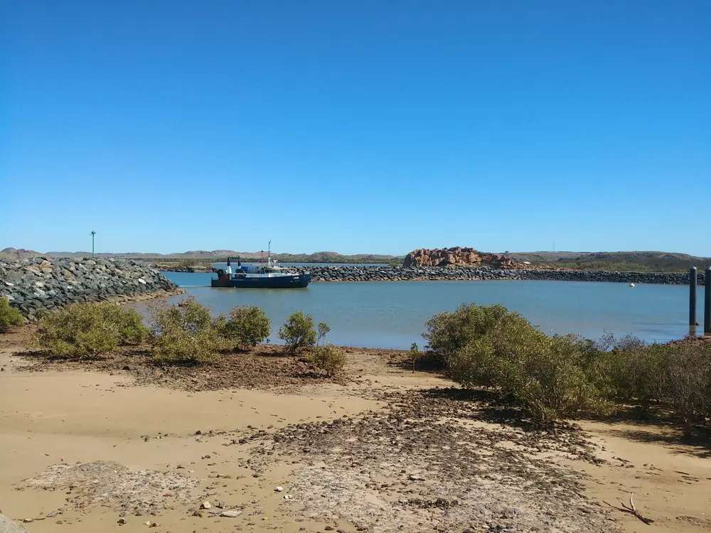
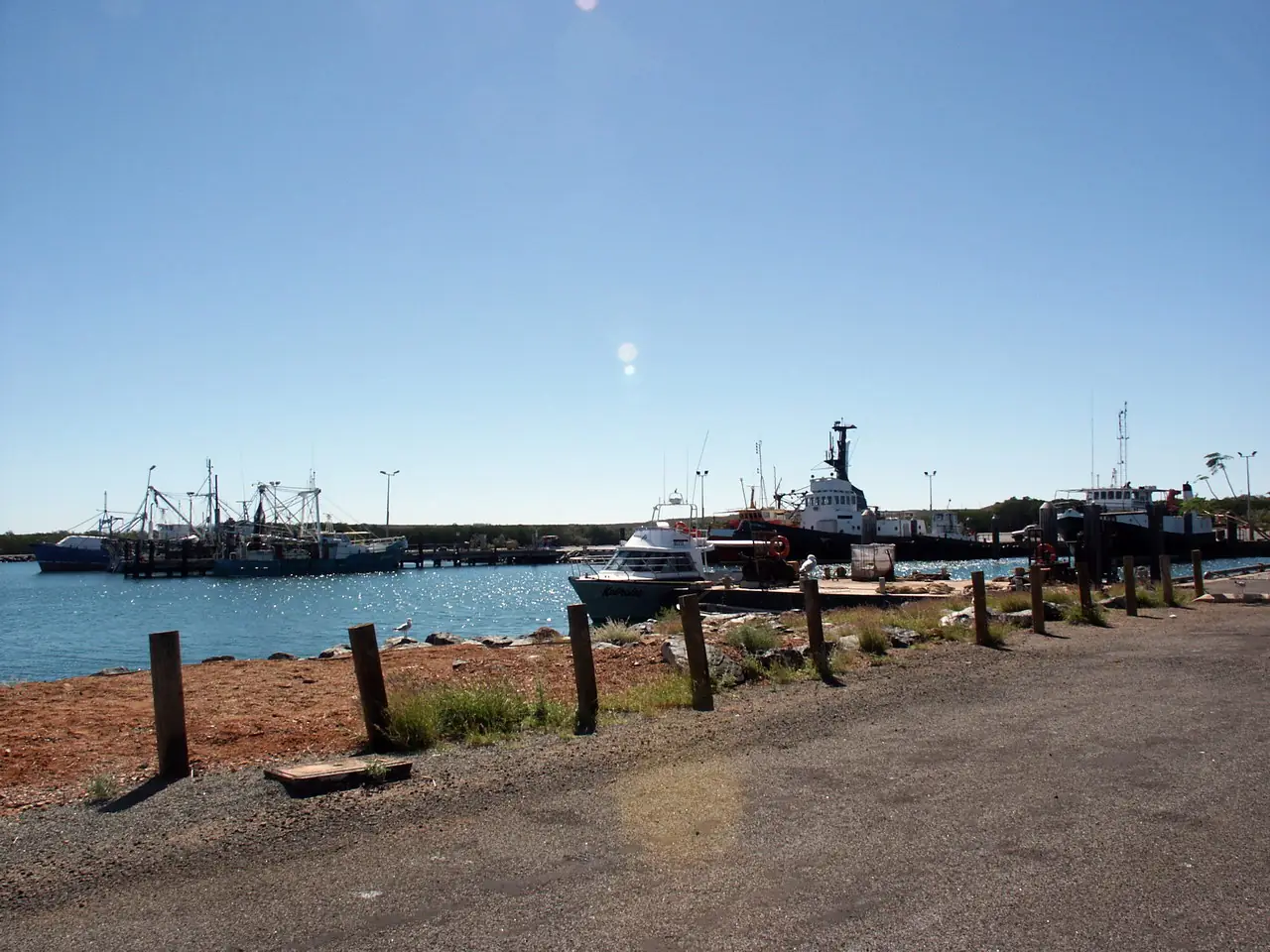
Boat in Point Samson harbourPhoto: Sam Wilson · CC BY-SA 4.0 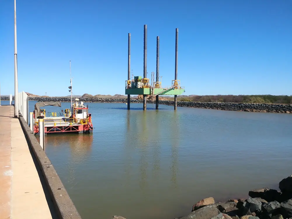
Work platform in Point Samson harbourPhoto: Sam Wilson · CC BY-SA 4.0 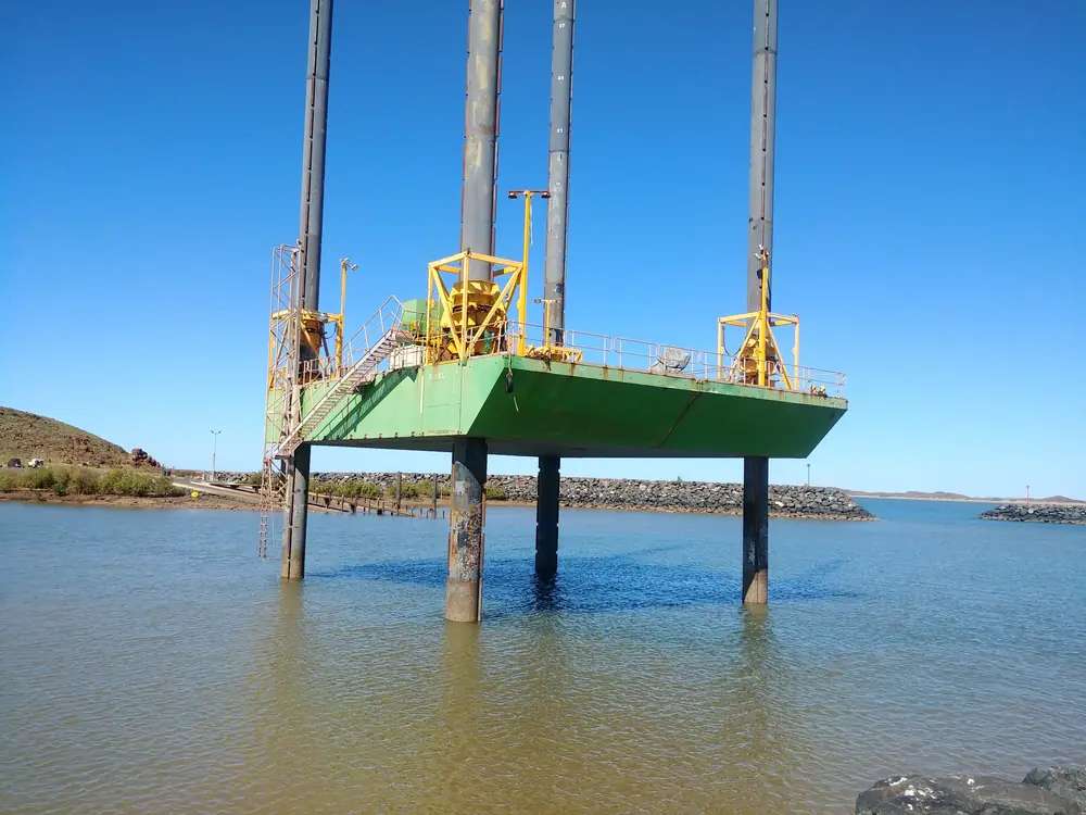
Jack-up platform in Point Samson harbourPhoto: Sam Wilson · CC BY-SA 4.0
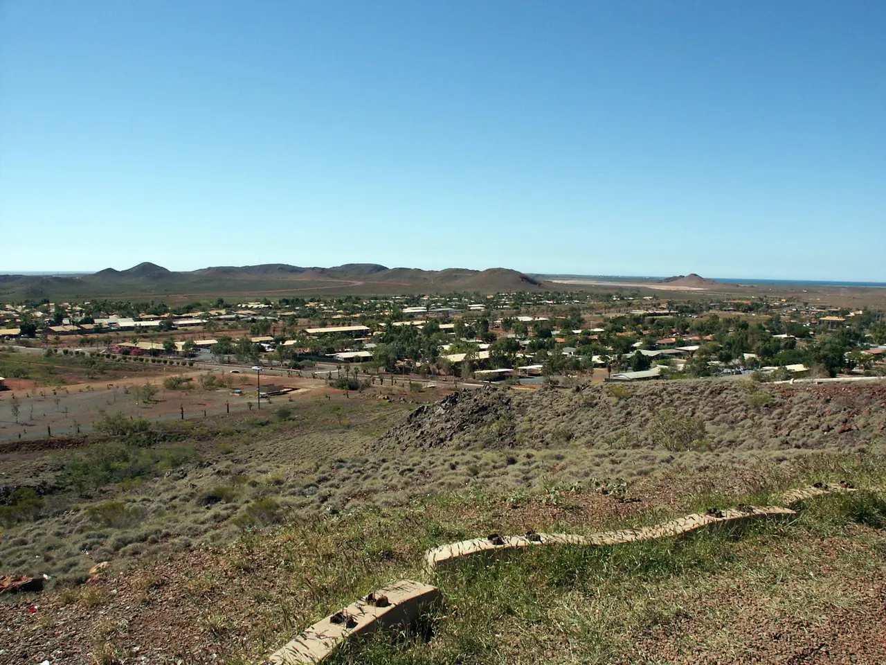
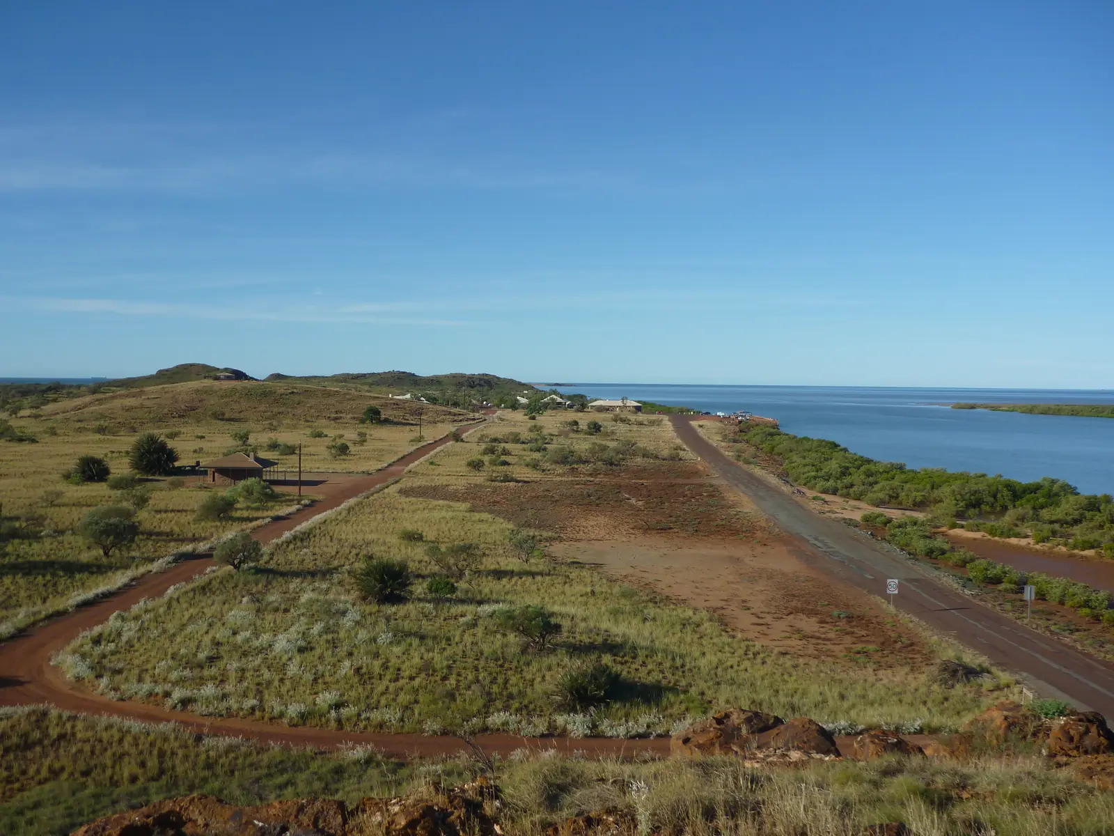
Point Samson sits on its own peninsula in Western Australia’s North West, inside the City of Karratha, 20 minutes north of Roebourne on Tourism WA. Australia’s North West: accessed via the Roebourne–Point Samson Road, off the North West Coastal Highway in Roebourne. This hub is that fishing hamlet — not Wickham, not Cossack and not Karratha CBD. Geraldton and Darwin have no town pages here. Perth is the capital; it has no town page here.
Australia’s North West’s jetty-and-chips sentence is the hinge used here: in contrast to its early years as a busy pastoral port, the town today is a relaxed coastal village famous for its fish and chips and delicious fresh seafood. Tourism WA: the tranquil fishing hamlet. That is a peninsula-beach story, not a Cape Lambert town-centre reprint and not a bluestone ghost-town reprint.
The ABS publishes urban centre Point Samson (L) UCL522055: 235 people, median age 45, sex split 51.3% male / 48.7% female, Aboriginal and/or Torres Strait Islander people 4 (1.7%). 62 families, 265 private dwellings, average household 2.3. The dwelling count is larger than the usual-resident count — holiday houses, not a second Wickham. Do not mix with Wickham 2,016. Travellers stop for Honeymoon Cove, a feed of fish and a van night. You still need Main Roads WA after a cyclone watch.
Where it is, and how far
Point Samson is the eastern City of Karratha fishing village at the end of the sealed peninsula road. Tourism WA: eastern gateway to the 42 islands and islets of the Dampier Archipelago. Australia’s North West Cossack: Cossack is 5 kilometres from Point Samson.
Official times from Tourism WA:
| Place | Distance from Point Samson (sourced) |
|---|---|
| Roebourne | 20 minutes north of Roebourne (Tourism WA Point Samson) |
| Karratha | 50 minutes east of Karratha (Tourism WA) |
| Port Hedland | Two and a half hours west of Port Hedland (Tourism WA) |
| Cossack | 5 km (Australia’s North West Cossack) |
| Perth | Direct flight to Karratha, then the peninsula road (Tourism WA). A road kilometre was not printed |
Tourism WA also names the Warlu Way, 2,480 kilometres.
Facts at a glance
Population. ABS 2021 Census Urban Centres UCL522055: 235 people. Median age 45. Use the UCL QuickStats.
Climate. There is no Point Samson-named BOM table. Use Roebourne Aero 004090: December mean maximum 39.7 °C, June 27.9 °C, annual rainfall 274.8 mm (21 years, 2001–2026). Status: open. Latest available data 14 November 2026. Do not blend Karratha Aero. See Point Samson weather.
Visitor information. Australia’s North West treats the Karratha Tourism and Visitor Centre as the regional desk. Confirm which door is actually open. Roads: Main Roads WA.
Traditional Owners
A Traditional Owner nation named for the Point Samson townsite was not on the Tourism WA Point Samson page or the Australia’s North West Point Samson Peninsula page. The City of Karratha Roebourne Heritage Trail names the Ngarluma people for Roebourne, 20 minutes south. This guide does not flatten that Roebourne sentence onto Honeymoon Cove. Confirm at the Karratha Visitor Centre. See visiting Country respectfully.
History
Australia’s North West: though gazetted in 1908, Point Samson came to prominence from 1902 with the construction of the jetty, designed to service newer and larger vessels for which the jetty at Cossack was inadequate. The original T-head jetty was almost 1,900 feet long; much of it was destroyed in a cyclone in 1925. What remained was in use until the 1980s, damaged beyond repair by Cyclone Orson in 1989 and later burned down in 1991. A jetty lookout was created on land at the site.
Tourism WA Cossack: after the opening of Point Samson jetty, Cossack was dissolved in 1910 and abandoned by 1950. That is why this hamlet is not Cossack.
Things to do
Tourism WA and Australia’s North West name these in and around Point Samson:
- John’s Creek and Honeymoon Cove — swimming, snorkelling, fishing; picnic and barbecue on grassed areas next to the beach on Australia’s North West
- Point Samson Heritage Trail — Australia’s North West; viewing platform for sunset
- Jetty lookout — old T-head site; whales July to October
- Marina — rock groins, boat launching ramp, commercial fishing fleet (Tourism WA)
- Dampier Archipelago — 42 islands; snorkel on a guided tour. This site has no Archipelago park page
- Seafood — Tourism WA names fish and chips and restaurants as a type, not a ranked dining list this hub will invent
Nearby, not in-town: Cossack is 5 km. Wickham is the residential town on the way in. Roebourne is 20 minutes. Jarman Island Lighthouse is visible from Point Samson and Cossack on Australia’s North West’s lighthouse listing.
See things to do in Point Samson.
Where to stay
The City camping brochure names Point Samson Tavern Caravan Park, Millars Close, 9187 0199, and The Cove Caravan Park, Honeymoon Cove, 9187 0199. Australia’s North West names The Cove Holiday Village and Point Samson Resort. Tourism WA names caravan parks, bed and breakfasts, self-contained holiday homes, chalets and a four-star resort as types. Those are official named types, not a star rating this site awards. If Point Samson is full, Wickham has no named park on the brochure — continue to Roebourne or Karratha.
- How to choose: Point Samson accommodation
- Camping detail: Point Samson caravan parks
- Operator enquiries: feature your business
Caravan and camping
Vans use Point Samson as the peninsula night. Official named camping starts with the two City-brochure parks. City wording: generally NO FREE CAMPING in the City; Hearson’s Cove is a Karratha-side ban, not a Point Samson beach camp. Read Point Samson caravan parks and outback camping. Do not unhitch on Honeymoon Cove sand.
Fuel and services
A locality of 235 people will not match Karratha. Confirm the bowser on arrival; this hub does not invent a brand. Fill in Roebourne or Karratha if the peninsula pump is shut.
No Point Samson hospital is named on WACHS. Roebourne Hospital: 24/7 emergency department. Karratha Health Campus is the larger campus. For maps use the Karratha Visitor Centre. Roads: Main Roads WA.
Road access
The Roebourne–Point Samson Road is sealed on Australia’s North West. Tourism WA: a few hours from Perth on a direct flight to Karratha, then the peninsula. After cyclones, the old jetty story is why you check Main Roads before treating the lookout carpark as 2WD-sensible.
South: Wickham, Roebourne, then Karratha. Side road: Cossack 5 km. East: Port Hedland at two and a half hours. Perth to Darwin via the Pilbara is the long corridor.
Nearby parks and towns
Named nature on official pages:
- Honeymoon Cove, John’s Creek — in-town beaches
- Dampier Archipelago — Tourism WA; no park page on this site
- Jarman Island — visible from shore on Australia’s North West
Towns on this site:
- Wickham — residential neighbour
- Cossack — 5 km, historic townsite
- Roebourne — 20 minutes
- Karratha — 50 minutes
- Dampier — western Archipelago port
- Port Hedland — two and a half hours
When to go, and how long
Tourism WA and Australia’s North West: whales July to October. Trails WA’s Roebourne window June to September is the cooler Heritage Trail season inland of here. BOM Roebourne Aero December 39.7 °C is still hot on a peninsula with little shade. June 27.9 °C / 13.8 °C is the cooler table.
An hour covers Honeymoon Cove and the jetty lookout. A half day adds John’s Creek and a Heritage Trail wander. A night covers a named van site and a seafood meal if a kitchen is actually serving. Cossack is a separate 5 km heritage hour. An Archipelago snorkel is a boat day.
Operators who want a checked listing: feature your business. The listings slot on this hub stays empty until then.
Plan this trip
Tell us the dates, who you are travelling with and where you need help. We reply with planning notes for Point Samson — we are not a booking agent.
Events and road-conditions newsletter
Occasional notes on outback festivals, race days and official road-condition sources — not a daily blast. We use these details only to send the newsletter.
Western Australia · North West
Point Samson accommodation
Where to stay in Point Samson: City of Karratha names Point Samson Tavern Caravan Park and The Cove Caravan Park. Australia’s North West names The Cove Holiday Village and Point Samson Resort. Confirm before you unhitch.
Read · 3 min
Western Australia · North West
Point Samson caravan parks
Camping in Point Samson: City of Karratha names Point Samson Tavern Caravan Park on Millars Close and The Cove Caravan Park at Honeymoon Cove. Beaches are not free camps. Not Wickham.
Read · 3 min
Western Australia · North West
Point Samson weather
Point Samson has no named BOM climate table. This page uses open Roebourne Aero (004090): December mean max 39.7 °C, June 27.9 °C, annual rainfall 274.8 mm. Whale window July–October on Tourism WA. Do not blend Karratha Aero.
Read · 3 min
Western Australia · North West
Things to do in Point Samson
Things to do in Point Samson: Honeymoon Cove, John’s Creek, jetty lookout, whales July–October, Dampier Archipelago. This is the fishing village, not Wickham and not Cossack.
Read · 3 min
Frequently asked questions
Is Point Samson the same as Wickham or Cossack?
No. This hub is Point Samson, the City of Karratha fishing hamlet on its own peninsula. Tourism WA: 20 minutes north of Roebourne. Wickham is the larger residential town on the same road. Cossack is the historic townsite 5 km away on Australia’s North West. Do not treat the three as one beach.
How far is Point Samson from Roebourne, Karratha and Port Hedland?
Tourism WA: 20 minutes north of Roebourne, 50 minutes east of Karratha, two and a half hours west of Port Hedland by road. Australia’s North West Cossack page: Cossack is 5 kilometres from Point Samson. Direct flight to Karratha, then the peninsula road.
What is Point Samson’s population?
235 people at the 2021 Census for urban centre Point Samson (L) UCL522055, median age 45. 62 families, 265 private dwellings. Do not mix with Wickham’s 2,016.
What is there to do in Point Samson?
Tourism WA names John’s Creek and Honeymoon Cove, snorkelling and fishing, whales July to October, a marina with a boat ramp and a commercial fishing fleet, and the 42-island Dampier Archipelago. Australia’s North West names the Point Samson Heritage Trail, a jetty lookout on the old T-head jetty site, and Cossack as the heritage neighbour. This site has no Archipelago park page — use Parks WA / Tourism WA.
What is the weather like in Point Samson?
There is no Point Samson-named BOM table. This hub uses Roebourne Aero (004090, open): December mean maximum 39.7 °C, June 27.9 °C, annual rainfall 274.8 mm. Do not blend with Karratha Aero.
Can I camp at Point Samson?
Yes, as named types. The City of Karratha camping brochure names Point Samson Tavern Caravan Park, Millars Close, and The Cove Caravan Park at Honeymoon Cove, both 9187 0199. Australia’s North West names The Cove Holiday Village and Point Samson Resort. Tourism WA names caravan parks, bed and breakfasts, holiday homes, chalets and a four-star resort. Confirm on arrival.
Sources and further reading
Facts on this page were checked against these primary and official sources. Conditions change — confirm before you travel or buy.
- Point Samson (L) 2021 Census QuickStats (UCL522055) — Australian Bureau of Statistics
- Climate statistics for Roebourne Aero (004090) — Bureau of Meteorology
- Point Samson — Tourism Western Australia
- Point Samson Peninsula — Australia's North West
- Cossack — Australia's North West
- Camping in the City of Karratha — City of Karratha
- Pilbara Hospitals and Health Services — WA Country Health Service
- Main Roads WA travel map — Main Roads Western Australia