At a glance
Sourced facts only. Distances and services change — confirm before you travel.
- Local government
- City of Karratha
- Traditional Owners
- Parks WA Murujuga: Mardudhunera, Ngarluma, Wong-Goo-Tt-Oo, Yaburara and Yindjibarndi, collectively Ngarda-Ngarli, Traditional Owners of Murujuga National Park on the Burrup Peninsula beside Dampier. Australia’s North West Karratha FAQ names Ngarluma and Yinidbarndi for the Karratha region.Confirm current wording at Murujuga Aboriginal Corporation or the Karratha Visitor Centre.
- Nearest regional city
- Australia’s North West: 20 kilometres west of Karratha.
- Capital
- A sourced Dampier–Perth kilometre was not on the Australia’s North West Dampier page. Australia’s North West puts Karratha 1,535 km north of Perth; do not average that onto Dampier.
- Nearest fuel
- Australia’s North West treats Dampier as a port town 20 km from Karratha’s shops. Confirm the bowser on arrival; this hub does not invent a brand. Fill in Karratha if you are unsure.
- Nearest hospital or clinic
- No hospital is named for the Dampier townsite on the sourced WACHS Pilbara hospitals page. Karratha Health Campus is the City of Karratha 24/7 emergency campus.
- Mobile coverage
- Check Telstra and Optus coverage maps before travel; do not assume a signal on Burrup tracks or offshore in the Archipelago.
- Best time to visit
- Australia’s North West Port Hedland itinerary treats May to September as the tour season on this coast. BOM Karratha Aero July mean maximum 26.5 °C; March 36.3 °C. That station is Karratha Aero, not a Dampier-named table.
Climate
Monthly means from the Bureau of Meteorology station Karratha Aero (004083). This is not a forecast. Open Karratha Aero table. There is no Dampier-named BOM climate table used here. Australia’s North West puts Dampier 20 km west of Karratha; do not treat these means as a foreshore thermometer. Temperature 33 years (1993–2026); rainfall 49 years (1972–2026). Latest available data 13 November 2026. Do not blend with Roebourne Aero.
| Month | Mean max (°C) | Mean min (°C) | Rainfall (mm) |
|---|---|---|---|
| Jan | 36.0 | 27.0 | 50.6 |
| Feb | 35.9 | 26.9 | 74.7 |
| Mar | 36.3 | 26.2 | 48.2 |
| Apr | 34.4 | 23.0 | 17.8 |
| May | 30.1 | 18.3 | 29.9 |
| Jun | 26.6 | 15.3 | 35.4 |
| Jul | 26.5 | 13.8 | 13.1 |
| Aug | 28.5 | 14.7 | 4.9 |
| Sep | 31.2 | 17.4 | 1.3 |
| Oct | 34.2 | 20.9 | 0.4 |
| Nov | 35.0 | 23.2 | 1.2 |
| Dec | 36.1 | 25.8 | 13.6 |
Dampier in pictures
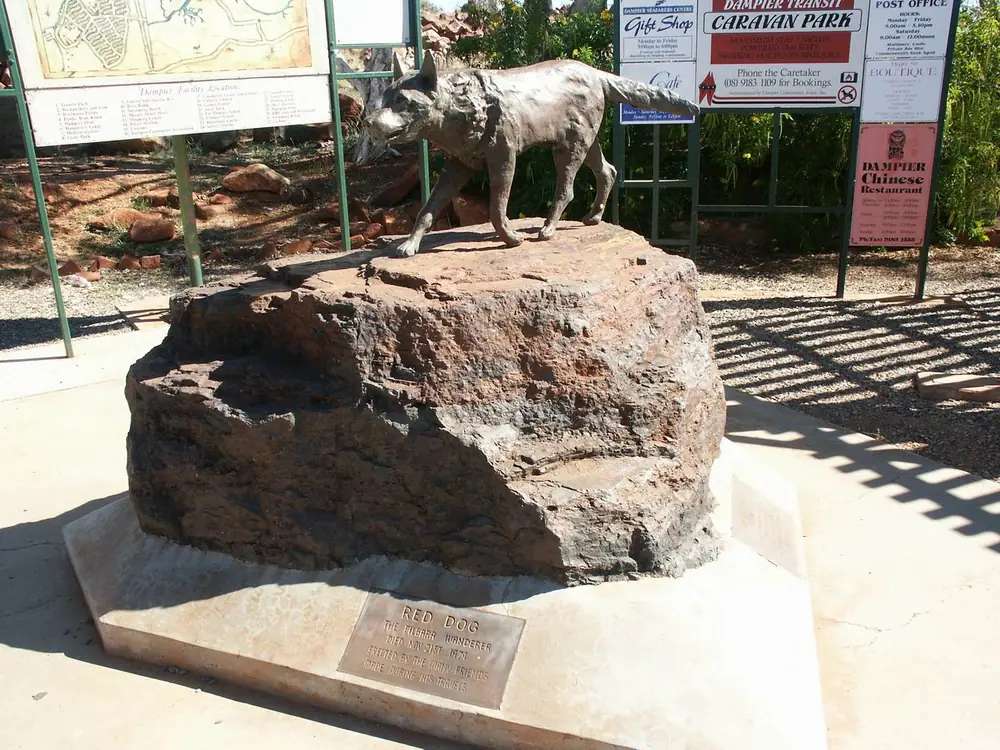
Red Dog statue in DampierPhoto: Nachoman-au · CC BY-SA 3.0 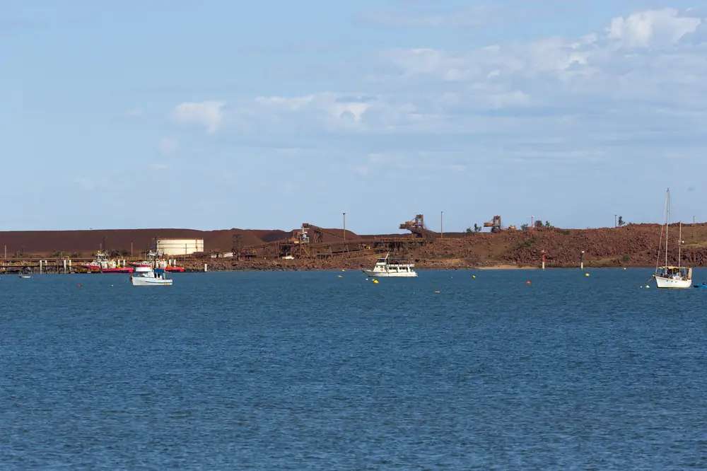
King Bay at DampierPhoto: Jim Bendon · CC BY-SA 2.0 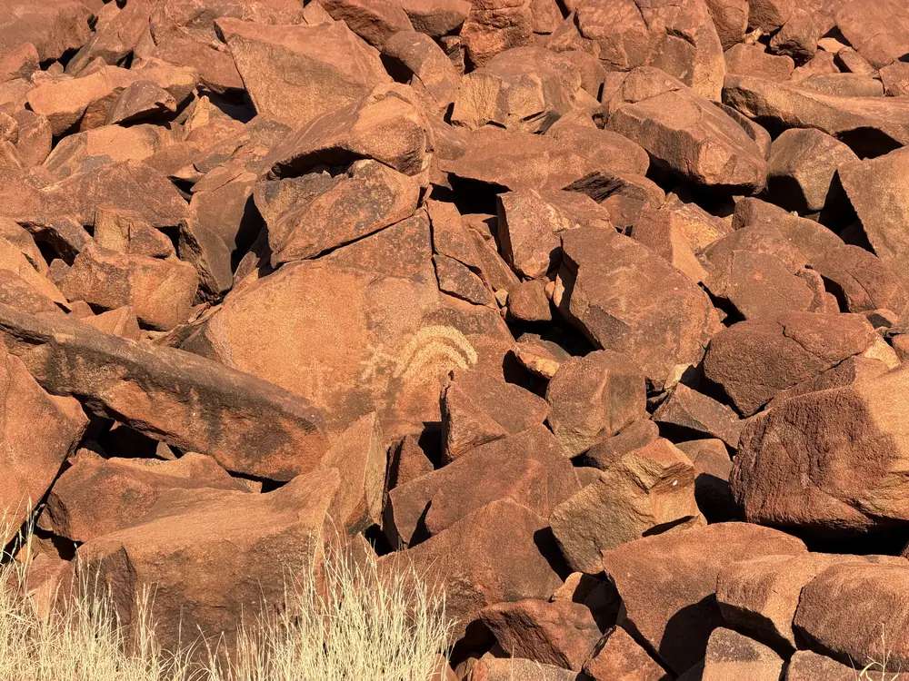
Rock art at Nganjarli on Murujuga near DampierPhoto: The editor next door · CC0 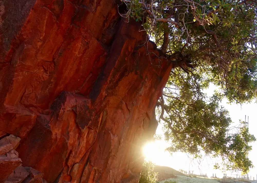
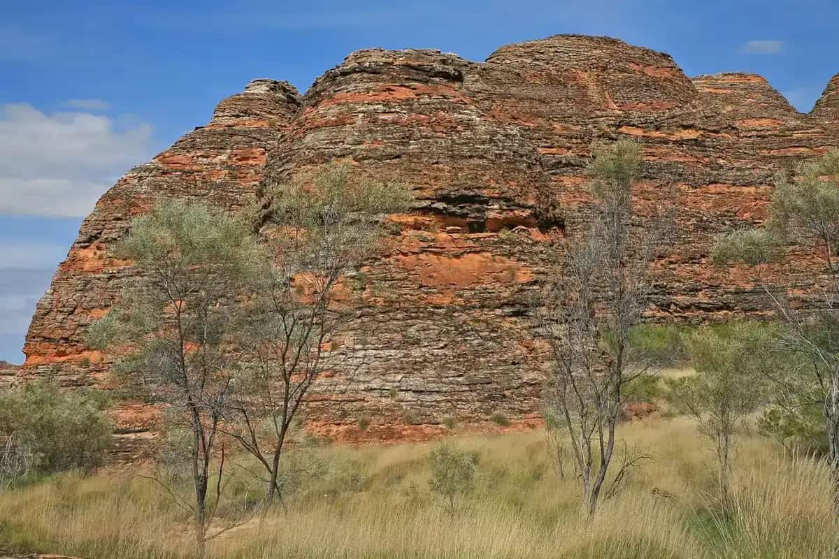
Murujuga cliff near DampierPhoto: Marius Fenger · CC BY-SA 4.0
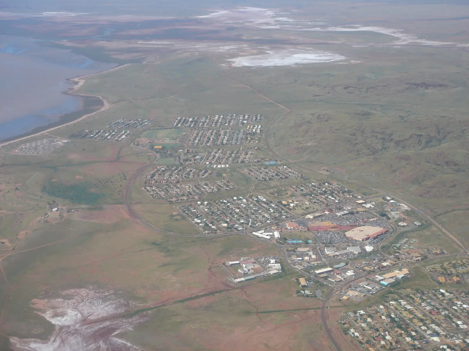
Dampier sits 20 kilometres west of Karratha in Western Australia’s North West, inside the City of Karratha, on the Burrup / Murujuga peninsula in the Pilbara. Australia’s North West: named after the English buccaneer William Dampier, who visited in 1688. This hub is that port town — not Karratha’s city centre, not Wickham and not Port Hedland. Geraldton and Darwin have no town pages here. Perth is the capital; it has no town page here.
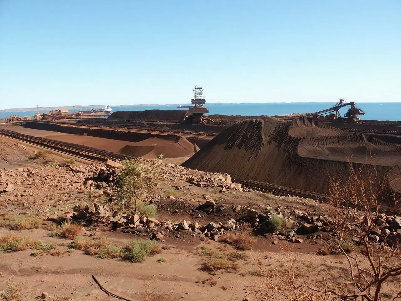
Australia’s North West’s harbour sentence is the hinge used here: built by Hamersley Iron in 1965, Dampier is the largest tonnage shipping port in Australia on that page and houses the massive export facilities of Hamersley Iron, Dampier Salt and the North West Gas Shelf Project. This site’s Tom Price hub: ore is railed to ports at Dampier and Cape Lambert. That is a 1965 company-port story, not a Karratha shopping-centre reprint and not a Cossack pearling-ghost reprint.
The ABS publishes matching 2021 geographies. Use urban centre UCL515008: 1,282 people, median age 35, sex split 51.8% male / 48.2% female, Aboriginal and/or Torres Strait Islander people 41 (3.2%). 322 families, 602 private dwellings, average household 2.9. Suburbs-and-localities SAL50378 counted the same 1,282. Do not substitute Karratha SUA 17,013. Travellers stop for Red Dog, the foreshore and an Archipelago boat. You still need Main Roads WA after rain.
Where it is, and how far
Dampier is the western City of Karratha harbour at the landward end of the Dampier Archipelago. Tourism WA’s Karratha page: the Archipelago’s 42 islands and islets sit within a 45-kilometre radius of neighbouring Dampier. Australia’s North West Karratha: Montebello Islands Marine Park 120 km west of Dampier.
A sourced Dampier–Perth kilometre was not on the Dampier destination page.
| Place | Distance from Dampier (sourced) |
|---|---|
| Karratha | 20 km east (Australia’s North West Dampier and Karratha) |
| Perth | Not printed on the sourced Dampier page. Karratha is 1,535 km north of Perth on Australia’s North West — a Karratha figure |
| Dampier Archipelago | 42 islands and islets within a 45 km radius of Dampier (Tourism WA Karratha) |
| Montebello Islands Marine Park | 120 km west of Dampier (Australia’s North West Karratha) |
| Murujuga National Park | On the Burrup Peninsula beside town; Australia’s North West Murujuga page measures from Karratha (around 35 km / 40 minutes), not as a Dampier street kilometre |
Do not invent a Dampier–Roebourne kilometre.
Facts at a glance
Population. ABS 2021 Census Urban Centres UCL515008: 1,282 people. Median age 35. Use the UCL QuickStats. SAL SAL50378: 1,282. Matching counts; still cite the geography you mean.
Climate. There is no Dampier-named BOM climate table on this hub. Use Karratha Aero 004083, 20 km east: March mean maximum 36.3 °C, July 26.5 °C, annual rainfall 297.8 mm (49 years, 1972–2026). Status: open. Latest available data 13 November 2026. Do not blend Roebourne Aero. See Dampier weather.
Visitor information. Australia’s North West treats the Karratha Tourism and Visitor Centre as the regional desk. The City camping brochure also names that centre on Karratha Road. Confirm which door is actually open. Roads: Main Roads WA.
Traditional Owners
Parks WA Murujuga: Mardudhunera, Ngarluma, Wong-Goo-Tt-Oo, Yaburara and Yindjibarndi, collectively Ngarda-Ngarli, Traditional Owners of Murujuga National Park. Murujuga means “Hip Bone Sticking Out” in the Ngarluma-Yaburara language and refers to the 42 islands of the Dampier Archipelago, Burrup Peninsula and the national park. A Traditional Owner nation named only for the Dampier townsite was not on the Australia’s North West Dampier page. This guide uses the Parks WA Murujuga wording for the peninsula beside town rather than flattening the Karratha FAQ onto the Esplanade. Confirm at Murujuga Aboriginal Corporation. See visiting Country respectfully and rock art sites.
History
Australia’s North West: named after William Dampier, who visited in 1688. Built by Hamersley Iron in 1965. Largest tonnage shipping port in Australia on that page, with Hamersley Iron, Dampier Salt and the North West Gas Shelf Project. Don’t miss the memorial to Red Dog on the way into town.
This is a 1965 iron-ore port, not Karratha’s later city centre. Karratha exists because Dampier’s harbour needed a larger residential town — that sequence is implied by the two destination pages sitting 20 km apart, but this hub does not invent a gazettal sentence Australia’s North West does not print.
Things to do
Australia’s North West names these in and around Dampier:
- Red Dog memorial — on the way into town
- Roaming with Red Dog Trail — signposted trail and online quest on that page
- Dampier Foreshore — shaded picnic areas and pedestrian walkways along the palm-lined Esplanade; swimming at Shark Cage Beach and Hampton Harbour Beach
- Dampier Archipelago day cruises — departure point on the destination page. This site has no Archipelago park page
- Murujuga National Park — a day on the destination page. Parks WA: Nganjarli (Deep Gorge) 700 m boardwalk; no dogs; no park entry fee. Use Parks WA Murujuga
Nearby, not in-town: Karratha is 20 km east. Point Samson is the eastern gateway to the same Archipelago on Tourism WA. Roebourne is the 1866 heritage town. Millstream Chichester National Park is a Karratha-side park day.
Where to stay
The City of Karratha camping brochure names Dampier Transit Park, The Esplanade, 9183 1109, 3 night. Karratha motels and parks sit 20 km east on the same brochure. Those are official named types. This hub does not invent a second Dampier hotel strip.
- How to choose: Dampier accommodation
- Camping detail: Dampier caravan parks
- Operator enquiries: feature your business
Caravan and camping
Vans use Dampier as a three-night transit on the Esplanade, not as a free camp on the foreshore. City wording: generally NO FREE CAMPING in the City. The Transit Park’s 3-night limit is the brochure fact. Read Dampier caravan parks and outback camping. Do not camp at Hearson’s Cove.
Fuel and services
A locality of 1,282 people will not match Karratha’s shopping centre. Australia’s North West treats Dampier as the pretty port town 20 km from Karratha. This guide does not invent a bowser brand. Fill in Karratha if the Esplanade pump is shut.
No Dampier hospital is named on the WACHS Pilbara hospitals page. Karratha Health Campus is the City’s 24/7 emergency department. For maps use the Karratha Visitor Centre. Roads: Main Roads WA.
Road access
The Dampier Highway from Karratha is the sealed 20 km run on Australia’s North West. Burrup Road continues toward Murujuga on the Murujuga destination page. After rain, park tracks still close. Main Roads first. Ore trucks and port traffic are the packing problem.
East: Karratha, then Roebourne. Further east: Wickham, Point Samson, Cossack, Port Hedland. Inland: Tom Price for Karijini. Perth to Darwin via the Pilbara is the long corridor.
Nearby parks and towns
Named nature on official pages:
- Murujuga National Park — Parks WA; no park page on this site
- Dampier Archipelago — Australia’s North West / Tourism WA
- Montebello Islands Marine Park — 120 km west
- Millstream Chichester National Park
Towns on this site:
- Karratha — 20 km east
- Roebourne — heritage neighbour
- Point Samson — eastern Archipelago gateway
- Wickham — Cape Lambert side of the City
- Cossack — historic townsite
- Tom Price — ore rails to this port
- Onslow — 139 km south of the Montebellos on Australia’s North West
When to go, and how long
May to September is the tour-season wording Australia’s North West uses on this coast’s Port Hedland itinerary. BOM Karratha Aero’s March 36.3 °C mean maximum is still the packing problem 20 km away. July 26.5 °C / 13.8 °C is the cooler dry-season table. February 74.7 mm is the wettest mean month.
An hour covers Red Dog and the foreshore if those named places are reachable. A half day adds the Red Dog Trail. A full day is Murujuga’s Deep Gorge boardwalk — Parks WA, not a Dampier street. An Archipelago cruise is a boat day, not a town walk. Sleep at the 3-night Transit Park or continue to Karratha.
Operators who want a checked listing: feature your business. The listings slot on this hub stays empty until then.
Plan this trip
Tell us the dates, who you are travelling with and where you need help. We reply with planning notes for Dampier — we are not a booking agent.
Events and road-conditions newsletter
Occasional notes on outback festivals, race days and official road-condition sources — not a daily blast. We use these details only to send the newsletter.
Western Australia · North West
Dampier accommodation
Where to stay in Dampier: the City of Karratha names Dampier Transit Park on The Esplanade, 3-night limit. Karratha motels sit 20 km east. Confirm before you unhitch. This is Dampier, not Karratha CBD.
Read · 3 min
Western Australia · North West
Dampier caravan parks
Camping in Dampier: City of Karratha names Dampier Transit Park on The Esplanade with a 3-night limit. Hearson’s Cove is not a free camp. Karratha parks sit 20 km east.
Read · 3 min
Western Australia · North West
Dampier weather
Dampier has no named BOM climate table. This page uses open Karratha Aero (004083), 20 km east on Australia’s North West: March mean max 36.3 °C, July 26.5 °C, annual rainfall 297.8 mm. Not a foreshore thermometer.
Read · 3 min
Western Australia · North West
Things to do in Dampier
Things to do in Dampier: Red Dog memorial and trail, Dampier Foreshore, Shark Cage Beach, Murujuga day, Archipelago cruises. This is the port town 20 km west of Karratha, not Karratha CBD.
Read · 3 min
Frequently asked questions
Is Dampier the same as Karratha?
No. This hub is Dampier, the City of Karratha port town 20 kilometres west of Karratha on Australia’s North West. Karratha is the city-centre stay on this site. Dampier is the harbour, Red Dog memorial and Archipelago departure point. Do not treat the two as one main street.
How far is Dampier from Karratha and Perth?
Australia’s North West: 20 kilometres west of Karratha. A sourced Dampier–Perth kilometre was not on that Dampier destination page. Australia’s North West puts Karratha 1,535 km north of Perth; this hub does not add 20 km onto that figure.
What is Dampier’s population?
1,282 people at the 2021 Census for urban centre UCL515008, median age 35, Aboriginal and/or Torres Strait Islander people 41 (3.2%). Suburbs-and-localities SAL50378 counted the same 1,282. Do not substitute Karratha’s 17,013 SUA figure.
What is there to do in Dampier?
Australia’s North West names the Red Dog memorial on the way into town, the Roaming with Red Dog Trail, Dampier Foreshore with Shark Cage Beach and Hampton Harbour Beach, day cruises to the Dampier Archipelago, and a day in Murujuga National Park. This site has no Murujuga or Archipelago park pages — use Parks WA and Australia’s North West.
What is the weather like in Dampier?
There is no Dampier-named BOM table on this hub. Use Karratha Aero (004083, open), 20 km east on Australia’s North West: March mean maximum 36.3 °C, July 26.5 °C, annual rainfall 297.8 mm. Do not blend with Roebourne Aero.
Can I camp at Dampier?
Yes, as a named type. The City of Karratha camping brochure names Dampier Transit Park on The Esplanade, 9183 1109, with a 3-night limit. City wording: generally no free camping in the City. Confirm on arrival.
Sources and further reading
Facts on this page were checked against these primary and official sources. Conditions change — confirm before you travel or buy.
- Dampier 2021 Census QuickStats (UCL515008) — Australian Bureau of Statistics
- Dampier 2021 Census QuickStats (SAL50378) — Australian Bureau of Statistics
- Climate statistics for Karratha Aero (004083) — Bureau of Meteorology
- Dampier — Australia's North West
- Karratha — Australia's North West
- Murujuga National Park — Parks and Wildlife Service, DBCA
- Camping in the City of Karratha — City of Karratha
- Karratha Health Campus — WA Country Health Service
- Main Roads WA travel map — Main Roads Western Australia